Navigace na stránkách
Pořiďte si tuto prohlídku do mobilního telefonu
Mapa
100% Tour de France stage - Cyclosport route n°12
heavy
Silniční kolo
104.82 km
Naskenujte QR kód a spusťte navigaci v aplikaci bergfex.
QR Code
Pěší turistika a stopování

100% Tour de France stage - Cyclosport route n°12

Vzdálenost
104.8 km
Doba trvání
06:45 h
Ascent
2182 hm
Hladina moře
386 - 1567 m

Úroveň obtížnosti: 4

Stažení skladby
Mapa
100% Tour de France stage - Cyclosport route n°12
heavy
Silniční kolo
104.82 km

Warning some parts of the route are closed during the winter period. Check inforoute09.fr before departure.

Trasa
Église Saint-Valier
(393 m)
Místo konání bohoslužeb
0.1 km
Chapelle Saint-Sernin
(476 m)
Místo konání bohoslužeb
13.3 km
Couflens de Betmajou
(557 m)
Vypořádání
20.4 km
Église de la Nativité-de-la-Sainte-Vierge
(681 m)
Místo konání bohoslužeb
28.2 km
Église Saint-Pierre
(707 m)
Místo konání bohoslužeb
65.0 km
Église de la Nativité de la Vierge
(649 m)
Místo konání bohoslužeb
68.7 km
Le Peyrou
(496 m)
Summit
102.1 km
Trasa
Mapa
100% Tour de France stage - Cyclosport route n°12
heavy
Silniční kolo
104.82 km
Saint-Girons
(392 m)
Město
0.1 km
Église Saint-Valier
(393 m)
Místo konání bohoslužeb
0.1 km
Aunac
(394 m)
Vypořádání
0.4 km
Plaine d'Aulot
(398 m)
Vypořádání
1.0 km
Eycheil
(407 m)
Vesnice
2.3 km
La Moulasse
(414 m)
Vypořádání
3.2 km
Laborio
(413 m)
Koridor/terén
3.8 km
Le Pont du Nert
(415 m)
Vypořádání
4.0 km
Église Saint-Pierre-aux-Liens
(428 m)
Místo konání bohoslužeb
5.5 km
Lacourt
(426 m)
Vesnice
5.5 km
La Quagne
(426 m)
Koridor/terén
5.7 km
Saint-Sernin
(472 m)
Koridor/terén
13.1 km
Chapelle Saint-Sernin
(476 m)
Místo konání bohoslužeb
13.3 km
Soueix
(488 m)
Vesnice
14.0 km
Lauzère
(512 m)
Vypořádání
15.3 km
Seix
(507 m)
Vesnice
17.3 km
Le Rive Gauche
(506 m)
Restaurace
17.7 km
l'azinat
(509 m)
Restaurace
17.7 km
Quai Bordes-Pages
(507 m)
Koridor/terén
17.7 km
Camp Redon
(520 m)
Vypořádání
18.2 km
Couflens de Betmajou
(557 m)
Vypořádání
20.4 km
Moulin Lauga
(543 m)
Vypořádání
20.5 km
Azas
(637 m)
Vypořádání
20.7 km
Auberge Des Deux Rivières
(563 m)
Restaurace
22.1 km
Pont de la Taule (Table)
(567 m)
Vypořádání
22.2 km
Les Miades
(623 m)
Vypořádání
23.1 km
Font Sainte
(619 m)
Zdroj:
24.3 km
La Bincarède
(638 m)
Vypořádání
24.5 km
La Pomarède
(638 m)
Vypořádání
25.1 km
Saburdac
(646 m)
Vypořádání
25.1 km
Le Tourté
(664 m)
Vypořádání
25.5 km
Es Côts
(678 m)
Vypořádání
26.4 km
Église de la Nativité-de-la-Sainte-Vierge
(681 m)
Místo konání bohoslužeb
28.2 km
Le Trein d'Ustou
(673 m)
Vesnice
28.3 km
Sérac d'Ustou
(687 m)
Vesnice
29.5 km
Les Souleillons
(1112 m)
Restaurace
35.3 km
Col de Latrape
(1110 m)
Vypořádání
35.3 km
Café Restaurant L'Etape
(740 m)
Restaurace
40.5 km
Aulus-les-Bains
(751 m)
Vesnice
40.8 km
Bar Restaurant Glacier de l'Étang de Lers
(1299 m)
Restaurace
55.6 km
Courtau de Bastard
(1293 m)
Koridor/terén
55.9 km
Moureau
(820 m)
Vypořádání
62.3 km
Moureous
(812 m)
Vypořádání
62.5 km
Chapelle du Touron
(725 m)
Místo konání bohoslužeb
64.7 km
Le Port
(729 m)
Vesnice
64.7 km
Église Saint-Pierre
(707 m)
Místo konání bohoslužeb
65.0 km
Chapelle Saint-Martin de Massat
(678 m)
Místo konání bohoslužeb
66.9 km
Massat
(653 m)
Vesnice
68.3 km
L'Oumbass
(654 m)
Restaurace
68.6 km
Église de la Nativité de la Vierge
(649 m)
Místo konání bohoslužeb
68.7 km
Eycharts
(896 m)
Vypořádání
73.8 km
Col des Marrous
(992 m)
Koridor/terén
86.7 km
Bourrel
(941 m)
Vypořádání
87.4 km
Fierrioulet
(941 m)
Vypořádání
88.2 km
Le Bosc
(674 m)
Vesnice
89.5 km
Madranque
(898 m)
Vypořádání
89.6 km
Falquet
(736 m)
Vypořádání
90.1 km
Peyroutéou
(718 m)
Vypořádání
90.4 km
Burret
(675 m)
Vesnice
91.9 km
Église Saint-Joseph
(679 m)
Místo konání bohoslužeb
91.9 km
La Mouline
(503 m)
Vypořádání
96.3 km
Serres-sur-Arget
(540 m)
Vesnice
96.8 km
La Barguillère
(447 m)
Restaurace
100.2 km
Saint-Pierre-de-Rivière
(444 m)
Vesnice
100.4 km
Le Peyrou
(496 m)
Summit
102.1 km
La Rochelle
(427 m)
Vypořádání
102.2 km
Foix
(388 m)
Město
104.6 km
Informace o prohlídce

This route, which reprises the 100% Ariège stage of the 2017 edition of the Tour de France, will let you discover Ariège from Saint-Girons to Foix passing a trio of competitive climbs:

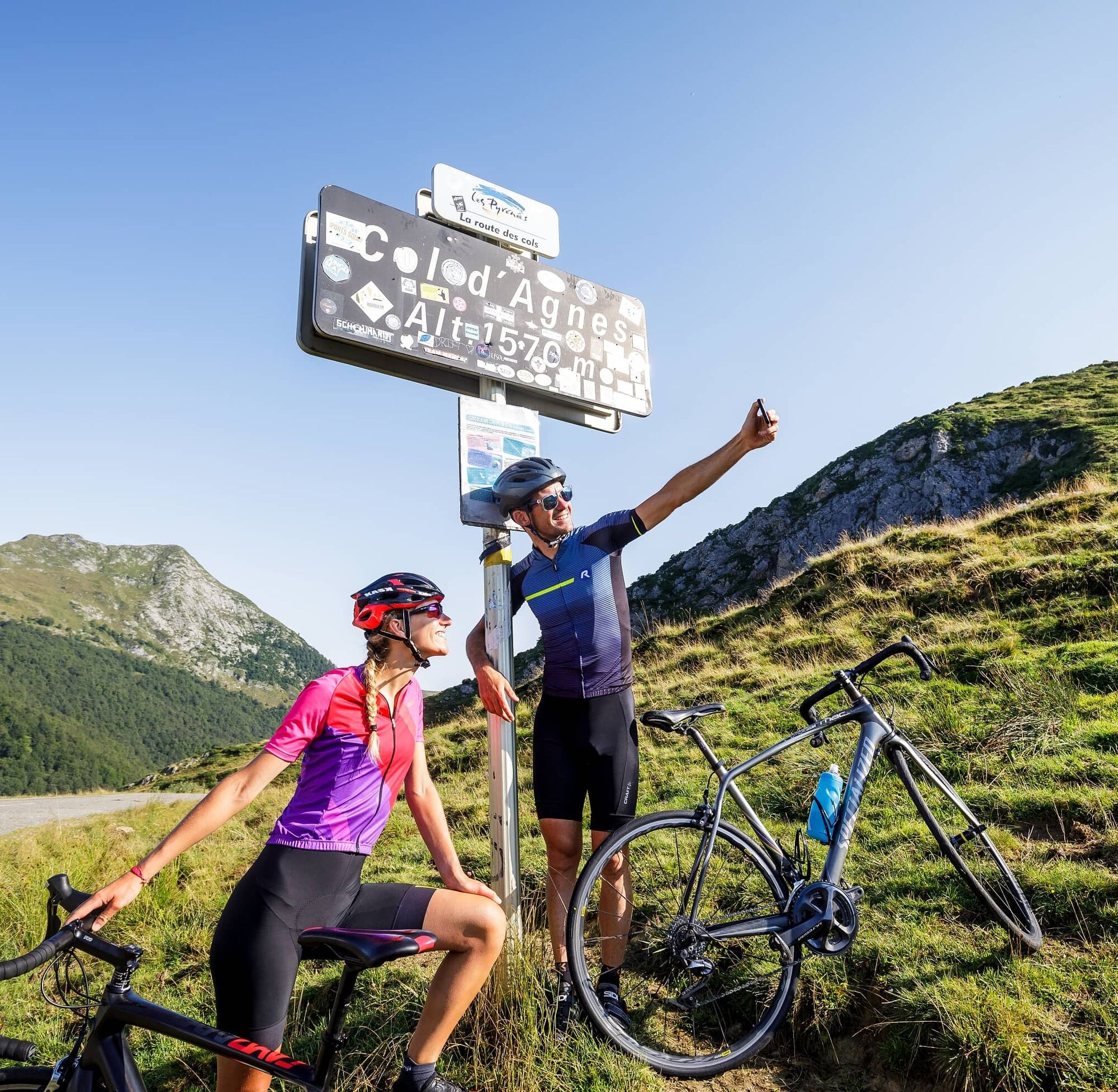
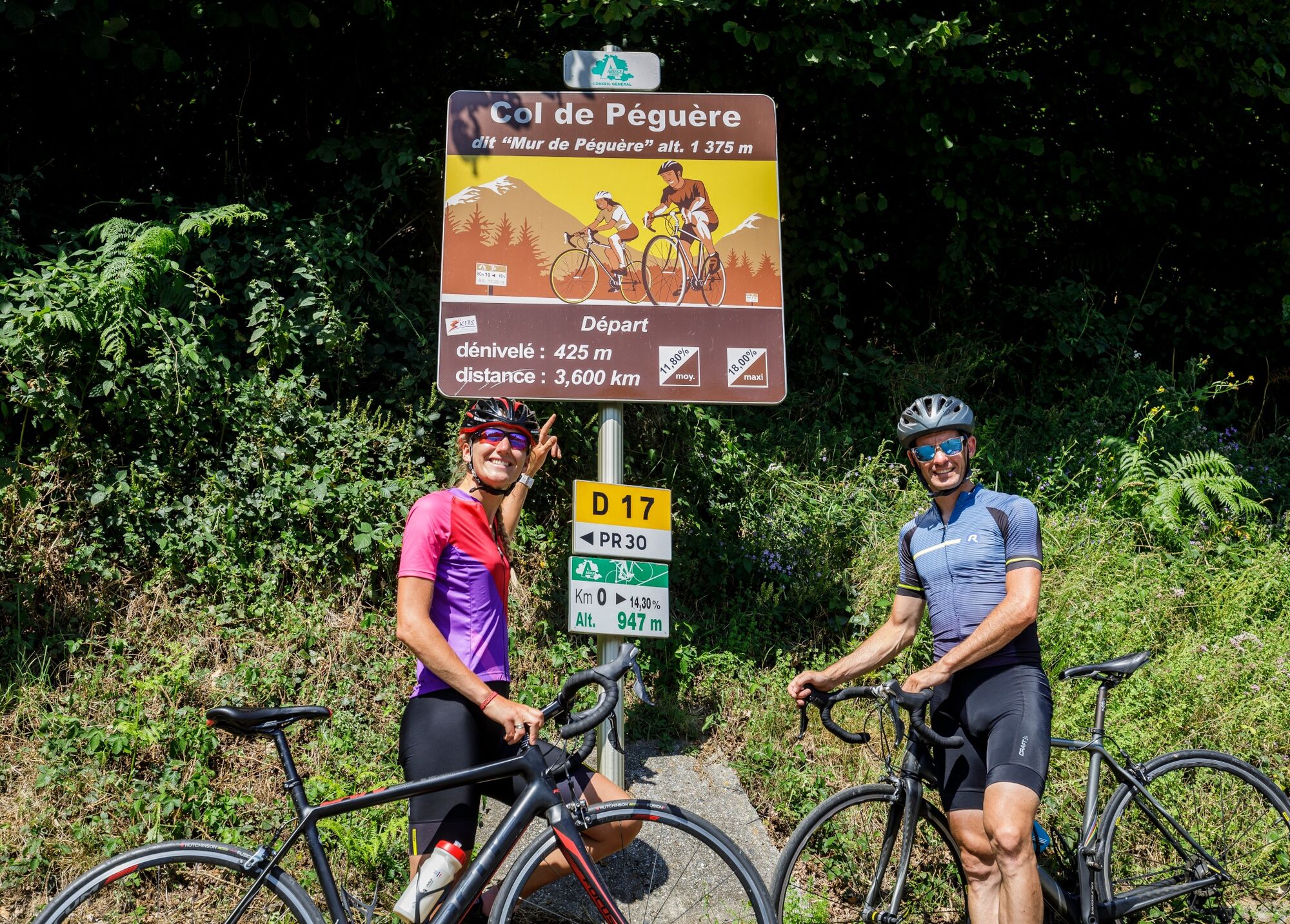
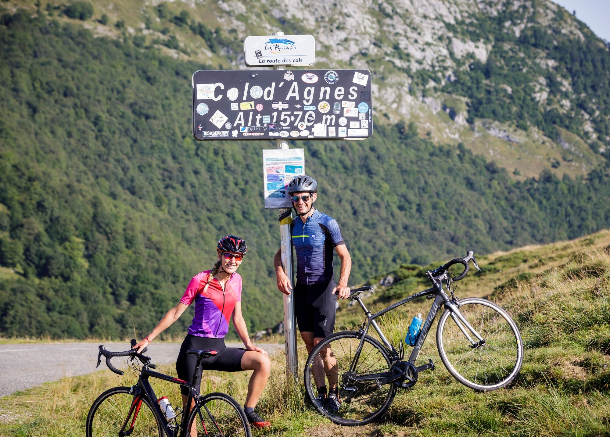
Col de Latrape 5.6 km at 7.3%, Col d'Agnes 10 km at 8.2%, and the Mur de Péguère.

Like the Frenchman Warren Barguil, who won the stage, you too can try the experience of this 100% Tour de France stage.

Technologie
4 / 6
Stav
5 / 6
Krajina
5 / 6
Zkušenosti
5 / 6
Nejlepší roční období
Led
Úno
Bře
Dub
Kvě
Čen
Čec
Srp
Zář
Říj
Lis
Pro
Sdílet prohlídku
Mapa
100% Tour de France stage - Cyclosport route n°12
heavy
Silniční kolo
104.82 km
Chyba
Došlo k chybě. Zkuste to prosím znovu.
Informace o trase
Trasa

 1- FROM SAINT GIRONS TO SEIX

From the tourist office Quai du Gravier Maurice Gardelle, take avenue Galienni, at the roundabout take the third exit towards Foix D117, continue to the next roundabout take the first exit D3 towards Seix. Pass Lacourt, then take the bridge to the right over the Salat river. At the end of the bridge turn left towards Seix still on D618, at the roundabout take the first exit to the right still towards Seix on D3.

2- FROM SEIX TO MASSAT

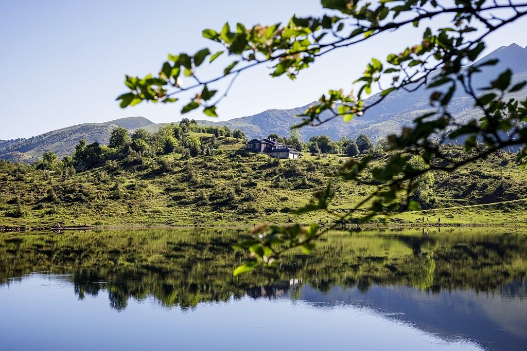
Cross Seix then head towards Couflens via D3. Then, turn left towards D8F in direction of Aulus-les-Bains. Pass over Col de Latrape before arriving at the village of Aulus-les-Bains. Continue on D8F after Aulus-les-Bains then climb Col d'Agnes to the Lers pond heading towards Massat via D18. 

3- FROM MASSAT TO FOIX

In Massat, take the direction of Saurat Tarascon sur Ariège D618. Climb up to Col de Caougnous. At the col turn left on D17 to start the ascent of Col de Péguère. From Col de Péguère, continue on D17 in direction of Le Bosc. Cross Serres sur Arget, Saint-Pierre de Rivière before reaching Foix. 

4- FOIX

You have arrived at Foix

Geologické zajímavosti

Ano

Bezpečnostní pokyny

Emergency number: 112

Informace o příjezdu
Parkování

Parking near the starting point

Další informace a tipy
Úroveň obtížnosti

4

Další informace

To learn more about the destination, visit our website.

Pěší turistika a stopování

Pěší turistika a stopování

Pěší turistika a stopování
Více než 550.000 návrhů výletů, podrobné mapy a intuitivní plánovač tras dělají z aplikace nezbytnou výbavu pro všechny milovníky přírody.
bergfex