


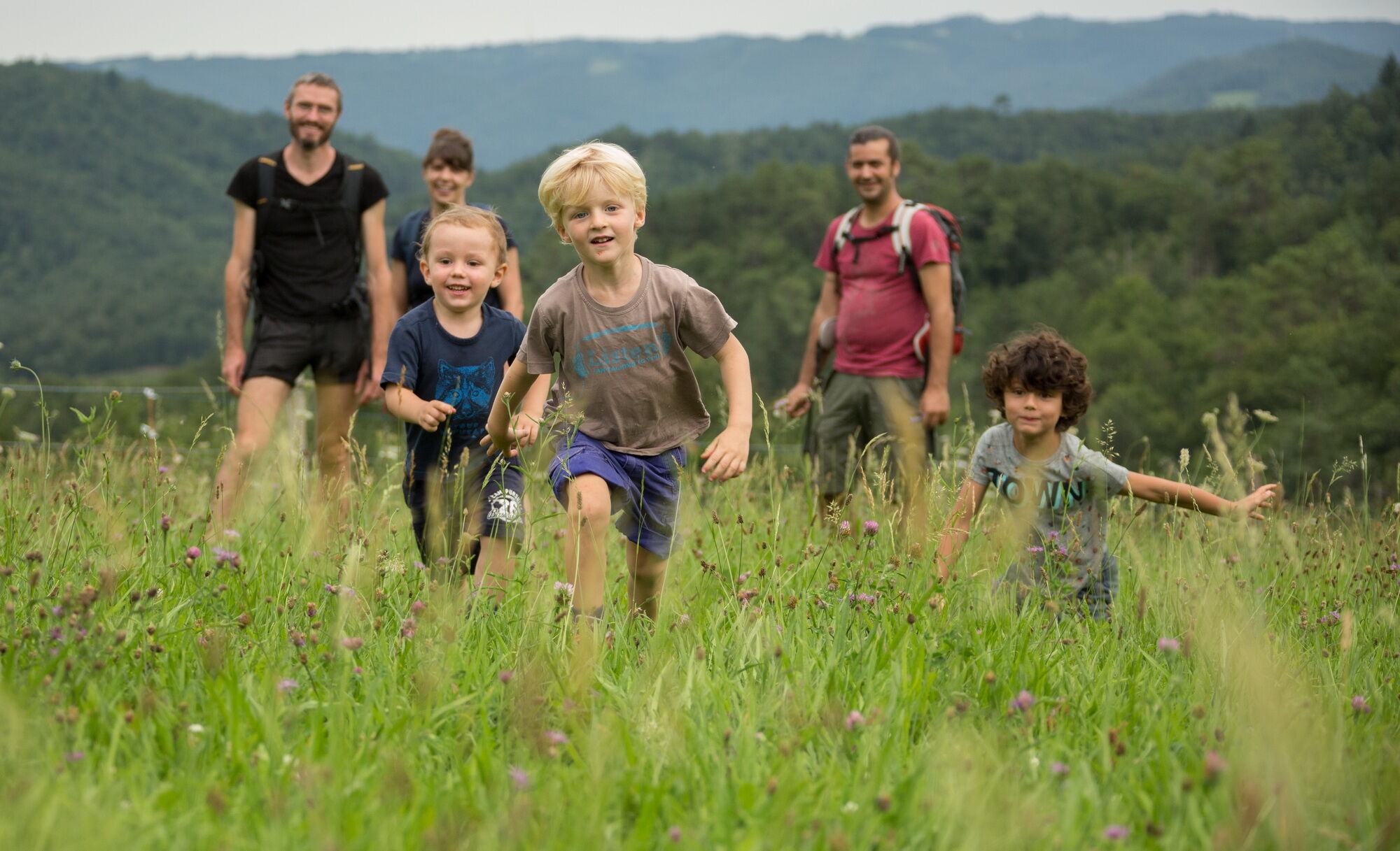
L'école buissonnière
You will hike in the footsteps of history in Aubazine, Corrèze, Curemonte, Uzerche, at the Tours de Merle, on the Gallo-Roman site of Les Cars... and enjoy many exceptional viewpoints!
The Romanesque church...
You will hike in the footsteps of history in Aubazine, Corrèze, Curemonte, Uzerche, at the Tours de Merle, on the Gallo-Roman site of Les Cars... and enjoy many exceptional viewpoints!
The Romanesque church of Saint-Chamant is at the heart of this village that you will overlook throughout this walk through woods, walking past old vine huts ending with beautiful panoramic views over the Soulages castle and the village of this community.
Follow the yellow markings.

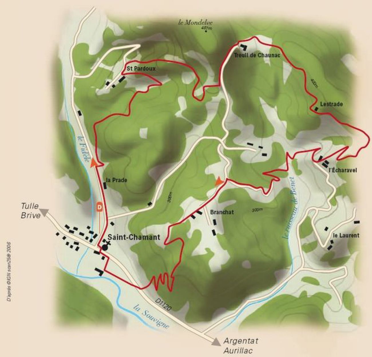
From the town hall of Saint-Chamant, cross the D 1120 (be very careful), take the alley opposite then turn right. At the church (remarkable porch), follow left in the direction of Saint-Bonnet-Elvert.
Leave the road. Follow the path going up on the right. At the vine hut, continue straight ahead, then left at the stream. Climb to Saint-Pardoux staying on the main path. View of the hamlet of Espargilière.
Take the uphill path on the right (beautiful oven). At the barn, take the right path that goes up through the undergrowth, then right at the fork. Pass a barn and a ruined building at La Vergne, then continue always on the left tracks going up.
Follow the road to the left (shortcut to the right towards point 6), at Treuil-de-Chaunac, view of the surrounding hamlets and, in clear weather, of the Xaintrie. After Le Treuil-deChaunac, take the road on the right then, after the cross, the stoned path opposite.
Before the crossroads, turn right. View of Le Laurent, the puy du Tour and the canton of Mercoeur.
After L'Écharavel, leave the road and follow the path on the right. Turn left at the stream, then the dirt path on the right.
Turn left at the junction. Cross Branchat. View of Saint-Chamant and the Souvigne valley. After the vine hut, head left, then right at the stream.
Cross the D1120. Continue on the road opposite. Go 300 m to the right, cross the village and return to the start.
Ano
Clothing adapted to the season and conditions (cold, hot, humid...)
Hiking shoes suitable for the terrain (even for children!)
Hiking poles (useful for stability and to relieve joints)
Mobile phone and spare battery
Before leaving:
Check the general and local weather ensuring no precipitation Inform yourself about the approach walk, itinerary height, duration, possible escape (IGN map, GPS, guidebook, etc.) Evaluate possible risks by consulting mountain professionals, refuge, lodges Inform a close person of your goal and contact them again if changes: departure and return times, number of participants with phone number of each, vehicle(s), parking Avoid going alone, use equipment suitable for the activity, adjusted and in good condition, headlamp, complete first aid kit, survival blanket, etc.In case of problem
Alert: call 112 (European emergency number)
5 key points to transmit your alert:
Where? municipality, place, itinerary, altitude Who? identity, phone number What? type of accident, number of victims, severity, fall dynamics When? time of accident Weather? wind, visibilityThink about carpooling
Parking possible near the starting point.
Please respect traffic rules.
Corrèze Tourism
45 Quai Aristide Briand,
19000 Tulle
A walk on the theme of the vine and Romanesque art.
Oblíbené prohlídky v okolí
The Tours de Merle
středníTuristika 11.2 kmBardot's Garden
středníTuristika 3.79 kmEspagnac - Chastang Dam
heavyJízda na kole 74.7 kmThe picturesque Dordogne
světloSilniční kolo 48.4 kmThe Roche de Vic Path
světloMountainbike 16.4 kmThe Étang de Miel
světloMountainbike 13.5 kmLa Dordogne et l'Art Roman (version longue)
světloSilniční kolo 29.6 kmLa Dordogne de villages en barrages - du Peuch à Argentat
heavyMountainbike 44.0 km- 5.0
Albussac - Cascade de la Vierge - Cascades de Murel
heavyTuristika 7.26 km - 5.0
Église Saint-Pierre - Longour - Chapelle Jeanne d'Arc - Argentat
středníTuristika 13.5 km
Pěší turistika a stopování


Nenechte si ujít nabídky a inspiraci pro vaši příští dovolenou
Vaše e-mailová adresa byl přidán do poštovního seznamu.