


Winter hiking from Semmering Pass summit to the 20-Schilling viewpoint
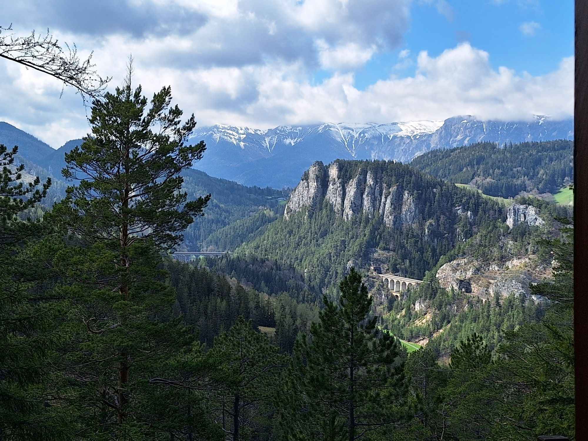
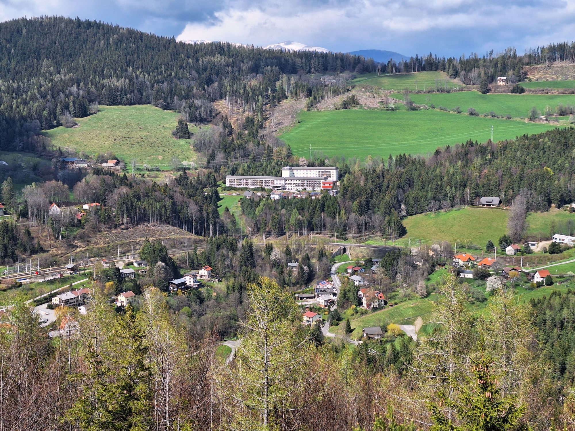
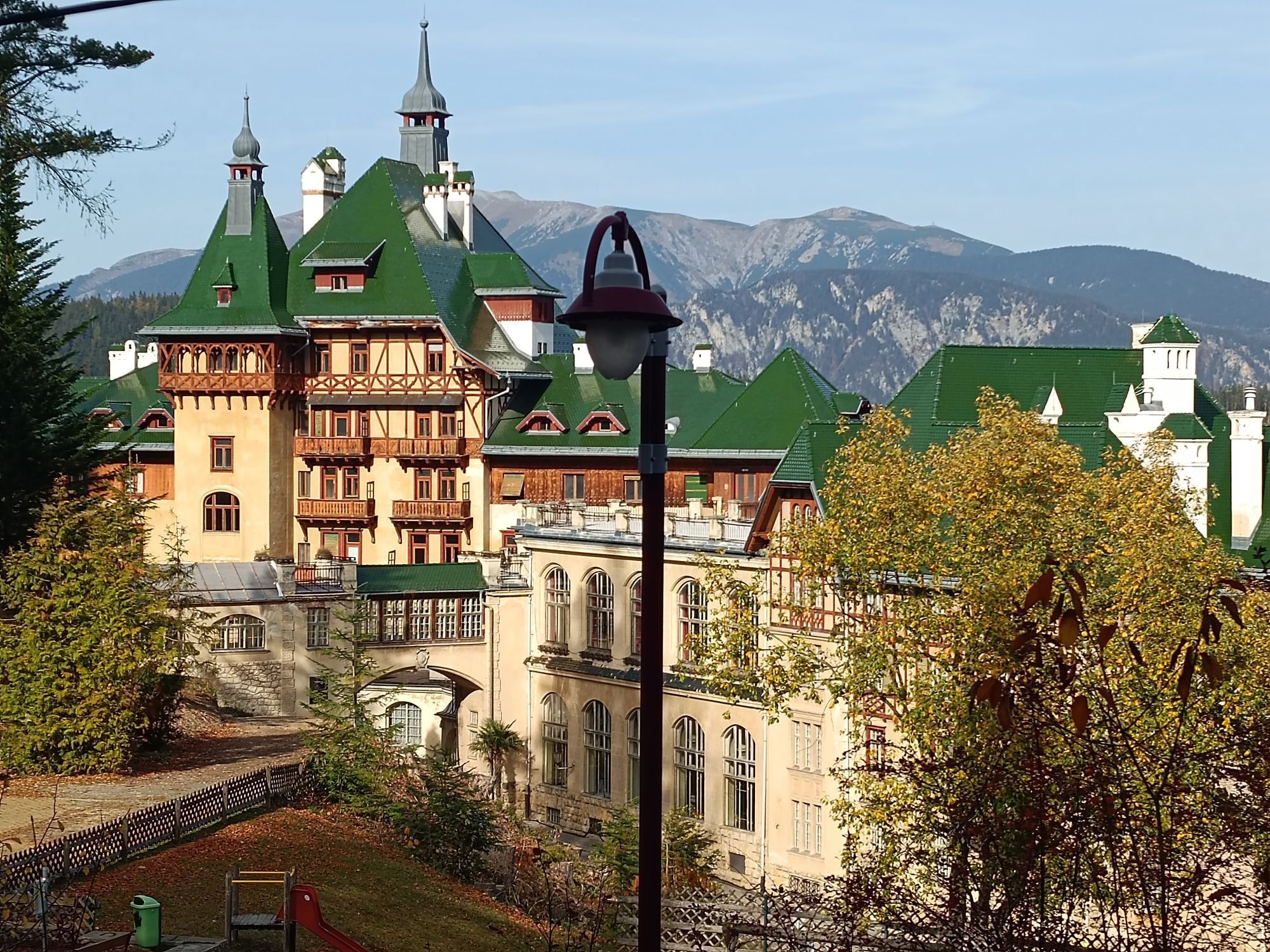
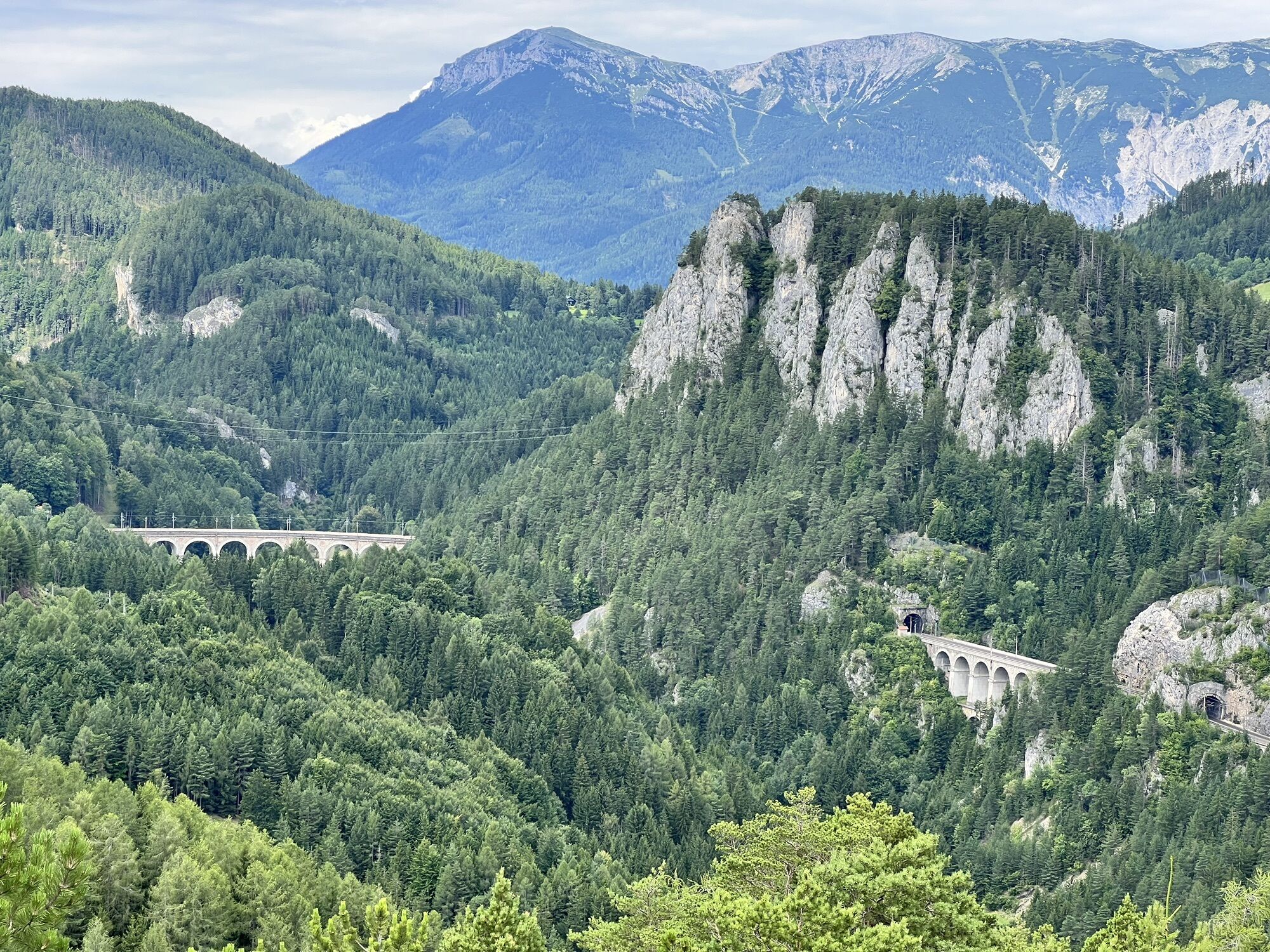
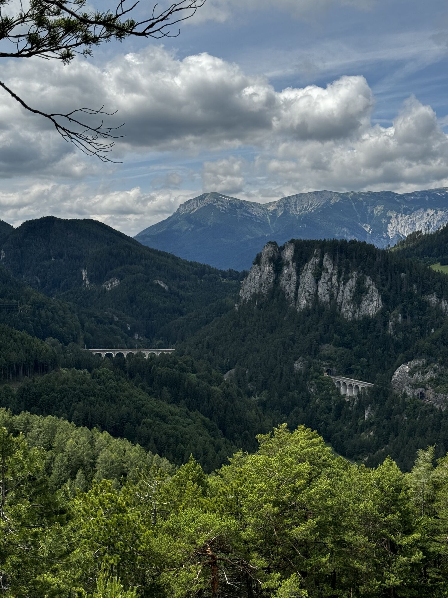
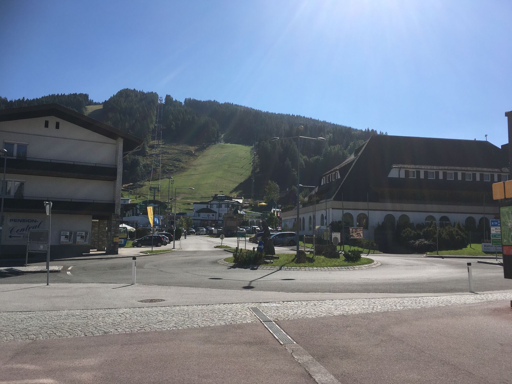
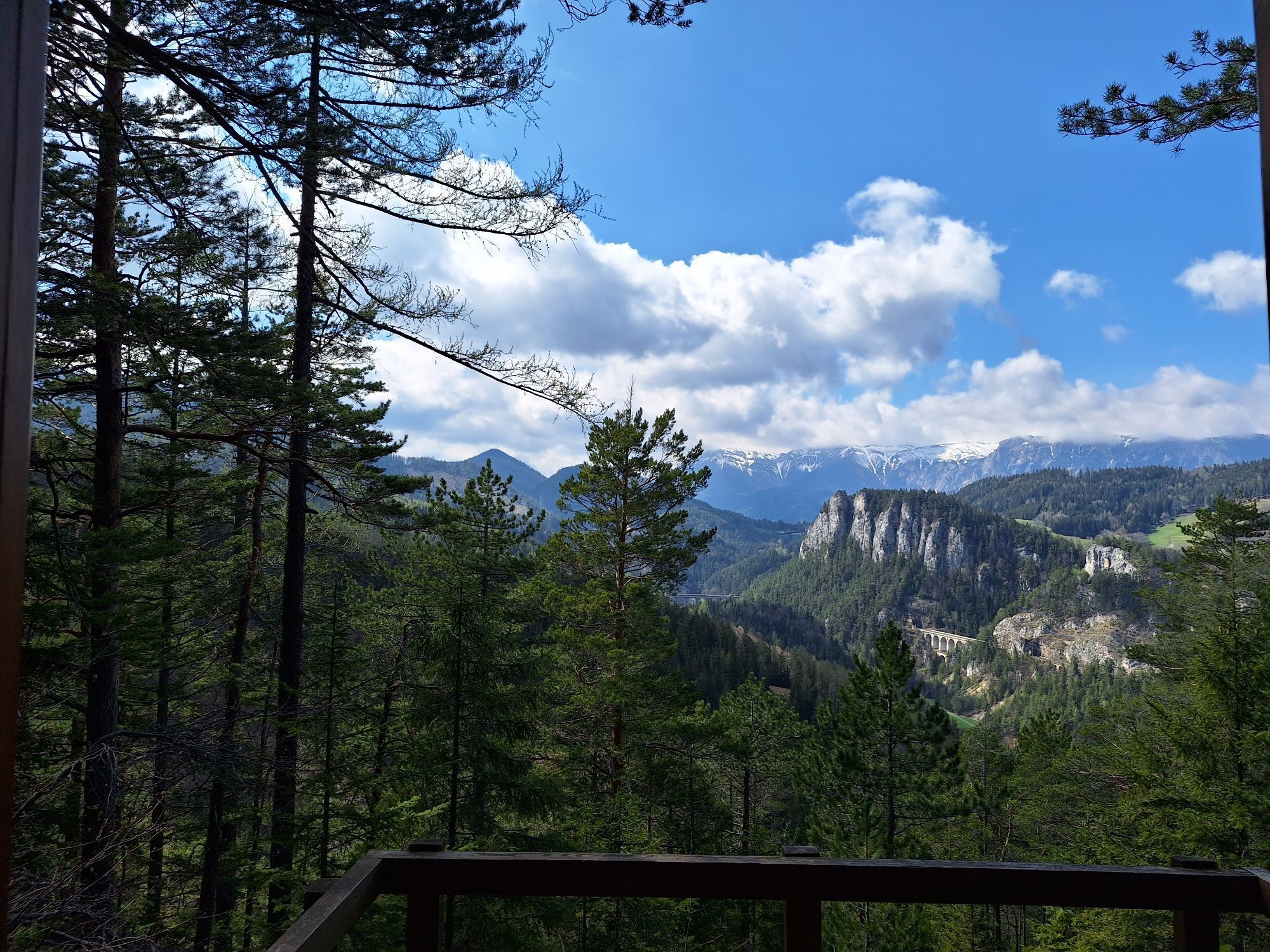
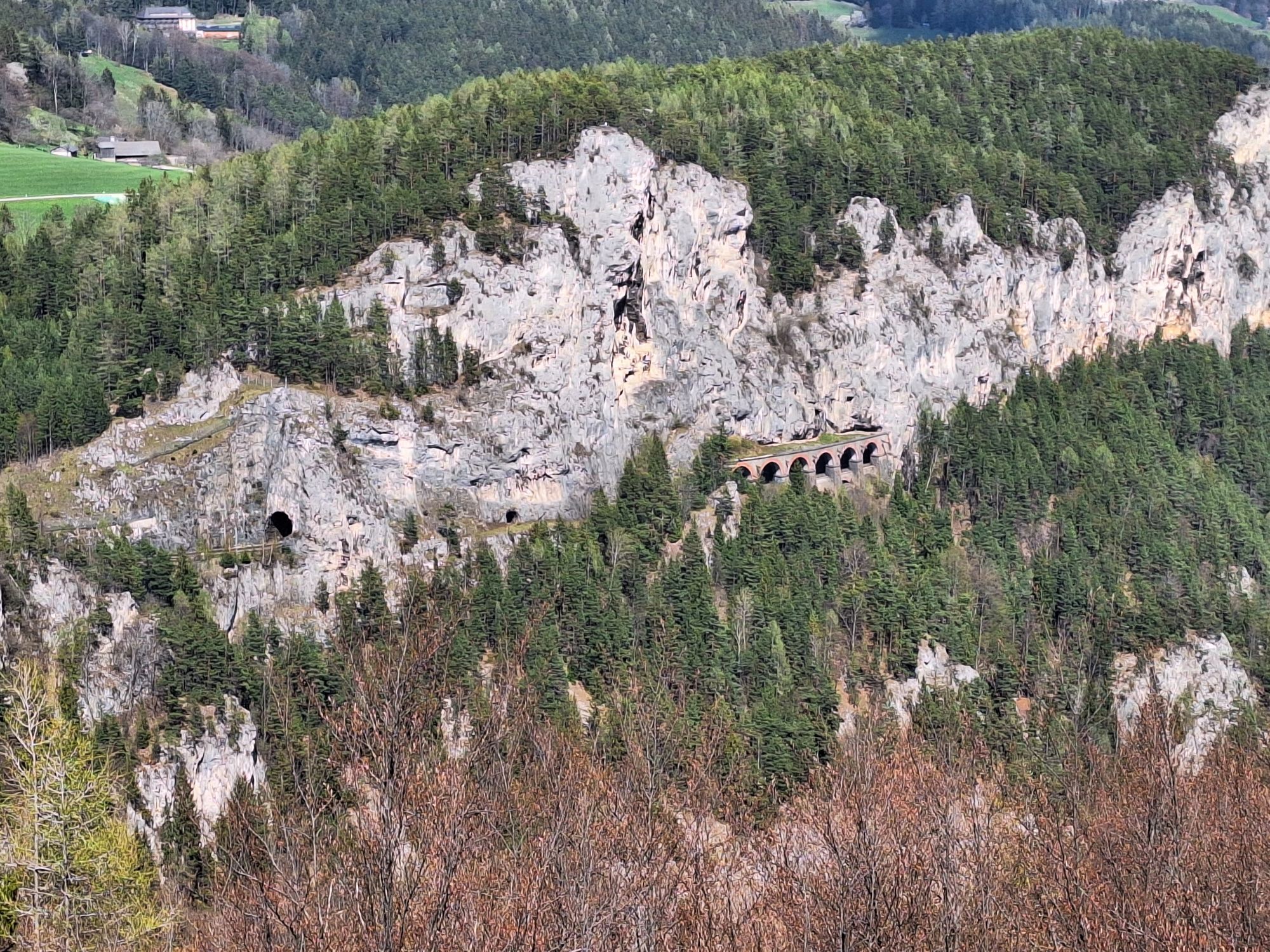
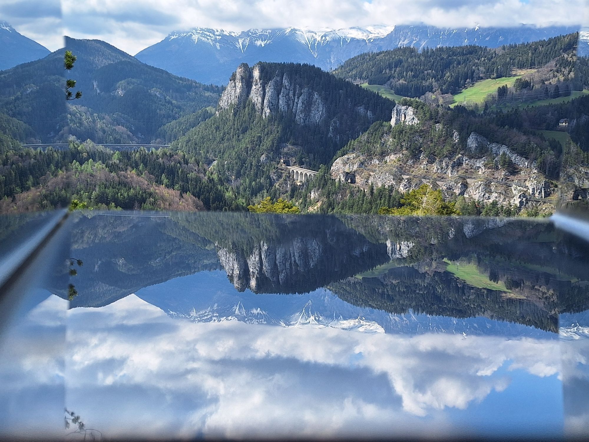
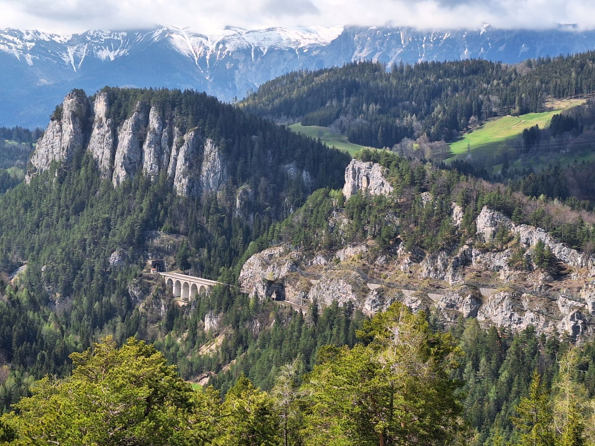
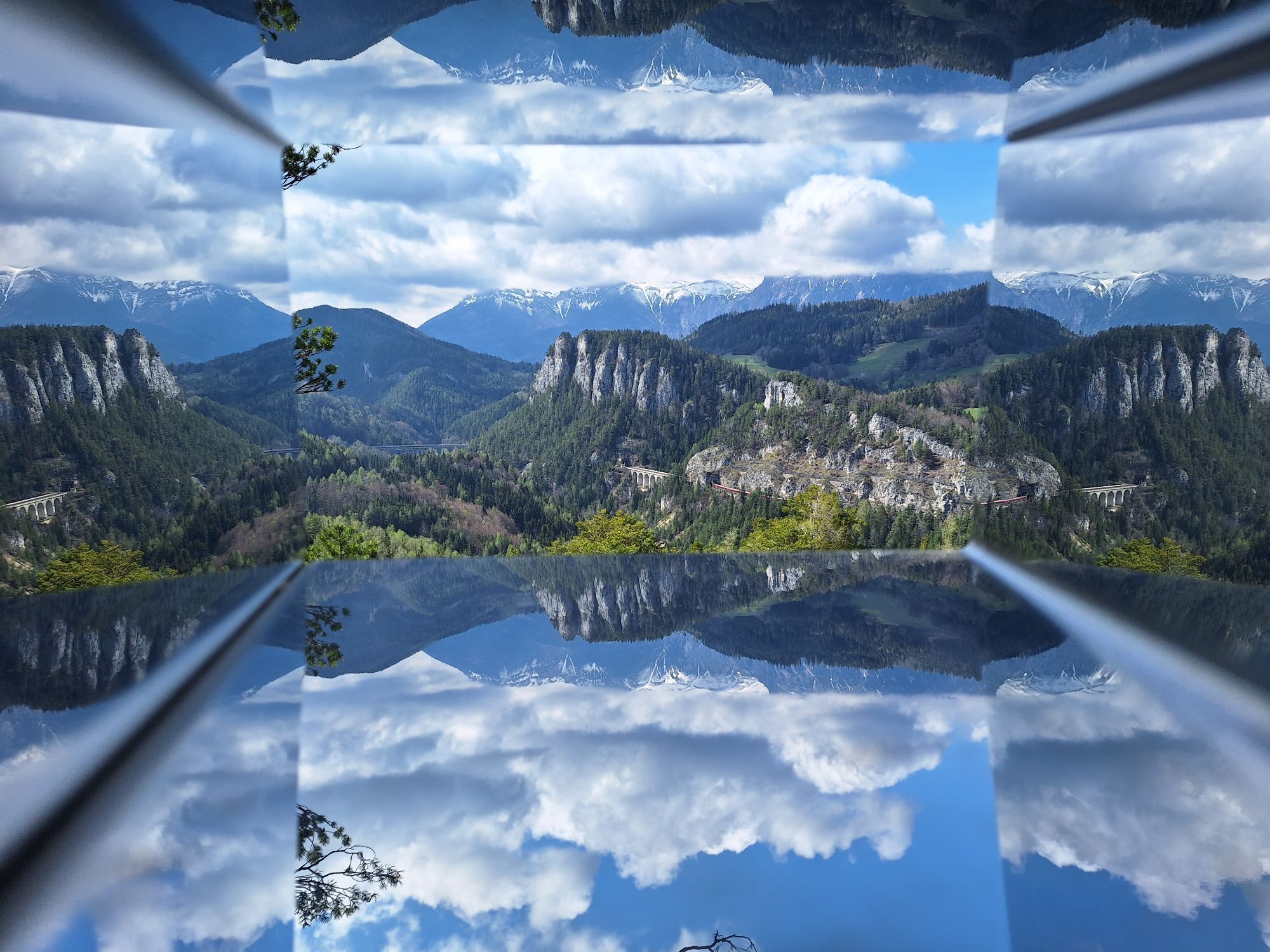
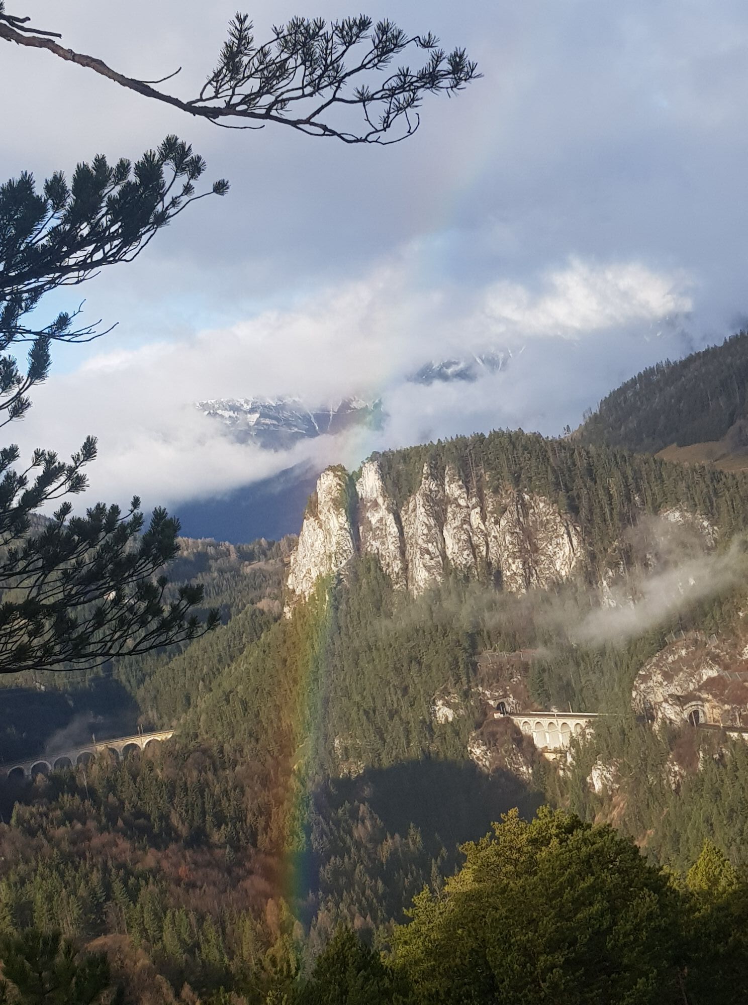
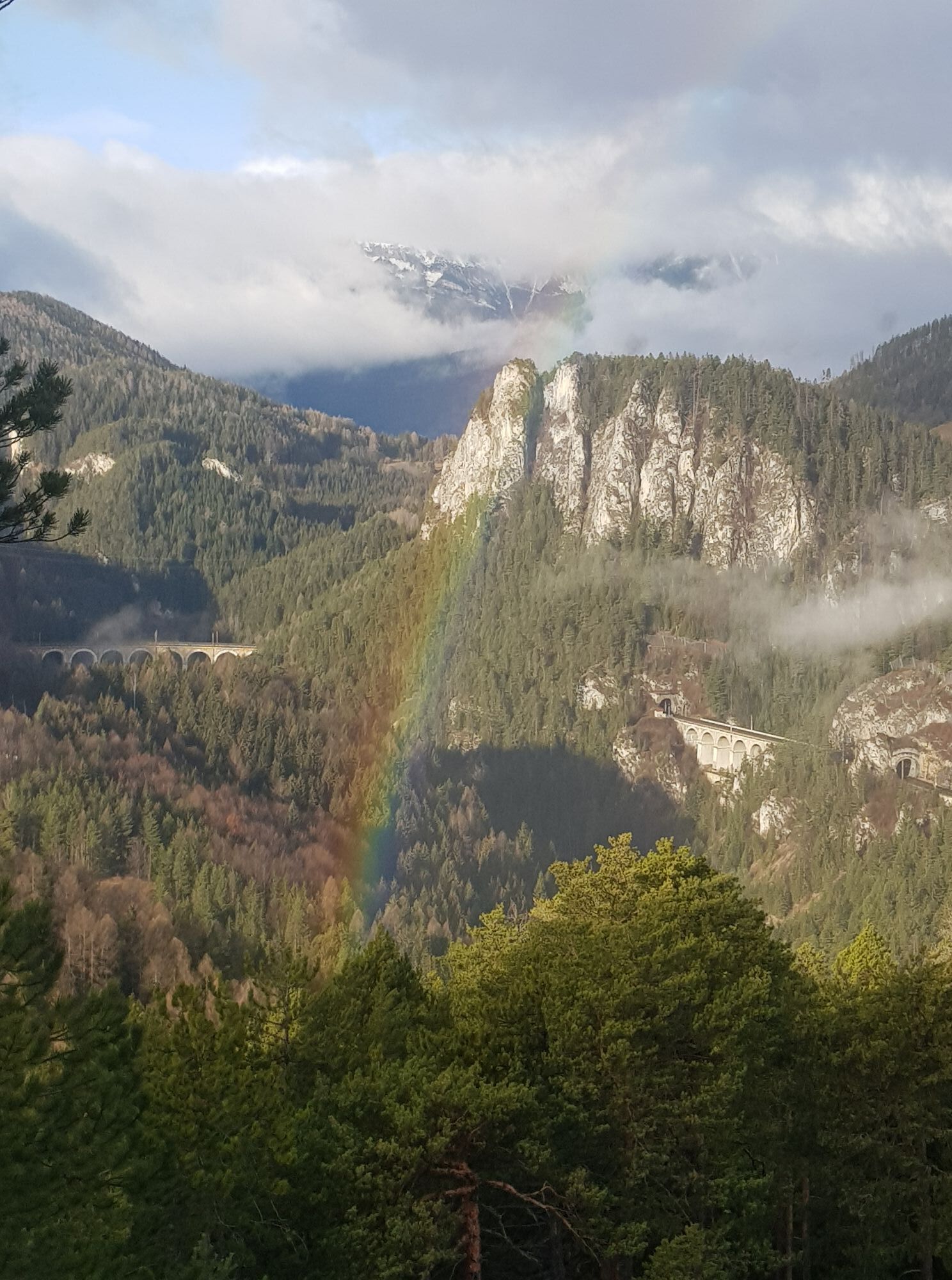
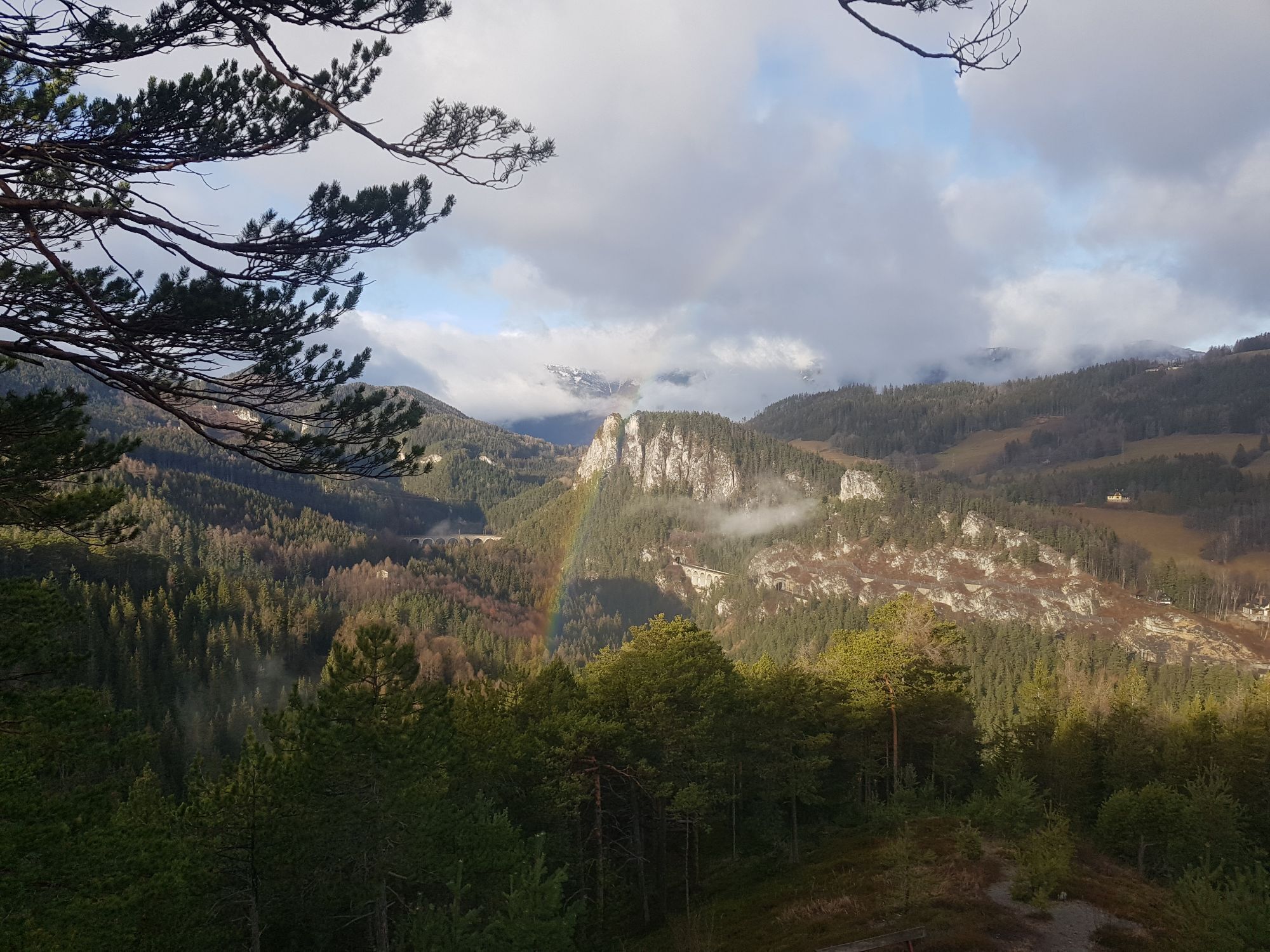
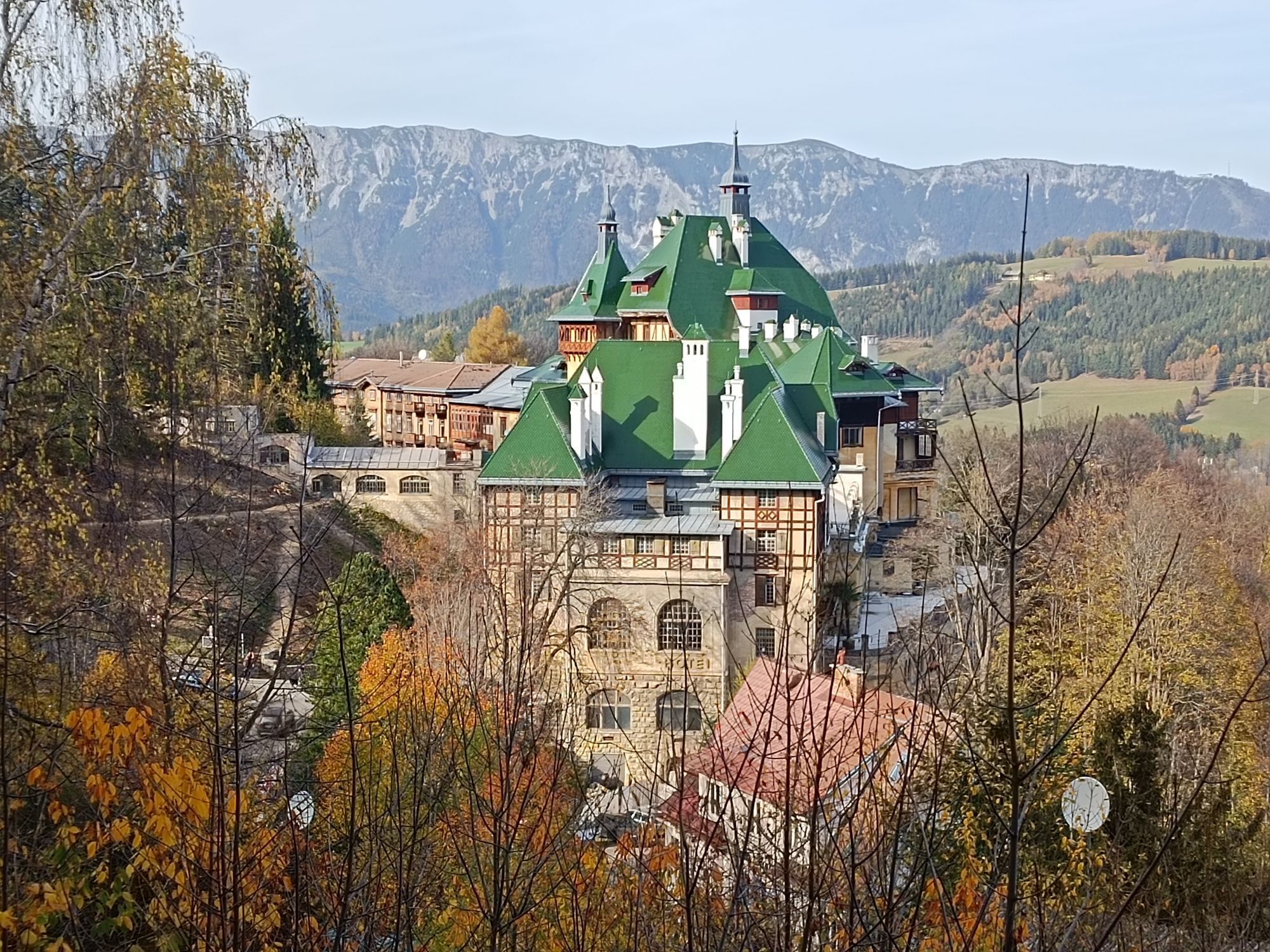
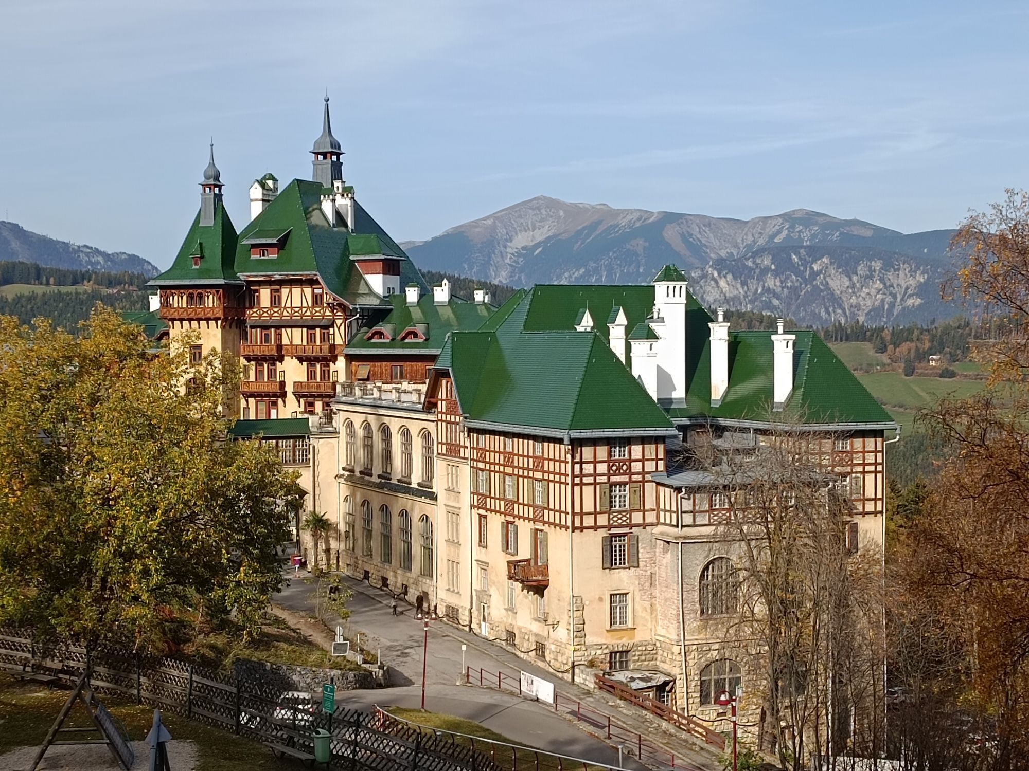
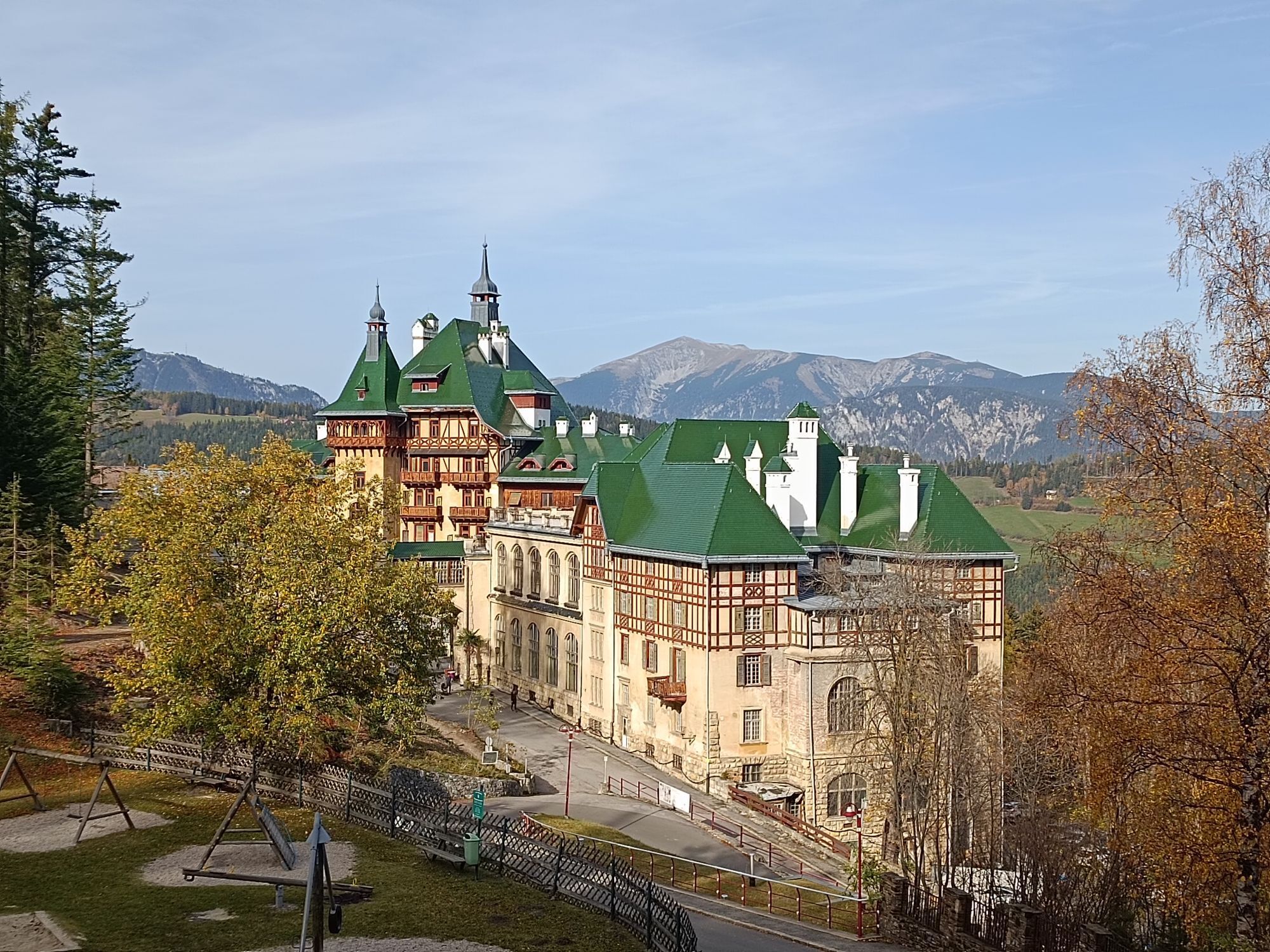
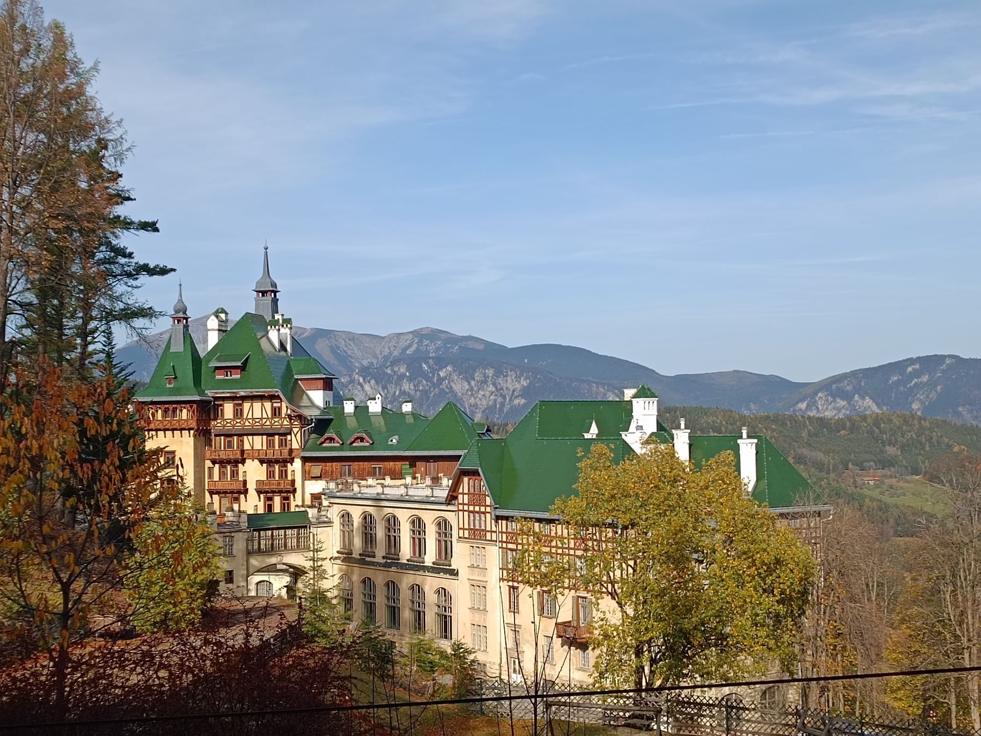
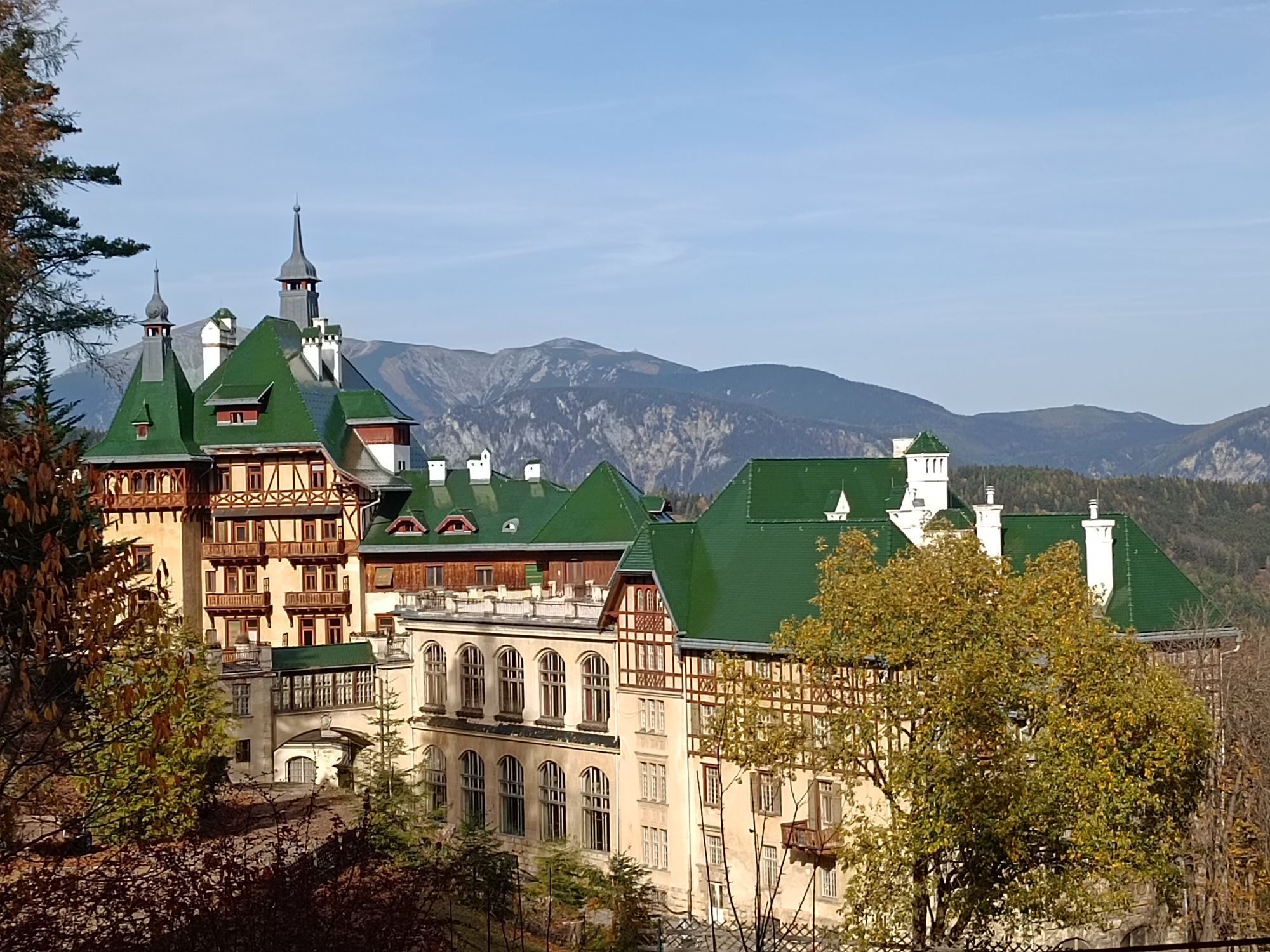
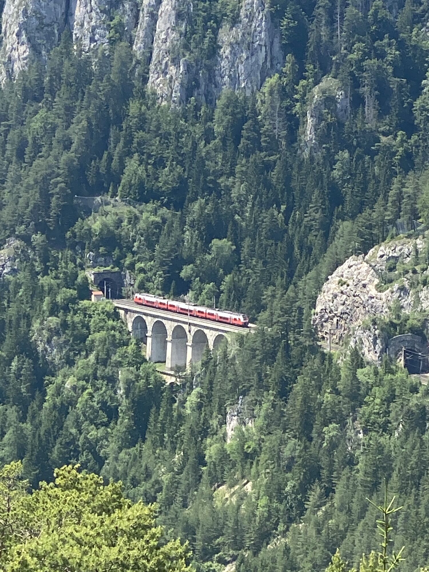
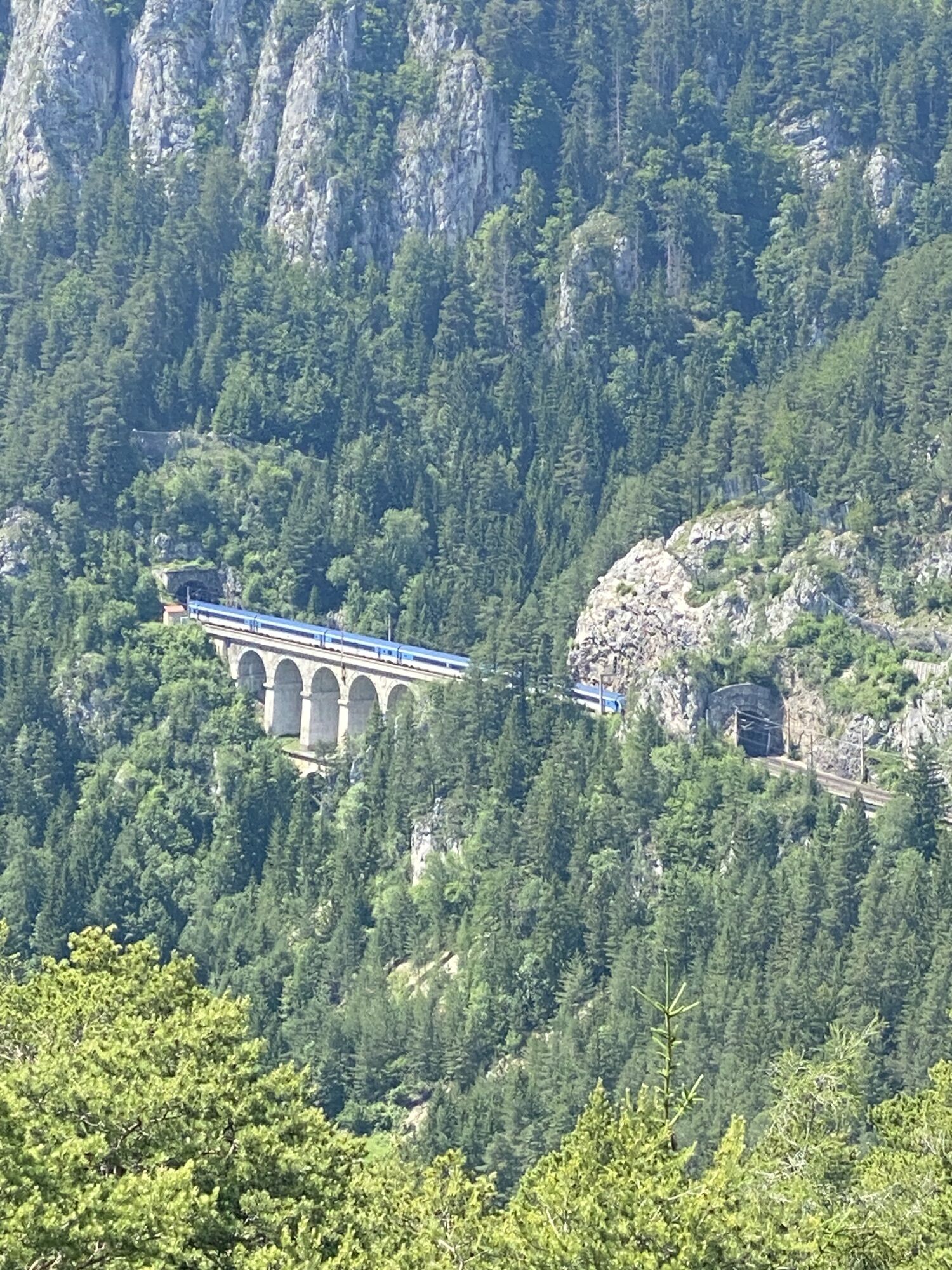
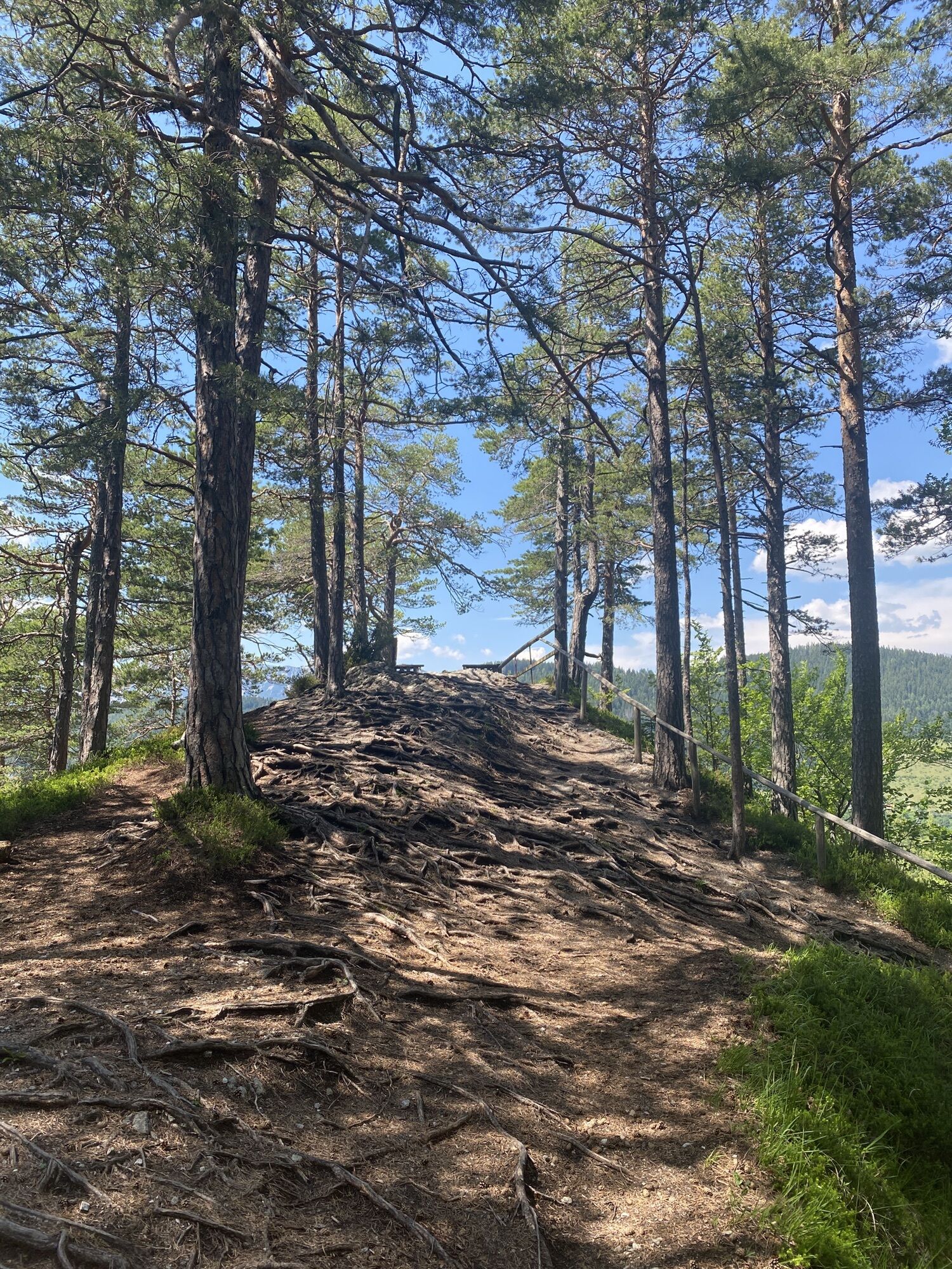
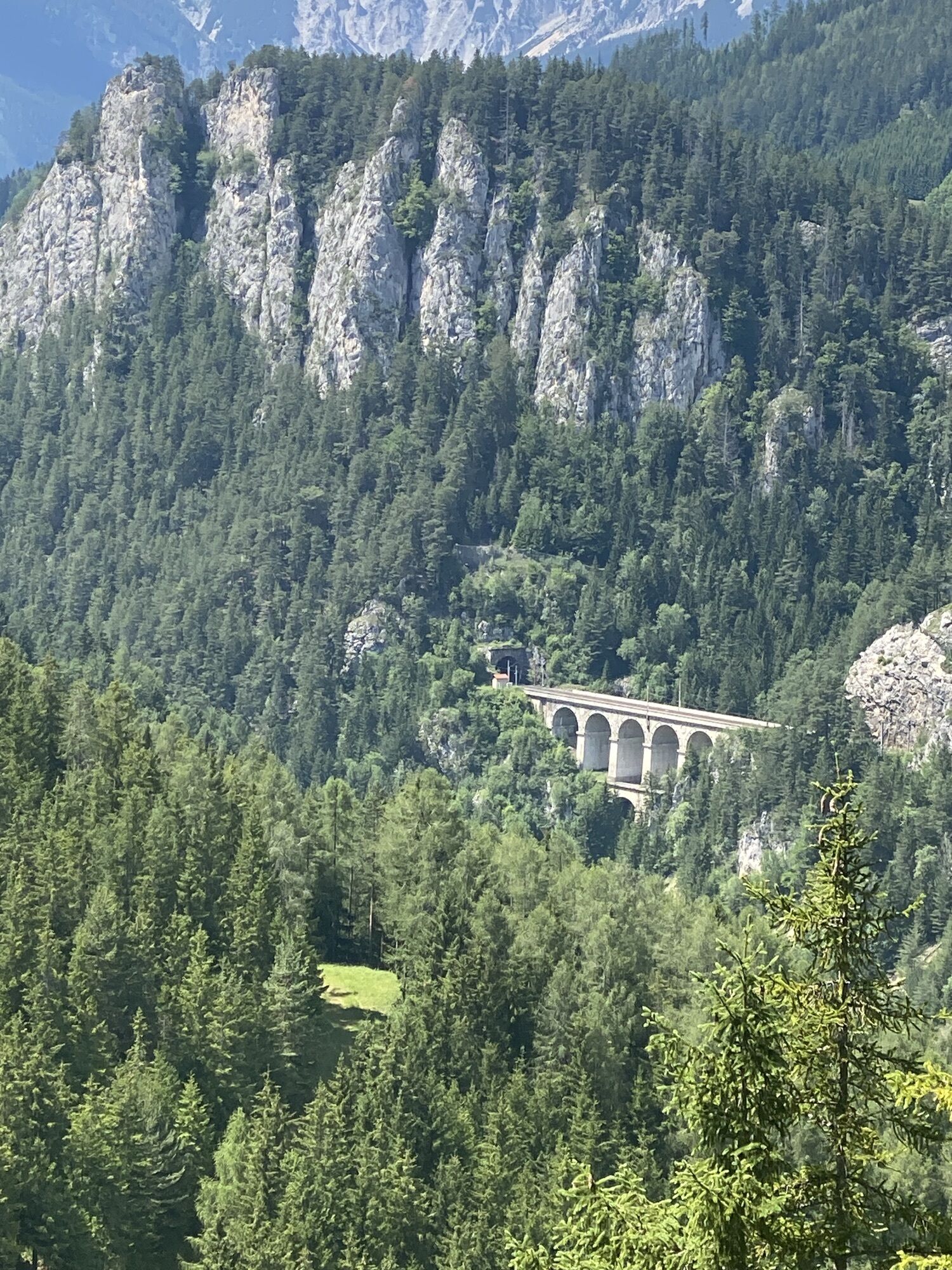
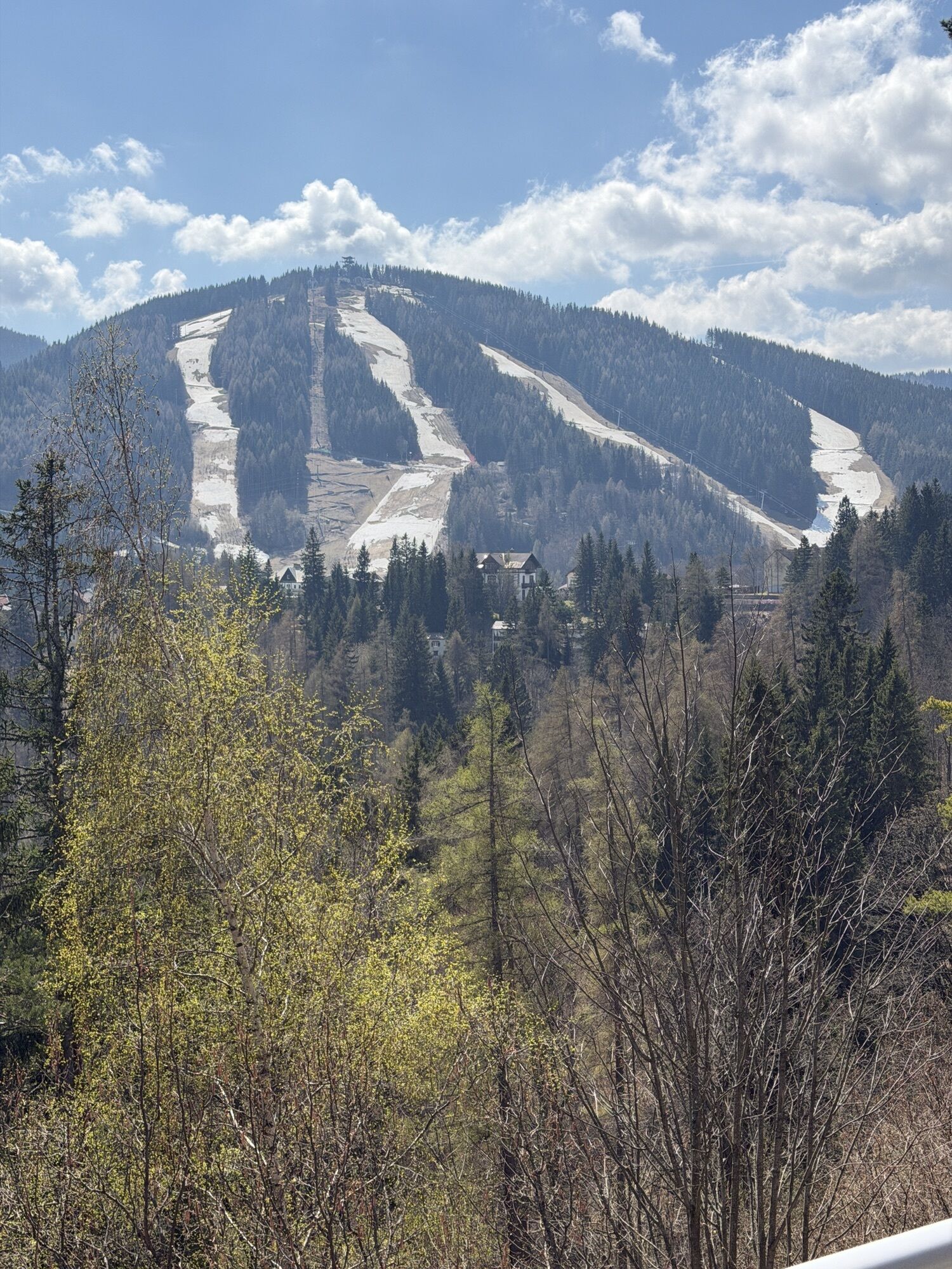
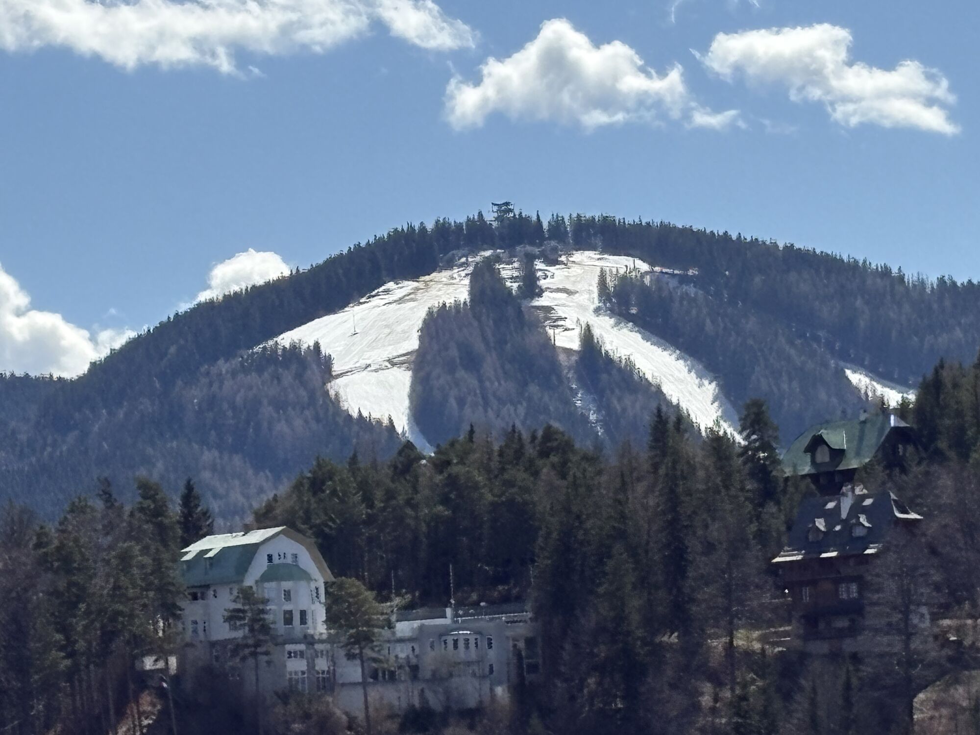
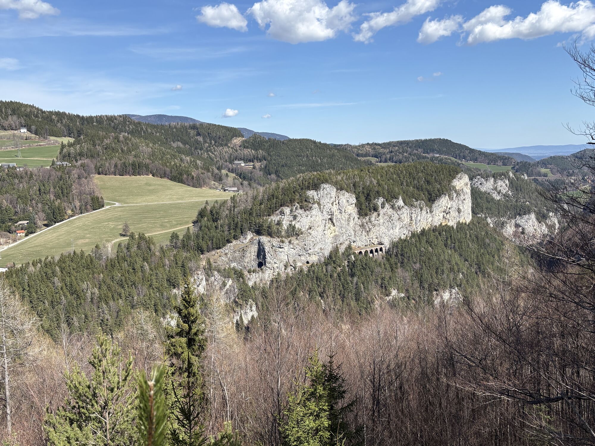
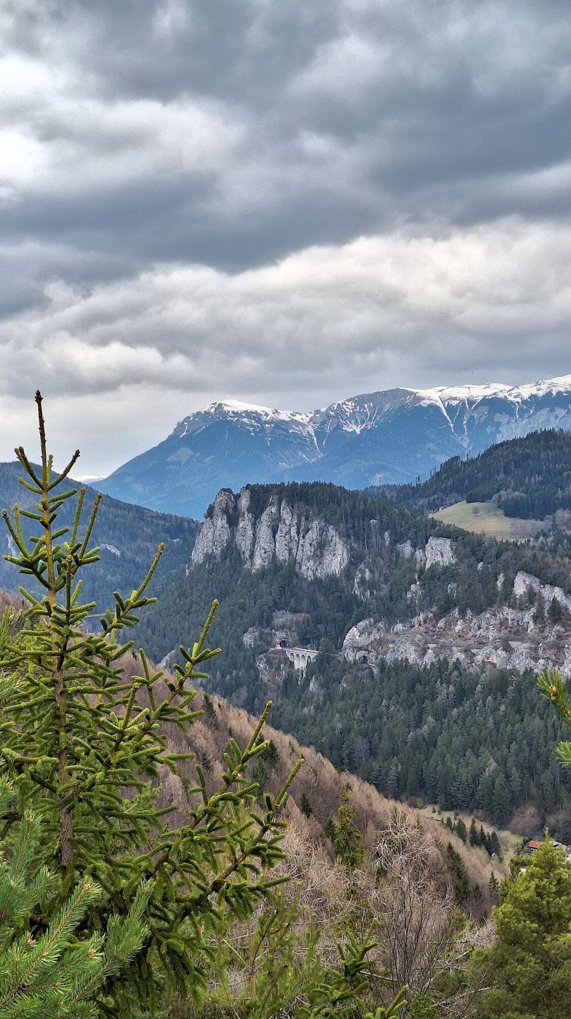
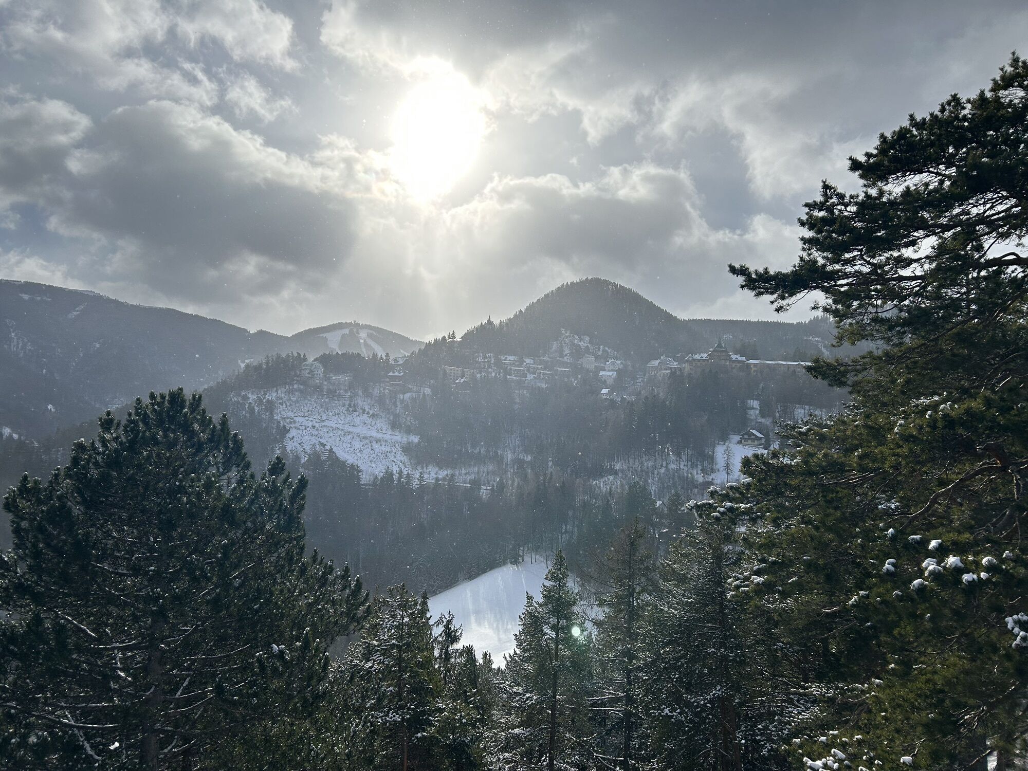
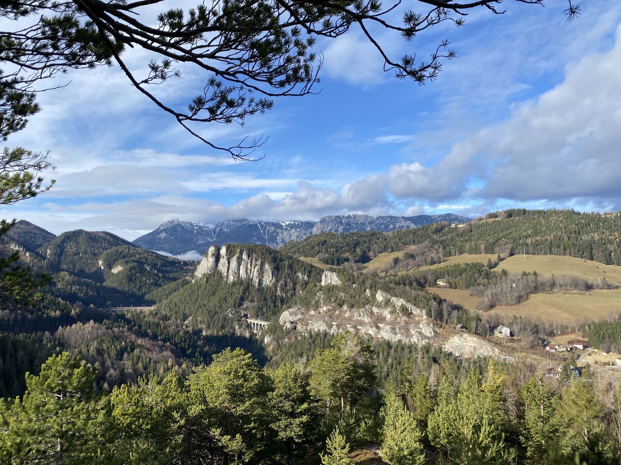
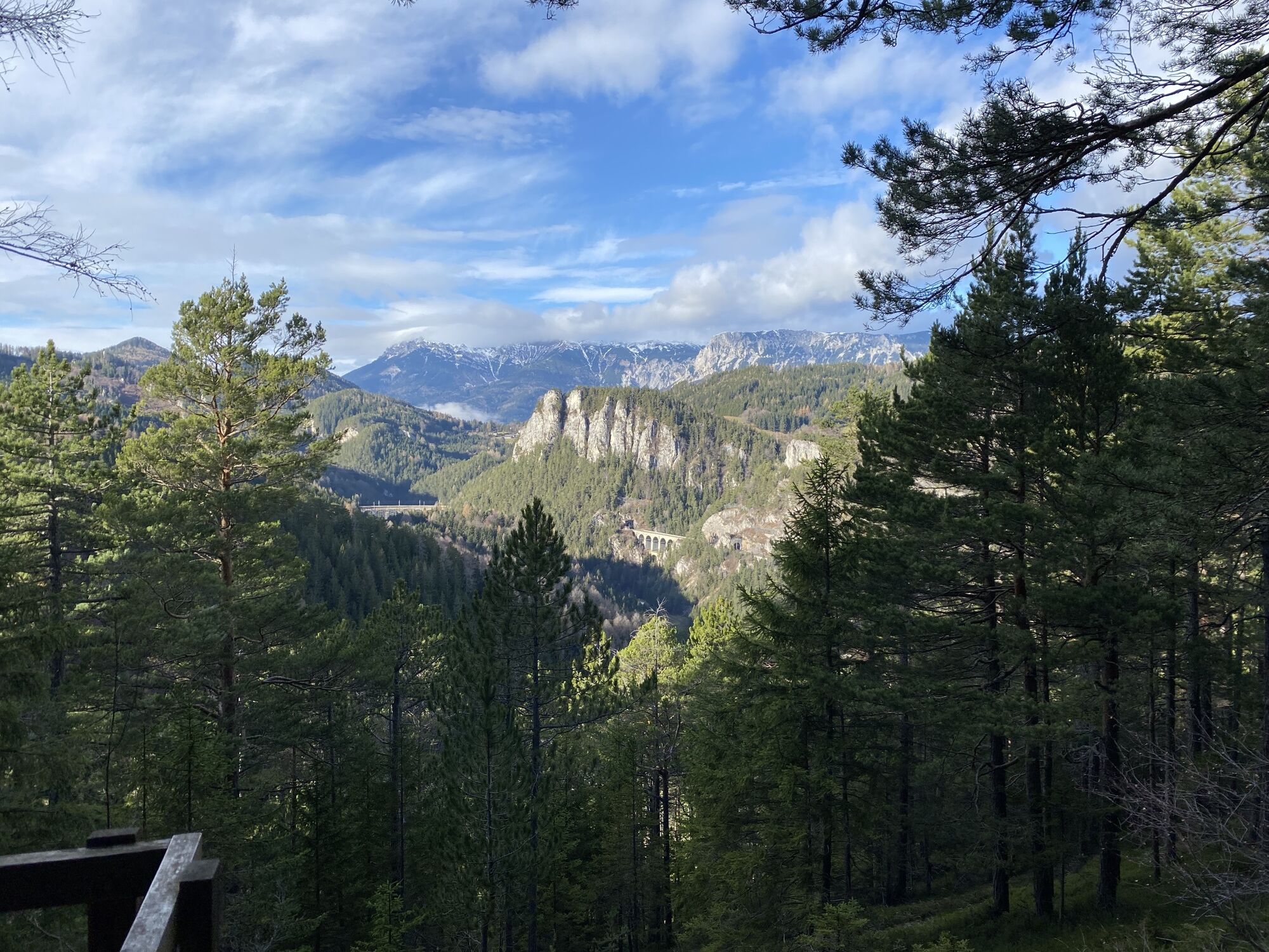
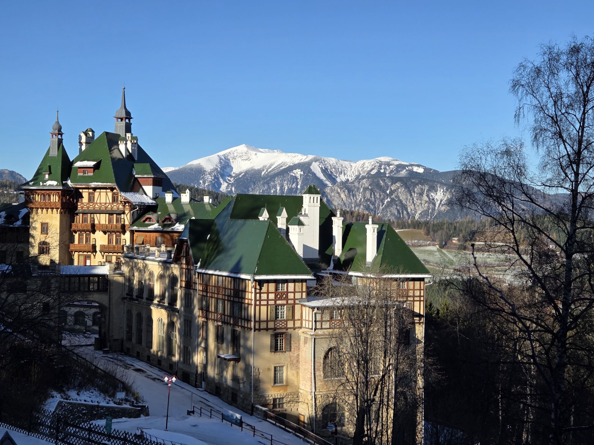

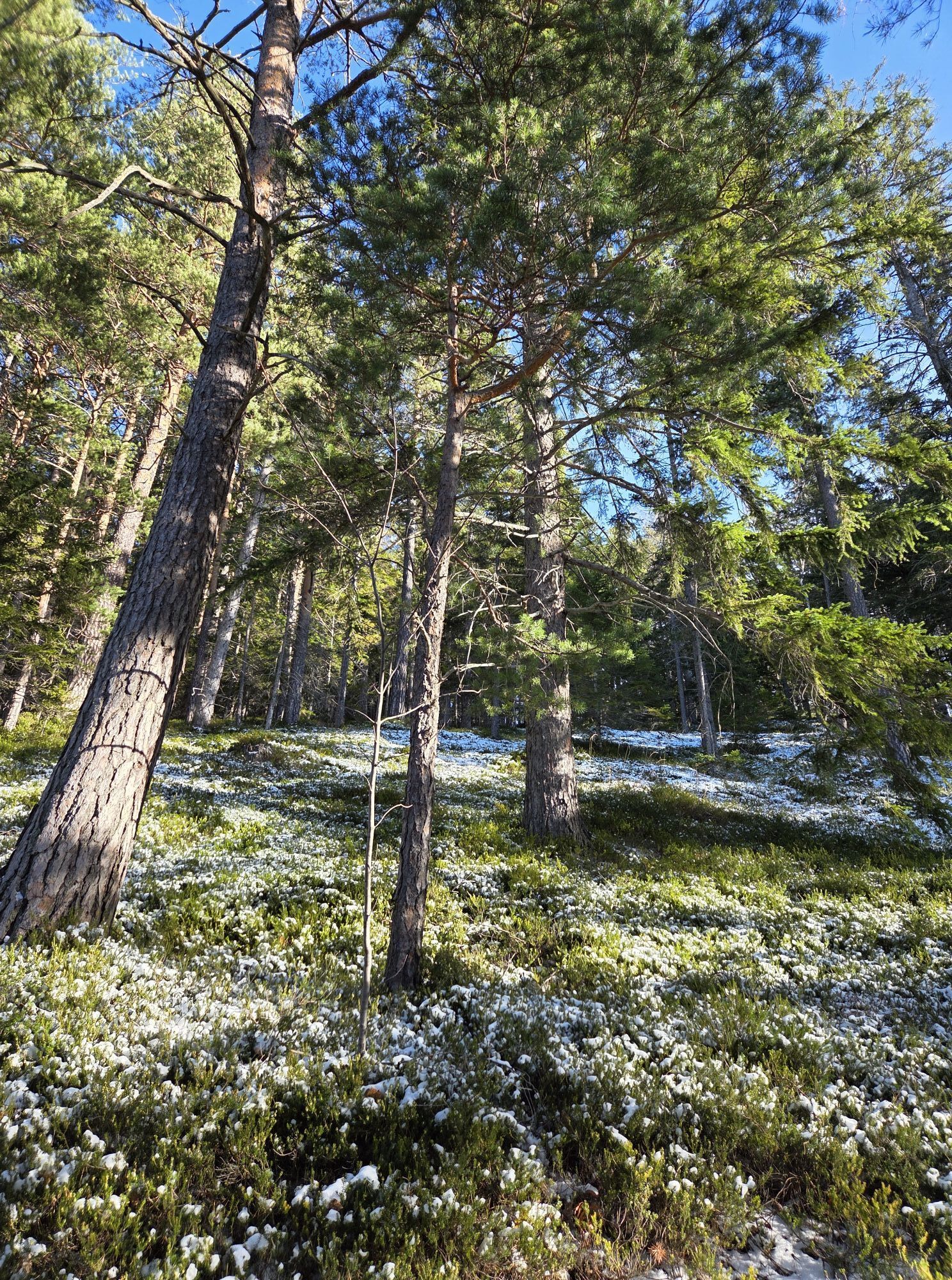
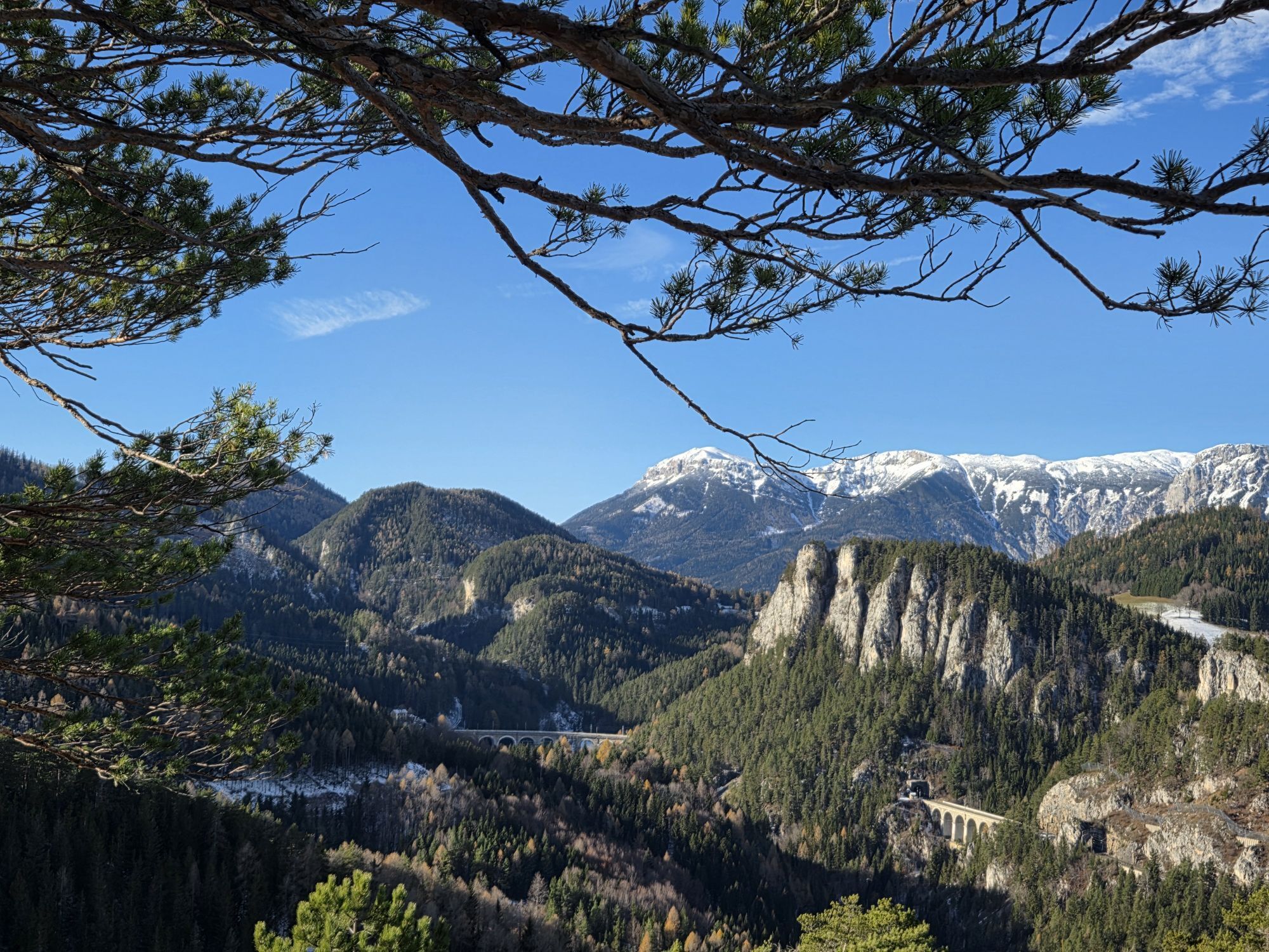
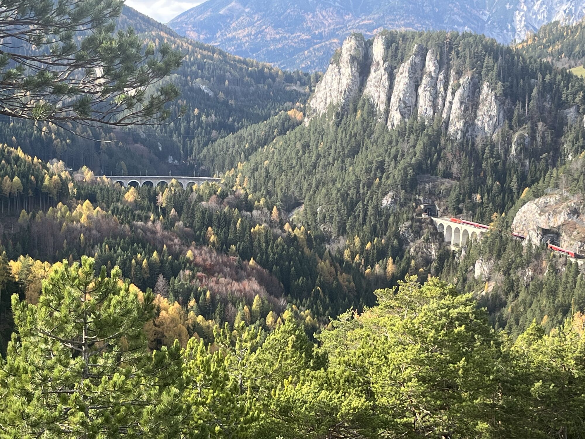
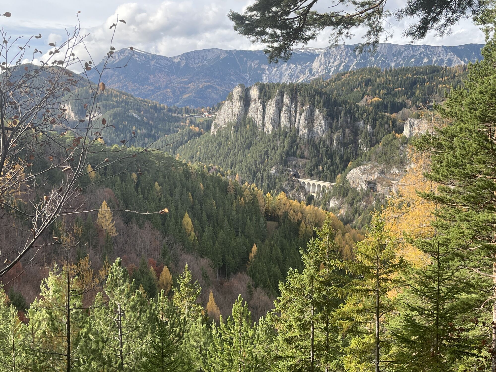
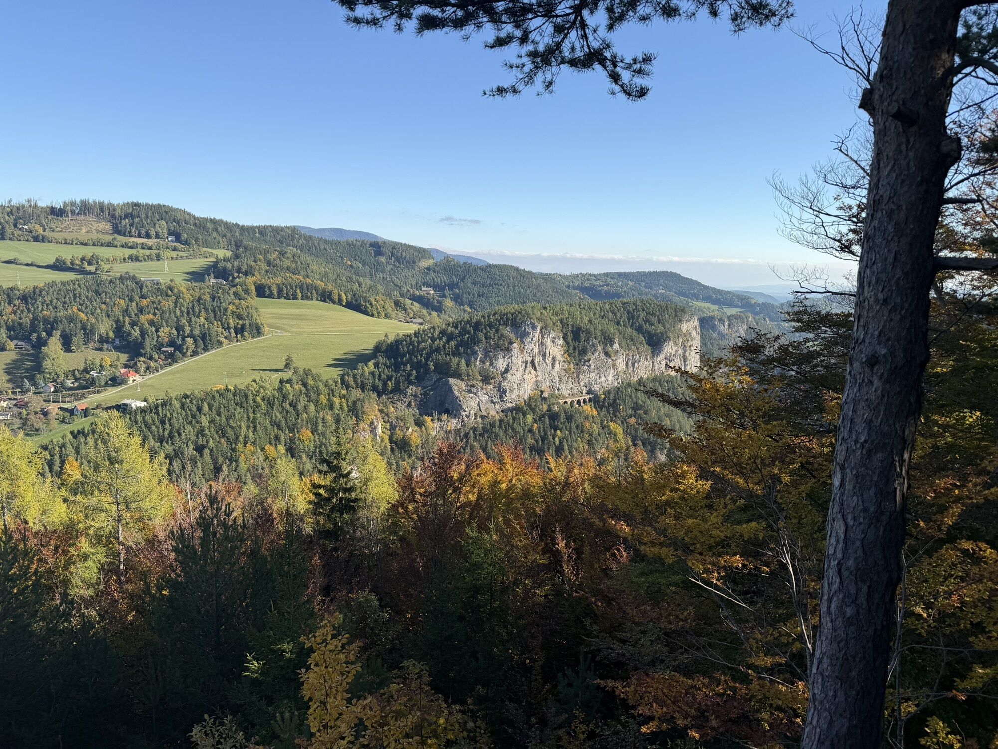
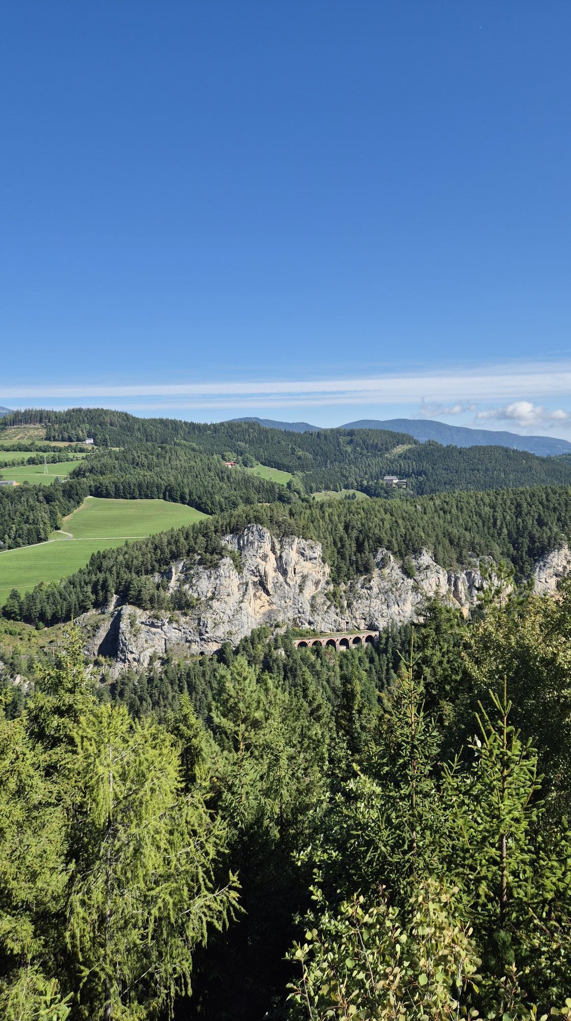
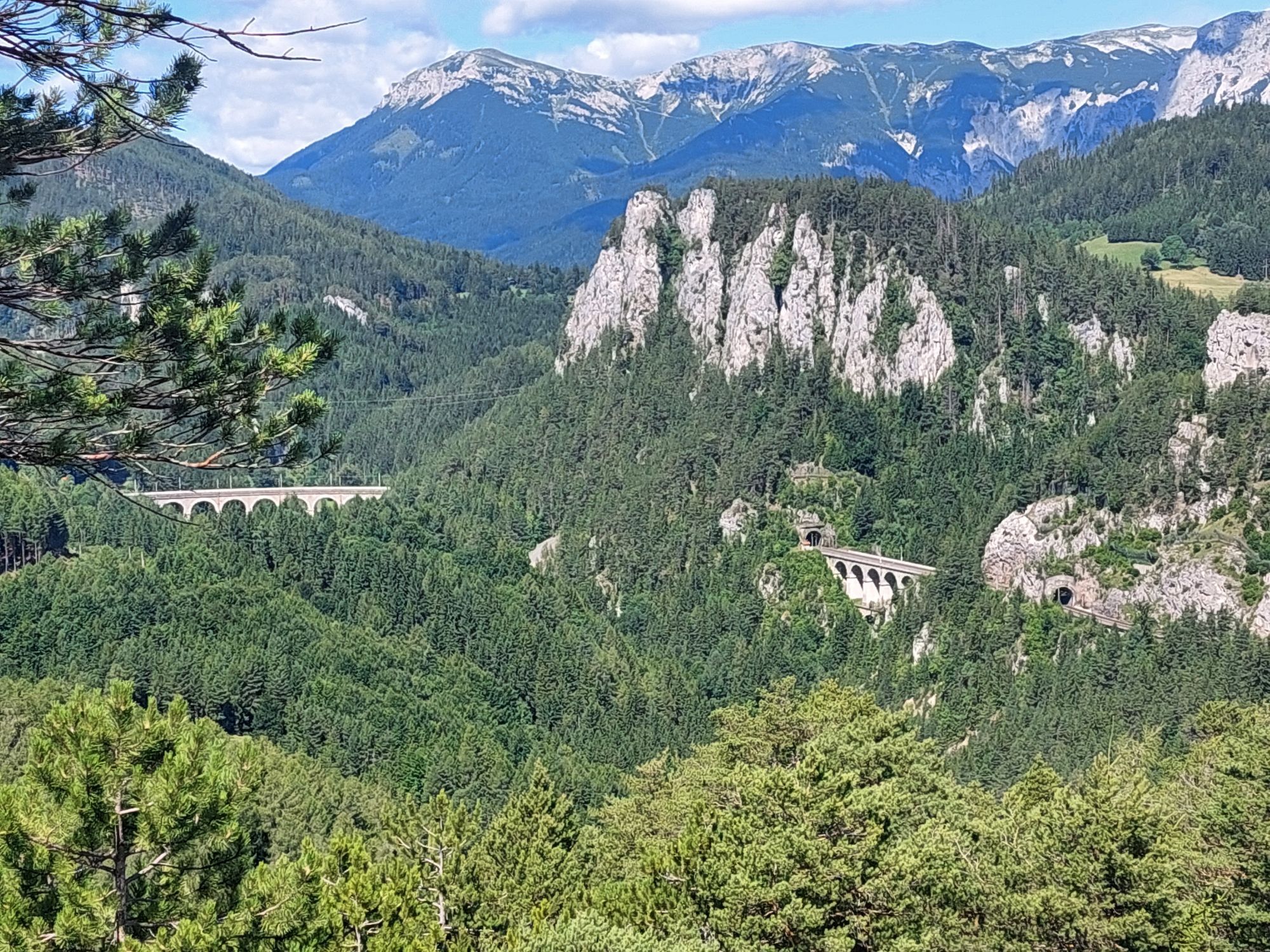
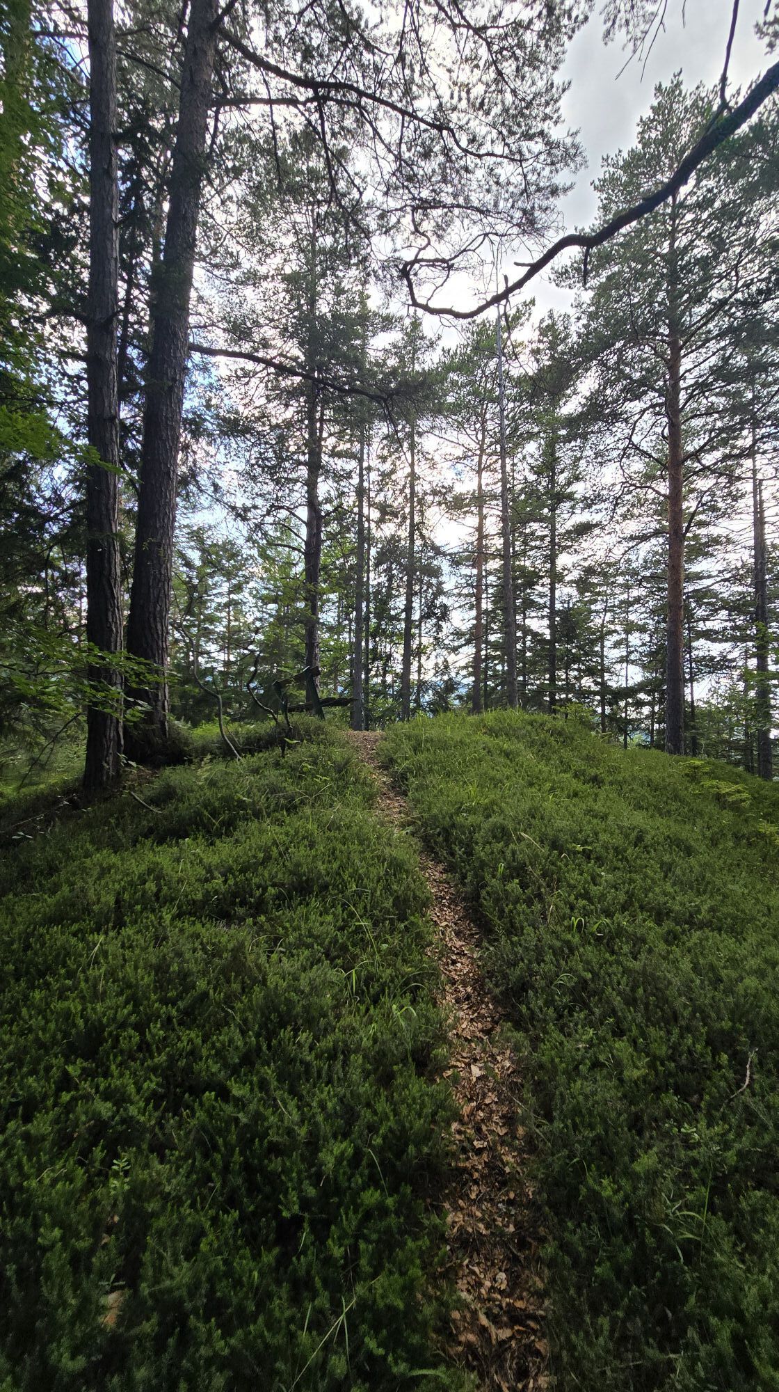
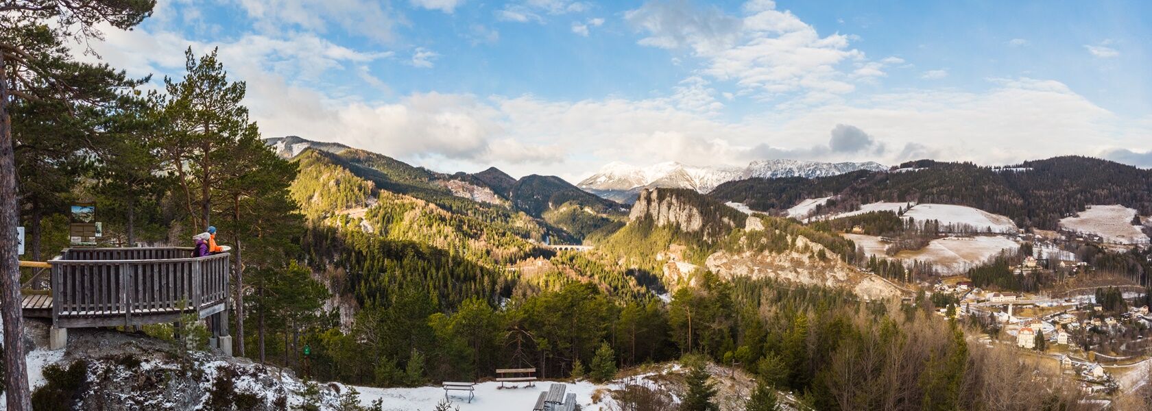
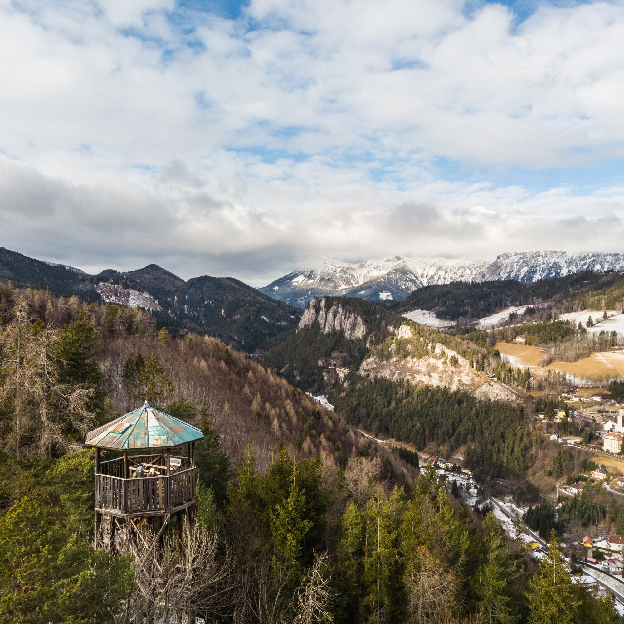
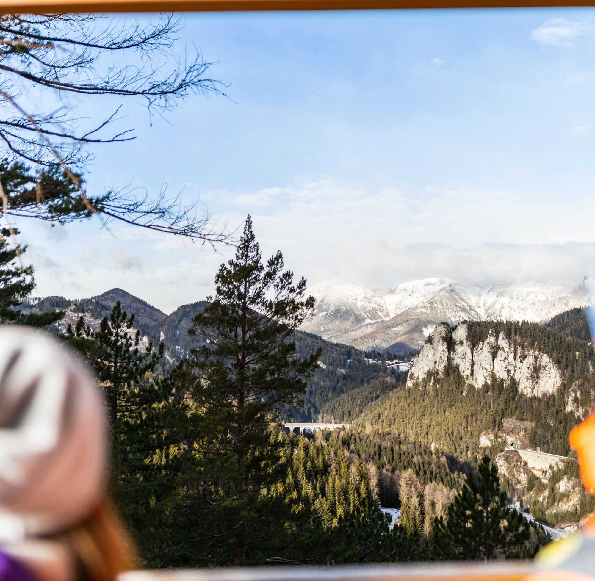
Start at the Semmering Pass summit and walk along the snow-covered Hochstraße, admiring the grand hotels and villas from the turn of the century and the winter view of the valley. The route continues past Waldhof Park and the sculpture park, past the Kurhaus, and further onto the railway hiking trail to the well-known Doppelreiter observation tower with a unique panoramic view. The highlight of the hike is the 20-Schilling viewpoint, the famous view of the Semmering railway. Then it goes back to the pass summit.
Ano
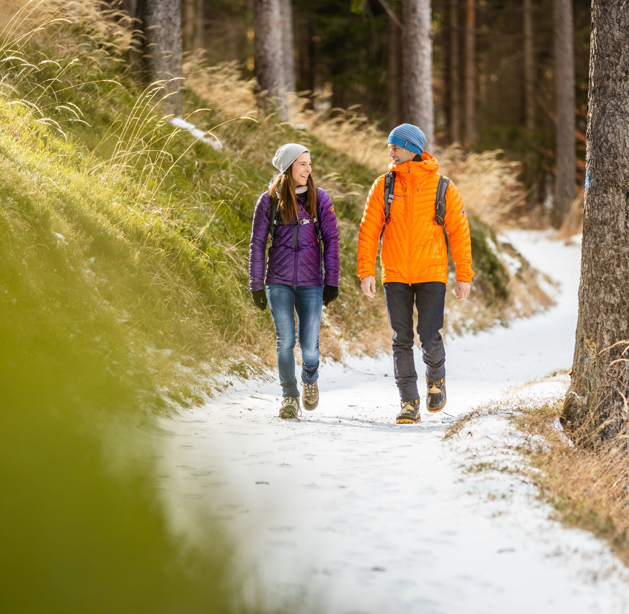
Always take suitable maps with you. Wear clothing appropriate for the route (sturdy shoes, poles, waterproof outdoor clothing, etc.). Bring sun and rain protection as well as water and a snack. Take your mobile phone and save the mountain rescue emergency number: 140
Your hikes in the Vienna Alps should be a completely beautiful and safe experience.
Please therefore note the following:
Make sure when choosing the route that it matches your mountain experience and fitness. Inform yourself in advance about the weather forecast. Weather in the mountains can change surprisingly quickly. Therefore, always set out properly equipped (suitable footwear, rain protection). Check whether the huts and snack stations you want to visit along the way are open. Inform someone about your route choice and planned return before you start. Stay on marked paths and avoid shortcuts. Due to dryness, meadows and forests are easily inflammable. Treat fire with respect and immediately report any possible fire to the fire department. Do not throw rubbish into the landscape and dispose of it properly.
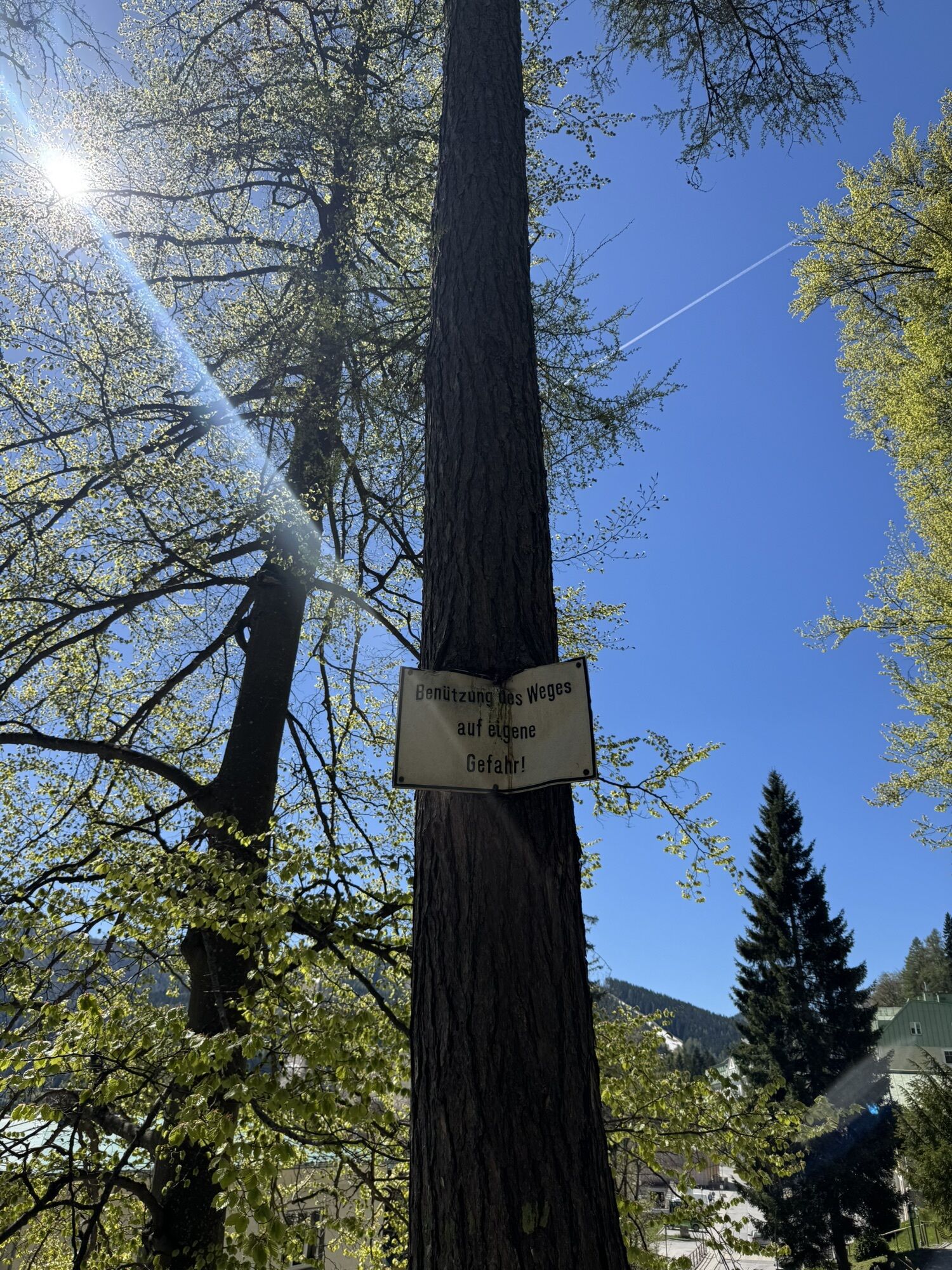
Attention, this winter hiking trail may not be completely cleared in snowy conditions and may have slippery spots. Use at your own risk! Please also bear in mind that markings may be invisible due to snow in winter, so prepare well for your tour! Pay attention to the early dusk and plan your tours particularly carefully.
Mountain rescue emergency number 140
EU emergency number: 112
Avalanche info: www.lawinenwarndienst-niederösterreich.at
From Vienna, take the A2 South Motorway to the S6 Semmering Expressway and take the Maria Schutz exit. Turn right onto L4168. Continue on Semmering/L4168 and Semmeringstraße.
From Graz, take the S6 Semmering Expressway and take the Spital/Semmering exit. Turn left onto Semmering Ersatz Str./B306. Continue on B306. At the roundabout, go straight to Semmering.
Travel by train to Semmering station. In about 25 minutes, you can walk from the station to the hiking start point (Semmering Pass summit).
Alternatively, book a ride individually with the RUFbus Semmering-Rax, which will take you to the hiking start point.
RUFbus stops:
Semmering station (109)
20-Schilling viewpoint (hiking entry) (106)
Panorama Hotel Wagner (110)
Hotel Panhans (111)
Hochstraße, Löffler (112)
Pass summit/Bus bay Billa (113)
TIP: Simply use the Postbus-Shuttle app or the hotline +43 660 900 88 22.
More information at www.oebb.at and www.vor.at
There are parking spaces available at the Semmering Pass summit.
Semmering-Rax region: www.semmering-rax.com
Vienna Alps in Lower Austria: www.wieneralpen.at +43 / 2622 / 78960
Tourism office Semmering: www.semmering.at +43 / 2664 / 20025
Hochstraße museum along the Hochstraße
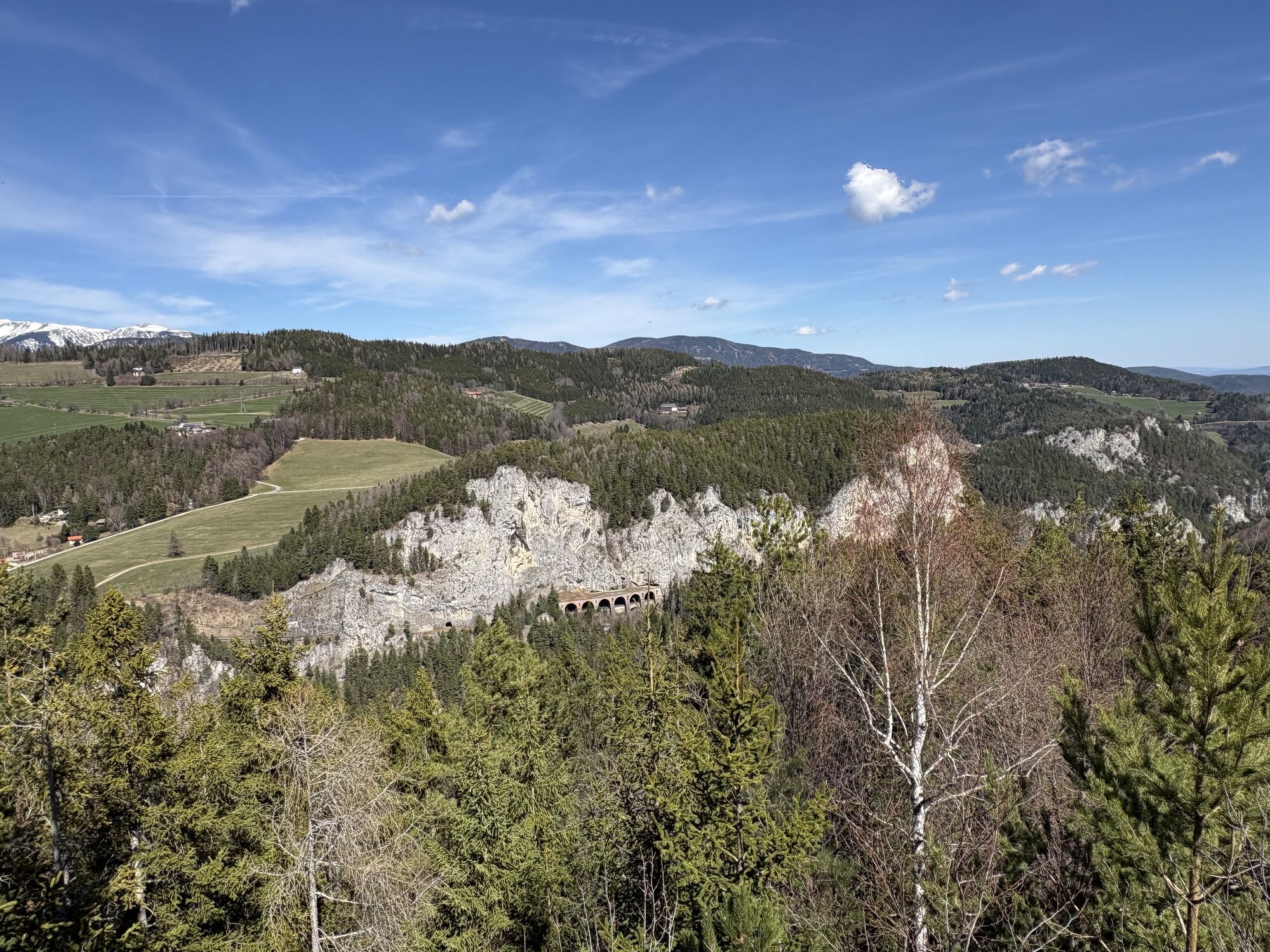
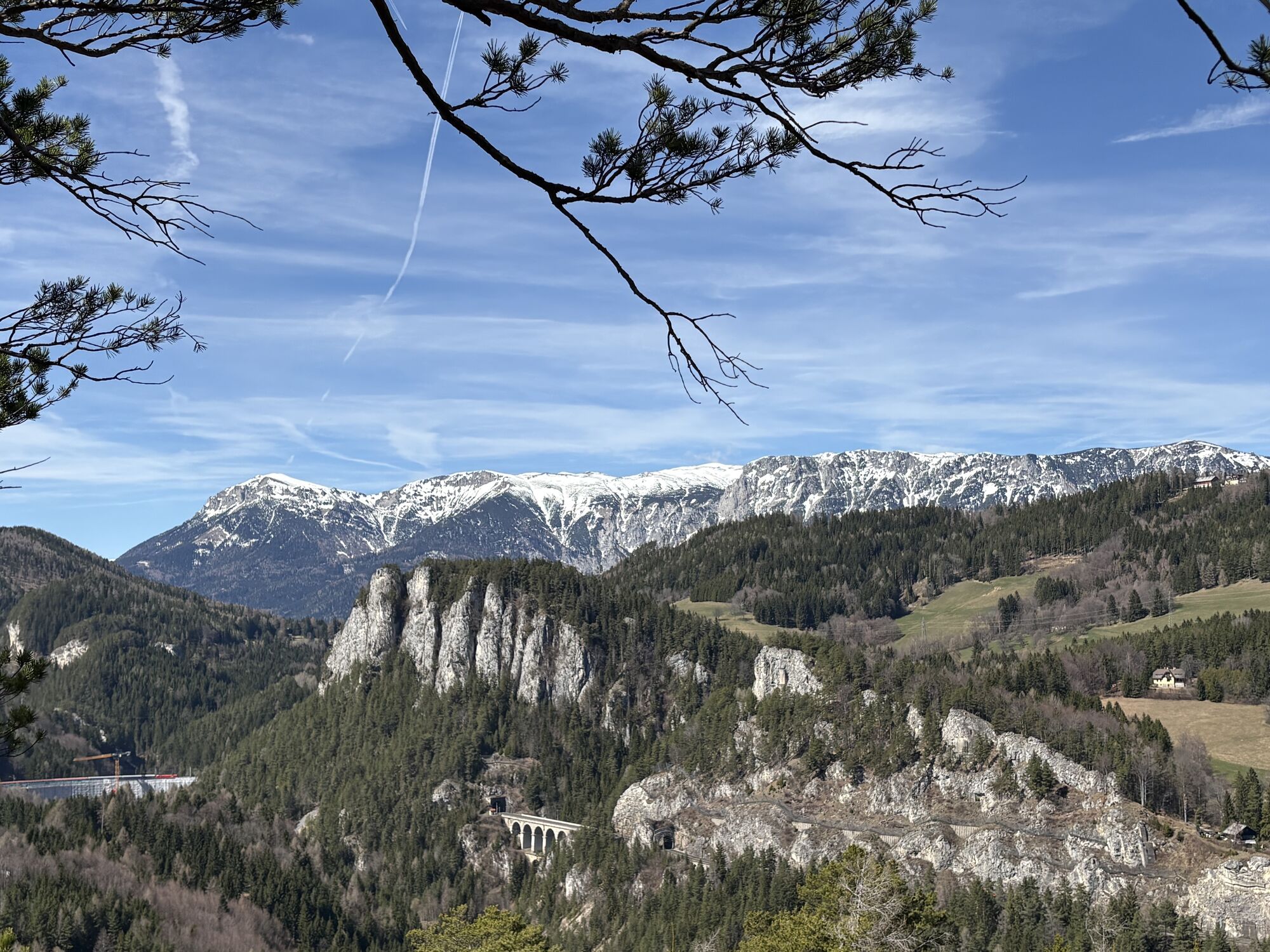
2 top viewpoints: Doppelreiter observation tower and 20-Schilling viewpoint
At the viewpoints, you will also find information boards with QR codes telling the history of the Semmering railway.
Aktivity na trase

Semmering, Niederösterreich/Österreich
17.05.2026 – Turistika
Spital am Semmering, Steiermark/Österreich
28.02.2026 – Procházka

Semmering - Kurort, Lower Austria/Austria
11.01.2026 – Turistika
Semmering, Niederösterreich/Österreich
05.12.2025 – Turistika
Semmering - Kurort, Niederösterreich/Österreich
29.08.2025 – Turistika
Oblíbené prohlídky v okolí
- 4.7
Zahnradbahn und Wandern am Schneeberg - Plateauwanderung
středníTuristika 6.90 km - 4.8
Rax - Heukuppe
Turistika 15.6 km - 4.8
Cultural walk Payerbach-Reichenau
světloTuristika 7.43 km - 3.7
Schwaigen Rundwanderung
světloTuristika 8.24 km - 5.0
"Weichtalklamm" über Stock und Stein durch das Höllental - Weichtalhaus - Kientallerhütte 1340m
středníTuristika 14.0 km - 4.9
Insider tip: Schneeberg via the Novembergrat
heavyTuristika 13.5 km - 4.9
Reißtalersteig und Gretchensteig
heavyTuristika 8.10 km - 4.9
RAX Preiner Gscheid Waxriegel Predigtstuhl Heukuppe Karl L.Haus ret. 20210908
středníTuristika 12 km - 4.8
"Krummbachstein 1602m" - Eng - Payerbach - Rundwanderweg
středníTuristika 24.8 km - 4.8
RAX Hinternaßwald Reißtalklamm Bärenlochsteig Habsburghaus Kaisersteig retour 01.08.2017
heavyTuristika 15.6 km
Pěší turistika a stopování


Nenechte si ujít nabídky a inspiraci pro vaši příští dovolenou
Vaše e-mailová adresa byl přidán do poštovního seznamu.