


Bachhüpfen am Gaberbachweg


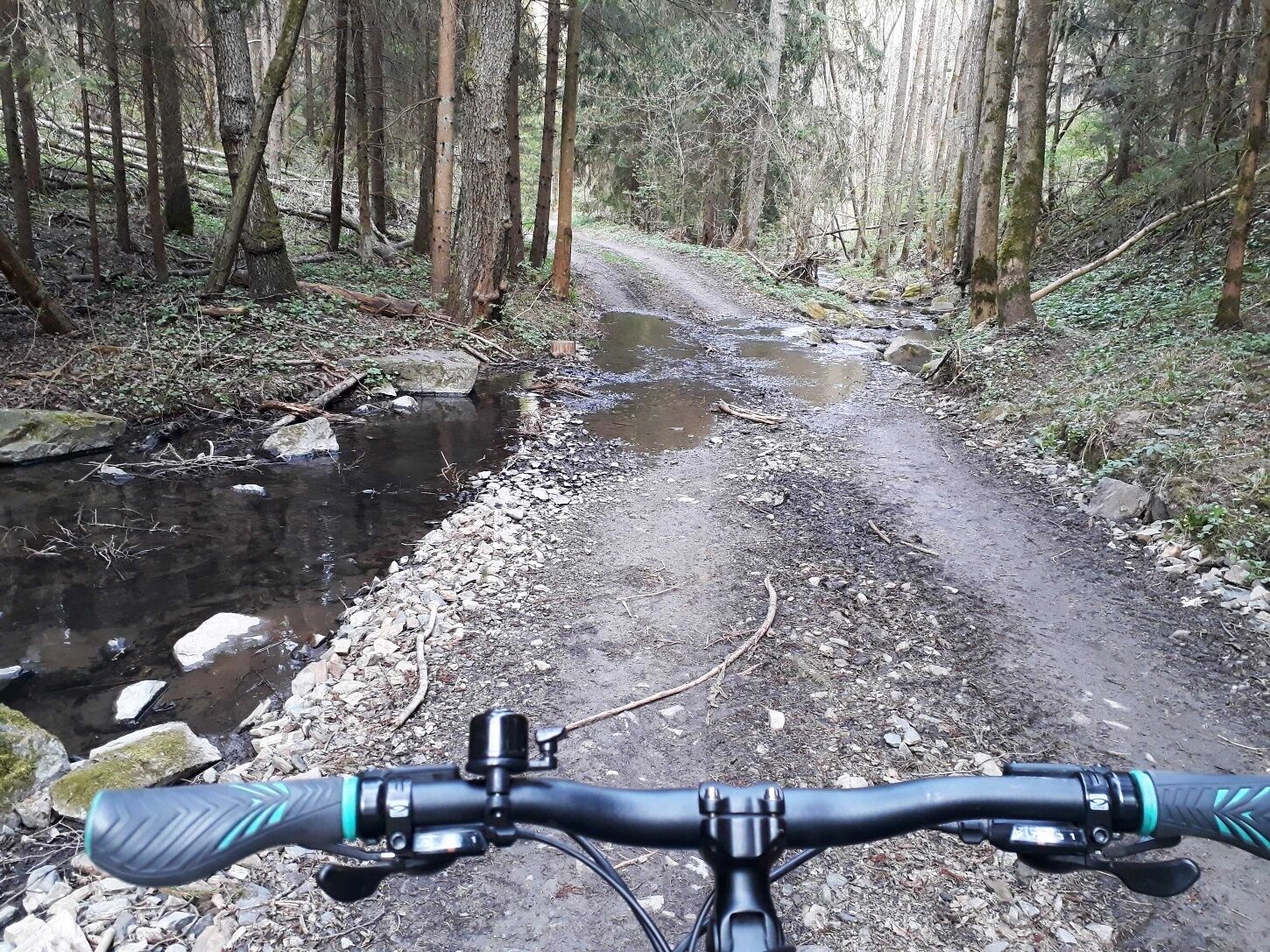
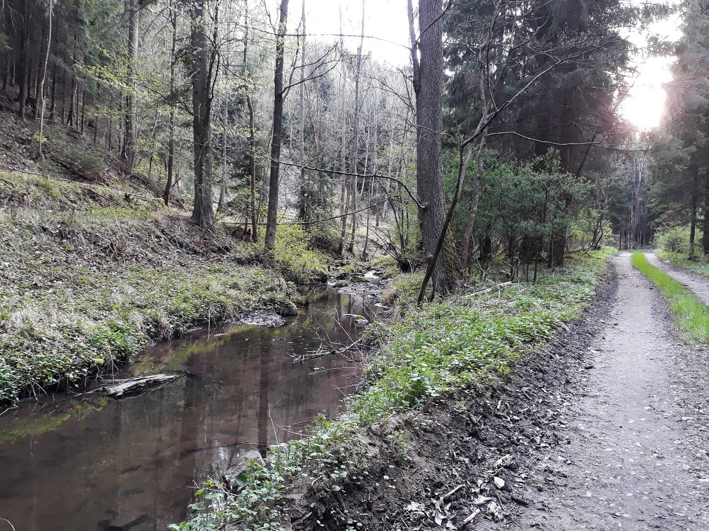
In Autendorf führt dich der Weg entlang des Golfplatzes hinab ins Gabertal. Hier sind die Ruinen einer gotischen Kirche zu sehen. Entlang des Bachufers – einmal links- und einmal rechtsseitig – wird es gerade Kindern nie langweilig, wo der Gaberbach Spiel- und Entdeckerfreude anregt. Vor Unterthürnau sind die Reste eines Kalkofens auf der rechten Seite des Baches zu sehen.
Wien: A 22 – Stockerau – S3 – B 303 bis Hollabrunn – B 2 bis Roseldorf – L49 bis Röschitz – L 50 bis Pulkau – L41 bis Drosendorf
Linz: A 7 Richtung Freistadt - B 310 bis Freistadt - B 38 bis Karlstift - B 41 bis Schrems - B 2 bis Göpfritz an der Wild – L 8038 bis Schönfeld – L 55 bis Raabs/Thaya - B 30 bis Drosendorf
Stadtgemeinde Drosendorf-Zissersdorf
2095 Drosendorf, Hauptplatz 1
T 02915/22 13-0, F DW 35
gemeinde@drosendorf.at
www.drosendorf.at
WALDVIERTEL Tourismus
3910 Zwettl, Sparkassenplatz 1/2/2
(T) +43(0)2822/54109, Fax DW 36
Gebührenfrei im Inland:
(T) +43(0)800/300 350
(E) info@waldviertel.at
(I) www.waldviertel.at
Als Erinnerung an deine Wanderung "Bachhüpfen am Gaberbachweg" im Waldviertel kannst du dir im Rathaus der Stadtgemeinde Drosendorf eine Wandermarke von der Stadtmauerstadt holen.
Wandermarken sind runde und durch Holzbrand gestaltete und beschriftete Plaketten, welche als Souvenir, und gleichzeitig als Auszeichnung für hervorragende Leistungen stehen. Fleißige Wandermarkensammler werden mit einer kostenlosen Prämiumwandermarke belohnt. Nähere Infos findest du unter www.wandermarken.at.
Oblíbené prohlídky v okolí
- 5,0
Drosendorf - Gaberbachweg
středníTuristika 12,6 km - 5,0
Wasser und Felsen
světloTuristika 8,31 km - 5,0
Ritterweg Ruine Kollmitz Raabs an der Thaya, Niederösterreich
Turistika 12,0 km - 5,0
07 Grenzlandweg, 09. Etappe: Geras - Hardegg
světlodálková pěší trasa 23,2 km - 5,0
Kollmitzgraben
středníTuristika 13,4 km - 5,0
07 Grenzlandweg, 06. Etappe: Dobersberg - Raabs an der Thaya
světlodálková pěší trasa 25,8 km 07 Grenzlandweg, 07. Etappe: Raabs an der Thaya - Drosendorf
světlodálková pěší trasa 20,4 km07 Grenzlandweg, 08. Etappe: Drosendorf - Geras
světlodálková pěší trasa 12,7 kmRaabs - Kollmitz - Eibenstein - Raabs
středníTuristika 24,3 kmKamp-Thaya-March Radroute 1
středníJízda na kole 101,9 km
Pěší turistika a stopování


Nenechte si ujít nabídky a inspiraci pro vaši příští dovolenou
Vaše e-mailová adresa byl přidán do poštovního seznamu.