


Feel Good hiking trail at Jauerling Route 2
Fotografie našich uživatelů
-

 © Josef LugerVytvořeno dne 03.05.2026
 -
 © Josef LugerVytvořeno dne 03.05.2026
 -
 © Josef LugerVytvořeno dne 03.05.2026
 -

 © Benjamin Gruber 3Vytvořeno dne 25.04.2026
 -
 © josef duermoserVytvořeno dne 14.01.2026
 -
 © josef duermoserVytvořeno dne 14.01.2026
 -
 © josef duermoserVytvořeno dne 14.01.2026
 -
 © josef duermoserVytvořeno dne 14.01.2026
 -
 © josef duermoserVytvořeno dne 14.01.2026
 -
 © Raphael RiedlerVytvořeno dne 05.01.2026
 -

 © Elisabeth RossaVytvořeno dne 10.12.2025
 -
 © Elisabeth RossaVytvořeno dne 10.12.2025
 -
 © Elisabeth RossaVytvořeno dne 10.12.2025
 -
 © Christian KakuskaVytvořeno dne 20.07.2024
 -

 © Michael Hell 1Vytvořeno dne 06.01.2022
 -
 © Michael Hell 1Vytvořeno dne 06.01.2022
 -
 © Ognjen ScekicVytvořeno dne 17.12.2022


<p>A leisurely hike, mostly on forest and forestry paths, through the woods of the Hoher Jauerling.</p>


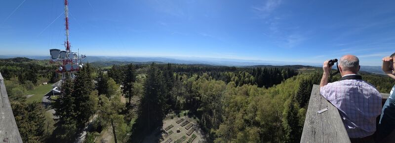
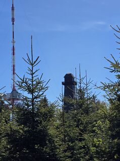
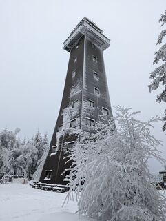
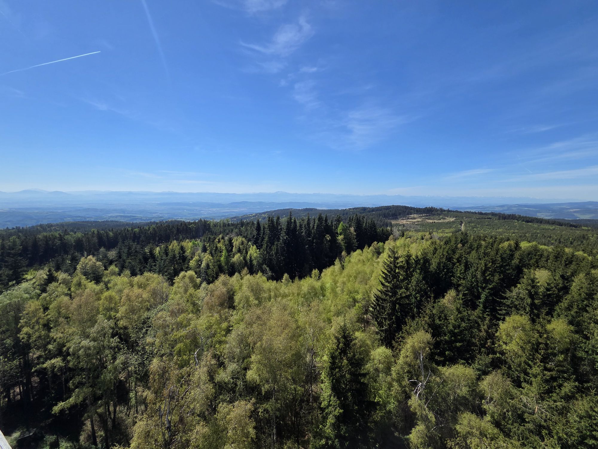
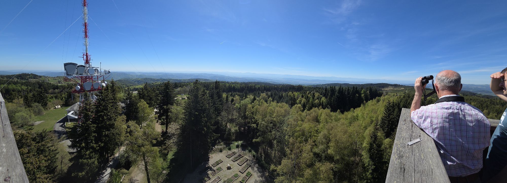
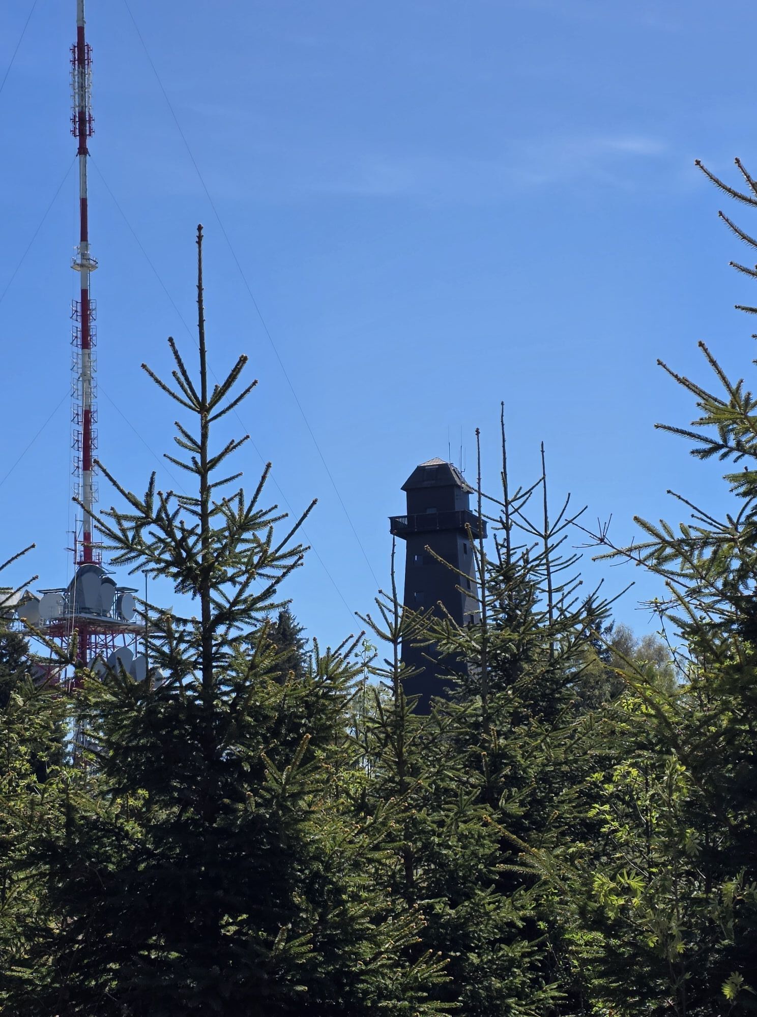
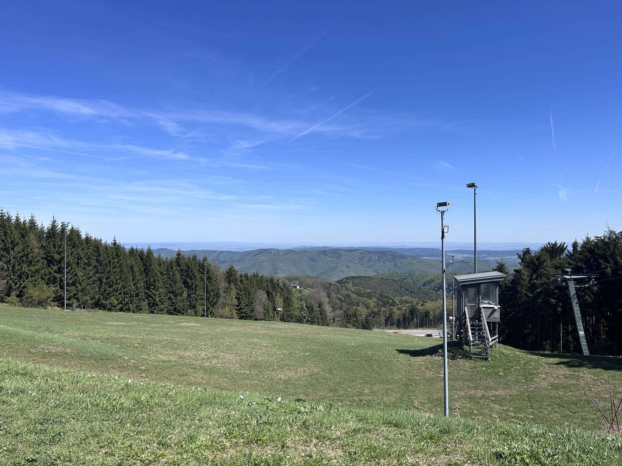
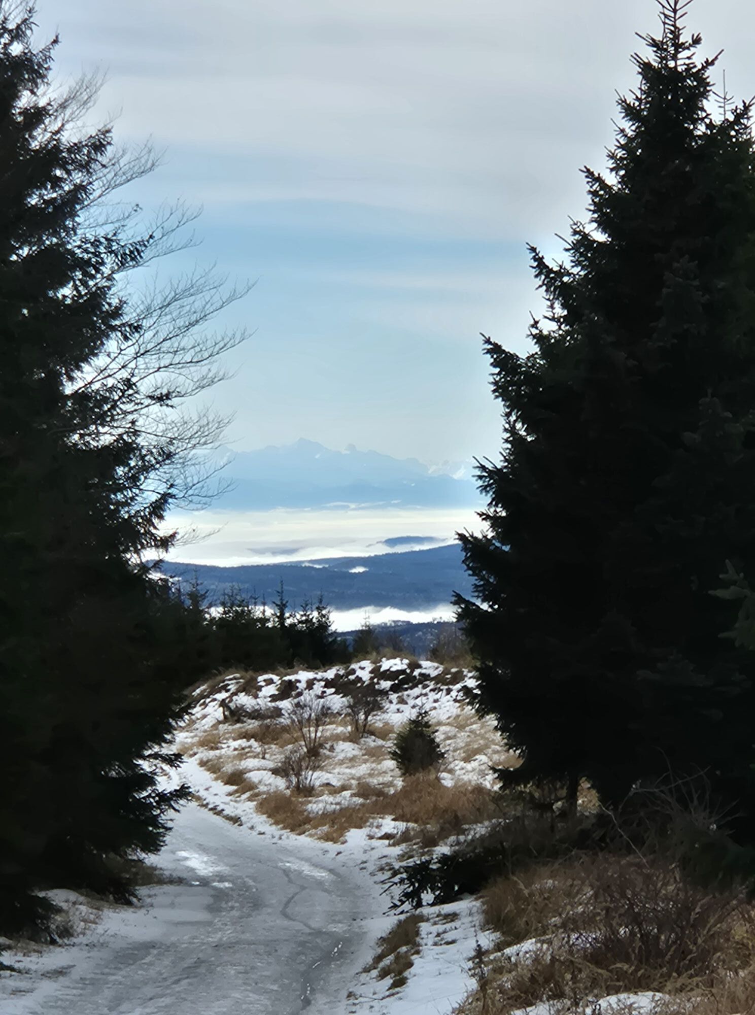
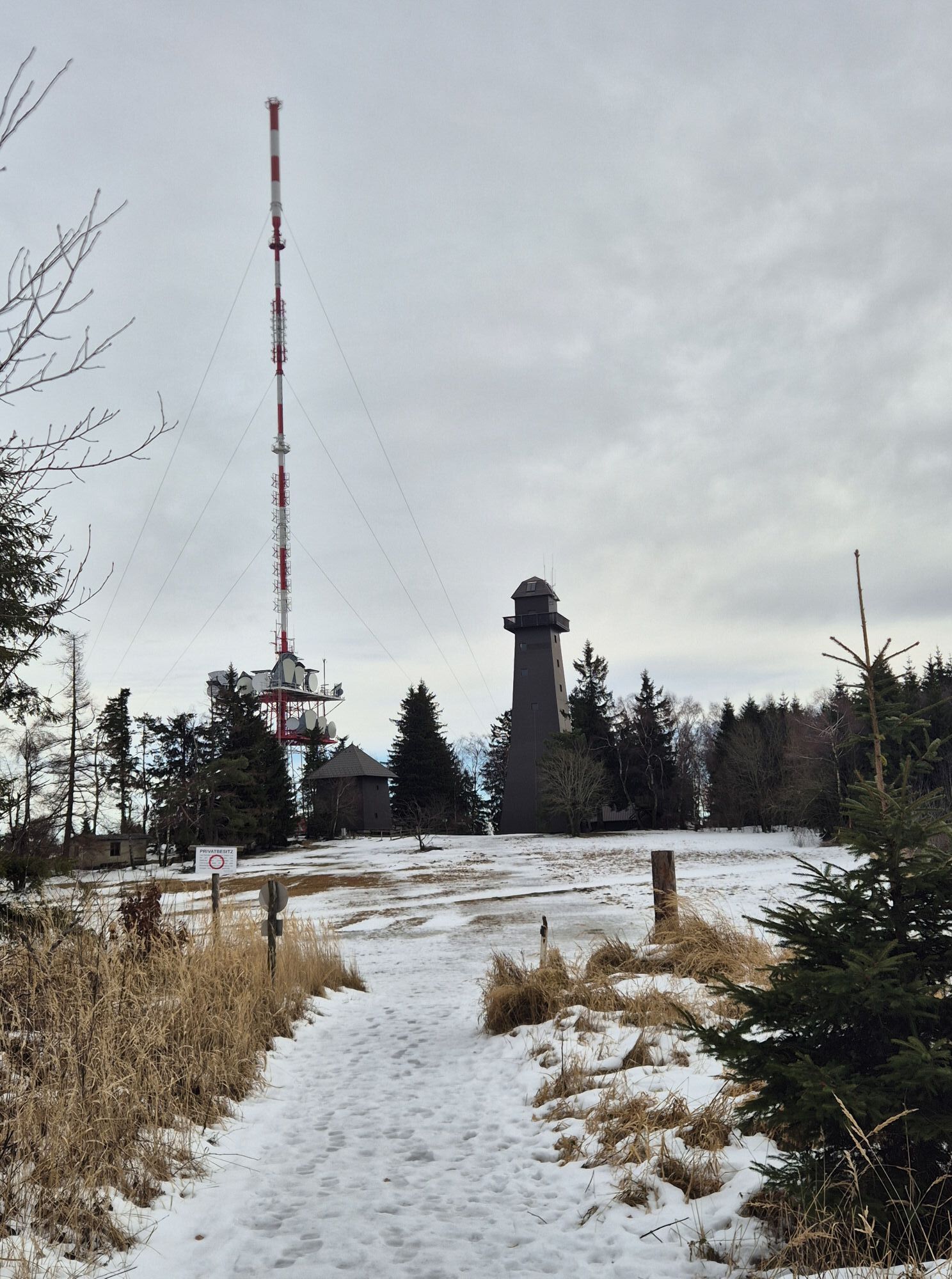
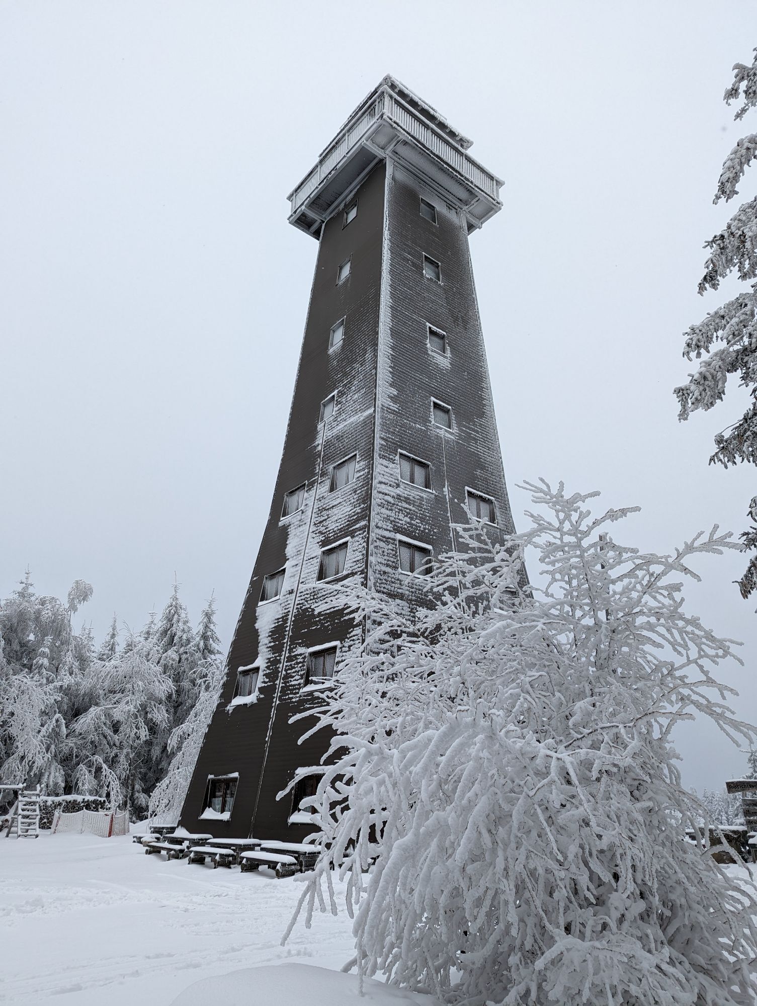
<p>From the parking lot at the mountain station of the ski lift, we first head to the lookout tower. It is open daily from April to around All Saints' Day from 9:30 am to 6:00 pm, in winter only on weekends and public holidays from 11:00 am to 6:00 pm and by prior arrangement. After the lookout tower, we cross the Turnerwiese, first follow route 73 straight ahead, then turn left towards the hunting lodge. From the hunting lodge, continue along the marking. We cross routes 73 and 26 and continue hiking through the forest until we come out below the Stauferhütte again. From there, it is only a few meters back to the parking lot.</p>
<p>Hiking boots, rainproof clothing, and drinking water. The Wachau hiking map is available from Donau Niederösterreich Tourismus, www.wachau.at.</p>
<p>Emergency call Mountain Rescue Wachau: 140</p>
<p>By car from the West Autobahn in Melk on the B3a towards Emmersdorf, then take the third exit at the roundabout (direction Dürnstein, Krems) on the B3 to Schallemmersdorf, turn left to Maria Laach on the L7145, from Maria Laach to Oberndorf on the L7133, then head towards the lookout tower up to the mountain station. The destination is Oberndorf am Jauerling (mountain hut).</p>
<p>Oberndorf is best reached by public transport on weekends. There is one bus per day from Melk (train to Melk station), but only during the school term. On weekends, the nature park bus or Jauerling bus goes to the parking lot at the nature park house. On weekends, the nature park bus circulates from Spitz via Jauerling to Emmersdorf and via Mühldorf and the Weitental to Emmersdorf and back. The bus operates as a call bus and must be reserved by phone – up to one hour before departure: T. 0810/810 278. Details on bus schedules can also be found at www.vor.at. Nextbike rental bike stations (EUR 1/hour) are located in Melk, Emmersdorf, Spitz, Aggsbach, and Mühldorf. www.nextbike.at/niederoesterreich.htm...
<p>Parking (free) is available at the nature park house and at the mountain station.</p>
Verantwortlicher für den Inhalt dieser Tour
Wachau-Nibelungengau-Kremstal
Letzte Aktualisierung: 12.10.2025
The Jauerlinger farmers' market of the Maria Laach farmers at the Kerblerhaus in the center of Maria Laach (every Saturday 9 am to 3 pm) is recommended.
At the Hoher Jauerling, the nature park offers a themed trail. The path "above us the wide, wide sky" is ideal for a walk and provides information about the Jauerling, the nature park communities, and the flora and fauna of the region. Younger hikers are also motivated to walk through the forest along the 10 stations, which can be explored with an app. More information (including map and audio sample) at http://www.naturpark-jauerling.at/gipfel-jauerling/ .
Just below the Jauerling summit at 915 m above sea level lies the nature park house – Gasthaus am Jauerling. From the Wachau terrace, you can enjoy the highest and most beautiful view of the Danube. The nature park house is car-free and traffic-calmed. The last ten minutes to the nature park house must be covered on foot. The tenants, the Gratz family, continuously spoil you with hot cuisine. Groups and/or bus tours are asked to register. Regional quality and products, as well as close cooperation with producers from the nature park, characterize the kitchen and the work of the Gratz family tenants.
www.naturpark-gasthaus.at
Oblíbené prohlídky v okolí
-
4.5
Welterbesteig Wachau 03: Weißenkirchen-Spitz
světlodálková pěší trasa 10.4 km -
4.7
Wachau: Seekopf - Hirschwand
středníTuristika 10.4 km -
4.5
Panoramaweg Weissenkirchen
světloTuristika 5.04 km -
4.6
Rundhöhenwanderweg Weißenkirchen in der Wachau - Schildhütten - Cholerakreuz - Weißenkirchen
světloTuristika 8.75 km -
4.5
Seekopf und Hirschwand
středníTuristika 2.83 km -
4.5
Maria Langegg - Rote Wand - Hoher Stein - Kastlkreuz
středníTuristika 11.4 km -
4.4
Hirschwand und Seekopf
středníTuristika 9.09 km -
4.8
Wachau: Panoramaweg Rossatz
světloTuristika 10.8 km -
3.9
Spitz a. d. Donau Jauerling Schwallenbach retour 16.04.2016
středníTuristika 20 km -
3.9
Spitz - Buchberg - Runde
středníTuristika 9.60 km
Pěší turistika a stopování


Nenechte si ujít nabídky a inspiraci pro vaši příští dovolenou
Vaše e-mailová adresa byl přidán do poštovního seznamu.