







Opponitz Gorge Hiking Trail
Bizarre rock formations and soft dark green moss areas await hikers on the just over three-kilometer-long gorge hiking trail in Opponitz. The start and end point is at the Schluchtenhütte, just a few minutes...
Bizarre rock formations and soft dark green moss areas await hikers on the just over three-kilometer-long gorge hiking trail in Opponitz. The start and end point is at the Schluchtenhütte, just a few minutes from the Ybbstal federal road B31 and the new Ybbstal bike path. In this area spared from mass tourism, nature reveals its most beautiful diversity. The circular walk in the fresh mountain air is a treat for body and mind. At the Schluchtenhütte at the "Oberdippelreith" farmhouse, exquisite traditional delicacies and cooling drinks await. Children have the opportunity to get to know numerous domestic animals, which can extend the walking time accordingly!

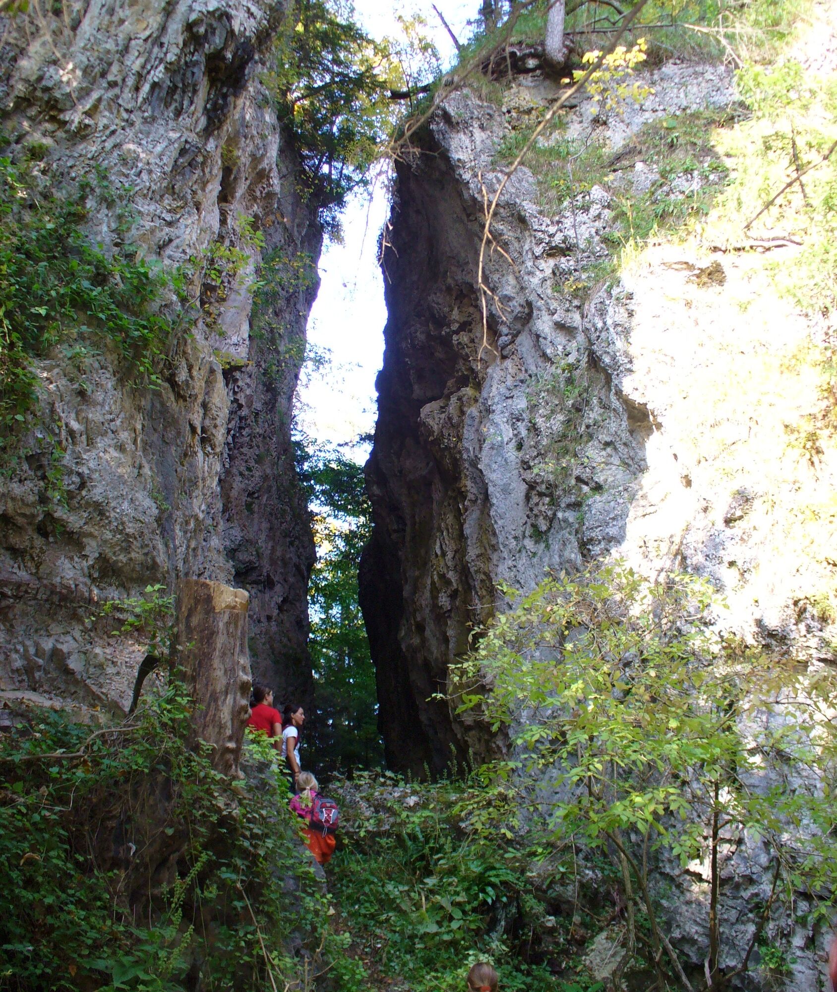
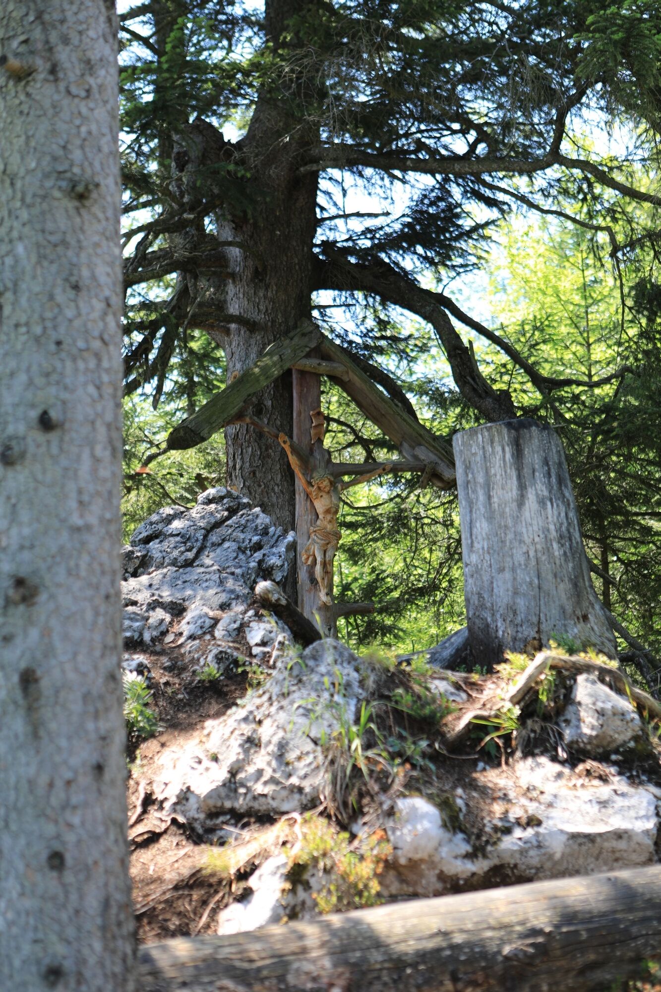
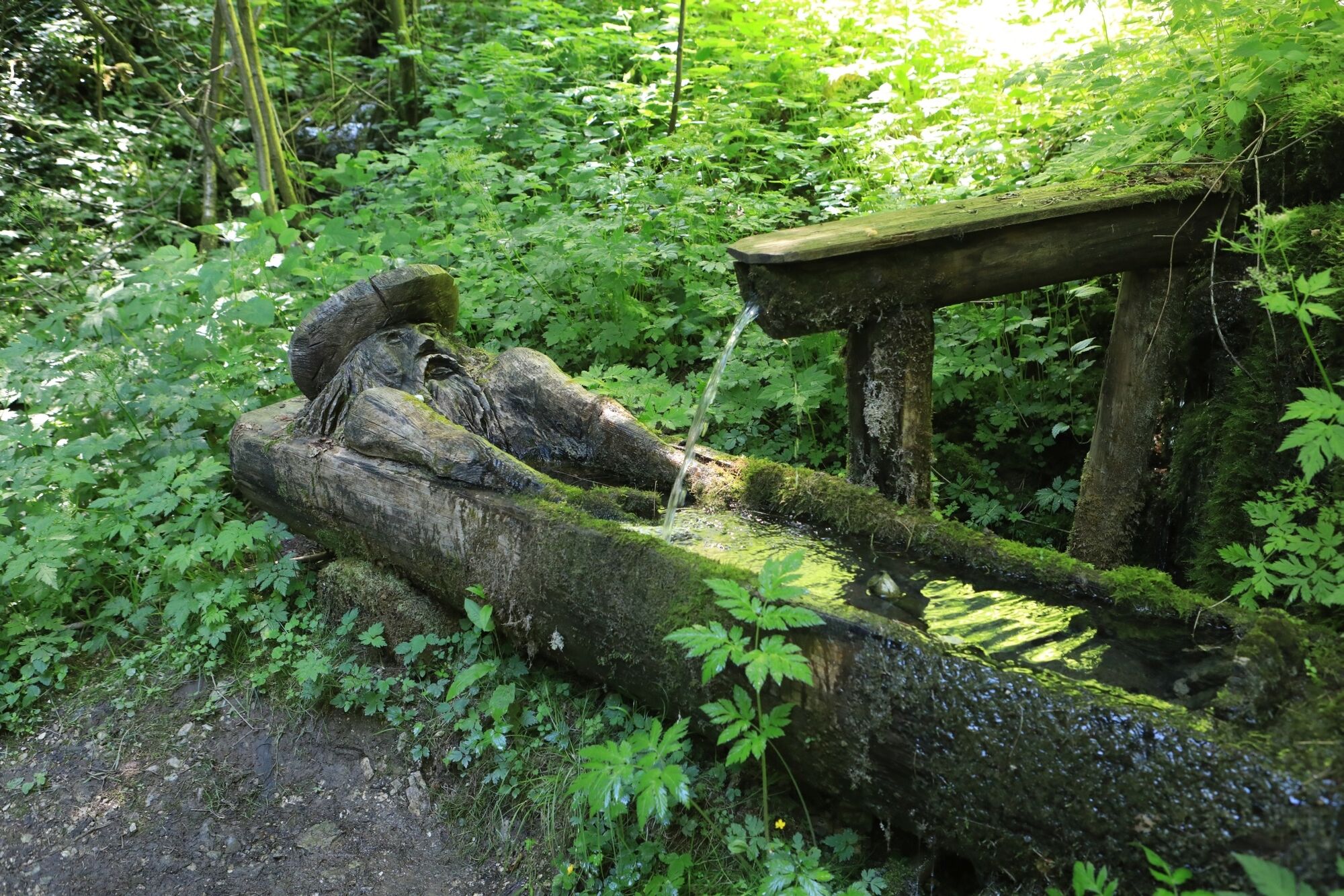
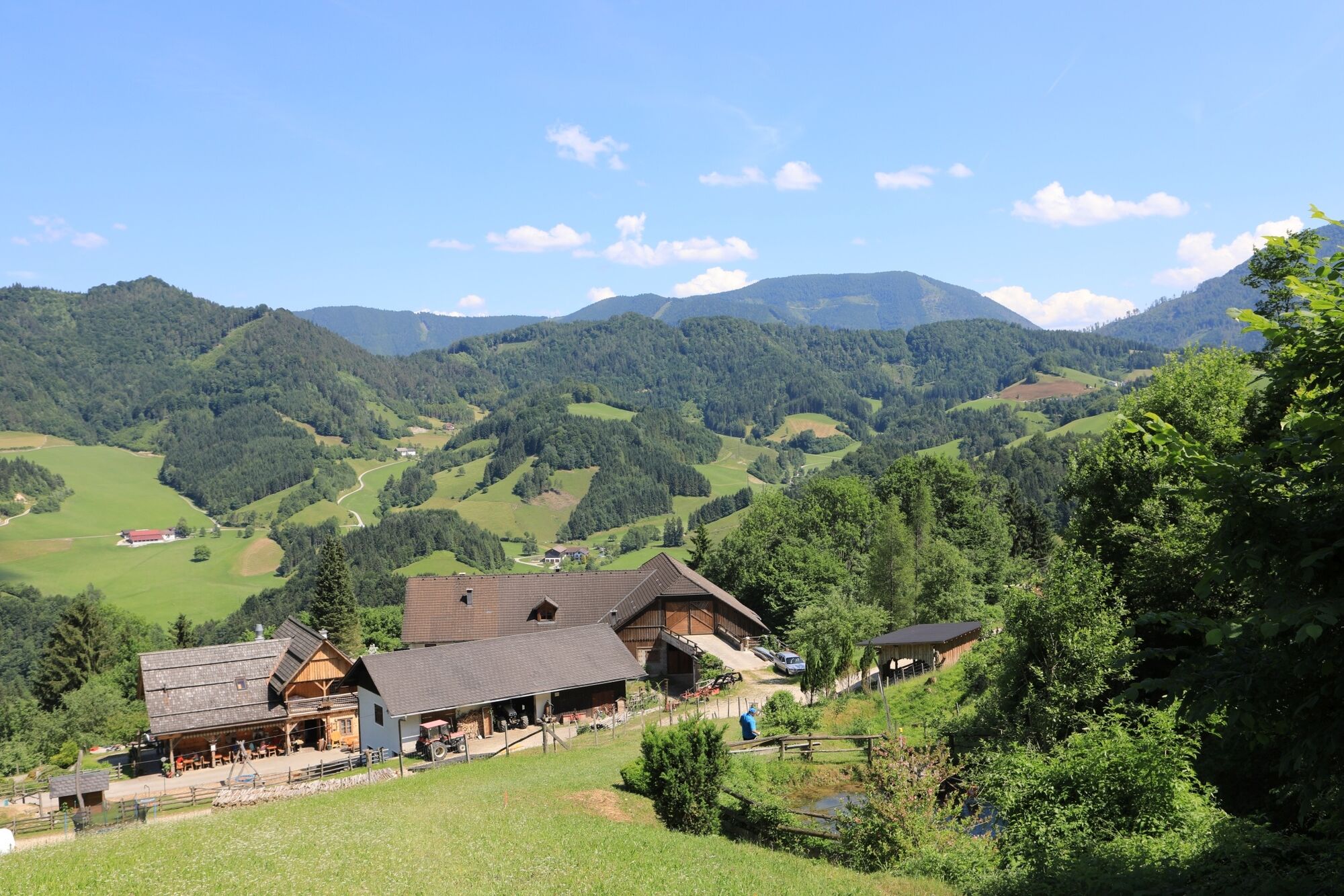
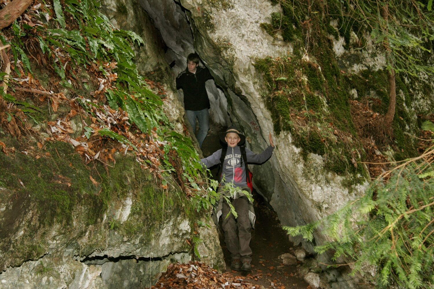
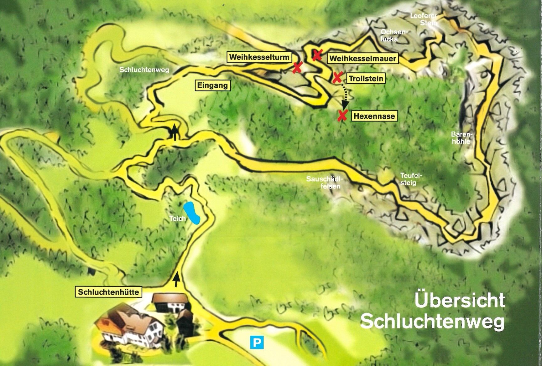

From the Schluchtenhütte, families hike up a forest road and continue on a meadow path until the beginning of the gorge path. First, hikers pass the "Hexenschlucht" (Witches' Gorge), then continue to the "Weihkesselmauer" and then up to the "Ochsenlucka." Via switchbacks, they reach the "Krokodilsfelsen" (Crocodile Rock) and the "Leofererstein," the highest point of the circular hiking route. From there, hikers enjoy a magnificent view of the surrounding mountain landscape and the town of Opponitz. After resting at the summit cross, the route continues past the "Sauschädelfelsen" (Boar Skull Rock) to the "Bärenhöhle" (Bear Cave). Along the "Teufelssteig" (Devil's Trail), where the very brave can abseil, hikers follow the creek past a pond back to the Schluchtenhütte.
Trail markings: signposting with humorous motifs
Ano
Ano
Sturdy footwear
From Vienna or Linz via West Motorway A1 - exit Amstetten - Waidhofen an der Ybbs - Opponitz
Parking at the Schluchtenhütte
Tourism Association Ybbstal Alps
+43-7484-93049
Facebook/Schluchtenhütte, www.opponitz.gv.at
Near the "Weihkesselmauer," many marked climbing routes offer natural climbing fun.



 Získejte přehled
Vždy živě na místě s více než 9 500 webkamerami. bergfex Jako uživatel Pro si nyní můžete zobrazit odpovídající webové kamery pro mnoho prohlídek v aplikaci prohlídky z. Můžete si tak přímo prohlédnout aktuální podmínky.
Získejte přehled
Vždy živě na místě s více než 9 500 webkamerami. bergfex Jako uživatel Pro si nyní můžete zobrazit odpovídající webové kamery pro mnoho prohlídek v aplikaci prohlídky z. Můžete si tak přímo prohlédnout aktuální podmínky.
Aktivity na trase
-

Opponitz, Niederösterreich/Österreich
13.08.2026 – Turistika -
Opponitz, Niederösterreich/Österreich
11.08.2026 – Turistika -

Opponitz, Niederösterreich/Österreich
15.03.2026 – Turistika -
Opponitz, Niederösterreich/Österreich
25.10.2025 – Mountainbike -

Opponitz, Niederösterreich/Österreich
14.09.2025 – Turistika -
Opponitz, Niederösterreich/Österreich
16.08.2025 – Procházka -
Opponitz, Niederösterreich/Österreich
10.08.2025 – Poutní stezka -

Schluchtenweg Opponitz
16.02.2025 – Turistika
Oblíbené prohlídky v okolí
-
4.8
Kurzeck- Siebenhütten- Turnhöhe- Kitzhütte Göstling an der Ybbs, Österreich
světloTuristika 12.8 km -
4.3
Freithofberg
středníTuristika 9.15 km -
4.3
Prochenberg von Ybbsitz
světloTuristika 6.29 km -
4.1
wanderung auf den alpl
středníTuristika 8.18 km -
3.9
Lindaumauer (1103 m)
Turistika 3.40 km -
4.5
Lindaumauer, Maria Neustift
středníTuristika 5.53 km -
5.0
Prochenbergrunde
středníTuristika 5.96 km -
4.7
Göstling a.d. Ybbs. Kogler Wasserfälle Rundweg
světloTuristika 5.23 km -
4.4
Friesling (1340m) ab Parkplatz Grosse Kripp
středníTuristika 9.01 km -
4.5
Sebaldusweg stage 3 of 4 | Maria Neustift - Gaflenz
středníPoutní stezka 20.4 km
Pěší turistika a stopování


Nenechte si ujít nabídky a inspiraci pro vaši příští dovolenou
Vaše e-mailová adresa byl přidán do poštovního seznamu.





