


Wine and Water Round to the Kamptalwarte on Heiligenstein, no. 65
Fotografie našich uživatelů
-
 © EderoVytvořeno dne 18.04.2026
 -
 © EderoVytvořeno dne 18.04.2026
 -
 © EderoVytvořeno dne 18.04.2026
 -
 © Jele HannesVytvořeno dne 08.10.2025
 -
 © Jele HannesVytvořeno dne 08.10.2025
 -
 © Gerhard PiglmannVytvořeno dne 01.03.2025
 -
 © Gerhard PiglmannVytvořeno dne 01.03.2025
 -
 © Anton SacherVytvořeno dne 09.02.2025
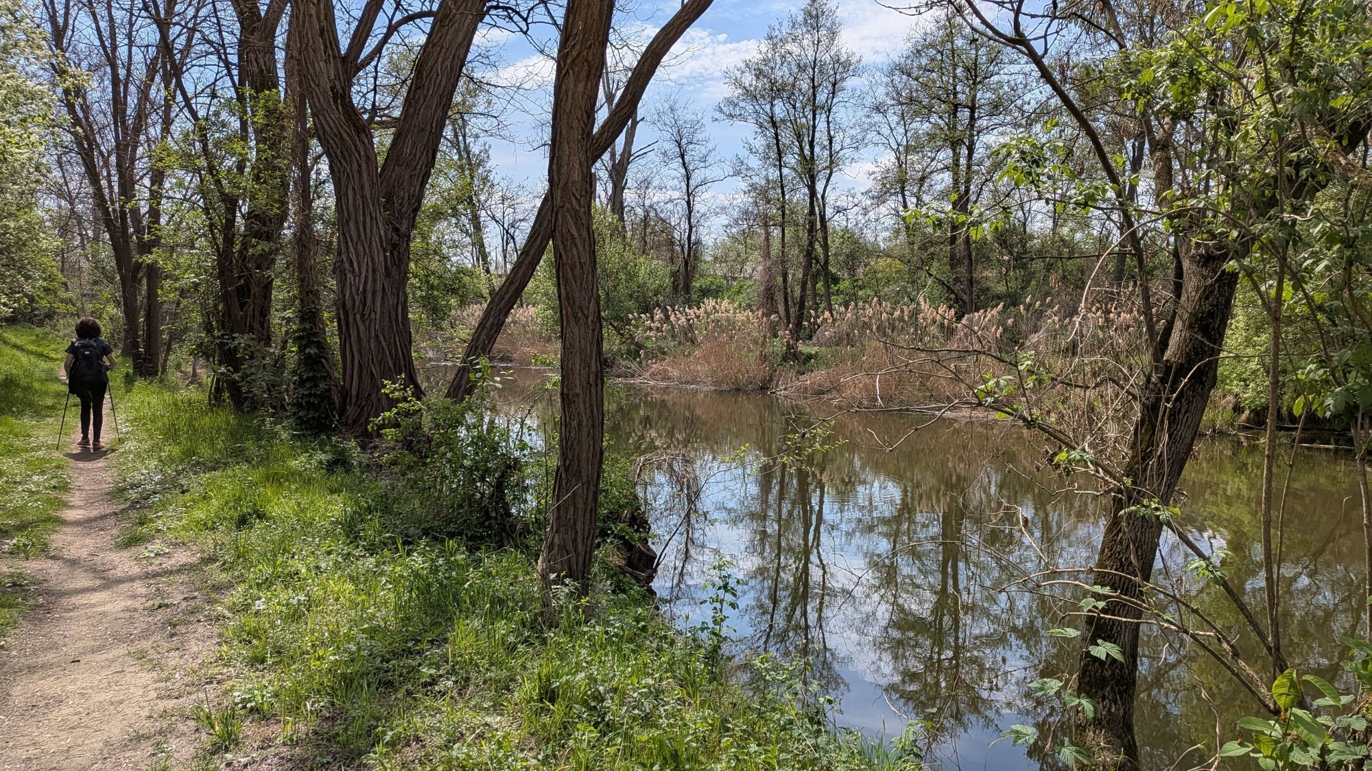
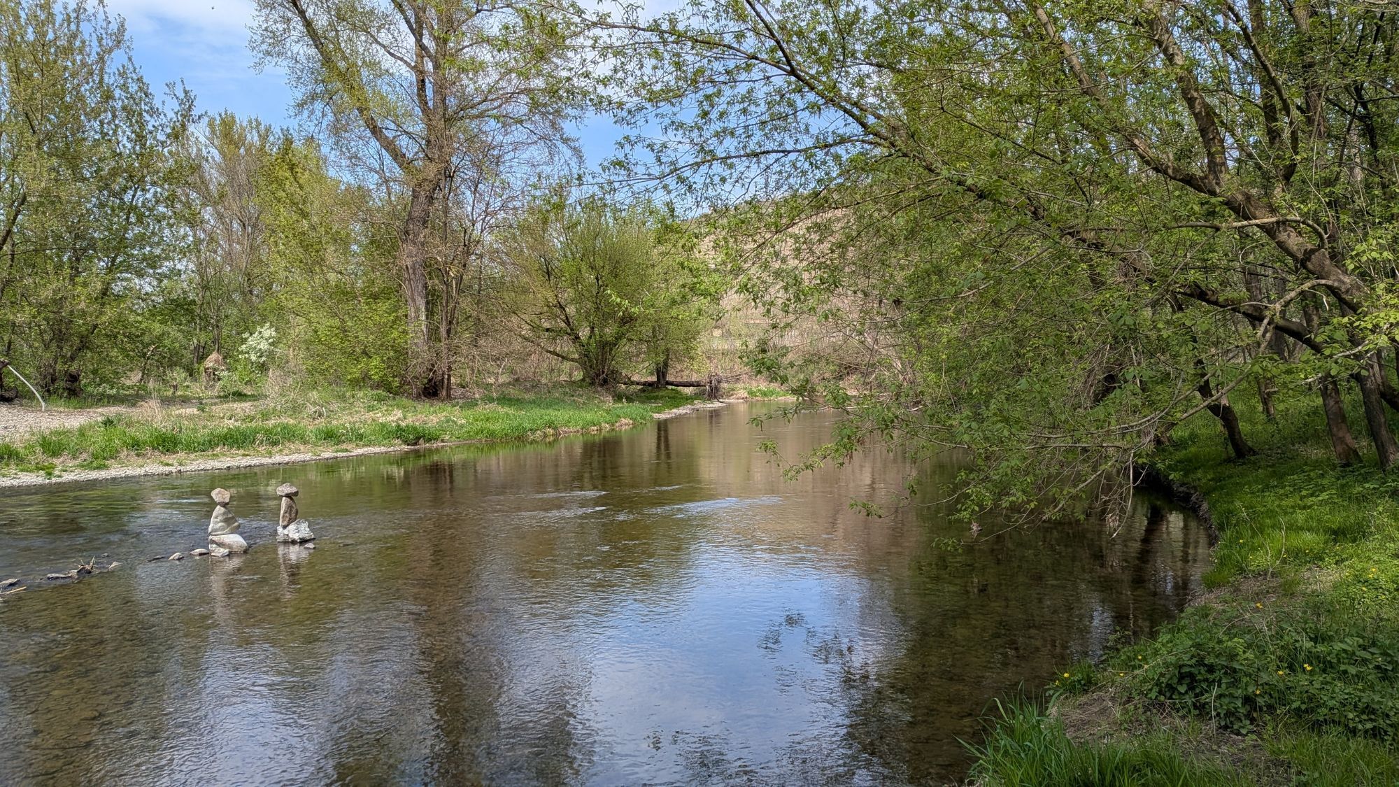
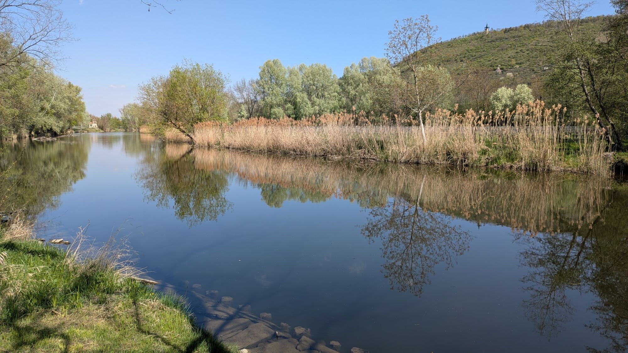
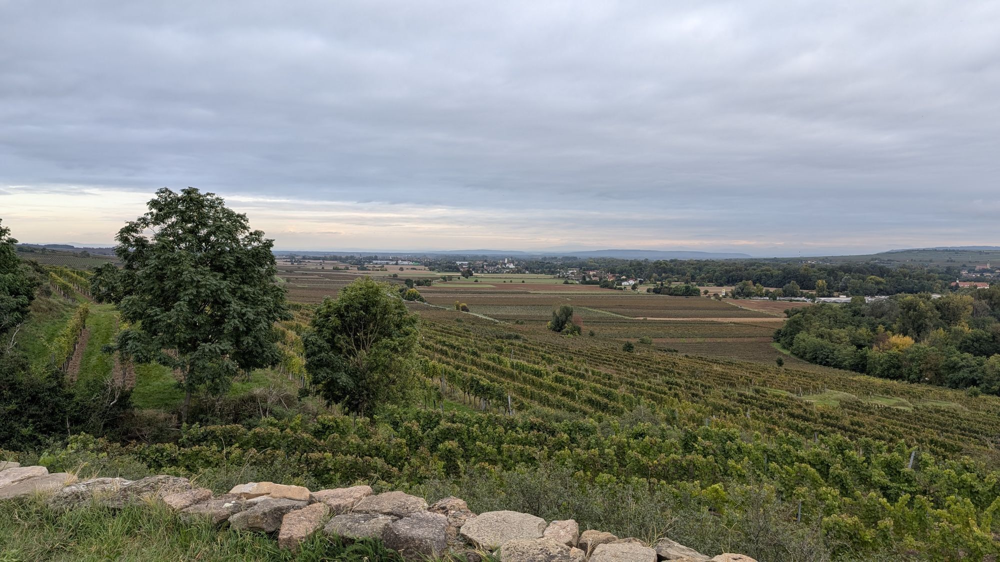


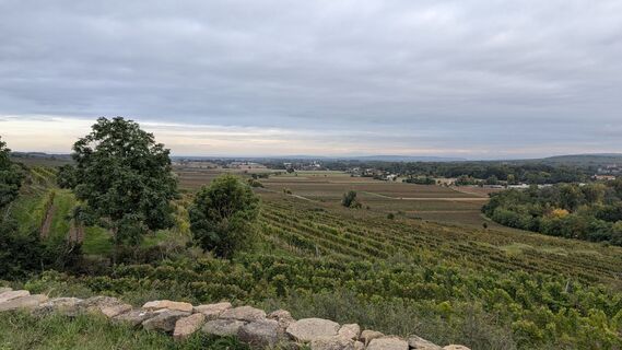
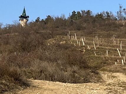
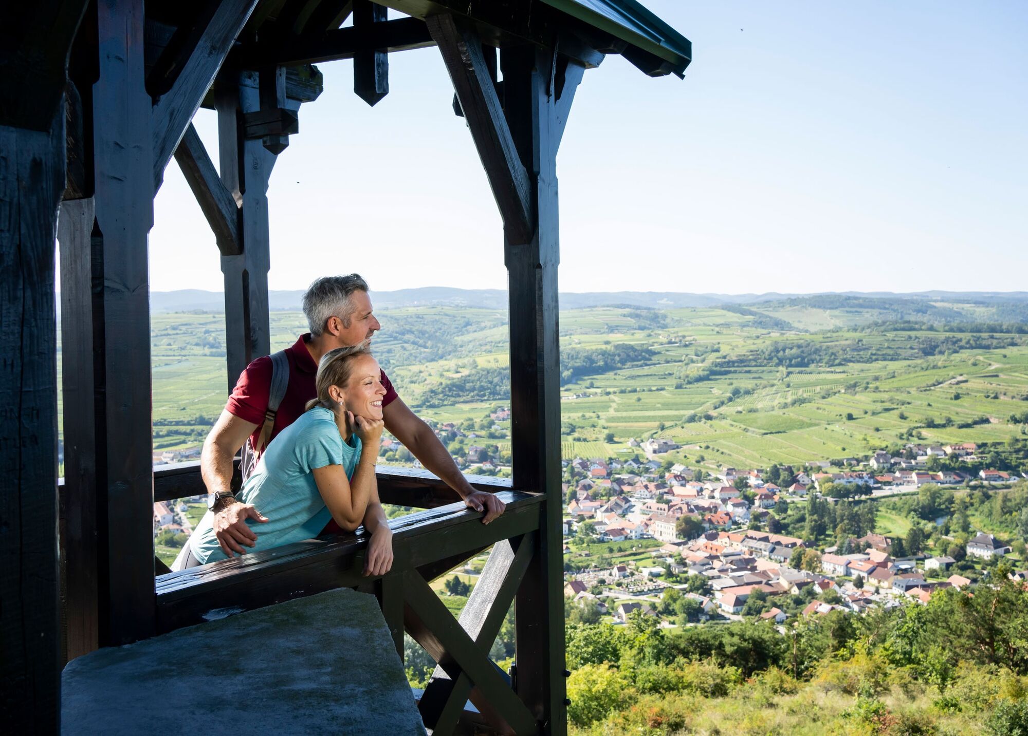
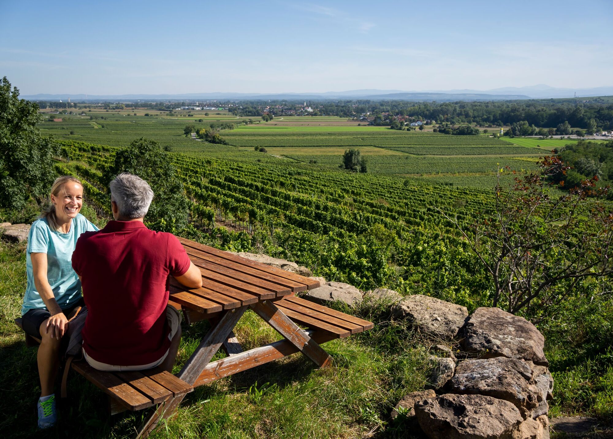
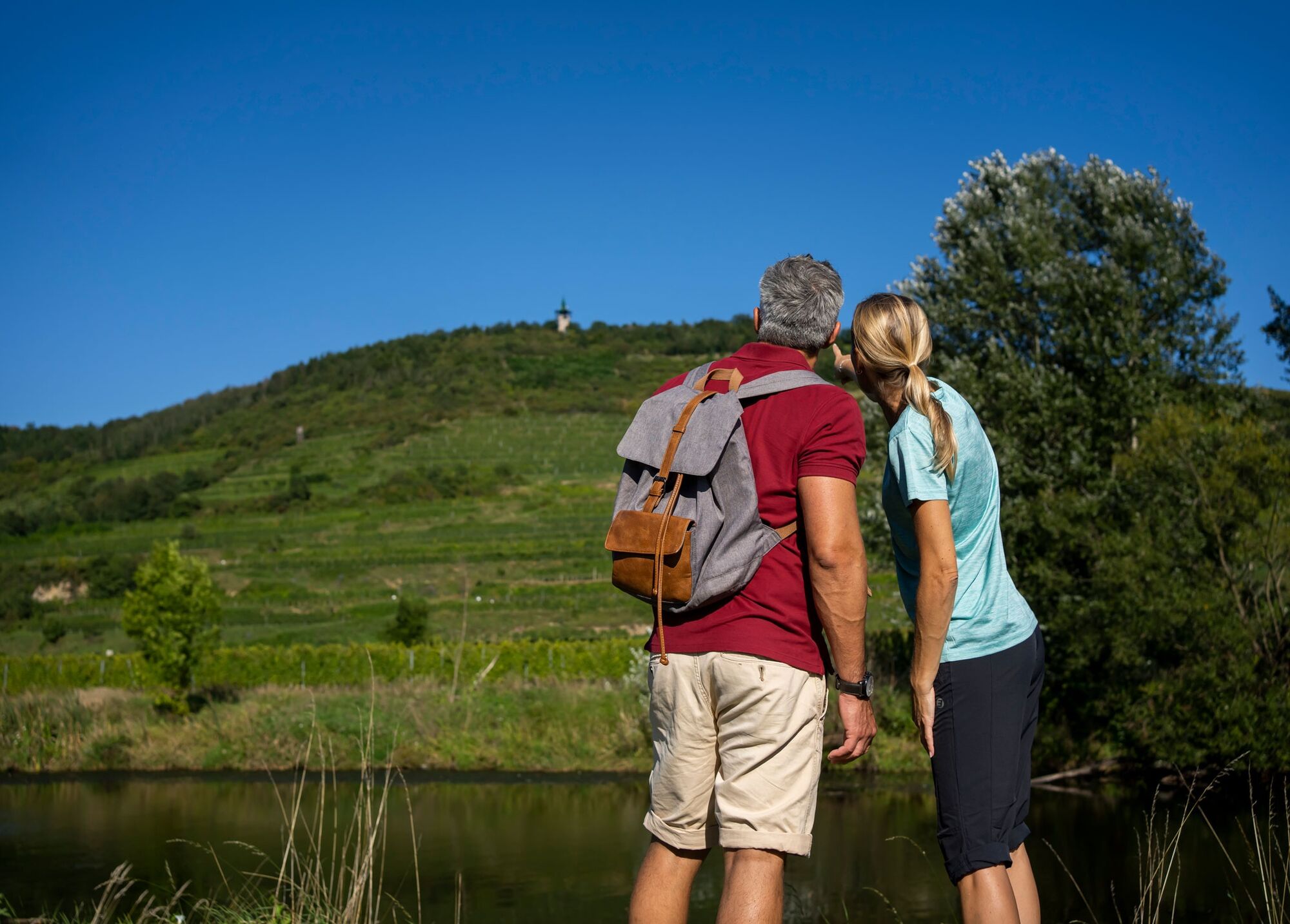
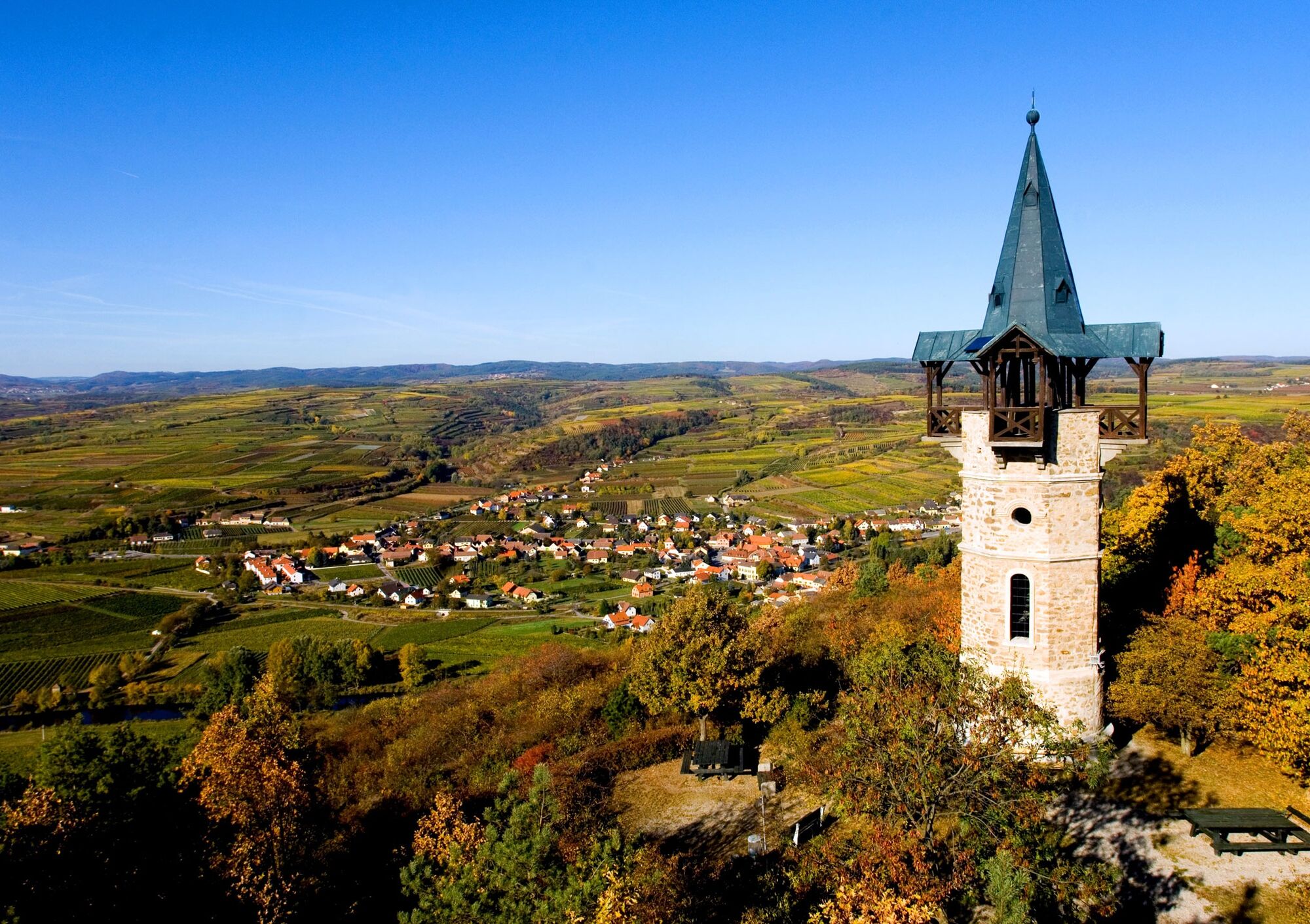
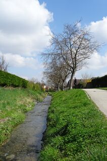
The 351-meter-high Heiligenstein, world-famous for its Rieslings, can be reached from Langenlois on a beautiful circular hike. The route passes through the Langenlois district of Haindorf and the wine...
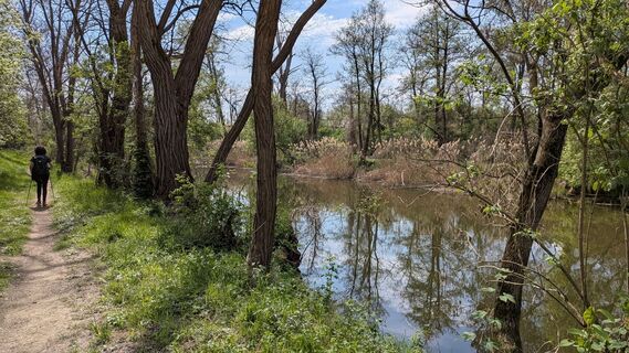
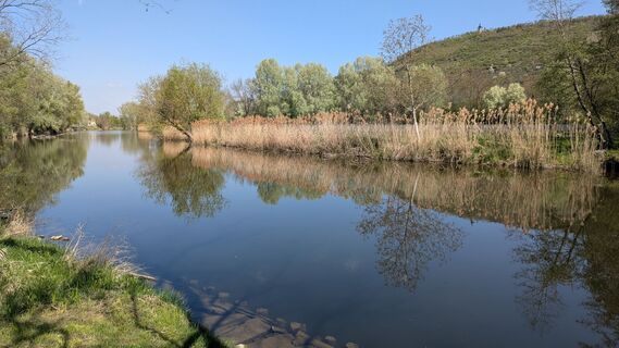
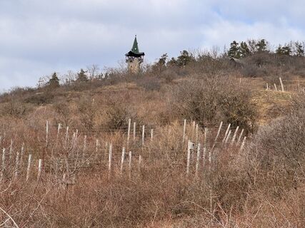
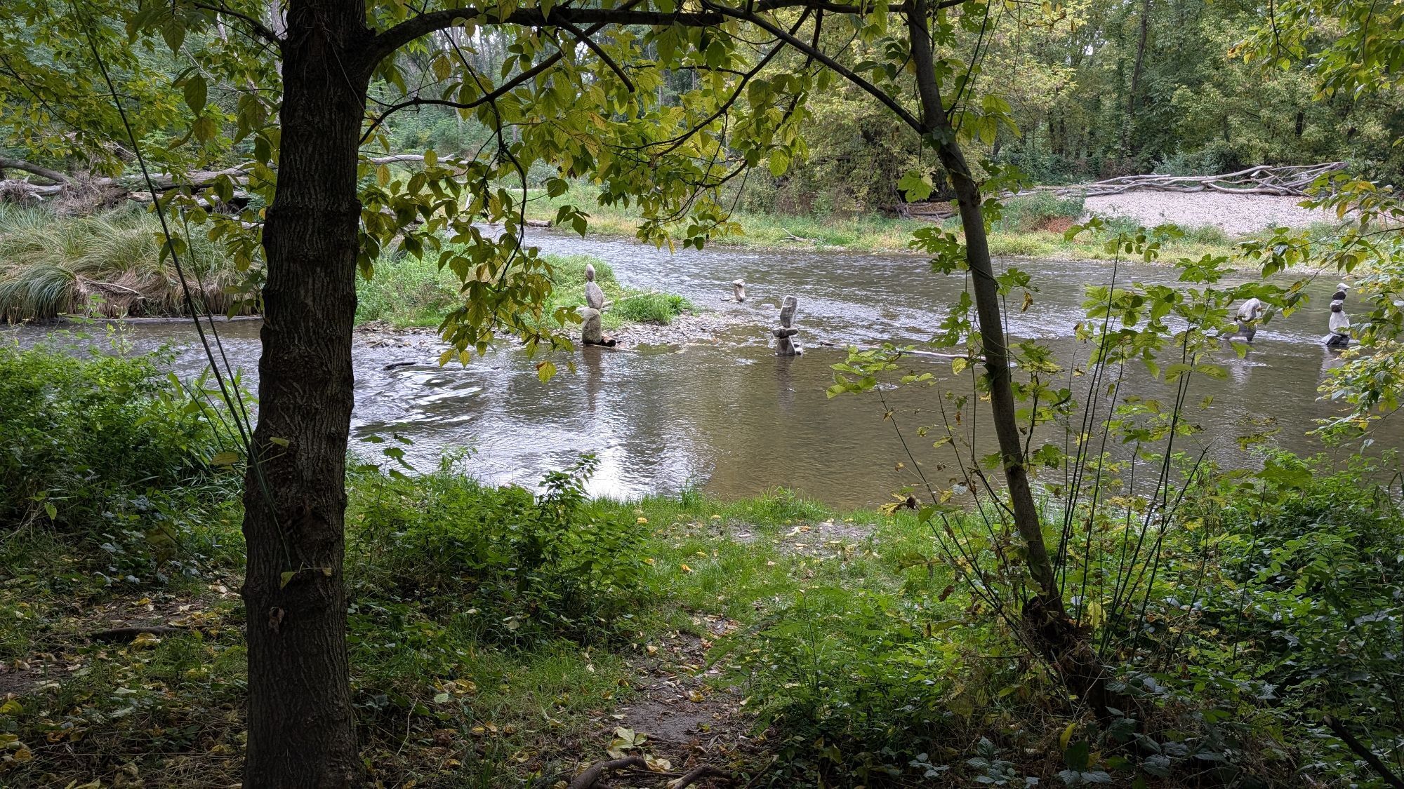
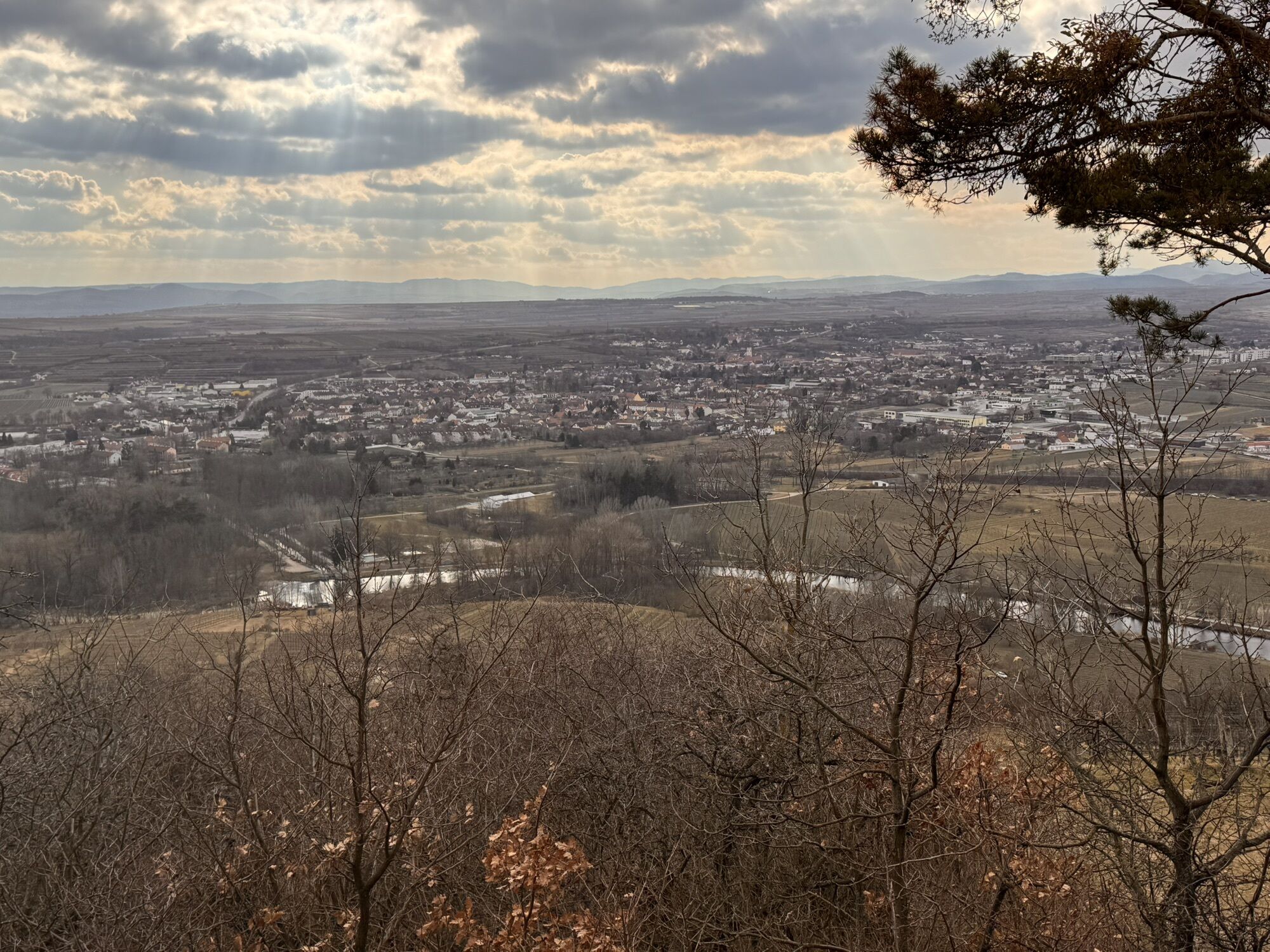
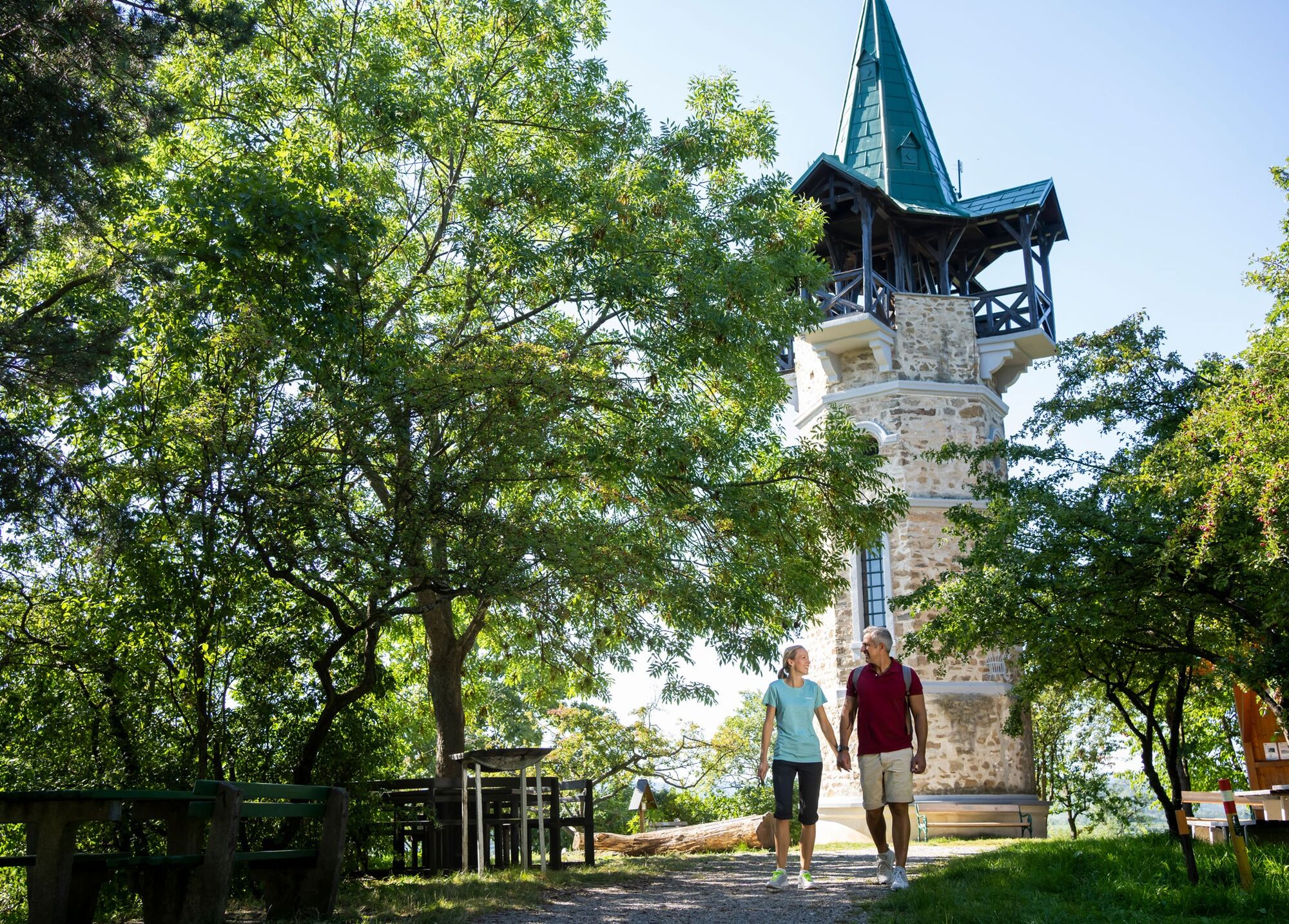
The 351-meter-high Heiligenstein, world-famous for its Rieslings, can be reached from Langenlois on a beautiful circular hike. The route passes through the Langenlois district of Haindorf and the wine village of Zöbing, along the Loisbach and Kamp rivers as well as through forests, vineyards, and wine terraces. The historic Kamptalwarte offers a magnificent view over Zöbing, Langenlois, and the lower Kamptal down to the Danube valley. On clear days, the peaks of Schneeberg and Ötscher are clearly visible on the horizon.

From the roundabout at Kornplatz towards the church, immediately turn left after the bridge over the Loisbach. Follow the Loisbach for about 500 m. After the Kaiser-Josef-Park, cross the Loisbach and follow Hochedlingergasse. At the intersection with Haindorfer Straße, turn left and immediately right into Austraße. After 200 m turn left and follow Kampweg for about 700 m out of town. At the underpass, turn right and now follow the path through vineyards and along the Kamp for about 1.3 km to Zöbing.
In Zöbing, take the bridge over the Kamp and then follow Heiligensteinstraße to the left. After 300 m turn right in the direction of Kellergasse. At the first cellars, keep slightly left and follow the path uphill for about 400 m. At a small parking lot, turn right and follow the flat path for about 200 m. Here a trail branches off to the left, which leads 600 m uphill. At the fork, turn right and follow the now flatter trail for about 300 m to the Kamptalwarte.
For the return journey, coming from Kamptalwarte, follow the gravel path straight ahead for about 100 m and turn right at the Fassdaubenkreuz. Now go down about 700 m – partly steep. At the asphalt road, turn left and after about 100 m immediately turn right into a gravel path. Follow this path through vineyards and along the Kamp for about 1 km. Cross the Kamp at the federal road (B34) and immediately turn right after the bridge. Follow the path along the Kamp for about 400 m. Turn right at the wayside shrine. At Hotel Schloss Haindorf, turn into Brunnengasse, cross the Loisbach and immediately turn right after the bridge. Now follow the Loisbach 2 km back to the starting point in the center of Langenlois.
Ano
Ano
Ano
Sturdy footwear, functional clothing, sun and rain protection, maps, telescopic poles if needed, first aid kit (blister plasters), sufficient provisions (snacks, muesli bars, fruit, water).
Make sure when choosing your route that it matches your fitness level. Check whether the gastronomy businesses you want to visit on the way are open. Pack your charged mobile phone and maps in your backpack.
From Vienna: Donauuferautobahn A22 towards Stockerau, continue on S5 towards Krems to the Fels am Wagram exit and on B34 to Langenlois.
From the west: Westautobahn A1 towards Vienna to St. Pölten, continue on S33 and B37 to Krems and on B218 to Langenlois.
Regular regional train connections between Langenlois and Hadersdorf (connection to Vienna), Krems, and the Kamptal (fahrplan.oebb.at).
Parking lot P1 Zentrum in Walterstraße or parking lot P2 Zentrum in Kamptalstraße
Ursin Haus Vinothek & Tourism Service GmbH
3550 Langenlois, Kamptalstraße 3
(T) +43 2734 2000-0, ext. 15
(E) info@ursinhaus.at
(I) www.langenlois.at
Waldviertel Tourism
3910 Zwettl, Sparkassenplatz 1/2/2
(T) +43 2822 54109
(E) info@waldviertel.at
(I) www.waldviertel.at
The key to the viewing platform is available at the Gasthaus Gutmann in Zöbing as well as at Ursin Haus and the Fiakerwirt in Langenlois.
At the end of the hike, visit one of the wine taverns in the Kellergasse at Heiligenstein or in Zöbing.


Oblíbené prohlídky v okolí
-
4.6
Welterbesteig Wachau 01: Krems-Dürnstein
světlodálková pěší trasa 12.3 km -
4.6
Krems (Welterbesteig) - Dürnstein - Vogelbergsteig - Kanzel - Fesslhütte - Krems
středníTuristika 18.0 km -
4.4
Wachauer Marillenerlebnisweg, Krems-Angern
světloTuristika 6.04 km -
4.7
Weinweg Langenlois - wohin ? in und um Wien
světloTuristika 5.68 km -
4.6
Der Weinskulpturenpfad auf dem Unteren Loibenberg
světloTuristika 4.03 km -
4.8
Übers "Loamstückl" zur Wetterkreuzkirche
světloTuristika 6.83 km -
4.3
DÜRNSTEIN Unterloiben Henglwand Vogelbergsteig ret. 13.04.2018
středníTuristika 13.3 km -
4.8
Rundwanderung Reisperbachtal, Donauwarte & Schreckberg
středníTuristika 8.89 km -
4.8
Vinum Circa Montem - Rund um den Göttweiger Berg
středníJízda na kole 19.4 km -
4.2
Zwei Ruinen und ein Schloss
světloTuristika 7.25 km

Pěší turistika a stopování


Nenechte si ujít nabídky a inspiraci pro vaši příští dovolenou
Vaše e-mailová adresa byl přidán do poštovního seznamu.