


Road leading to Kotavaara tower, Kemijärvi
From the Kotavaara parking lot, there is a steep walking path about 400 meters to the summit of Kotavaara. At the top of Kotavaara, there is a three-story metal observation tower, which you can climb at...
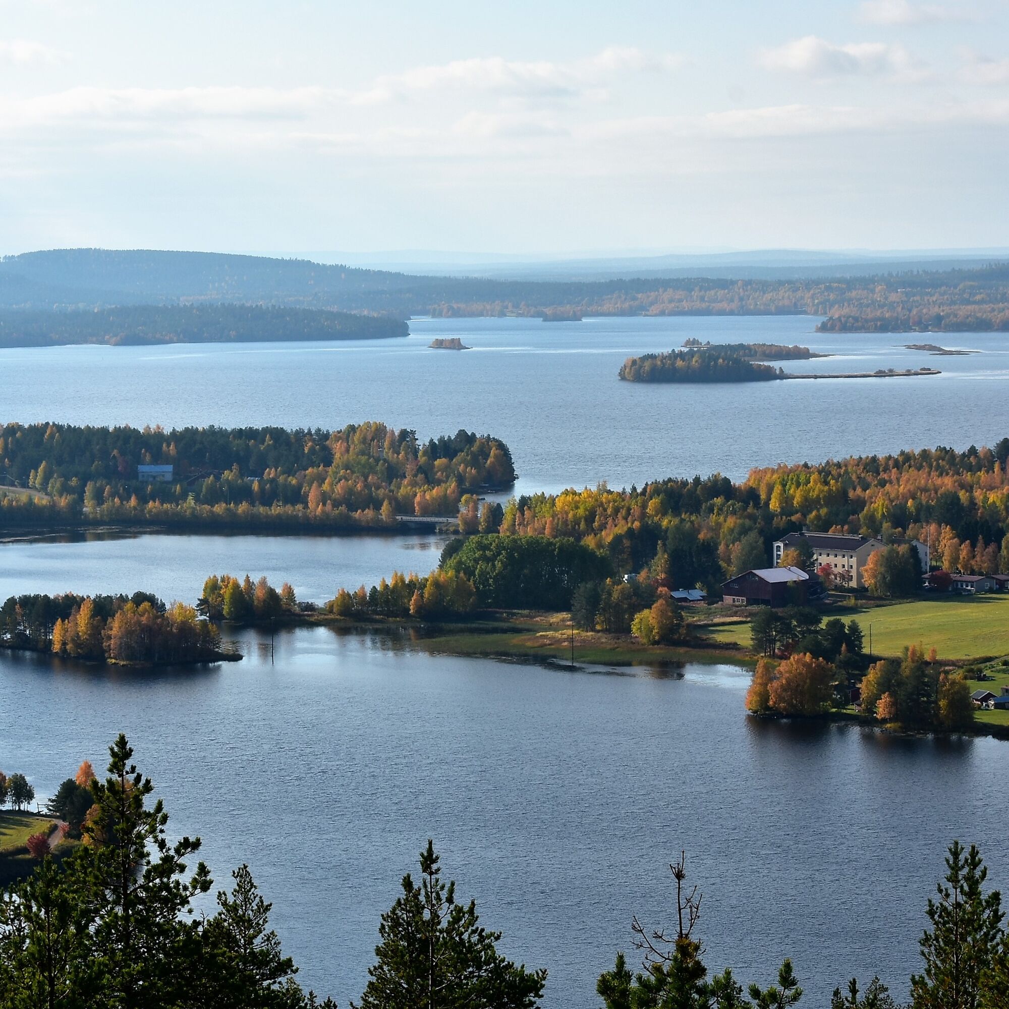
From the Kotavaara parking lot, there is a steep walking path about 400 meters to the summit of Kotavaara. At the top of Kotavaara, there is a three-story metal observation tower, which you can climb at your own risk. From the tower, you can also observe birds, such as cranes. You may also see the grey-headed woodpecker and other forest grouse in the surroundings. Next to the tower, there is also a lean-to shelter and a campfire site. A great destination both in summer and winter. It is easy to get here and the views are amazing!
Address: Vaaralantie 38, 98100 Kemijärvi

Drive 7 km from Kemijärvi center towards Kuusamo. Turn left to the village of Puikkola. The sign for Kotavaara observation tower is before the Puikkolantie intersection on the right. Drive 1.5 km forward and turn to Vaaralantie. On the left, there is a small Kotavaara parking lot. From the parking lot, there is a steep walking path of about 400 meters to the top of Kotavaara. At the top, there is a three-story metal observation tower, which you can climb at your own risk.
Ano
Ano
Good hiking boots and snowshoes in winter.
The route to the observation tower goes uphill and is partly rocky. The stairs of the observation tower can be slippery in winter.
There is a free parking spot near the starting point of the route.
Below the Kotavaara observation tower there is a lean-to shelter and a campfire site.
Oblíbené prohlídky v okolí
Ämmänvaara nature trail, Kemijärvi
světloTuristika 2.48 kmHonkakangas Forest Path
světloTuristika 3.33 kmValometsä
světloTematická stezka 0.62 kmEsteetön reitti Honkalmmen tulipaikalle
světloTuristika 0.20 kmKemijärvi Town Center Walking and Cycling Route
světloTuristika 4.80 kmKemijärvi - Särkikangas - Kemijärven Siion
světloTuristika 5.22 kmKemijärvi - Särkikangas
světloTuristika 5.06 kmPöyliöjärvi Canoeing Route
světloKajak / Kánoe 10.6 kmHonkakangas forest trail
středníTuristika 3.19 km
Pěší turistika a stopování


Nenechte si ujít nabídky a inspiraci pro vaši příští dovolenou
Vaše e-mailová adresa byl přidán do poštovního seznamu.