


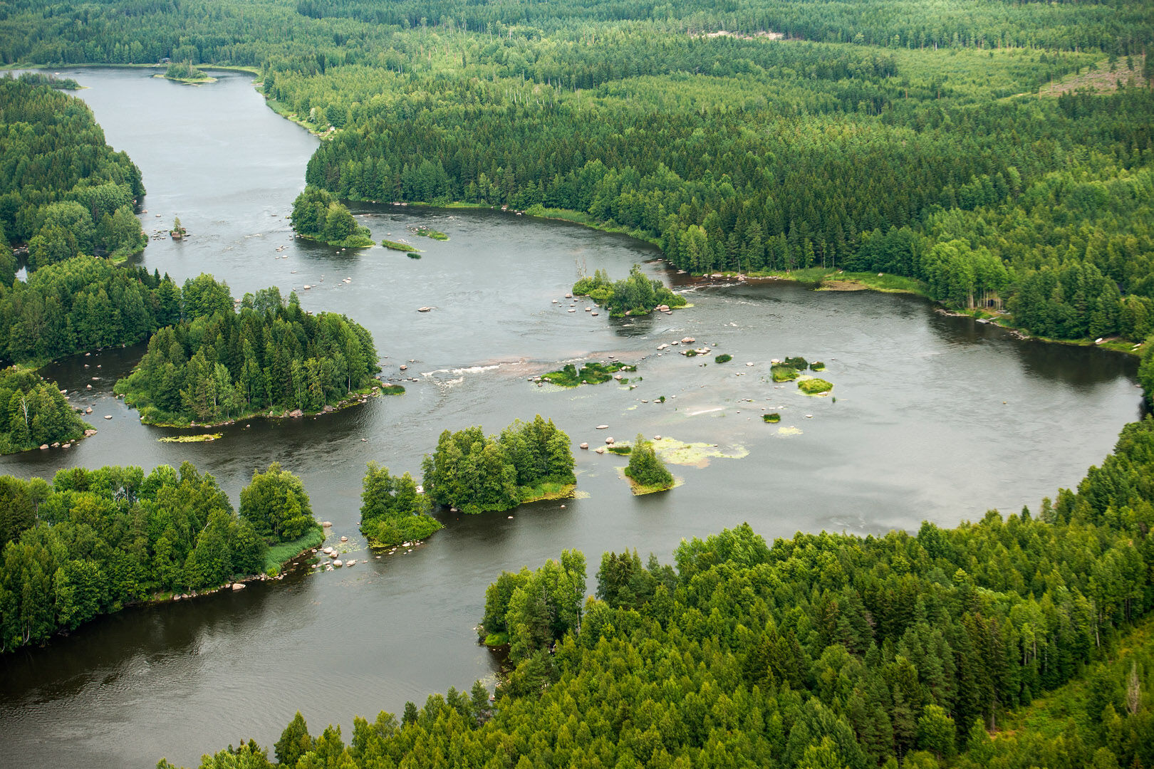
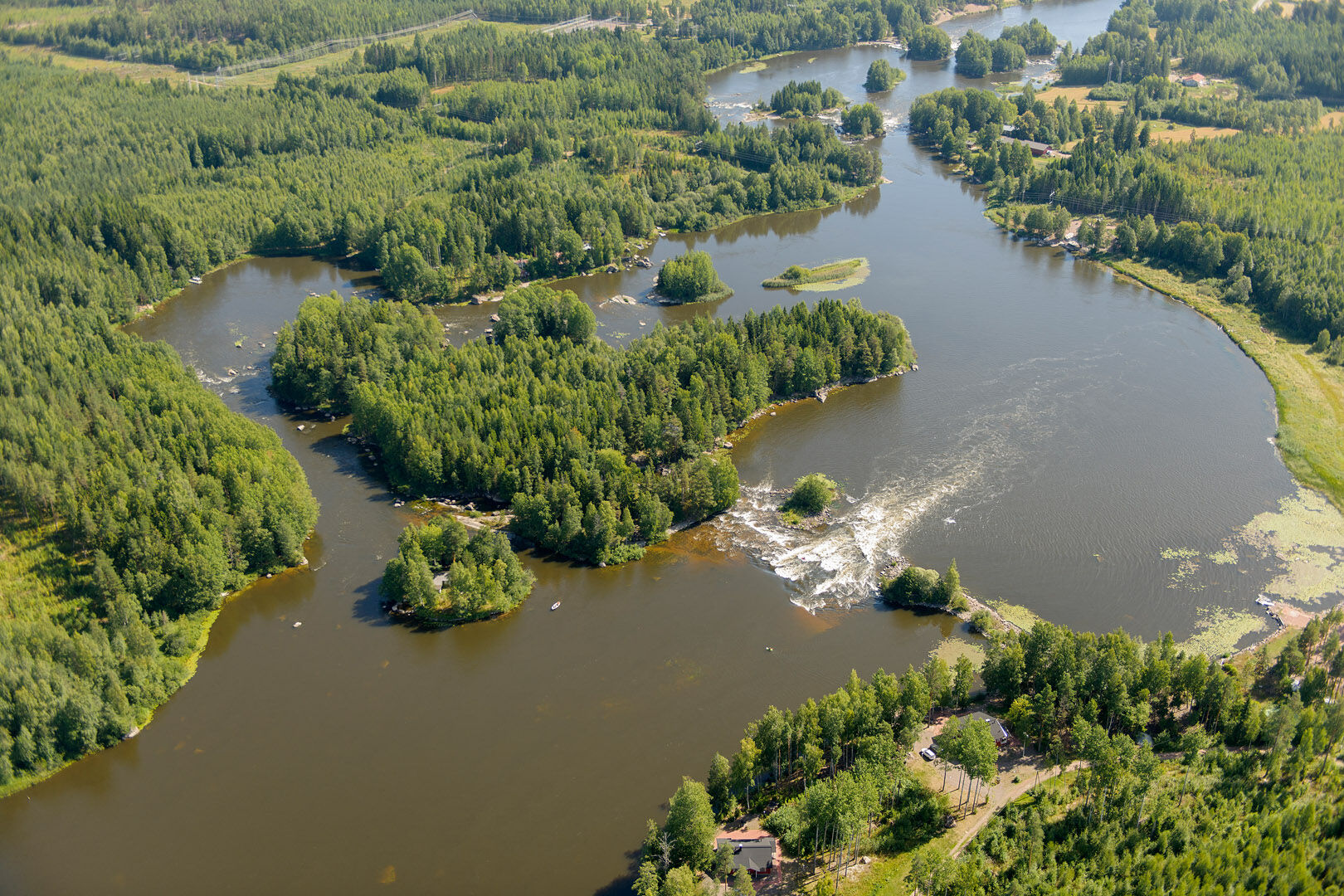
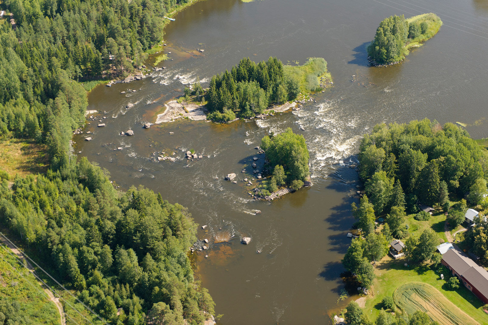
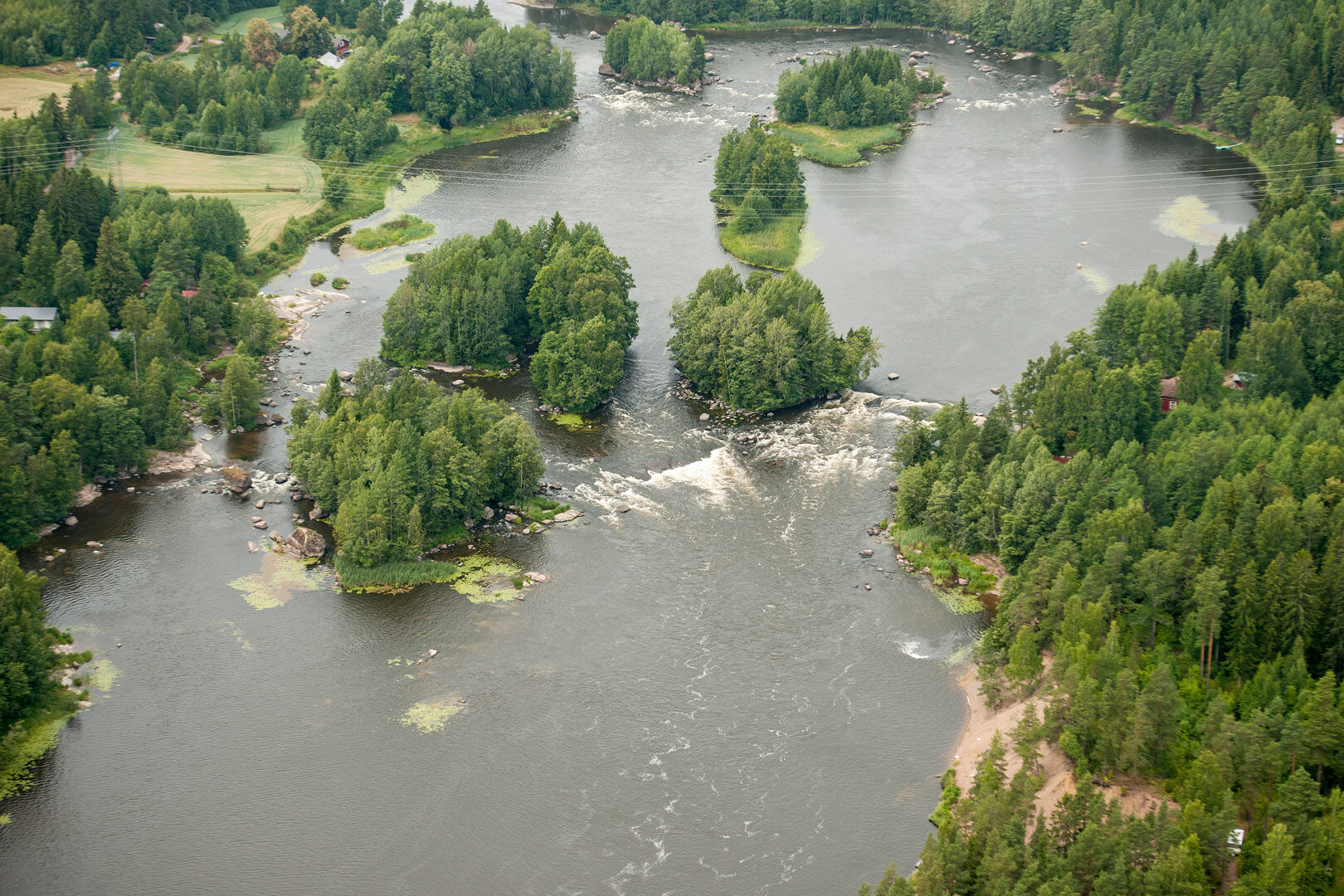
Pernoo branch of the Kymijoki River, Kotka
Is there anything more that a hiker can hope for from their trip.
No, the Kymijoki River offers all that and more.
This gem of Southern Finland is a fairly unknown destination for many hikers.
Its old reputation...
No, the Kymijoki River offers all that and more.
This gem of Southern Finland is a fairly unknown destination for many hikers.
Its old reputation as an industrial sewer still holds true, although the reality is quite different today.
The river has been cleaned up a great deal and is now home to several indicator species of clean water, including salmon and several rare insects.
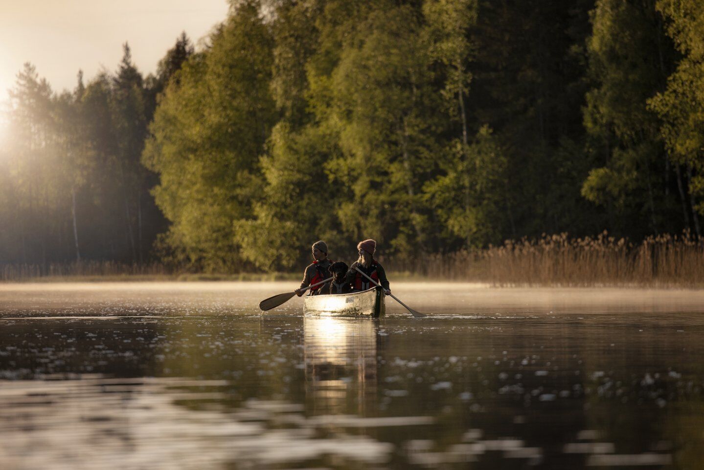
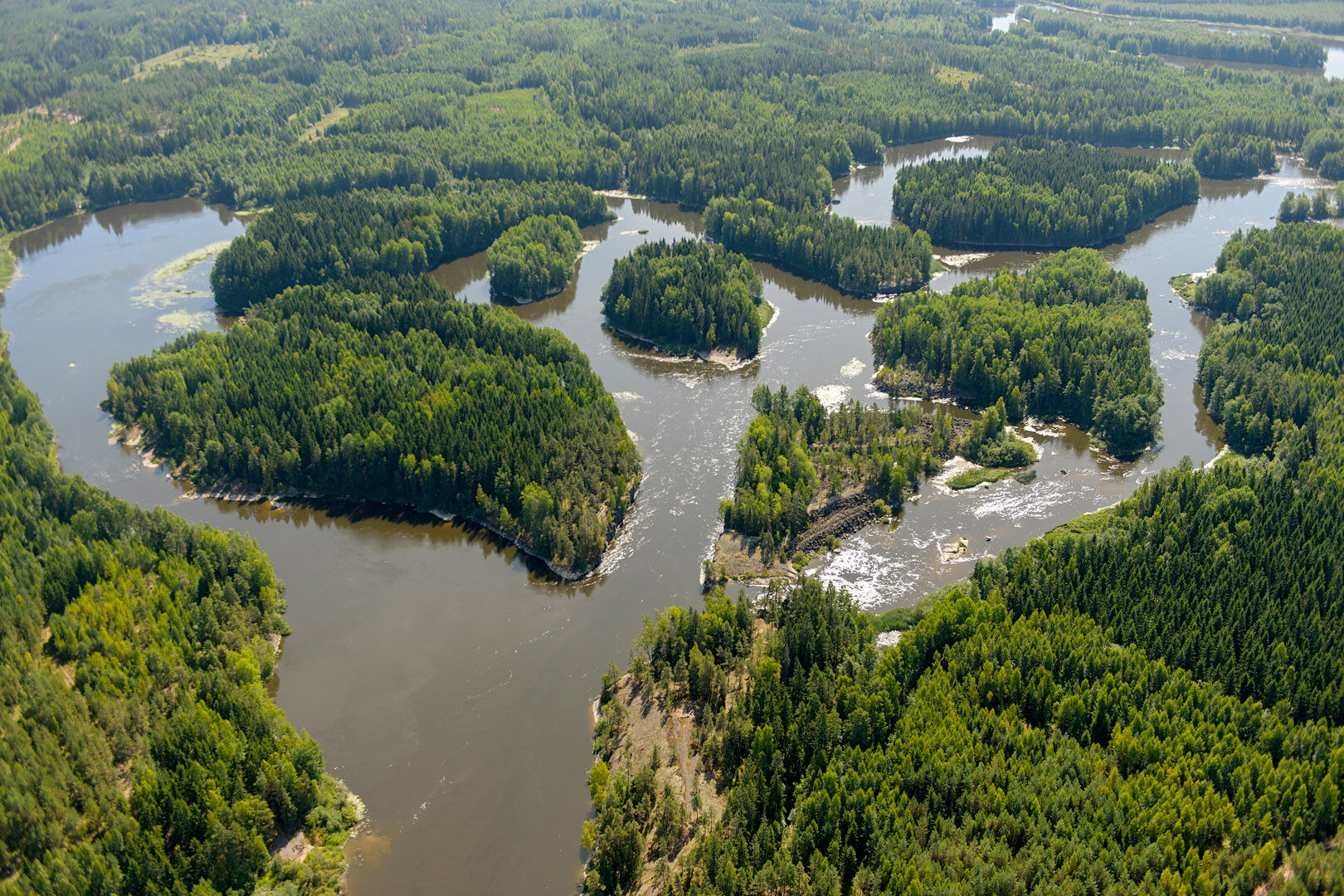
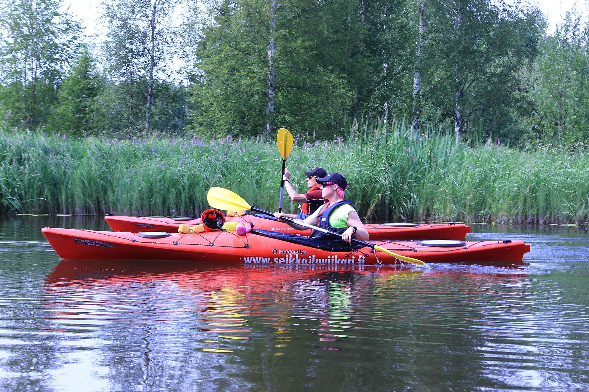
A large part of the lower reaches of the river has also been left undeveloped, allowing paddlers to test their paddling skills.
The rapids can also be canoe-passed, making it possible for those with less paddling experience to make the trip.
The Pernoonhaara paddling route is the shortest of the three main routes on the Kymijoki River.
It is 33 kilometres long and can easily be paddled in one day.
For hikers and nature lovers, a two-day trip may be the most recommended.
Video: Kymijoki pagcraft river rats on a brown trip on the Kymijoki River part 1, part 2, part 3

Detailed canoeing route guide for the Pernoo branch
Other equipment to be considered.
Helmet for rapids. Dry and wet suit if necessary. White light if paddling in the dark. Spare paddle.Paddlers should familiarise themselves with the rapids beforehand, as conditions may become more difficult as water levels change.
It is always the paddler's responsibility to choose the descent route and make the decision to descend.
Calculation routes drawn in the route guide are always RECOMMENDATIONS, never absolute truths.
The self-guided hiker must judge the situation on the spot, based on his own observations.
General guidelines
Do not set off on a kayaking trip alone or without telling anyone. Make sure you can read the map and map markings. Practise rescue techniques, at least pair rescue. Always keep your mobile phone waterproofed in your paddling vest pocket. Store an emergency number in your phone's speed dial. Download the 112 Suomi mobile app to your phone Make sure you have an up-to-date weather forecast. Make sure you have the right and adequate equipment. Do not paddle under the influence of alcohol or other intoxicants.Weather and paddling
Be prepared for changes in the weather!
Stormy weather, fog, poor visibility, darkness or sudden heat can quickly surprise you and make paddling difficult.
If the weather worsens, consider whether it is possible to change the route to a safer one, whether it is worth continuing or going back.
Choose a route based on your skills and equipment.
Pack anything that gets wet in a waterproof container and protect your sleeping bag in particular.
Use good quality equipment and make sure it is intact when you set off.
Also make sure you know how to use all your equipment.
Pack enough food and drink, at least for one extra day.
Please note that food spoils more quickly in warm weather.
When approaching the motorway from Helsinki or Hamina, take ramp 80 and continue north following these directions
Free parking is available at the departure point.
At the head of the Ahvio rapids is the Kuovinkallio rest area, next to which is a rocky promontory with a magnificent view of the rapids. Ahvio Rays is a 35-hectare area with 12 large islands. In this area you can choose from a wide variety of paddling routes while exploring the islands, which are practically in their natural state. At the very bottom of the rapids area are two sparkling rapids, Martinkoski and Kotokoski.
The banks of the Kymijoki River have a fairly rich heron population. Great egrets are seen on almost every trip. Great White Storks, on the other hand, are rarely seen, but can be heard more often. You can identify a Great White Heron by its sound, which is similar to blowing into an empty bottle. In addition to herons, large falcons often glide along the river.
Oblíbené prohlídky v okolí
-
Řeka Kymijoki Cyklistická trasa dvou měst
heavyCyklistika na velkou vzdálenost 218.9 km -
Pyhtää branch canoeing route of Kymijoki River
středníKajak / Kánoe 68.9 km -
Canoe expedition Inkeroinen - Kotka
středníKajak / Kánoe 93.7 km -
Kymijoki riverside scenic route
středníJízda na kole 73.3 km -
Kymenlaakso industrial heritage route
světloMotorrad 153.3 km -
Alvar Aalto's Kymenlaakso
světloJízda na kole 96.8 km -
Fortresses Coast, Loviisa, Kotka, Hamina
světloJízda na kole 88.5 km -
Villa Jaakkola's rural route
světloJízda na kole 35.8 km -
Pyhtää - Lintutorni
světloTuristika 2.29 km -
Kylpylä - Lappeen Marian kirkko - Variskallio - Lentokenttä
Motorrad 240.1 km

Pěší turistika a stopování


Nenechte si ujít nabídky a inspiraci pro vaši příští dovolenou
Vaše e-mailová adresa byl přidán do poštovního seznamu.