





Torronsuo trail, Tammela

Torronsuo National Park is a pristine, large mire area in Southern Finland. Torronsuo is located in the Häme Lake Highlands, a rugged wilderness area with forested shores. In addition to the beautiful...
Torronsuo National Park is a pristine, large mire area in Southern Finland. Torronsuo is located in the Häme Lake Highlands, a rugged wilderness area with forested shores. In addition to the beautiful shores, the area has forests of various ages and valuable mire areas. The hiking trail leading to the southern parts of Torronsuo and the village of Torro is an excellent all-day hiking destination. Particularly in spring and autumn, it is worth observing bird migration at Torronsuo. Many bird species, such as cranes and geese, stop to rest on the mire.
Good to know
The Häme Nature Centre, which also has a café, is located about five kilometers from the eastern edge of the national park. The nearest services are found in Somero and Forssa. All trails in the national park start from the Kiljamo parking area. The national park's parking area is located in Kiljamo along the Forssa – Somero road (no. 282, Tammela). The starting point for hiking trails is at the same place. Torronsuo National Park is situated in the municipality of Tammela, west of highway 2. There are signs to the national park from highway 2 (Helsinki-Pori). You can take a bus to Forssa, from where it is 11 km to the Kiljamo parking area. It is 15 km from Somero to Kiljamo. You can also ski at Torronsuo. Tracks are maintained from early January to the end of November. There are as much as 45 km of tracks at their best.
Torronsuo's trails are part of the Häme Lynx trail network. The Härkä road cycling route passes through Forssa.
See the photo gallery from the Torronsuo trail

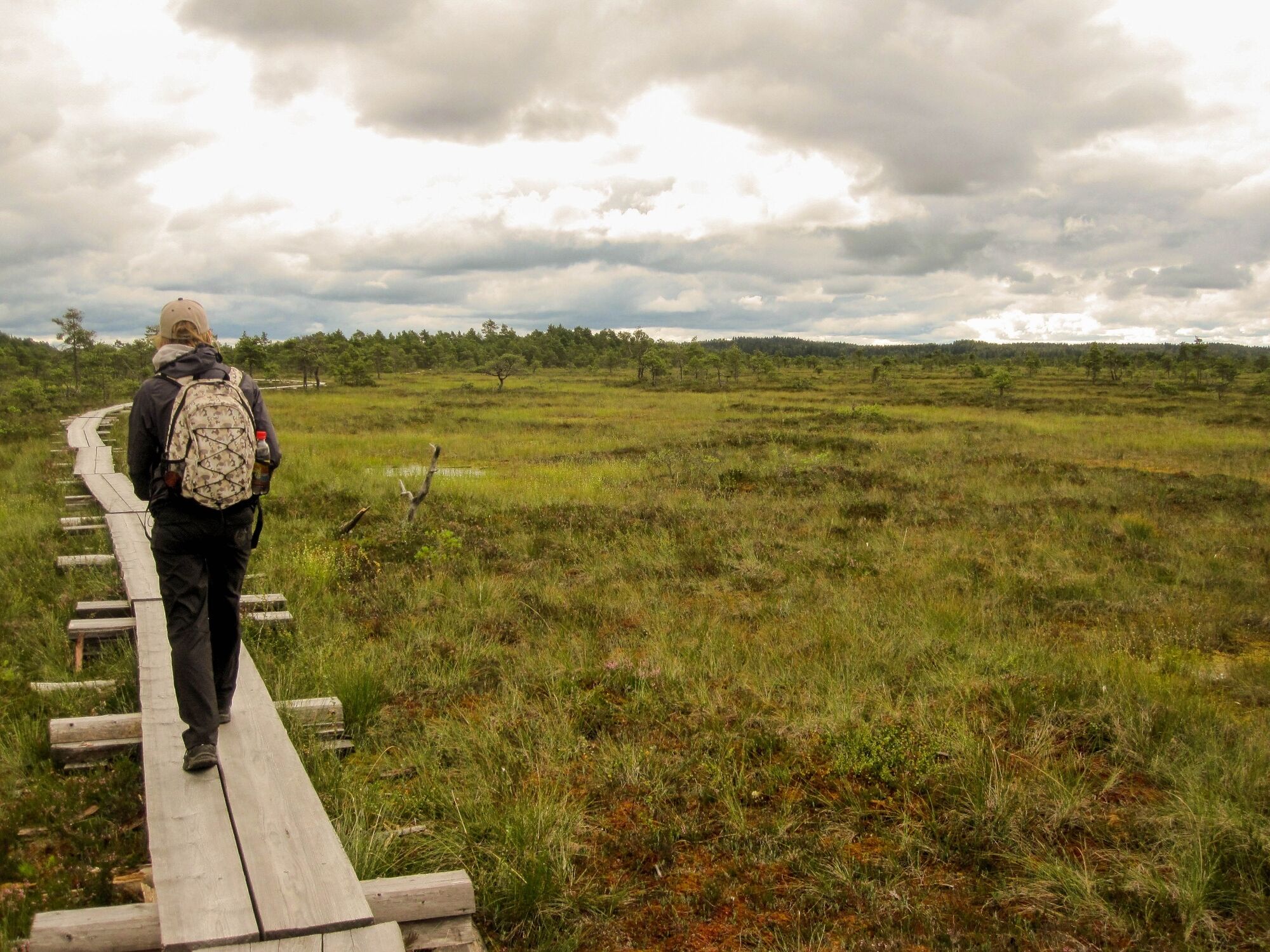

Route description
The route starts beside the Kiljamo campfire site and crosses Torronsuo to the old quarry of Härksaari. There are boardwalks in the mire section. Upon reaching the southern edge of the mire, the route runs for a while through the shelter of the forest. Quartz was once quarried from the old Härksaari quarry. From Härksaari, you can return to Kiljamo by the same route, but if you want to hike a 10 km route, you should continue 1 km to Haiponniittu, from where a gravel road continues to the village of Torro. From the village, you can return to the national park via the main road to the boardwalk section. The nature of Torronsuo mainly consists of mire, with small pine forest islands in the middle of the mire area. The mire area is bordered by forests, ridges, and cliffs with stunning views. Torronsuo is a resting place for migratory birds and a popular breeding area for birds. There are also many insect species. The basic plants of the mire grow in the area, such as heather, marsh labrador tea, cowberry, crowberry, and lingonberries. Berry picking is also allowed in the national park. Torronsuo was formed over 10,000 years ago and has been inhabited since the Stone Age. The peat layer in Torronsuo is over 10 meters thick at its deepest.
Ano
Ano
Difficulty
Along the trail, there is the Kiljamo observation tower, near which there is a campfire site and a dry toilet. Due to the wetness of Torronsuo, especially during spring and autumn floods, boots are necessary even on the boardwalk routes. There are many mosquitoes, horseflies, and flies in the boardwalk area during summer. The national park has no water points or café and shop services.
Trail markings
Trail markings are partly insufficient. In the forest sections, there are sparse trail markings with yellow paint marks on the trees.
Suitability
The trail is also suitable for families with children but is not barrier-free.
Links
Koulukatu 13, 30100 FORSSA
Open weekdays 8 am - 4 pm
Tel. (03) 4240 4724
Fax: (03) 4240 4740
matkailuneuvonta@fskk.fi
Torronsuo National Park , Metsähallitus
Attractions
The Kiljamo observation tower offers beautiful mire landscapes. You can see cranes and geese resting during migration times on the bogs.
The cultural landscapes of Torro village are unique. Torro has been designated as one of the nationally significant built cultural environments by the National Board of Antiquities.
The nearby Häme Nature Centre has a permanent exhibition on southern Finnish mire nature and Torronsuo.
Oblíbené prohlídky v okolí
-
Loimijoki paddling route
Kajak / Kánoe 83.9 km -
Ruostejärvi - Saari Hämeen Ilvesreitti 14.3 km
heavyTuristika 14.3 km -
Hämeen Ilvesreitti Liesjärvi 19.6 km
středníMountainbike 19.4 km -
Hyypiö route, Tammela
středníTuristika 5.89 km -
Vaellusreitti Liesjärvi 16,1km
heavyTuristika 16.7 km -
Tammela's Ruostejärvi children's water nature trail
Kajak / Kánoe 2.19 km -
Eerikkilä-Piippurinsuo Hämeen Ilvesreitti 9,7km
Turistika 9.72 km -
Yhdysreitti Liesjärven Kansallispuisto - Ruostejärvi Hämeen Ilvesreitti
heavyTuristika 15.8 km -
Tammela - Klubitalo
středníTuristika 7.38 km -
Kuusisto Line (Turun lähtölaituri) - Turun vapaaseurakunta - Liedon seurakuntatalo - Asemanranta
středníCyklistika na velkou vzdálenost 183.1 km
Pěší turistika a stopování


Nenechte si ujít nabídky a inspiraci pro vaši příští dovolenou
Vaše e-mailová adresa byl přidán do poštovního seznamu.





