



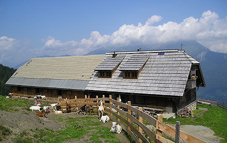
Oberbuchacher Alm

Farm road from Griminitzen to Oberbuchach, further Alm path to Gundersheimer Alm, with a branch to Oberbuchacher Alm to the left before the stream crossing. Beautiful, shady and not steep path, however...
Farm road from Griminitzen to Oberbuchach, further Alm path to Gundersheimer Alm, with a branch to Oberbuchacher Alm to the left before the stream crossing. Beautiful, shady and not steep path, however somewhat steeper to Oberbuchacher Alm. From both Alms you have a beautiful view into the valley. Hiking time to Oberbuchacher Alm approx. 3.5 hours, to Gundersheimer Alm approx. 4 hours


Beautiful, shady path, in some places also a bit steep.
Sturdy footwear.
Please observe the signposts!
From the Klagenfurt - Villach direction - exit Gailtal/Hermagor - B111 Gailtal federal road to Gundersheim
A road leads from Gundersheim to Griminitzen
By bus and train, boarding and alighting possible in Gundersheim
Parking available in Griminitzen
Altitude difference approx. 950m.
Very beautiful view from the Alm.


Oblíbené prohlídky v okolí
-
4.7
Drau Cycle Path R1
světloJízda na kole 75.9 km -
5.0
Plöckenhaus - Polinik - Plöckenhaus
heavyTuristika 10.9 km -
3.7
Cellon-Stollen und Senza Confini auf den Cellon und Steinberger Weg zum Abstieg
středníVia ferrata 7.09 km -
4.7
KL_N5 Crete Rosse
středníVia ferrata 6.96 km -
4.7
Möselalm - Weißbriach/Gitschtal
světloTuristika 5.12 km -
3.7
RW_N61 Kleiner Pal (1,867 m)
heavyTuristika 6.52 km -
5.0
Frischenkofel
středníTuristika 5.25 km -
4.6
Circular route Weißbriach via Bravensteig (No. 7) to Möselam, return via Möselalmweg (No. 6) to Weißbriach - Weißbriach/Gitschtal
středníTuristika 9.28 km -
5.0
Nassfeld - Winklalm - Madritschen - Nassfeld
světloTuristika 7.29 km -
4.7
ST_N9 Madritschen (1,918 m)
Lyžařská trasa 2.71 km
Pěší turistika a stopování


Nenechte si ujít nabídky a inspiraci pro vaši příští dovolenou
Vaše e-mailová adresa byl přidán do poštovního seznamu.


