


Vierbergeweg Stage 4 St. Leonhard near Liebenfels - Gradenegg
Fotografie našich uživatelů
-
 © Herwig WinklerVytvořeno dne 18.04.2026
 -
 © Herwig WinklerVytvořeno dne 18.04.2026
 -
 © Herwig WinklerVytvořeno dne 18.04.2026
 -
 © Herwig WinklerVytvořeno dne 18.04.2026
 -
 © Bernhard KollerVytvořeno dne 17.04.2026
 -
 © Bernhard KollerVytvořeno dne 17.04.2026
 -
 © Markus MosserVytvořeno dne 17.04.2026
 -
 © Daniela ProseggerVytvořeno dne 17.04.2026
 -

 © EllsiVytvořeno dne 17.04.2026
 -
 © Bernhard KollerVytvořeno dne 17.04.2026
 -
 © Bernhard KollerVytvořeno dne 17.04.2026
 -
 © Bernhard KollerVytvořeno dne 17.04.2026
 -
 © EllsiVytvořeno dne 17.04.2026
 -
 © Markus MosserVytvořeno dne 17.04.2026
 -
 © Markus MosserVytvořeno dne 17.04.2026
 -
 © Markus MosserVytvořeno dne 17.04.2026
 -

 © Anna KopfmüllerVytvořeno dne 06.04.2026
 -
 © Anna KopfmüllerVytvořeno dne 13.03.2026
 -
 © WernerVytvořeno dne 07.08.2025
 -
 © WernerVytvořeno dne 07.08.2025
 -
 © Dagmar HoferVytvořeno dne 02.05.2025
 -
 © Sabine KobanVytvořeno dne 02.05.2025
 -
 © Dagmar HoferVytvořeno dne 02.05.2025
 -
 © Dagmar HoferVytvořeno dne 02.05.2025
 -

 © Roland NaglVytvořeno dne 02.05.2025
 -
 © Katarina VodincarsVytvořeno dne 02.05.2025
 -
 © Katarina VodincarsVytvořeno dne 12.04.2024
 -
 © Herbert WeberVytvořeno dne 12.04.2024
 -
 © Katarina VodincarsVytvořeno dne 12.04.2024
 -
 © derScheifeVytvořeno dne 16.04.2021
 -

 © Matthias RathVytvořeno dne 02.05.2025
 -
 © Katja GonziVytvořeno dne 01.05.2026
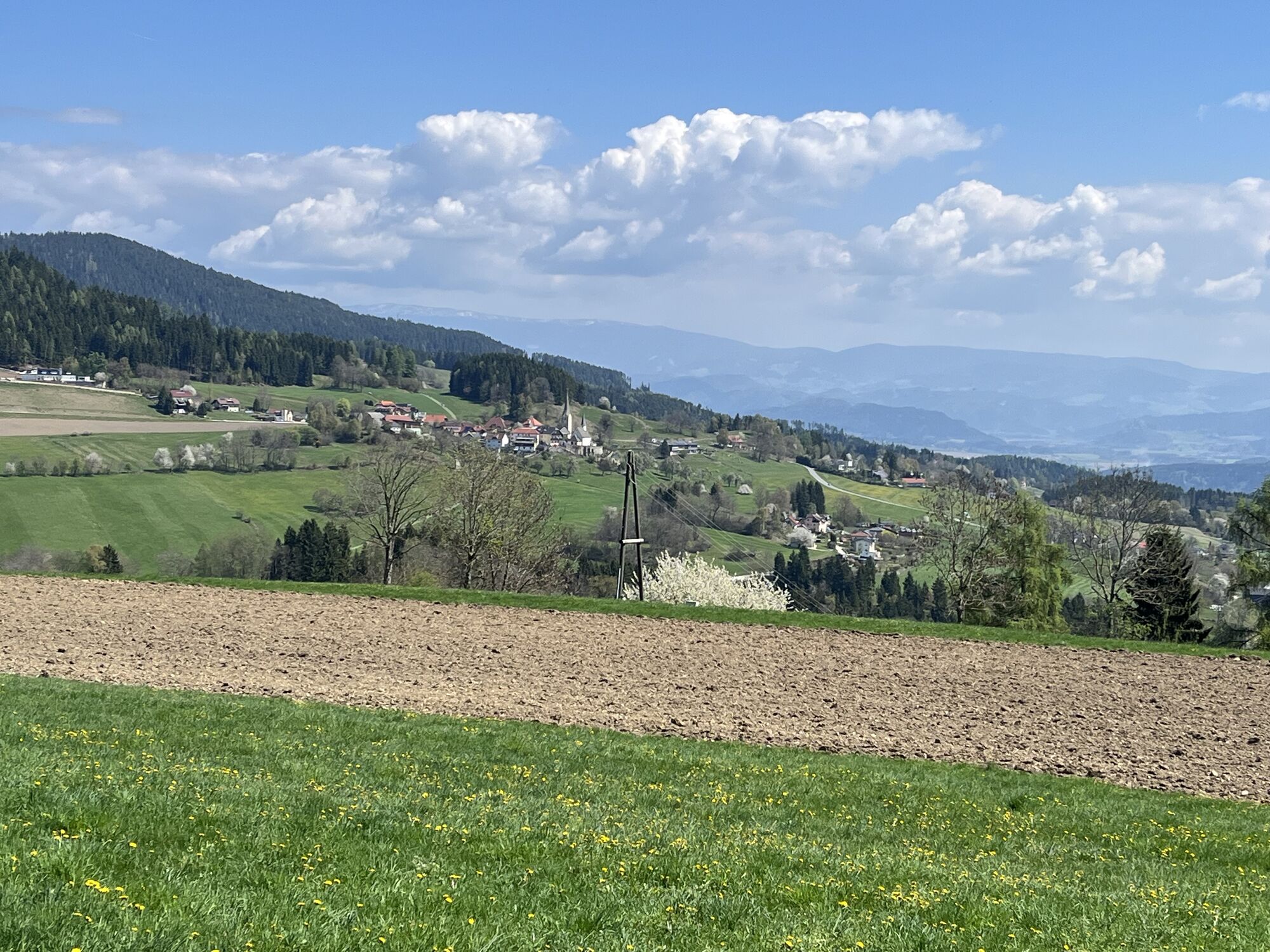
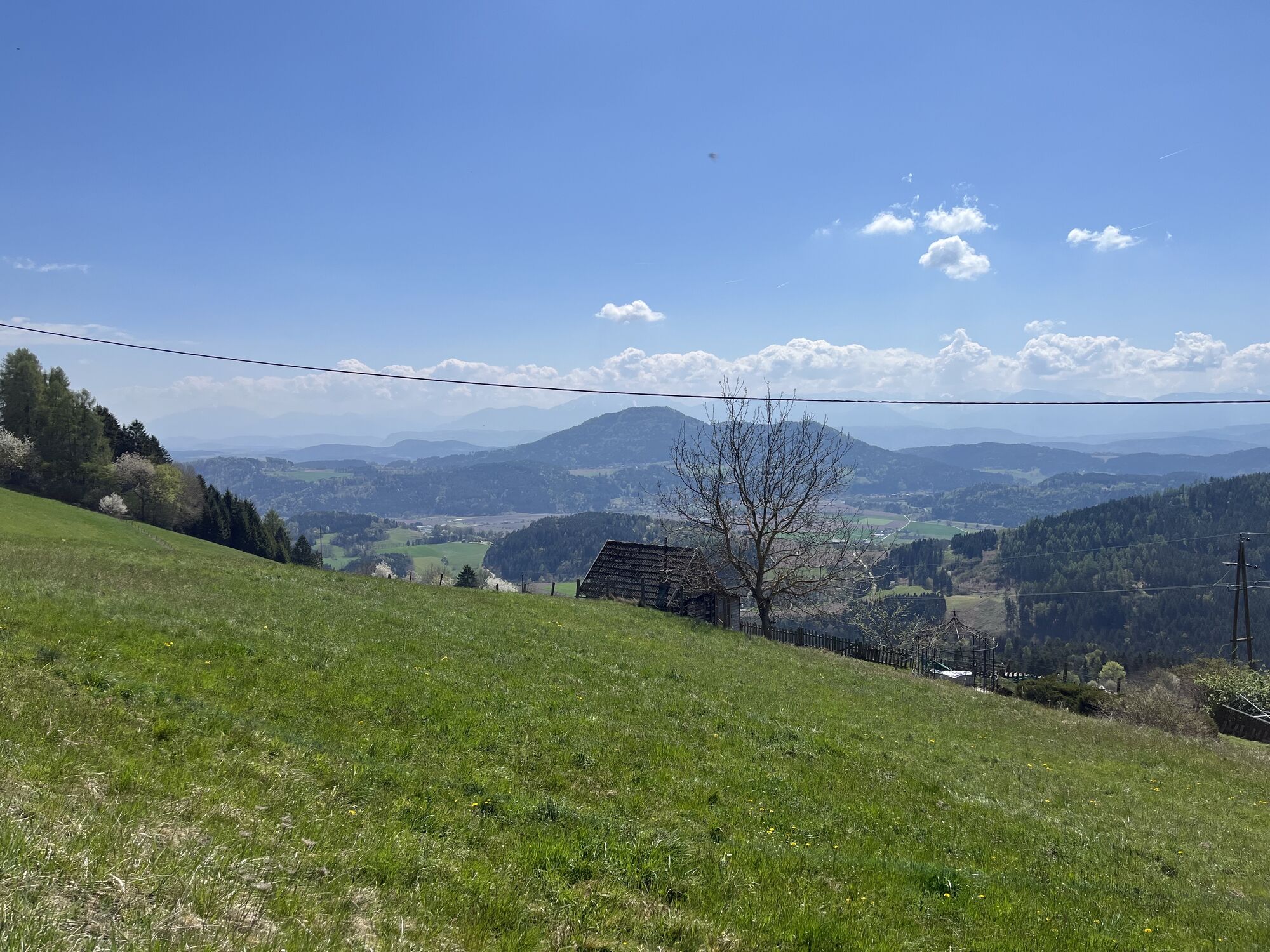
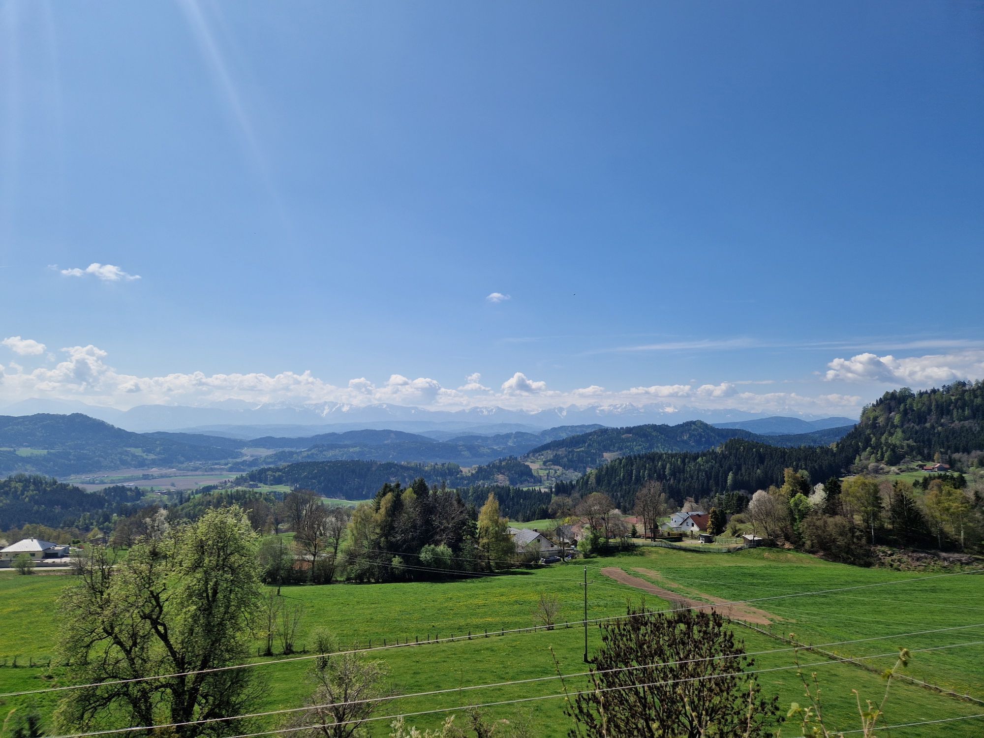

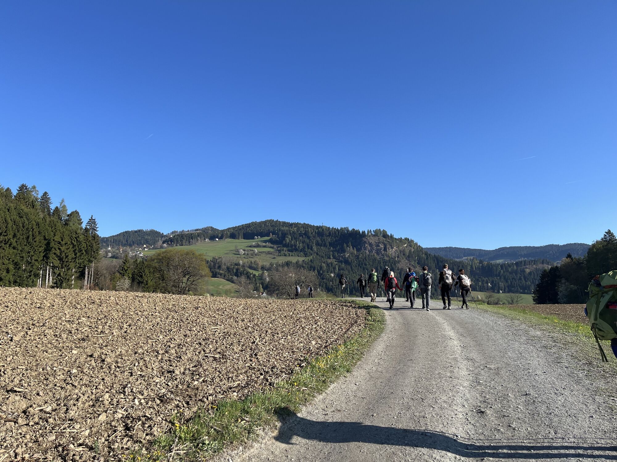
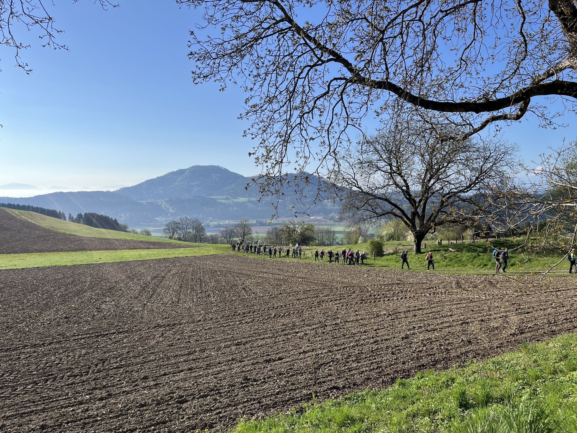


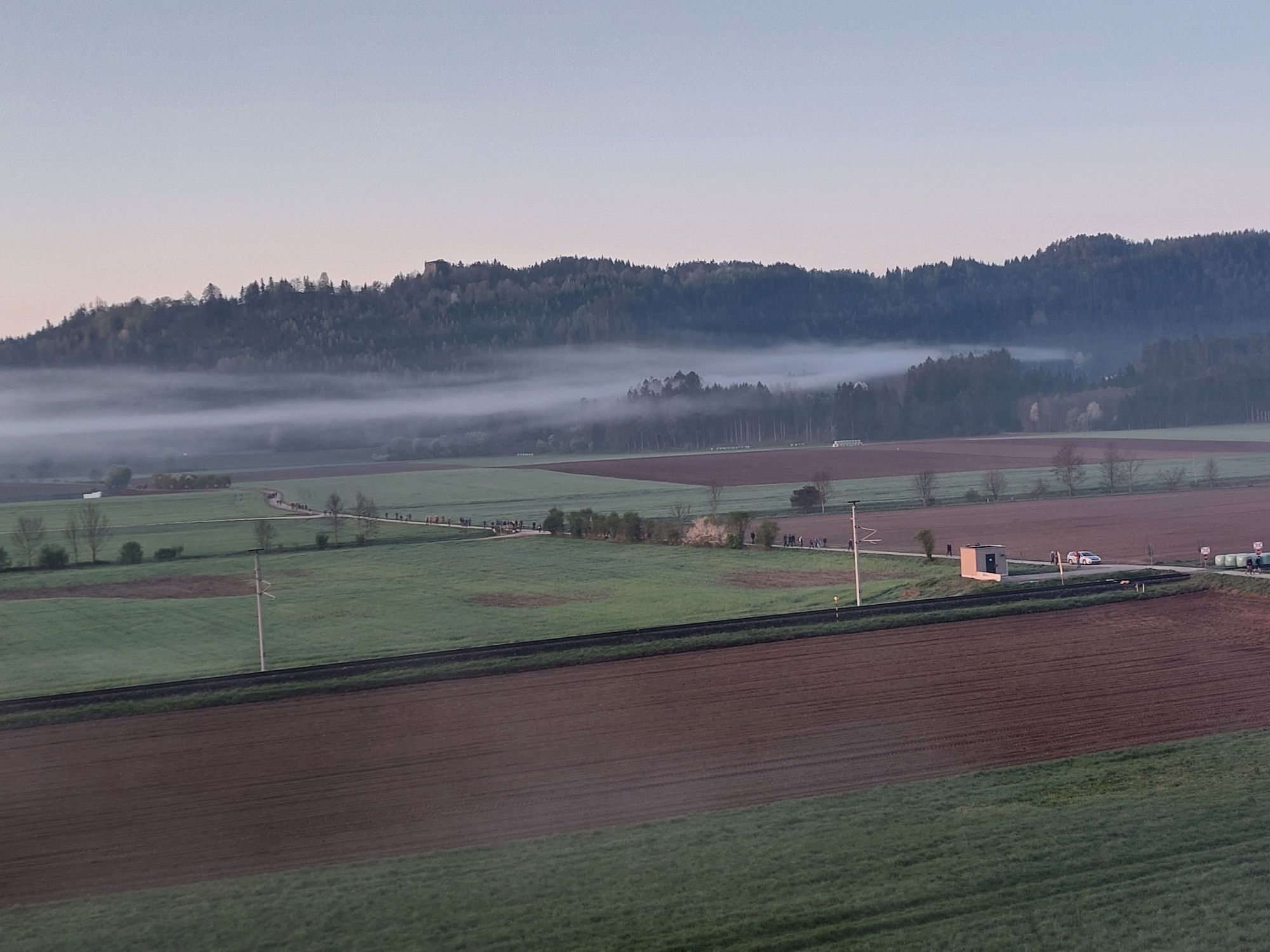


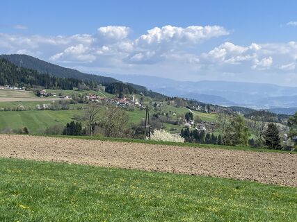
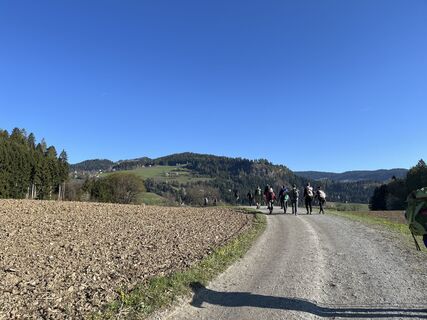
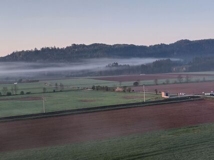
The village of St. Leonhard is crossed until the ascent over the so-called "Kulm" begins. After overcoming the Kulmberg, you continue ascending and reach Liemberg. Via the high valley of the Liemberg creek,...
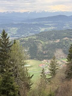
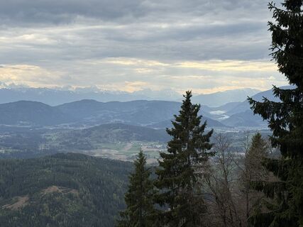
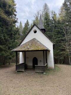
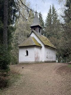
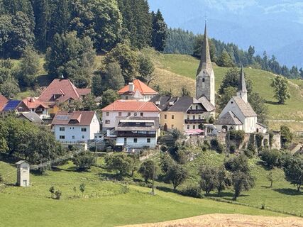
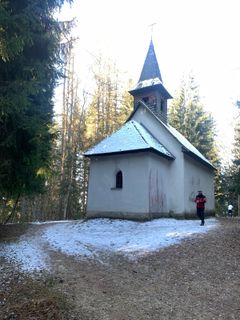
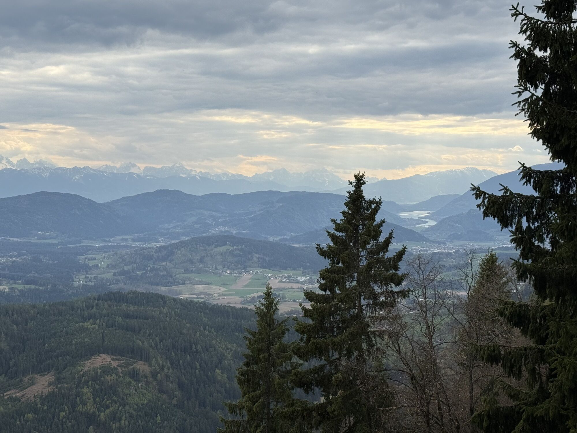
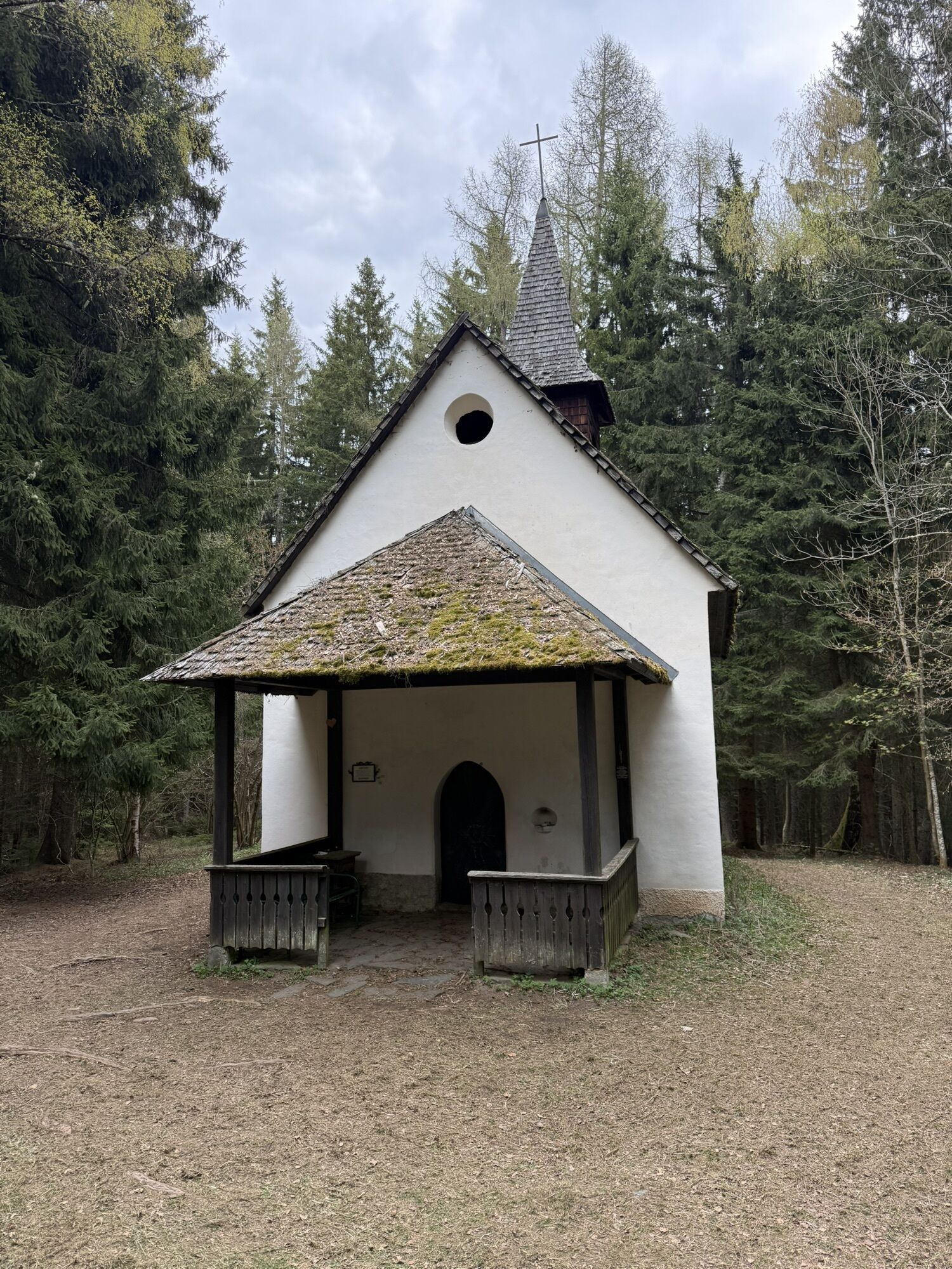
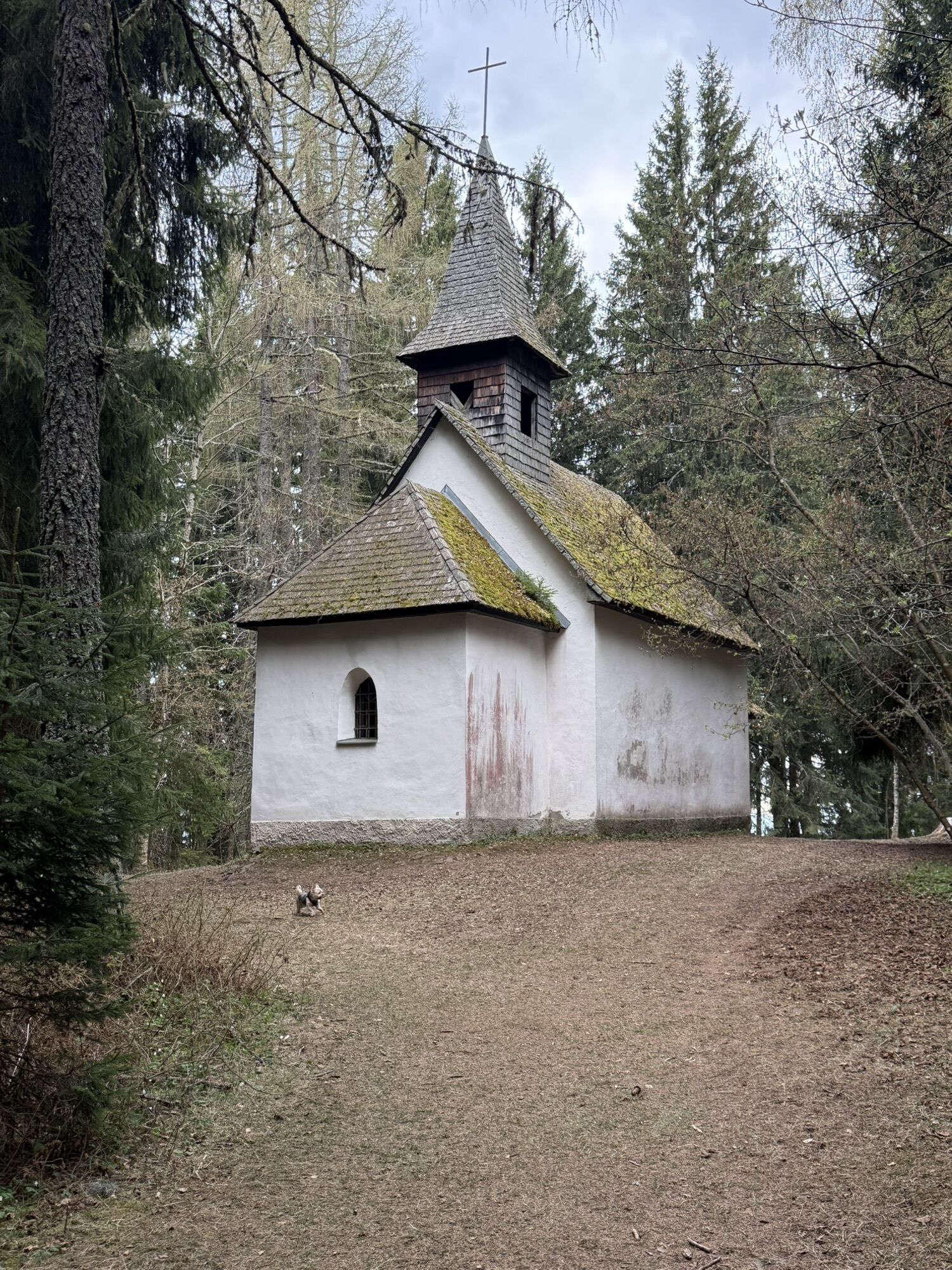
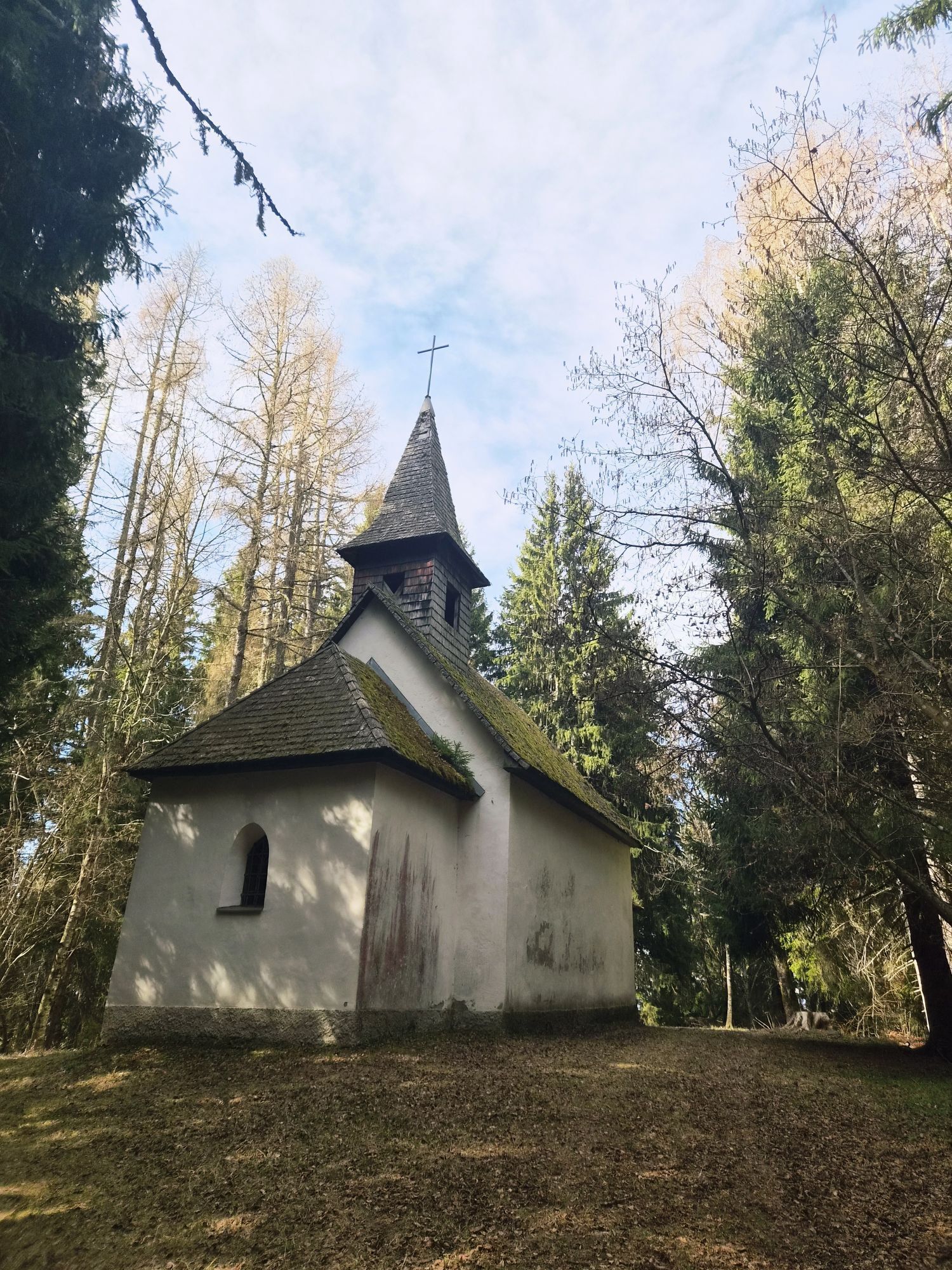
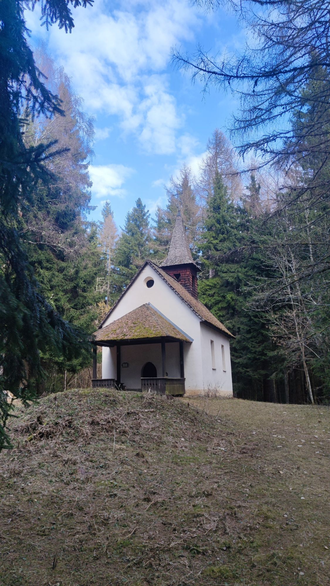
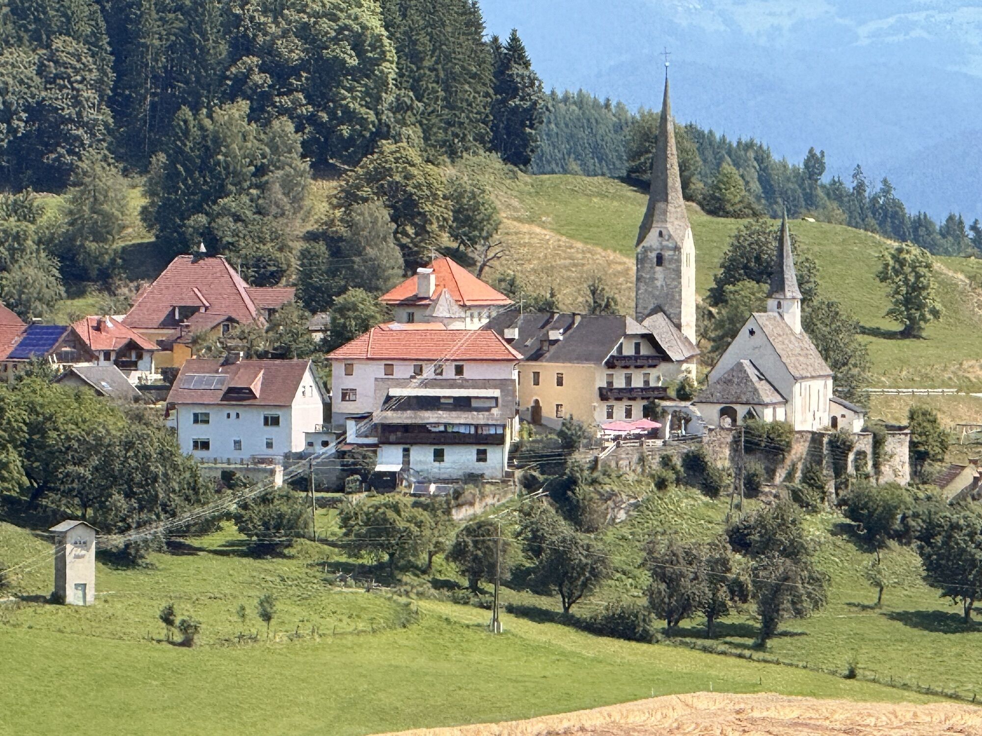
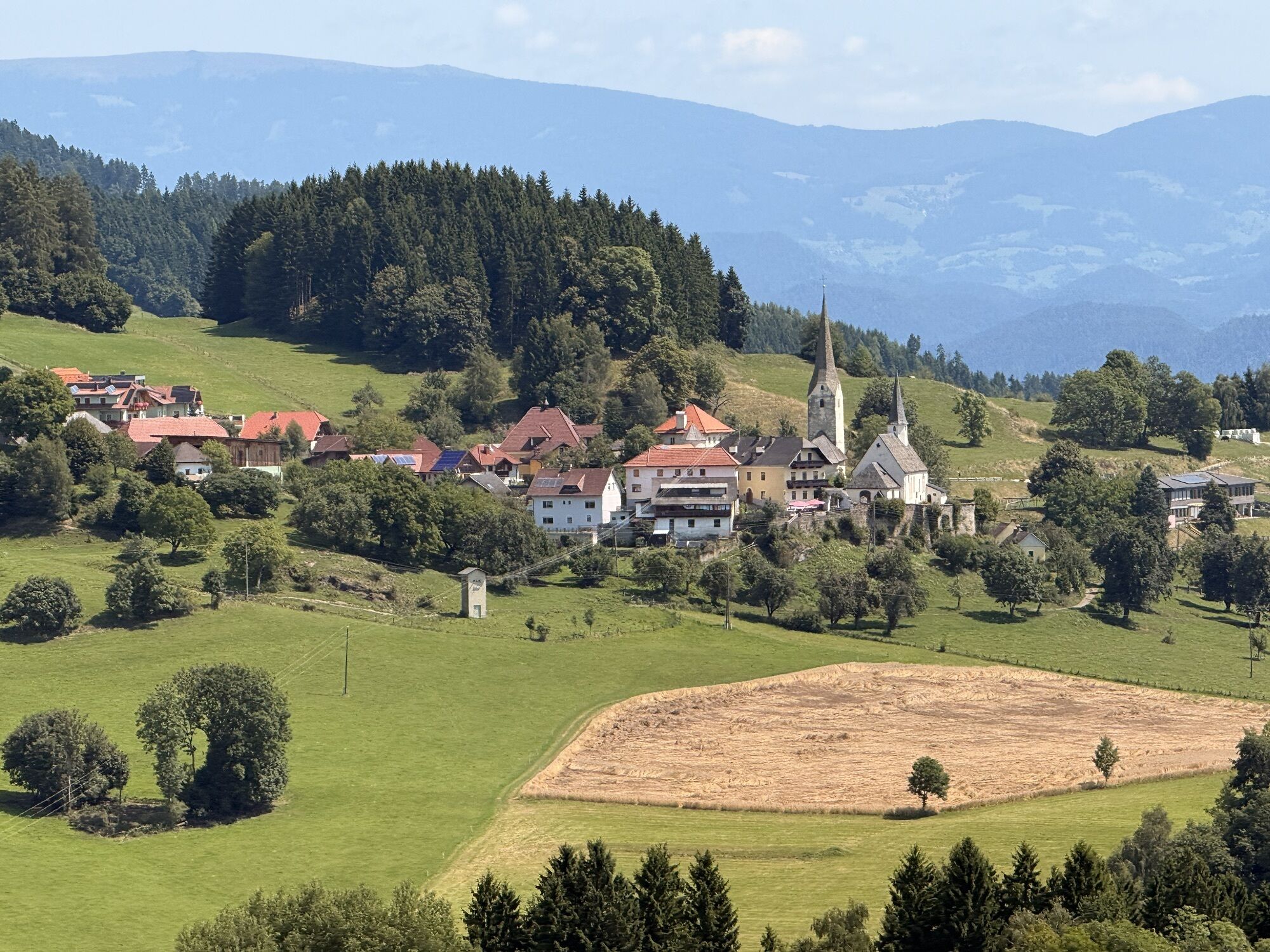
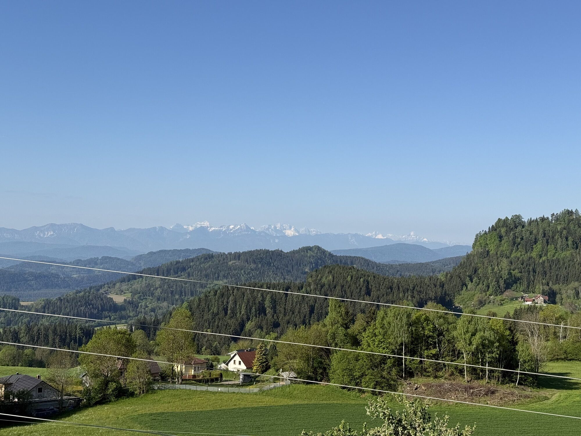
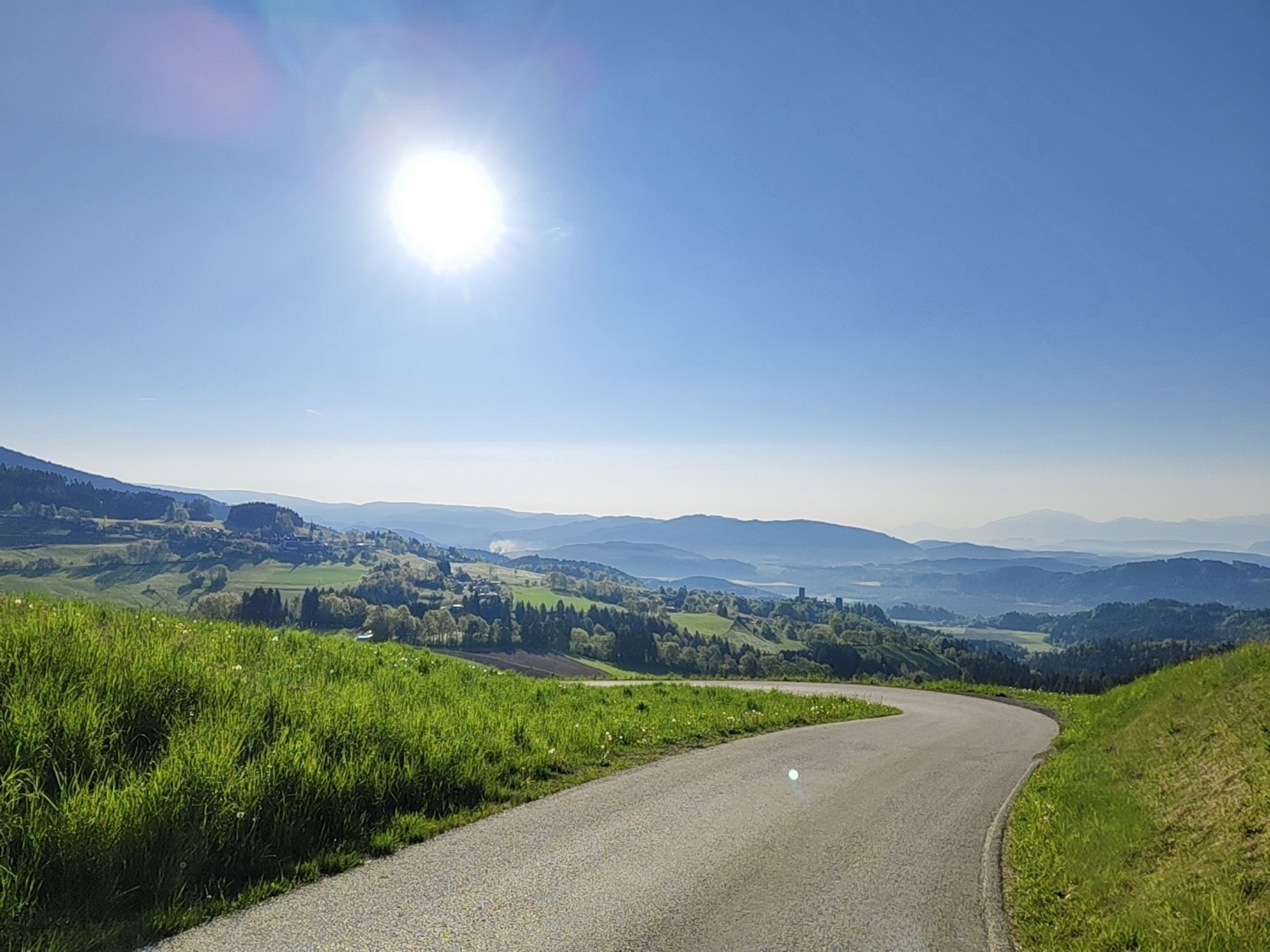
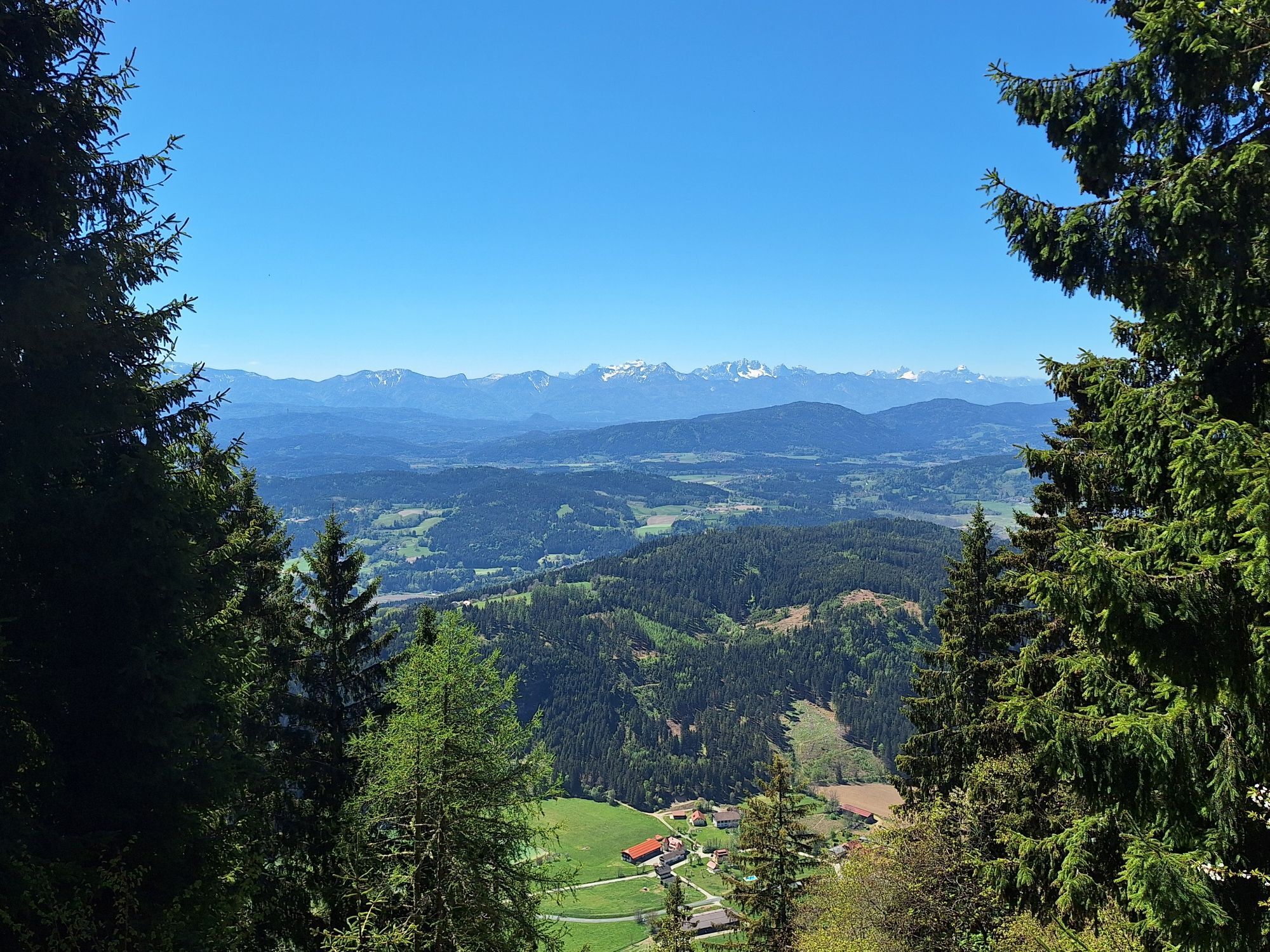
The village of St. Leonhard is crossed until the ascent over the so-called "Kulm" begins. After overcoming the Kulmberg, you continue ascending and reach Liemberg. Via the high valley of the Liemberg creek, you reach Zwattendorf. Here begins the strenuous ascent to Veitsberg, the highest point of the entire route (1158 m above sea level). After a short rest at the little church, the route continues along the ridge above the Glan valley to Gradenegg.

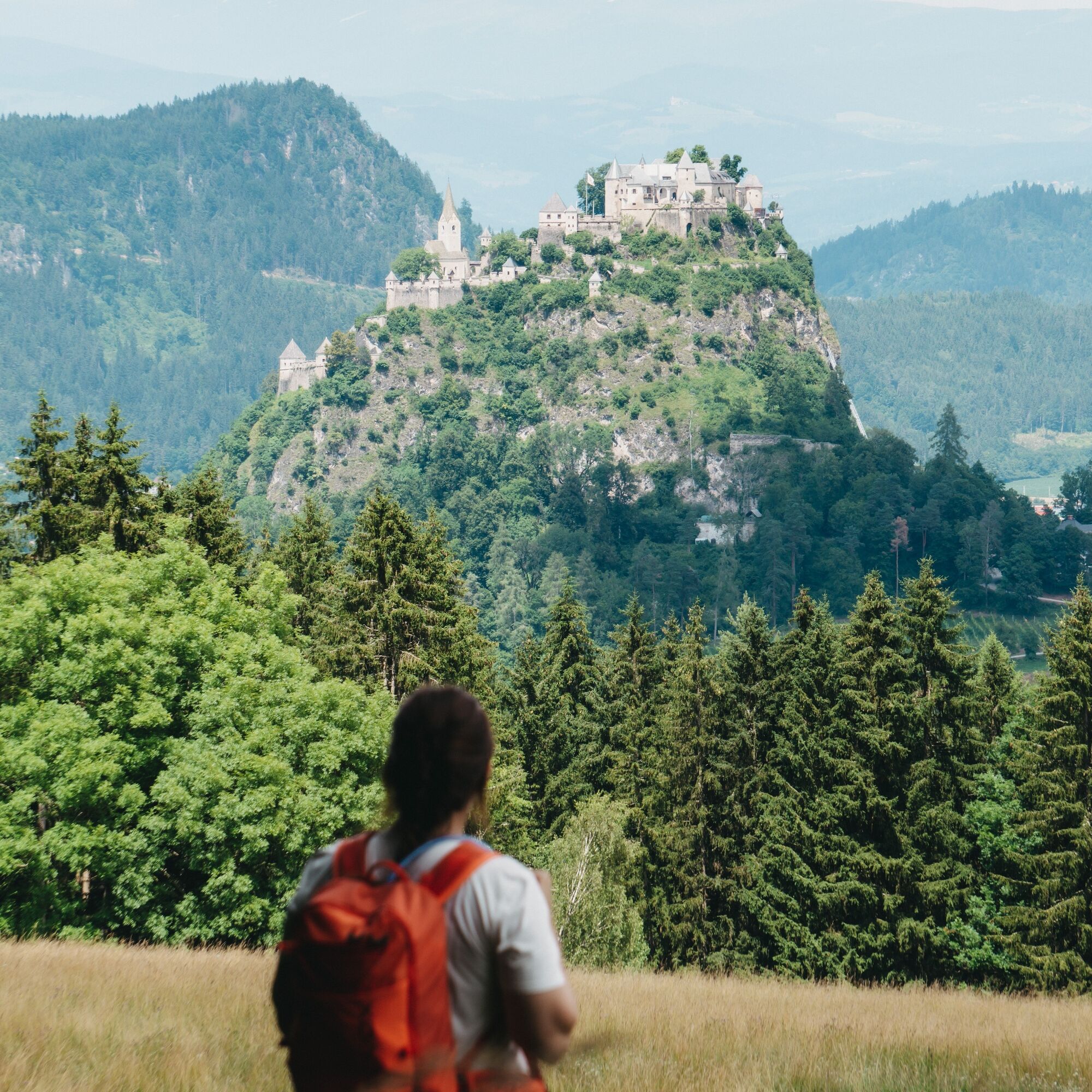
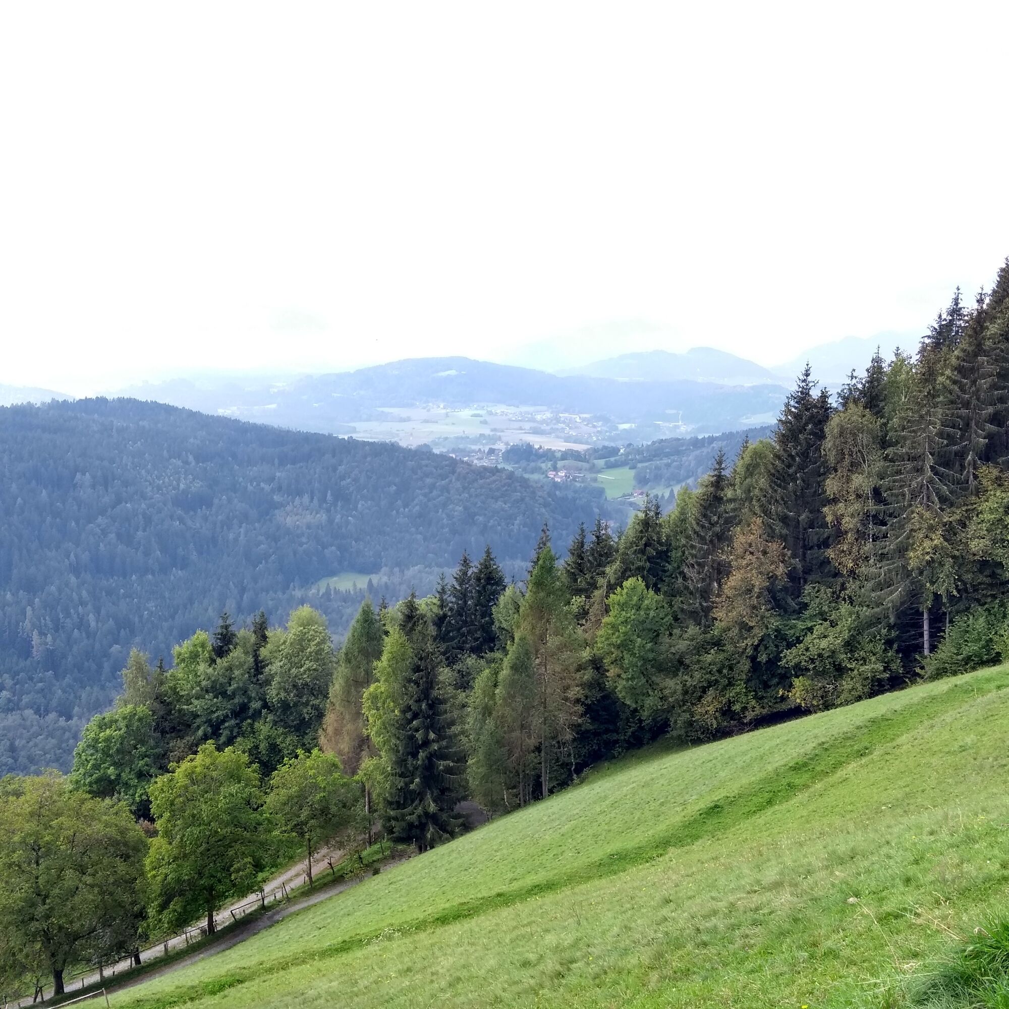
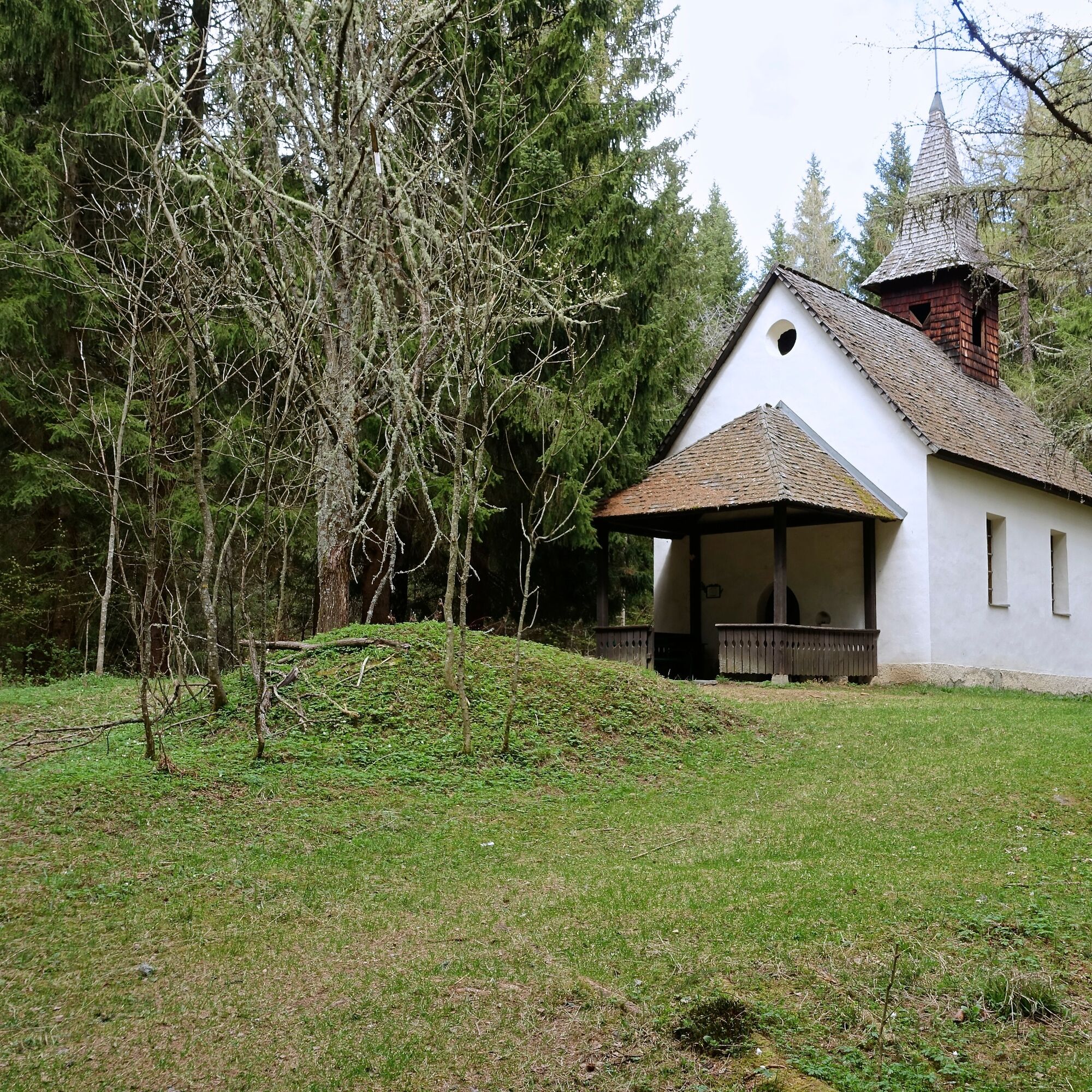
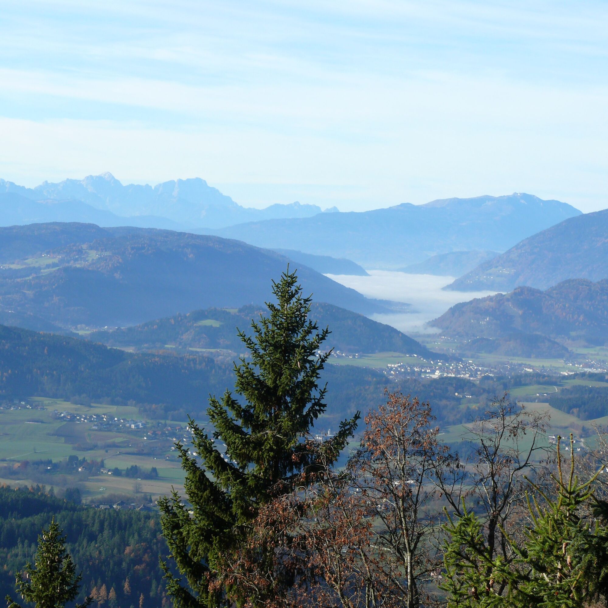
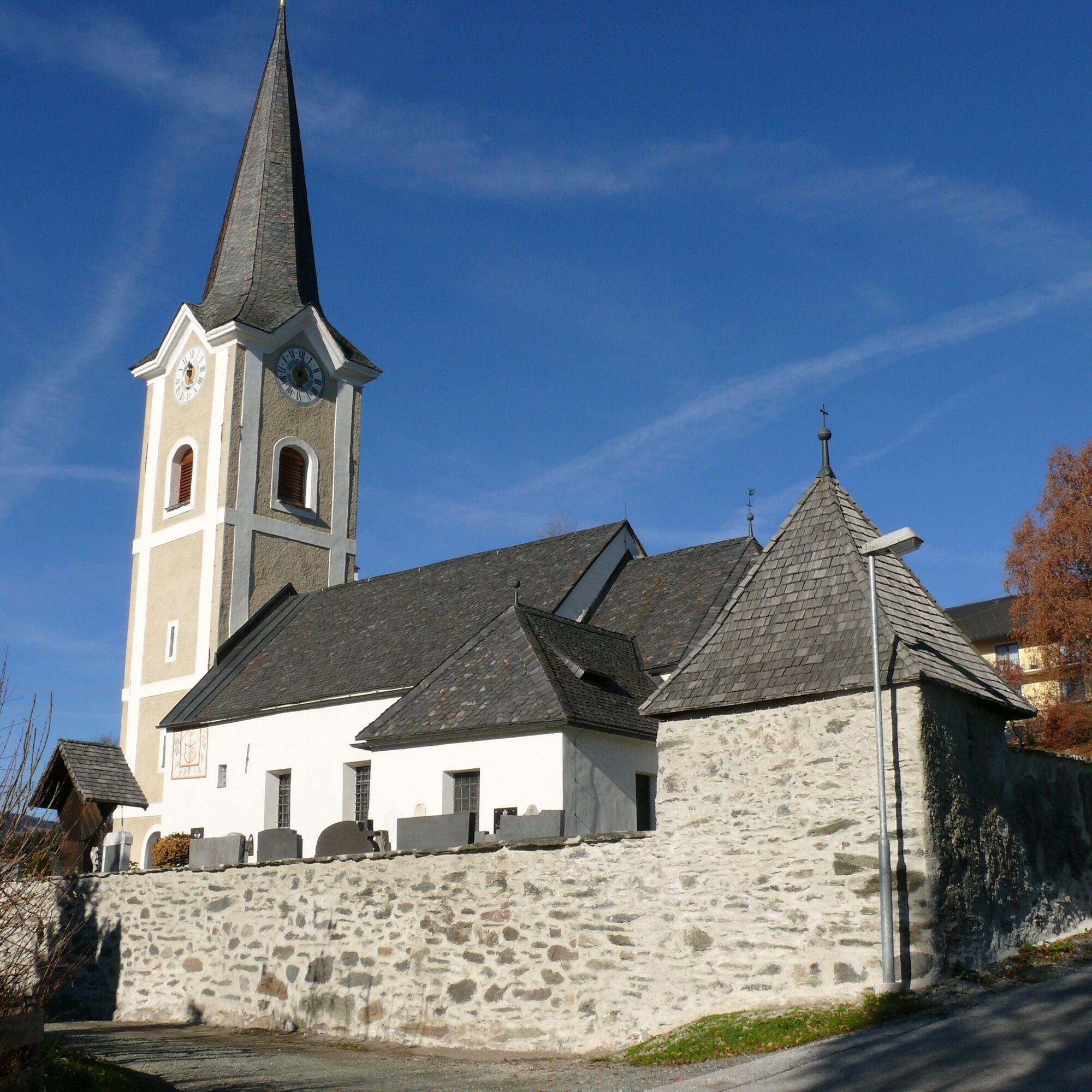
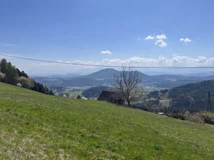
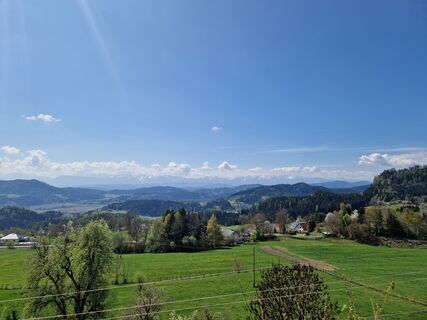
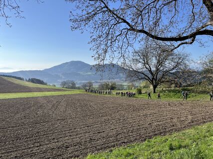
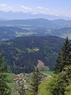
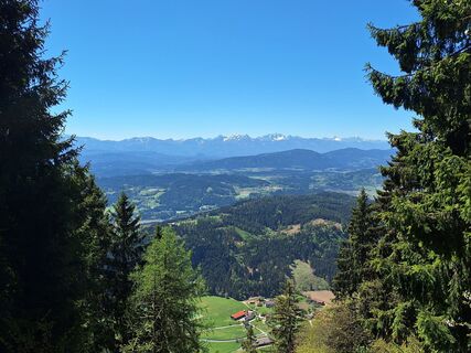
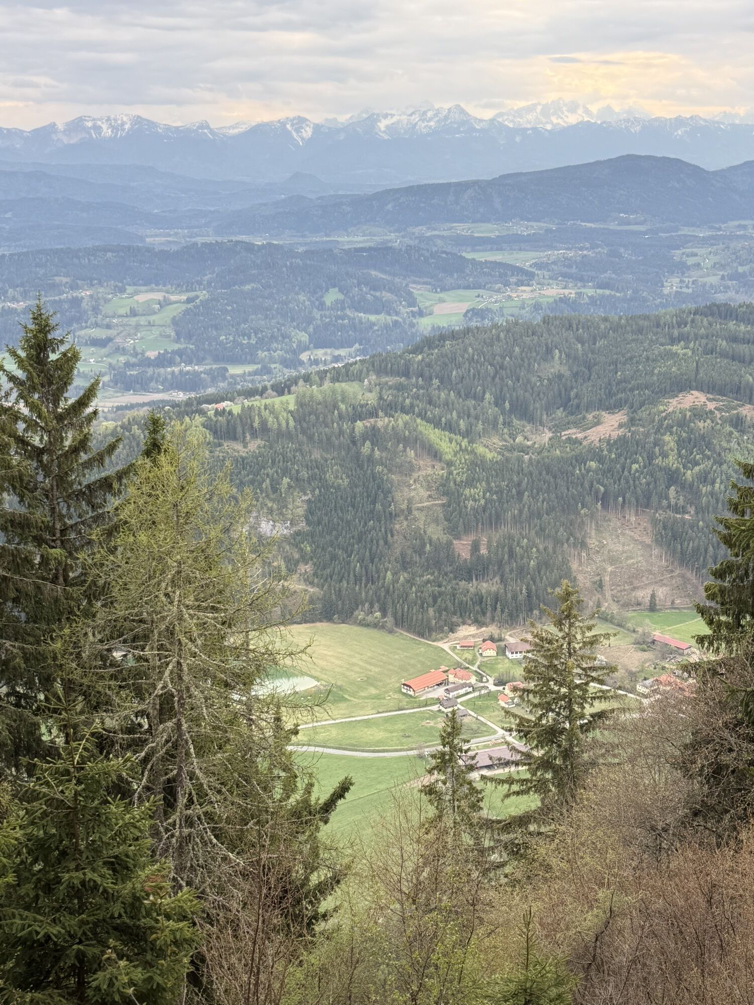
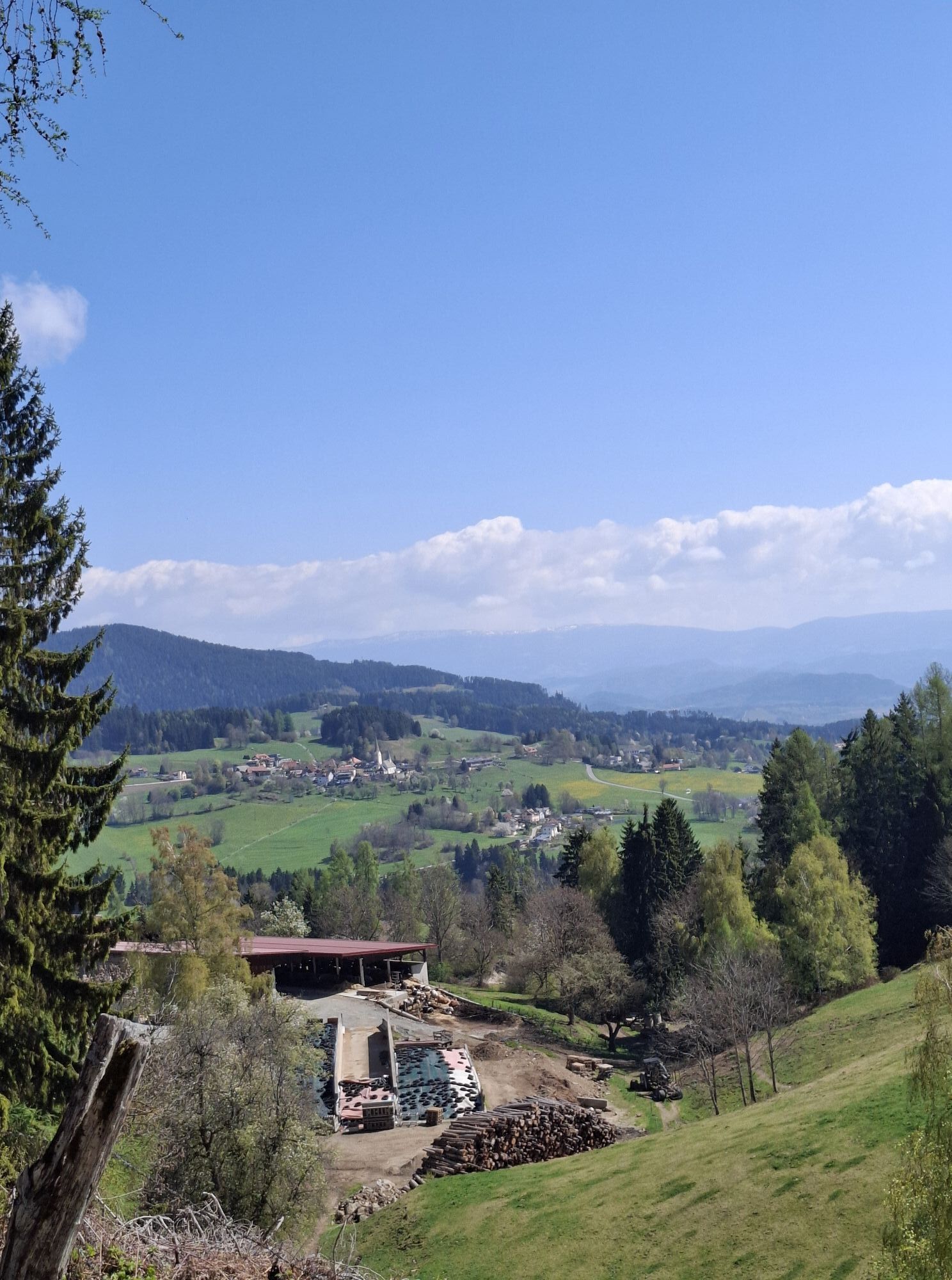
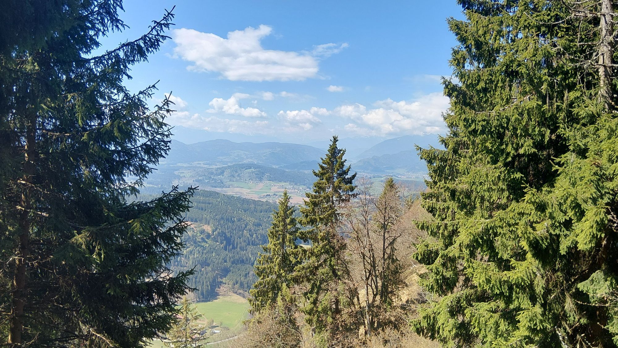
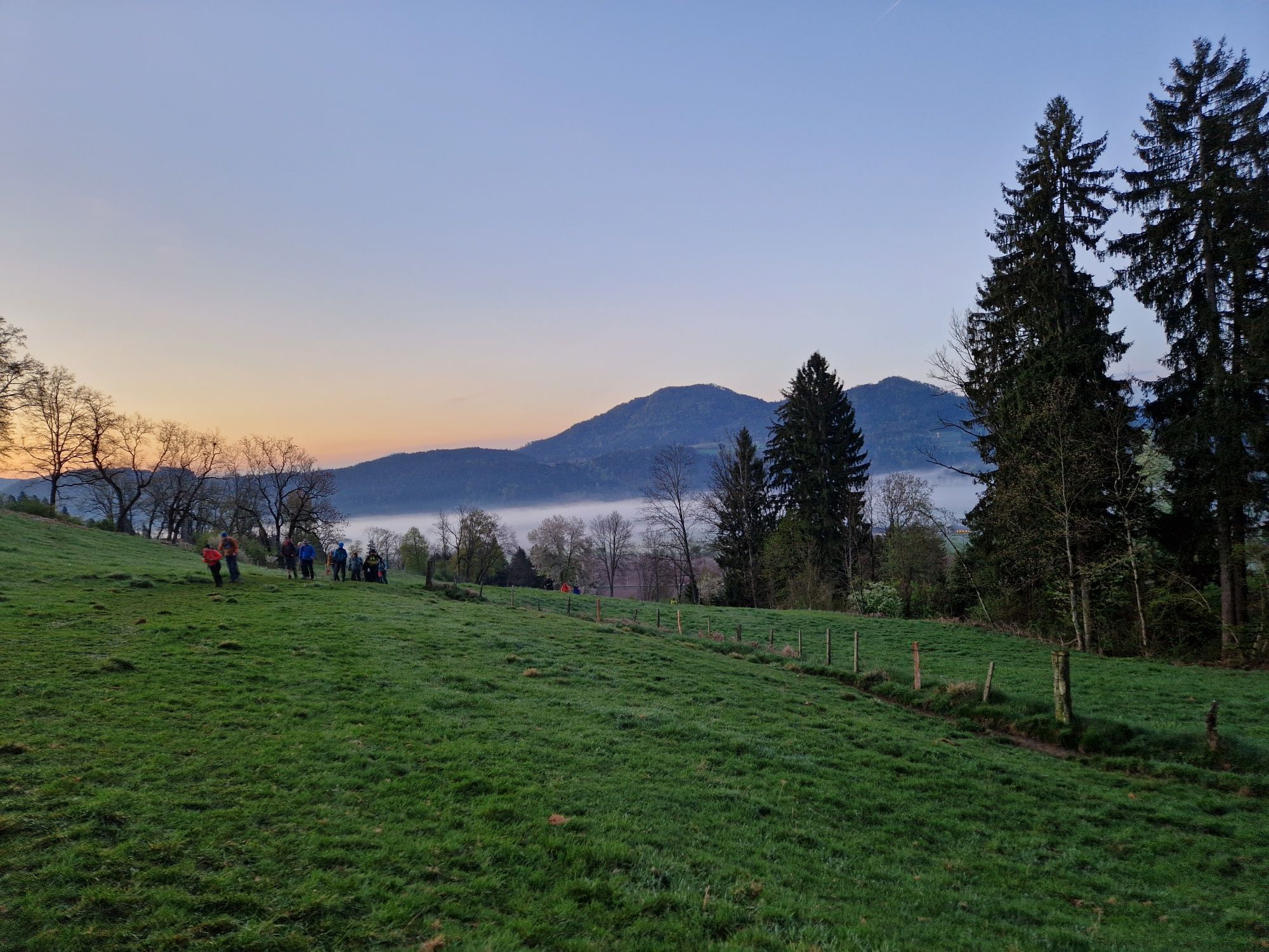
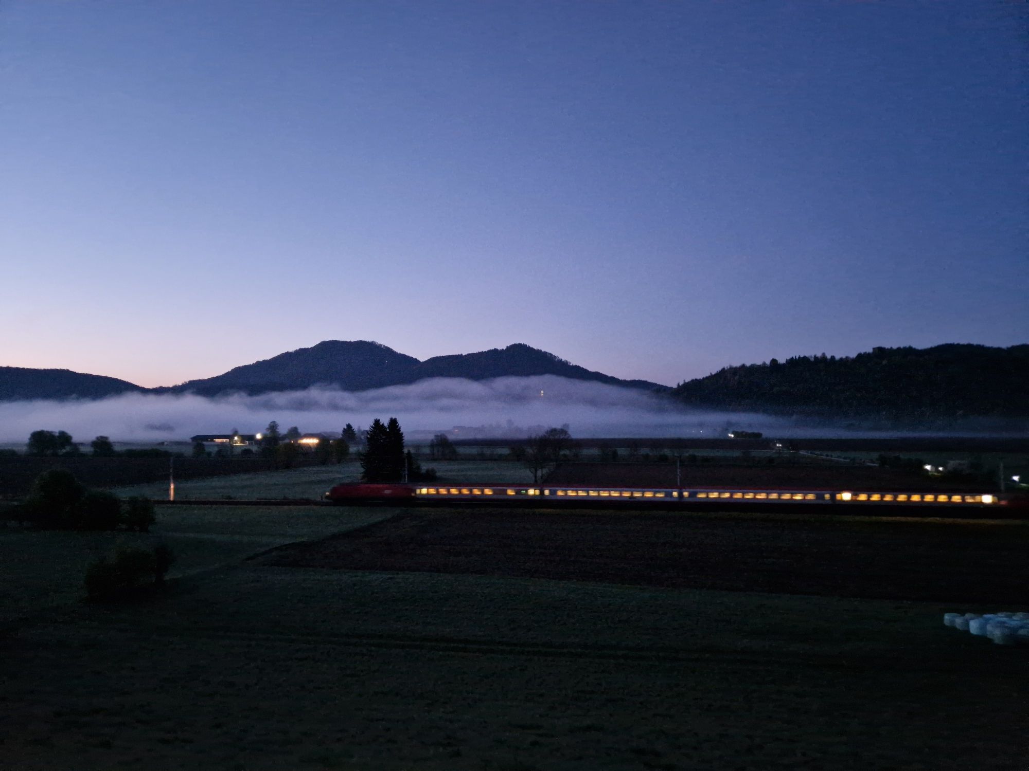
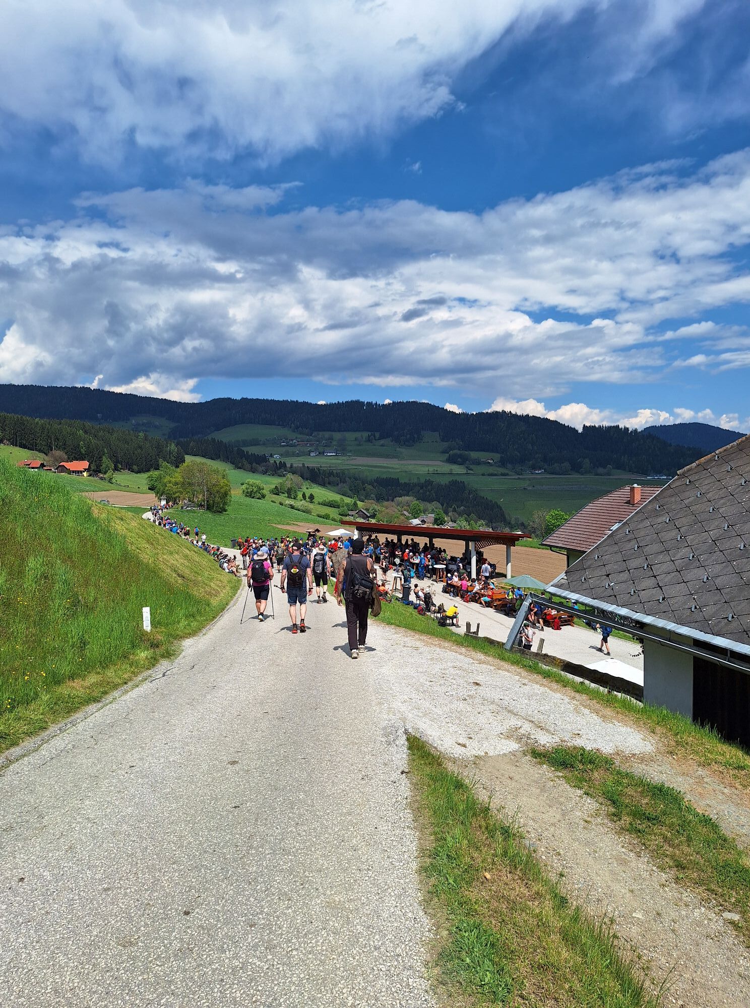
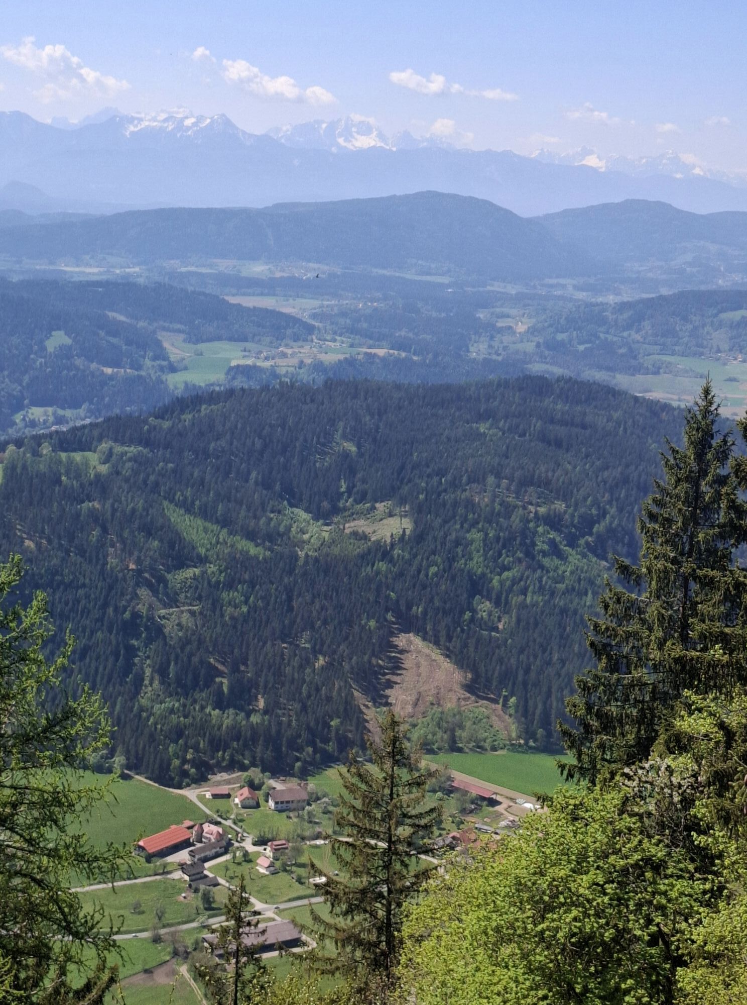
You leave Zwattendorf again and take the marked hiking trail heading north. The strenuous and steep slope leads up the Veitsberg until you finally reach the small church dedicated to Saint Vitus/Veit. A wooden bench invites you to rest, offering a view through the treetops over Zwattendorf to Lake Ossiach. Along the pleasant and shady forest path, you leave the heights of Veitsberg behind and cross the so-called "Grund" at the valley floor after passing through the northern part of Liemberg. After a short ascent, the church tower of Gradenegg already greets you in the distance, where two rustic inns invite you to rest.
Good footwear and clothing adapted to the season as well as sufficient drinking supplies are recommended.
beachten Sie das Wetter; sagen Sie jemanden Bescheid wohin Sie gehen und wann Sie wiederkommen werden; geladenes Handy achten Sie auf lokale Verkehrsregeln und gelegentlich landwirtschaftliche Fahrzeuge auf den Straßen
Herold route planner:
www.herold.at/routenplaner
ÖBB timetable information:
https://fahrplan.oebb.at/webapp/#!P|TP!H|813951
Parking available
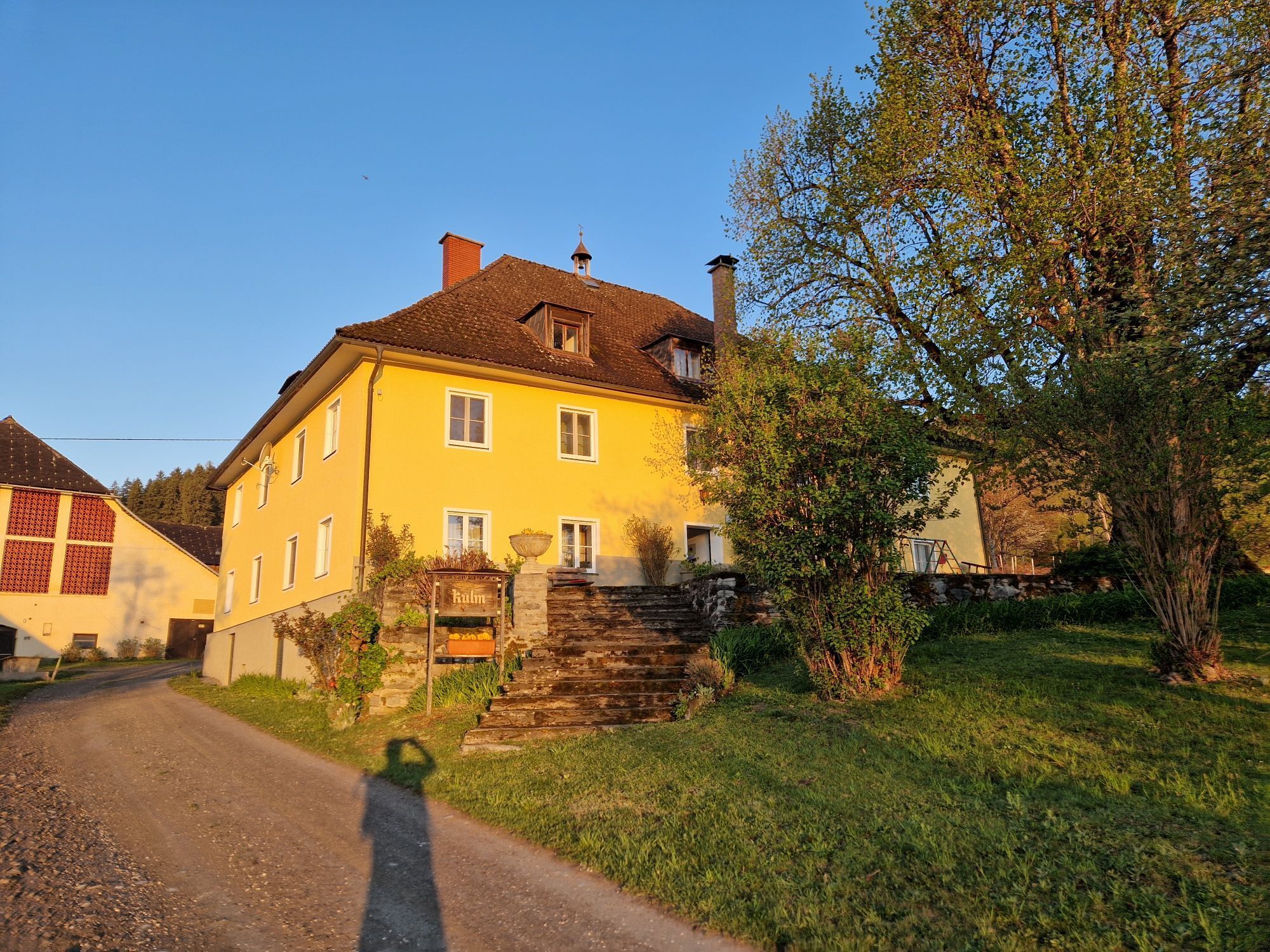
Gasthof Sonnwirt, about 5 km from the Gradenegg endpoint; here you do not have the opportunity to shop for the last stage
Stage 5 Gradenegg - St. Veit/Glan: End of the stage in the town of St. Veit - here you have the option to continue by bus or train
The public transport network is not developed enough to guarantee a bus connection at all times.
Taxi:
City Taxi: +43 4212 2612
Taxiservice Lister Manfred: +43 4212 2299
Taxi Bernhard: +43 664 1884040
Taxi Haber: +43 4212 6767
Stadttaxi Habibi: +43 4212 33833
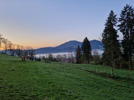
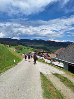
On the steep ascent of Veitsberg, there is a rest area with a magnificent view that invites you to linger and catch your breath. Directly at Veitsberg, following the example of the Vierberge hikers on the Vierbergelauf, you can ring the wish bell and gather leaves from the boxwood. A visit to the cozy inns of the idyllic village of Gradenegg is recommended at the end of the hike.
Oblíbené prohlídky v okolí
-
4.7
Abenteuer-Wasser-Weg
středníTuristika 9.13 km -
4.7
Vierbergelauf
středníPoutní stezka 47.6 km -
4.7
Zillhöhe
středníBěh 7.94 km -
4.5
Ulrichsberg
světloTuristika 5.60 km -
4.6
Hoher Gallin route
středníTuristika 7.09 km -
4.3
Slow Trail Brahmsweg
středníTuristika 5.86 km -
4.4
Magdalensberg von St.Donat
světloTuristika 9.28 km -
4.9
Slow Trail Maltschacher See - large loop
světloTematická stezka 7.04 km -
3.8
Schloss Frauenstein - Kraiger lake circular route
světloTuristika 6.96 km -
4.5
Wanderung Hoher Gallin lt. Feldkirchner Stadtplan Weg Nr. 4
středníTuristika 10.9 km

Pěší turistika a stopování


Nenechte si ujít nabídky a inspiraci pro vaši příští dovolenou
Vaše e-mailová adresa byl přidán do poštovního seznamu.