







Floßlände

Raftsmen were once the heroes on the Drau! Those who want to trace their experiences are right at the Floßlände. What is a welcome refreshment for us on hot days was an icy everyday routine for the raftsmen...
Raftsmen were once the heroes on the Drau! Those who want to trace their experiences are right at the Floßlände. What is a welcome refreshment for us on hot days was an icy everyday routine for the raftsmen in all weather. During their work, they stood for hours up to their waist in the cold water of the Drau. On their adventurous journey along the Drau, the men steered the raft through the current using a mighty rudder. The Floßlände with its wide gravel banks still serves today as an ideal landing and resting place for raftsmen, boaters, and nature lovers.
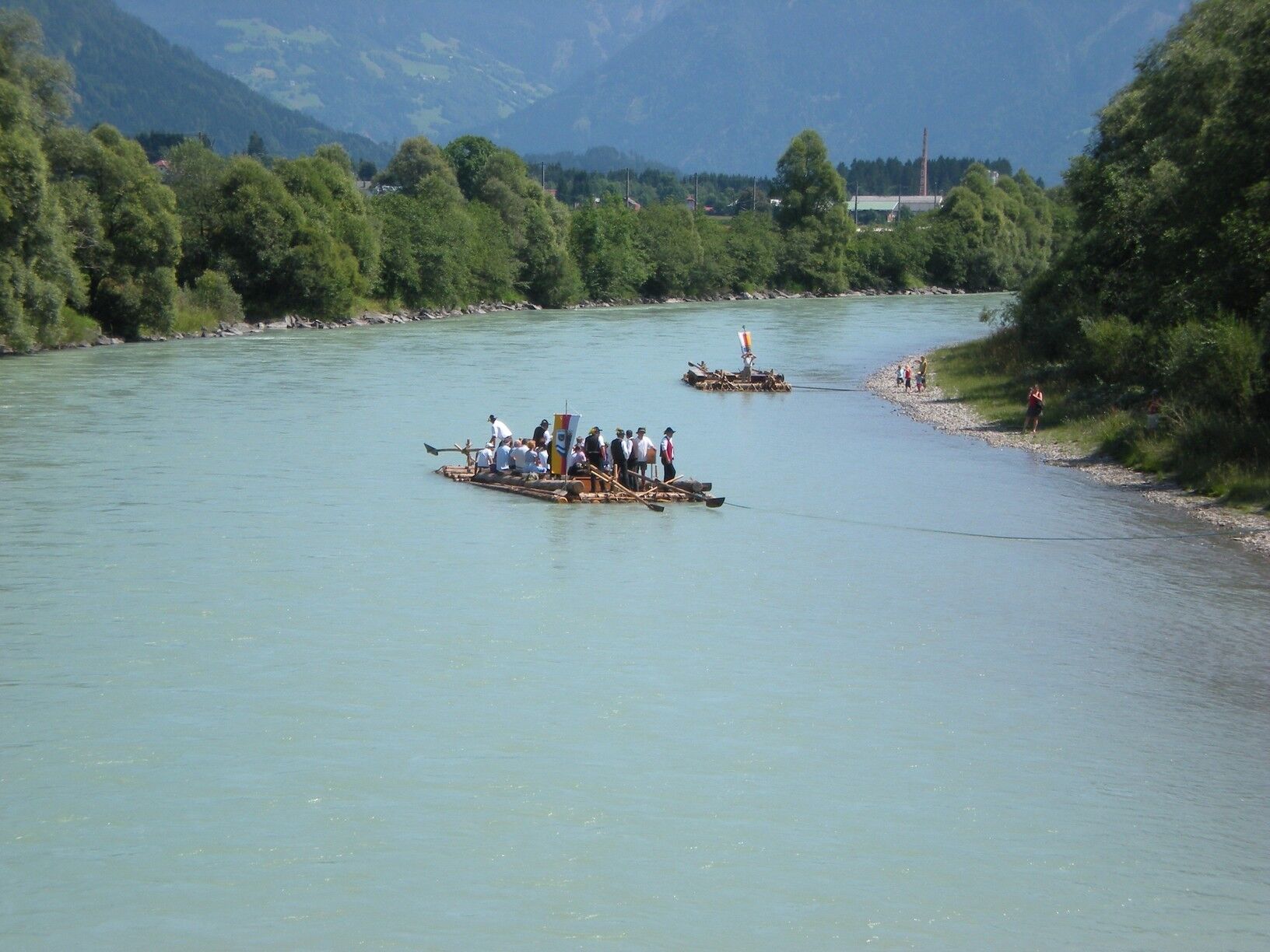

The Floßlände is best explored from the historic town center. You leave the market square heading west and walk to the upstream Draubrücke. Shortly before the bridge, keep right and turn onto a narrow path. This now runs along the emerald green Drau, which gently meanders through the valley bottleneck of the Sachsenburg Drau bend. Soon you reach the campsite and shortly after – depending on the water level – you spot the first gravel banks. The actual Floßlände then stretches near the lower Draubrücke, which you reach after about a 30-minute walk. Here you can best enjoy and experience the mountain river Drau. An information point offers interesting facts about rafting, the history of Sachsenburg, and natural history information. After an eventful afternoon, you walk back along the Sachsenburg state road to the center of Sachsenburg.
Via the B100 to Sachsenburg.
By OEBB to Sachsenburg. Distance info point - stop: 300m.
Sachsenburg market square

Oblíbené prohlídky v okolí
-
4.9
Slow Trail Weissensee
středníTuristika 6.69 km -
5.0
Bergfried Hütte, Stoder 2433, Gmeineck 2592
heavyTuristika 8.23 km -
5.0
Bella Vista auf Hohe Leier
středníVia ferrata 15.6 km -
4.9
Weissensee Ost- nach Westufer
světloTuristika 10.2 km -
4.9
Parkplatz Seetal - STAFF und retour
středníTuristika 13.2 km -
4.8
Weiße Wand - Alm hinterm Brunn
Mountainbike 22.1 km -
4.1
Barbarossa Gorge near Mühldorf/Mölltal
světloTuristika 2.74 km -
4.4
WY_W2 hike to the Alm behind the Brunn
středníZimní turistika 3.04 km -
4.3
The Glockner cycle route R8
středníJízda na kole 123.5 km -
4.7
W14 - Gold route
heavyMountainbike 64.8 km
Pěší turistika a stopování


Nenechte si ujít nabídky a inspiraci pro vaši příští dovolenou
Vaše e-mailová adresa byl přidán do poštovního seznamu.





