


Hike Vrin - Uors over the suspension bridge Val da Silgin
Úroveň obtížnosti: T1
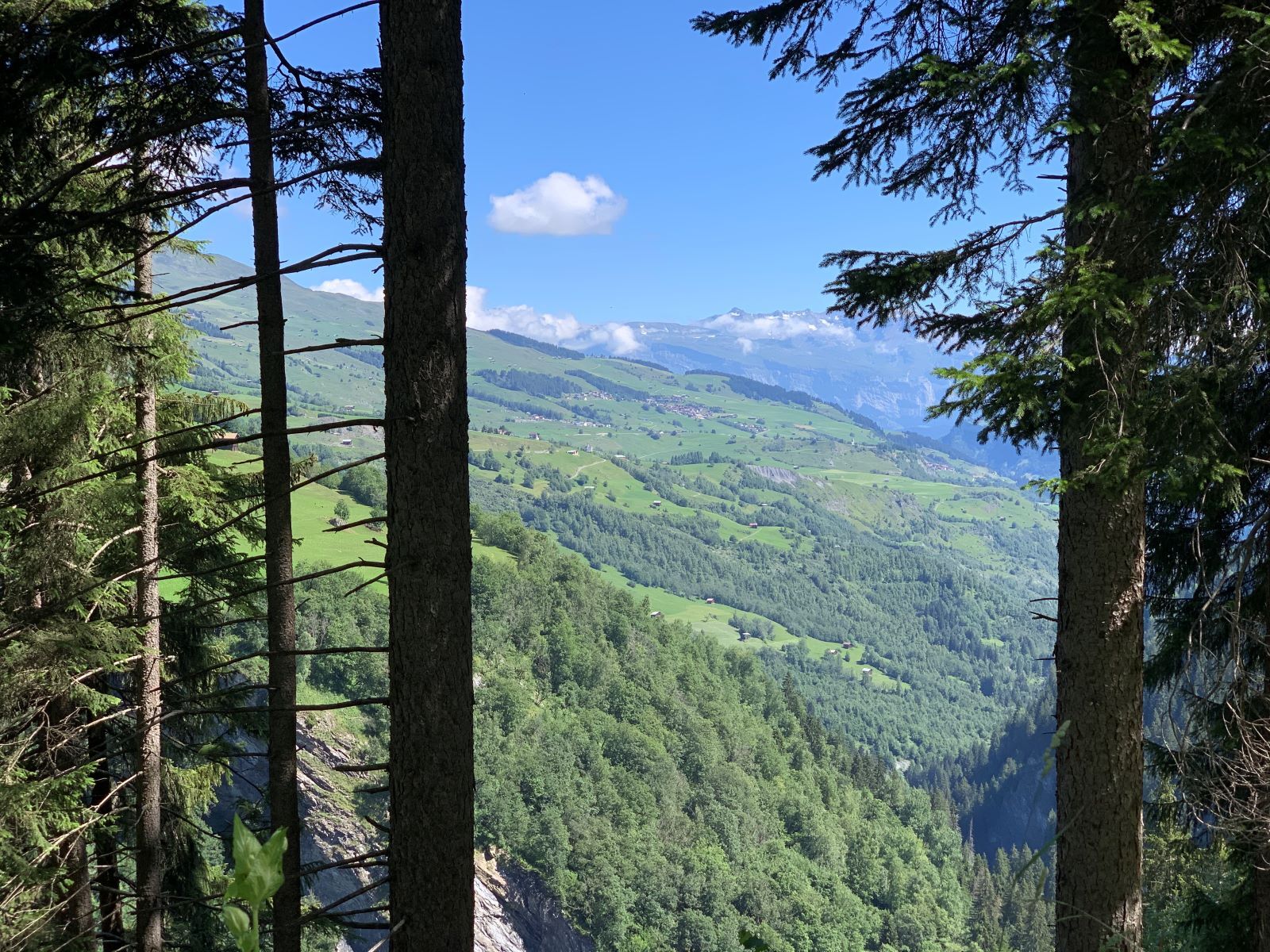
From Vrin, a country road leads through lush meadows and a species-rich mixed forest down to the Glogn. Then it continues past the Bronze Age settlement Crestaulta to Surin. From Surin, the hiking trail...
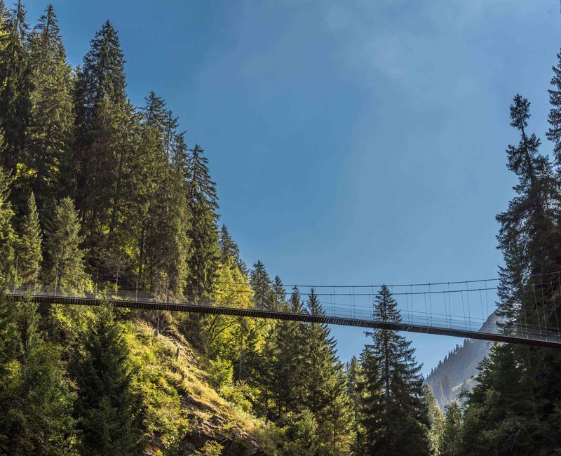
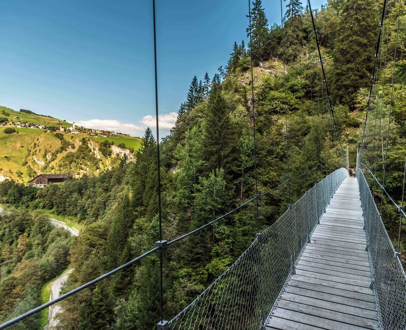
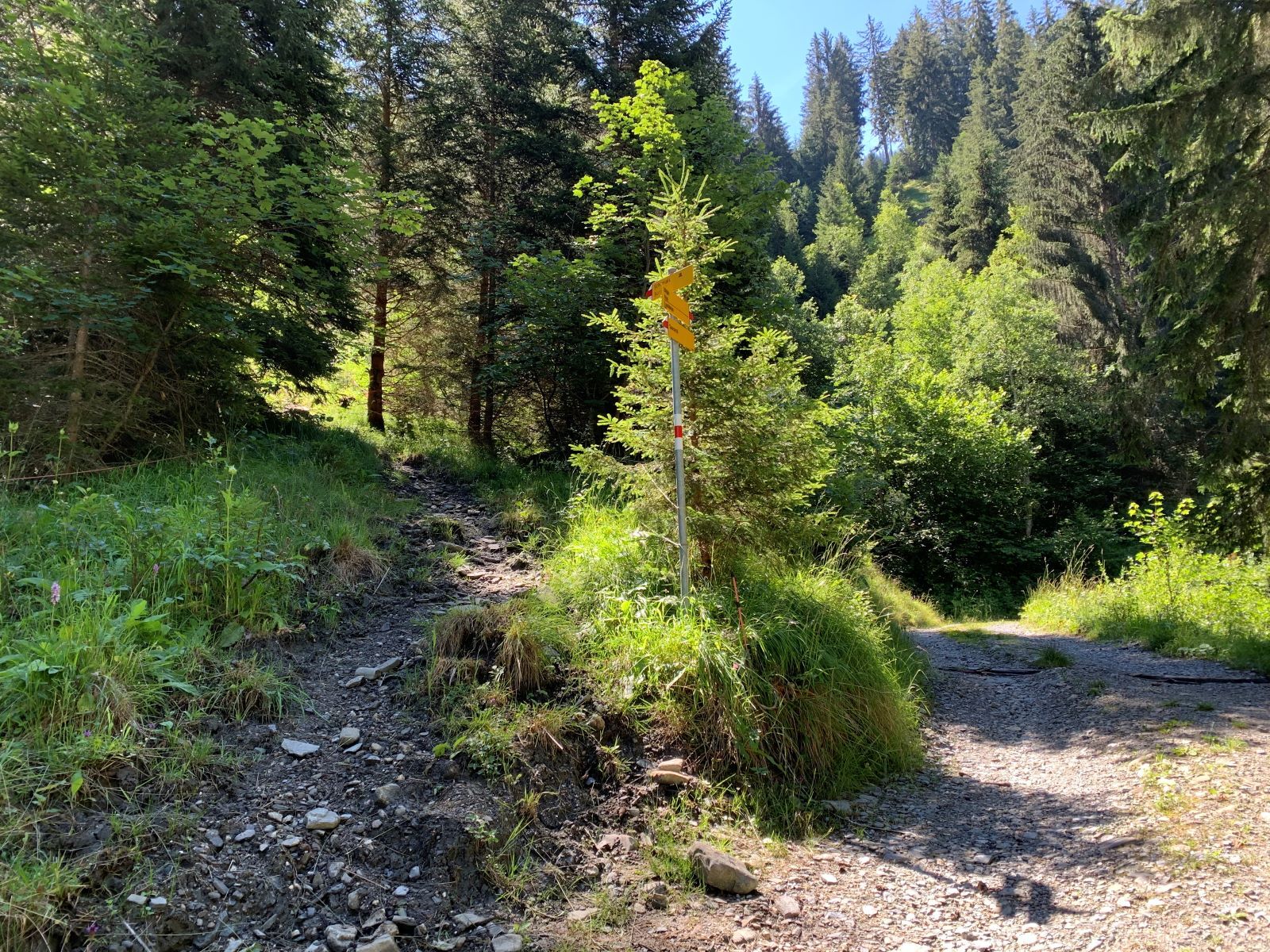
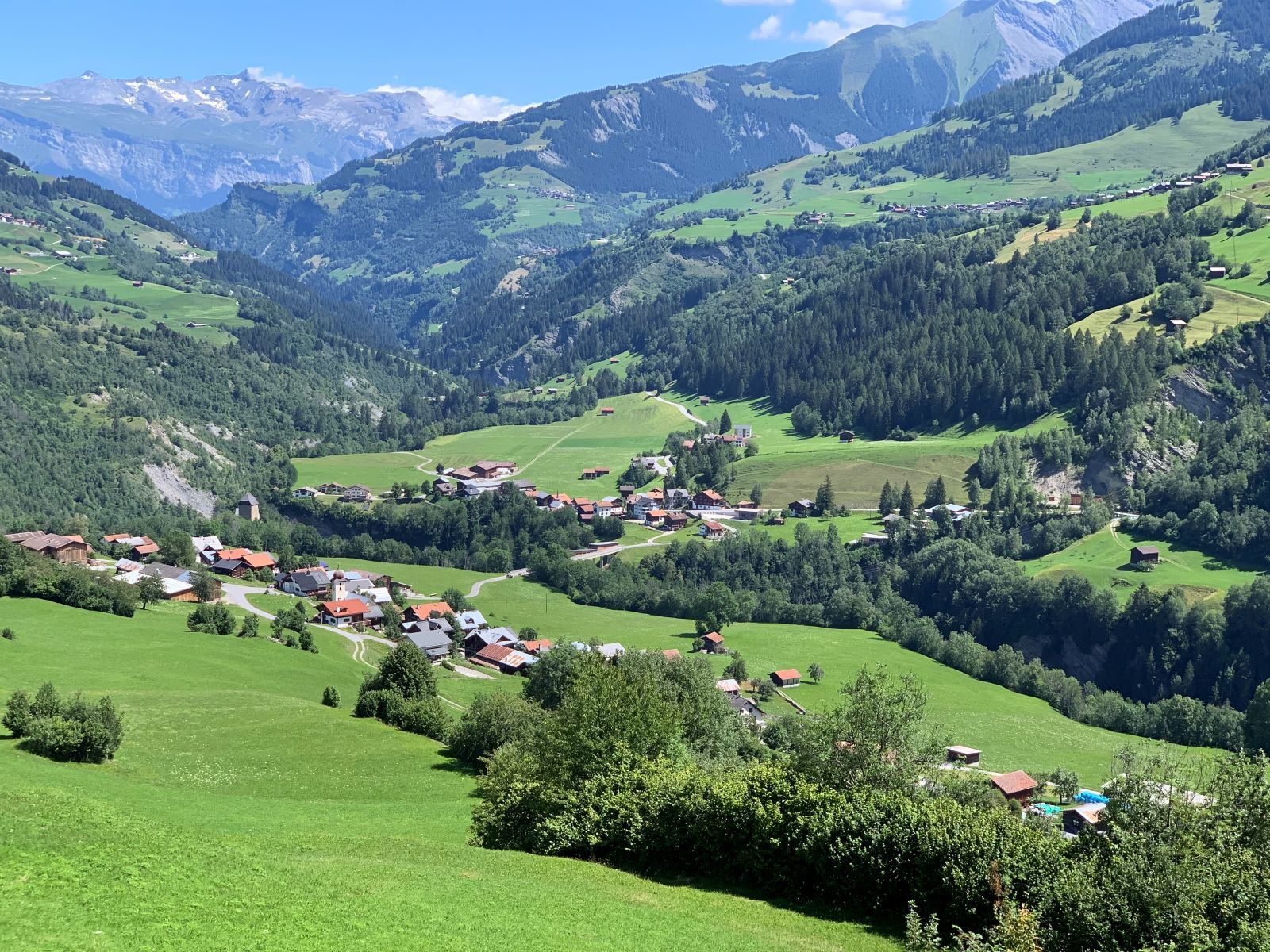
From Vrin, a country road leads through lush meadows and a species-rich mixed forest down to the Glogn. Then it continues past the Bronze Age settlement Crestaulta to Surin. From Surin, the hiking trail follows the little-trafficked main road to Pruastg Dado. There you leave the road and follow the path over the meadows up to the suspension bridge. Crossing the 67-meter-long and 45-meter-high bridge may require some overcoming for some. After the bridge, a hiking trail leads down to Silgin. From there, the hike continues on the forest road towards Surcasti. After about two kilometers, the path forks. Take the upper path towards Schumials. From the Schumials fire pit, there are two ways to hike to Surcasti. One leads over the paved melioration road, the other is a path through the forest towards Surcasti. Walk through the village towards the church Sogn Luregn. Via the old connecting road, you reach Uors.


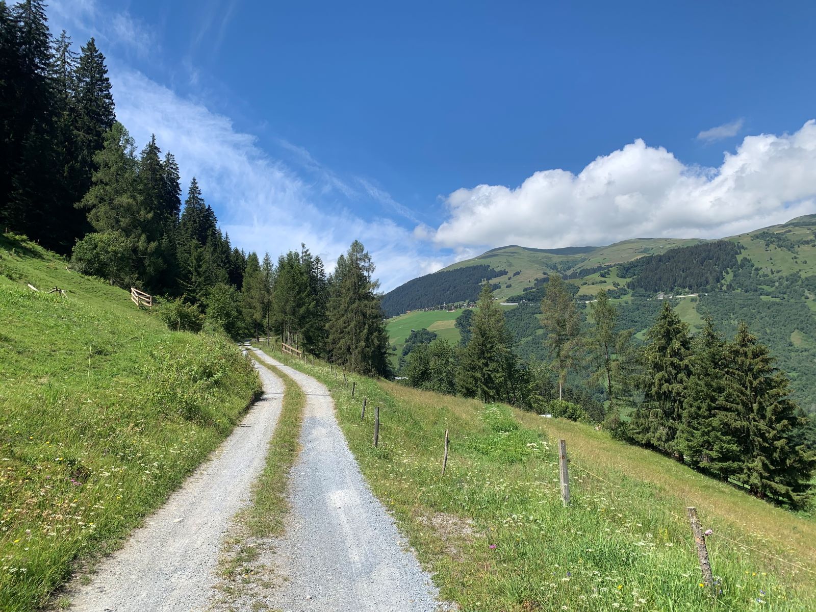
Vrin - Surin - Pruastg - Silgin - Schumials - Surcasti - Uors
Ano
Good hiking shoes with a good tread or trekking shoes, weather-appropriate clothing (rain jacket), possibly trekking poles.
The hike should not be started in uncertain weather conditions. Weather changes in the mountains are frequent. If a rain front or similar approaches during the hike, you should turn back in good time.
Via Chur A3/A13 via Flims to Ilanz into the Val Lumnezia.
Arrival: Postbus line 90.441 Ilanz - Vrin
Return: Postbus line 90.431 Vals - Ilanz, from Uors bus stop
Vrin: Public parking spaces at the school premises (overnight parking subject to charge)
Uors: Public parking spaces at the village edge (coming from Ilanz) and at the school premises.
T1
Instead of hiking towards Schumials, you can also take the direct route (partly paved) to Surcasti.
Barbecue sites in the forest of Surin and in Schumials.
Refreshments available: Vrin, Uors, Silgin (open only on Sundays)
Oblíbené prohlídky v okolí
-
5.0
High valley Val Frisal
heavyTuristika 12.4 km -
Piz Fess 2880m, der Stolze
heavyTuristika 12.8 km -
5.0
Panorama route
světloTuristika 5.39 km -
4.7
Dutjer Alp - magnificent view
středníTuristika 8.23 km -
5.0
Hiking route Suspension Bridge Val da Tersnaus
středníTuristika 3.24 km -
3.3
3-lake hike
středníTuristika 12.8 km -
5.0
Winter hike Gadastatt - Frunt - Zerfreila (Panorama trail)
světloZimní turistika 5.36 km -
Panoramic route between Piz Mundaun and Péz Sezner
středníTuristika 6.75 km -
5.0
Southeast Switzerland Hiking Day Vals 2017
světloTuristika 11.8 km -
Piz Terri, 3.149 m
středníVysokohorská turistika 6.92 km
Pěší turistika a stopování


Nenechte si ujít nabídky a inspiraci pro vaši příští dovolenou
Vaše e-mailová adresa byl přidán do poštovního seznamu.