






Places of magic - Vattiz/Degen
Úroveň obtížnosti: T1
In the Lumnezia you will find many natural, powerful places. The hike takes you from power place to power place. Perhaps you will feel the different qualities of energy or even find long-sought answers...
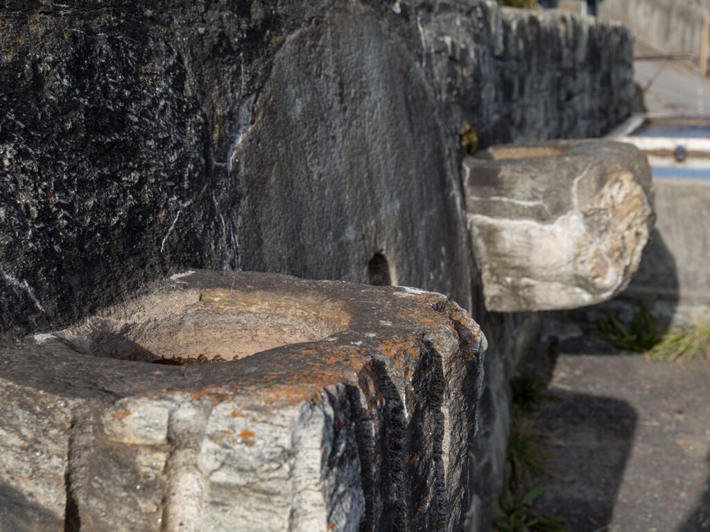
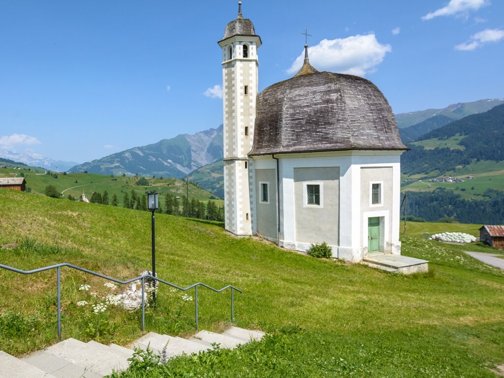
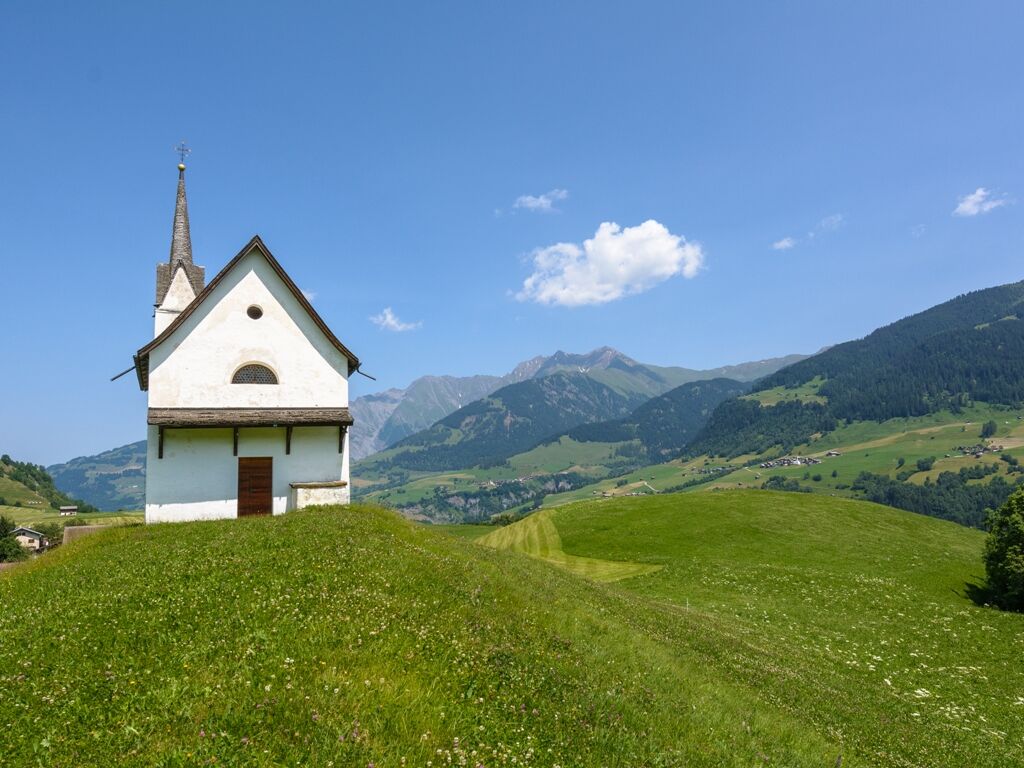
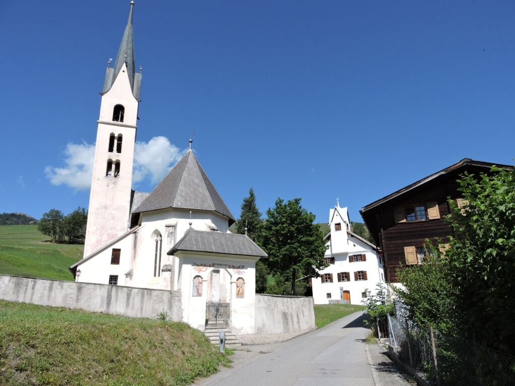
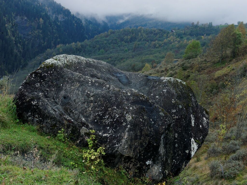
From the Postbus stop, the road leads downhill to the fountain, where two bowl stones (16th century) and a millstone are walled in. The octagonal Sontgaclau e Sogn Valentin chapel (17th century) stands to the south. The route descends through meadows and fields to Degen. The small chapel of Sogn Vetger (18th century) stands on a hill on the edge of the village. The parish church of Nossadunna (19th century) and the rectory with its lovely garden form an oasis of peace. From the village center, take the turn-off to the southern edge of the village. Turn right to Crap Malèe, the Devil's Stone (22nd), which impresses with its black color. Back to the starting point, turn left to the Turatscha viewpoint (21st).
16 When the road was widened between 1970 and 1980, a millstone came to light. This was integrated into the road wall together with two large bowl stones. It is assumed that the large shells of the two stones originally served as suspension devices for the axle of a waterwheel.
17 This octagonal, detached church with its hexagonal tower stands out architecturally from the other sacred buildings in Val Lumnezia thanks to its oval shape.
18 The powerful Sogn Vetger chapel was part of the parish of Fraissen and is located on a moraine sill from the Ice Age.
19 the church with its almost dried-up spring on the old place of worship is dedicated to Nossadunna, our dear Lady Mary. Be inspired by the magic and power of the pre-Christian and Christian place of worship and the seven holy women and their symbols.
21 In the past, Degen was of regional transport and cultural importance for centuries. The ancestral castle of the episcopal ministerials of Blumenthal, who controlled and secured the roads, once stood on this level, elevated site with its grass-covered ruins.
22 The large boulder Crap Malèe, Devil's Stone, stands out with its black color, apple shape and intense, uplifting energy. The limestone boulder has a legendary past.
The Research Center for Power Places Switzerland, in collaboration with Lumnezia Turissem, has tested 66 special locations in the region and documented them in 12 hiking routes. Information about the routes can be found in the book "Orte der Magie", which is available at the information office in Vella.


Vattiz - Degen
Good hiking boots with a good profile or trekking shoes, clothing suitable for the weather (rain jacket/sun protection), drink, food, possibly walking sticks.
From Ilanz and Vella to Vattiz. Since there are no parking spaces in the village, you must use the parking facilities at the Davos Munts bathing lake.
Return trip: PostBus line 90.444 Degen – Vella, then continue with PostBus line 90.441 Ilanz – Vrin
Since there are no parking spaces in the village, you must use the parking facilities at the Davos Munts bathing lake.
T1
Refreshment options: Vattiz, Degen (not always open)
Získejte přehled
Vždy živě na místě s více než 9 500 webkamerami. bergfex Jako uživatel Pro si nyní můžete zobrazit odpovídající webové kamery pro mnoho prohlídek v aplikaci prohlídky z. Můžete si tak přímo prohlédnout aktuální podmínky.
Oblíbené prohlídky v okolí
-
4.8
Rheinschlucht: From Ilanz to Versam into the heart of the Rheinschlucht
středníTuristika 11.4 km -
5.0
High valley Val Frisal
heavyTuristika 12.4 km -
4.3
Circular hike: Falera-Curnius-Alp Dadens-Falera
středníTuristika 11.4 km -
5.0
Panorama route
světloTuristika 5.39 km -
5.0
Hiking route Suspension Bridge Val da Tersnaus
středníTuristika 3.24 km -
Piz Fess 2880m, the proud one
heavyTuristika 12.8 km -
4.7
Dutjer Alp - magnificent view
středníTuristika 8.23 km -
3.3
3-lake hike
středníTuristika 12.8 km -
5.0
2-day hike Greina high plateau
středníTuristika 14.9 km -
Panoramic route between Piz Mundaun and Péz Sezner
středníTuristika 6.75 km
Pěší turistika a stopování


Nenechte si ujít nabídky a inspiraci pro vaši příští dovolenou
Vaše e-mailová adresa byl přidán do poštovního seznamu.





