


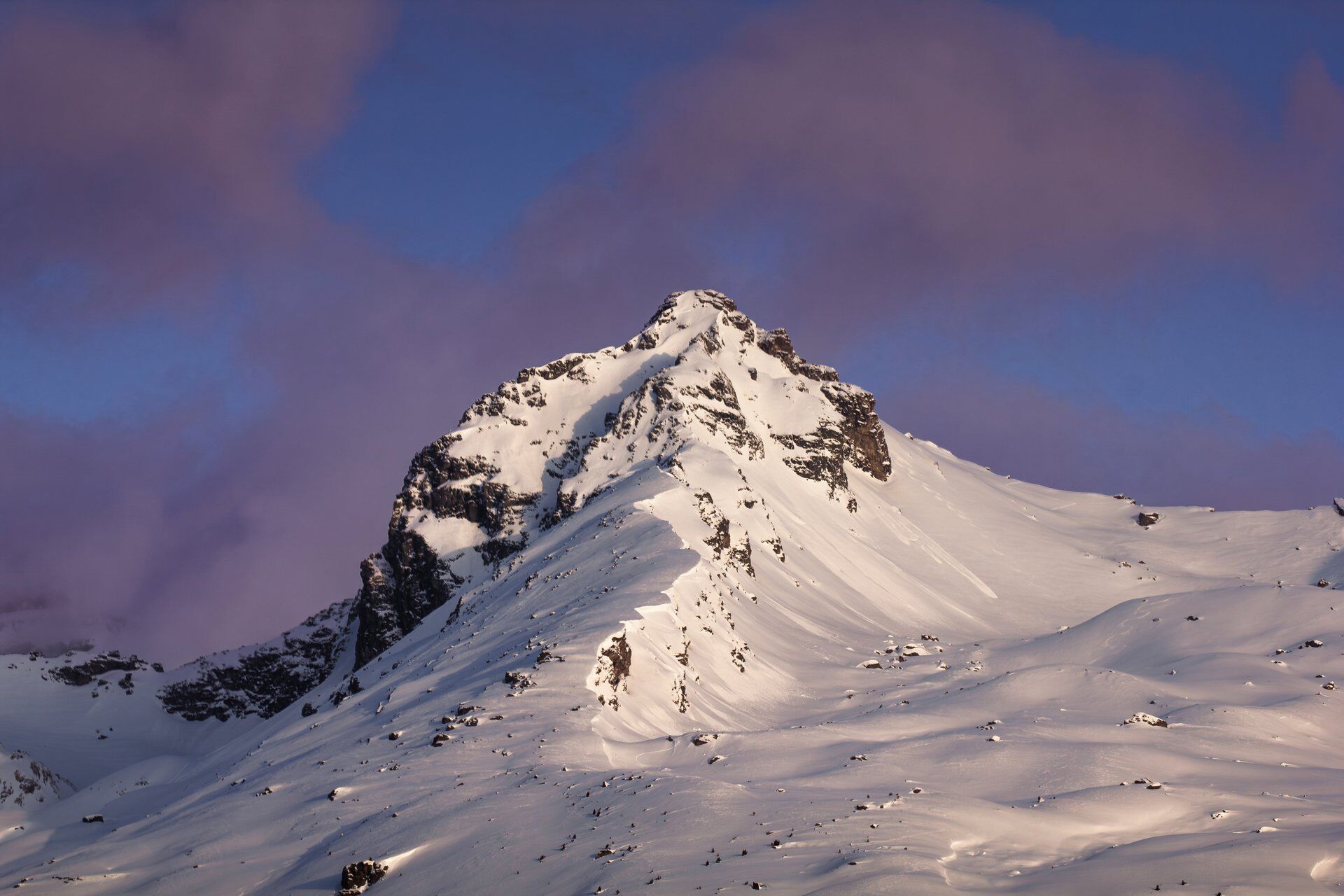
Piz Dadens
Úroveň obtížnosti: AD-
At the chapel Sogn Giacun you can put on the skins and start the tour. The beginning is leisurely. At first, the alp road leads through the forest, later over alpine meadows to the alp Tschegn Dadens Sut....
At the chapel Sogn Giacun you can put on the skins and start the tour. The beginning is leisurely. At first, the alp road leads through the forest, later over alpine meadows to the alp Tschegn Dadens Sut. Now the slopes become partly steeper and you can gain good altitude. Above the tree line, in Val Miez, the scenery becomes even more magnificent. The rock formations at Piz Dadens and Piz Dado come closer and the panorama to the south extends further and further with each step.
At an altitude of about 2500 m above sea level, turn left towards the west and climb over the increasingly steep hollow, later on a northern exposure, up to the ski depot just below the summit. Mostly on foot, continue up to the summit. The small summit point is usually not climbed in winter. It is quite exposed and tricky to climb.
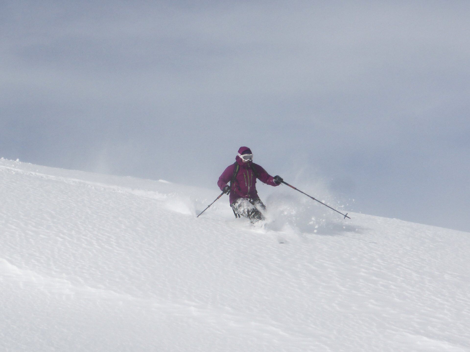
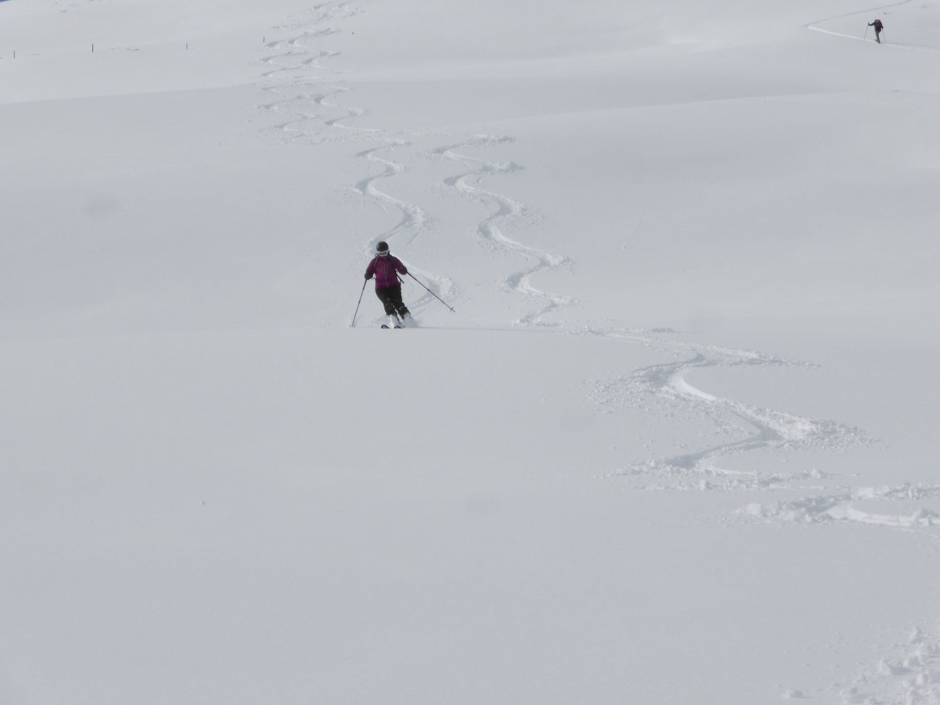
The descent is on the ascent route back to Brigels. This tour should only be undertaken under safe conditions. Especially the slopes near the summit are very steep and there is partial risk of falling. Under safe conditions and with corresponding technical skills, however, Piz Dadens is a great ski tour.

Brigels Sogn Giacun - Tschegn Dadens Sut - Val Miez - summit - descent on the same route
Ano
Ano
See safety instructions
Ski and snowshoe tours in unsecured terrain require good knowledge in assessing avalanche danger and tour planning. A complete safety equipment must always be carried – regardless of the current avalanche danger.
For preparation and planning of the tour, we recommend the app and website of WhiteRisk.
For carefree enjoyment, we recommend our mountain guides of the Surselva.
Coming on the main road from Disentis or Ilanz to Sumvitg.
From Brigels on the wide mountain road to Tavanasa and then on the main road towards Ilanz or Disentis.
Take the train to Sumvitg-Cumpadials and hike up to the village of Sumvitg in a few minutes.
In Brigels, take the post bus from Breil-vitg, Posta to Tavanasa-Breil/Brigels and continue by train.
Further timetable information can be found on the SBB website:
Various possibilities in Brigels, e.g., cable cars, village center, post office.
AD-
To be able to start early, an overnight stay in Brigels can be useful. Here are the options.
In spring, be sure to start early. At this time of year, you may have to carry your skis for a short distance at the beginning and end of the tour.
Webové kamery z prohlídky
Oblíbené prohlídky v okolí
-
5.0
High valley Val Frisal
heavyTuristika 12.4 km -
5.0
Kalktrittli - Nüschentäli - Muttsee - Obersee - Muttenchopf - Mörtel - Limmerensee - Kalktrittli (durch Stollen)
středníTuristika 14.8 km -
5.0
Hiking route Suspension Bridge Val da Tersnaus
středníTuristika 3.24 km -
Panoramic route between Piz Mundaun and Péz Sezner
středníTuristika 6.75 km -
5.0
2-day hike Greina high plateau
středníTuristika 14.9 km -
4.5
Around the Grep da Plaids
středníTuristika 8.05 km -
5.0
Hike Vrin - Uors over the suspension bridge Val da Silgin
středníTuristika 12.3 km -
3.5
Places of Magic - Lumbrein
středníTuristika 8.74 km -
5.0
Disentis - Cavardiras - Cupadials - Sumvitg
světloTuristika 13.7 km -
5.0
Breil/Brigels - Val Frisal Rundwanderung
středníTuristika 20.8 km
Pěší turistika a stopování


Nenechte si ujít nabídky a inspiraci pro vaši příští dovolenou
Vaše e-mailová adresa byl přidán do poštovního seznamu.