Auberge aux 2 sapins - Montricher - Buvette du Mont Tendre - Mont Tendre
heavy
Pořiďte si tuto prohlídku do mobilního telefonu
Auberge aux 2 sapins - Montricher - Buvette du Mont Tendre - Mont Tendre
heavy
Turistika
13.77
km
Naskenujte QR kód a spusťte navigaci v aplikaci bergfex.

Pěší turistika a stopování


Auberge aux 2 sapins - Montricher - Buvette du Mont Tendre - Mont Tendre
heavy
Vzdálenost
13.77
km
Doba trvání
04:33
h
Ascent
938
hm
Hladina moře
745 -
1671
m
Stažení skladby
Auberge aux 2 sapins - Montricher - Buvette du Mont Tendre - Mont Tendre
heavy
Turistika
13.77
km
Trasa
Auberge aux 2 sapins
(754 m)
Restaurace
0.0 km
Montricher
(752 m)
Vesnice
0.1 km
Le Belvédère
(976 m)
Úhel pohledu
1.9 km
Pré Anselme
(1290 m)
Vypořádání
3.6 km
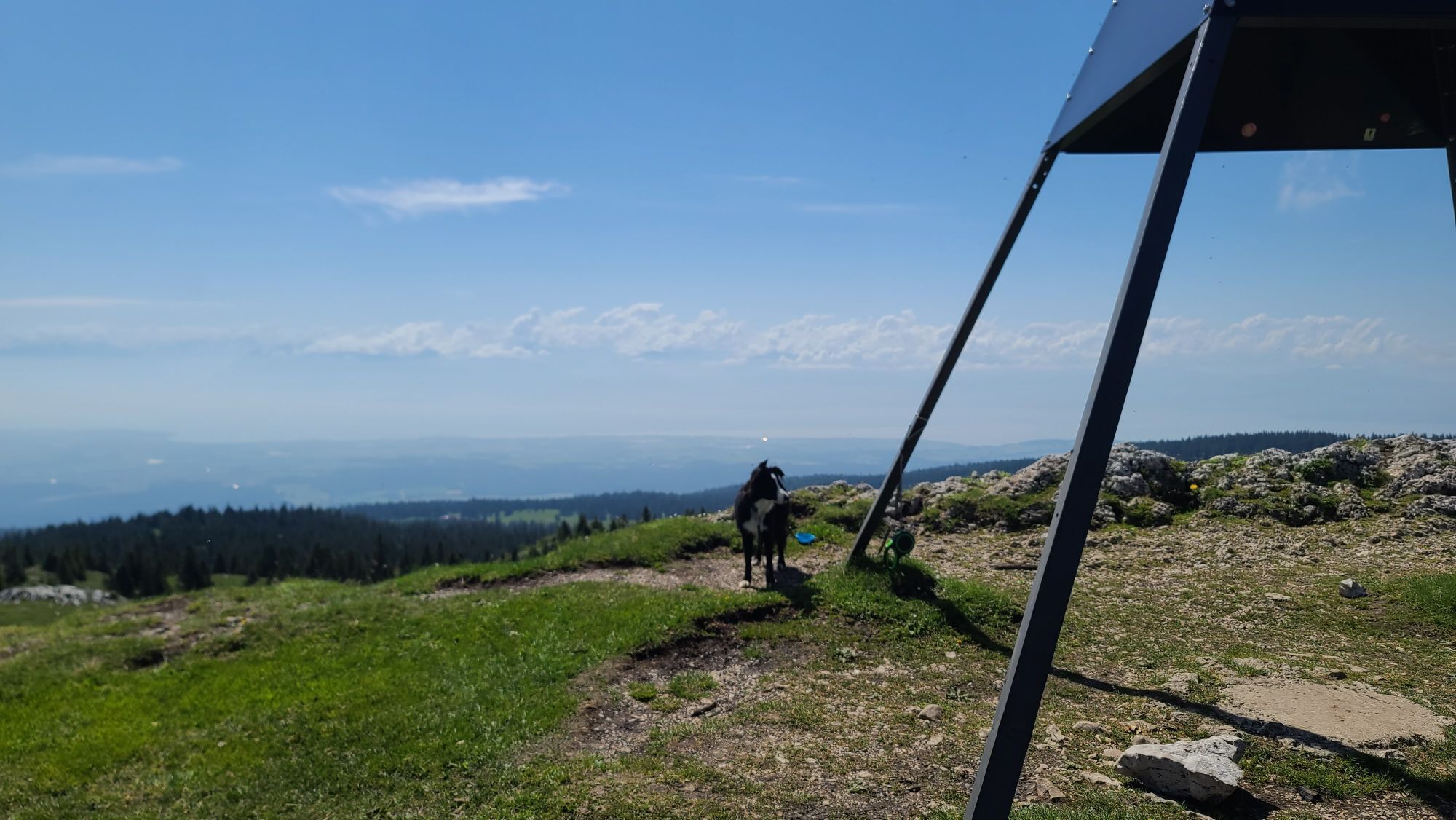
Mont Tendre
(1679 m)
Summit
7.0 km
Pré Anselme
(1290 m)
Vypořádání
10.1 km
Montricher
(752 m)
Vesnice
13.7 km
Trasa
Auberge aux 2 sapins - Montricher - Buvette du Mont Tendre - Mont Tendre
heavy
Turistika
13.77
km
Auberge aux 2 sapins
(754 m)
Restaurace
0.0 km
Montricher
(752 m)
Vesnice
0.1 km
Le Belvédère
(976 m)
Úhel pohledu
1.9 km
Pré Anselme
(1290 m)
Vypořádání
3.6 km
Buvette du Mont Tendre
(1616 m)
Restaurace
6.2 km
Mont Tendre
(1679 m)
Summit
7.0 km
Pré Anselme
(1290 m)
Vypořádání
10.1 km
Le Belvédère
(976 m)
Úhel pohledu
11.8 km
Montricher
(752 m)
Vesnice
13.7 km
Auberge aux 2 sapins
(754 m)
Restaurace
13.7 km
Naposledy sledované
před 3 dny
Zatím žádné recenze
Oblíbené prohlídky v okolí
- 4.0
Sur les rives du Lac de Joux
světloTuristika 13 km Grandes Traversées du Jura (GTJ) : Mountain bike route from Mandeure to Culoz via the Grand Colombier Massive
heavyMountainbike 389.4 km- 4.0
Arboretum du Vallon de l’Aubonne
středníTuristika 6.88 km 2.Etappe, Col du Marchairuz - Le Pont, 20.6.2022
světloTuristika 19.9 kmArboretum du Vallon de l’Aubonne, Nord-Ouest.
středníTuristika 7.82 kmArboretum de Vallon de l’Aubonne, côté Ouest.
světloTuristika 5.43 kmBois des Tattes et de Burtigny
středníTuristika 6.96 km3. Etappe Vaulion, Waadt/Schweiz 11.11.2022
středníHorolezectví po ledovci 15.6 kmMontricher - Pré Anselme - Buvette du Mont Tendre - Mont Tendre
heavyTuristika 17.6 kmMontricher - Châtel - Mont Tendre - Buvette du Mont Tendre
heavyTuristika 17.8 km

Pěší turistika a stopování

Více než 550.000 návrhů výletů, podrobné mapy a intuitivní plánovač tras dělají z aplikace nezbytnou výbavu pro všechny milovníky přírody.

Nenechte si ujít nabídky a inspiraci pro vaši příští dovolenou
Přihlaste se k odběru newsletteru
Chyba
Došlo k chybě. Zkuste to prosím znovu.Děkujeme za vaši registraci
Vaše e-mailová adresa byl přidán do poštovního seznamu.
Zájezdy po celé Evropě
Rakousko Švýcarsko Německo Itálie Slovenia Francie Nizozemsko Belgie Polsko Lichtenštejnsko Česko Slovensko Španělsko Chorvatsko Bosna a Hercegovina Lucembursko Andorra Portugal Iceland United Kingdom Ireland Greece Albania North Macedonia Malta Norway Montenegro Moldova Kosovo Hungary San Marino Romania Estonia Latvia Belarus Cyprus Lithuania Serbia Bulgaria Monaco Denmark Sweden Finland