


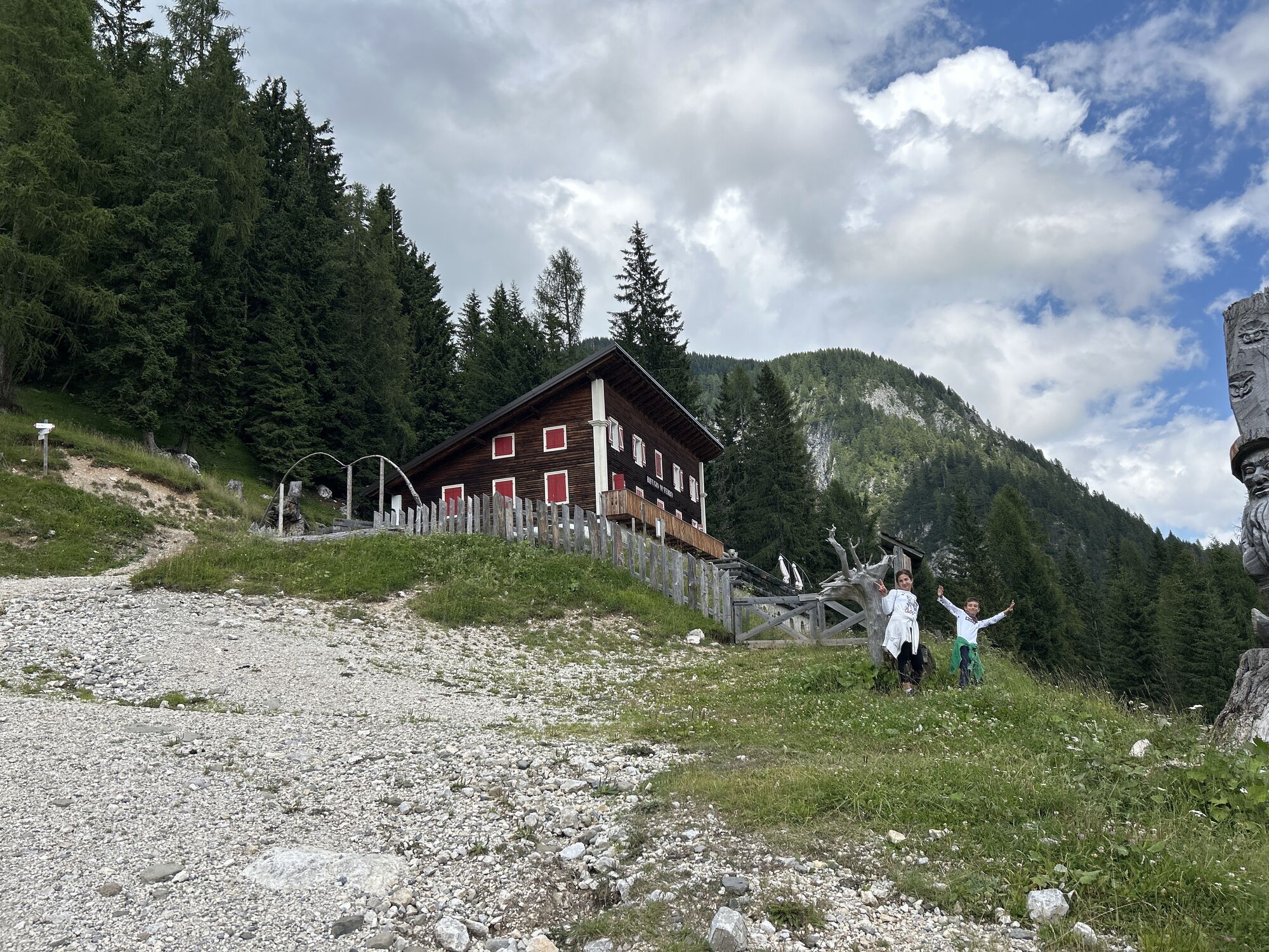
16 MONTE FERRO REFUGE from Borgata Bach - Sappada

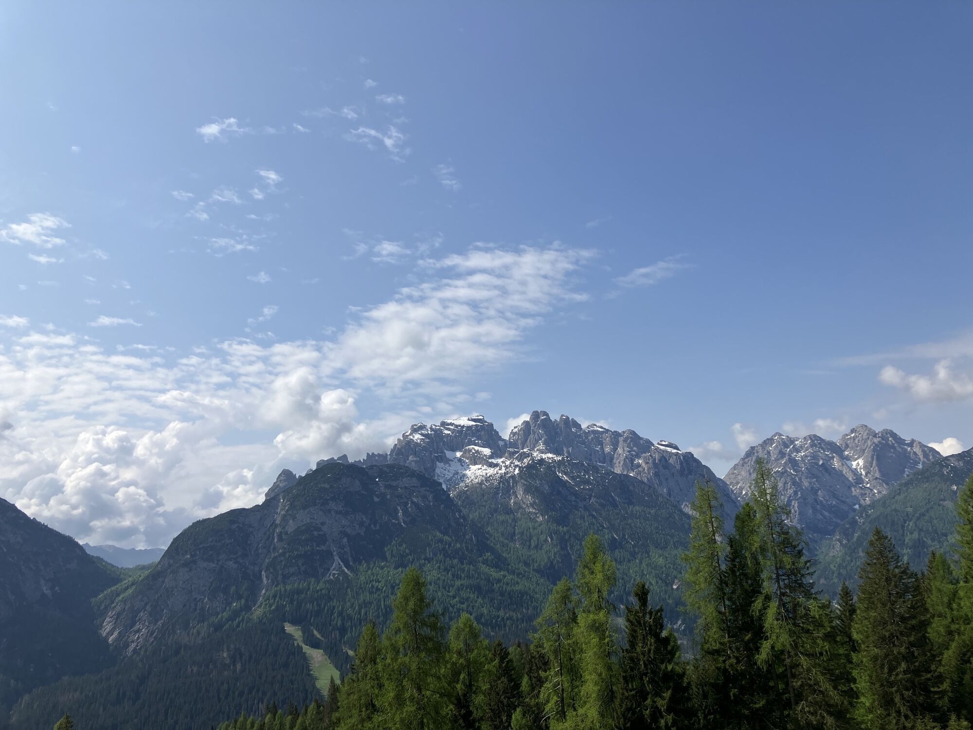
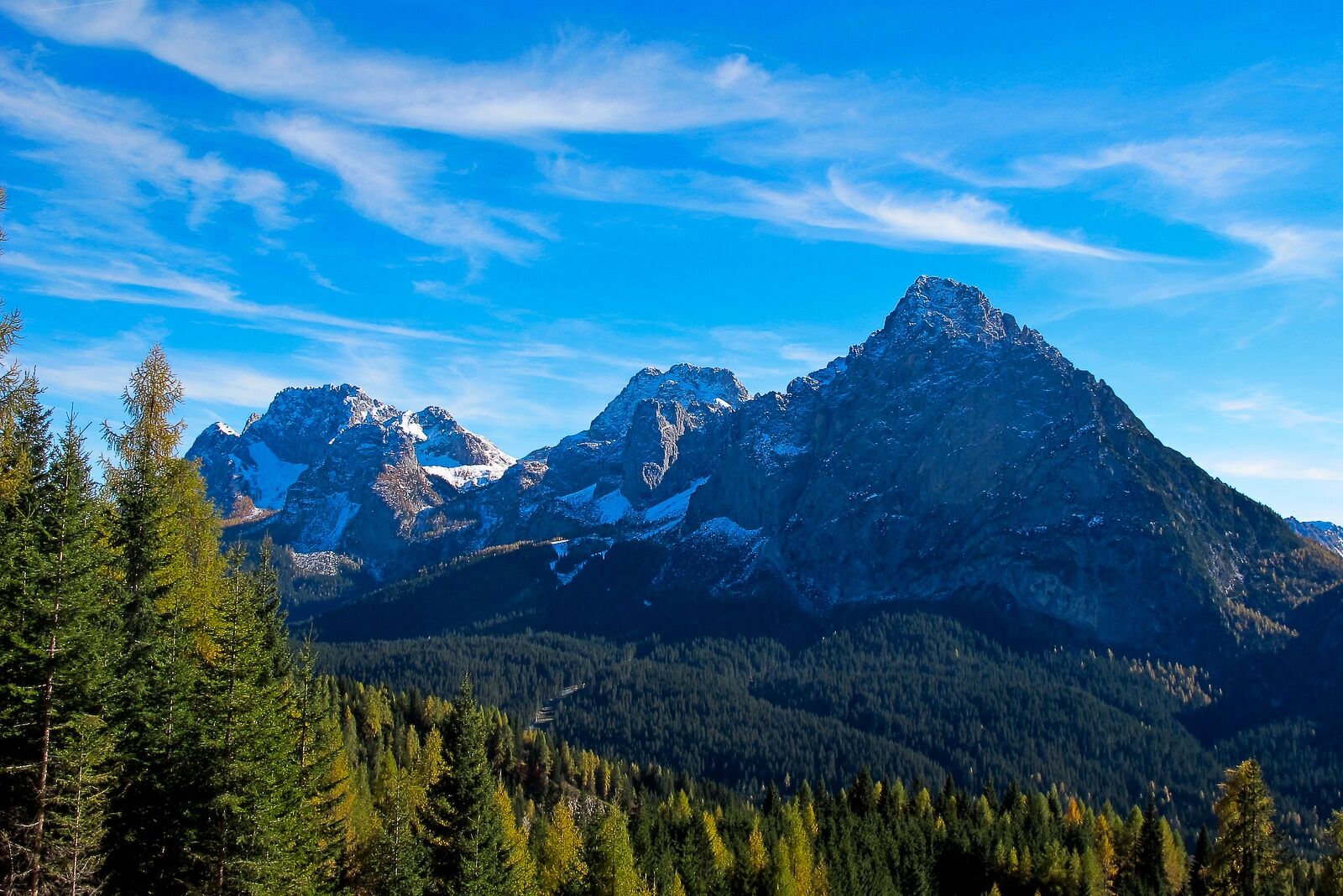
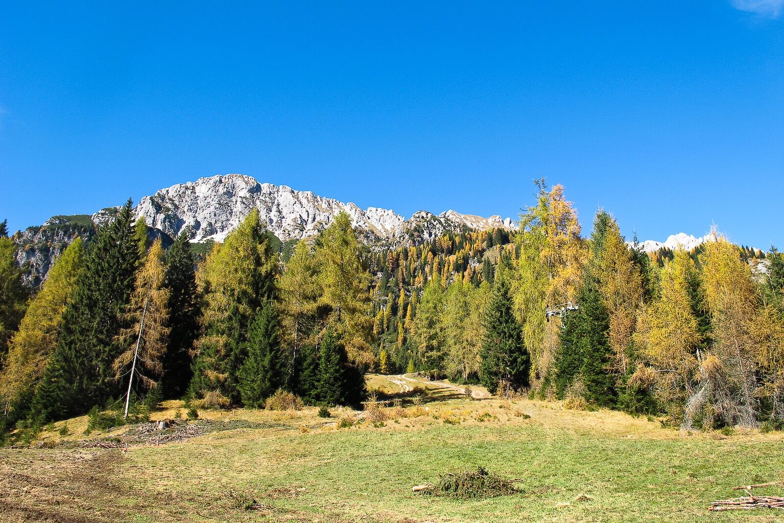
Short but interesting walk which first crosses the forest above the hamlet and then climbs a steep grassy slope. Outside the fir woods and in sight of the refuge your view can span 180° over the valley...
Short but interesting walk which first crosses the forest above the hamlet and then climbs a steep grassy slope. Outside the fir woods and in sight of the refuge your view can span 180° over the valley and the mountains that frame it to the south.
Author: © Giovanni Borella
C.A.I. Sappada/Plodn
Interreg V Italy-Austria - CLLD Dolomiti Live. Project “Safe Mountain – Adventure Mountain” ITAT 4019 CUP B43J16000270004

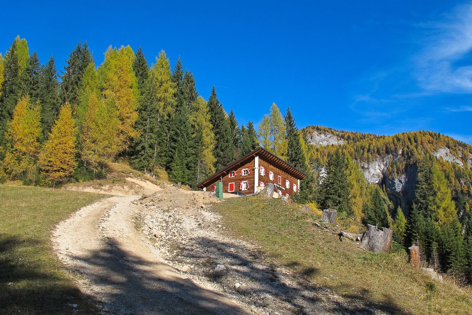
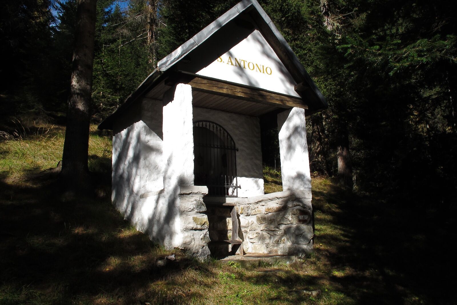
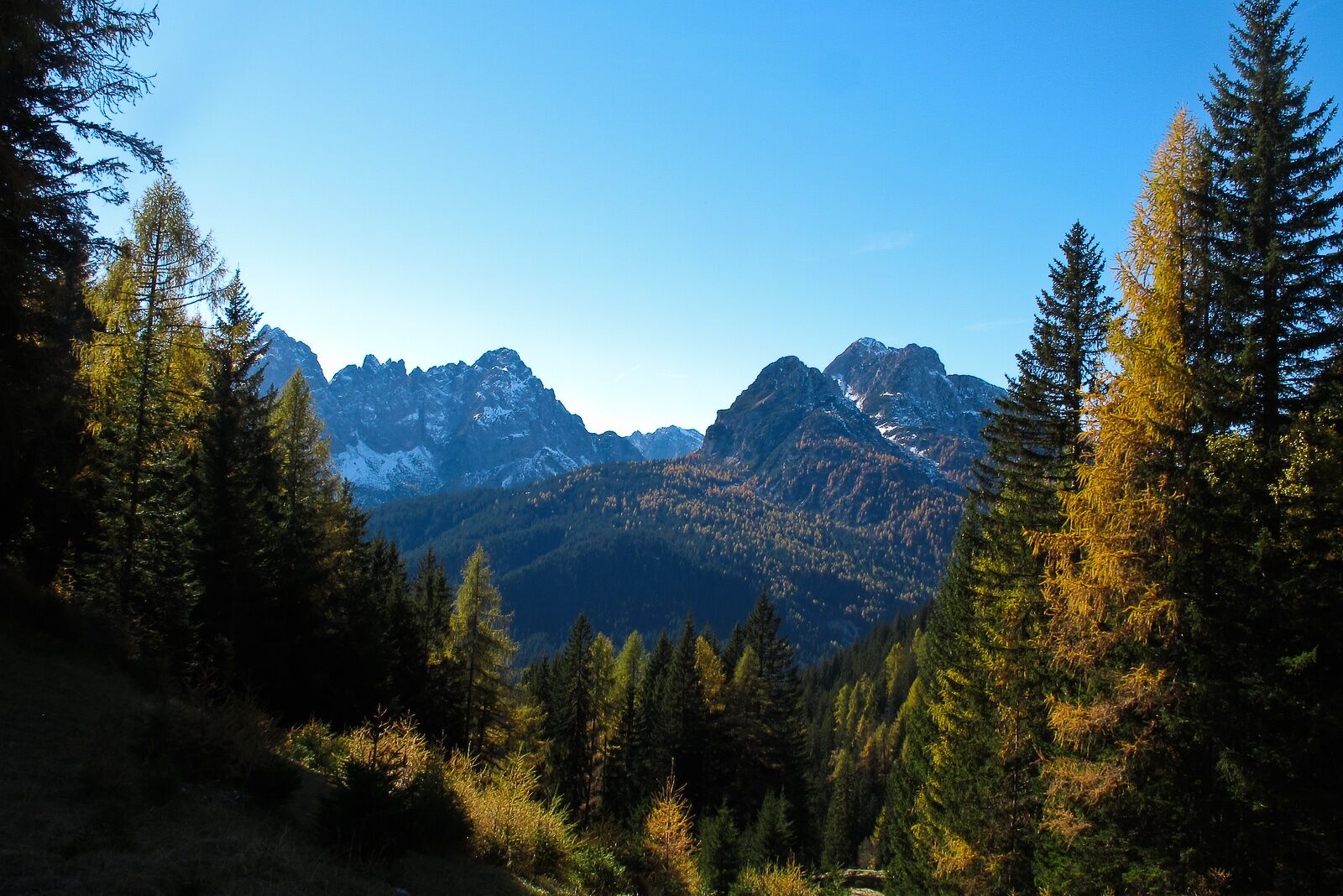

Coming from Sappada center, before the bridge over the Mühlbach stream, head towards the so-called "high road". Shortly after the Bladen hotel, you will reach the chapel dedicated to Saint Anthony (the oldest of all the Maindl chapels in Sappada as it was built in 1726). Here follow a small road on the right (signpost indicating "Monte Ferro refuge") which shortly ahead, after the last houses, becomes a trail that climbs up the forest with a moderate and steady slope (attention: at various forks always take the left). Once you reach the starting station of the disused "Sasso Alto" ski lift, you can continue on the path that runs parallel to it and quickly leads to the sunny grassy slope now in sight of the refuge, or ascend a little to the left (west) along the old ski slope, quite steep in the first section, which after about a hundred meters reconnects with the previous track.
The descent can be made by the same route to Borgata Bach, or to Borgata Mühlbach via route 17, or also to Borgata Granvilla via route 18, always in 30-40 minutes.
Author: © Giovanni Borella
Even if the hike is simple (for example, a route in search of mushrooms) always wear appropriate shoes with non-slip sculpted soles. Also always carry extra clothing in case of weather changes.
Difficulty: T
Hours: ascent 0:45-1:00 descent 0:30-0:40 total 1:15-1:40
MARKINGS: trail, red and yellow marks N3
DIFFICULTY SCALE
The technical data sheet of each route contains the abbreviations commonly used in mountain guides (T- E - EE- EEA - A). Some routes may have a double abbreviation (e.g. T/E or E/EE) because they have characteristics of both categories
T (tourist) indicates routes that are almost always short and easy, which follow forest roads and/or well-marked or clearly visible trails that do not require special training
E (hiking) indicates routes, sometimes quite long, that run on mule tracks and/or trails often above 2000 meters, visible but not always with marking signs. They have no significant difficulties, but may sometimes have some exposed or awkward sections or single passages. Adequate equipment, some experience, and training are required
EE (for experienced hikers) indicates routes generally at altitudes above 2000 meters, which may lie on hazardous terrain and/or in rugged areas, often characterized by exposed and/or equipped passages or sections, sometimes on rocky parts with grade 1 difficulty. They require experience, surefootedness, sense of direction, good equipment, and psycho-physical preparation.
EEA (for experienced hikers with equipment) indicates routes equipped with metal cables, brackets, ladders. Exposure is almost always constant. Experience, training, and proper equipment including helmets and via ferrata set are mandatory. Gloves are useful.
A (for mountaineers) indicates rock routes leading to peaks with low mountaineering difficulty (grade 1/2). They require technical skills, good experience, physical preparation, and suitable equipment (helmet, some slings, always useful also a 20-30 meter short rope)
WARNINGS
The information below cannot be considered a substitute for the presence of a professional alpine guide The mountain is a wonderful environment but not free from risks, so it should always be approached with the utmost caution In the Warnings of the Guides of the Mountains of Italy C.A.I./T.C.I. it is stated that the difficulty classification "remains essentially indicative and should be considered as such", as it is a subjective element. This also applies to the routes proposed on the site The classification of difficulties and travel times refer to a hiker/mountaineer of average level regarding training, experience, aptitude, training When undertaking a particular route, carefully assess the difficulties, your abilities, and your level of training Before facing a route (other than a short walk) it is good practice: 1) to consult the Dolomiti Meteo of Arpav by visiting the website http://www.arpa.veneto.it or calling 049 8239399 (Option 2). The bulletin, unlike national weather bulletins, offers a fairly reliable local forecast. 2) to get information from the Tourist Office, the local C.A.I. section, alpine guides, refuge managers. Indeed, the state of passability of a route and its difficulty level may change significantly even in a very short time due to natural events (landslides, unfavorable weather conditions) and/or contingent situations (deterioration of trail markers, fixed equipment, presence of residual snowfields, etc.) The mobile phone can give a false sense of security because it must be borne in mind that there are areas without phone coverage In the unfortunate event of an accident, illness, or inability to continue, contact only and exclusively the emergency number 118Oblíbené prohlídky v okolí
- 4,5
Karnischer Höhenweg – Etappe 4: Hochweißsteinhaus – Wolayersee Hütte
heavydálková pěší trasa 15,9 km - 4,7
Obergail - Obergailer Alm - Obergailer Lake - Enderberg hut - Source for Health & Peace - Madonna circular hiking route - Obergail
středníTuristika 11,4 km - 5,0
Porzehütte (1.942 m)
světloTuristika 9,01 km - 4,3
Mountainbiketour von der Hubertuskapelle zum Wolayersee
heavyMountainbike 9,06 km - 5,0
Carnic altitude trail. Stage 4: Porzehütte – Hochweißsteinhaus
heavyTuristika 17,5 km - 3,8
Karnischer Höhenweg KHW 403 - "Weg des Friedens"
středníTuristika 46,7 km - 3,8
Circular hike Obergail - Gamskofel - Obergail Alm - Obergail
středníTuristika 13 km - 2,0
Porzehütte/Tilliacher Joch am Karnischen Kamm
středníMountainbike 8,99 km - 2,9
Wolayersee
heavyTuristika 7,90 km - 4,3
Spitzköfele (2.314 m)
středníTuristika 3,90 km

Pěší turistika a stopování


Nenechte si ujít nabídky a inspiraci pro vaši příští dovolenou
Vaše e-mailová adresa byl přidán do poštovního seznamu.