


Albtraufgänger (stage 1) *Trauf story*
Úroveň obtížnosti: T2
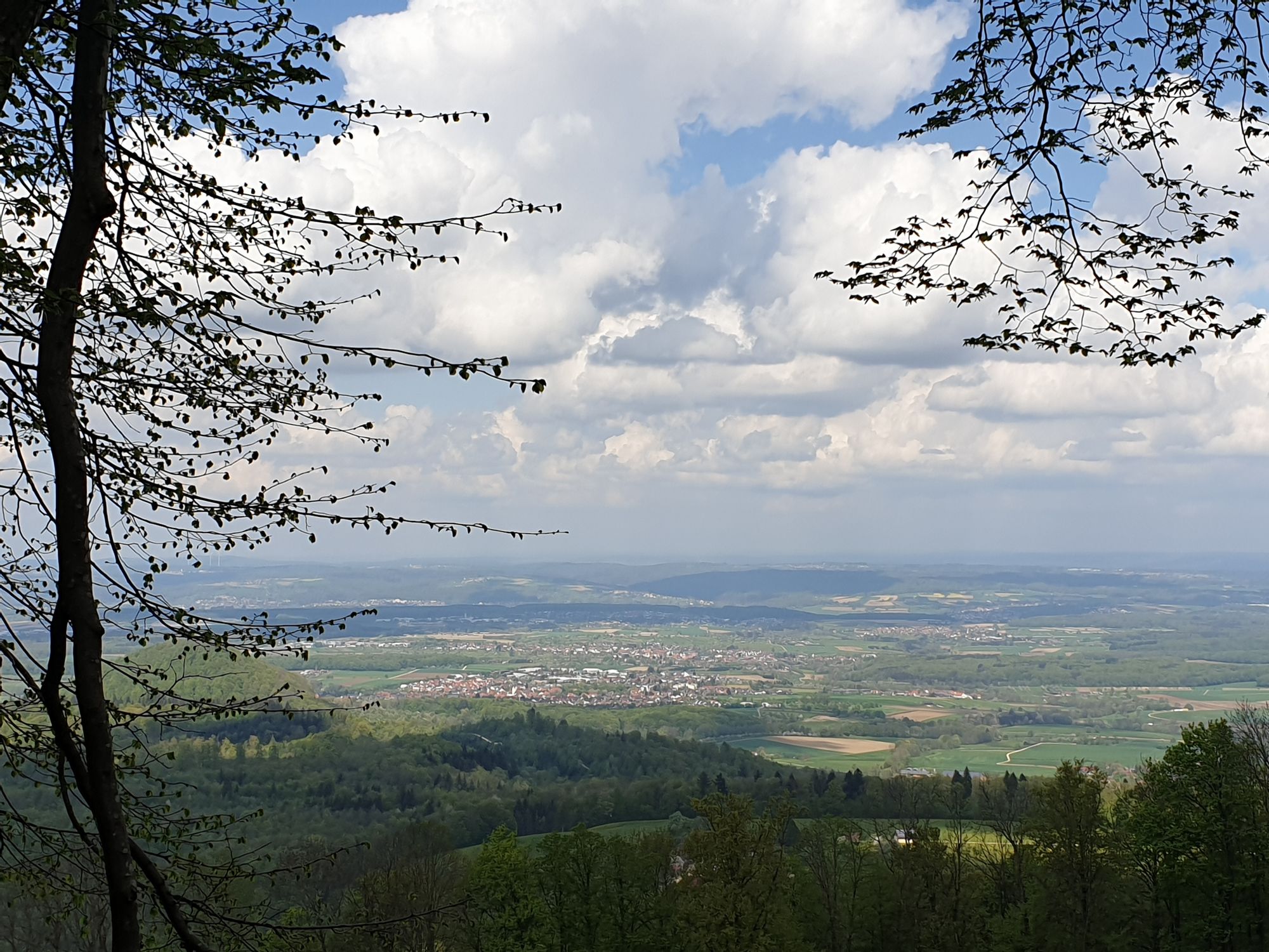
Encountering the unique landscape of the Albtrauf is an unforgettable experience: juniper heaths, orchid meadows and striking rocky outcrops characterize the Swabian Albtrauf adventure region. Experience...
Encountering the unique landscape of the Albtrauf is an unforgettable experience: juniper heaths, orchid meadows and striking rocky outcrops characterize the Swabian Albtrauf adventure region. Experience gentle hilltops, valleys and health-boosting springs. Pass through small villages and enjoy history, art and culinary delights with Swabian tradition. The Albtrauf Trail captures all the enchanting facets of the region and offers relaxation and adventure at the same time.
Erlebnisregion Schwäbischer Albtrauf e.V.
Weberstraße 7 | 73084 Salach
07162 70414-20 | info@mein-albtrauf.de | www.mein-albtrauf.de

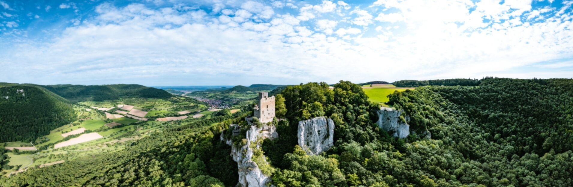
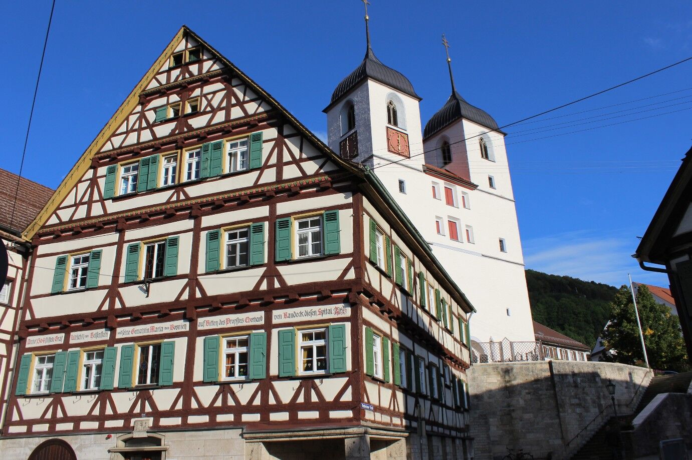
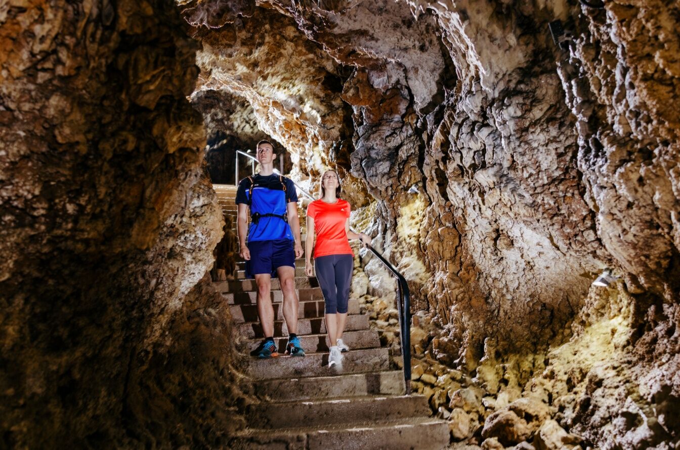
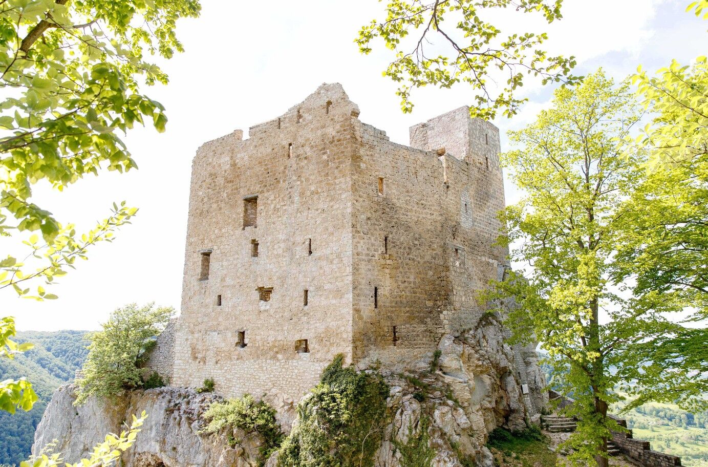
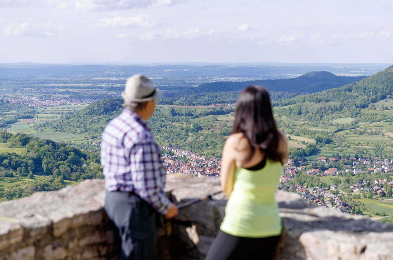
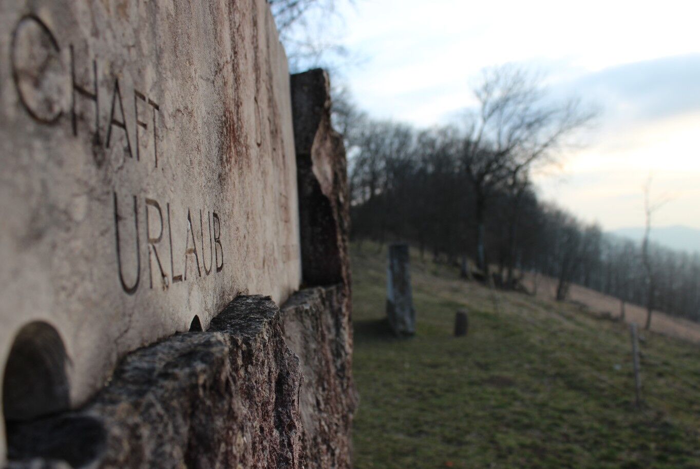
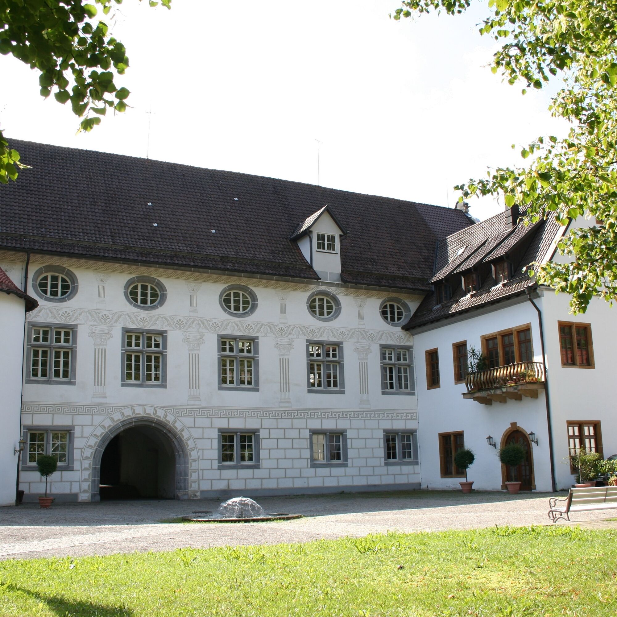
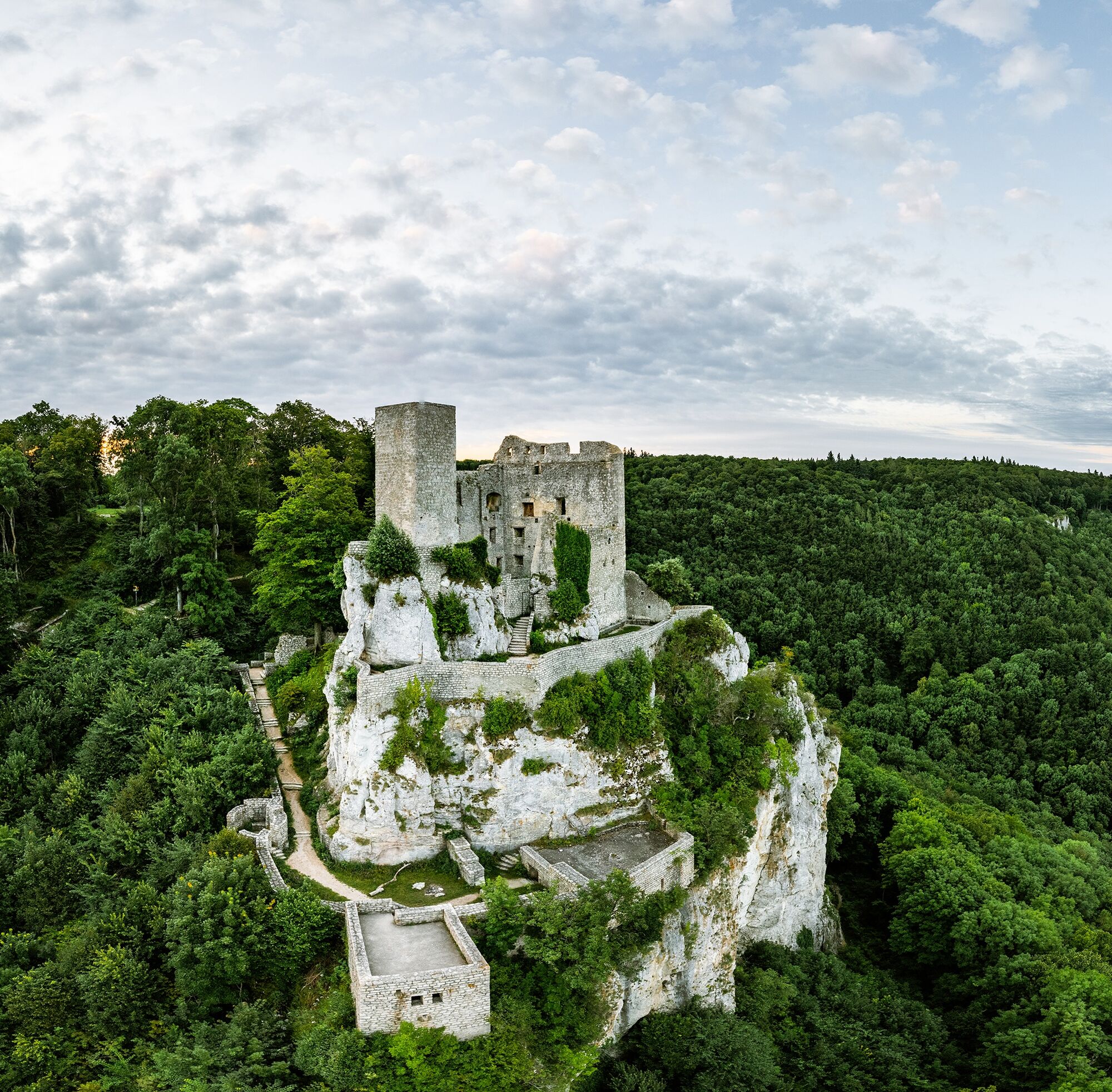
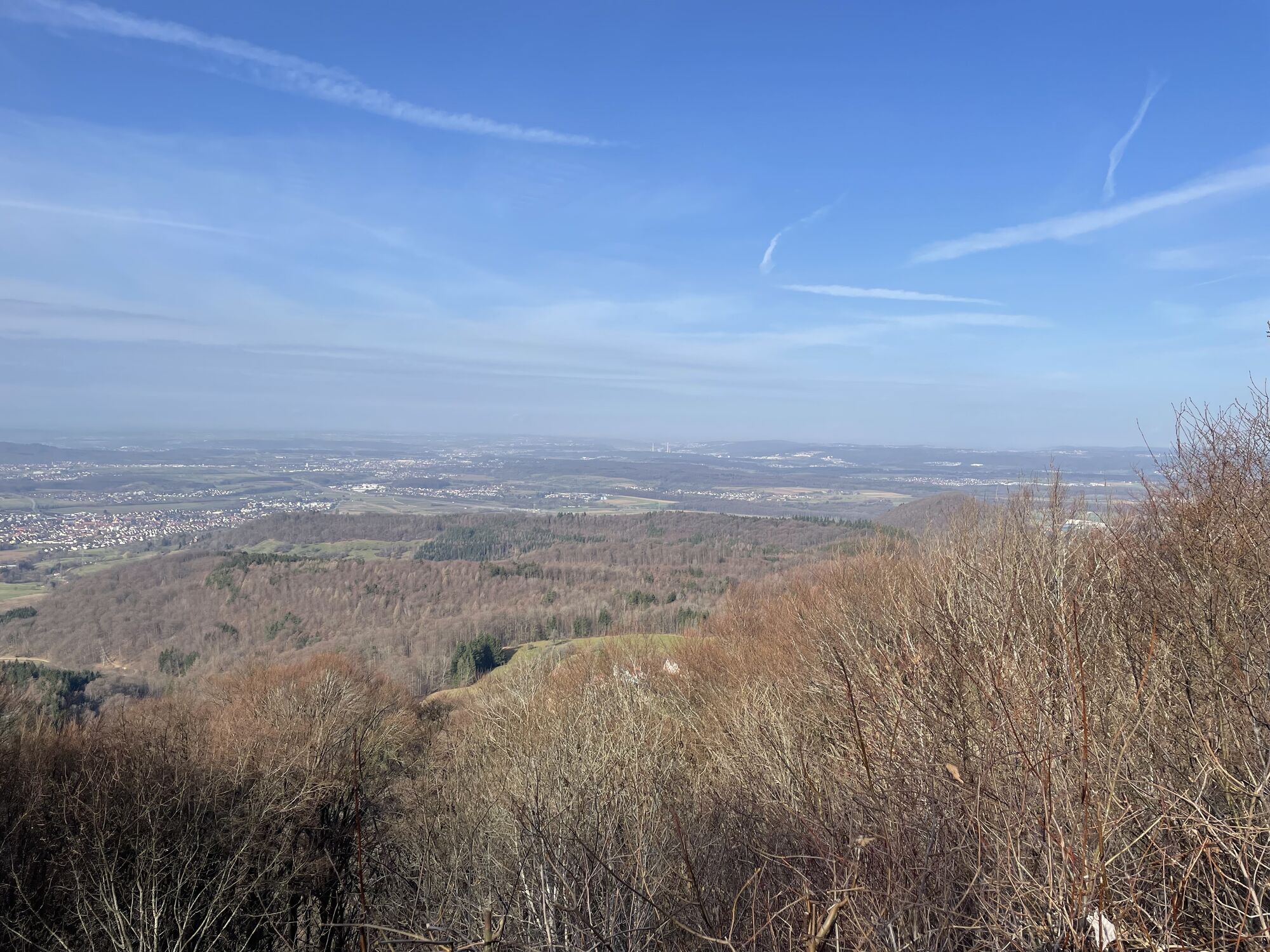
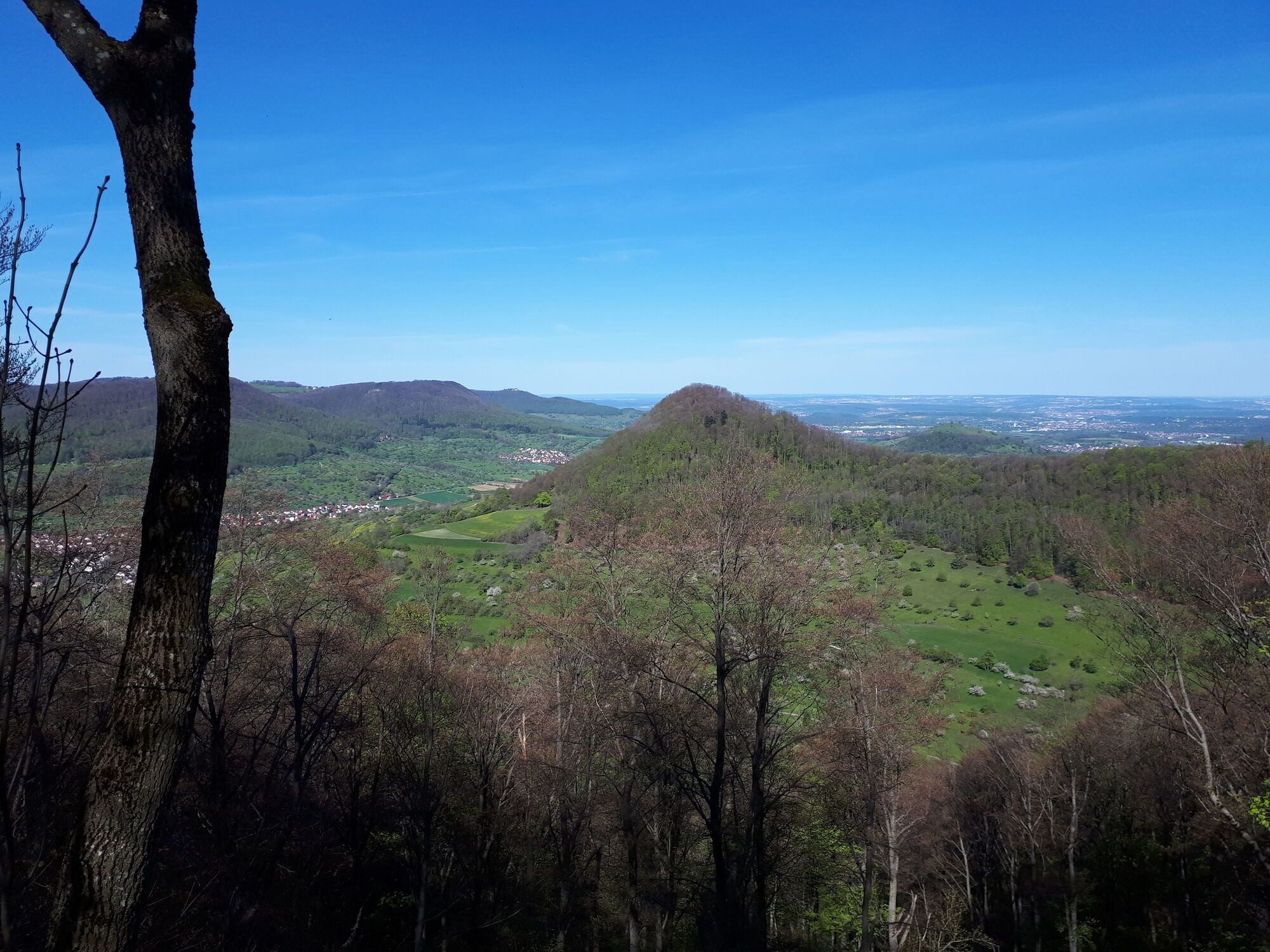
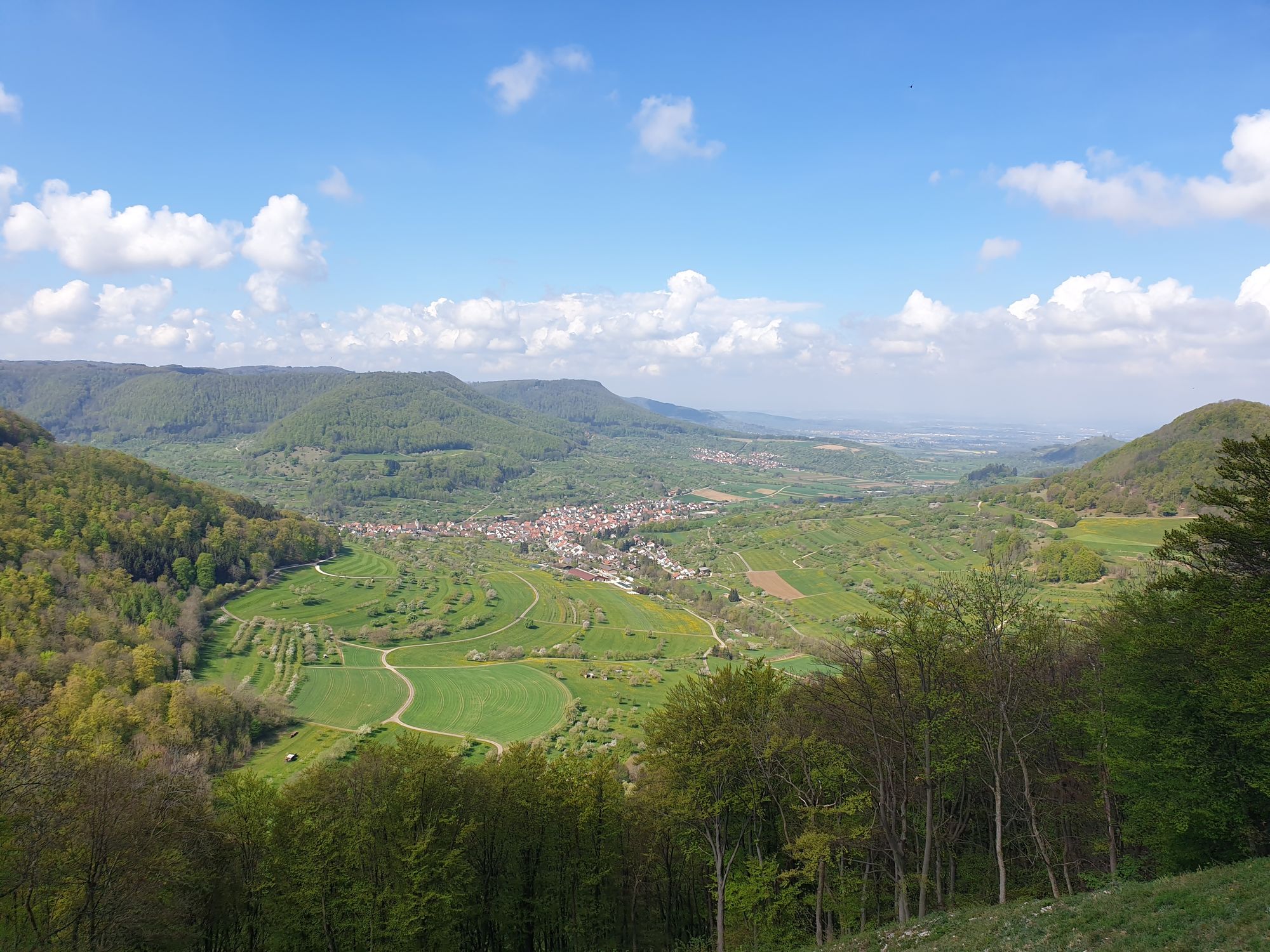
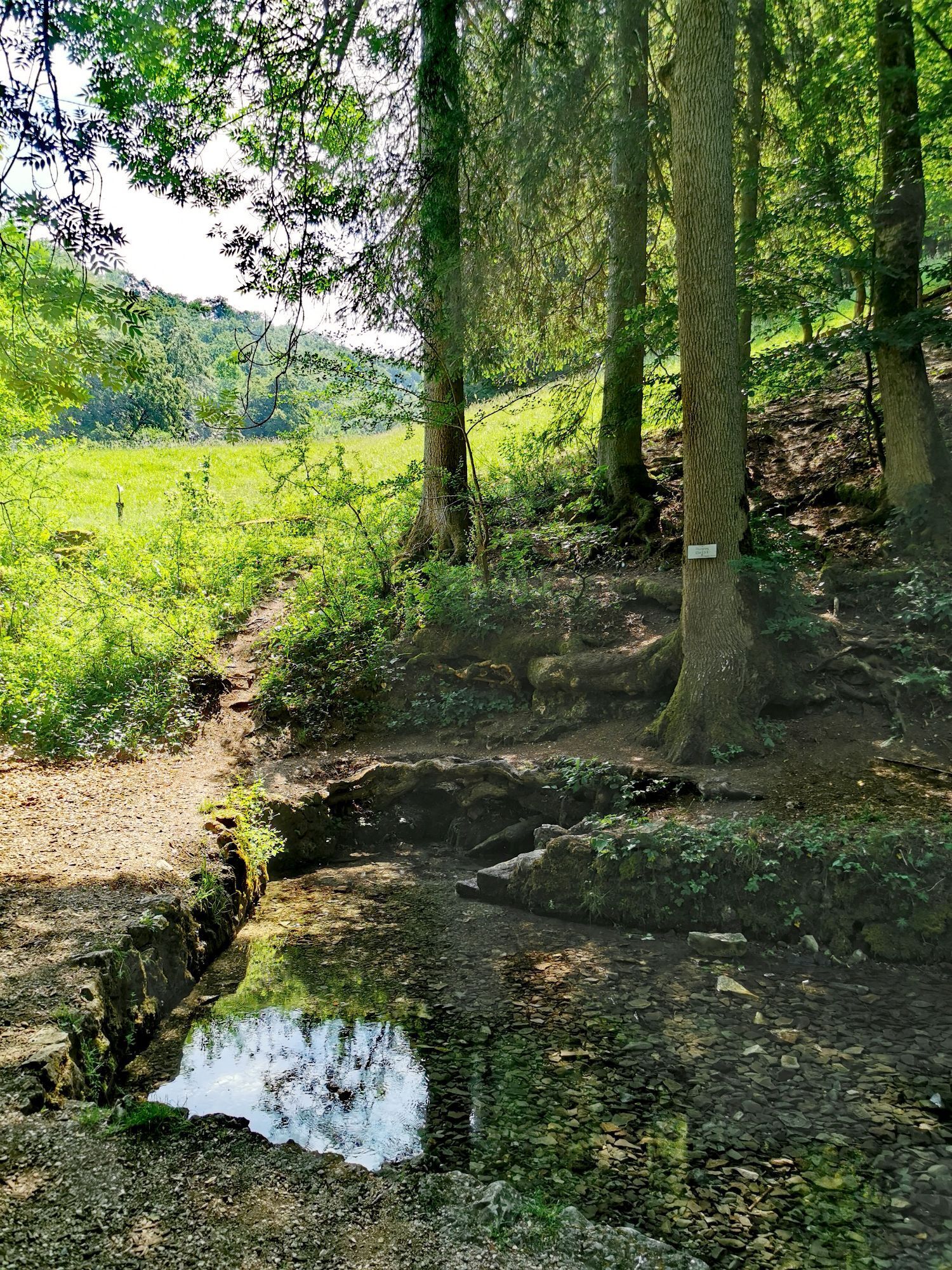
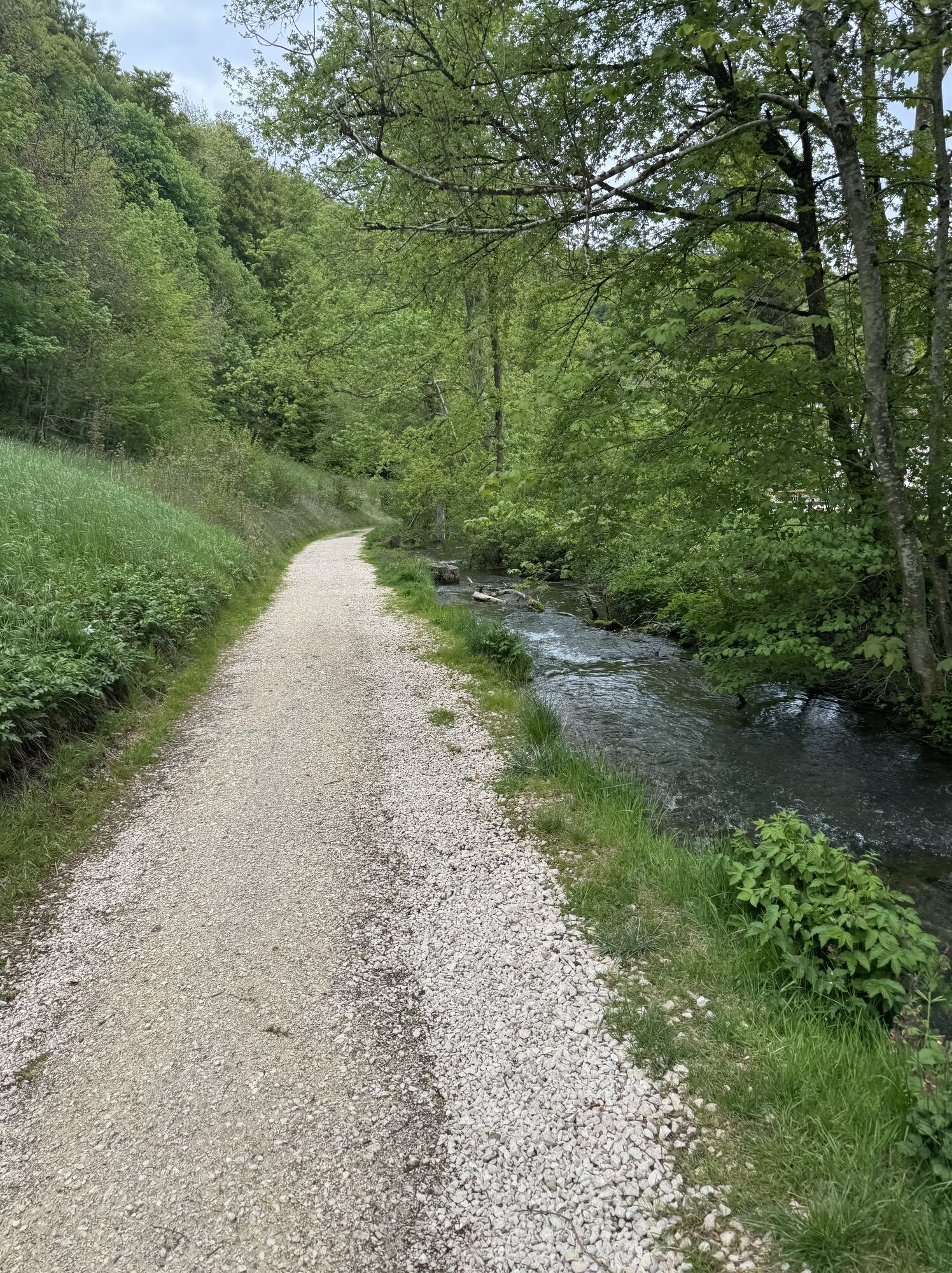
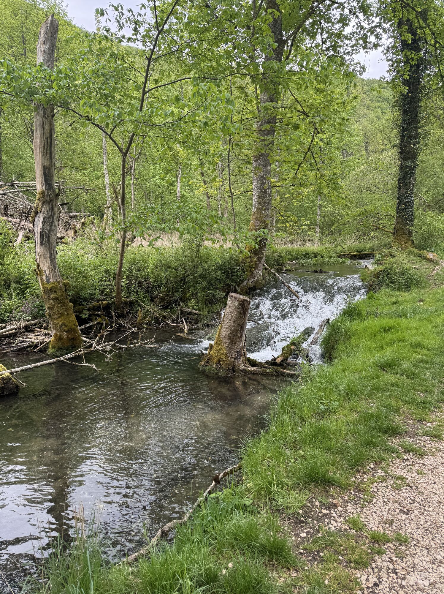
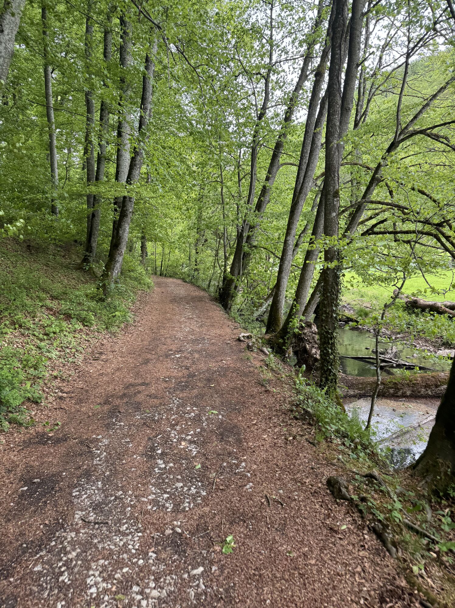
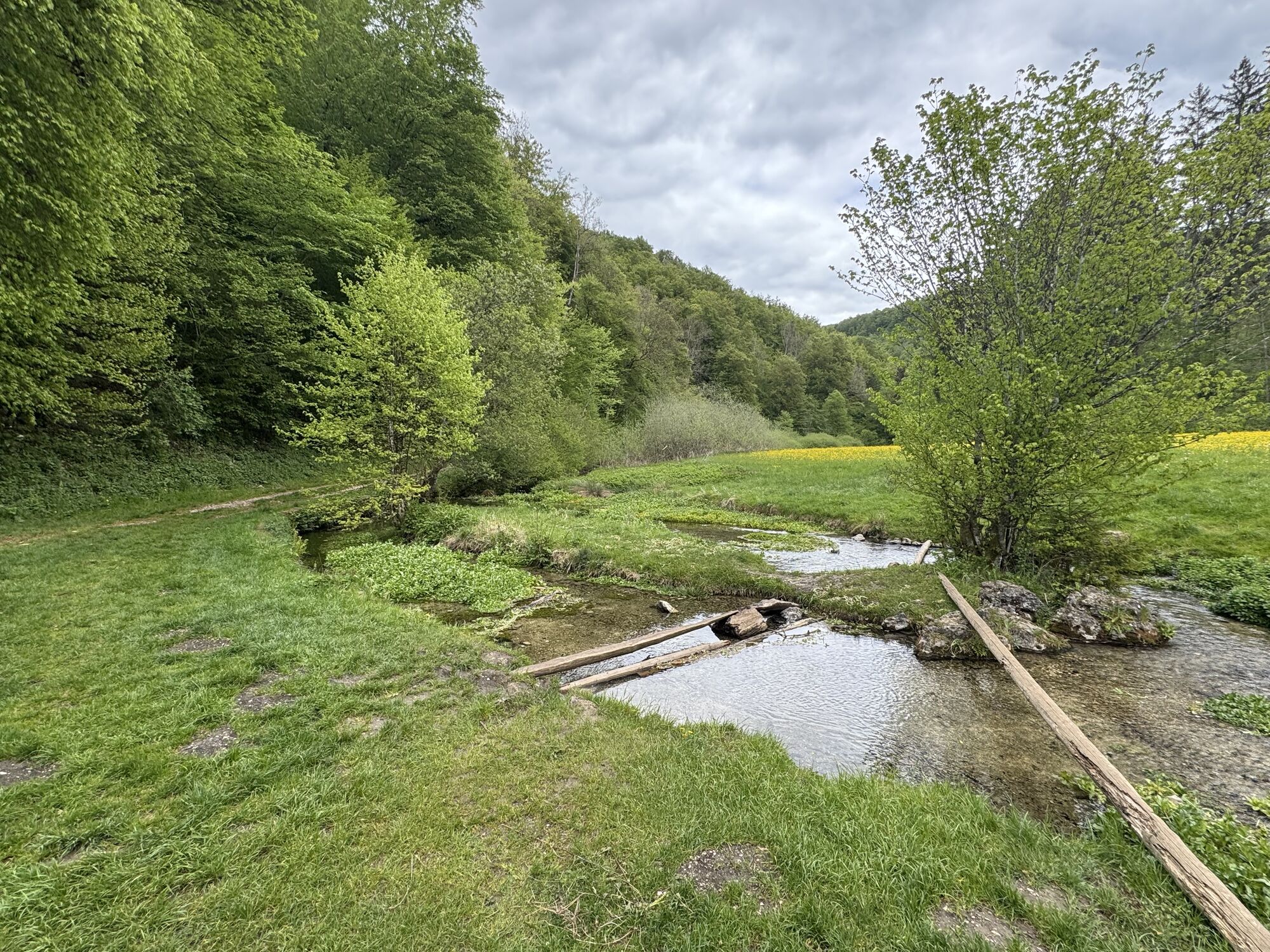
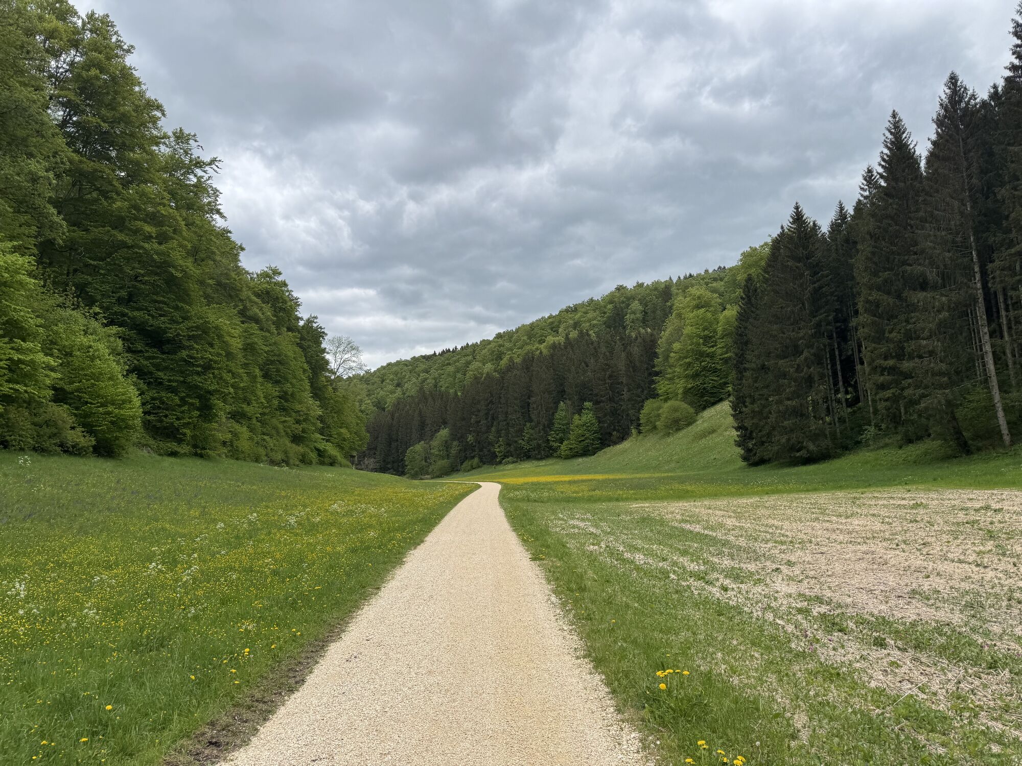
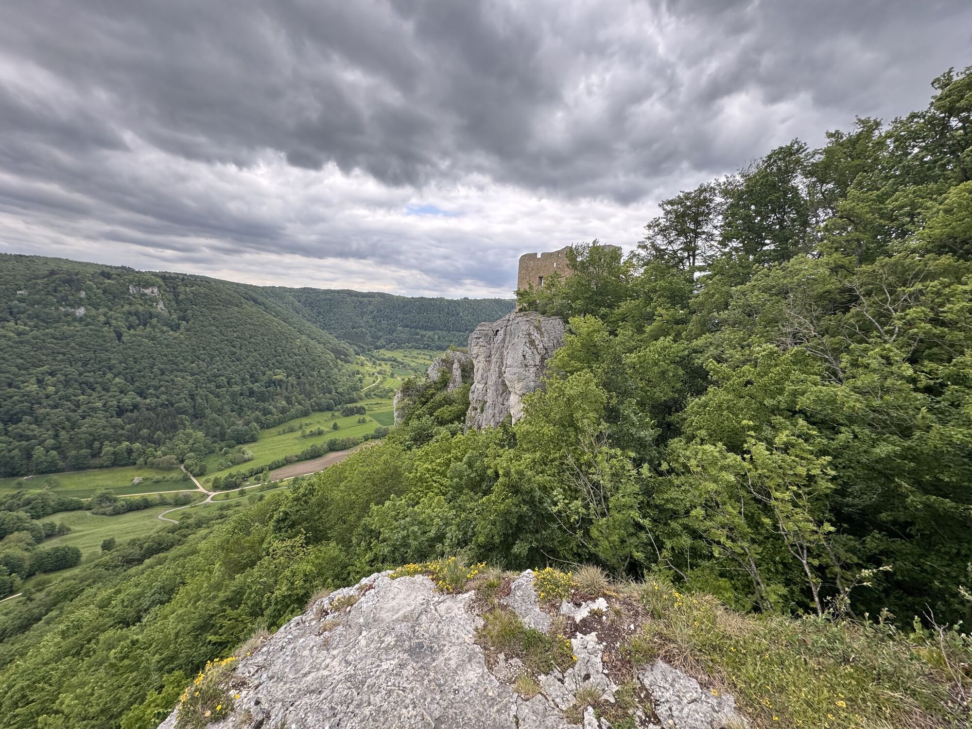
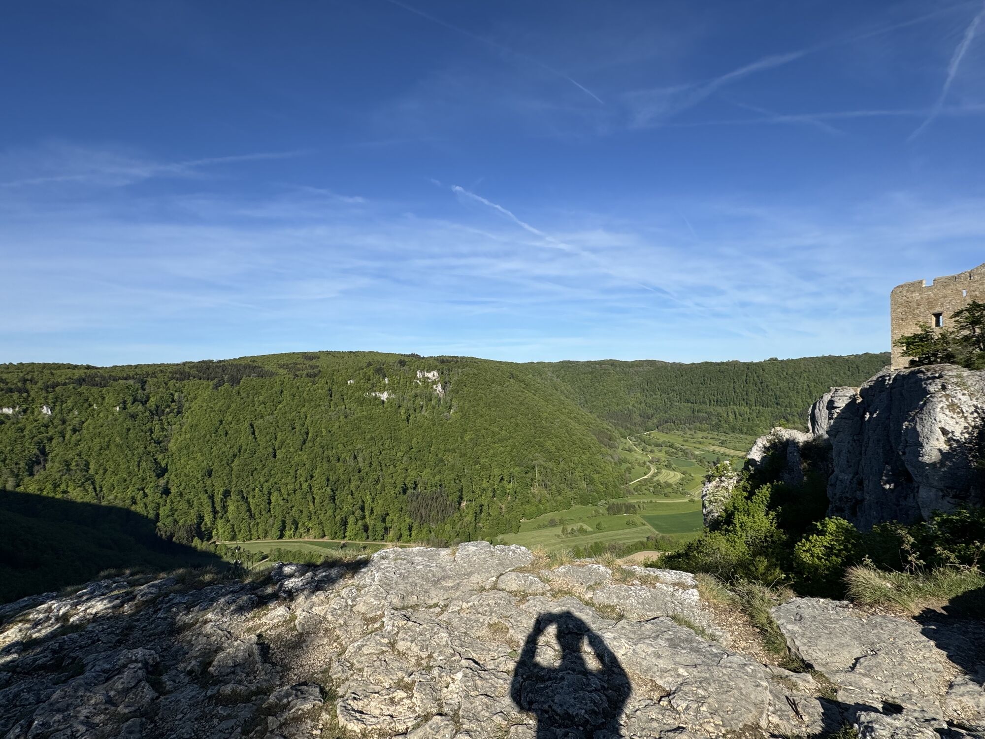
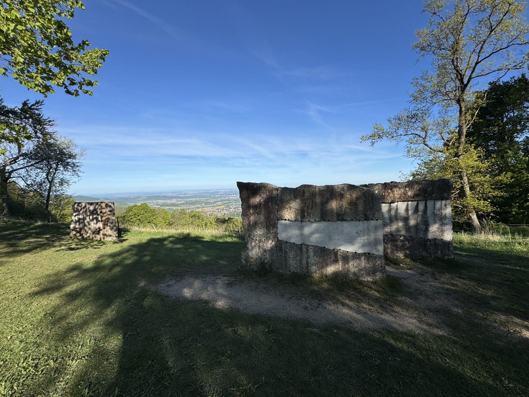
The Albtraufgänger starts in Wiesensteig at the castle courtyard. As the route continues, you can admire the historic half-timbered houses of the small "town" of Wiesensteig. The route continues to the beautifully situated Filsursprung, the source of the River Fils, which from there makes its way through the idyllic valley past beautiful meadows. The trail takes you to just before the Schertelshöhle cave, which is well worth a short detour. Where the Jurassic sea once covered the Albtrauf, you can now admire beautiful stalactite formations and hollowed-out rocks. The route then climbs up from the earth to the ruins of Reußenstein Castle, which is often referred to as the "jewel of the Swabian Alb". From the ruins, the route heads towards Bossler. On the way there, you can marvel at the Century Stone in Gruibingen. This is a work of art that deals with the 20th century. Three large stone tablets are engraved with a hundred key words relating to technology, culture, science, politics and everyday life in the last century. Once at the top of the Bossler, you can enjoy the wonderful panorama of the Albtrauf at almost 800 m.
Ano
sturdy shoes, weatherproof clothing
The climbs require a head for heights, a good level of fitness and surefootedness, especially in wet conditions.
Navigation to the starting point with Google Maps
You can find the district timetable at: www.vvs.de/fahrplan
Castle parking lot
Parking lot at the sports field
Parking lot at the outdoor pool
Ano
T2
Respectful cooperation in the district of Göppingen.
Code of conduct:
Respect trail closures and the quiet zones developed in the leisure trail concept. Leave no traces such as garbage and animal droppings, treat your path with care. Act with foresight and consideration. Adapt your behavior to the situation at hand. Safety first. Respect other users of the forest and meadows. Be considerate of animals and plants. Plan ahead and make the most of daylight. Try to avoid dusk in the morning and evening. Observe the ban on entering agricultural land during the growing season. Stay on the designated paths and avoid the edges of the forest so that wild animals can get used to people better.More information at ruecksicht-macht-wege-breiter.de
Worth seeing
Historic half-timbered houses in Wiesensteig Filsursprung near Wiesensteig Schertelshöhle cave near Westerheim Reußenstein castle ruins Century stone, Gruibingen Bossler viewpointOblíbené prohlídky v okolí
-
4.5
Löwenpfad "Orchideenpfad" - Herbs, Pasqueflower and Juniper Heathlands
středníTuristika 9.33 km -
4.8
Löwenpfad "Filsursprung-Runde" - pure nature around the Reußenstein
středníTuristika 14.1 km -
5.0
Lion trail "Berta-Hörnle-Tour" - castle stories in a dreamlike setting
heavyTuristika 14.7 km -
5.0
Boßler circuit
středníTuristika 8.59 km -
3.7
Löwenpfad "Wasserberg-Runde" - pure panorama and typical Swabian Jura landscapes
heavyTuristika 12.0 km -
3.8
Lion trail "Ave-Weg" - A touch of pilgrimage on the Albtrauf
středníTuristika 8.65 km -
1.0
Nordalbrunde
středníTuristika 4.76 km -
5.0
Lenningen: Weiße Lauter, Wasserfels, Guttenberger-,Gußmannshöhle, Schopflocher Moor, Hohgreutfels, Ruine Wielandstein
středníTuristika 15.7 km -
Löwenpfad "Höhenrunde" - Hiltenburg and the Albtrauf in its purest form
středníTuristika 10.7 km -
5.0
Breitensteinrunde
světloTuristika 10.3 km
Pěší turistika a stopování


Nenechte si ujít nabídky a inspiraci pro vaši příští dovolenou
Vaše e-mailová adresa byl přidán do poštovního seznamu.