







Burgenweg 8 through the romantic Krebsbachtal
This large 'brother' of the premium hiking trail Krebsbachputzer can be hiked both from the Lochmühle and from the church in Honstetten. Scenic hike, beautiful view from the Tudoburg, also into the wild...
This large 'brother' of the premium hiking trail Krebsbachputzer can be hiked both from the Lochmühle and from the church in Honstetten. Scenic hike, beautiful view from the Tudoburg, also into the wild romantic Krebsbachtal.

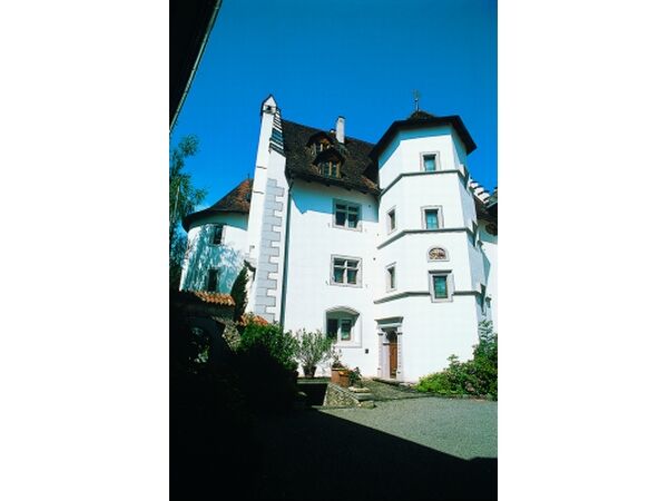
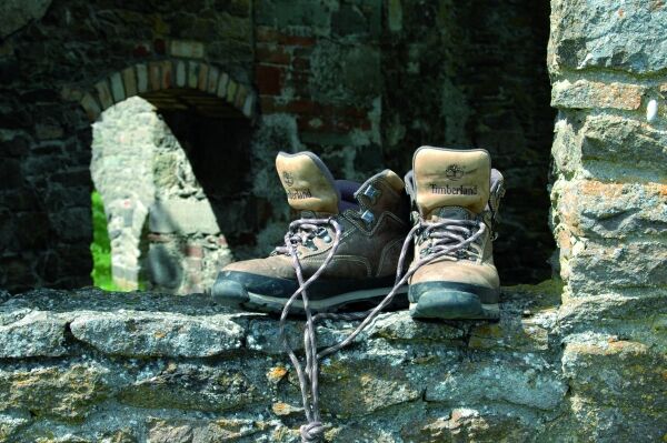

The path winds further through the narrow valley forest. After a longer stretch there is a hut on the right. Diagonally left opposite is a small bridge where you cross the stream. You turn right and soon the path goes uphill and leads to the edge of the forest. At the top a path branches off to the right to a barrier. At the barrier turn left and follow a small footpath to the Tudoburg. Then go back to the barrier and uphill on the paved path.
The Krebsbachtal
The box-shaped cross-section of the Krebsbachtal is created by sediment filling of the valley floor and side erosion of the stream on the valley slopes. The Tudoburg was built above a particularly steep slope. A V-shaped deeply cut side valley created a strategically favorable spur position for the castle. Worth seeing is a small waterfall, which has formed in the side valley above a layer of resistant Jurassic limestone (Malm). The masonry of the Tudoburg is made from the same rock. The castle moat between the outer bailey and main castle served as a quarry for building stones during construction. The Tudoburg lies in the transition area from the steep Krebsbachtal to the gently hilly plateau of the Hegaualb.
You soon reach the Honstetten cemetery (662m), pass it and turn left into Honstetten. In Honstetten, at a slight right curve, keep left uphill. The paved path leads you to the hilltop. First turn left then right, and on the ridge path pass a field cross down into the village of Eckartsbrunn (646m). There turn left and then right over the K6119 past some houses on a path that is first paved then gravel downhill. After a short stretch you meet the district road again and walk downhill until you reach a junction. There turn left and you come to a parking lot with a barbecue area on the left. From there turn left into the forest. Follow this path straight ahead and turn right at the hilltop into Käpelleweg. You do not leave this path anymore. You walk out of the forest to the barrier, then past the water reservoir to the right and then turn left on the paved road, which leads you back to the Lochmühle.
Regional train to Nenzingen station. From there take the local bus to Eigeltingen, stop Alteschulde/Lochmühle. From there about 15 minutes walk to the Lochmühle.
Lochmühle parking lot
Visit the church in Honstetten, a small but worthwhile detour!
Oblíbené prohlídky v okolí
-
3.2
Bodenseeradweg
Jízda na kole 210.8 km -
4.8
"Hegauer Kegelspiel" Alter Postweg
středníTuristika 9.26 km -
5.0
"Hegauer Kegelspiel" Stettener Panoramaweg
středníTuristika 7.62 km -
5.0
Vulkansee Höwenegg Rundweg
světloTuristika 7.05 km -
4.5
Mühlsberg route
středníTuristika 8.67 km -
2.8
"Hegauer Kegelspiel" Hewensteig
středníTuristika 6.23 km -
5.0
"Hegauer Kegelspiel" Hohentwieler
středníTuristika 7.21 km -
Aacher Geißbock
středníTuristika 13.4 km -
4.0
Homburg-Steig
středníTuristika 5.83 km -
5.0
Volcanic path Hohentwiel
středníTuristika 4.63 km
Pěší turistika a stopování


Nenechte si ujít nabídky a inspiraci pro vaši příští dovolenou
Vaše e-mailová adresa byl přidán do poštovního seznamu.





