


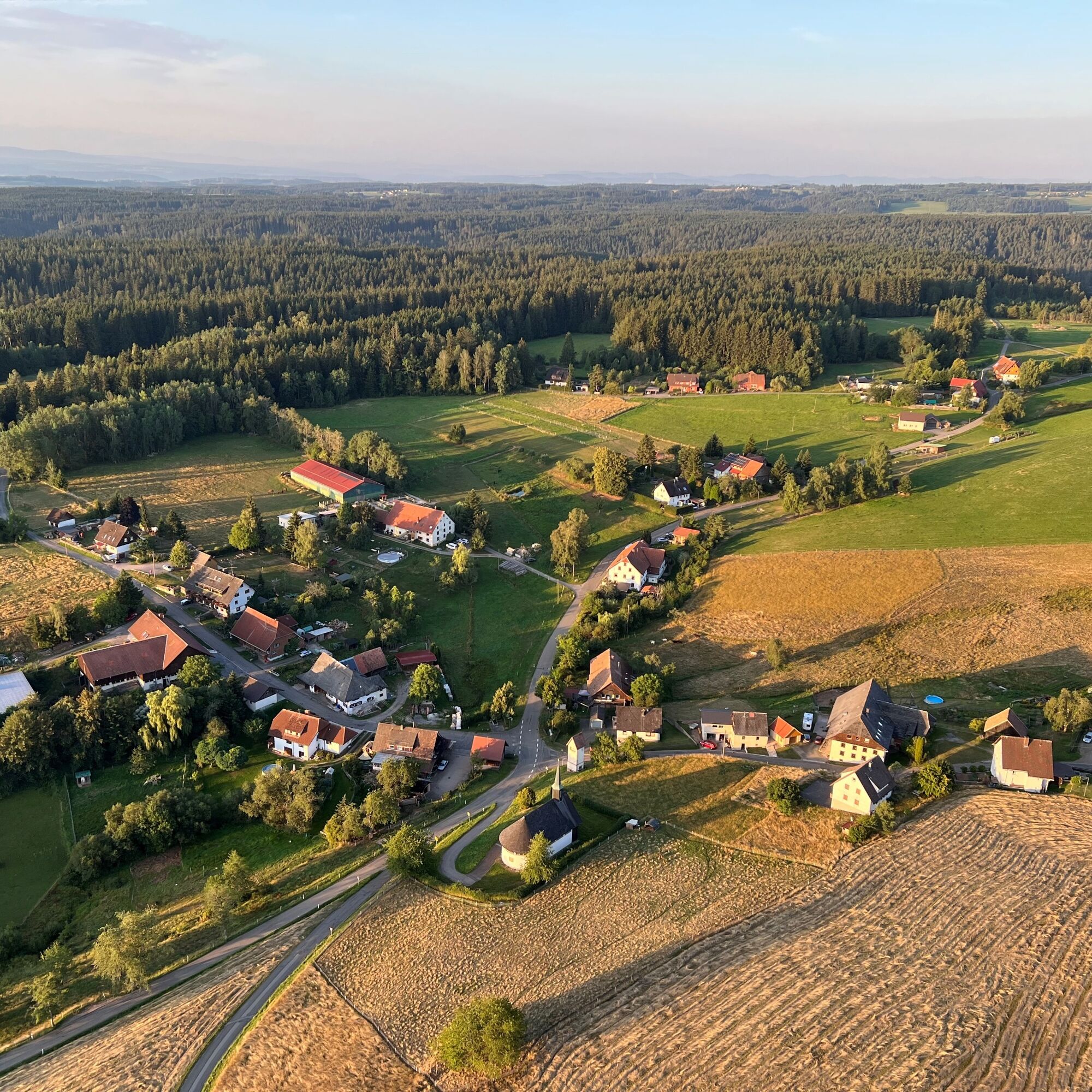
Ebnet village tour
This one-hour hike around the Kohlplatzhütte in Ebnet offers a varied mix of nature, views and village charm.
After just a short distance, impressive views of Bonndorf open up with striking landmarks such...
This one-hour hike around the Kohlplatzhütte in Ebnet offers a varied mix of nature, views and village charm.
After just a short distance, impressive views of Bonndorf open up with striking landmarks such as the windmill and church. On a clear day, the view even extends as far as the entire Alpine chain - a particular highlight of the tour.
Another charming section leads along the Kreuzleweg trail with a cross and benches, which invites you to take a short break. Two beautiful, typically regional sights await you in the centre of the village: the St. Anna Chapel and the village fountain.
The route alternates between open landscapes, quiet forest passages and paths with great views. Particularly noteworthy is a small panoramic path with benches, which once again offers impressive views of Ebnet and the Alps.
All in all, it is an entertaining, easy circular tour with several viewpoints and cultural stops - ideal for a relaxing break in nature.

The start is at the Kohlplatzhütte. From there, turn right down the tarmac farm track. After around 300 metres, a beautiful view of Bonndorf opens up, with the wind turbine and church clearly visible.
The path continues to the right as far as the country road. If visibility is good, you have a wide view over the entire Alpine chain. You then cross the country road and follow the Kreuzleweg, which is equipped with a cross and benches.
The Kreuzleweg leads down to the centre of the village. There you pass St Anna's Chapel and the village fountain. The route then turns left uphill again along Martin-Gerbert-Straße.
At Martin-Gerbert-Haus, you can choose between two options: Either turn right along the slightly shorter, still tarmac path, or straight ahead along the forest path (Rohrweg). The Rohrweg ends at Welschweg, which you follow uphill to the right.
After about 300 metres, leave the forest again and continue to the village road. Continue uphill to the left. As soon as the forest begins again, you can turn right onto a small panoramic path with benches. From here, there is another beautiful view of Ebnet and the Alpine chain.
The path then leads back to the Kohlplatzhütte.
Ano
Oblíbené prohlídky v okolí
-
4.7
Wutachschlucht Rundwanderung im Süd Schwarzwald
středníTuristika 9.76 km -
3.7
From Titisee to the Hochfirst with its stunning views
středníTuristika 10.6 km -
4.0
Gorges, climbs and culture
heavyTuristika 12.1 km -
3.5
Premium Hiking Trail - Rappenfelsensteig
heavyTematická stezka 12.8 km -
5.0
Wutachschlucht+Lotenbachklamm
světloTuristika 10.0 km -
5.0
Berau - ruins, rocks & gorges
středníTuristika 9.71 km -
5.0
Premium Hiking Trail - Schluchseer Jägersteig
středníTematická stezka 11.9 km -
5.0
Premium Hiking Trail - 3-Schluchten Tour
středníTematická stezka 9.62 km -
Schluchtensteig Schwarzwald
heavydálková pěší trasa 120.1 km -
Hike to the Schluchsee Highlights
středníTuristika 15.4 km
Pěší turistika a stopování


Nenechte si ujít nabídky a inspiraci pro vaši příští dovolenou
Vaše e-mailová adresa byl přidán do poštovního seznamu.