





Path of faith 18 - Cyriakusweg
Úroveň obtížnosti: T1
When you come to Ottenbach for the first time, you quickly realize why the municipality is known as the Allgäu of the district of Göppingen. 45 outlying farmsteads in the middle of gentle meadows with...
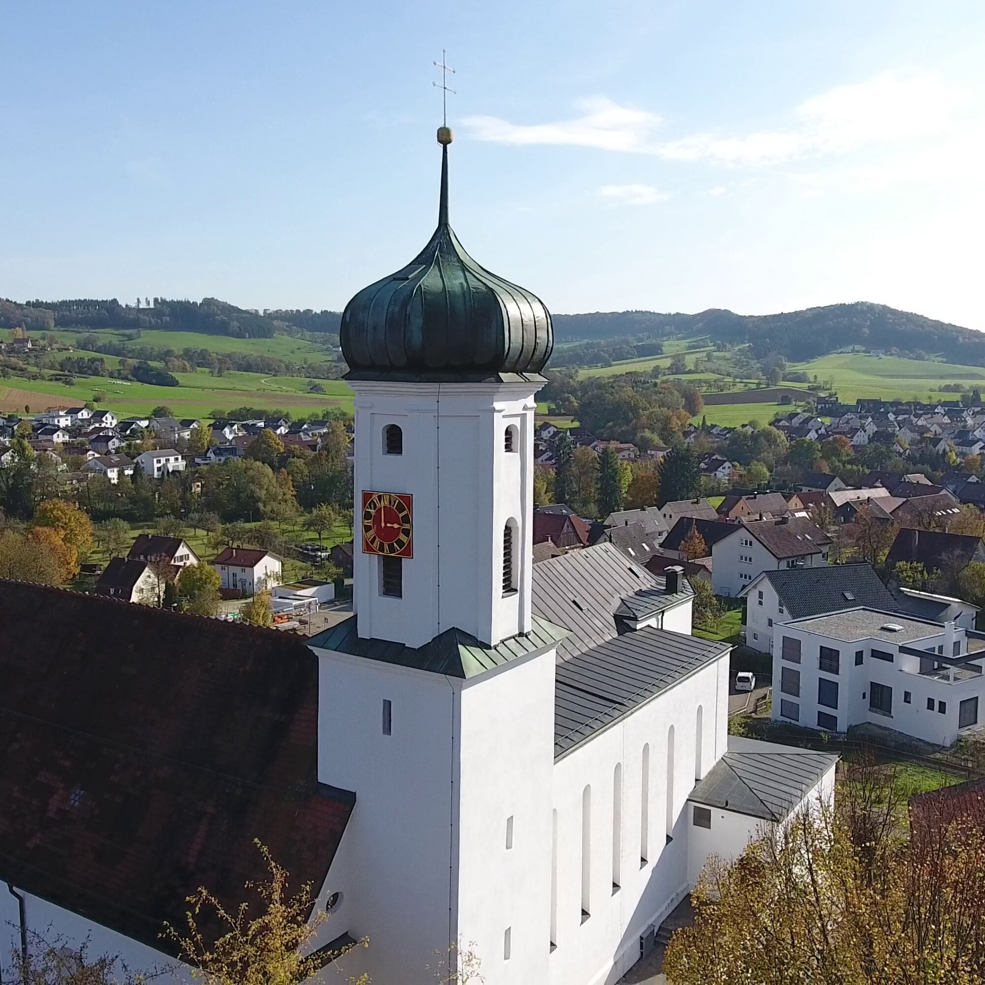
When you come to Ottenbach for the first time, you quickly realize why the municipality is known as the Allgäu of the district of Göppingen. 45 outlying farmsteads in the middle of gentle meadows with pasture farming characterize the landscape. Naturally, this landscape is ideal for hiking and cycling, although the surrounding mountain slopes require a good level of fitness. The village itself lies on the valley floor, framed by the Hohenstaufen and Rechberg imperial mountains and is therefore easily visible from the ridges of the Rehgebirge and Aasrücken. The parish church of St. Sebastian catches the eye from all sides, truly built by the forefathers in an ideal location. The hamlet of Kitzen also contributes to the idyllic rural appearance.
Community of Ottenbach
Hauptstraße 4 | 73113 Ottenbach
07165 91291-0 | info@ottenbach.de | www.ottenbach.de

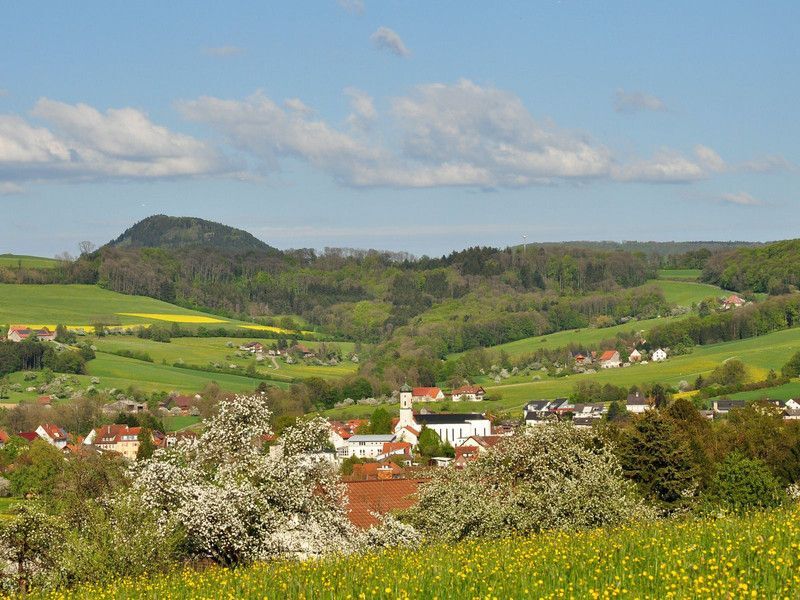
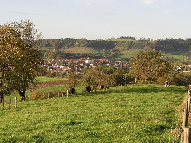

The picturesque landscape, framed by the striking Hohenstaufen and Rechberg imperial mountains, becomes visible as soon as you arrive at the starting point. The route is around 9 kilometers long and starts in a south-westerly direction. During the ascent, the trail leads through the hamlet of Kitzen and on to the Stumpenhof. Again and again, impressive views open up, illustrating the nickname "Allgäu of the district of Göppingen": The varied landscape of rolling hills, wide pastures, meadows and woodland features a total of 45 scattered farmsteads. Many of the meadows are used as pastures in summer.
The trail then turns north and leads towards Rechberg. The highest point of the circular hike is reached just below the village of Rechberg. From here, the trail leads back to Ottenbach, with viewpoints inviting you to linger and offering a wonderful view of the Ottenbach valley and its surroundings.
Wear sturdy, non-slip shoes and clothing suitable for the weather. A rucksack with water, snacks and a first aid kit is recommended.
Some paths can be slippery and dangerous when wet. Watch your steps and use walking poles for stability if necessary.
Take the RE 5 or MEX 16 from Stuttgart or Ulm to Göppingen. From there, take bus no. 941 to the bus stop "Ottenbach, Gasthaus Krone". The hiking trail begins after a 5-minute walk.
You can find the district timetable at www.vvs.de/fahrplan
Parking lot at Ottenbach cemetery
Parking lot at Ottenbach town hall
T1
Respectful cooperation in the district of Göppingen.
Code of conduct:
Respect trail closures and the quiet zones developed in the leisure trail concept. Leave no traces such as garbage and animal droppings, treat your path with care. Act with foresight and consideration. Adapt your behavior to the situation at hand. Safety first. Respect other users of the forest and meadows. Be considerate of animals and plants. Plan ahead and make the most of daylight. Try to avoid twilight in the morning and evening. Observe the ban on entering agricultural land during the growing season. Stay on the designated paths and avoid the edges of the forest so that wild animals can get used to people better.More information at ruecksicht-macht-wege-breiter.de
Cyriacus:
Cyriacus is a saint of the Roman Catholic Church and is one of the 14 Holy Helpers. He died a martyr's death in 303 AD during the persecution of Christians in Rome. During his lifetime, he is said to have devoted himself as a deacon mainly to helping the elderly, children and the sick. The trail passes the Cyriacus farm of the same name in the hamlet of Kitzen.
Oblíbené prohlídky v okolí
-
4.5
Löwenpfad "Orchideenpfad" - Herbs, Pasqueflower and Juniper Heathlands
středníTuristika 9.33 km -
4.9
Löwenpfad "Staufer-Runde" - Barbarossa's traces before a dreamlike backdrop
středníTuristika 11.3 km -
5.0
Löwenpfad "Heldentour" - The king stage of the Löwenpfade
heavyTuristika 23.6 km -
4.4
Löwenpfad "Geislinger Felsen-Tour" - up and down through the Eybach valley
středníTuristika 10.8 km -
4.5
Löwenpfad "Weitblick-Tour" - High up and far-reaching view
heavyTuristika 12.0 km -
3.7
Löwenpfad "Wasserberg-Runde" - pure panorama and typical Swabian Jura landscapes
heavyTuristika 12.0 km -
3.5
Lion trail "Messelberg tour" - hiking with impressive views
středníTuristika 7.72 km -
1.0
Nordalbrunde
středníTuristika 4.76 km -
3.0
Circular route Drei-Kaiserberge
heavyTuristika 25.8 km -
4.5
Löwenpfad "Schloss-Filseck-Runde" - castle stories and lake dreams
světloTuristika 3.97 km
Pěší turistika a stopování


Nenechte si ujít nabídky a inspiraci pro vaši příští dovolenou
Vaše e-mailová adresa byl přidán do poštovního seznamu.





