Walking tour of the Plan d'Aval dam
světlo
Pořiďte si tuto prohlídku do mobilního telefonu
Walking tour of the Plan d'Aval dam
světlo
Turistika
3.08
km
Naskenujte QR kód a spusťte navigaci v aplikaci bergfex.


Pěší turistika a stopování




Walking tour of the Plan d'Aval dam
světlo
Vzdálenost
3.08
km
Doba trvání
01:15
h
Ascent
60
hm
Hladina moře
1939 -
2023
m
Stažení skladby
Walking tour of the Plan d'Aval dam
světlo
Turistika
3.08
km
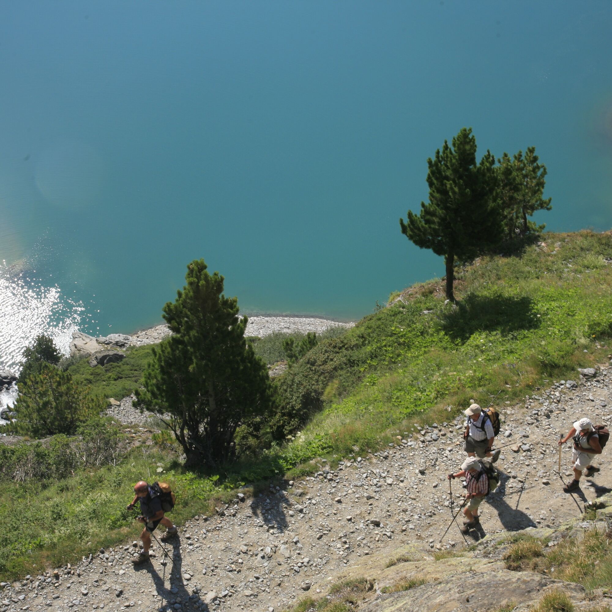
As a symbol of human impact, this reservoir offers you a real-life tour of
the local industrial heritage. Discover the life of high-altitude dams at your
own pace.
And if you keep your eyes open, you may...
Popis
As a symbol of human impact, this reservoir offers you a real-life tour of
the local industrial heritage. Discover the life of high-altitude dams at your
own pace.
And if you keep your eyes open, you may spot some very agile yellow-billed choughs having fun above the lake. Our friends, affectionately called
"choucas" here, know how to have a good time... They'll perform an aerial
dance from Dent Parrachée to Râteau d'Aussois merely to take a good look
at you, out of sheer curiosity.
After your walk, take a break on the sunny south-facing slope, enjoying
sweeping views over Aussois village.
And, as the icing on the cake, you'll leave with a wealth of knowledge about
the scientific and industrial heritage of Haute Maurienne Vanoise. You'll
understand all the workings of hydroelectricity.
the local industrial heritage. Discover the life of high-altitude dams at your
own pace.
And if you keep your eyes open, you may spot some very agile yellow-billed choughs having fun above the lake. Our friends, affectionately called
"choucas" here, know how to have a good time... They'll perform an aerial
dance from Dent Parrachée to Râteau d'Aussois merely to take a good look
at you, out of sheer curiosity.
After your walk, take a break on the sunny south-facing slope, enjoying
sweeping views over Aussois village.
And, as the icing on the cake, you'll leave with a wealth of knowledge about
the scientific and industrial heritage of Haute Maurienne Vanoise. You'll
understand all the workings of hydroelectricity.
Autor
Poskytuje Haute Maurienne Vanoise
Prohlídku Walking tour of the Plan d'Aval dam zajišťuje outdooractive.com.


Informace o trase
Trasa
To guide you on the ground, consult the "step by step" directional diagram provided in pdf.
Další informace a tipy
Další informace
The duration of hiking trails is calculated using reference paces: 300 m/h ascent, 500 m/h descent and 4 km/h on the flat.
As hazards may occur at any time on the routes, the GPX tracks provided are not contractual. They are given for information only. Riders use them at their own risk, depending on their level of technological proficiency and their understanding of the terrain.
As hazards may occur at any time on the routes, the GPX tracks provided are not contractual. They are given for information only. Riders use them at their own risk, depending on their level of technological proficiency and their understanding of the terrain.
Zatím žádné recenze
Získejte přehled
Vždy živě na místě s více než 9 500 webkamerami. bergfex Jako uživatel Pro si nyní můžete zobrazit odpovídající webové kamery pro mnoho prohlídek v aplikaci prohlídky z. Můžete si tak přímo prohlédnout aktuální podmínky.
Oblíbené prohlídky v okolí
-
BARDONECCHIA Rochemolles Dam - Scarfiotti Refuge
středníTuristika 7.77 km -
Refuge du Fond d'Aussois - a wild valley in the Vanoise - 2-day hike
světloTuristika 9.22 km -
The White Lake
světloTuristika 4.42 km -
5.0
The Builder's Trail on foot
světloTematická stezka 7.23 km -
Col de l'Iseran from Modane
heavySilniční kolo 59.5 km -
Col du Mont Cenis from Modane
heavySilniční kolo 34.8 km -
Col du Mont Cenis from Lanslebourg
heavySilniční kolo 9.84 km -
5.0
Girarde footpath
světloTuristika 8.10 km -
5.0
Goldtoni - Alpenbogen A068 Refuge de la Leisse-Termignon Val Cenis
střednídálková pěší trasa 28.7 km -
5.0
Walking tour of the Plan du Lac refuge
světloTuristika 4.58 km
Pěší turistika a stopování

Více než 550.000 návrhů výletů, podrobné mapy a intuitivní plánovač tras dělají z aplikace nezbytnou výbavu pro všechny milovníky přírody.

Nenechte si ujít nabídky a inspiraci pro vaši příští dovolenou
Přihlaste se k odběru newsletteru
Chyba
Došlo k chybě. Zkuste to prosím znovu.
Děkujeme za vaši registraci
Vaše e-mailová adresa byl přidán do poštovního seznamu.
Zájezdy po celé Evropě
Rakousko
Švýcarsko
Německo
Itálie
Slovenia
Francie
Nizozemsko
Belgie
Polsko
Lichtenštejnsko
Česko
Slovensko
Španělsko
Chorvatsko
Bosna a Hercegovina
Lucembursko
Andorra
Portugal
Iceland
United Kingdom
Ireland
Greece
Albania
North Macedonia
Malta
Norway
Montenegro
Moldova
Kosovo
Hungary
San Marino
Romania
Estonia
Latvia
Belarus
Cyprus
Lithuania
Serbia
Bulgaria
Monaco
Denmark
Sweden
Finland





