
Trail to the Avérole refuge via the hamlet
světlo
Pořiďte si tuto prohlídku do mobilního telefonu
Trail to the Avérole refuge via the hamlet
světlo
Trailrunning
9.36
km
Naskenujte QR kód a spusťte navigaci v aplikaci bergfex.


Pěší turistika a stopování




Trail to the Avérole refuge via the hamlet
světlo
Vzdálenost
9.36
km
Doba trvání
01:35
h
Ascent
334
hm
Hladina moře
1827 -
2204
m
Stažení skladby
Trail to the Avérole refuge via the hamlet
světlo
Trailrunning
9.36
km
The trail winds through this wild and secluded valley, following the Avérole
torrent. The sound of water flowing through this fold in the mountains
accompanies you throughout your hike, just as it once...
Popis
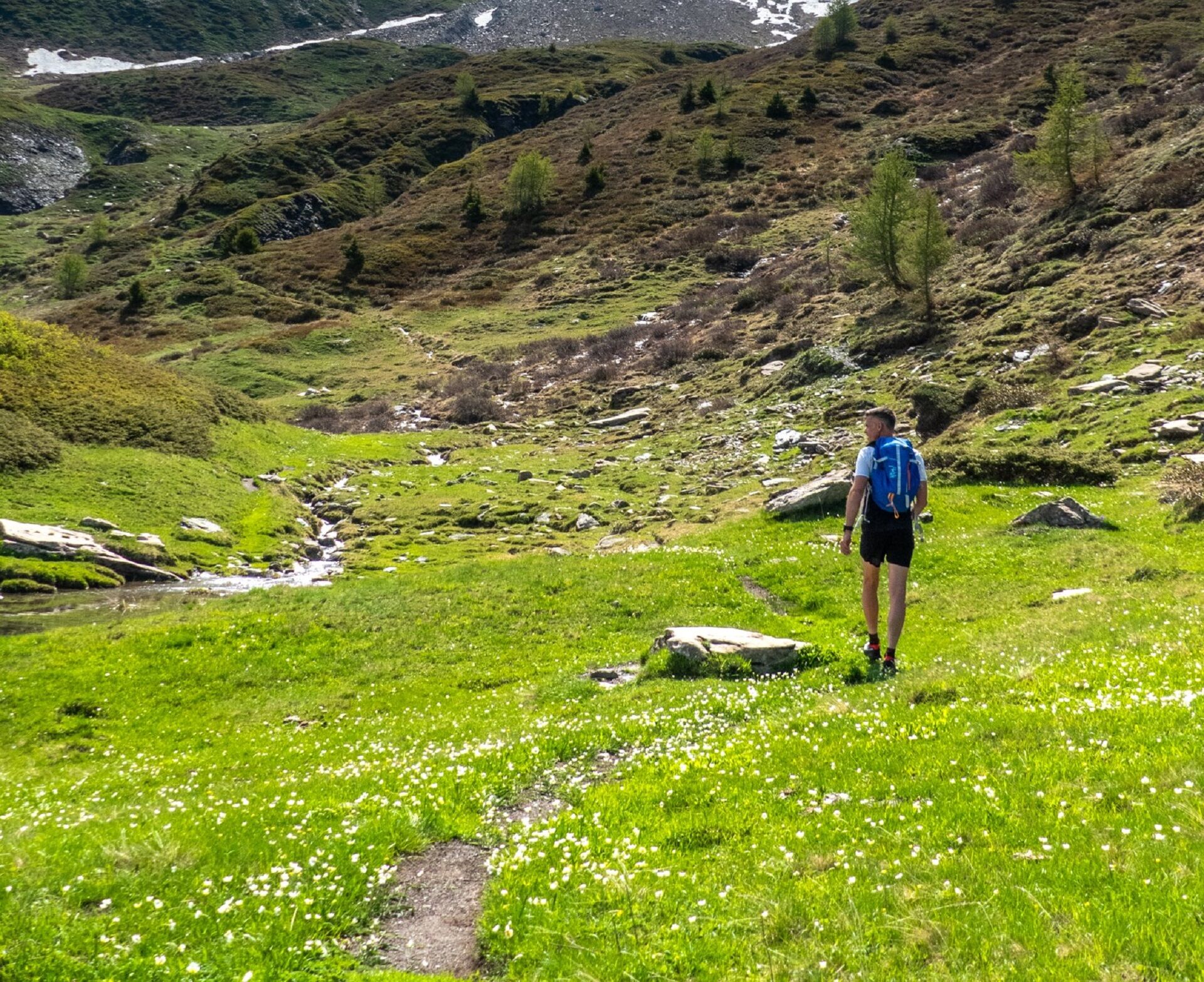
The trail winds through this wild and secluded valley, following the Avérole
torrent. The sound of water flowing through this fold in the mountains
accompanies you throughout your hike, just as it once accompanied the
peddlers selling their goods door to door as they travelled to Italy. Once upon
a time, this valley was not so sparsely populated. Look around you, there are
traces of the former bustling agricultural life everywhere! Who built this dry
stone wall that safeguard the path between hamlets? Who prayed at these
oratories and chapels dotted along the route? Who lived in these houses
with stone roofs built in the traditional mountain village style? There were
many people living here in bygone days and they've left their footprints.
Follow these footprints to the refuge, a cosy nest where you'll be welcomed
by Virginie, the guardian.
Feast your eyes on the majestic Charbonnel peak, rising to 3,752 metres,
dwarfing its neighbours that still reach 3,000 metres!
torrent. The sound of water flowing through this fold in the mountains
accompanies you throughout your hike, just as it once accompanied the
peddlers selling their goods door to door as they travelled to Italy. Once upon
a time, this valley was not so sparsely populated. Look around you, there are
traces of the former bustling agricultural life everywhere! Who built this dry
stone wall that safeguard the path between hamlets? Who prayed at these
oratories and chapels dotted along the route? Who lived in these houses
with stone roofs built in the traditional mountain village style? There were
many people living here in bygone days and they've left their footprints.
Follow these footprints to the refuge, a cosy nest where you'll be welcomed
by Virginie, the guardian.
Feast your eyes on the majestic Charbonnel peak, rising to 3,752 metres,
dwarfing its neighbours that still reach 3,000 metres!
Trasa
Vincendières
(1851 m)
Vypořádání
0.2 km
Chapelle Saint-Pierre
(1994 m)
Místo konání bohoslužeb
2.2 km
Refuge d'Avérole
(2211 m)
Úkryt
4.6 km
Fenêtre de l'Île
(2041 m)
Vchod do jeskyně
6.3 km
Vincendières
(1851 m)
Vypořádání
9.3 km
Trasa
Trail to the Avérole refuge via the hamlet
světlo
Trailrunning
9.36
km
Vincendières
(1851 m)
Vypořádání
0.2 km
Avérole
(1986 m)
Vypořádání
2.1 km
Chapelle Saint-Pierre
(1994 m)
Místo konání bohoslužeb
2.2 km
Refuge d'Avérole
(2211 m)
Úkryt
4.6 km
Fenêtre de l'Île
(2041 m)
Vchod do jeskyně
6.3 km
Vincendières
(1851 m)
Vypořádání
9.3 km
Autor
Poskytuje Haute Maurienne Vanoise
Prohlídku Trail to the Avérole refuge via the hamlet zajišťuje outdooractive.com.

Naposledy sledované
před 3 týdny

Informace o trase
Trasa
To guide you in the field, consult the "step-by-step" directional diagram provided in pdf.
Další informace a tipy
Další informace
1/ How is trail running time calculated? Trail times are calculated on the basis of reference paces for a regular runner who practices running on average 1 or 2 times a week. 600m/h ascent in altitude 900m/h ascent on descent 9km/h on the flat
2/ Using GPX tracks As hazards may occur at any time on the routes, the GPX tracks provided are not contractual. They are given for information only. Riders use them at their own risk, depending on their level of technological proficiency and their understanding of the terrain.
2/ Using GPX tracks As hazards may occur at any time on the routes, the GPX tracks provided are not contractual. They are given for information only. Riders use them at their own risk, depending on their level of technological proficiency and their understanding of the terrain.
Zatím žádné recenze
Webové kamery z prohlídky
Získejte přehled
Vždy živě na místě s více než 9 500 webkamerami. bergfex Jako uživatel Pro si nyní můžete zobrazit odpovídající webové kamery pro mnoho prohlídek v aplikaci prohlídky z. Můžete si tak přímo prohlédnout aktuální podmínky.

Oblíbené prohlídky v okolí
-
4.5
Rocciamelone partedjo dalla Riposa. Mompantero, Piemont/Italien
středníTuristika 10.6 km -
5.0
The Grand Méan lake via the Evettes circus
heavyTuristika 13.6 km -
5.0
BALME Green Lakes and Lago Paschiet
středníTuristika 7.51 km -
4.5
Hiking at Lake Clair
heavyTuristika 6.99 km -
little 'Haute-Maurienne Vanoise' circuit
heavySilniční kolo 32.0 km -
5.0
BALME Arnas Ring - Pian della Mussa
heavyTuristika 13.6 km -
USSEGLIO Lake Nero from Lake Malciaussia
světloTuristika 4.79 km -
5.0
Alta Via delle Valli di Lanzo | Stage 4 Rifugio Citt di Ciri - Rifugio Cibrario
heavyTuristika 12.0 km -
4.7
High Way of the Lanzo Valleys | Stage 6 Tazzetti Refuge - Lake of Malciaussia
středníTuristika 5.49 km -
USSEGLIO Lake behind the Tower and of the Rossa
heavyTuristika 17.1 km

Pěší turistika a stopování

Více než 550.000 návrhů výletů, podrobné mapy a intuitivní plánovač tras dělají z aplikace nezbytnou výbavu pro všechny milovníky přírody.

Nenechte si ujít nabídky a inspiraci pro vaši příští dovolenou
Přihlaste se k odběru newsletteru
Chyba
Došlo k chybě. Zkuste to prosím znovu.
Děkujeme za vaši registraci
Vaše e-mailová adresa byl přidán do poštovního seznamu.
Zájezdy po celé Evropě
Rakousko
Švýcarsko
Německo
Itálie
Slovenia
Francie
Nizozemsko
Belgie
Polsko
Lichtenštejnsko
Česko
Slovensko
Španělsko
Chorvatsko
Bosna a Hercegovina
Lucembursko
Andorra
Portugal
Iceland
United Kingdom
Ireland
Greece
Albania
North Macedonia
Malta
Norway
Montenegro
Moldova
Kosovo
Hungary
San Marino
Romania
Estonia
Latvia
Belarus
Cyprus
Lithuania
Serbia
Bulgaria
Monaco
Denmark
Sweden
Finland





