Navigace na stránkách
Pořiďte si tuto prohlídku do mobilního telefonu
Mapa
Le Pilat Rhodanien - The Balconies of Pilat Rhodanien - Loop 1.4
heavy
Silniční kolo
61.50 km
Naskenujte QR kód a spusťte navigaci v aplikaci bergfex.
QR Code
Pěší turistika a stopování

Le Pilat Rhodanien - The Balconies of Pilat Rhodanien - Loop 1.4

Vzdálenost
61.50 km
Doba trvání
04:30 h
Ascent
981 hm
Hladina moře
259 - 665 m

Úroveň obtížnosti: 5

Stažení skladby
Mapa
Le Pilat Rhodanien - The Balconies of Pilat Rhodanien - Loop 1.4
heavy
Silniční kolo
61.50 km

Sporty side
This 62 km course is difficult: fairly long distance, height difference greater than 1,000 m. It is therefore rather intended for trained cyclists.
Small gears will be useful to climb to the...

Popis
Sporty side
This 62 km course is difficult: fairly long distance, height difference greater than 1,000 m. It is therefore rather intended for trained cyclists.
Small gears will be useful to climb to the top of the four passes of the circuit (Pavezin, Grenouze, Chassenoud and Bourrin). This route allows you to discover the Rhone Pilat.

Tourism side
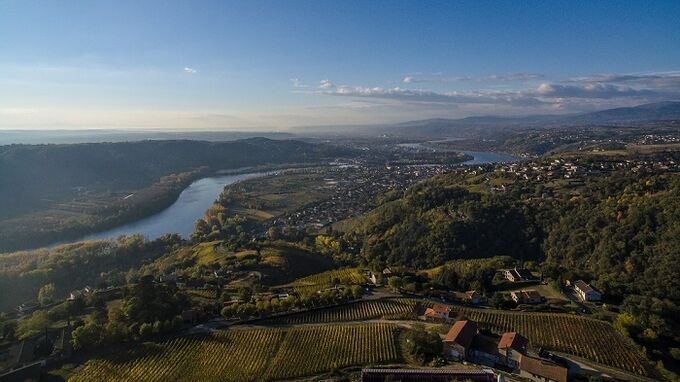
In this northern sector of the Regional Natural Park, two contrasting landscapes stand out. To the south the relief gains in altitude. The wooded hills and crests appear with their emblematic gray stone flows known locally as chirats.
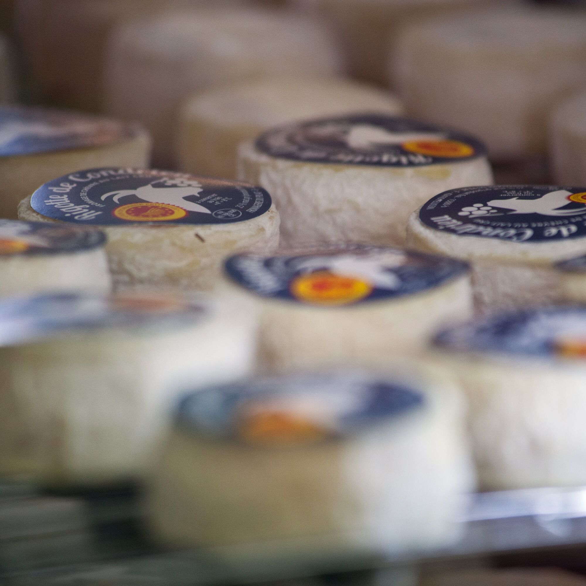
The northern facade of the massif is dominated by the plateaus. A diversified and high-quality agricultural activity is developing there, with products that can be found in the markets of the region: goat cheese, Pilat apples, etc.

Trasa
Église Saint-Joseph
(427 m)
Místo konání bohoslužeb
10.2 km
Église Saint-Jean-François-Régis
(462 m)
Místo konání bohoslužeb
13.1 km
Chapelle Sainte-Marguerite
(530 m)
Místo konání bohoslužeb
22.1 km
Église Saint-Pierre-et-Saint-Paul
(457 m)
Místo konání bohoslužeb
30.1 km
Église Notre-Dame-de-l'Assomption
(331 m)
Místo konání bohoslužeb
37.4 km
Église Saint-Martin
(367 m)
Místo konání bohoslužeb
43.5 km
Col du Bourrin
(464 m)
Horské sedlo
48.1 km
Trasa
Mapa
Le Pilat Rhodanien - The Balconies of Pilat Rhodanien - Loop 1.4
heavy
Silniční kolo
61.50 km
Chez Plasson
(353 m)
Vypořádání
0.6 km
La Couronne
(371 m)
Vypořádání
5.3 km
Le Coin
(327 m)
Vypořádání
6.3 km
Au Coin
(334 m)
Sousedství
6.8 km
Zonas
(322 m)
Vypořádání
7.3 km
Les Murettes
(355 m)
Koridor/terén
8.9 km
La Chapelle-Villars
(419 m)
Vesnice
9.9 km
Église Saint-Joseph
(427 m)
Místo konání bohoslužeb
10.2 km
Auberge de la chapelle
(427 m)
Restaurace
10.3 km
L'Oliveraie
(441 m)
Restaurace
10.6 km
Le Pras
(432 m)
Vypořádání
11.0 km
Grange Blanche
(446 m)
Vypořádání
12.3 km
Église Saint-Jean-François-Régis
(462 m)
Místo konání bohoslužeb
13.1 km
Chuyer
(458 m)
Vesnice
13.2 km
Chez Chavas
(479 m)
Vypořádání
13.4 km
Auberge du Col
(651 m)
Restaurace
16.3 km
Col de Pavezin
(652 m)
Vypořádání
16.4 km
Pavezin
(595 m)
Vesnice
16.7 km
La Côte
(657 m)
Vypořádání
16.8 km
Grenouze
(620 m)
Vypořádání
20.0 km
Chapelle Sainte-Marguerite
(530 m)
Místo konání bohoslužeb
22.1 km
La Vieille Chapelle
(532 m)
Vypořádání
22.1 km
La Chapelle-Villars
(419 m)
Vesnice
23.9 km
La Grange des Serpents
(466 m)
Koridor/terén
24.5 km
Chassenoud
(567 m)
Vypořádání
27.7 km
Le Château
(477 m)
Sousedství
29.8 km
Longes
(461 m)
Vesnice
30.0 km
Le pt’it bouchon
(457 m)
Restaurace
30.0 km
Église Saint-Pierre-et-Saint-Paul
(457 m)
Místo konání bohoslužeb
30.1 km
Le Plantier
(447 m)
Koridor/terén
30.4 km
La Bernardière
(416 m)
Vypořádání
32.5 km
Le Colombet
(362 m)
Vypořádání
34.1 km
La Dhuire
(363 m)
Vypořádání
36.1 km
Le Garon
(367 m)
Vypořádání
36.7 km
Les Pierres Blanches
(351 m)
Sousedství
37.3 km
Église Notre-Dame-de-l'Assomption
(331 m)
Místo konání bohoslužeb
37.4 km
Trèves
(329 m)
Vesnice
37.5 km
Grosjean
(339 m)
Vypořádání
38.0 km
Le Toret
(332 m)
Vypořádání
40.9 km
La Blanchette
(337 m)
Vypořádání
41.7 km
Le Pré
(366 m)
Vypořádání
43.2 km
Église Saint-Martin
(367 m)
Místo konání bohoslužeb
43.5 km
Échalas
(366 m)
Vesnice
43.5 km
Saint-Martin
(371 m)
Sousedství
43.8 km
Le Lac
(436 m)
Vypořádání
45.1 km
La Groirie
(436 m)
Vypořádání
45.9 km
Le Bourrin
(465 m)
Vypořádání
47.9 km
Col du Bourrin
(464 m)
Horské sedlo
48.1 km
Le Recru
(435 m)
Vypořádání
51.5 km
Le Girard
(487 m)
Vypořádání
52.6 km
Tartaras
(353 m)
Vypořádání
56.8 km
Informace o prohlídce

The Rhone Pilat offers magnificent bike rides for experienced or more occasional cyclists.

Technologie
5 / 6
Stav
6 / 6
Krajina
5 / 6
Zkušenosti
5 / 6
Nejlepší roční období
Led
Úno
Bře
Dub
Kvě
Čen
Čec
Srp
Zář
Říj
Lis
Pro
Sdílet prohlídku
Mapa
Le Pilat Rhodanien - The Balconies of Pilat Rhodanien - Loop 1.4
heavy
Silniční kolo
61.50 km
Chyba
Došlo k chybě. Zkuste to prosím znovu.
Informace o trase
Geologické zajímavosti

Ano

Vybavení

Good habits:

To safely enjoy your ride, here are our tips:

- Check the condition of your bike before departure (brakes, transmission, tightness of screws, ...) and the battery for electric bikes

- Wear a helmet, and keep it on while climbing

- Wear clothing suitable for the activity and the weather

- Bring water and food

- Carry a repair kit (tools, inner tube, pump...)

- Do not overestimate your skills

- Study the route before leaving

- Inform someone close about the loop you will do

- Have the phone number of a contact person in case of an accident

Bezpečnostní pokyny

Cycling tourists are subject to and must respect the highway code (pedestrian crossings, yield signs, traffic lights, etc.). The road belongs no more to cyclists than to motorists. The highway code specifically prohibits cyclists from riding side by side when a car is overtaking.

Informace o příjezdu
Příjezd

45 min via the A7 motorway.

Veřejná doprava

Saint-Clair-les-Roches station, direction Valence-Ville from Lyon.

Parkování

Parking near the starting point

Další informace a tipy
Úroveň obtížnosti

5

Další informace
APIDAE Tourism data updated on 13/11/2022 by "Rhône Tourisme".
An error on this sheet? Write to the owner mentioning these references:
Sheet name: Le Pilat Rhodanien - Les Balcons du Pilat Rhodanien - Loop 1.4 | Sheet ID: 5799189 | URL (link) of this Outdooractive page.
Pěší turistika a stopování

Pěší turistika a stopování

Pěší turistika a stopování
Více než 550.000 návrhů výletů, podrobné mapy a intuitivní plánovač tras dělají z aplikace nezbytnou výbavu pro všechny milovníky přírody.
bergfex