


Suonen hike Visperi
“Suonen” is the term for the historic irrigation channels in Valais, most of which are still preserved or even in operation today. They were used by farmers to channel the valuable water from mountain...
“Suonen” is the term for the historic irrigation channels in Valais, most of which are still preserved or even in operation today. They were used by farmers to channel the valuable water from mountain streams onto orchards, pastures, and vineyards on the slopes to protect them from drought. The “Visperi” takes its water from the Gamsa in the Nanztal, then crosses forests, meadows, and steep rock passages, and finally ends above Visp. The hike takes you in 15 minutes from Visp station onto the historic paths along the Suone and lets you experience the impressive paths of the water. If you like, you can extend your hike by 45 minutes with the chestnut forest loop around Eyholz.


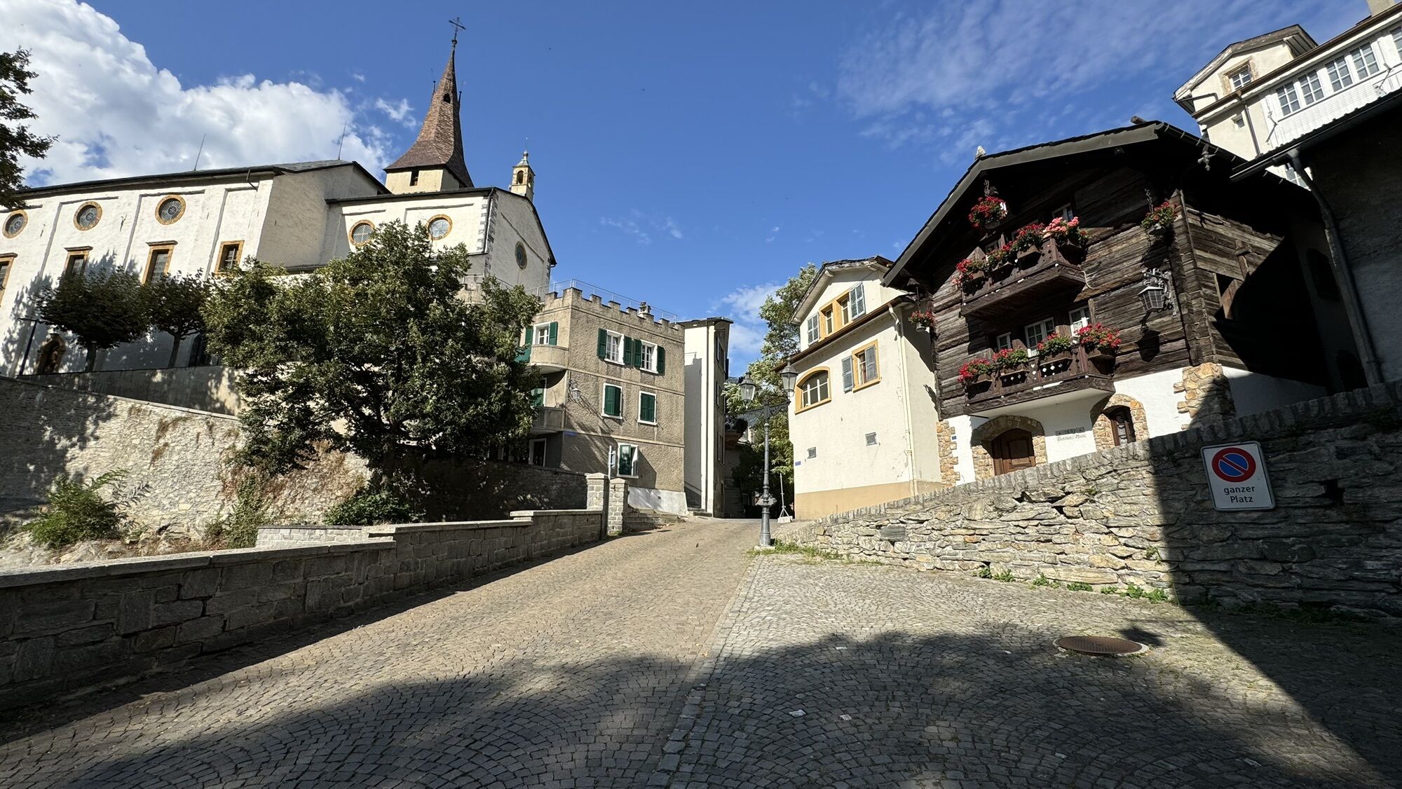
From the station in Visp, first walk through Bahnhofstrasse towards the old town with the Martinskirche. At the cemetery, turn left and hike to the upper city edge. There, after the place name sign on the street toward Visperterminen, you will find the trailhead to the Visperi on the left. Eastward, the path leads along the Suone through lush meadows into the chestnut forest. Soon you reach the Schlegel, which – driven by a water wheel – signaled the flow of water to the Vispern through its knocking sounds. Then the terrain becomes rockier and drops steeply to the left. Here you need some surefootedness and a head for heights. The most difficult passages are, however, equipped with handrails. Far from the city, you can admire the course of the Suone, the blooming splendor, and the views over Visp. Soon you reach the open terrain above Eyholz and descend into the village. If you like, you can extend your hike by 45 minutes with the chestnut forest loop. After the descent, you can return to Visp in a few minutes by train or post bus.
Sturdy footwear, weather-appropriate clothing, trekking poles if needed, water
Some sections are exposed and therefore require surefootedness and a head for heights. The most difficult sections are, however, equipped with handrails.
Via Bern and Lötschberg car shuttle, direction Brig to Visp
By train to Visp station
Fee required at Visp station
An unforgettable panoramic view of the Rhone Valley.
Oblíbené prohlídky v okolí
- 3.8
Höhenweg Saas-Fee - Grächen
Turistika 12.0 km - 4.0
NATICHERBERG CIRCULAR TRAIL
středníTuristika 12.1 km Panoramaweg Visperterminen
světloTuristika 9.72 km- 5.0
Moosalp Panoramaweg
světloTuristika 6.36 km Gibidumpass
světloTuristika 11.6 km- 5.0
Jolischlucht
středníTuristika 8.06 km Hannigalp-Seetal-Hannigalp
středníTuristika 10.4 kmVilla Cassel - Hohfluh - Blausee - Moosfluh - Moränenweg - Villa Cassel
středníTuristika 8.49 kmFinnen-Honegga-Brischeru-Salwald-Finnen
světloTuristika 10.8 kmSimplon-Staldenhorn- Simplon
středníTuristika 8.27 km

Pěší turistika a stopování


Nenechte si ujít nabídky a inspiraci pro vaši příští dovolenou
Vaše e-mailová adresa byl přidán do poštovního seznamu.