


Col de la Croix de Cœur – Mythical Alpine Passes
Úroveň obtížnosti: 6
From Aproz, first drive towards the village of Fey. At the village exit, a short but quite steep climb towards the main road presents the first challenge. On the main road, you pass through Basse-Nendaz,...
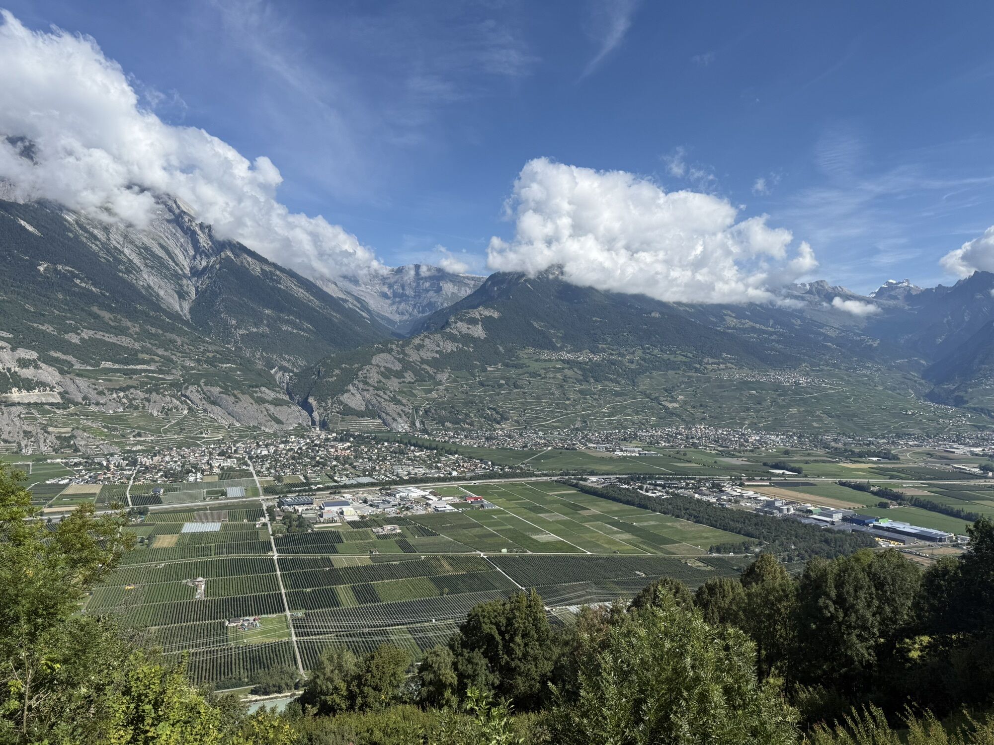
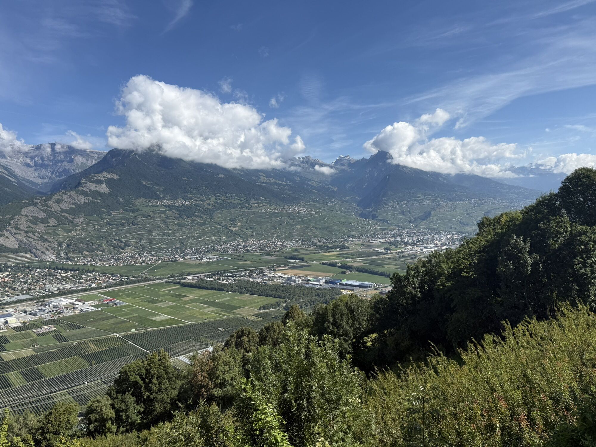
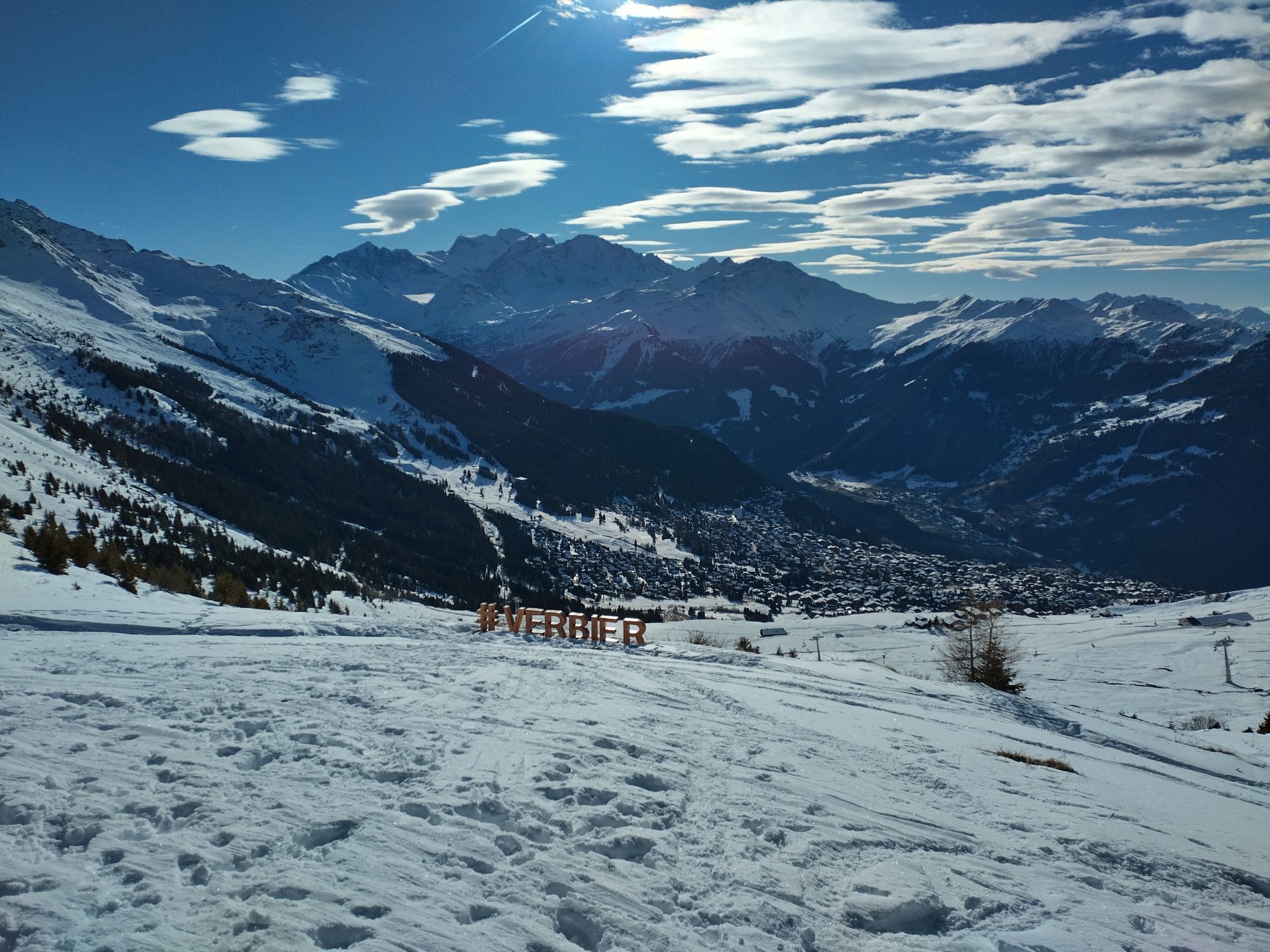
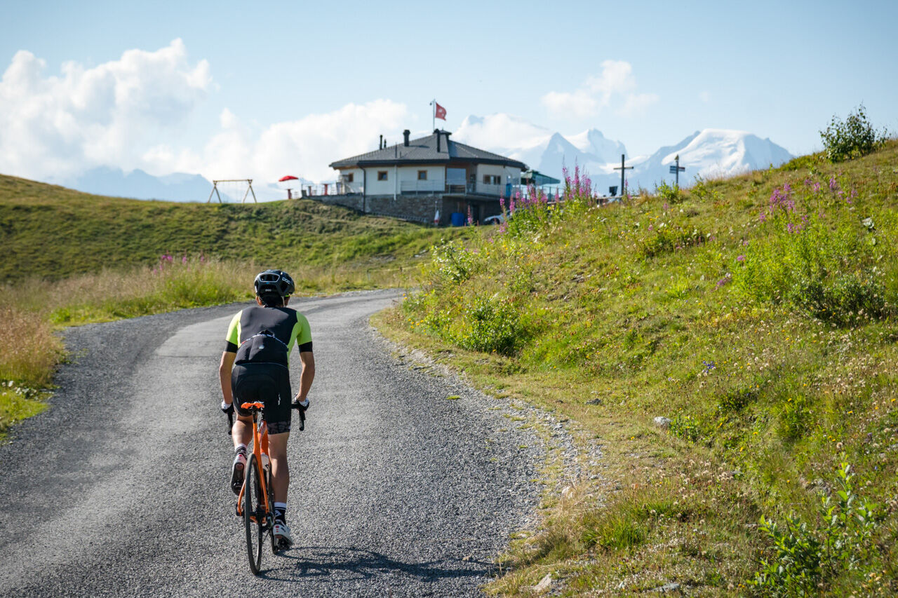
From Aproz, first drive towards the village of Fey. At the village exit, a short but quite steep climb towards the main road presents the first challenge. On the main road, you pass through Basse-Nendaz, where you turn onto the lightly trafficked road to Saclentse. Up to this point, the route follows the same path as the one leading to the Cleuson dam. Turn right at the entrance of Haute-Nendaz and pass through the village center before descending on a winding road with views of the valley towards Isérables. A sharp left turn leads you over a wooden bridge and an unpaved section to La Tzoumaz. At the village exit, the road winds through the forest and then crosses alpine pastures until the pass at 2173 meters altitude. The last section runs on a paved gravel road and offers a wonderful view of the Val de Bagnes landscape and the holiday resort Verbier below upon arrival at the pass.

From Aproz, take the road towards the village of Fey and then continue to Basse-Nendaz. Here the route turns left. Follow this path for 1.7 kilometers before turning left and continuing on a small, lightly trafficked road via Saclentse. Up to this point, the route follows the same path as the one leading to the Cleuson dam. Turn right towards Haute-Nendaz and then descend towards Isérables. A sharp left turn leads you over a wooden bridge and an unpaved, steep section to La Tzoumaz. At the exit of the village, the road winds through the forest and then passes over alpine pastures up to the pass at 2173 meters altitude. The last section runs on a paved gravel road.
Our recommendation: Technically flawless bike, helmet, gloves and bell, weather-appropriate clothing depending on conditions (always bring rain protection), drink and snacks.
Respect the rules of Swiss road traffic. Traveling on this route is at your own risk; all liability is excluded. Respect the flora and fauna in your surroundings. For your safety, we recommend wearing a bicycle helmet. Emergency numbers: 144 Ambulance / 117 Police /1414 Rega.
Assess your own skills and fitness well. Traveling on the various routes is always at your own responsibility.
Motorway A9 to exit 25 Conthey or 26 Sion-Ouest. Then follow the cantonal road to the village of Aproz.
Regional trains on the Simplon–Brig line. Stops at St-Pierre-de-Clages or Sion.
Parking available at Domaine des Îles (municipality of Sion).
6
More information :
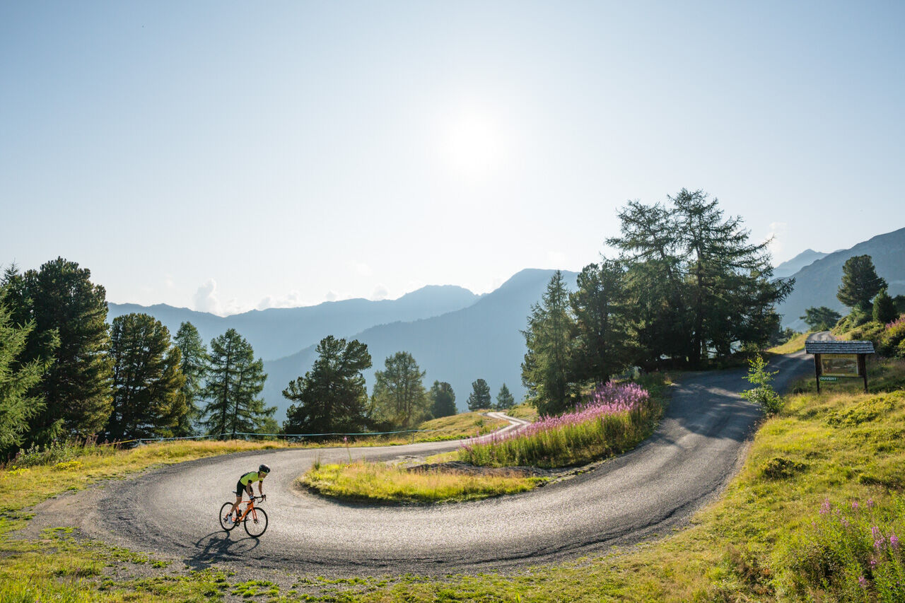
La TzoumazFrom Saclentse, follow in the footsteps of cycling champions Cadel Evans, Primoz Roglic, and Alberto Contador, who raced the final of the cycling race “Tour des Stations” on this route! For safety, carry two spare inner tubes to be prepared for any punctures on the several kilometers of gravel road.
Webové kamery z prohlídky
Oblíbené prohlídky v okolí
- 5,0
From Saillon to the Farinet suspension bridge
středníTuristika 7,86 km From Savoleyres to the mountain lake Lac des Vaux
středníTuristika 14,0 km- 5,0
Sentier des bouquetins
středníTuristika 8,73 km - 4,5
Cleuson Dam
středníTuristika 11,5 km Tour du Grand Chavalard
středníTuristika 14,9 km- 4,0
Tripon - Brac – Ancien Bisse du Torrent Neuf – St. Marguerite – Torrent Neuf – Prafirmin - St. Germain
světloTuristika 12,9 km - 4,5
The Larches of Balavaux
světloTuristika 11,0 km - 5,0
Tour de La Seya hike
středníTuristika 8,09 km - 4,0
Sentier des Chamois
heavyTuristika 11,6 km - 4,0
Belvédère via ferrata
středníVia ferrata 1,81 km

Pěší turistika a stopování


Nenechte si ujít nabídky a inspiraci pro vaši příští dovolenou
Vaše e-mailová adresa byl přidán do poštovního seznamu.