


Flowtrail Crans-Montana - Sierre
Úroveň obtížnosti: S2
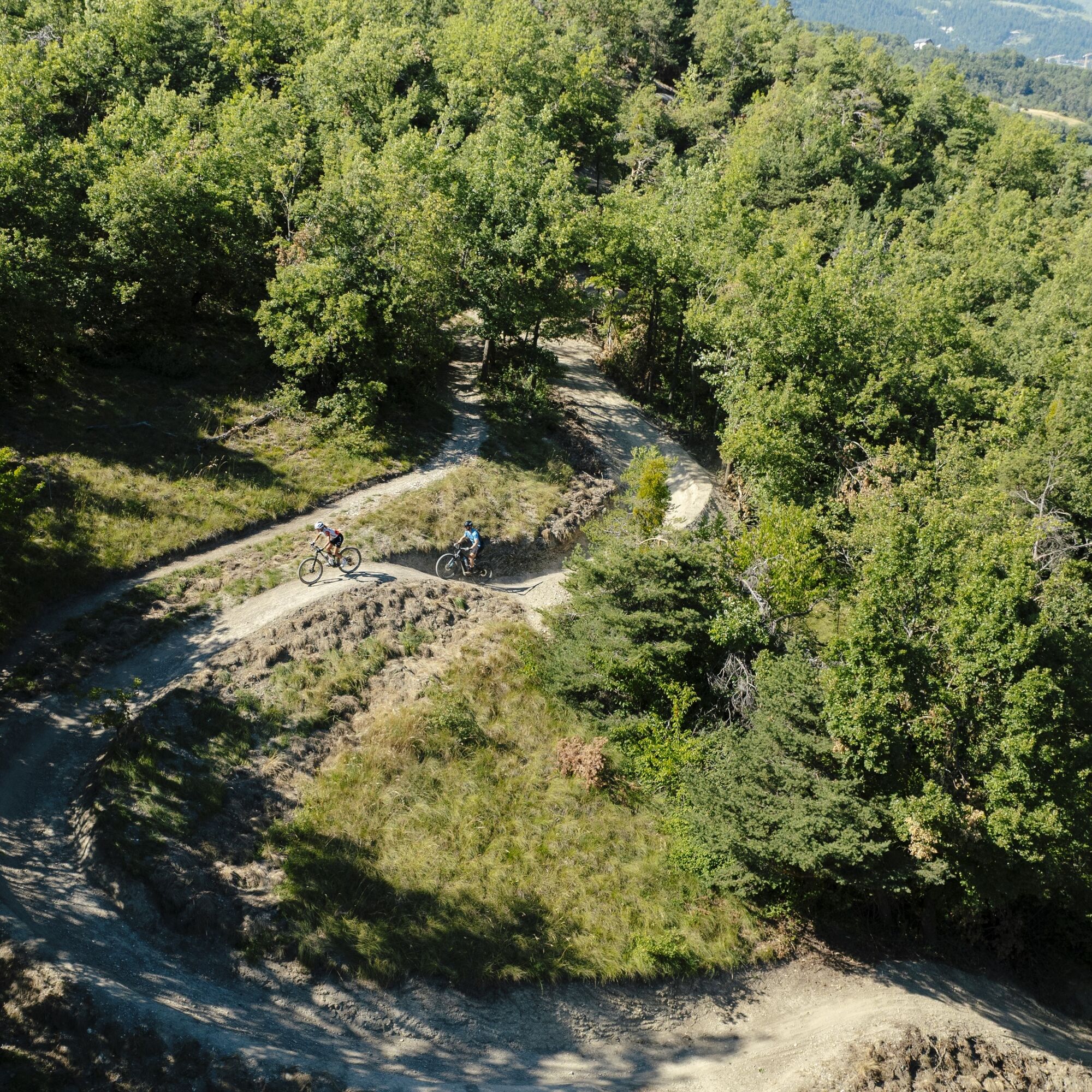
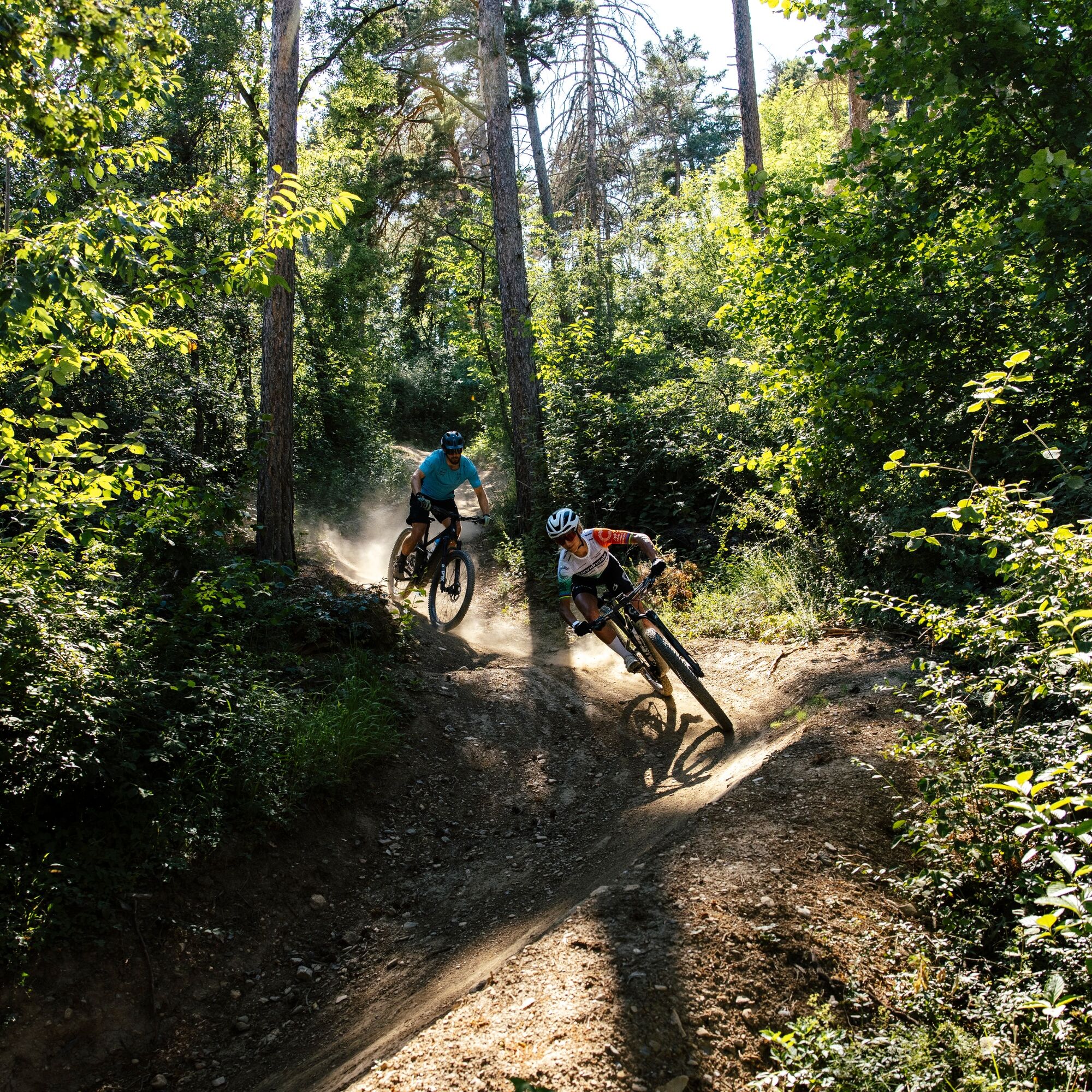
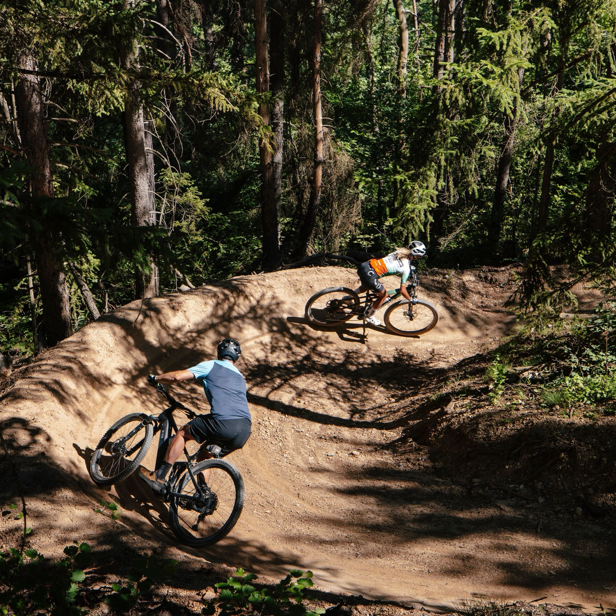
This route connects Crans-Montana to Sierre in a long 9-kilometer descent designed for pleasure. From the start, the trail plunges into a succession of banked turns, fast sections, and more technical but...
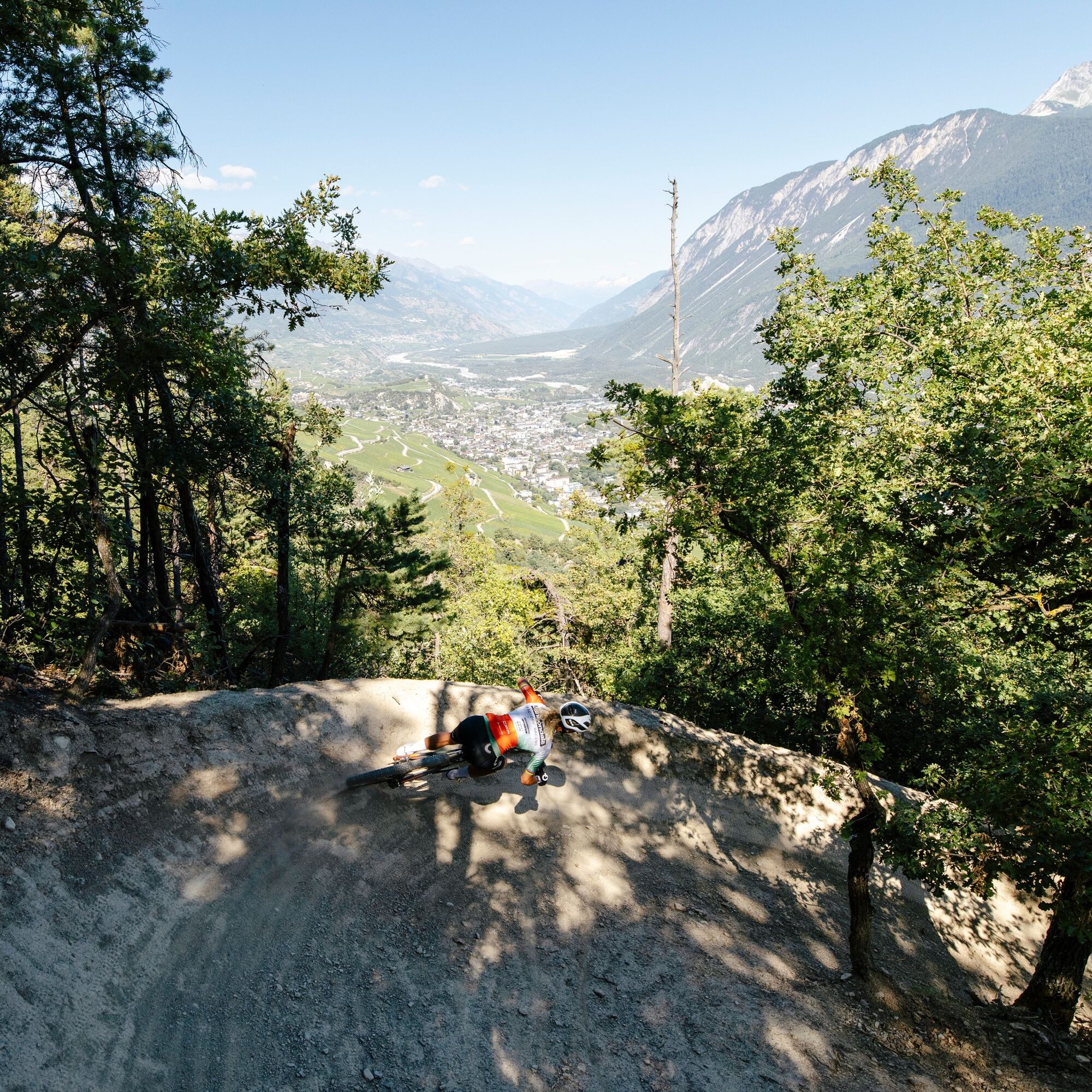
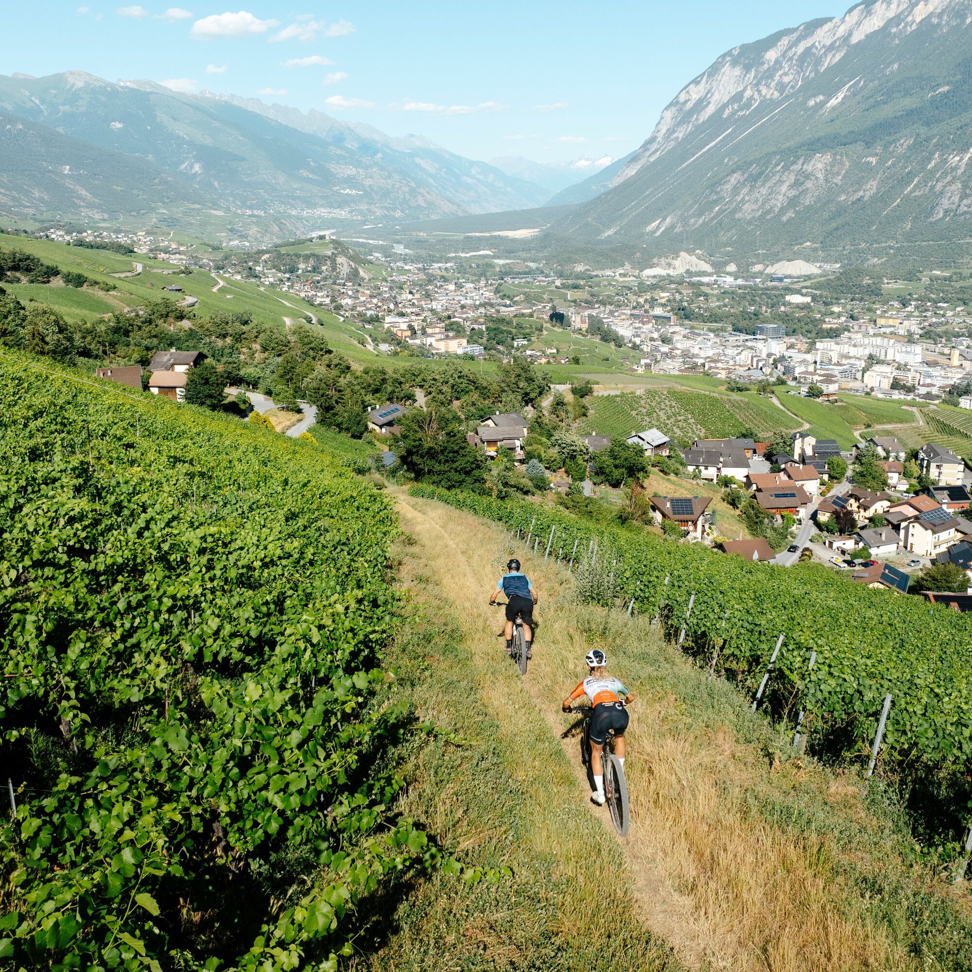
This route connects Crans-Montana to Sierre in a long 9-kilometer descent designed for pleasure. From the start, the trail plunges into a succession of banked turns, fast sections, and more technical but always accessible passages. Throughout the descent, the pace remains sustained and playful, offering riders the chance to link their moves smoothly and test their speed safely. The variety of scenery adds to the experience: shaded forests, crossings of Alpine villages, and sunny vineyards follow one another, while the view regularly opens up to the Rhône valley and the Valais Alps. The route finishes directly at the start of the Sierre funicular, convenient for returning to Crans-Montana and completing the adventure. With just over 900 meters of negative elevation, this unique flowtrail promises an intense, varied, and memorable adventure, ideal for all who love to combine thrills and landscapes.
Prepare your mountain bike outing
The rules of good conduct
Evaluate your physical condition and abilities well. The use of the various routes is always at your own risk.
From the A9 Sierre-west motorway exit, follow signs towards Crans-Montana (about 20-25 minutes) then Montana-center or â½ðð¾ð§, âº, or Adventure Park. At Moubra, parking is available on site.
From the Sierre CFF train station, go to the SMC funicular station and take it towards "Crans-Montana, station" (last stop, about 13 minutes journey, departures 3x/hour). At the funicular exit:
Ride about 6 minutes to reach the start of the route at Moubra.or Free shuttles from the SMC bus company serve the entire Crans-Montana resort. The closest stop to the start is "Lac Moubra" on lines 433 or 436.
The free parking at Moubra is available on site.
S2
Oblíbené prohlídky v okolí
- 5,0
Bella-Tola
středníVysokohorská turistika 6,72 km - 4,7
Leukerbad - Gemmipass - Lämmerenhütte
středníTuristika 9,49 km - 4,0
Grand Bisse de Lens
světloTuristika 8,73 km - 4,0
Gemmipass - Lämmerenhütte - Rote Totz Lücke - Daubensee - Gemmipass
středníTuristika 13,7 km - 4,0
Tripon - Brac – Ancien Bisse du Torrent Neuf – St. Marguerite – Torrent Neuf – Prafirmin - St. Germain
světloTuristika 12,9 km Gratweg
Via ferrata 5,16 kmTalabfahrt (Rinderhütte-Tunnel-Folljeret-Leukerbad)
Turistika 7,78 km- 4,0
Wolfstritt
Turistika 7,02 km - 5,0
Klettersteig Daubenhorn
heavyVia ferrata 5,34 km - 4,0
Belvédère via ferrata
středníVia ferrata 1,81 km
Pěší turistika a stopování


Nenechte si ujít nabídky a inspiraci pro vaši příští dovolenou
Vaše e-mailová adresa byl přidán do poštovního seznamu.