



Tour of the Alpine Pastures

Úroveň obtížnosti: S1
The start of your route is at the valley station of the gondola from Anzère. The first stage is the easiest, as you take the gondola to the middle station. From there, you cross the alpine pastures of...
The start of your route is at the valley station of the gondola from Anzère. The first stage is the easiest, as you take the gondola to the middle station. From there, you cross the alpine pastures of Anzère, where you can certainly admire Eringer cows. After arriving at "Les Rousses" you ride down the road leading to the Tseuzier dam. Above Pracombère, a small alpine pasture, you take the dirt road, on which you ride to the right up to the Suone of Sion. Then follow this Suone to the alpine pasture of Griellesses and continue on the road "Les Luys" back to the starting point.



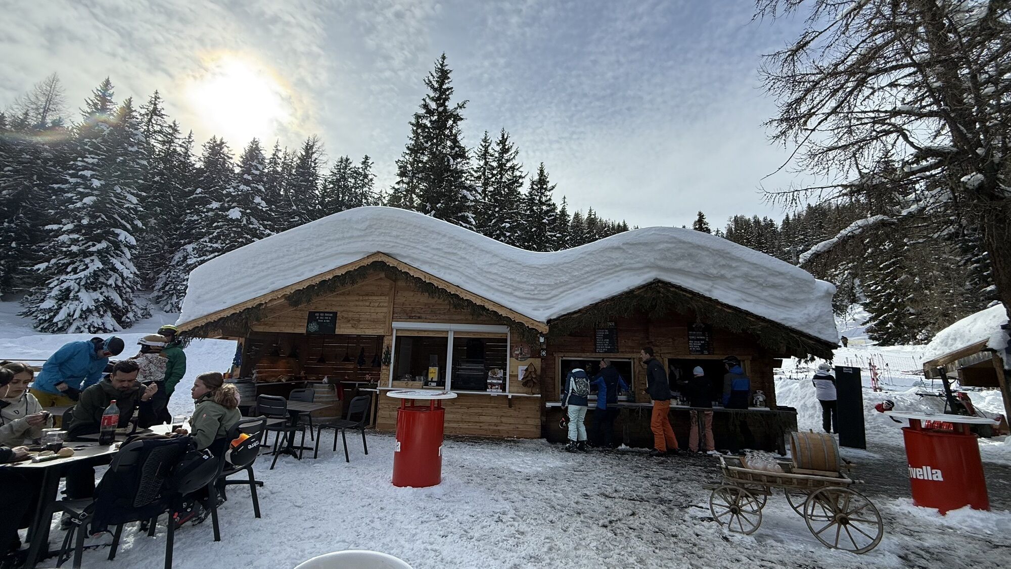
Before you can get on your bike, take the gondola from Anzère to the middle station. From there, a gentle descent leads to Alpe Tsalan. There you can take a break at Rosemarie's refreshment stand and enjoy the magnificent panorama. Then continue towards the Duex and Serin Alps, where you can observe the impressive Eringer cows with their combative character. You will ride down to Les Rousses, where you will reach the road leading to the Tseuzier dam. Ride down this road to Pracombère. Above this charming alpine pasture, take the dirt road to the Suone of Sion. Follow this Suone to the alpine pasture of Griellesses and continue on the road of Les Luys back to the starting point gondola.
Ano
Our recommendation:
Technically flawless bike Helmet, gloves, and bell Weather-appropriate clothing (always with you: rain protection) Drink and food.The mountains, a place of joy to share and respect. The mountain world is a place to meet and experience unforgettable moments together – whether by bike or on foot. So that all users can benefit from it, it is essential to share this space with respect for nature and agriculture. Respectful behavior allows everyone to pursue their leisure activities under the best conditions. Get informed about recommendations and rules.
Assess your own skills and fitness well. Riding the different routes is always at your own risk.
Sion East highway exit towards Ayent/Anzère
PostBus from Sion to Anzère and to Les Rousses
Several parking lots are available in Anzère
S1
More information: Anzere
Take the opportunity during a break to taste local products and enjoy the view of the majestic Valais 4000-meter peaks.
Webové kamery z prohlídky

Oblíbené prohlídky v okolí
- 4,6
Leukerbad - Gemmipass - Lämmerenhütte
středníTuristika 9,49 km - 4,2
Grand Bisse de Lens
světloTuristika 8,73 km - 4,6
Lauenen - Höji - Bühlhaus Lauenensee
středníTuristika 9,03 km - 4,0
Gemmipass - Lämmerenhütte - Rote Totz Lücke - Daubensee - Gemmipass
středníTuristika 13,7 km - 4,0
Tripon - Brac – Ancien Bisse du Torrent Neuf – St. Marguerite – Torrent Neuf – Prafirmin - St. Germain
světloTuristika 12,9 km - 5,0
Klettersteig Daubenhorn
heavyVia ferrata 5,34 km - 5,0
Grand bisse d’Ayent
středníTuristika 11,7 km - 5,0
Family-friendly Tsittoret bisse
světloTuristika 7,14 km - 4,0
Belvédère via ferrata
středníVia ferrata 1,81 km - 4,7
Leiterli (Bergstation) - Berghaus Leiterli
světloTuristika 7,45 km
Pěší turistika a stopování


Nenechte si ujít nabídky a inspiraci pro vaši příští dovolenou
Vaše e-mailová adresa byl přidán do poštovního seznamu.


