


"Col di Lana" mountain
The "Col di Lana", 2452 meters high, is the most famous mountain in our area, both for its landscape value and its historical importance. It is in fact central to important dolomitic groups, such as "Tofane",...
The summit can be reached from four different directions: from the south starting from "Pieve di Livinallongo", from the east starting from the village "Castello", from the north coming from the "Sief" saddle, from the west from the "Corte" Village.
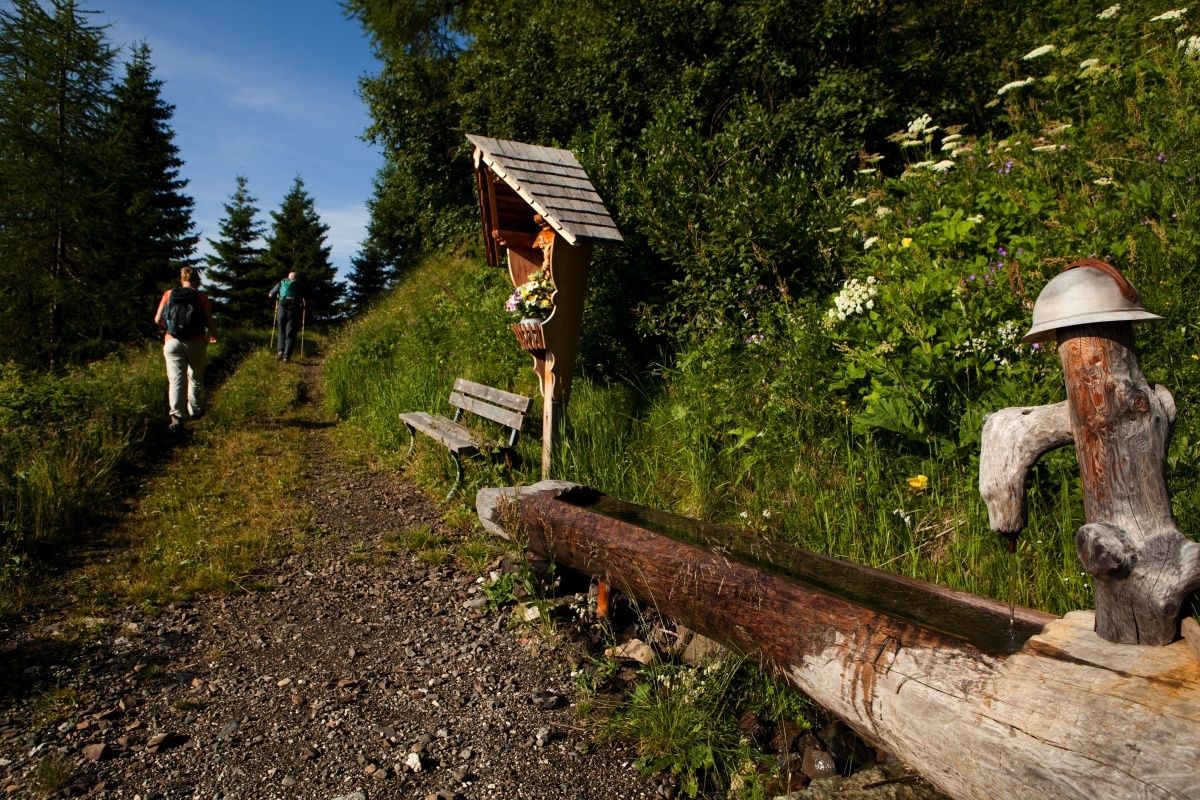
The most common starting point is "Pieve di Livinallongo", which can be reached by car until the village of "Palla". From here, following the path CAI 21 /a, the difference in height is 776 meters and you reach the top in about three hours. First follow a dirt road that runs through the woods; at "Pian de la Lasta", where there is a former refuge, you can continue on the dirt road or turn left onto the path that runs through the "Bosco dell'Impero". Both routes lead to the "Plan de la Chicia".
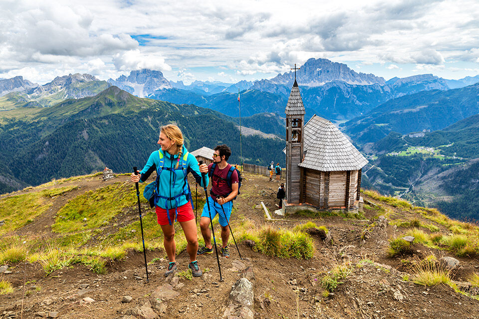
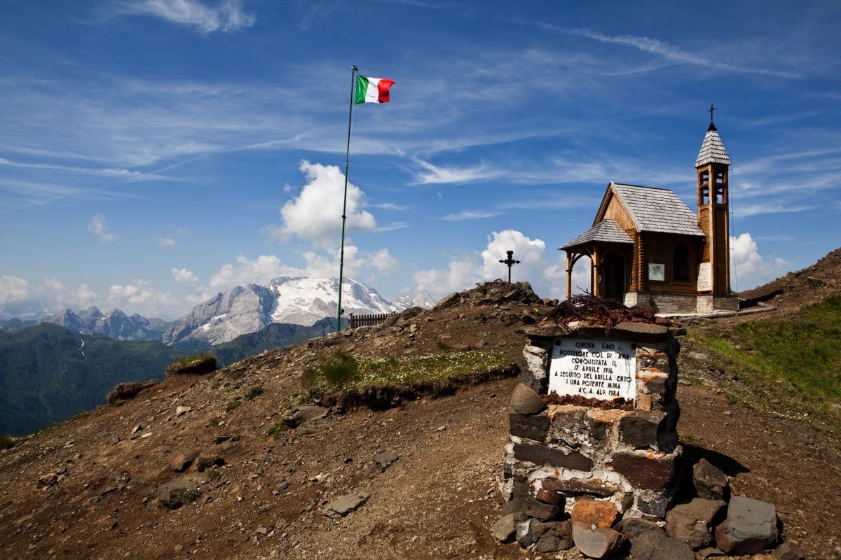
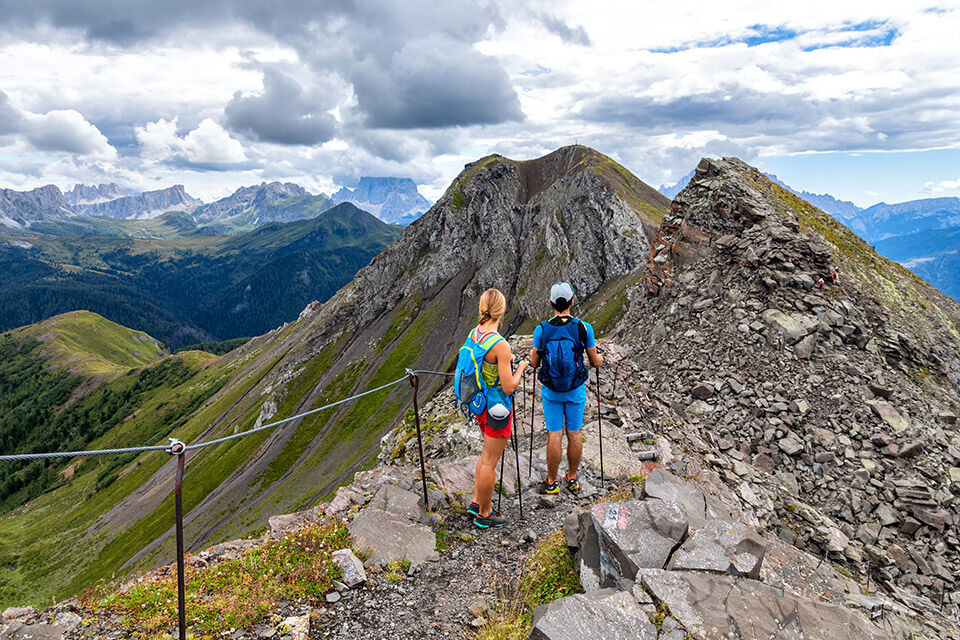
Climb up to "Ciadiniei" (an important Austro-Hungarian post called "Panettone" by the Italians and Infanteriestellung by the adversaries). You then come to a characteristic rocky jump called "Napoleon's Hat". From here the climb becomes more steep up to the nearby peak, characterized by the crater of the mine. There is a commemorative chapel and a bivouac. The view is great.

From the Village of "Pieve di Livinallongo", take the uphill road to the village of "Palla", the starting point of the trail.
Ano
Ano
The hiker's kit:
waterproof backpack or backpack with waterproof cover (not too big if the hike is short)
topographic map (or a local map with recommended paths)
compass and altimeter (or a sports watch)
binoculars
water bottles
energy bars or snacks
chocolate
sandwiches (or lunch in a mountain hut)
breathable t-shirt
substitute T-shirt (preferably breathable)
sweatshirt or pile
windproof and waterproof jacket
shorts
long trousers
long socks (long or mid-calf)
multi - sport boots soft and snug on the ankle
light hat/headband
anti-glare
sunglasses
sun cream
telescopic poles
first aid kit (plasters, disinfectant, gauzes, etc.)
The telephone number in case of emergency is 112 or 118 (ambulance).
By train
Nearest railway stations
Belluno - 70 km Brunico - 48 km Ponte Gardena - 51 kmBy bus
Brunico - 47 Km connection by SAD line www.sad.it Belluno - 70 km - connected by the Dolomitibus www.dolomitibus.itBy plane
Venice Treviso/Venice Marco Polo - 160/170 km Innsbruck - 140 km Verona - 270 km Milan Bergamo/Milan Malpensa - 310/400 kmFree parking in "Palla" Village.
There is no rest stop along the way, so you should take water and food with you.
It is reccomended to visit the small commemorative chapel of the First World War.
"The vademecum of the sustainable hiker":
choose the route according to your physical and technical abilities before the start, read up on the route you intend to take (distances, height difference, hours spent, springs, fountains, refuges, lifts, bivouacs, etc.). check the condition of the chosen path never undertake a hike alone always take the rubbish back to the village please stay on the marked trails lease be quiet do not pick up stones or minerals do not feed animals do not light fires do not pick up flowers or plantsOblíbené prohlídky v okolí
-
4.6
Pordoi Pass - Sass Pordoi - Forcella Pordoi - Piz Boè - Boè Refuge - Forcella Pordoi - Pordoi Pass
heavyTuristika 8.39 km -
4.4
Dolomiten Sellagruppe, Alb. Col di Lana, Sas de Pordoi, Piz Boé retour 22.06.2016
středníTuristika 5 km -
4.6
Five Towers circuit (Averau, Nuvolau and Scoiattoli huts) from Passo Giau
středníTuristika 10.8 km -
4.7
Passo Giau roundtrip
středníTuristika 8.10 km -
4.9
Pisciadùsteig Sella Gruppe
středníVia ferrata 7.15 km -
5.0
Via Ferrata "Cesare Piazzetta"
heavyVia ferrata 9.07 km -
4.2
Viel dal pan
světloTuristika 6.60 km -
3.0
Lieutenant Mario Fusetti Via Ferrata
středníVia ferrata 4.22 km -
5.0
Magnifique et très variée
středníTuristika 12.6 km -
4.0
Sellastock - Der Berg der Ladiner
Turistika 8.56 km
Pěší turistika a stopování


Nenechte si ujít nabídky a inspiraci pro vaši příští dovolenou
Vaše e-mailová adresa byl přidán do poštovního seznamu.