


"Arabba - "Burz" mountain
Fotografie našich uživatelů
-

 © AntonioVytvořeno dne 05.03.2026
 -
 © Fehér KristófVytvořeno dne 05.02.2026
 -
 © Bartek JatczakVytvořeno dne 04.02.2026
 -
 © Fehér KristófVytvořeno dne 02.02.2026
 -
 © Mariusz KozlowskiVytvořeno dne 29.01.2026
 -
 © István Gábor 1Vytvořeno dne 03.06.2025
 -
 © István Gábor 1Vytvořeno dne 03.06.2025
 -
 © István Gábor 1Vytvořeno dne 01.06.2025
 -
 © István Gábor 1Vytvořeno dne 01.06.2025
 -
 © István Gábor 1Vytvořeno dne 01.06.2025
 -
 © István Gábor 1Vytvořeno dne 01.06.2025
 -
 © István Gábor 1Vytvořeno dne 01.06.2025
 -
 © István Gábor 1Vytvořeno dne 01.06.2025
 -
 © Massimiliana BattagliniVytvořeno dne 26.03.2025


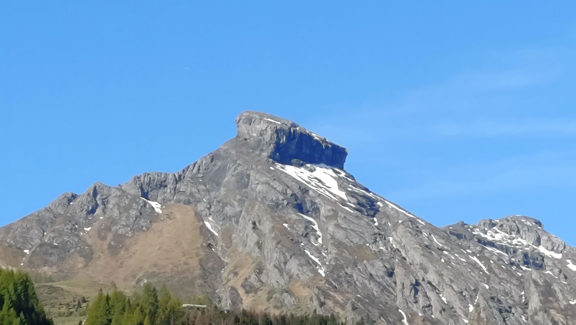
An easy walk suitable for families and for those who are in the "Fodom" valley just for one day.
You will reach the Mount "Burz" by taking the homonym chairlift from the centre of "Arabba".
From here you...
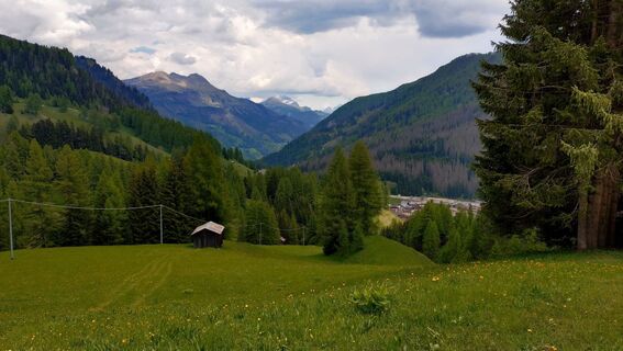
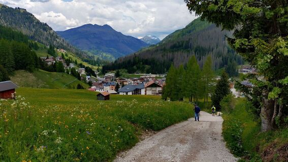
An easy walk suitable for families and for those who are in the "Fodom" valley just for one day.
You will reach the Mount "Burz" by taking the homonym chairlift from the centre of "Arabba".
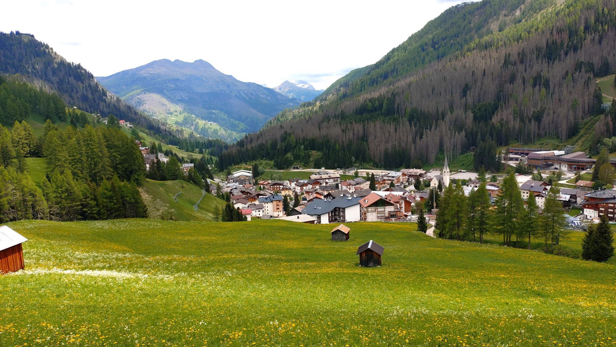
From here you can admire the "Sella" Group the picturesque village of "Arabba" on the opposite side of the valley.
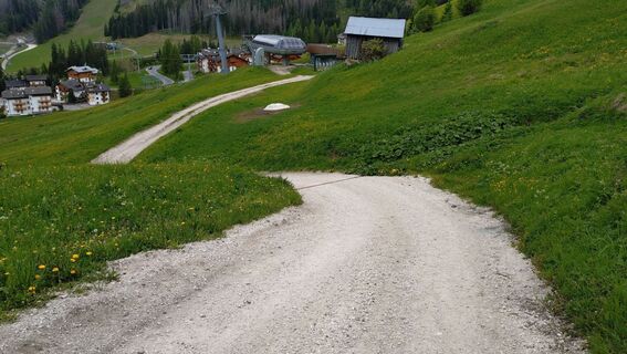
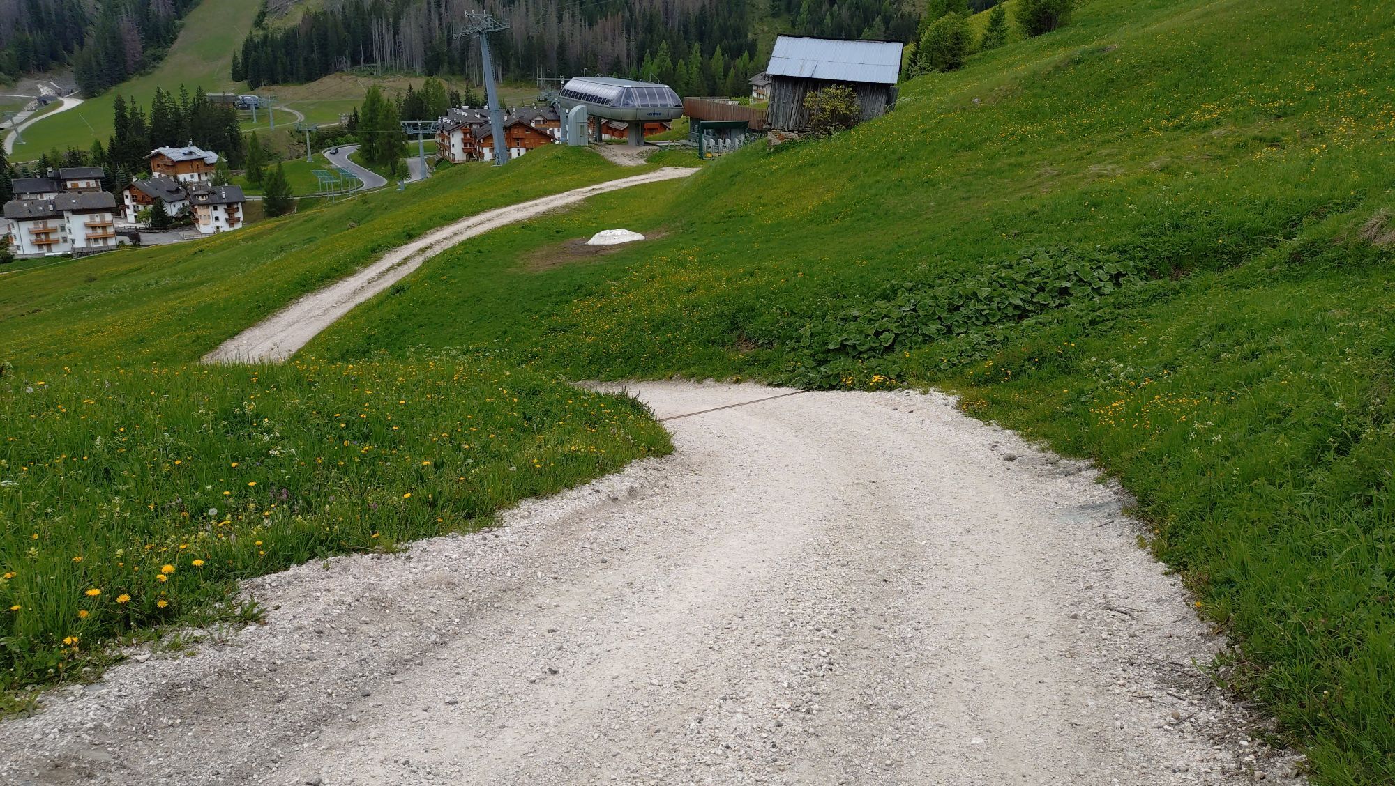
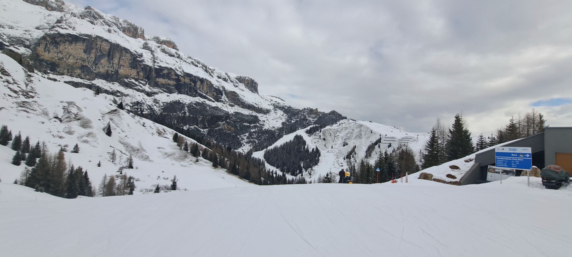
From here continue on the dirt road in the direction of "Arabba" and then continue on CAI path n. 637.
The walk is all downhill among flowering meadows and can also be done on the other way as the climb is gentle.
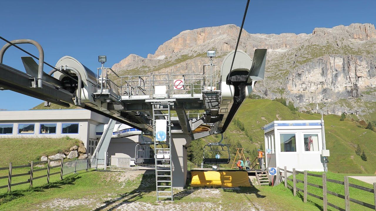


You will reach the Mount "Burz" by taking the homonym chairlift from the centre of "Arabba".
From here you can admire the "Sella" Group the picturesque village of "Arabba" on the opposite side of the valley.
From here continue on the dirt road in the direction of "Arabba" and then continue on CAI path n. 637.
The walk is all downhill among flowering meadows and can also be done on the other way as the climb is gentle.
Ano
Ano
The hiker's kit:
waterproof backpack or backpack with waterproof cover (not too big if the hike is short) topographic map (or a local map with recommended paths) compass and altimeter (or a sports watch) binoculars water bottles energy bars or snacks chocolate sandwiches (or lunch in a mountain hut) breathable t-shirt substitute T-shirt (preferably breathable) sweatshirt or pile windproof and waterproof jacket shorts long trousers long socks (long or mid-calf) multi - sport boots soft and snug on the ankle light hat/headband anti-glare sunglasses sun cream telescopic poles first aid kit (plasters, disinfectant, gauzes, etc.)Always let someone know where you are going and the approximate duration of the hike and avoid going alone.
The telephone number in case of emergency is 112 or 118 (ambulance).
By train
Nearest railway stations
Belluno - 70 km Brunico - 48 km Ponte Gardena - 51 kmBy bus
Brunico - 47 Km connection by SAD line www.sad.it Belluno - 70 km - connected by the Dolomitibus www.dolomitibus.itBy plane
Venice Treviso/Venice Marco Polo - 160/170 km Innsbruck - 140 km Verona - 270 km Milan Bergamo/Milan Malpensa - 310/400 kmThe town is served by the SAD 472 line which goes around the Sellaronda. More information, times and activation dates of the service www.sii.bz.it
Furthermore, it relates to the Province of Belluno thanks to the service offered by DolomitiBus. More information, times and activation dates of the service www.dolomitibus.it
Tickets can also be purchased on the bus.
Free parking is available near the "Porta Vescovo" cable car and paid parking near the Church of "Arabba".
Before leaving, we advise you to inquire about the weather, which changes suddenly in the mountains, and the conditions of the route.
"The vademecum of the sustainable hiker":
choose the route according to your physical and technical abilities before the start, read up on the route you intend to take (distances, height difference, hours spent, springs, fountains, refuges, lifts, bivouacs, etc.). check the condition of the chosen path never undertake a hike alone always take the rubbish back to the village please stay on the marked trails please be quiet do not pick up stones or minerals do not feed animals do not light fires do not pick up flowers or plantsWebové kamery z prohlídky
-
Arabba - Bec de Roces
-
Arabba - Porta Vescovo
-
Boé
-
Boé
-
Boé
-
Boé
-
Mezdi Bergstation
-
Mezdi Bergstation
-
Rifugio Burz
-
Rifugio Burz
-
Rifugio Burz
-
Rifugio Burz
-
Rifugio Burz
-
Rifugio Burz
-
Rifugio Burz
-
Pista Fodoma
-
Rifugio Burz
-
Rifugio Burz
-
Rifugio Burz
-
Pista Fodoma
-
Passo Padon
-
Passo Padon
-
Passo Padon
-
Sass Pordoi
Oblíbené prohlídky v okolí
-
4.6
Pordoi Pass - Sass Pordoi - Forcella Pordoi - Piz Boè - Boè Refuge - Forcella Pordoi - Pordoi Pass
heavyTuristika 8.39 km -
4.9
Lang- und Plattkofel Umrundung
středníTuristika 17.5 km -
4.8
Langkofel-Umrundung
středníTuristika 12.9 km -
5.0
Langkofel Klettersteig/Ferrata Furcela de Saslonch
heavyVia ferrata 7.07 km -
5.0
Um den Langkofel
středníTuristika 9.76 km -
3.8
Der Friedrich-August-Weg
středníTuristika 10.4 km -
4.6
Five Towers circuit (Averau, Nuvolau and Scoiattoli huts) from Passo Giau
středníTuristika 10.8 km -
4.4
Dolomiten Sellagruppe, Alb. Col di Lana, Sas de Pordoi, Piz Boé retour 22.06.2016
středníTuristika 5 km -
4.3
Seceda und Regensburger Hütte
středníTuristika 14.1 km -
4.7
Passo Giau roundtrip
středníTuristika 8.10 km

Pěší turistika a stopování


Nenechte si ujít nabídky a inspiraci pro vaši příští dovolenou
Vaše e-mailová adresa byl přidán do poštovního seznamu.