


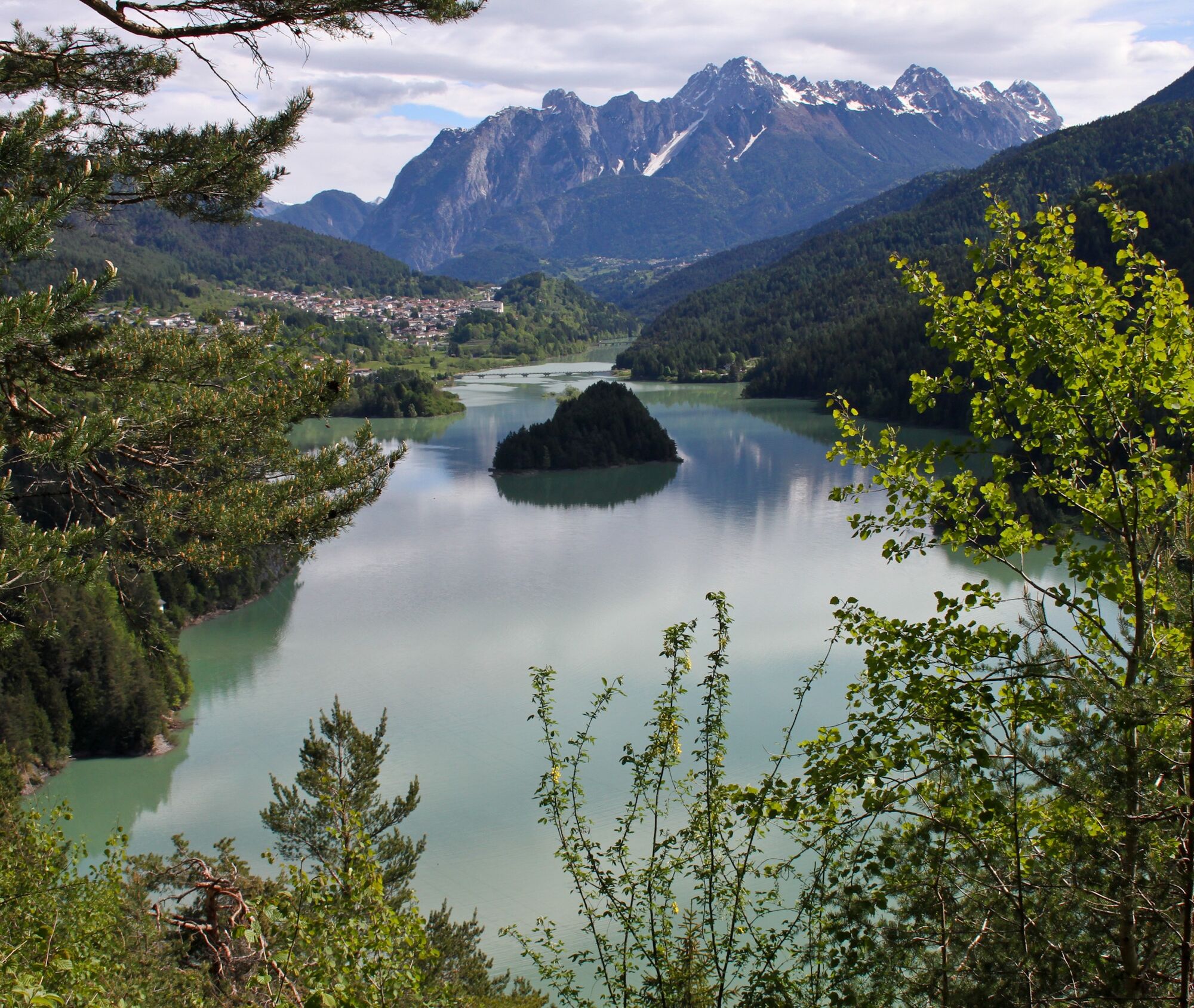
Lake Centro di Cadore and the Laghetto delle Tose from Pieve di Cadore
This route connects Lake Centro Cadore to the more collected Laghetto delle Tose, offering a varied hike between lake environments and stretches surrounded by nature. The route, about 5.5 km round trip,...
Lake Centro Cadore, one of the main reservoirs in the area, accompanies the first part of the walk with wide views and open glimpses of the surrounding landscape. Leaving the shore, the trail gradually enters a quieter environment, among vegetation and shady stretches, leading toward the Lagole area, known for its springs and naturalistic setting.
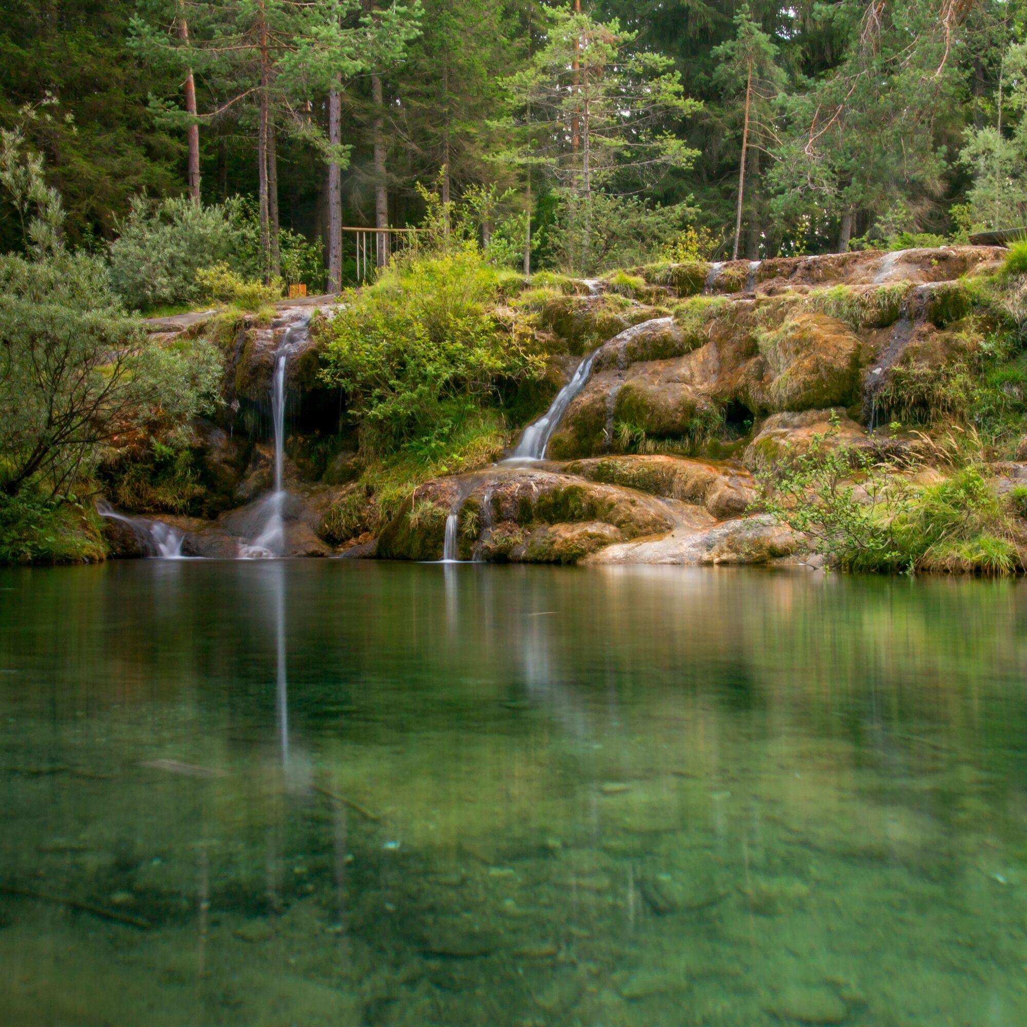
Continuing on, one reaches Laghetto delle Tose, a smaller and more secluded body of water, surrounded by greenery and characterized by a collected and quiet atmosphere. This contrast between the large lake and the small natural basin is the distinctive element of the itinerary.
The route is generally uncrowded and is suitable for those seeking a hike of medium difficulty, ideal for tackling from late spring to autumn.

Hiking boots with good grip. Light backpack, water, layered clothing and sunscreen recommended.
Be careful in wet or slippery terrain, especially in sections in the woods and near water.
Always check weather conditions before departure and approach the hike with adequate preparation and water supplies.
Continuing on to Laghetto delle Tose you reach a more cozy and quiet environment, perfect for a break surrounded by nature.
We recommend tackling the hike in the less central hours of the day to enjoy more tranquility along the way.
Oblíbené prohlídky v okolí
-
5.0
Val d’oten
světloTuristika 5.99 km -
Baita Sun bar-punta sorapis-fopa di matia-croda marcora
heavyHorolezectví 24.9 km -
TREKKING FORCELLA DEL DURANNO
heavyTuristika 15.1 km -
Urtisiel and Canpuros, Dolomitic wonders
středníTuristika 13.5 km -
5.0
Campanile di Val Montanaia a Bivacco Perugini
středníTuristika 2.76 km -
TRAIL OF THE LOOKOUTS OF THE CAMPANILE DI VAL MONTANAIA
světloTuristika 3.07 km -
BIVACCO MARCHI-GRANZOTTO DA FORNI DI SOPRA
heavyTuristika 10.3 km -
Prstenec Friulských Dolomit z Forni di Sopra
střednídálková pěší trasa 34.7 km -
Anello delle Dolomiti Friulane 3 Rifugio Pordenone - Rifugio Padova
středníTuristika 7.04 km -
5.0
Ferrata La Rota Caprioli e trekking Forcella piccola
středníHorská turistika 6.51 km
Pěší turistika a stopování


Nenechte si ujít nabídky a inspiraci pro vaši příští dovolenou
Vaše e-mailová adresa byl přidán do poštovního seznamu.