


Monte Casale da Comano
Fotografie našich uživatelů
-

 © Daniele SpeziaVytvořeno dne 17.12.2023
 -
 © Daniele SpeziaVytvořeno dne 17.12.2023
 -
 © Daniele SpeziaVytvořeno dne 17.12.2023
 -
 © Daniele SpeziaVytvořeno dne 17.12.2023
 -
 © Daniele SpeziaVytvořeno dne 17.12.2023
 -
 © Daniele SpeziaVytvořeno dne 17.12.2023
 -
 © Daniele SpeziaVytvořeno dne 17.12.2023
 -
 © Daniele SpeziaVytvořeno dne 17.12.2023
 -
 © Daniele SpeziaVytvořeno dne 17.12.2023
 -
 © Daniele SpeziaVytvořeno dne 17.12.2023
 -
 © Daniele SpeziaVytvořeno dne 17.12.2023
 -
 © Daniele SpeziaVytvořeno dne 17.12.2023
 -
 © Daniele SpeziaVytvořeno dne 17.12.2023
 -
 © Daniele SpeziaVytvořeno dne 17.12.2023
 -
 © Daniele SpeziaVytvořeno dne 17.12.2023
 -
 © Daniele SpeziaVytvořeno dne 17.12.2023
 -
 © Daniele SpeziaVytvořeno dne 17.12.2023
 -
 © Daniele SpeziaVytvořeno dne 17.12.2023
 -
 © Daniele SpeziaVytvořeno dne 17.12.2023
 -
 © Daniele SpeziaVytvořeno dne 17.12.2023
 -
 © Daniele SpeziaVytvořeno dne 17.12.2023
 -
 © Daniele SpeziaVytvořeno dne 17.12.2023
 -
 © Daniele SpeziaVytvořeno dne 17.12.2023
 -
 © Daniele SpeziaVytvořeno dne 17.12.2023
 -
 © CornihVytvořeno dne 25.09.2024


In order to climb up to the car park at Le Quadre you must purchase the daily permit at the Albergo Panorama. The cost of the permit is per vehicle and is valid for the whole day. The money collected for...
In order to climb up to the car park at Le Quadre you must purchase the daily permit at the Albergo Panorama. The cost of the permit is per vehicle and is valid for the whole day. The money collected for the permits is used to upkeep the road.
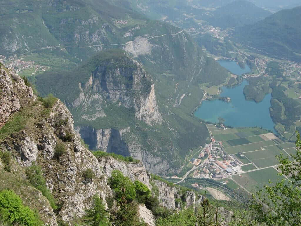
From the car park, climb along the dirt road, pass the sign that indicates the Le Quadre locality (1479 m) and keep going straight until you reach the summit meadows of Monte Casale.
Turn right at the crossroads on the dirt road, following the sign for Rifugio Don Zio.
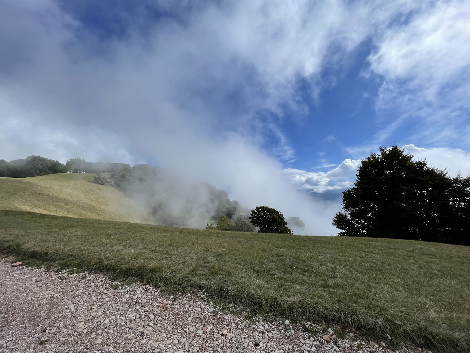
The road rises steeply and with a panoramic view climbs among the meadows to the west of Monte Casale.
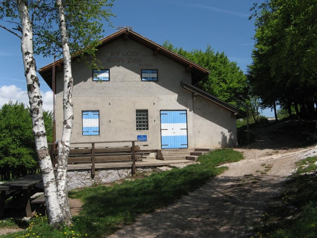
Along the panoramic trail you will finally reach Rifugio Don Zio that is visible for most of the upper portion of the road.
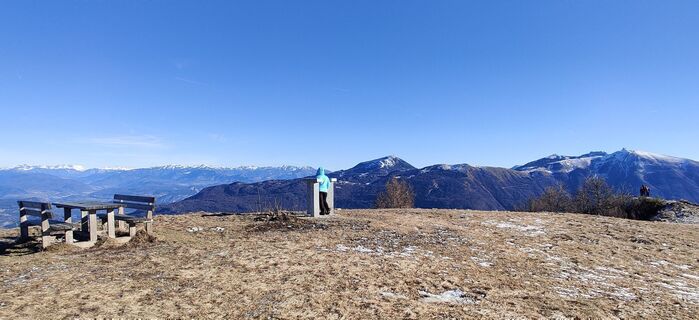
Once at the mountain hut, walk to the right of it and go beyond the small copse of trees near the mountain hut.
After passing the trees you will see, on the right, the antenna of a signal repeater close to the peak.
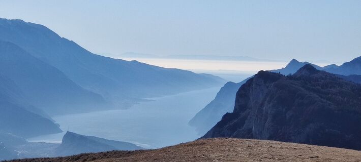
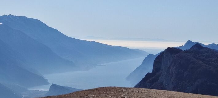
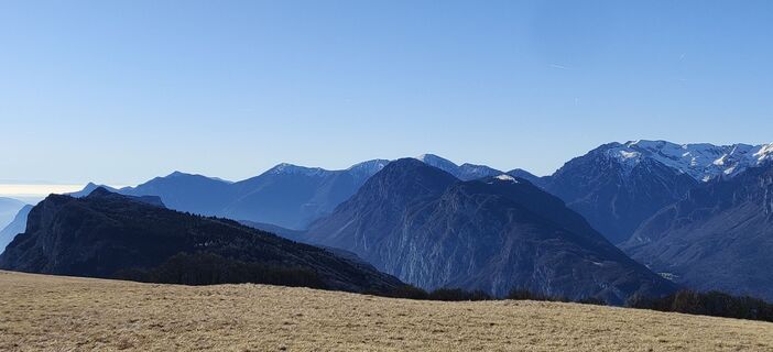
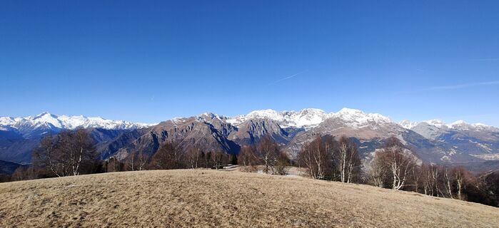
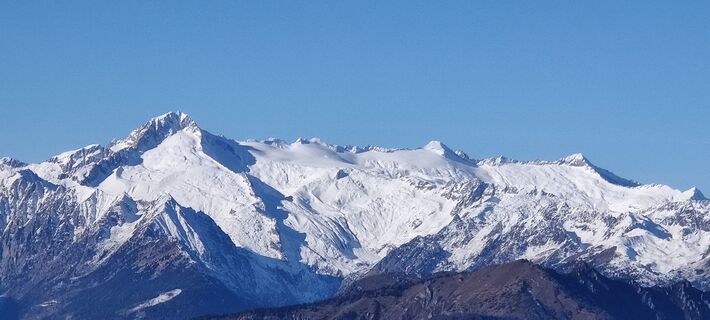
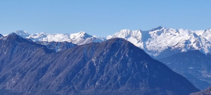
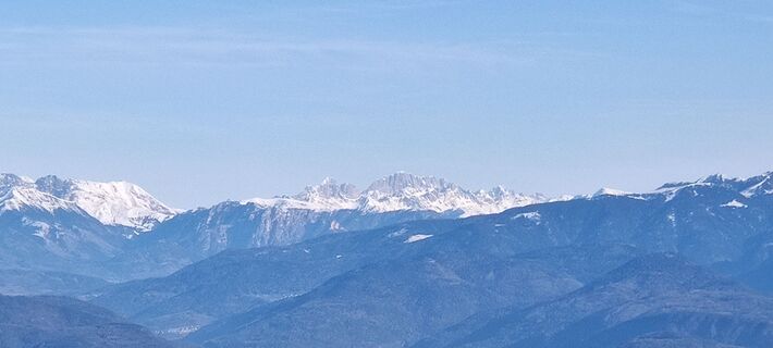
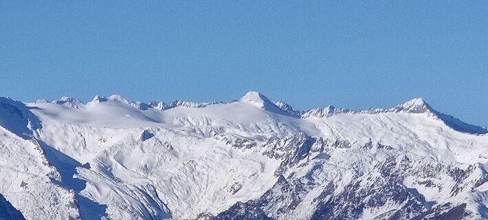
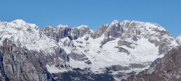
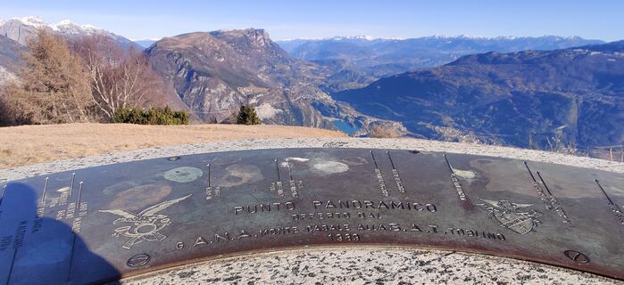
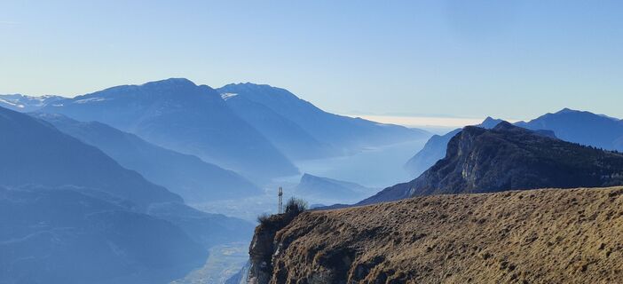
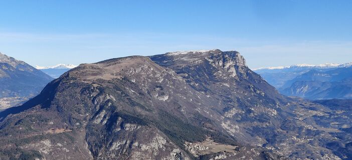
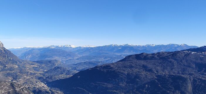
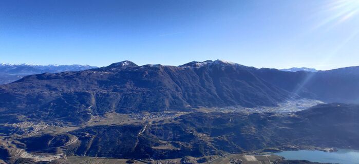
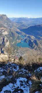
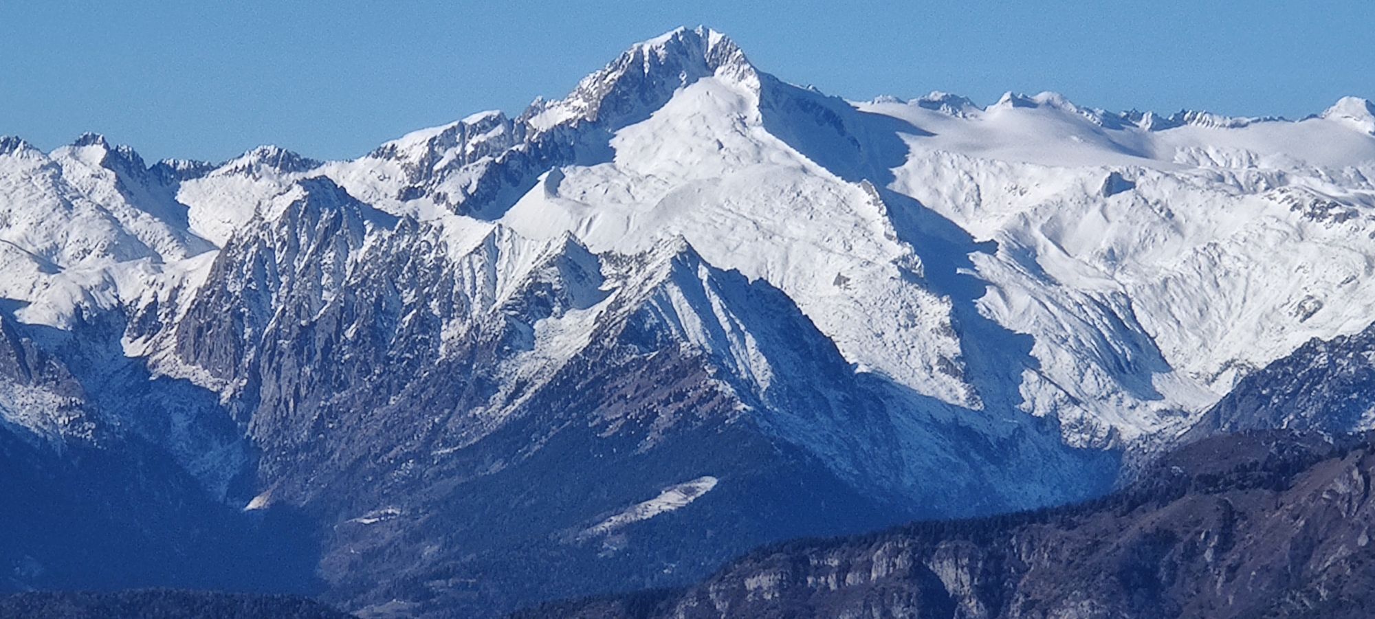
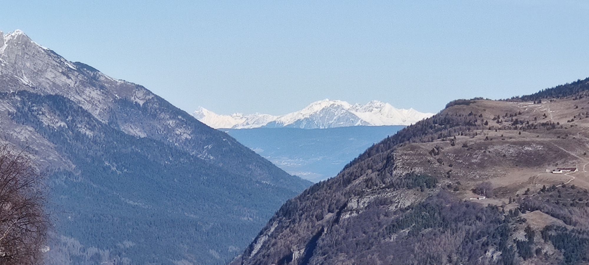
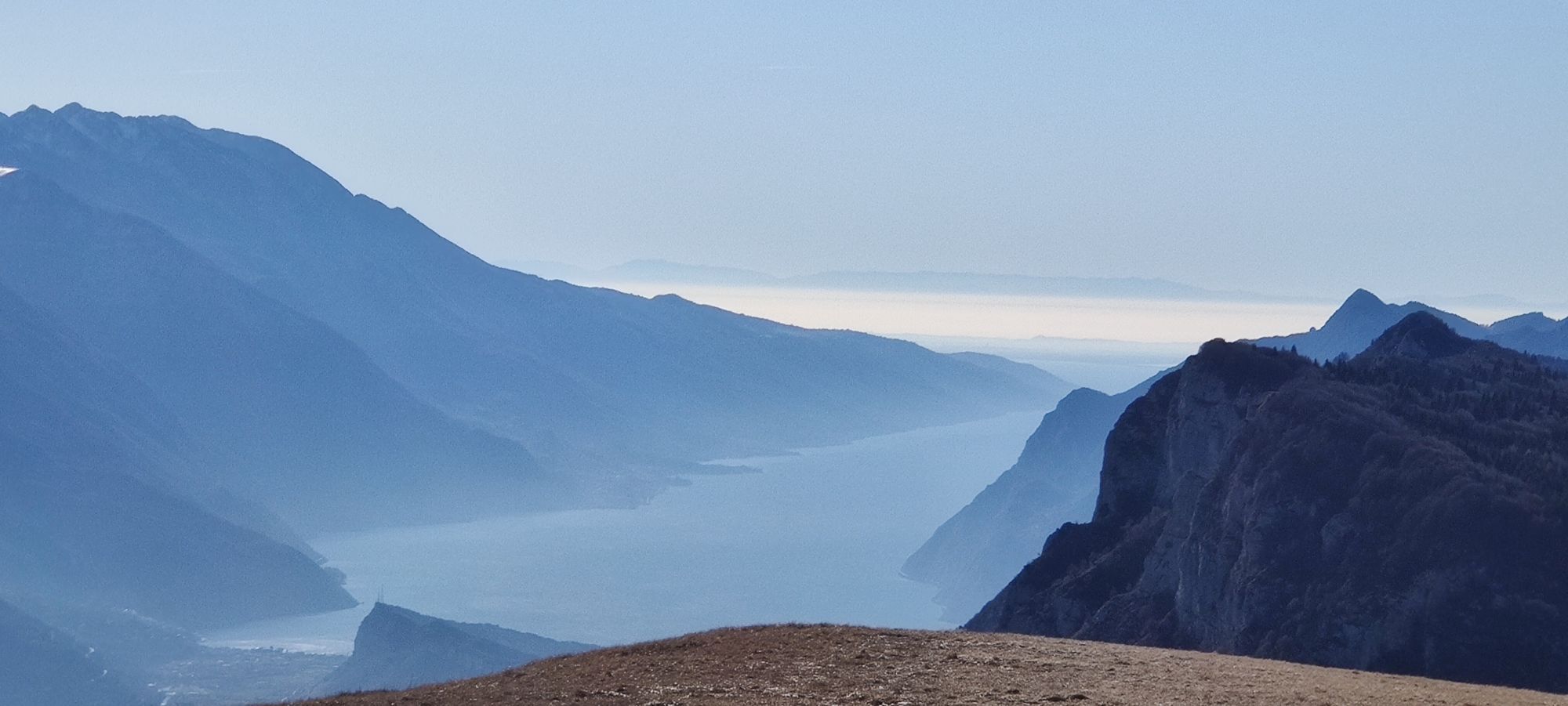
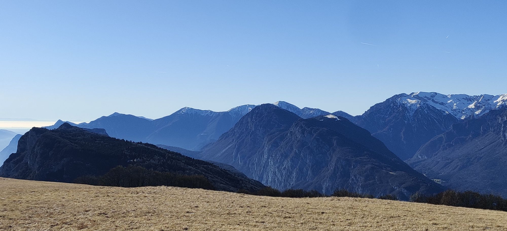
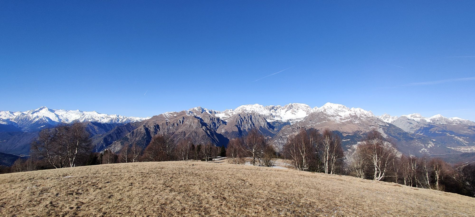
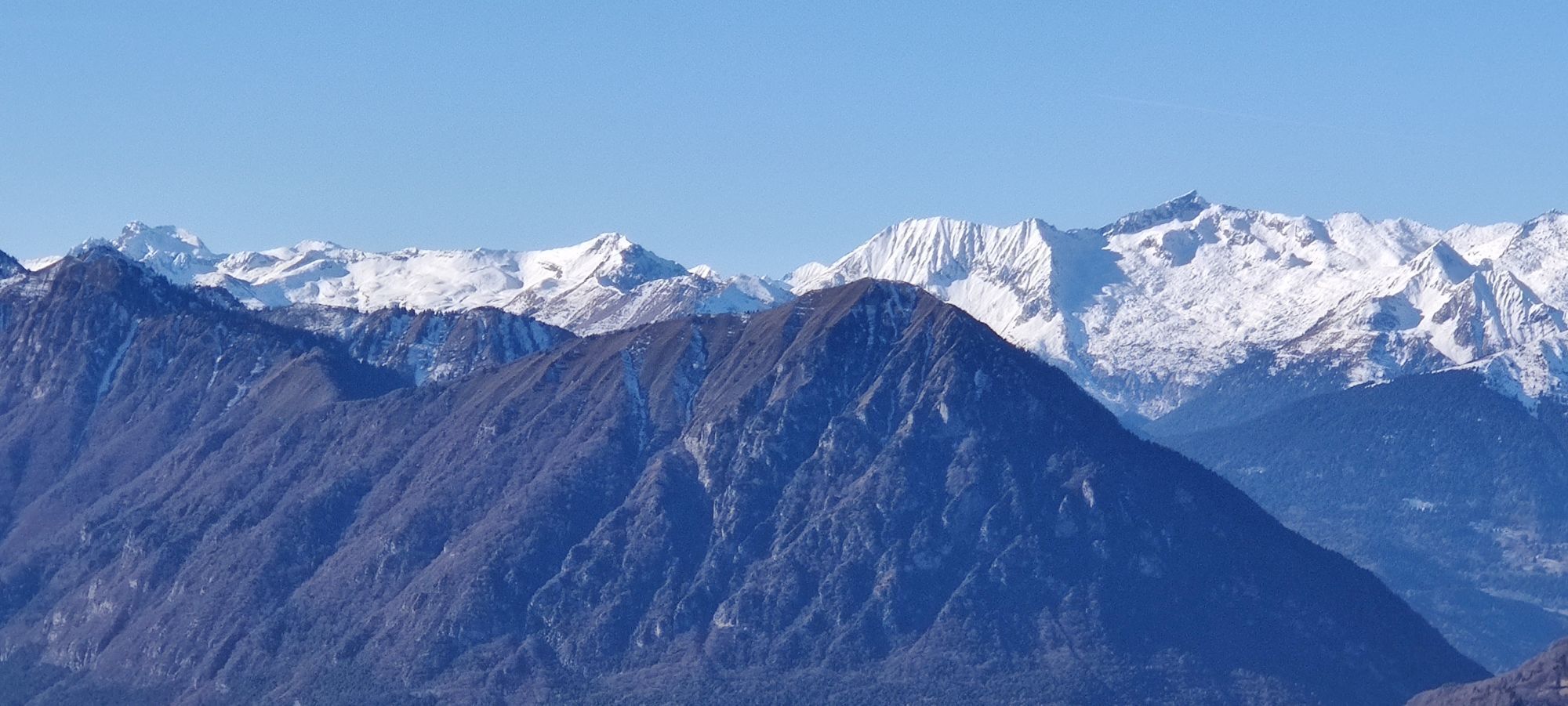
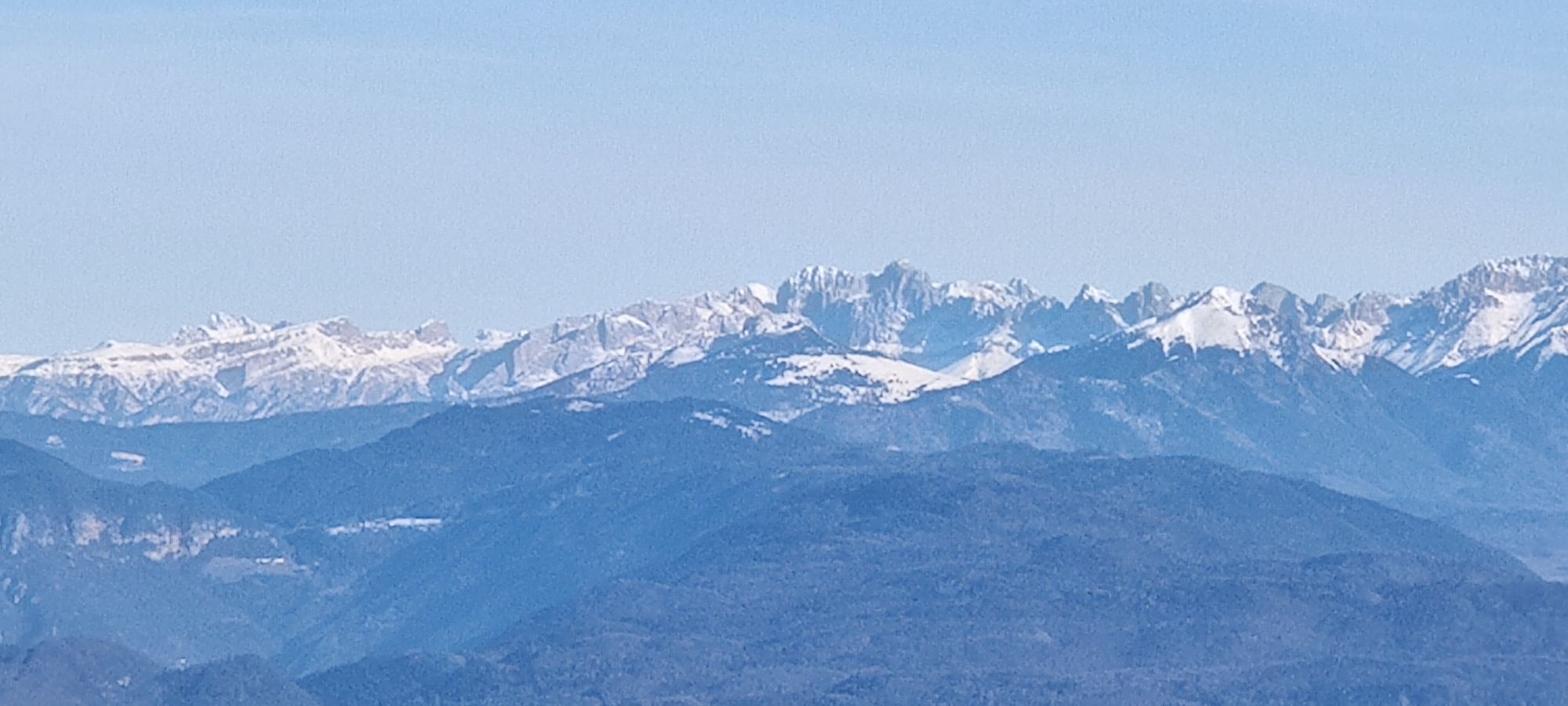
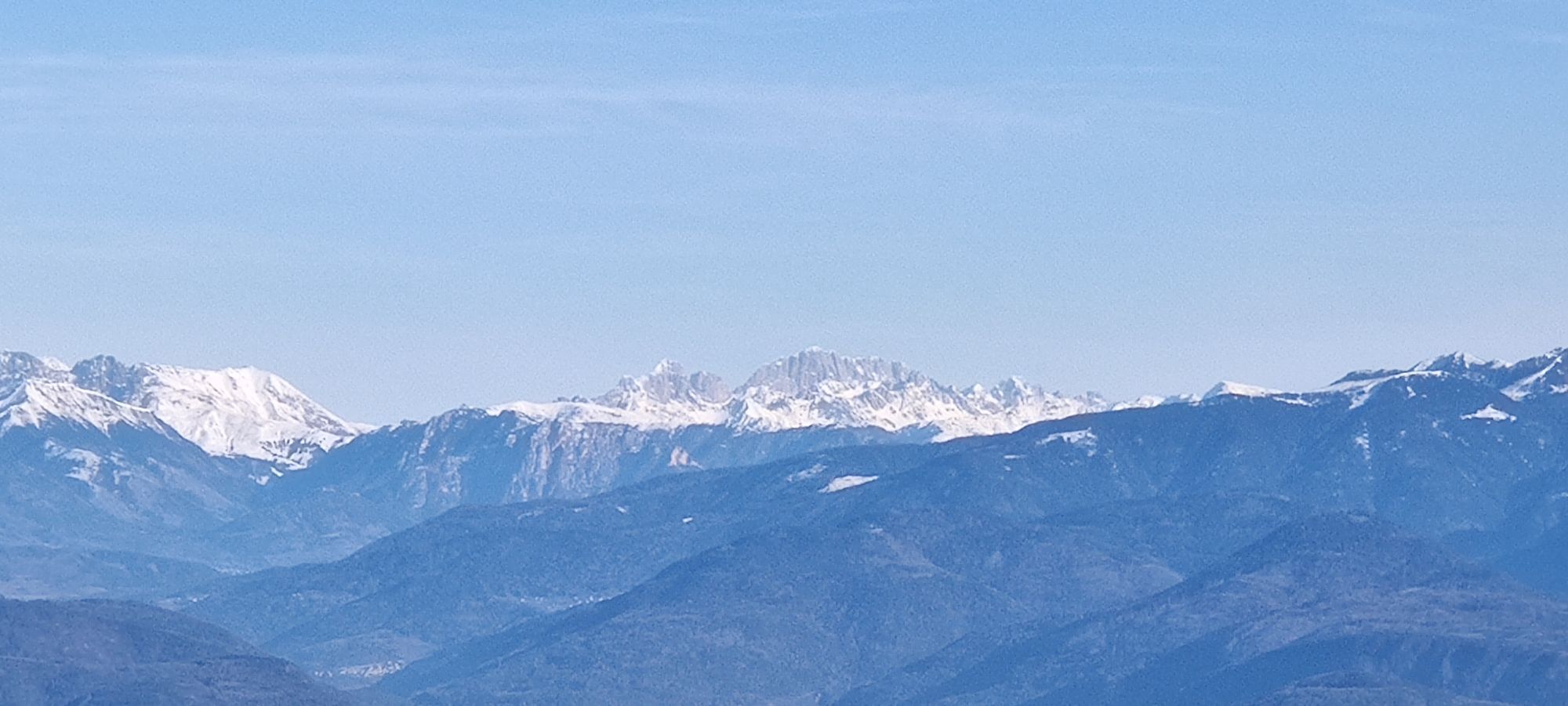
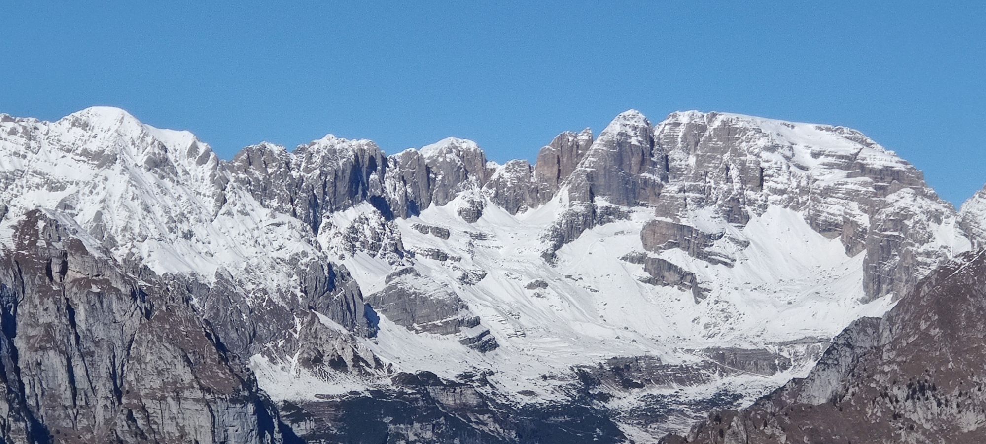
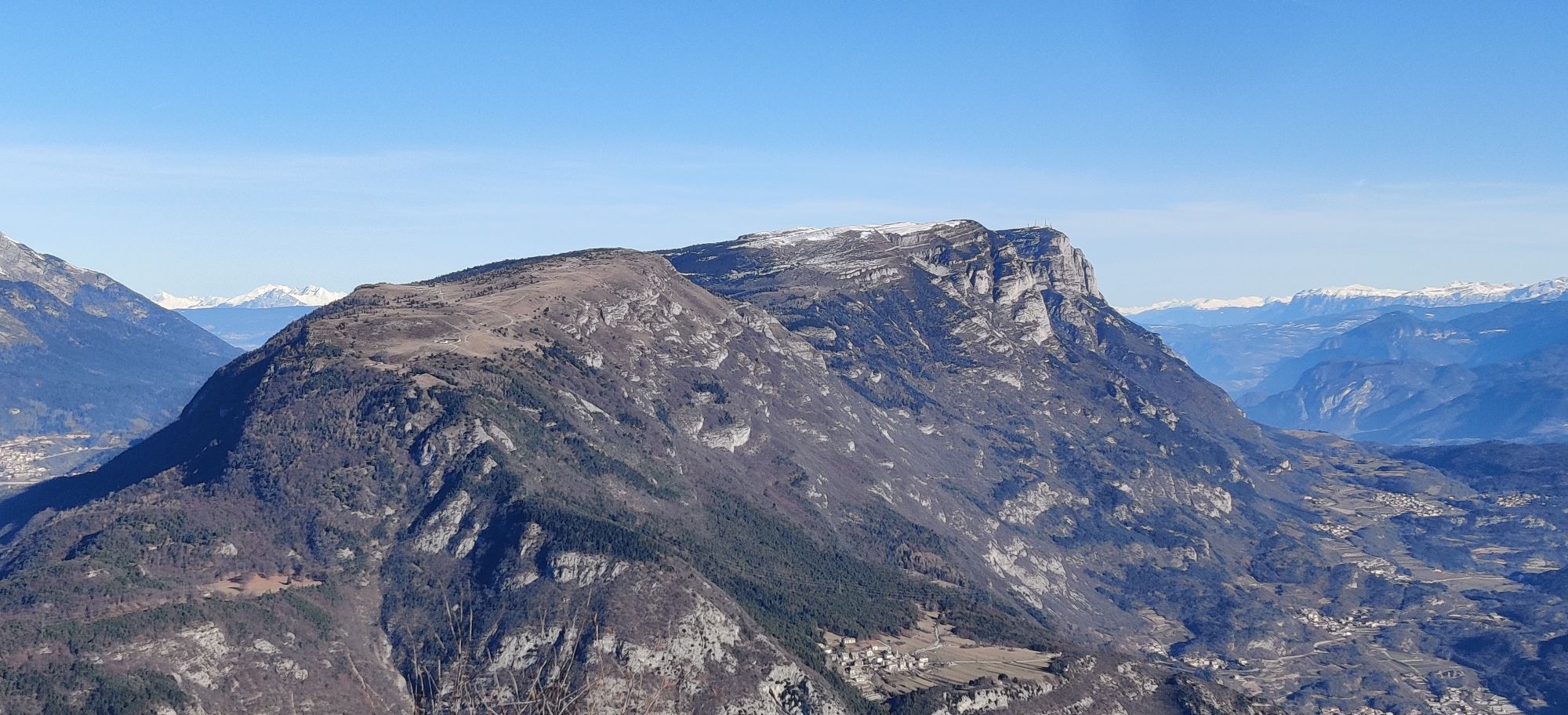
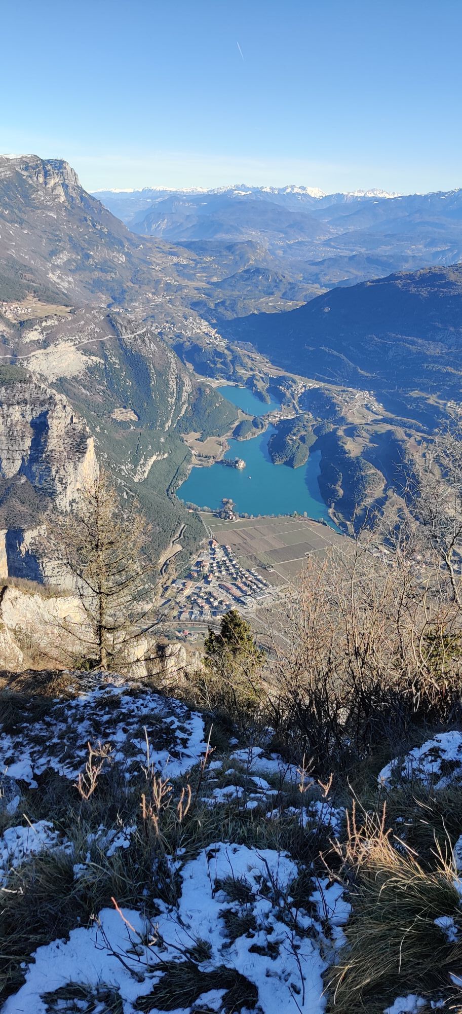
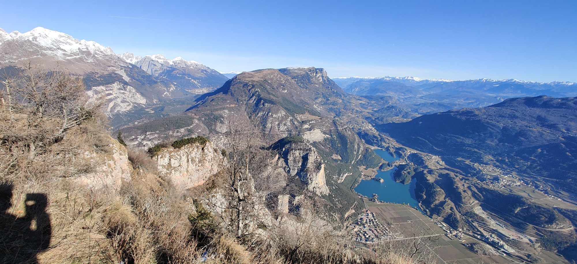
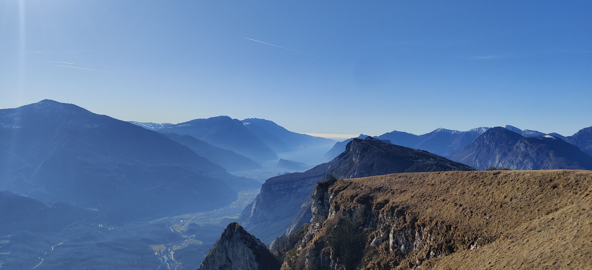
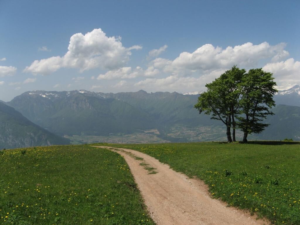
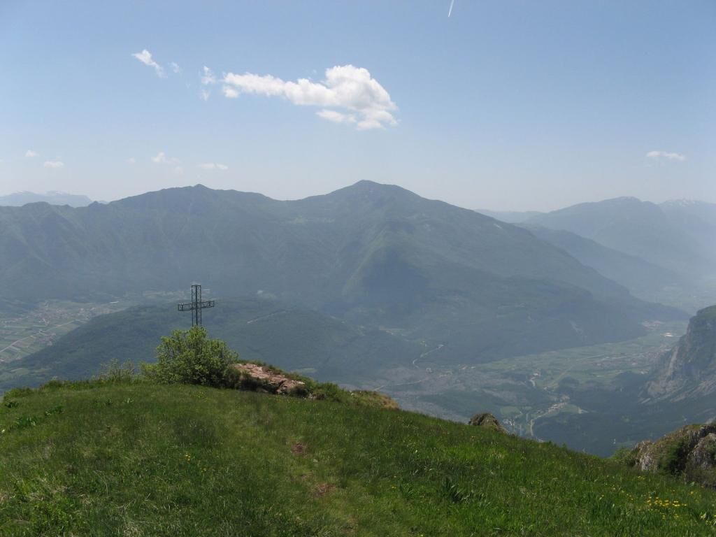
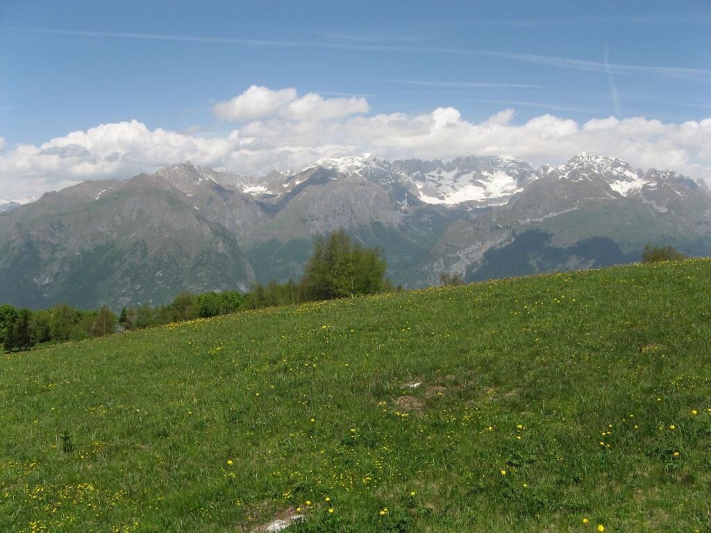
Cross the meadow and approach the summit (1631 m), from which you will enjoy a panoramic view of Valle del Sarca.
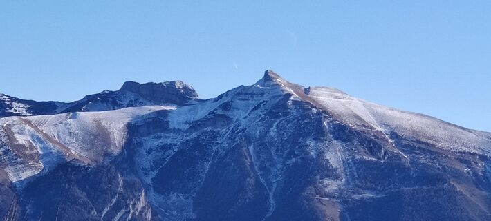
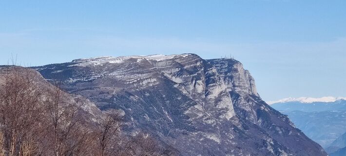
To the right of the antenna there is a lookout point from which to view the area’s most famous peaks.
You can then descend to the cross standing further south and then return to the mountain hut.
From the mountain hut, return to the departure point by retracing your steps.

Vom Parkplatz geht man den Erdweg bergauf weiter, am Schild vorbei, das auf die Ortschaft Le Quadre (1479 m) hinweist, dann geradeaus weiter bis zu den Höhenwiesen des Monte Casale.
An der Wegteilung am Erdweg nach rechts gehen, Schild zur Berghütte Don Zio.
Der Weg bäumt sich auf und führt auf einer Panoramastrecke aufwärts zwischen die westlichen Wiesen des Monte Casale.
Der Weg wird zu einer Panoramastrecke und führt so zur Berghütte Don Zio, die vom oberen Teil des Weges fast immer sichtbar ist.
An der Hütte, die an den Wochenenden geöffnet ist, geht man auf der rechten Seite weiter, bis jenseits der kleinen Baumgruppe in der Nähe der Hütte.
Nach den Bäumen ist rechts nahe der Bergspitze die Antenne einer Relaisstation zu sehen.
Man überquert die Grasfläche und steigt zum Gipfel; am Gipfel (1631 m) hat man einen schönen Ausblick auf das Sarca-Tal.
Rechts von der Antenne ist ein Panoramapunkt, der einen Überblick über die berühmtesten Gipfel der Gegend bietet.
Dann kann man zum südlicher aufgestellten Kreuz absteigen und zur Hütte zurück gehen.
Von der Hütte auf dem gleichen Weg wie beim Aufstieg wieder zum Ausgangspunkt zurückkehren.
Ano
Ano
There is nowhere to stop off for refreshments along the trail so you are advised to bring water and something to eat
You need to be wearing the right clothing and take the proper gear when you go hiking in the mountains. Even on relatively short easy outings make sure to take all you need so you don't run into trouble if things take an unexpected turn, for example a storm blows up or you have a sudden drop in energy levels.
What should you take when you go on a hike?
What you should have in your rucksack (for a day trip a 25/30L capacity should do):
water canteen (1L) snacks (e.g. mixed dried fruit or chocolate) First aid kit windproof jacket fleece change of t-shirt and socks (in a plastic bag) make sure to wear or at least bring a pair of long trousers hat sun screen sunglasses gloves whistle to attract attention in an emergencyEmergency telephone number: 112
Make sure you're wearing the right footwear for the trail and season. The going can get rough and rocky underfoot and a pair of hiking boots will protect you from sprains. When wet, a grassy slope, rocky slab or steep trail can be dangerous unless you are wearing the proper footwear.
And finally... ... don't forget to bring your camera! You'll need it to capture the stunning views you come across all over Garda Trentino. And if you like, you can share your memories with us at #GardaTrentino.
The information on this chart is subject to inevitable variations, so this means that none of the indications are absolute. It is not entirely possible to avoid giving inexact or imprecise information, given how quickly environmental and weather conditions can change. For this reason we decline any responsibility for changes which the user may encounter. In any case, the hiker is advised to check the conditions of the places, environment and weather before setting out.
Once in Comano, turn right immediately past the church and follow the road that on a left-hand bend leads towards the exit of the town, close to the Panorama hotel.
At a distance of 300 m there is a hairpin bend with a crucifix on the right.
This is from where the long road called “La panoramica” starts, climbing up along the sides of Monte Casale to an altitude of 915 m (antennas and no-trespassing sign, 2.80 km) and then proceeds first dirt and then cemented with porphyry in the last steep stretch, up to the car park at about 1460 m (about 7.40 km from the crucifix of the first hairpin bend).
Wer das Geld für den Parkplatz sparen möchte, muss das Auto in 915 m Höhe bei einigen Antennen und dem Durchfahrtsverbot stehen lassen. Dann überquert man über den Sat-Weg Nr. 411 die Straße und steigt zu Fuß zum Ort Le Quadre (ca. 1 Stunde).
Oblíbené prohlídky v okolí
-
4.8
Via Ferrata Rio Sallagoni
středníVia ferrata 2.75 km -
5.0
Via Ferrata Signora delle Acque - Rio Ruzza
heavyVia ferrata 5.32 km -
4.6
Colodri Klettersteig (A/B)
Via ferrata 7.50 km -
3.8
Monte Velo - Tour
heavyMountainbike 29.4 km -
4.2
Bosco Caproni and Trenches of Vastrè
světloTuristika 5.77 km -
4.5
From Malga Campo to Monte Stivo
středníTuristika 8.46 km -
4.2
Sentiero dell'Anglone + Sent. Scaloni (A/B)
Via ferrata 7.01 km -
5.0
Laghel - Tour
středníMountainbike 10.3 km -
4.4
Lakes Cycle Path: Torbole – Sarche
středníJízda na kole 24.8 km -
3.7
Bocca di Tovo Trail-Tour
heavyMountainbike 33.1 km
Pěší turistika a stopování


Nenechte si ujít nabídky a inspiraci pro vaši příští dovolenou
Vaše e-mailová adresa byl přidán do poštovního seznamu.