


Dolomites Cycle & Footpath in the Fiemme and Fassa Valleys
Úroveň obtížnosti: S1
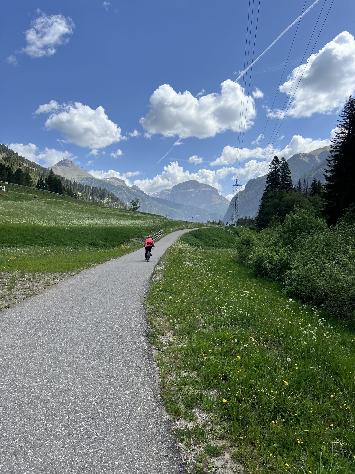


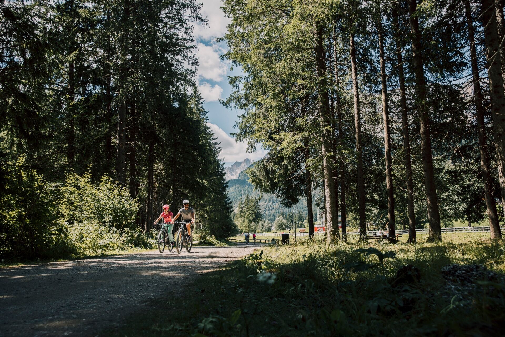
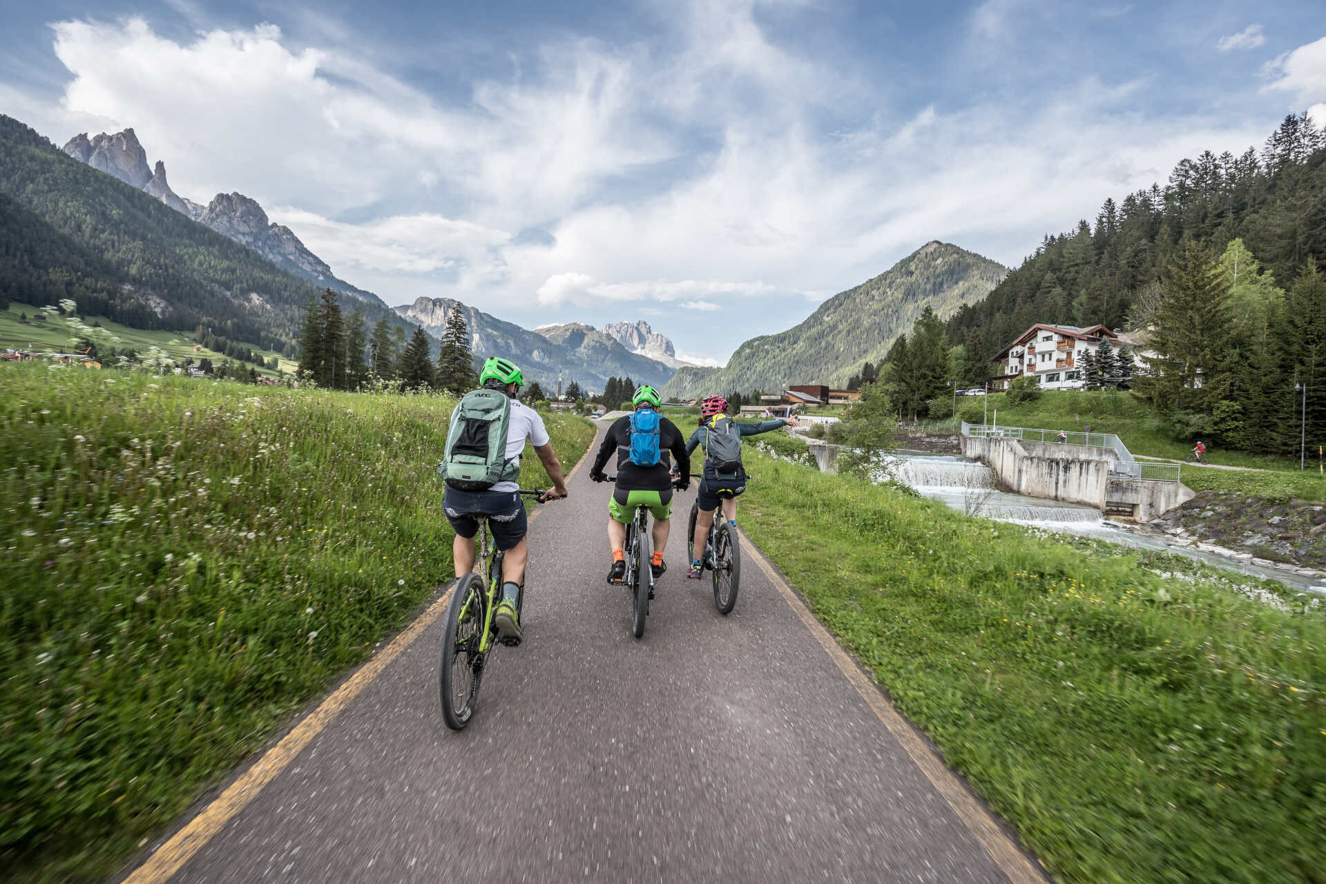
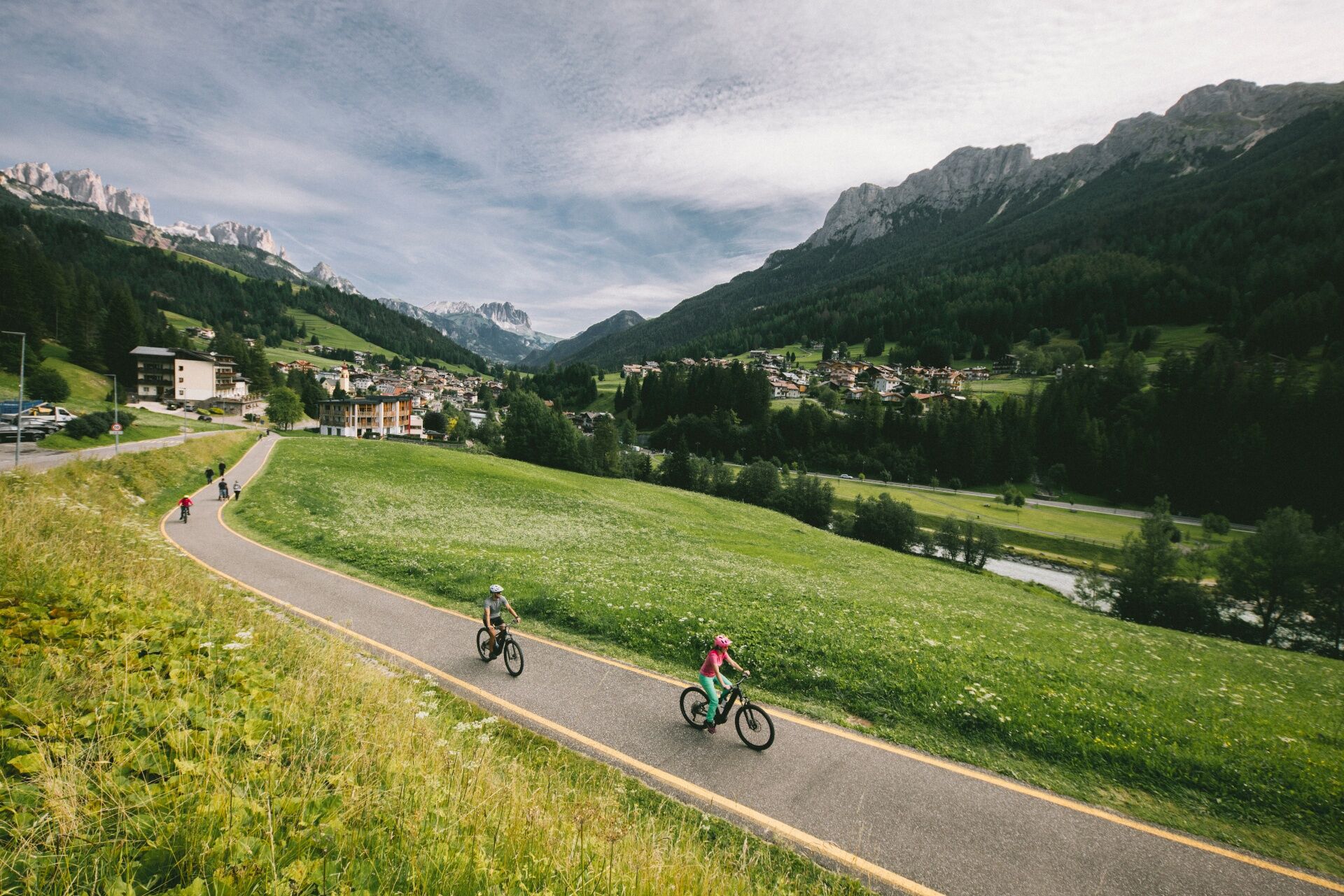
There are plenty of good reasons to hop on your bike and follow the cycle and footpath linking the Fassa and Fiemme valleys. The first is simple: here, you can ride at an easy pace, surrounded by nature,...
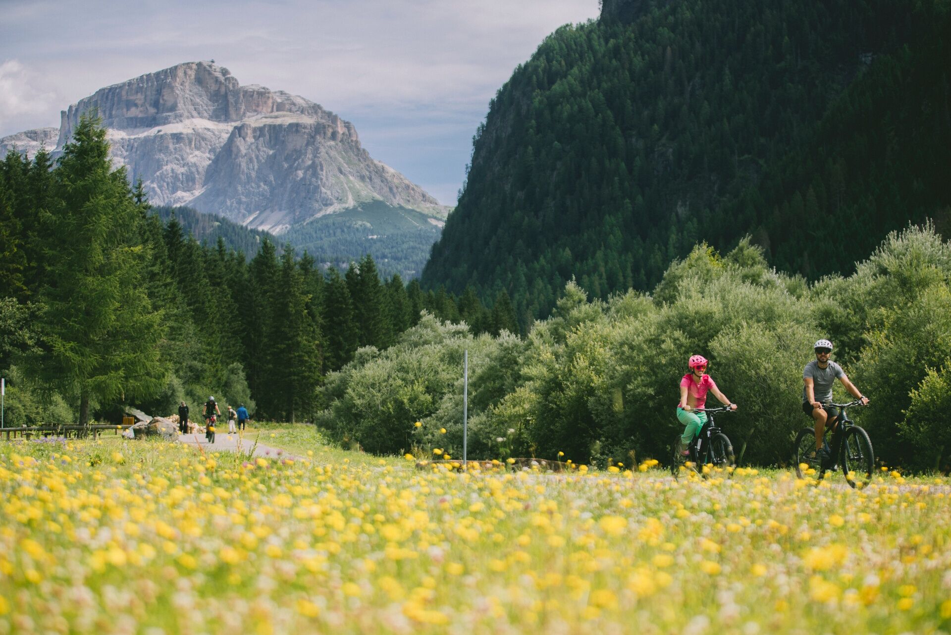
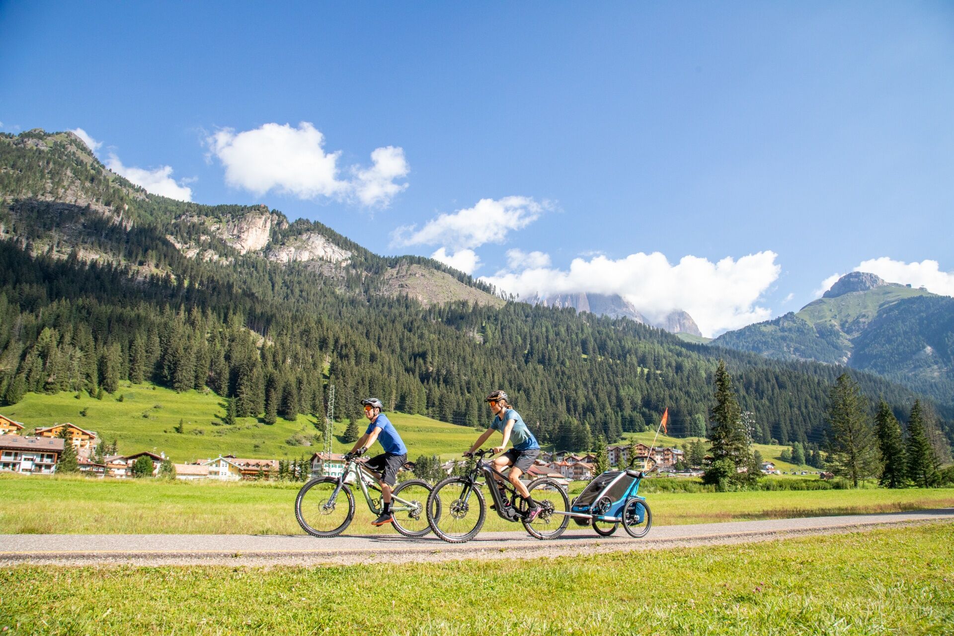
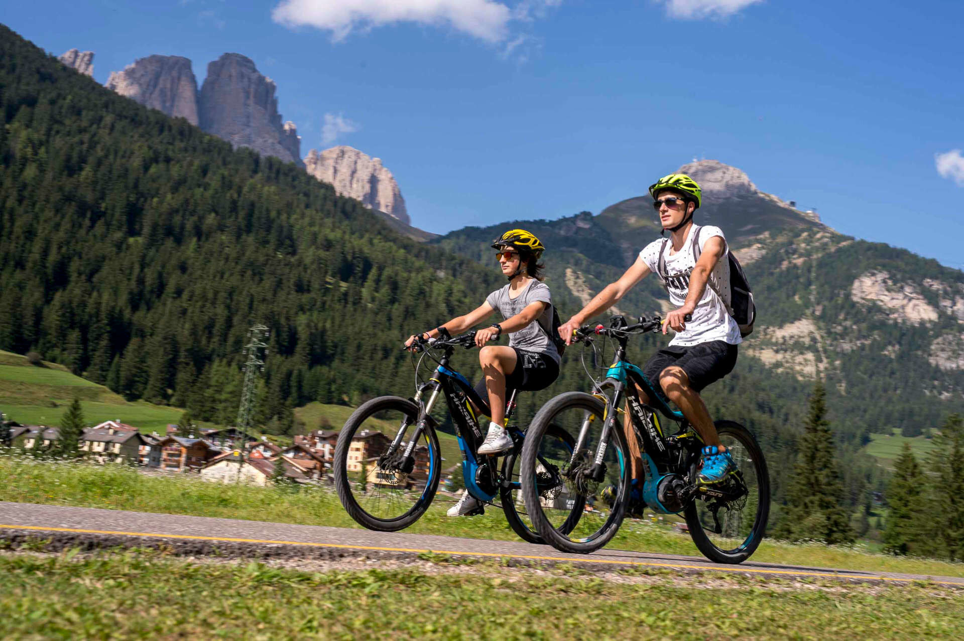
The route is suitable for a wide range of cyclists: families with children, cycle tourists, e-bike riders and anyone looking for a pleasant, scenic ride that is not too demanding. It alternates between long, smooth stretches, gentle descents and a few short climbs - enough to add a little rhythm to the day without turning it into a challenge.
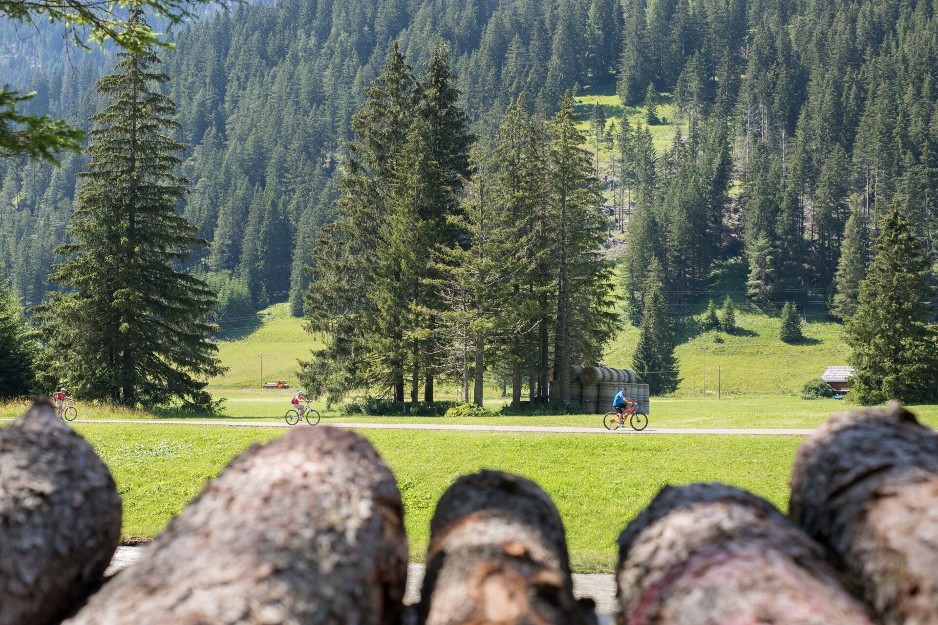
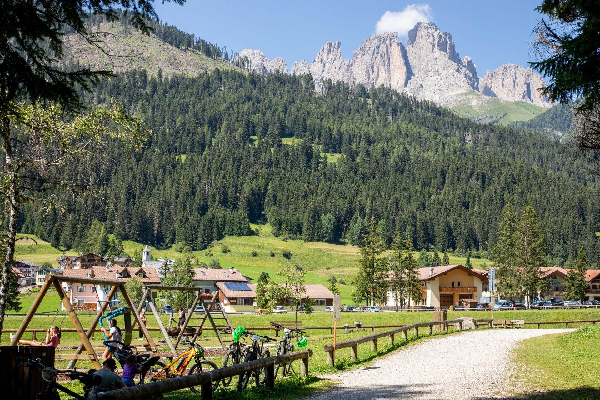
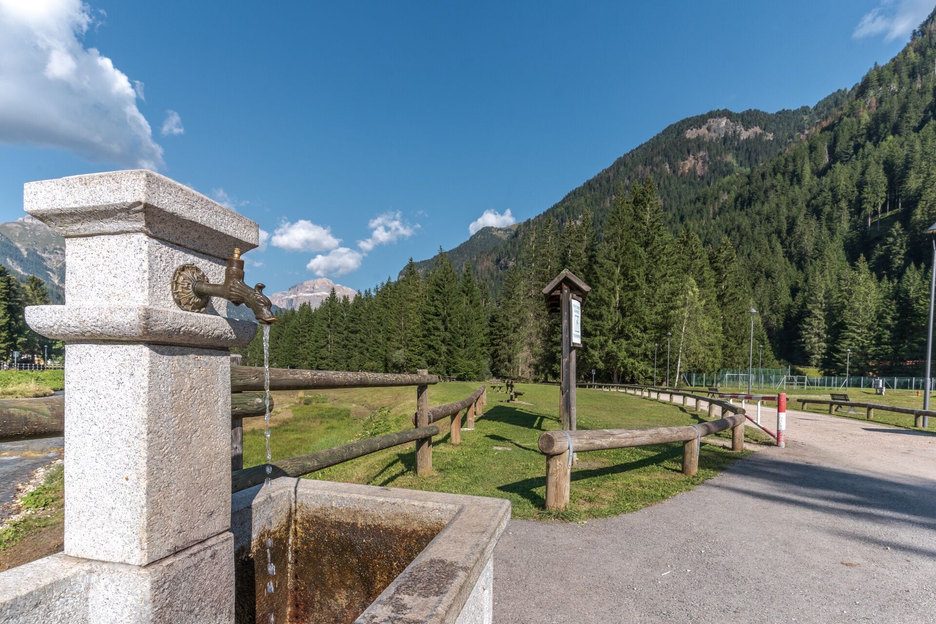
Along the way, you'll find fountains, picnic areas, playgrounds and plenty of perfect spots for a break: a snack on the grass, a photo with a view of the Dolomites, a stop in one of the villages or simply a moment to breathe in the fresh valley air.
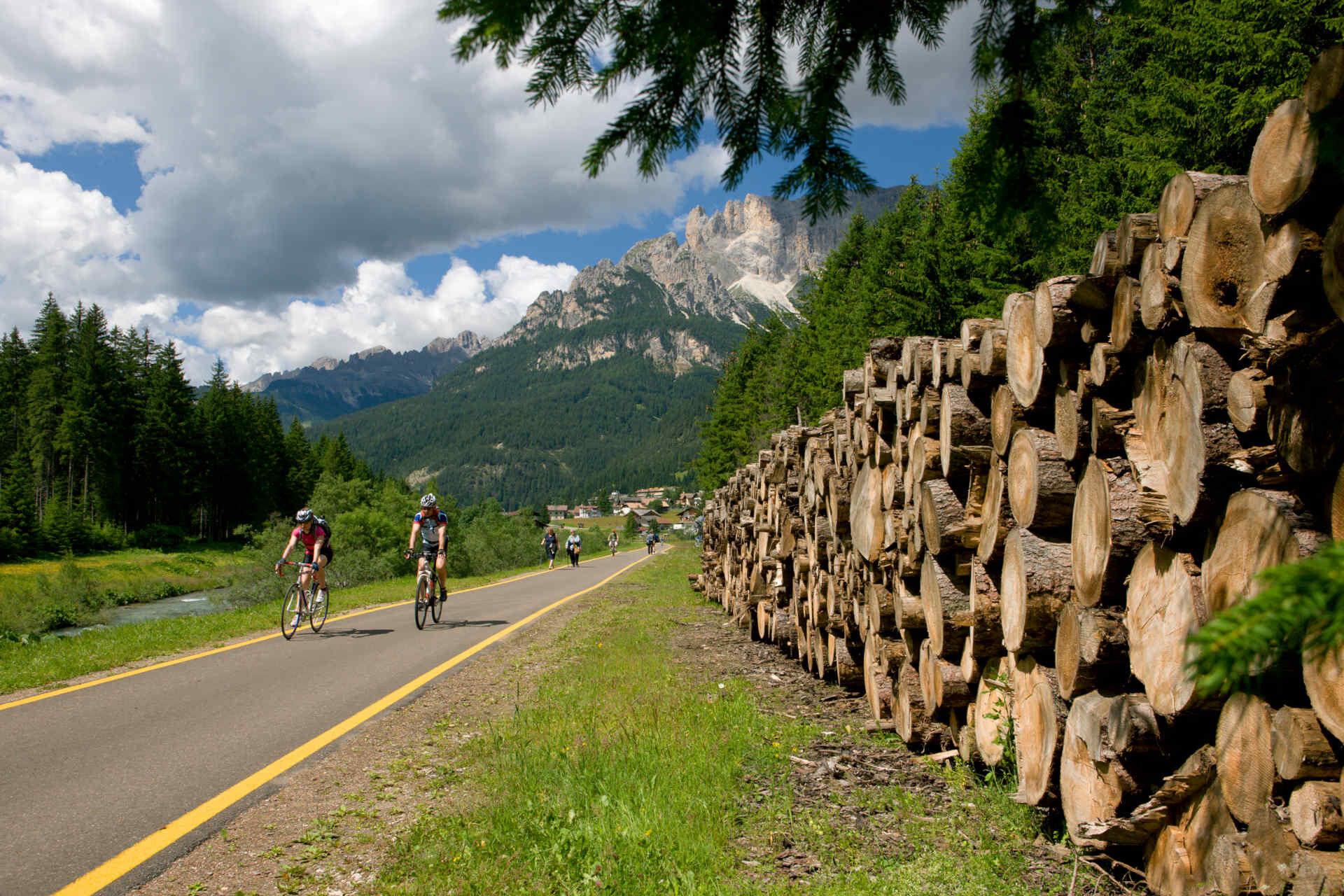
As you ride, you pass places rich in history and everyday life: churches, barns, bridges, old railway tracks and hidden corners that tell the story of the area, step by step - or rather, pedal stroke by pedal stroke.
This is a route to enjoy at an easy pace: spending time outdoors, moving without even noticing, having fun with the family and creating little holiday memories, bend after bend.
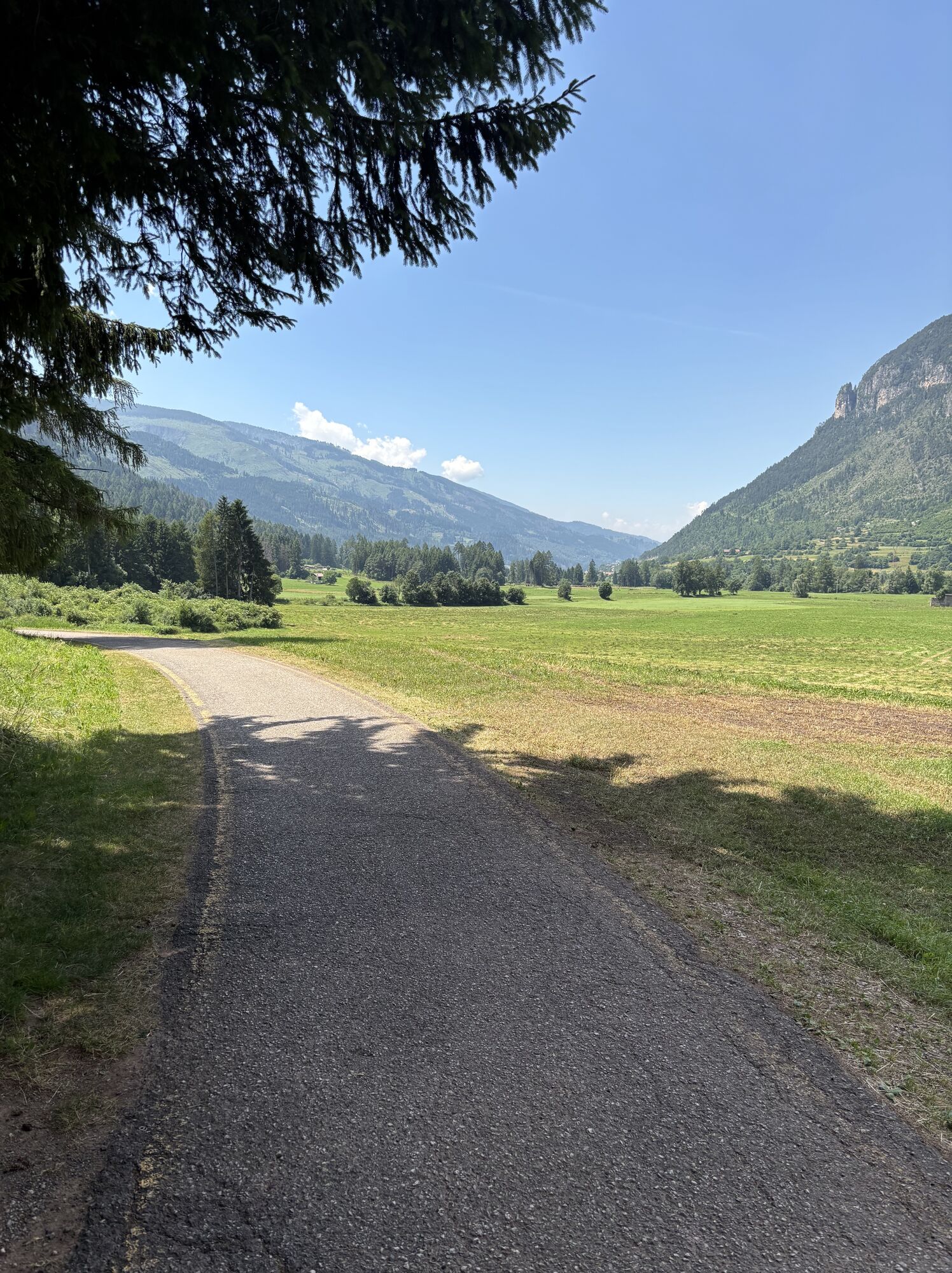
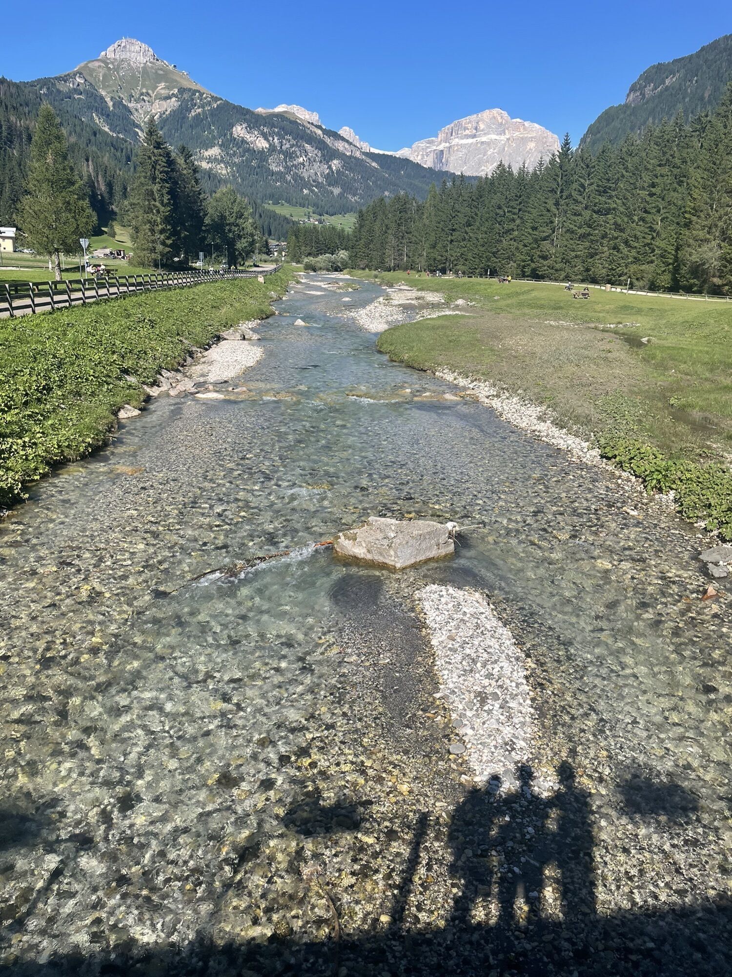
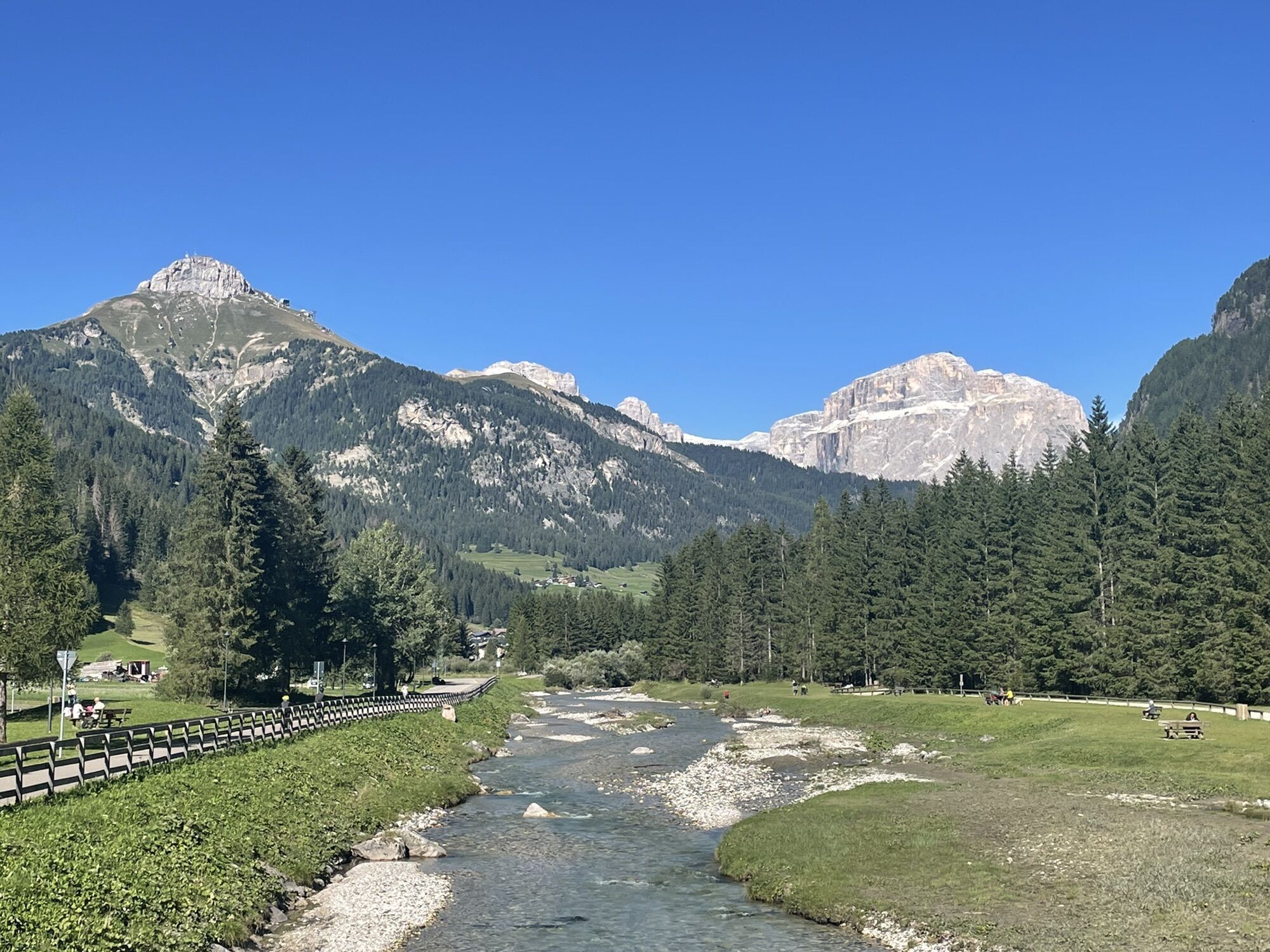
Your journey begins in Alba di Canazei, on a gentle path running along the right bank of the Avisio stream. After carefully crossing the main road near the Civil Protection Centre, continue towards Canazei, passing Camping Marmolada, the Dòlaondes water park and the playground. First turn slightly right and, at the next junction, left onto Strèda de Ciuch, heading south.
The route, initially shaded by lush pine trees, leads to the Ischia area in Campitello, where you cross Strèda de Pènt de Sera diagonally. You'll pass Camping Miravalle, the lower part of the village and the nearby hamlets of Fontanazzo di Sotto, Campestrin and Mazzin, without entering the built-up areas, along a quiet route immersed in the tranquillity of the valley floor.
From here, a pleasant descent begins towards Pera, with a few gentle ups and downs as far as Fraine. If you do not wish to stop at the playground, do not cross the bridge and continue along the main route. At the bus stop in Vac, follow a short stretch of the main road, pass the roundabout for Meida and, opposite Hotel Monzoni, rejoin the cycle path.
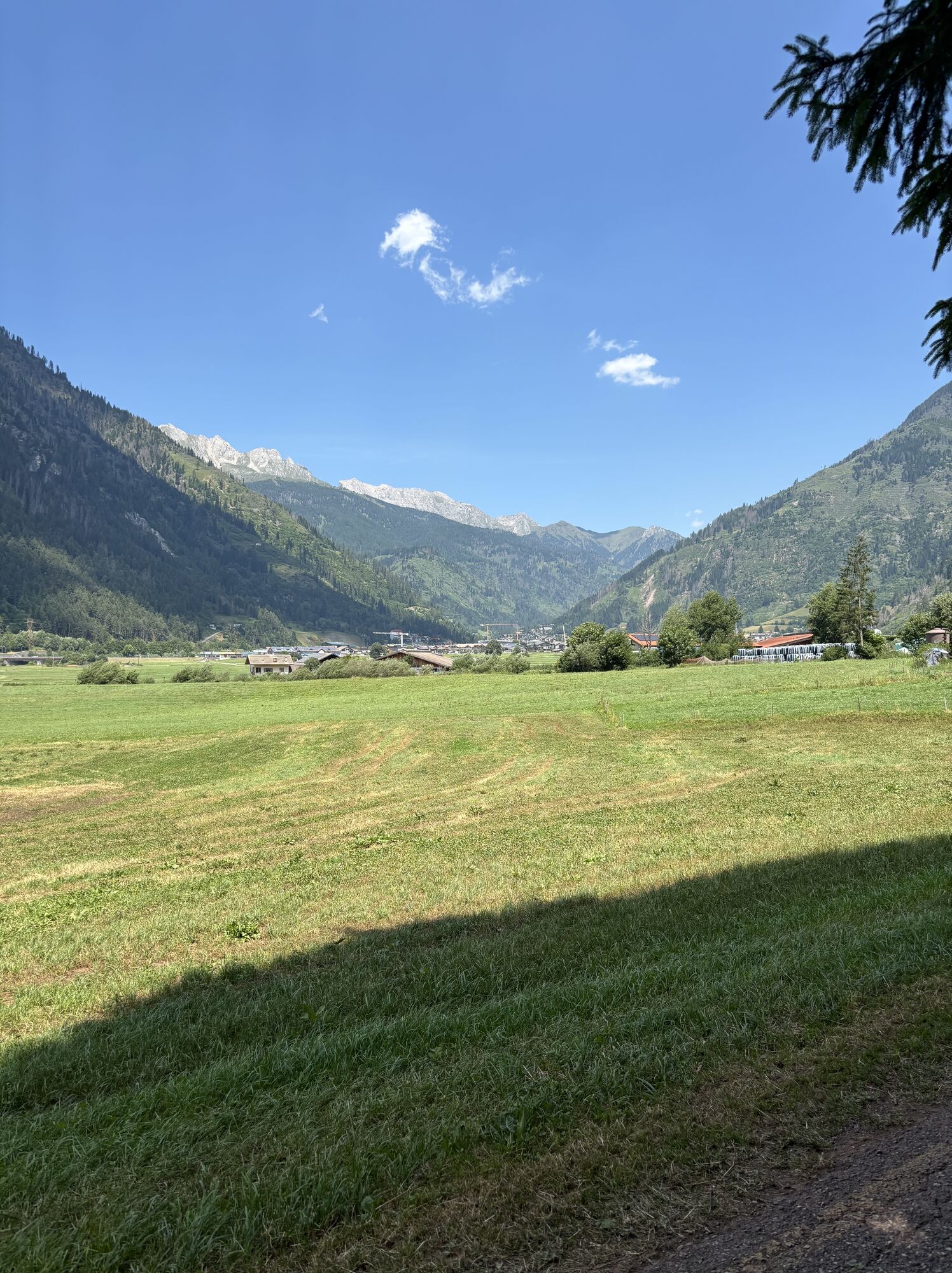
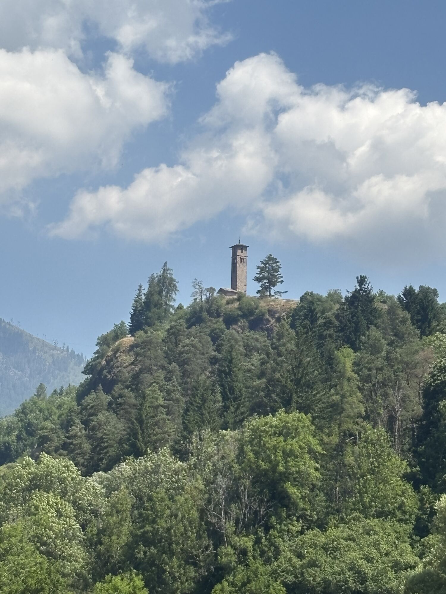
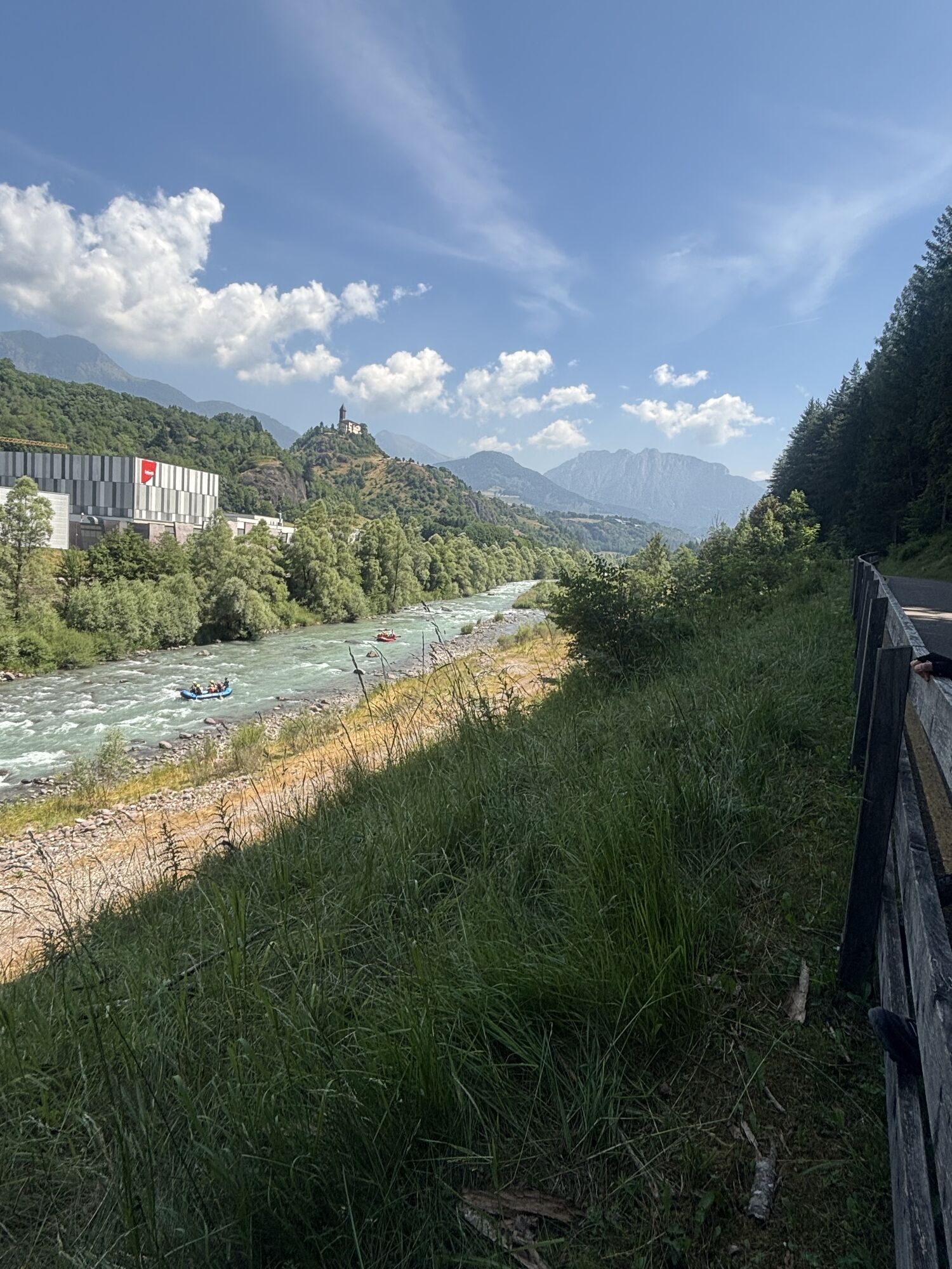
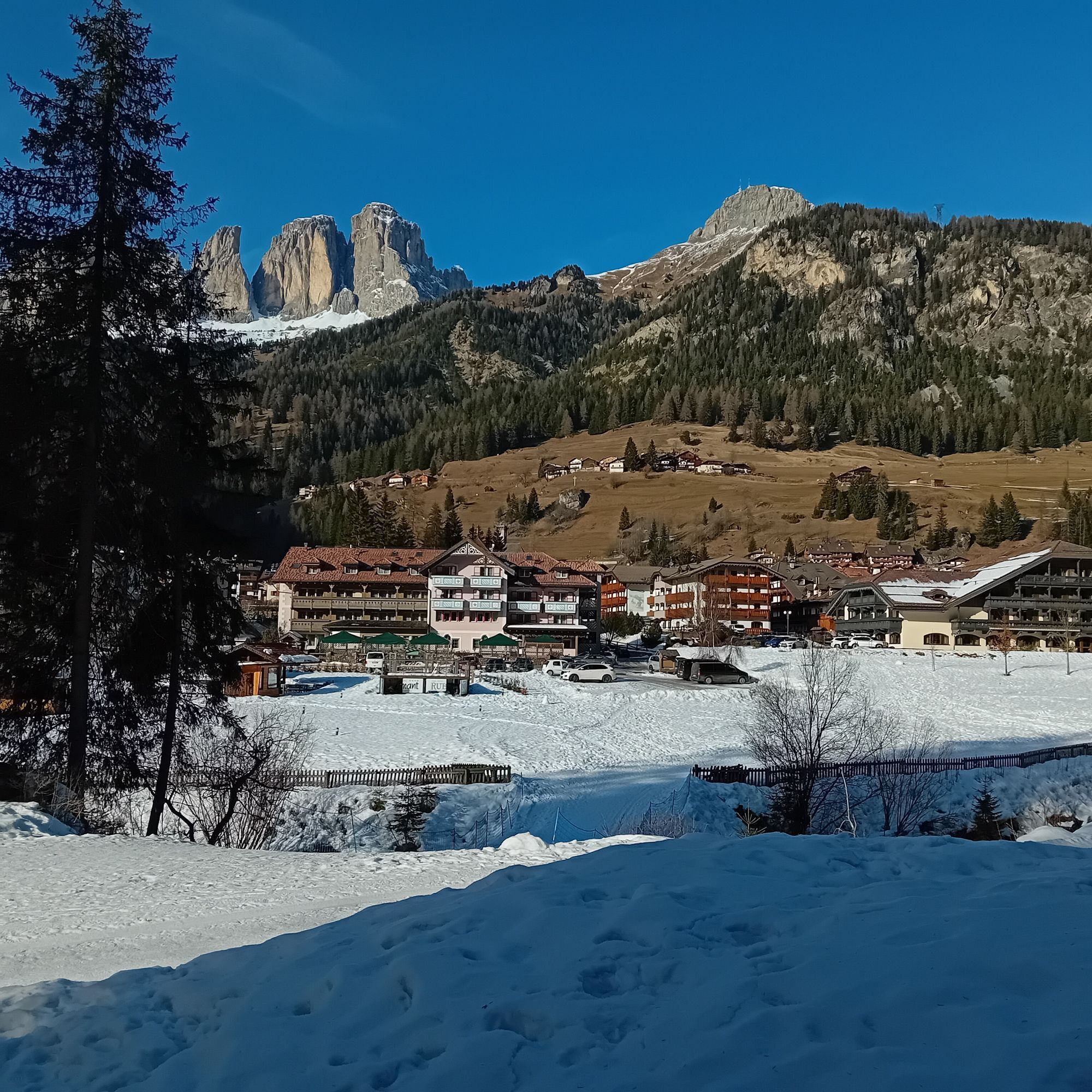
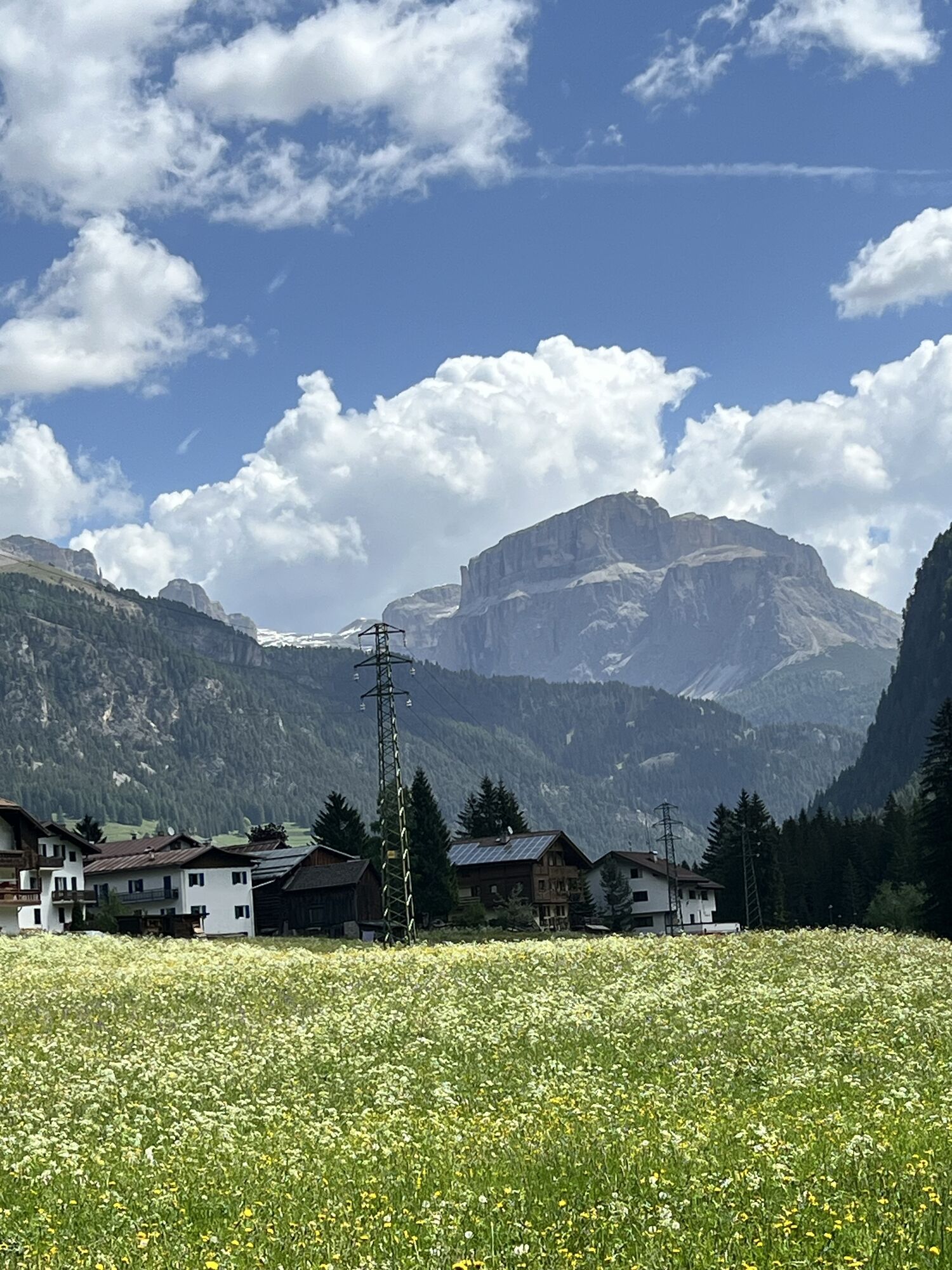
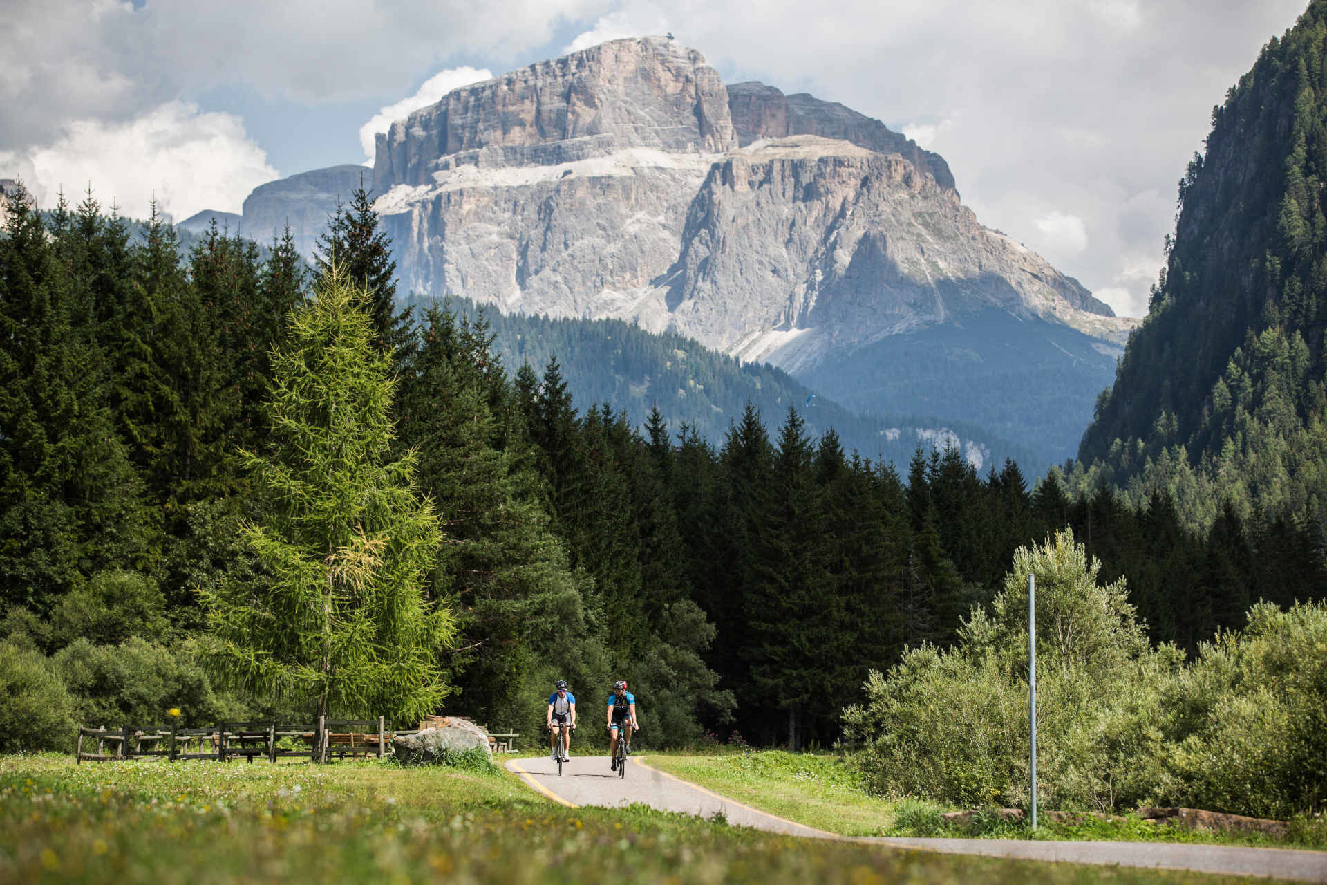
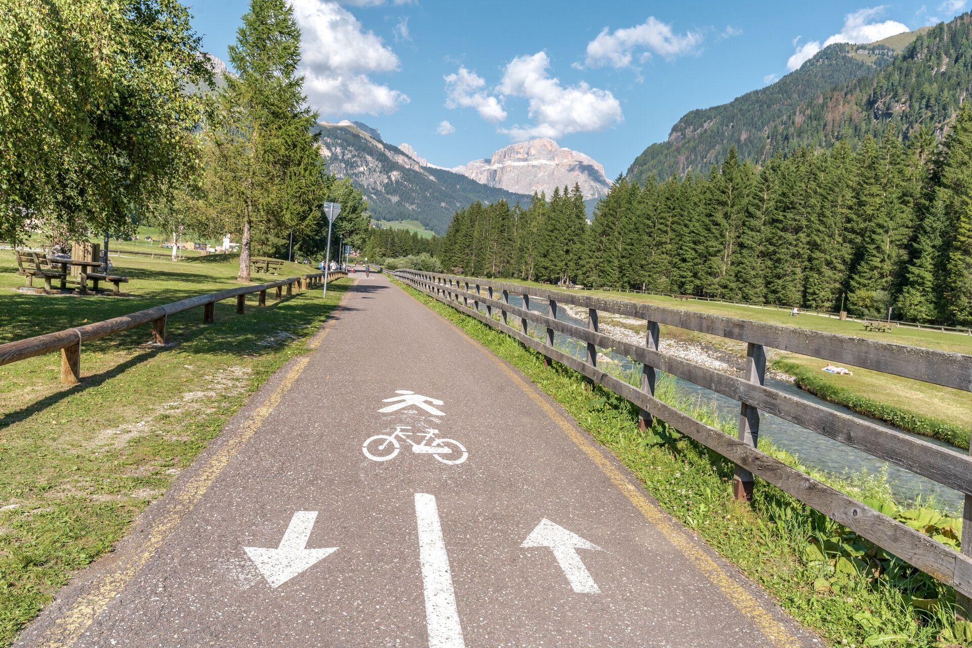
Cycling past Camping Rosengarten, cross the bridge and leave Pozza behind, while Vigo appears on your right, with the bell tower of the parish church of San Giovanni rising towards the sky. The landscape becomes even more picturesque: green meadows, fragrant woods and spectacular views open up onto the ridges of the Catinaccio and Latemar.
Reach Soraga, taking care when crossing the industrial estate. In a few minutes, you'll arrive at the village playground. A convenient underpass allows you to cross the main road safely and start theclimb towards Palua. Turn around for a picture-postcard view of Val di Fassa, framed by the jagged peaks of the Catinaccio, Sassolungo, Pordoi and Monzoni.
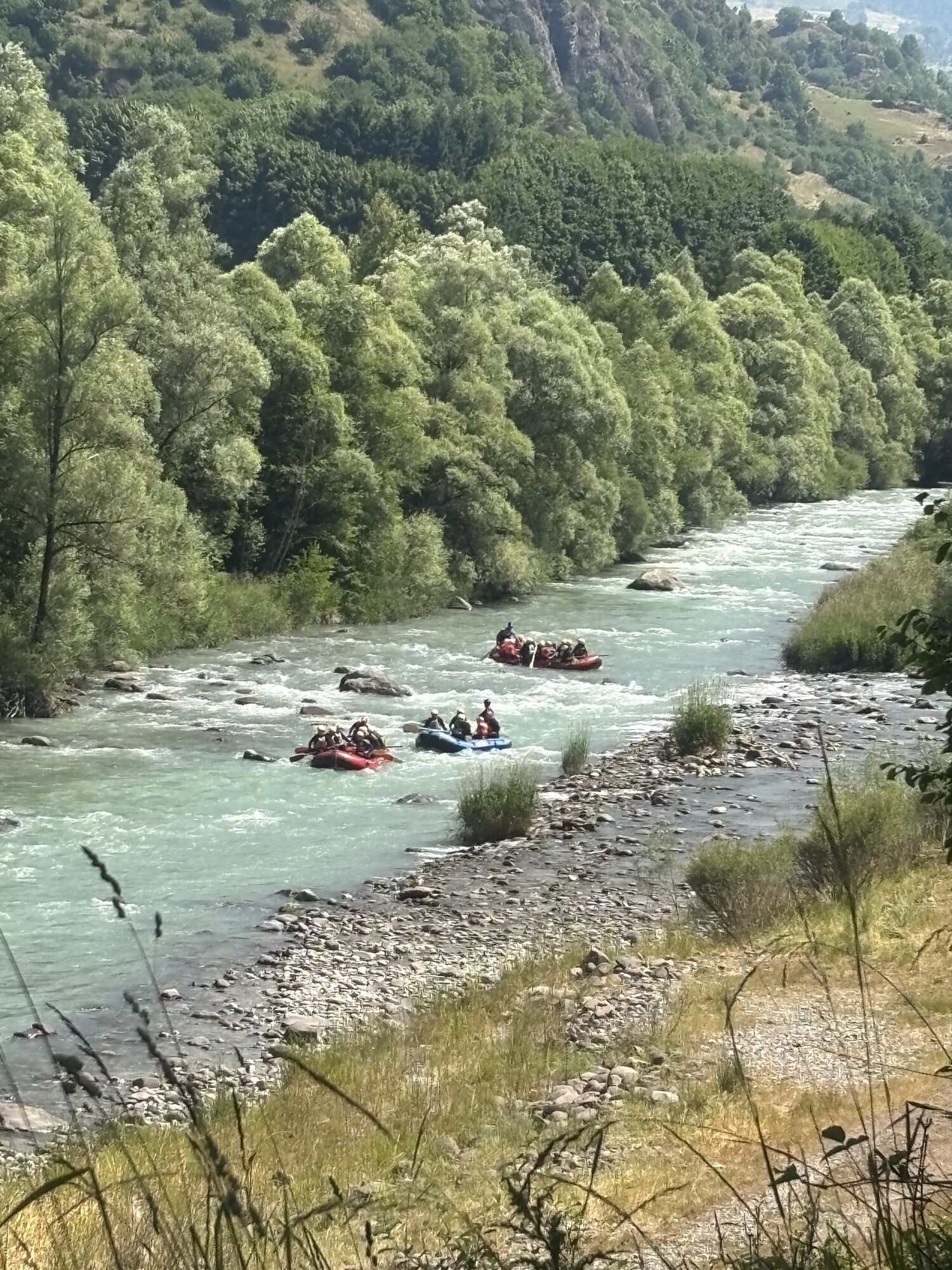
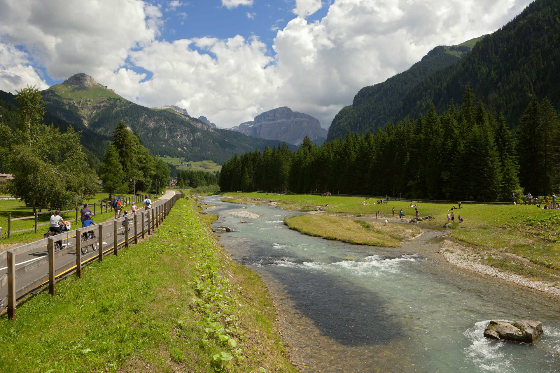
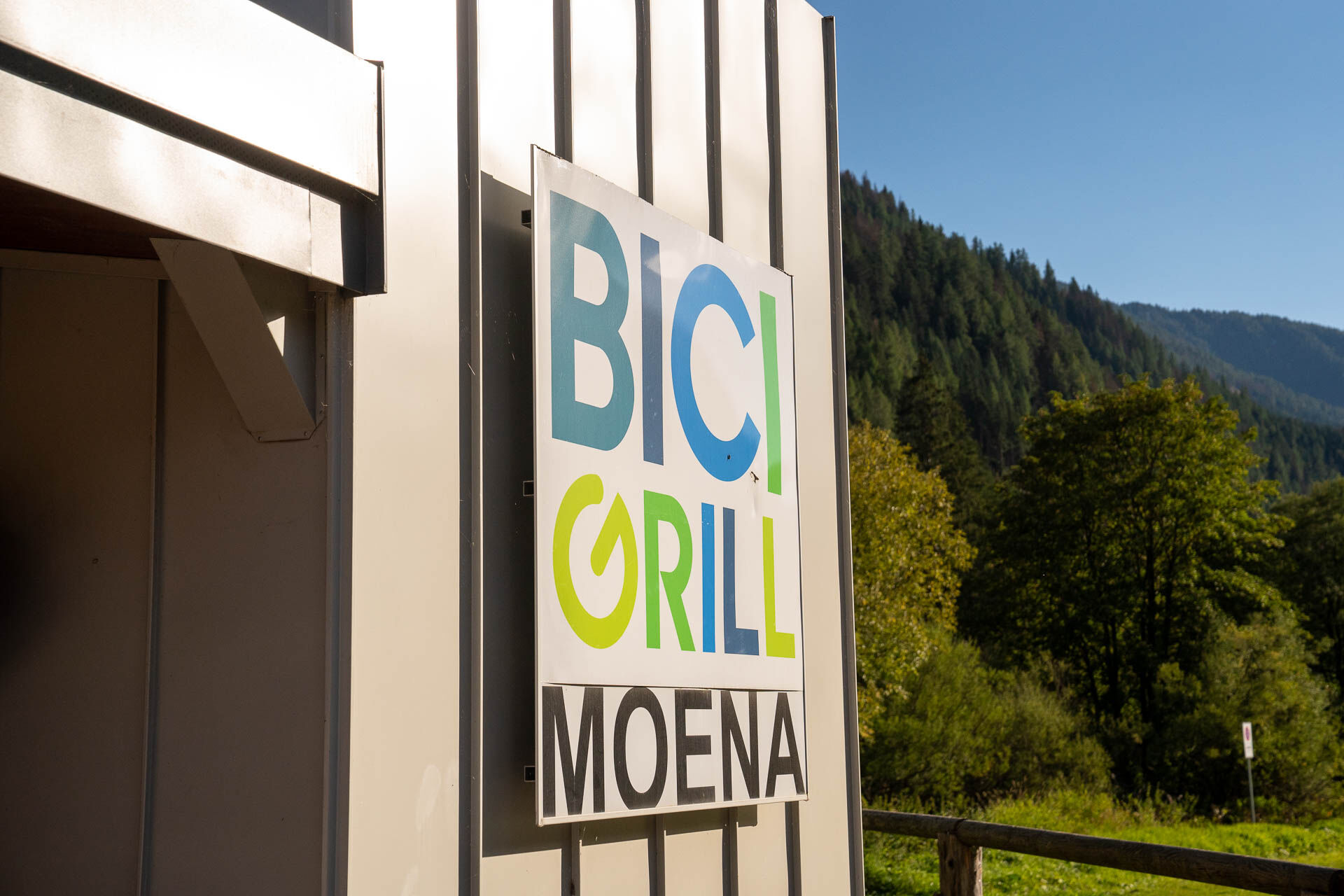
From here, the descent towards Moena resumes. The trail ends near the Alpine Training Centre, but the route continues along the municipal road to Piaz de Sotegrava. At the junction, turn left, then immediately right after the bridge to take "L Vial", the avenue leading to the Navalge area. Cross the road to Passo San Pellegrino and the car park: near the sports fields, the cycle path runs alongside the Avisio again. Pass through the tunnel carved into the rock beneath Pont de Mur, cross the bridge behind the Esso petrol station and reach the Bici Grill. You have arrived on the Moena valley floor, the starting point of the famous Marcialonga in January. From here, you can continue towards Predazzo and Val di Fiemme, along a route that keeps offering new views and emotions with every pedal stroke.
Ano
Ano
Suitable for all types of bikes: mountain bikes, e-MTBs, e-bikes, city bikes and road bikes.
Plan your ride according to your ability and the weather conditions.
Take your time, ride carefully and enjoy the scenery and the quiet.
Adapt your riding style to the type and condition of the route.
Wear a helmet and suitable clothing and equipment.
Respect the environment around you.
If you encounter pedestrians, let them know you are approaching and slow down.
Do not walk your dog on a lead while cycling: it is prohibited by the Highway Code and can be dangerous for both you and your dog. If you wish to exercise with your dog, stop and continue on foot.
Other access routes to Val di Fassa
From the A27 motorway (Venice), Belluno/Ponte nelle Alpi exit: SS 203 to Agordo, then SP 346 over Passo San Pellegrino to Moena (Val di Fassa). From the Moena bypass, continue towards Canazei From the A27 motorway (Venice), Belluno/Ponte nelle Alpi exit: SS 203 to Agordo/Alleghe/Rocca Pietore, then SP 641 over Passo Fedaia to Canazei From Arabba: SS 48 over Passo Pordoi to Canazei From Val Gardena: SS 242 over Passo Sella to CanazeiPublic transport lines SAD - Val di Fassa:
line no. 180 Vigo di Fassa - Carezza Pass - BolzanoThis route lets you cycle the full length of Val di Fassa, either uphill or downhill, following part of the Marcialonga course. The itinerary starts in Alba di Canazei, but you can join it from any village along the valley.
S1
Strèda Roma, 36
38032 Canazei (TN)
Phone +39 0462 609500
info@fassa.com
www.fassa.com
The ride can easily be split into several stages, choosing the section that best suits your pace and the time you have available. From May to October, the Fassa & Fiemme Bike Express runs along the valley: a convenient bike shuttle bus connecting Molina di Fiemme and Canazei.
Along the route, you'll find drinking fountains, picnic areas and playgrounds, making the experience even more enjoyable and family-friendly.
Webové kamery z prohlídky
Col dei Rossi
Ciampedie - Rosengarten
Ciampedie - Rosengarten
Ciampedie - Rosengarten
Ciampedie - Rosengarten
Le Cune
Le Cune
Le Cune
Le Cune
Le Cune
Le Cune
Le Cune
Rifugio Maria Sass Pordoi
Val Gardena - Citta dei Sassi
Pordoi - Pass
Catinaccio - Rosengarten Pra Martin
Ciampedie - Rosengarten
Ciampedie - Rosengarten
Ciampedie - Rosengarten
Ciampedie - Rosengarten
Catinaccio - Rosengarten Pra Martin
Catinaccio - Rosengarten Pra Martin
Canazei - Col dei Rossi
Canazei - Col dei Rossi
Canazei - Col dei Rossi
Le Cune
Castelir
Castelir
Castelir
Castelir
Castelir
Castelir
Pozza di Fassa - Buffaure
Canazei - Col Rodella
Canazei - Col dei Rossi
Canazei - Col dei Rossi
Canazei - Col dei Rossi
Canazei - Col dei Rossi
Canazei - Col dei Rossi
Canazei - Ciampac


Oblíbené prohlídky v okolí
- 4,8
Santnerpass Klettersteig
středníVia ferrata 8,29 km - 4,9
Torre di Pisa mountain hut
středníTuristika 9,09 km - 5,0
Ciampedie - Gardeccia - Refuges Vajolet and Preuss - Refuge Re Alberto I - Gardeccia - Ciampedie
heavyTuristika 11,8 km - 4,7
Passo Costalunga - Sella del Ciampaz
středníTuristika 8,35 km - 5,0
Ciampedie - Gardeccia - Principe Pass - Antermoia Refuge - Val Duron - Campitello
heavyTuristika 18,7 km - 4,7
Stage 1 Dolomiti Trek King in autumn - Catinaccio
heavyTuristika 15,3 km - 5,0
Latemar Umrundung - die Kurze und Bequeme
středníTuristika 12,1 km - 4,5
Kölner Hütte - Hirzelsteig - Rotwandhütte - Baita Tre - Karerpass
středníTuristika 9,56 km - 4,4
Cavallazza Peak
středníTuristika 7,82 km - 5,0
Rosengarten: Cigoladepass und Fassaner Höhenweg
středníTuristika 15,6 km
Pěší turistika a stopování


Nenechte si ujít nabídky a inspiraci pro vaši příští dovolenou
Vaše e-mailová adresa byl přidán do poštovního seznamu.