
Ski tour Goisele 2.433m
střední
Pořiďte si tuto prohlídku do mobilního telefonu
Ski tour Goisele 2.433m
střední
Lyžařská trasa
8.44
km
Naskenujte QR kód a spusťte navigaci v aplikaci bergfex.


Pěší turistika a stopování





Ski tour Goisele 2.433m
střední
Vzdálenost
8.44
km
Doba trvání
05:00
h
Ascent
1048
hm
Hladina moře
1163 -
2257
m
Stažení skladby
Ski tour Goisele 2.433m
střední
Lyžařská trasa
8.44
km
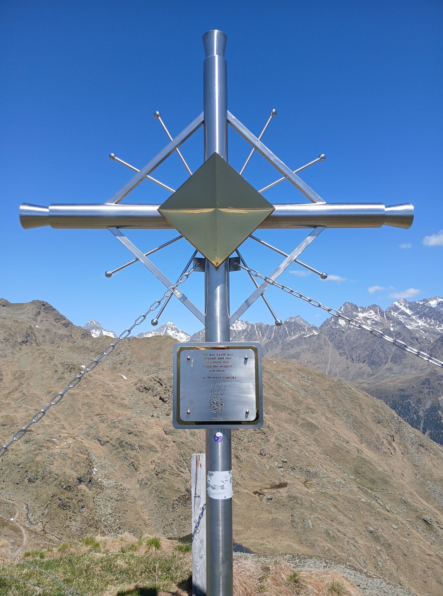
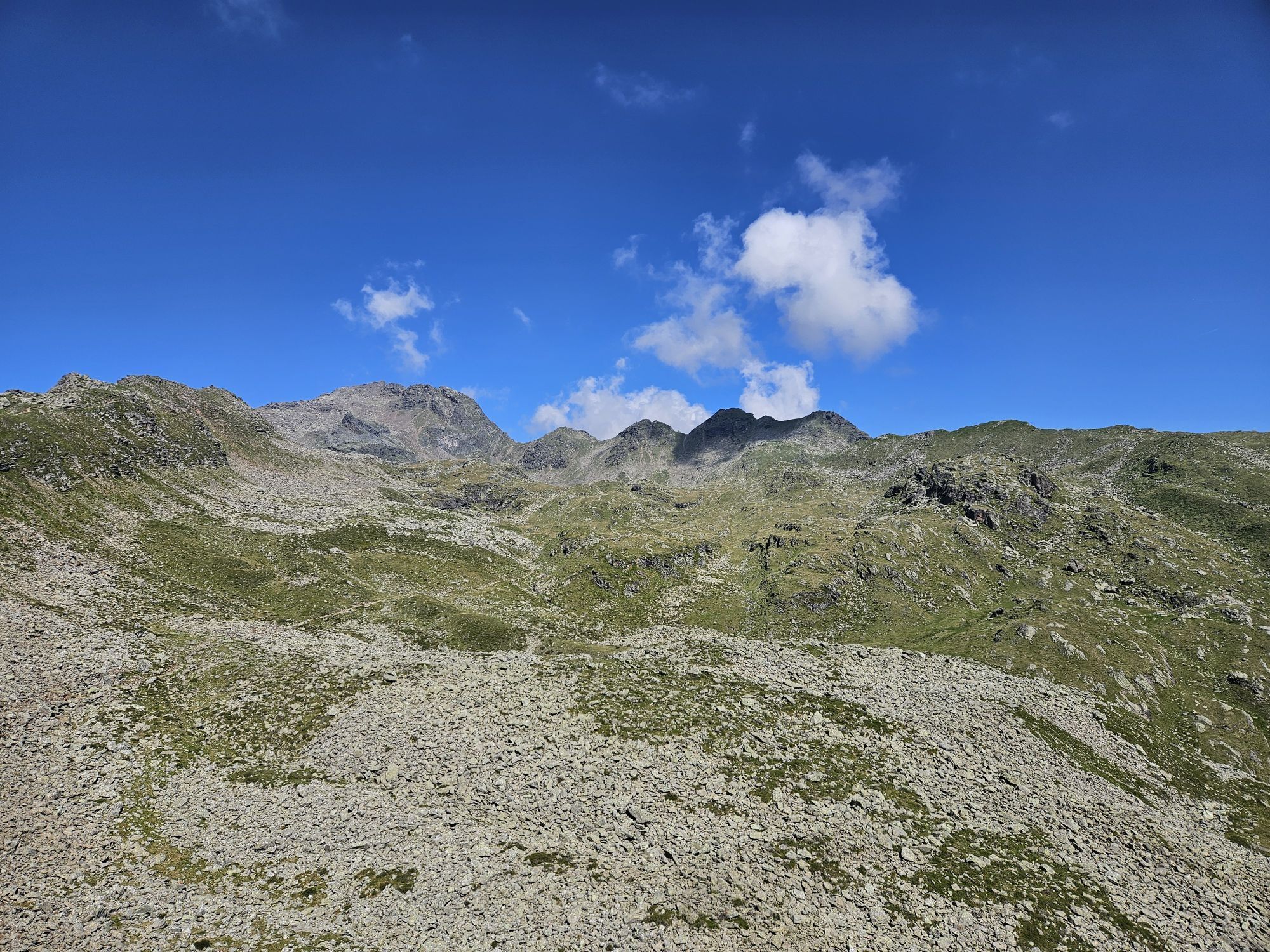
The Goiselemandl, also shortened to Goißele by the locals, is a little snow pyramid at the north-west end of Lienz’s sunny ski area, Zettersfeld. In terms of ski touring technique the ascent is no more...
Popis
The Goiselemandl, also shortened to Goißele by the locals, is a little snow pyramid at the north-west end of Lienz’s sunny ski area, Zettersfeld. In terms of ski touring technique the ascent is no more than a ski hike, even if there are a few hairpin bends on the somewhat ascending summit ridge. The descent on the east side into neighbouring Debanttal reckons on you having appropriate top-class conditions. Avalanche safety and an option of heading back at the so-called ‘Säge’ (1170 m) are required, and it is here that our descent variant finishes. It is also possible for the very fit to walk via a not-too-short goods trail (Hochstubenweg) back to Faschingalmstraße and to the Naturfreunde Hütte, where you enter the eastern end of the ski area.
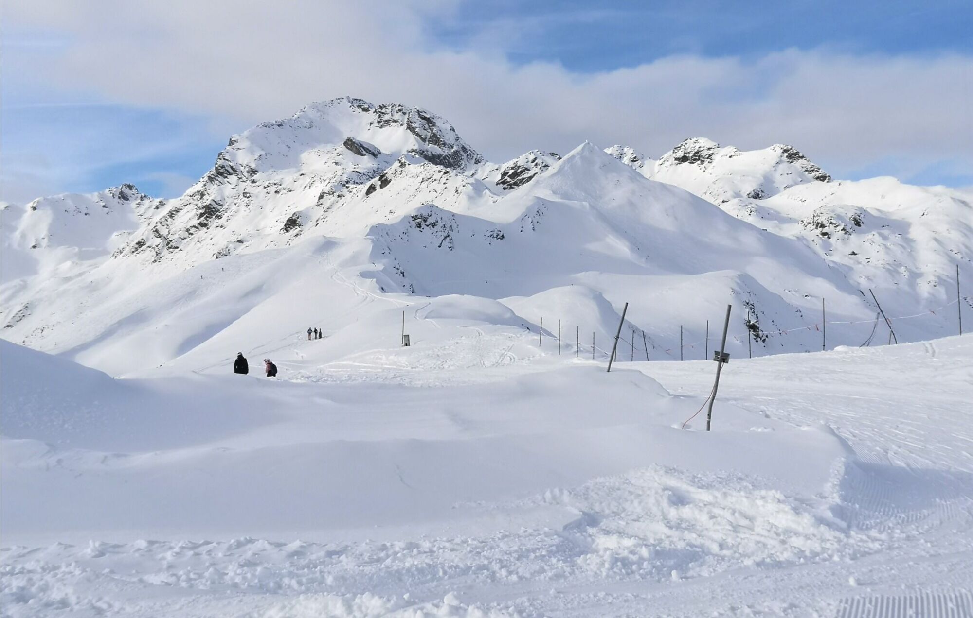
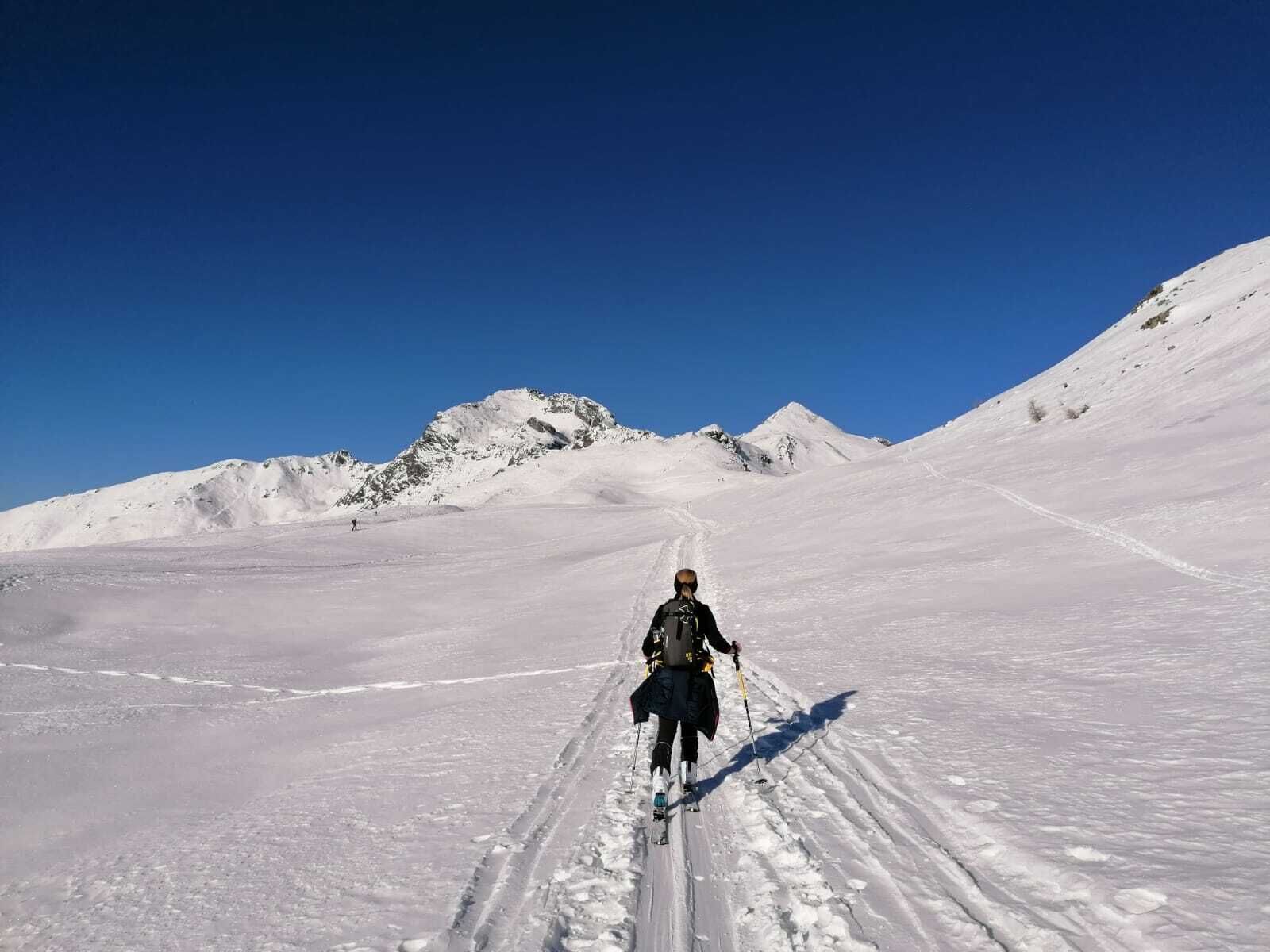
There are several starting points when it comes to climbing the Goißele. The shortest proceeds from the mountain station for the Steinermandl chairlift (2200 m) across the piste heading north- west and reaches the ridge in a dip (wooden signpost), 300 metres to the north west of the mountain station for the Schoberköpfl T-bar lift (2281 m). Those of you who prefer things to be really leisurely can of course also ascend via the T-bar lift to the Schoberköpfl and, descending slightly initially, cross the dip to the north west. A more leisurely, somewhat quieter ascent proceeds from the peak of the ‘Thurner-Zettersfeldstraße’ (1880 m) via the tranquil Rottmann ski route (No. 13) to the Schoberköpfl and branches off just before Lifthüttl across troughs to the summit ridge of the Goißele. Quite a number of ski tracks now lead us obviously from the aforementioned enclosed basin along the wide ridge, up and down slightly, in a north-westerly direction to the destination of our tour which has a lovely metal cross. The ski tour to the Schleinitz uses the trough to the east side beneath the Goißele, but we disregard it. The descent into Debanttal proceeds through the eastern flank which is a bit steep initially (>30°), before heading into gentle terrain and opens up several variants. One heads in a long left loop (north-east) to Wellalm (steeper), before after glades and the route crossings of the aforementioned Hochstubenweg and in further consequence the bottom of the Debanttal is tackled. From there, after crossing a river at skating pace, head to the start of the asphalt road at the ‘Säge’. Those who are heading east to the Seewiesenalm (1996 m) can ascend back into the ski area again there, which yields a nice circular tour, or continue into Debanttal via Kuchlmairalm.
There are several starting points when it comes to climbing the Goißele. The shortest proceeds from the mountain station for the Steinermandl chairlift (2200 m) across the piste heading north- west and reaches the ridge in a dip (wooden signpost), 300 metres to the north west of the mountain station for the Schoberköpfl T-bar lift (2281 m). Those of you who prefer things to be really leisurely can of course also ascend via the T-bar lift to the Schoberköpfl and, descending slightly initially, cross the dip to the north west. A more leisurely, somewhat quieter ascent proceeds from the peak of the ‘Thurner-Zettersfeldstraße’ (1880 m) via the tranquil Rottmann ski route (No. 13) to the Schoberköpfl and branches off just before Lifthüttl across troughs to the summit ridge of the Goißele. Quite a number of ski tracks now lead us obviously from the aforementioned enclosed basin along the wide ridge, up and down slightly, in a north-westerly direction to the destination of our tour which has a lovely metal cross. The ski tour to the Schleinitz uses the trough to the east side beneath the Goißele, but we disregard it. The descent into Debanttal proceeds through the eastern flank which is a bit steep initially (>30°), before heading into gentle terrain and opens up several variants. One heads in a long left loop (north-east) to Wellalm (steeper), before after glades and the route crossings of the aforementioned Hochstubenweg and in further consequence the bottom of the Debanttal is tackled. From there, after crossing a river at skating pace, head to the start of the asphalt road at the ‘Säge’. Those who are heading east to the Seewiesenalm (1996 m) can ascend back into the ski area again there, which yields a nice circular tour, or continue into Debanttal via Kuchlmairalm.
Additional ski tour tips can be obtained in the ski tour guides by Thomas Mariacher. These are available here: http://www.grafikzloebl.at/verlag/buecher/
Trasa
Debanttal
(1463 m)
Koridor/terén
5.9 km
Goiselemandl
(2433 m)
Summit
8.2 km
Trasa
Ski tour Goisele 2.433m
střední
Lyžařská trasa
8.44
km
Debanttal
(1463 m)
Koridor/terén
5.9 km
Goiselemandl
(2433 m)
Summit
8.2 km


Informace o příjezdu
Příjezd
Coming from Lienz, drive in the direction of Debant. Turn off after Nußdorf and continue into the Debant valley until you reach the "Säge".
Zatím žádné recenze
Získejte přehled Vždy živě na místě s více než 9 500 webkamerami. bergfex Jako uživatel Pro si nyní můžete zobrazit odpovídající webové kamery pro mnoho prohlídek v aplikaci prohlídky z. Můžete si tak přímo prohlédnout aktuální podmínky. Oblíbené prohlídky v okolí
- 4.9
Wangennitzsee Hütte
středníTuristika 3.80 km - 5.0
Ederplan round from the parking lot Stronach
středníTuristika 7.19 km - 4.7
Karlsbader Hütte über Rudl-Eller-Weg
heavyTuristika 5.10 km - 4.8
Glödis 3206m: PP Seichenbrunn, Lienzer Hütte, Glödis KS A/B
heavyVysokohorská turistika 16.1 km - 4.7
Karlsbader Hütte
středníMountainbike 13.4 km - 4.3
Böses Weibele, 3119m, Lucknerhaus
heavyTuristika 13.8 km - 4.2
Gradental to Adolf Nossberger Hut - circular route
středníTuristika 11.1 km - 4.9
Astental: Mohar, Moharkreuz
středníTuristika 9 km - 4.7
Lienzer Hütte
světloTuristika 7.39 km - 4.0
Karlsbader Hütte - Lienzer Dolomiten
Turistika 8 km

Pěší turistika a stopování

Více než 550.000 návrhů výletů, podrobné mapy a intuitivní plánovač tras dělají z aplikace nezbytnou výbavu pro všechny milovníky přírody.

Nenechte si ujít nabídky a inspiraci pro vaši příští dovolenou
Přihlaste se k odběru newsletteru
Chyba
Došlo k chybě. Zkuste to prosím znovu.Děkujeme za vaši registraci
Vaše e-mailová adresa byl přidán do poštovního seznamu.
Zájezdy po celé Evropě
Rakousko Švýcarsko Německo Itálie Slovenia Francie Nizozemsko Belgie Polsko Lichtenštejnsko Česko Slovensko Španělsko Chorvatsko Bosna a Hercegovina Lucembursko Andorra Portugal Iceland United Kingdom Ireland Greece Albania North Macedonia Malta Norway Montenegro Moldova Kosovo Hungary San Marino Romania Estonia Latvia Belarus Cyprus Lithuania Serbia Bulgaria Monaco Denmark Sweden Finland





