


Trail route from Schlossberg to the trenches
The route is also manageable for less experienced trail runners and certainly offers a nice challenge with a great landscape and nature experience. Along the way, there are many information boards where...
The route is also manageable for less experienced trail runners and certainly offers a nice challenge with a great landscape and nature experience. Along the way, there are many information boards where you can learn more about viticulture and the geological peculiarity of the doline. Dolines are neither fruit nor animals!

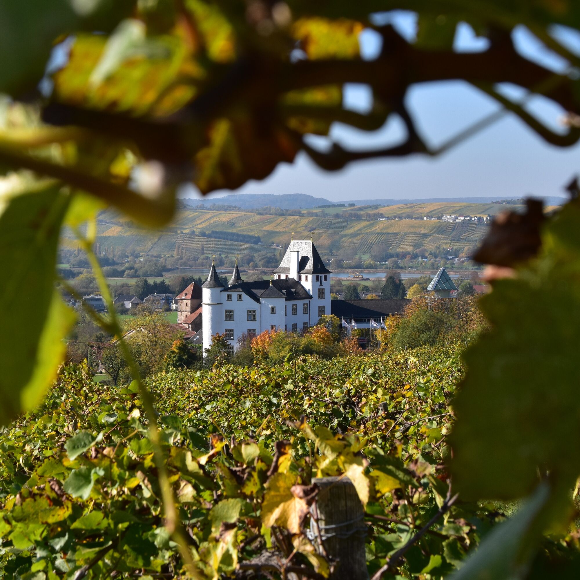
We start at the parking lot at Schloss Berg in Nennig. Built on a hill above the village of Nennig, Schloss Berg consists of two castles: the lower and the upper castle. These are two interconnected water castles whose history dates back to the 12th century. The lower castle is privately owned, while the upper castle — converted into a Renaissance palace in later centuries — now houses a luxury hotel, a gourmet restaurant, and a modern casino.
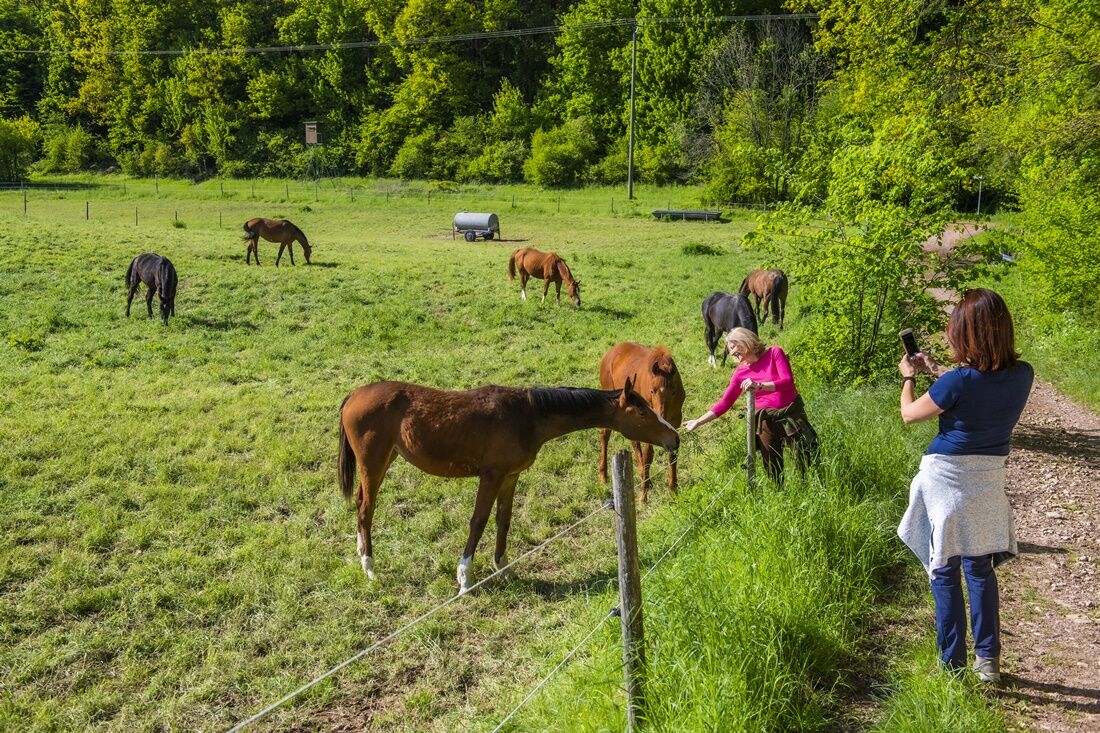
Our route begins quite gently on less demanding paths and leads us over Schlossstraße past the restaurant "Die Scheune" into the vineyards near Nennig. From here, we pass the old marketplace into Felsstraße and thus to the first long ascent. This follows altitude meter by altitude meter the course of the "Nennigerbach" stream. This section of the path is especially popular with riders from the region, so don’t be surprised if there’s a horse on the track.
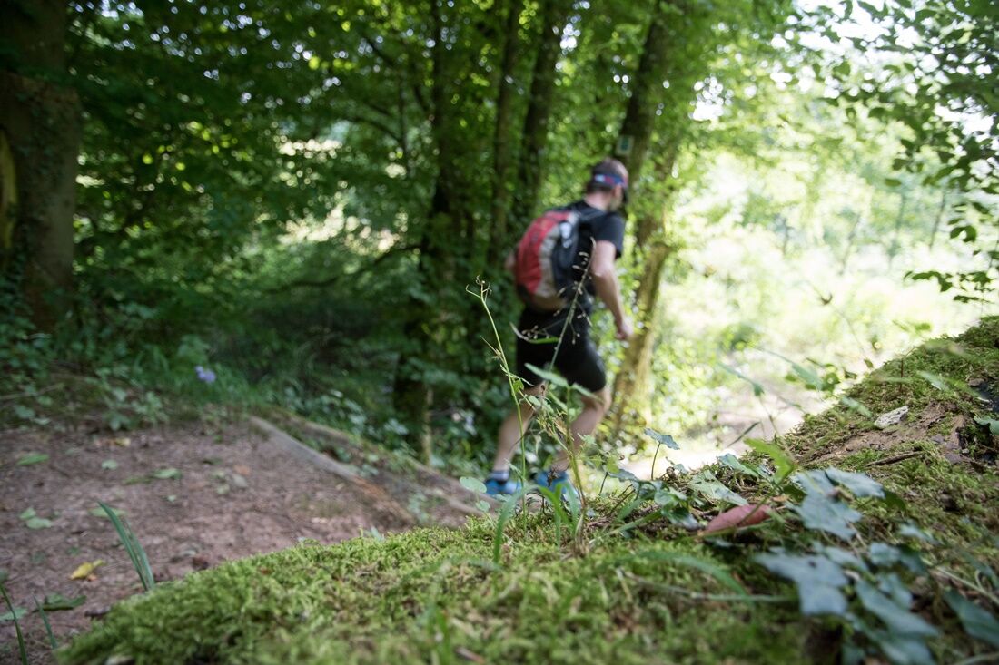
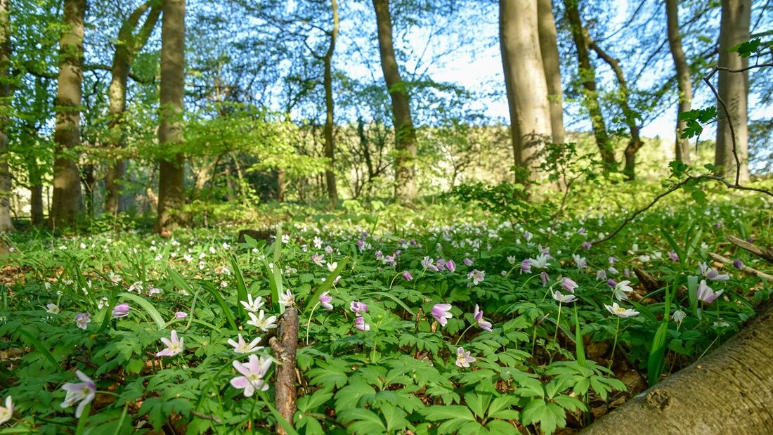
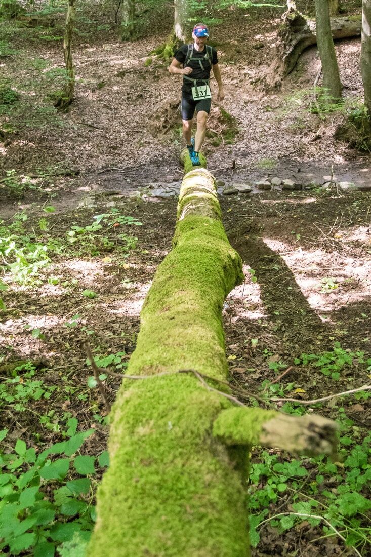
At the top, we are in the middle of the Lateswald, a private forest of the namesake homestead association. This forest with its huge old trees offers incredible calm and serenity compared to usual everyday stress. We take the opportunity to make a few loops and twists through this forest before continuing toward Tettingen. Near the Wingertshof, we encounter a great trail section. Many changes of direction, small hills, roots, and completely different forest formations delight every trail runner and nature lover. The last section of this trail leads us through old trenches from the war years. They are still mute witnesses of a terrible time that heavily shaped our tri-border area. Around the district of Tettingen, numerous remains of the former Siegfried Line, a several-kilometer-long concrete tank barrier, can be found, embedded in the landscape like scars.
From the trenches, we walk along lush meadows and paddocks to the first doline. A doline is neither a fruit nor a long-haired animal. Dolines are also not ancient instruments or devices. Dolines are funnel-, kettle-, or chimney-shaped hollow forms in karst rock with underground water drainage. They are geological peculiarities and form through dissolution processes in the karstifiable substrate. The first doline along the route is a doline with a swallow hole. It has a depth of several meters and is equipped with a so-called swallow hole (ponor). This prevents the accumulation of rainwater. On rainy days, you can hear the "swallowed" water rushing underground.
We reach the second doline after a short but challenging trail ascent at the forest edge. This place regularly invites hikers to rest or picnic. The second doline is a solution doline without a swallow hole. Here, the precipitation water accumulates into a pond surrounded by an ecologically valuable vegetation edge.
From now on, it’s either a relaxed cool-down or a last push of pace. The final meters go continuously downhill and offer a wonderful view of the Moselle valley, the neighboring Luxembourg border town Remich, and, at the end, of course, from the vineyards to Schloss Berg.
Ano
Oblíbené prohlídky v okolí
- 4.4
Traumschleife Cloefpfad
středníTuristika 8.04 km - 4.5
Trassem - Haus Jochem - Kruterberg - Klein Heide
středníTuristika 11.3 km - 4.8
Taben-Rodt Gipfel Maunert
středníTuristika 12.0 km - 5.0
Traumschleife Kastel-Staadt Felsenpfad
heavyHorská turistika 10.2 km Moselsteig Stage 02: Palzem - Nittel
střednídálková pěší trasa 16.4 km- 4.0
Montclair Tafeltour 01.08.2021
světloTuristika 9.17 km Moselsteig Stage 01: Perl – Palzem
heavydálková pěší trasa 23.8 kmMosel Cycle Path Section 1: From Perl to Nittel
světloCyklistika na velkou vzdálenost 25.3 kmPerl 44
heavyMountainbike 43.9 kmJakobsweg-Zuwegung Merzig – Perl-Borg
heavyPoutní stezka 37.8 km
Pěší turistika a stopování


Nenechte si ujít nabídky a inspiraci pro vaši příští dovolenou
Vaše e-mailová adresa byl přidán do poštovního seznamu.