


Forest hike: Bobenheim am Berg - Waldfroschweg
Right at the beginning of your walk along the Haard ridge, you will be rewarded with a magnificent view. The first kilometer steadily ascends, then continues quite flat before descending steadily but comfortably...
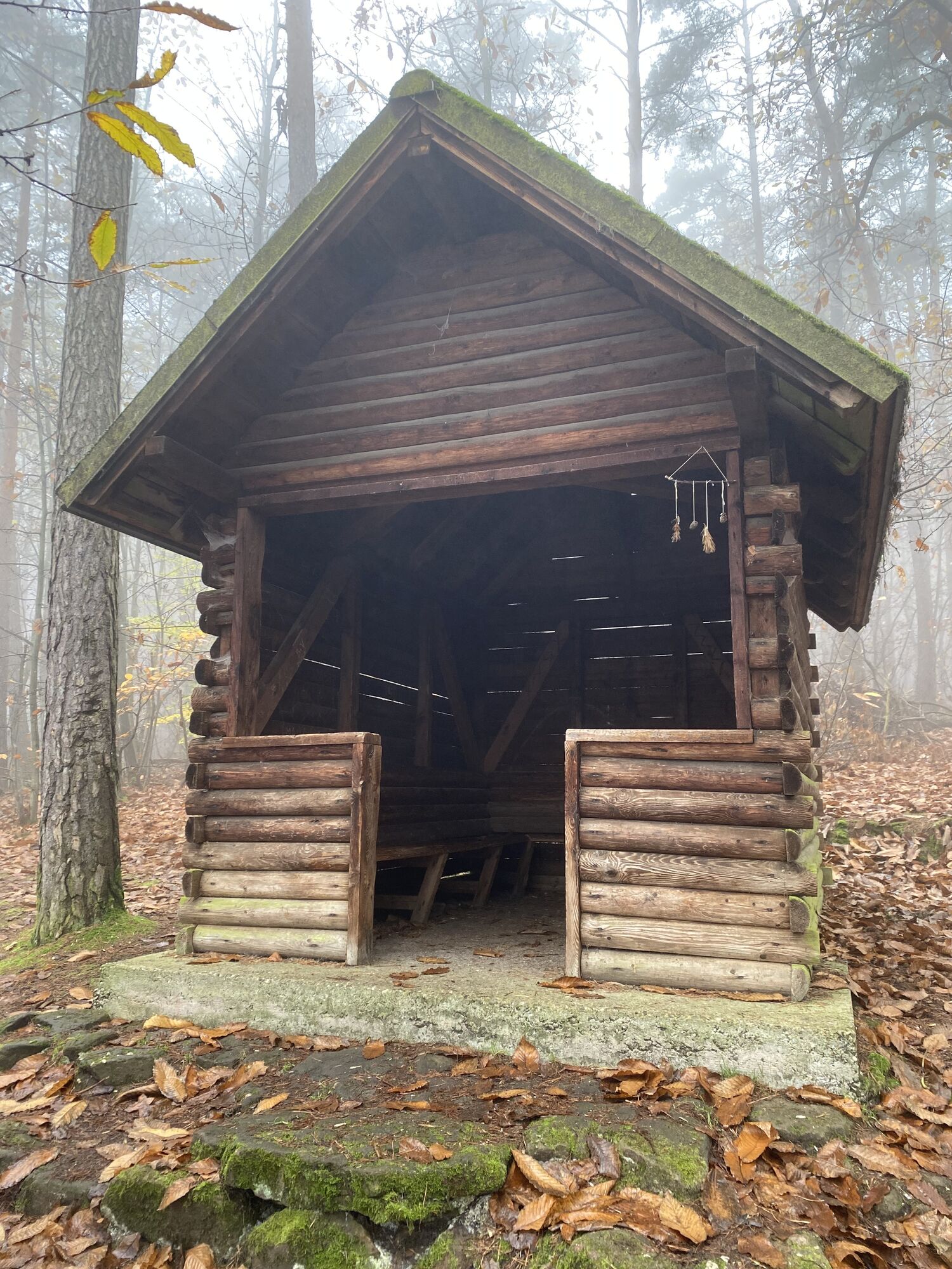
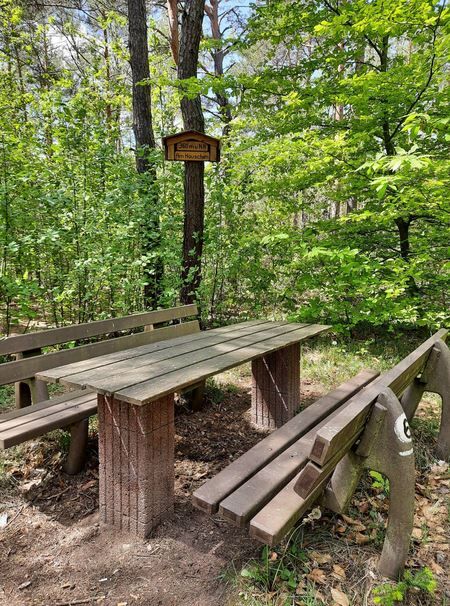
Right at the beginning of your walk along the Haard ridge, you will be rewarded with a magnificent view. The first kilometer steadily ascends, then continues quite flat before descending steadily but comfortably in the last kilometer back to Bobenheim am Berg. The path passes the Triforstbrunnen and the rest area at the hut with tables and benches. Just before the Triforstbrunnen, there is an option to turn left heading south via the Plauser rest area towards Ungeheuersee with PWV hut.

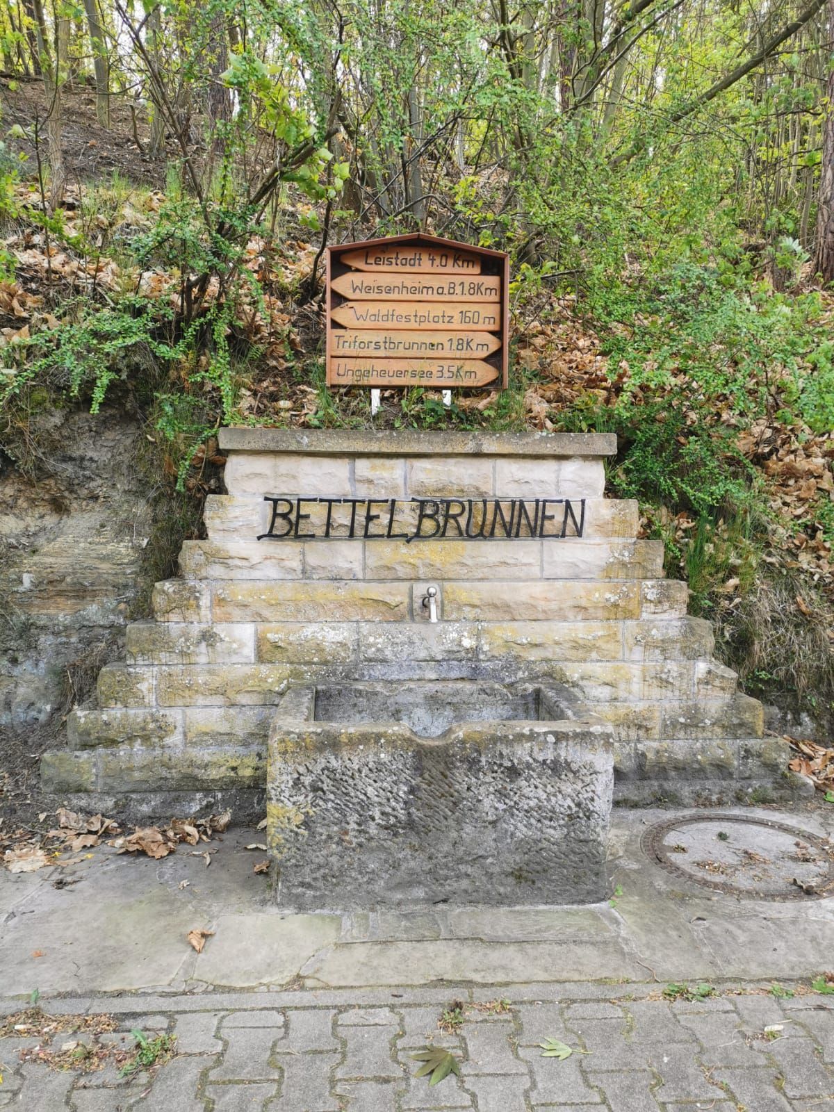
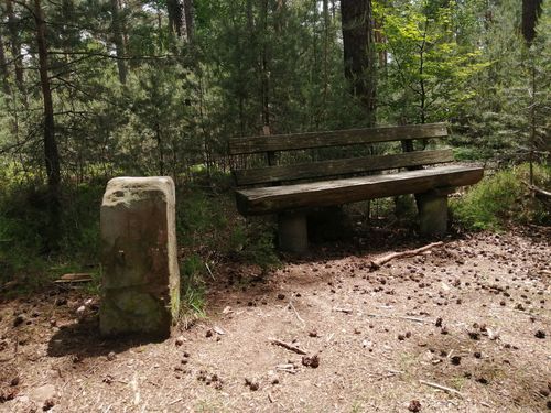
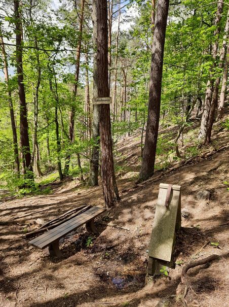
From the parking lot, walk about 200 m straight ahead towards the west (forest). On the left side, at the "Bettelbrunnen" with signposts, turn into Haardtweg and walk uphill along the street towards the forest festival area. At the forest festival area, head south past the houses, following the sign with the black frog. Continue straight to the next marker (black frog on white background). After about 50 m, go up the small hill on the right (the next sign is on the tree to the left). Do not take the 1 path straight ahead. After about 200 m, the 1st boundary stone is on the left. The path gradually climbs. At the intersection, continue straight on the narrow path. On the left is the next marker, 1 path and Waldfroschweg. This section is very uneven, partly crossed by roots and eroded. You will reach the 2nd boundary stone on the left and continue on this path to the Triforstbrunnen. Between the "black frog" sign and the split tree, go down the narrow path. You will come directly to the Triforstbrunnen.
Then go back up the slope, turn left, and then pass the rest area at the hut back towards Bobenheim am Berg onto the street "In den Hahndornen," which turns into "Am Woogtal" and leads back to the parking lot at the starting point.
Alternatively, from the Triforstbrunnen, you can turn right to head towards Ungeheuersee. You can reach the lake via the Plauser rest area and then continue south on hiking trail 3.
The path mostly runs on unpaved forest ground. Watch out for roots, rocks, and stones so you don't lose your footing. After rainy days and especially in spring, autumn, and winter, the paths can be wet and therefore slippery.
From the north:
via the A61 motorway at the Frankenthal interchange onto the A6 towards Kaiserslautern. Exit Grünstadt/Deutsche Weinstraße. Continue on B271 (German Wine Route) towards Bad Dürkheim, exit Kirchheim/Kleinkarlbach. In Kleinkarlbach turn left towards Bobenheim. In the village, turn right after the church into Leininger Straße. Drive up the street until after a bend it turns left into the street "Am Woogtal." Small parking lot at the junction of Haardtweg.
From the south:
via the A61 motorway at the Ludwigshafen interchange onto the A650 towards Bad Dürkheim. At the end of the motorway continue on B37. Pass the Bruch industrial area, next traffic light turn right to Ungstein. At the roundabout take the 3rd exit into the village. After about 50 m turn right onto B271 (German Wine Route) towards Grünstadt. At the traffic light in Herxheim am Berg turn left towards Weisenheim am Berg. At the village entrance turn right over the bypass road to Bobenheim am Berg. Shortly after the village entrance to Bobenheim, turn left into Leininger Straße. Drive up the street until after a bend it turns left into the street "Am Woogtal." Small parking lot at the junction of Haardtweg.
Bus line 453 from Grünstadt (north) or Bad Dürkheim (south). Stop: Bobenheim/Winzer. Timetable information www.vrn.de
Then walk to Leininger Straße, which after about 600 m turns into the street "Am Woogtal." The starting point is the small parking lot at the junction of Haardtweg.
Woogtal parking lot, accessible via Leininger Straße.
Freinsheim holiday region, info point Kallstadt, Tel.: 06322-667838
North of Bobenheim is the Krummbachtal hiking parking lot, from which other hiking trails are signposted, for example, leading up to Battenberg.
Oblíbené prohlídky v okolí
-
4.0
Ganerbenweg - Premium circular hiking route in the Freinsheim holiday region
středníTuristika 10.5 km -
4.5
From Deidesheim over the Heidenlöcher to Eckkopf
středníTuristika 14.6 km -
Wachenheim - Eckkopf - Heidenlöcher - Wachenheim
středníTuristika 12.8 km -
5.0
Wachenheimer Valleys Route to Oppauer Haus
středníTuristika 11.7 km -
5.0
Circular route through forest and vineyard: Weisenheim am Berg - "Wine, Forest, Ungeheuer"
středníTuristika 12.5 km -
5.0
Leininger Castle Trail - Premium hiking trail with audio and video stations
heavyTuristika 22.3 km -
4.0
Thomas‘ Waldweinstube über die Wachtenburg
světloTuristika 4.81 km -
3.5
Leininger Monastery Trail - Premium hiking trail with audio and video stations
středníTuristika 15.3 km -
4.3
Zwei-Burgen Tour Battenberg
středníTuristika 5.43 km -
Palatinate Wine Steig Stage 03 Bad Dürkheim - Deidesheim
střednídálková pěší trasa 15.2 km

Pěší turistika a stopování


Nenechte si ujít nabídky a inspiraci pro vaši příští dovolenou
Vaše e-mailová adresa byl přidán do poštovního seznamu.