


Adolf-von-Nassau Wanderweg
In the fight for the royal crown against Albrecht of Austria, he lost his life at the Battle of Hasenbühl near Göllheim on 2 July 1298. The battle put an end to the conflict over the throne and was the...
In the fight for the royal crown against Albrecht of Austria, he lost his life at the Battle of Hasenbühl near Göllheim on 2 July 1298. The battle put an end to the conflict over the throne and was the last knight's battle on German soil. Adolf of Nassau was initially buried at Rosenthal Abbey before he was put in his final resting place at Speyer Cathedral.
The circular trail is marked with a stylised yellow Königskreuzkapelle (King's Cross Chapel) on a blue background and has 344 metres of ascent and descent.

It goes over the road and straight ahead at junctions. At the end of the path, we turn right ("Hohebirk") and keep following the forest path, which makes a left turn. At the crossroads in front of a building, go down the path on the right. We turn right onto the road and left to the Arleshof.
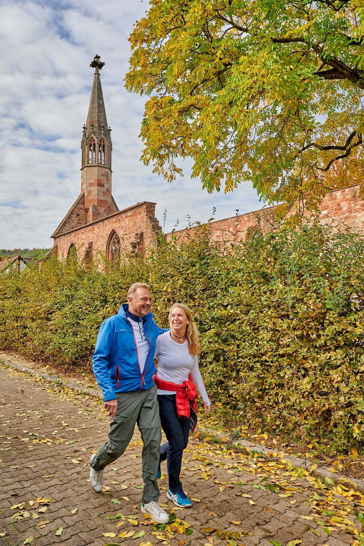
The tour continues to Rosenthal Abbey, which was a Cistercian convent dedicated to the Virgin Mary. It was endowed in 1241. In 1572, the last nun gave up her duties.
The abbey ruins are open on Sundays from April to October from 1 to 6 p.m. or by appointment.
In the village, go straight towards Göllheimer Häuschen. Then cross the road and turn right shortly after the building towards Dreisen. Afterwards it goes back to Göllheim.
In the village, turn right onto Gutenbergstraße and left onto Königskreuzstraße to Königskreuz.
It is the perfect hiking trail for those who love history, beautiful views and the tranquillity of the forest!
Topographische Wanderkarte 1:25:000 - Blatt2 – Naturpark Pfälzerwald „Grünstadt und Stumpfwald“
Sturdy shoes
Clothing suitable for the weather
Protection against sun and rain
Sufficient food and drink, as food and drink outlets may not be available or open.
Even though the trails are very well marked, it is always advisable for safety reasons to carry a suitable hiking map in order to be able to find a safe place quickly in case of a storm or emergency, for example.
In autumn in particular, it is important to remember that leaves lying on the ground can hide bumps, roots, stones and holes in the path. Trees can topple and branches can fall down after thunderstorms and rainstorms. Natural paths can become muddy and slippery, especially in poor weather conditions. Not all rocks and precipices are secured with ropes or railings. You need to be sure-footed in certain areas. Damage to paths of this kind is to be expected on hikes. If you feel that certain sections of the path are not passable for you, please avoid them.
NOTE:
We endeavour to announce all closures due to forest work or hunting parties on this platform. Nevertheless, sometimes there are situations where hiking trails are closed and we may not have been informed. If you unexpectedly encounter a road closure or diversion, please follow the instructions for your own safety.
Motorway A6 to Wattenheim exit, continue on B47 towards Eisenberg, continue to Göllheim.
By train to Eisenberg/Pfalz
BUS 920 to Göllheim and back
Car park by the L396 towards Ramsen.
Car park at Kriegsberghütte.
Car park at Göllheimer Häuschen.
Car park in Rosenthal.
Oblíbené prohlídky v okolí
-
4.0
Ganerbenweg - Premium circular hiking route in the Freinsheim holiday region
středníTuristika 10.5 km -
5.0
Circular route through forest and vineyard: Weisenheim am Berg - "Wine, Forest, Ungeheuer"
středníTuristika 12.5 km -
5.0
Leininger Castle Trail - Premium hiking trail with audio and video stations
heavyTuristika 22.3 km -
3.5
Leininger Monastery Trail - Premium hiking trail with audio and video stations
středníTuristika 15.3 km -
4.3
Zwei-Burgen Tour Battenberg
středníTuristika 5.43 km -
5.0
Palatinate Wine Trail Stage 01 Bockenheim - Neuleiningen
střednídálková pěší trasa 16.9 km -
5.0
Palatinate Wine Trail Stage 02 Neuleiningen - Bad Dürkheim
střednídálková pěší trasa 17.6 km -
Wine hike: Kallstadt - Rieslingweg
světloTuristika 6.57 km -
4.0
Wine hike: Weisenheim am Berg - Herxheim am Berg - Dackenheim
světloTuristika 7.95 km -
5.0
Circular route through vineyards and forest: Weisenheim am Berg - Bobenheim am Berg - Leiningerland - Dackenheim
heavyTuristika 17.0 km
Pěší turistika a stopování


Nenechte si ujít nabídky a inspiraci pro vaši příští dovolenou
Vaše e-mailová adresa byl přidán do poštovního seznamu.