


Bridges - Diamond grinder trail (circular trail - 7.6 km)
The hiking trail leads over a distance of approx. 7.6 km from the parking lot Diamond Cutter Museum (1) and the Old Church (2) in Brücken/Pfalz via the main road, Glanstraße to Hochstraße and then further...
The hiking trail leads over a distance of approx. 7.6 km from the parking lot Diamond Cutter Museum (1) and the Old Church (2) in Brücken/Pfalz via the main road, Glanstraße to Hochstraße and then further up into the Brückenwald forest to the Roman Villa Rustica (17). On the hill, at the boundary stone (18), turn right and after approx. 200 m turn right again and continue downhill to the "Hut at the Fritz Claus spring" (19). Passing the coal mines(20), we cross the K7 and reach the former Steinerne Fahrt (21) on the Ohmbach. Now we pass the settlement "Fuchsgrund" and the information board for the former chapel (22) and come to another information board "Villa Rustica Schmidtsgrund" (23). We continue to follow the signpost"Diamantschleifer Weg" and now come to Brücken again on the road "Auf den Birken". We continue along the street "Petschwiesen", Dr. Schuck-Straße, Feldstraße and Hauptstraße to reach our destination, the Diamond Grinder Museum (1).

Marking: "Diamond grinder path"
(Start) Bridges Diamond Cutter Museum (1)- to the northeast into the main street - Old Church (2) - to Glanstraße and then turn right onto the "Abkürzung Schleife Brücken" markings (yellow footpath on blue background)
Marking: "Abkürzung Schleife Brücken" (yellow footpath on blue ground)
Glanstraße - up to the"Diamantschleifer Weg" markings
Marking: "Diamantschleifer Weg"
Glanstraße - Hochstraße - Brückenwald - Roman Villa Rustica (17) - Boundary stone (18) - Auf der Hub -Hut at the Fritz Claus spring (19) - Coal mines(20) - crossing of the K7 - Ohmbach - Steinerne Fahrt (21) - Fuchsgrund - chapel (22) - Villa Rustica Schmidsgrund (23) - Brücken Straße "Auf den Birken" - Straße "Petschwiesen" - Dr. Schuck-Straße - Feldstraße - Hauptstraße - Diamond Cutter Museum (1).
Ano
Ano
Sturdy shoes are recommended in any case!
NOTICE:
We endeavor to announce on this platform any closures that occur on our hiking trails in the region due to forestry work, hunting parties or similar.
Nevertheless, there are situations where hiking trails are closed and we have not been informed.
Every hiker who hikes through closed areas (route tape, "Caution Hunting" etc.), even at weekends, is acting with gross negligence and is responsible for their own actions!
BAB 6 exit Bruchmühlbach-Miesau or Waldmohr, direction Schönenberg-Kübelberg, then Brücken.
BAB 62 exit Konken, direction Konken, then direction Brücken.
BAB 62 exit Glan-Münchweiler, direction Glan-Münchweiler, then direction Brücken.
Diamond cutter museum directly on the RSW Homburg-Kusel line, Brücken town center stop
Directly at the Diamond Cutter Museum
Hauptstraße 47, 66904 Brücken.
Coordinates: Longitude 7° 21' 35'' / Latitude 49° 25' 55''
Parking lot at the Sparkasse
Glanstraße 2, 66904 Brücken.
Coordinates: Longitude 7° 21' 38'' / Latitude 49° 25' 56''
Municipality of Oberes Glantal
Rathausstraße 8, 66901 Schönenberg-Kübelberg
Tel.: 06373/504-0;
Further information on the Diamantschleifer Trail
The trail leads over a distance of approx. 20 km around the two communities of Brücken and Ohmbach. On Sundays, you can watch the cutters at work in the Diamond Cutter Museum.
The largest altar mosaic in the Palatinate can be found in the Catholic parish church. The mine tunnel in Brücken is a reminder of the former mining of hard coal.
The replica of the Wartturm tower near Ohmbach is a striking vantage point.
CULTURE ON THE DIAMOND CUTTER TRAIL
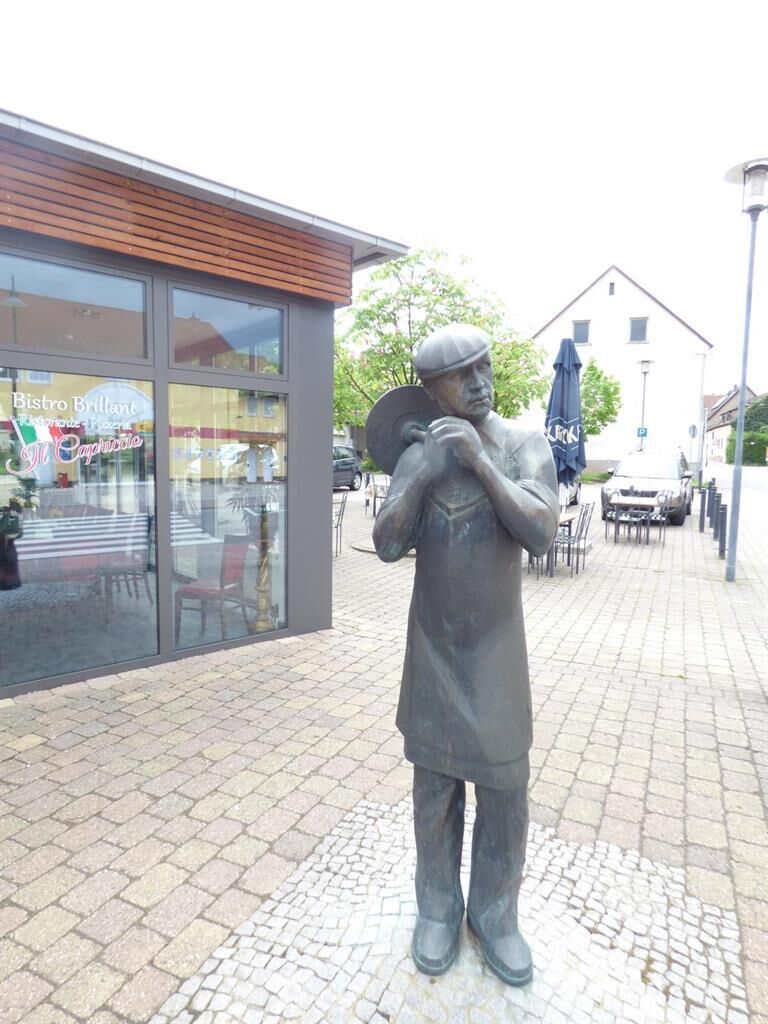
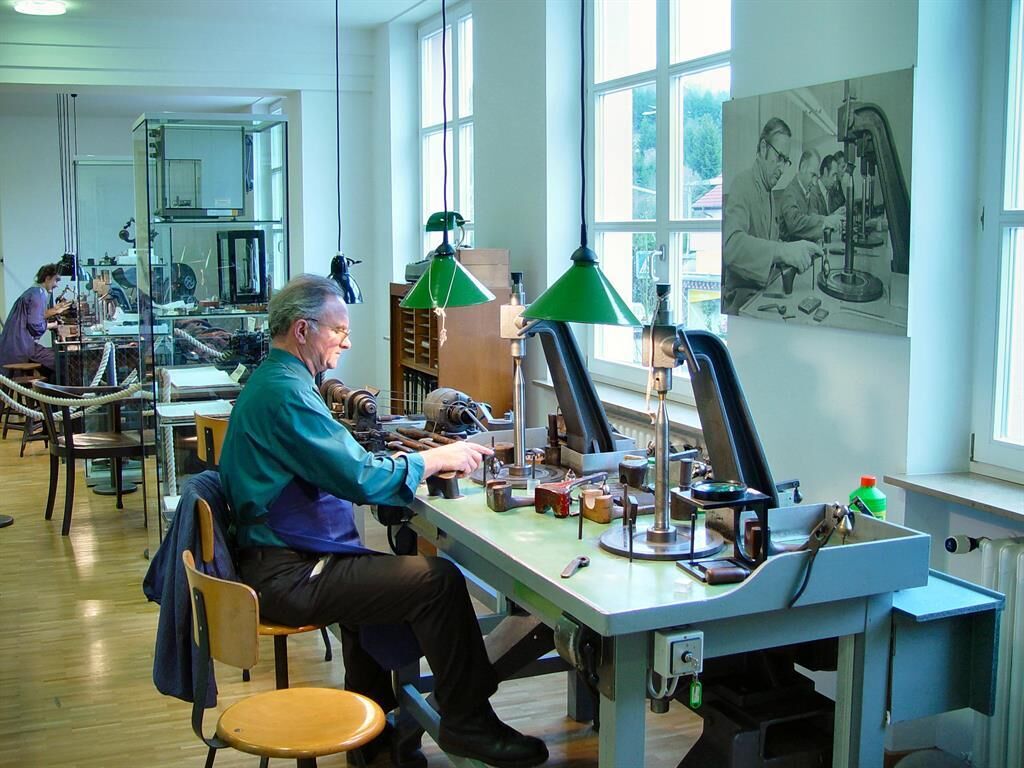
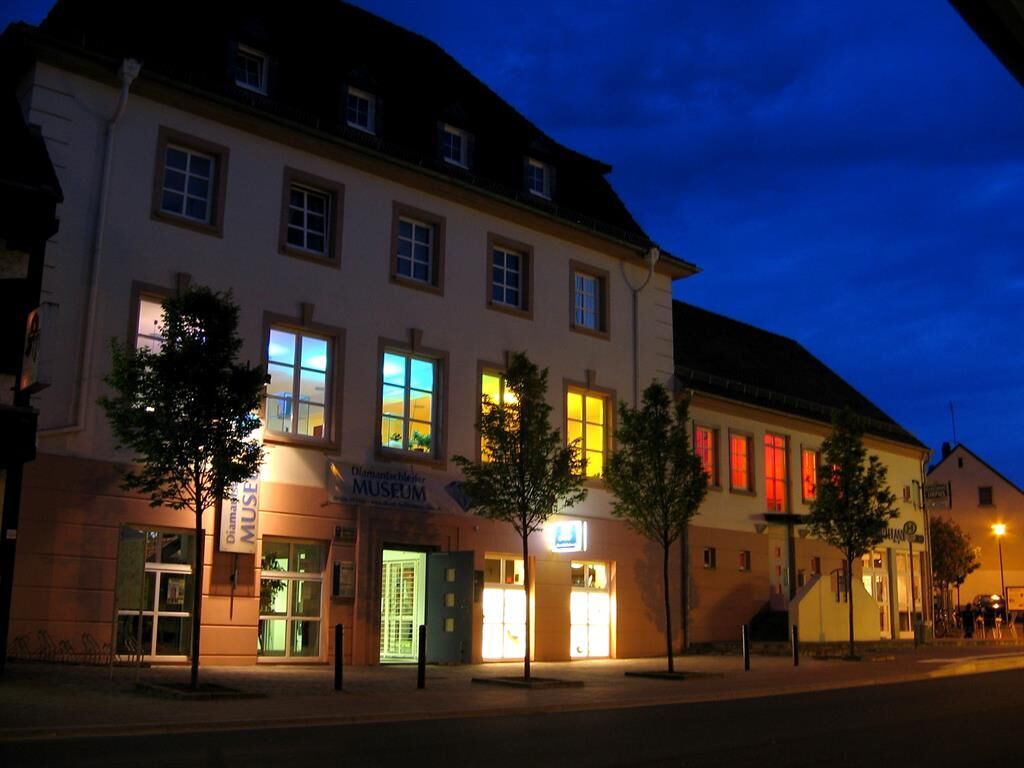
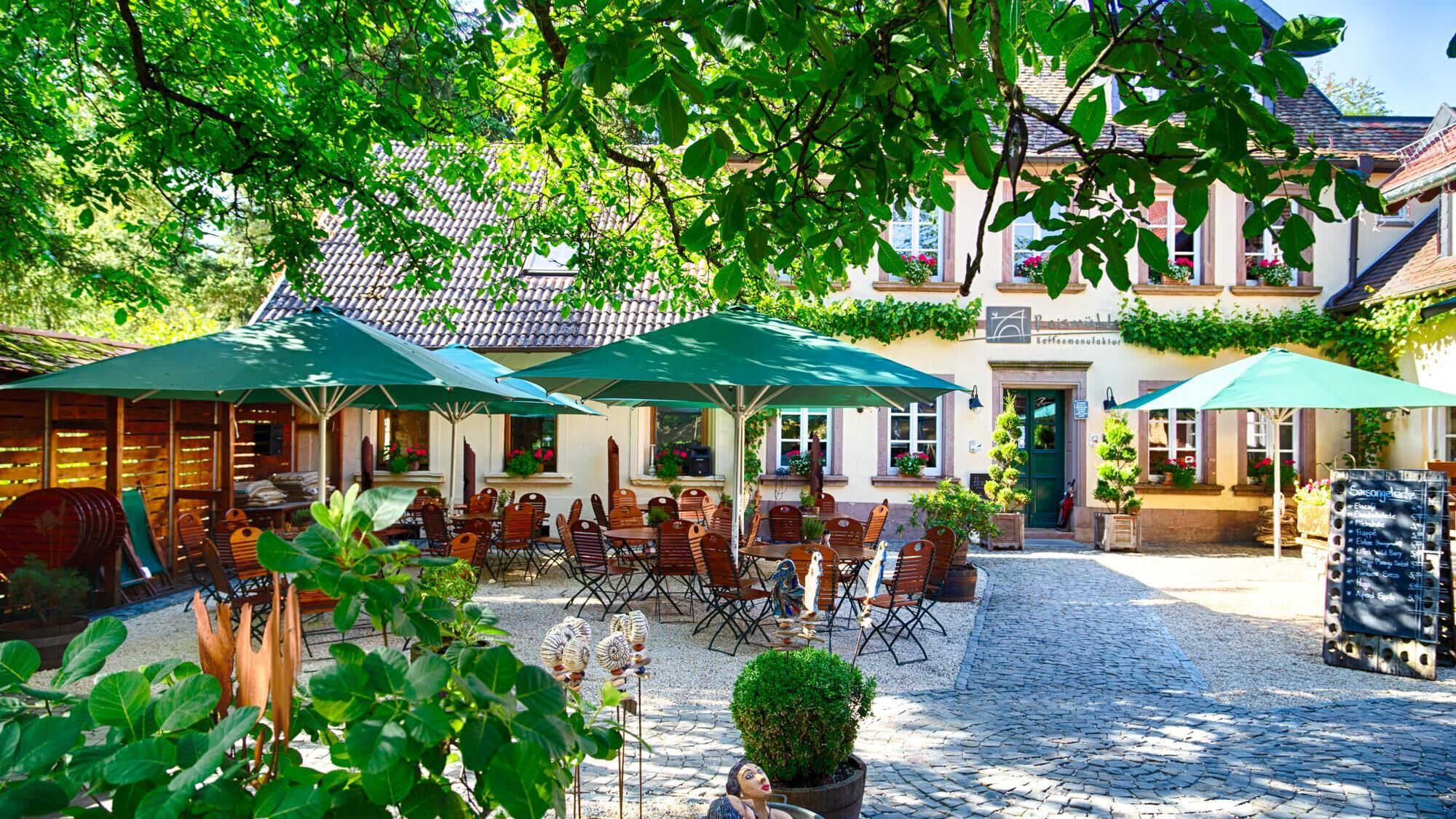
(1) Diamond cutter museum (Brücken)
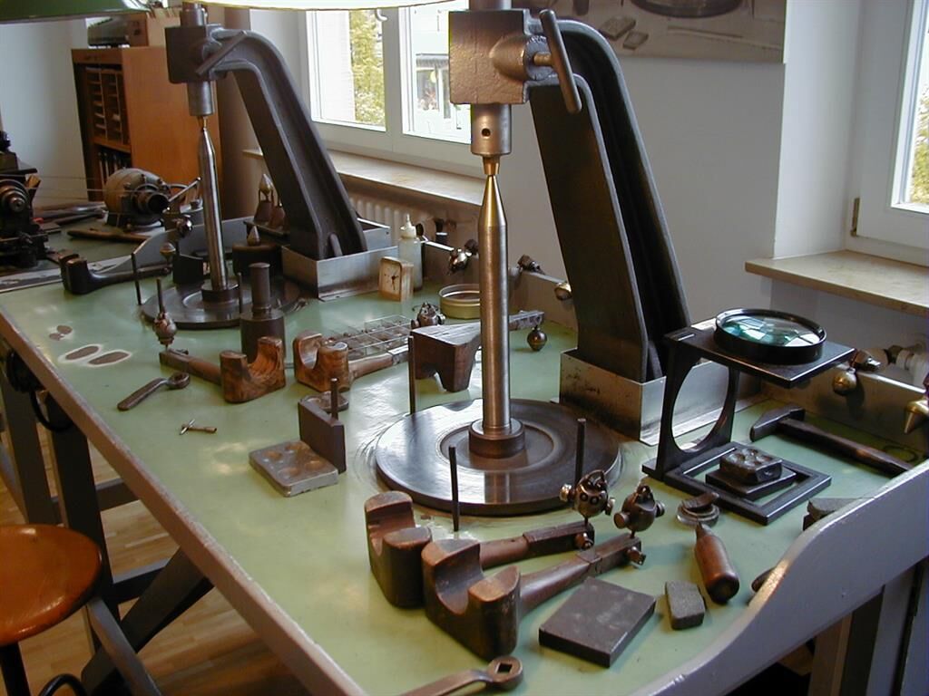
In 1888,Isidor Triefus from Steinbach opened the first Palatinate diamond cutting workshop on the Neumühle between Brücken and Ohmbach. Skilled workers from Hanau trained the first local apprentices as diamond cutters. Until the First World War, further diamond cutting shops were established in Brücken and several neighboring villages. By the mid-1930s, the industry had reached its peak with 2,500 cutters and grinders in the Western Palatinate. After the Second World War, there was another brief boom. The emergence of new diamond cutting centers in Israel, Russia and India, with very low wage levels, led to a steady decline from 1957 onwards. Today, there is only one diamond cutting shop left in Brücken.
The Diamond Cutter Museum, established in 1998, shows the historical, technical and economic development of the Palatinate diamond industry. On Sundays, you can look over the shoulders of the former cutters at the grinding wheel in the Diamond Cutter Museum and immerse yourself in the fascination of diamonds.
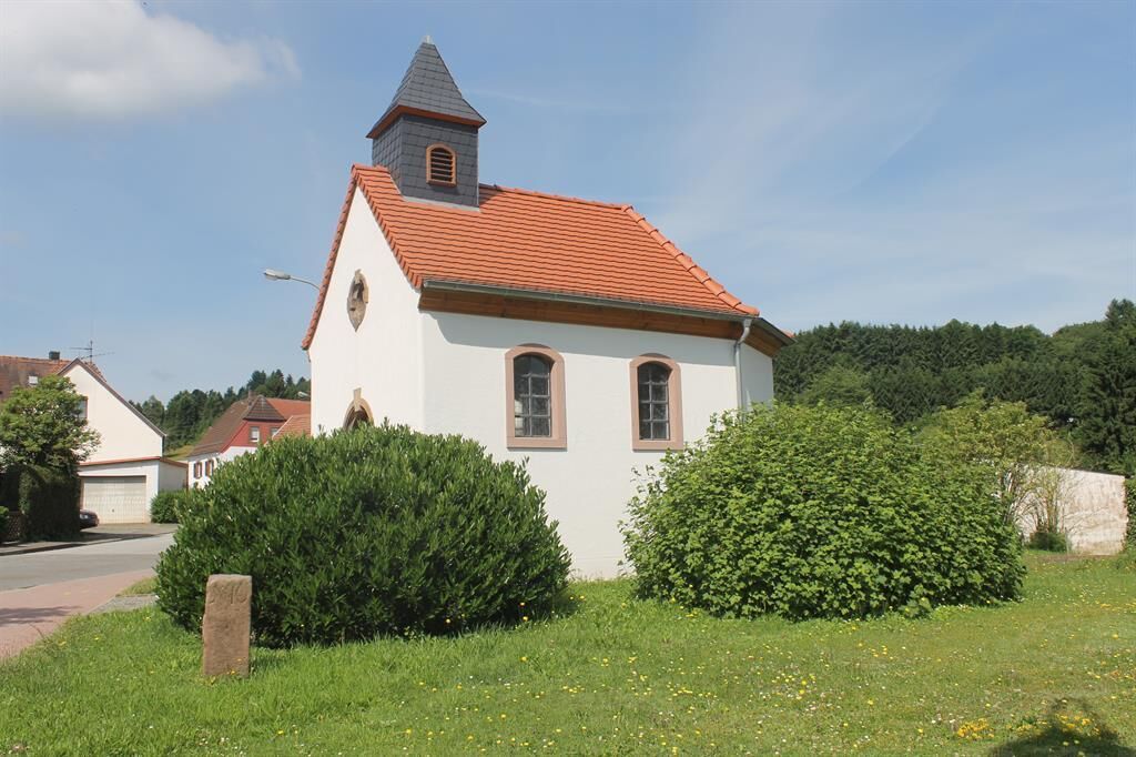
There was already a chapel in the center of the village in medieval times. It was destroyed during the Thirty Years' War. In 1715, the Catholics built a new chapel from the remains. The chapel 's bell dates back to 1463. After the parish of Brücken was established in 1730, the small church served as the parish church. At the beginning of the 19th century, the church was too small and also in a poor state of repair. The factory council therefore decided to build a larger parish church in 1829. In the years 1836-38, a new church was built according to the plans of the civil building inspector August von Voit. By 1900, the church was once again too small. In 1915, the church was to be completely rebuilt. However, the First World War thwarted the building project. The church conversion was not pursued any further later, as the decision was made to build a new church elsewhere. After the new church was built (1953-55), the"old church", as it was now called, was used less and less and was finally demolished in 1970.
(17) Roman Villa Rustica
A Roman villa rustica was located on the 385-metre-high local mountain of Brücken, the "Brücker Kopf". An important old road ran along the ridge between Brücken and Glan-Münchweiler . There are also several burial mounds from the Bronze Age along this old ridgeway. The villa rustica at Brücker Kopf was in visual contact with another Roman villa near the Roman road that led from Brücken via Wahnwegen to Kusel .
The ditches running through the site here are the result of rock quarrying. The very hard, coarse-grained sedimentary rock with pebble inclusions(conglomerate), which resembles chunks of concrete, was quarried as a building material until the 1960s.
(18) Boundary stones from 1786
The highest point of the Diamantschleifer path is at the boundary stone from 1786. For centuries, the state border between the Electoral Palatinate and the County of von der Leyen ran between Brücken and Steinbach. In 1779, the court of Kübelberg and Brücken were exchanged from the Electoral Palatinate to the Duchy of Palatinate-Zweibrücken. In the course of this change, the state border between Palatinate-Zweibrücken and von der Leyen was remeasured in 1786. From Ohmbach to Gries , 50 new boundary stones were set at that time. They were all numbered. In the area of the bridges, the numbers 10 to 33 were used. About half of these stones are still preserved today. The boundary stones bear the Wittelsbach diamond coat of arms and the initials PZ for Pfalz-Zweibrücken on one side. The coat of arms of the von Leyen family is depicted on the other side: A vertical pole in a round circle. In addition, the letters GL.
(19) Fritz Claus spring and Brücken mine
In 1927, the spring was tapped by the local branch of the Palatinate Forest Association and inaugurated as the Fritz Claus Spring. It commemorates the Palatinate pastor and local poet Martin Jäger, alias Fritz Claus (1853-1923), who was instrumental in shaping the idea of the Palatinate Forest Association.
Below the PWV hut was a tunnel entrance to the Brücken mine. The mining of hard coal at the Brücker Kopf began in 1776. In the 19th century, the annual output of the two Brücker mines was around 500 to 1,000 tons. In 1872, the Brücken and Steinbach mines were merged. The Brücken mine was closed in 1911. In 1928, a joint venture began mining coal again. During the Nazi era, further expansion of the mine was planned as part of the job creation program of the time. With the outbreak of the Second World War, the Brück coal mine closed for good.
The PWV hut stands on the edge of the Schleifstein gorge. Stones for grinding stones were quarried in the gorge. The Schleifsteingraben was first marked on an old mining map in 1776.
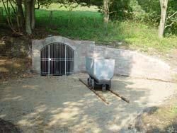
(20) Brücken coal mine
In 1775, Bernhard Scheuer opened the first coal minein Brücken. Coal was then mined at Brücker Kopf for more than a century. The mine closed in 1911 because the coal seam along the main adit had been largely mined out.
In 1928, a consortium built a new adit at this location and began mining coal again. The decline runs downwards at an angle of 30° and reaches the coal seam, which is almost 30 cm thick, after around 80 m. In 1932-34, a weighing house and a large colliery building with offices and crew rooms were built. In 1936, the tunnel entrance was bricked up. At that time, 30 miners worked in the local mine. Despite state aid, the small mine constantly had to struggle with financial and technical difficulties. On July 1, 1939, the operation was finally shut down due to unprofitability. The average annual output of the mine was around 2,200 tons of coal. Between 1928 and 1939, over 3 km of tunnels were driven. With the old mine field abandoned in 1911, the entire tunnel system in the Brück area covered more than 12 km.
(21) Steinerne Fahrt
An old ford crossed the Ohmbach at this point. The "Steinfurth" is first documented in the records in 1600. In the 18th century, there is talk of the "Steinerne Fahrt". The stream bed here was particularly well laid out with stones to make it easier for carts to cross on a flat bank. Today's bridge was built in 1934 when the Ohmbach was straightened. With a trained eye, the course of the Ohmbach 's former course can still be traced quite well from the different plant growth in the meadows.
The Ritterwald forest extends above the Brücken- district road. There was a limestone quarry here in the 19th century. The last lease for lime extraction was signed in 1923.
There used to be a legend in the village that a secret passage near the Steinerne Fahrt in the lower Heidchen led to a castle in the Ritterwald.
(22) At the chapel
A chapel is mentioned several times in the 18th century in the area of the former church path, which led from Brücken over the Kirchenberg to Kübelberg. In 1754 it was called "an der Cappelneben der Straß" and in 1790 "hinter der Straß gegen die Kapelle". The "Straß" refers to the asphalt road that runs here today, which follows the route of an old Roman road. Nothing is known about the existence of a chapel in this immediate area in the village. However, it is possible that a field chapel was built here. Perhaps it served as a station for the annual procession from Brücken to Kübelberg during the week of the cross in the 18th century.
(23) Villa Rustica Schmidtsgrund
There has been a tradition in Brücken since ancient times, according to which a castle is said to have stood in the area of the meadows on the Kirchenberg above the Kohlbach valley. Farmers had repeatedly come across hewn stones while working the land. In the summer of 1921, geometric lines appeared in a clover field due to the long dry season.
In 1928-30, the foundations of a Roman villa rustica were uncovered above the Kohlbach valley. The Roman estate measured 31.60 m x 13.50 m. Clay shards, hand-forged nails, a piece of column and the remains of heating pipes were found during the excavation. The site dates back to the 3rd century and was located very close to the old Roman road that ran from Sand in the direction of Frohnhofen. Heated rooms and a bathing facility were not discovered. However, judging by the remains of heating pipes, a heating system, i.e. a hypocaust, was probably present.
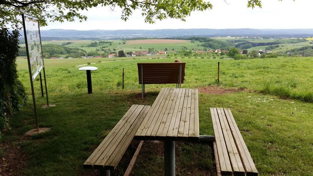
A visit to the "Hütte an der Fritz-Claus-Quelle" should definitely be planned.
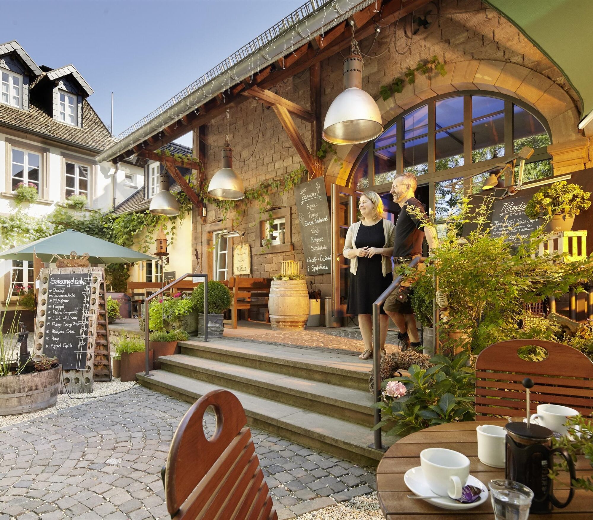
A visit to the Diamond Cutter Museum in Brücken is highly recommended.
Oblíbené prohlídky v okolí
-
Bruchmühlbach-Miesau - Sagenhafter Waldpfad
středníTuristika 17.8 km -
5.0
Börsborn - Muhleichenweg
středníTuristika 11.3 km -
3.0
Bridges - Dream Tour Diamond
heavyTuristika 15.2 km -
4.0
Börsborn - Von-der-Leyen-Weg
středníTematická stezka 12.2 km -
4.0
Fritz-Wunderlich Cycle Path
středníJízda na kole 26.1 km -
Wingertsweiher Ottweiler
světloTuristika 8.82 km -
Kusel - Preußensteig
heavyTuristika 25.6 km -
5.0
Kottweiler-Schwanden - Kottenweg
středníTematická stezka 16.2 km -
Breitenbach - Panorama route
středníTematická stezka 11.7 km -
Waldmohr - Rundweg Verladerampe
světloTuristika 6.40 km
Pěší turistika a stopování


Nenechte si ujít nabídky a inspiraci pro vaši příští dovolenou
Vaše e-mailová adresa byl přidán do poštovního seznamu.