Gutweiler - Gutweiler Berg - Galgenkopf - St. Cosmas und Damian
střední
Pořiďte si tuto prohlídku do mobilního telefonu
Gutweiler - Gutweiler Berg - Galgenkopf - St. Cosmas und Damian
střední
Turistika
7.82
km
Naskenujte QR kód a spusťte navigaci v aplikaci bergfex.

Pěší turistika a stopování


Gutweiler - Gutweiler Berg - Galgenkopf - St. Cosmas und Damian
střední
Vzdálenost
7.82
km
Doba trvání
02:01
h
Ascent
169
hm
Hladina moře
281 -
407
m
Stažení skladby
Gutweiler - Gutweiler Berg - Galgenkopf - St. Cosmas und Damian
střední
Turistika
7.82
km
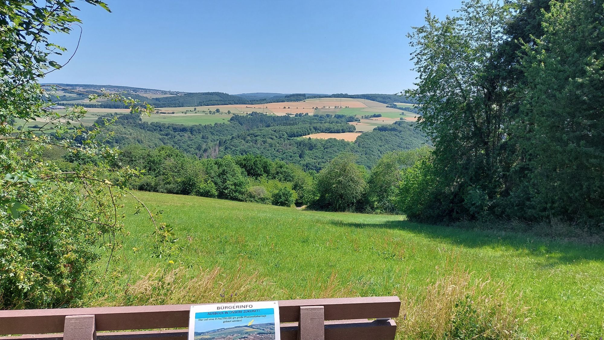
Trasa
Gutweiler
(305 m)
Vesnice
0.0 km
Gutweiler Berg
(405 m)
Summit
1.5 km
Galgenkopf
(380 m)
Summit
3.0 km
St. Cosmas und Damian
(304 m)
Místo konání bohoslužeb
7.6 km
Trasa
Gutweiler - Gutweiler Berg - Galgenkopf - St. Cosmas und Damian
střední
Turistika
7.82
km
Gutweiler
(305 m)
Vesnice
0.0 km
Gutweiler Berg
(405 m)
Summit
1.5 km
Galgenkopf
(380 m)
Summit
3.0 km
Korlingen
(294 m)
Vesnice
6.5 km
St. Cosmas und Damian
(304 m)
Místo konání bohoslužeb
7.6 km
Gutweiler
(305 m)
Vesnice
7.7 km
Zatím žádné recenze
Oblíbené prohlídky v okolí
- 5.0
Moselsteig Stage 07: Mehring – Leiwen
střednídálková pěší trasa 14.5 km - 5.0
Moselsteig Stage 05: Trier – Schweich
střednídálková pěší trasa 20.0 km - 4.5
Spießbratenhalle - Fatima Kapelle - Hau's am See - Schillingen
středníTuristika 15.8 km Moselsteig Stage 04: Konz – Trier
střednídálková pěší trasa 21.0 km- 5.0
Moselsteig stage 06: Schweich – Mehring
střednídálková pěší trasa 12.4 km - 5.0
Rockenburger Urwaldpfad
středníTuristika 13.6 km - 4.0
Keller See
světloTuristika 2.33 km - 5.0
Traumachleife 5 Täler Tour
světloTuristika 10.4 km - 5.0
Rundwanderung um Frommersbach im Naturpark Saar-Hunsrück
Turistika 7.10 km - 5.0
Rundwanderung um Niederzerf in Naturpark Saar-Hunsrück am 26. August 2024
Turistika 7.72 km
Pěší turistika a stopování

Více než 550.000 návrhů výletů, podrobné mapy a intuitivní plánovač tras dělají z aplikace nezbytnou výbavu pro všechny milovníky přírody.

Nenechte si ujít nabídky a inspiraci pro vaši příští dovolenou
Přihlaste se k odběru newsletteru
Chyba
Došlo k chybě. Zkuste to prosím znovu.Děkujeme za vaši registraci
Vaše e-mailová adresa byl přidán do poštovního seznamu.
Zájezdy po celé Evropě
Rakousko Švýcarsko Německo Itálie Slovenia Francie Nizozemsko Belgie Polsko Lichtenštejnsko Česko Slovensko Španělsko Chorvatsko Bosna a Hercegovina Lucembursko Andorra Portugal Iceland United Kingdom Ireland Greece Albania North Macedonia Malta Norway Montenegro Moldova Kosovo Hungary San Marino Romania Estonia Latvia Belarus Cyprus Lithuania Serbia Bulgaria Monaco Denmark Sweden Finland