


Karlstal Gorge Circular Hiking Route
The Karlstal is a gorge-like incised notch valley, designed as a natural forest park. In the 18th century, it was created as part of an English landscape park around Trippstadt Castle. Friedrich Ludwig...
The Karlstal is a gorge-like incised notch valley, designed as a natural forest park. In the 18th century, it was created as part of an English landscape park around Trippstadt Castle. Friedrich Ludwig Sckell, who also designed the English Garden in Munich, was commissioned for this.
In 1983, the valley was declared a nature reserve, primarily because of its geological significance and its features, including block fields and massive rock blocks. Almost all fern species found in the Palatinate Forest can be found here. In the rich moss flora, 170 species were documented, including 31 rare and 13 very rare species.
UFFBASSE! - Campaign for respectful coexistence in nature
Always behave considerately, friendly, and respectfully towards everyone you meet on your way. Respect nature, do not destroy plants, and always stay on the paths. Try to avoid excessive noise and leave the forest before dusk. Remember to bring a garbage bag for the way and take your waste back home. Please always keep your dog on a leash. Other visitors and animals will thank you. For your own safety, observe all trail closures, even on weekends. Park only in designated parking areas. Leave space for emergency vehicles and agricultural machinery. Give priority to agricultural and forestry traffic.
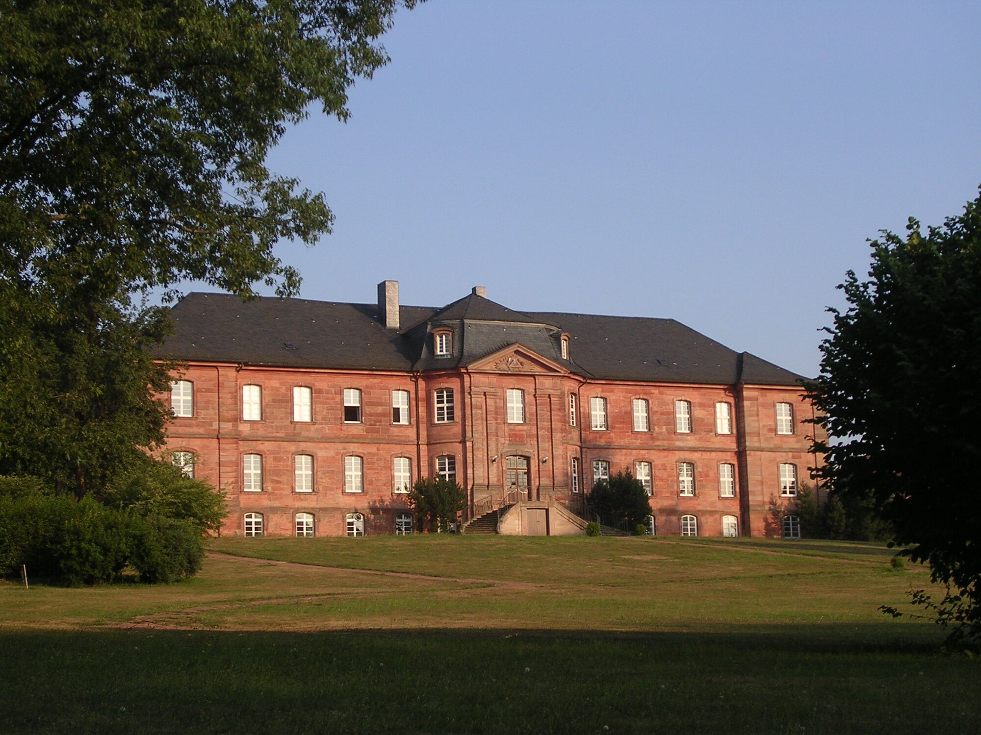
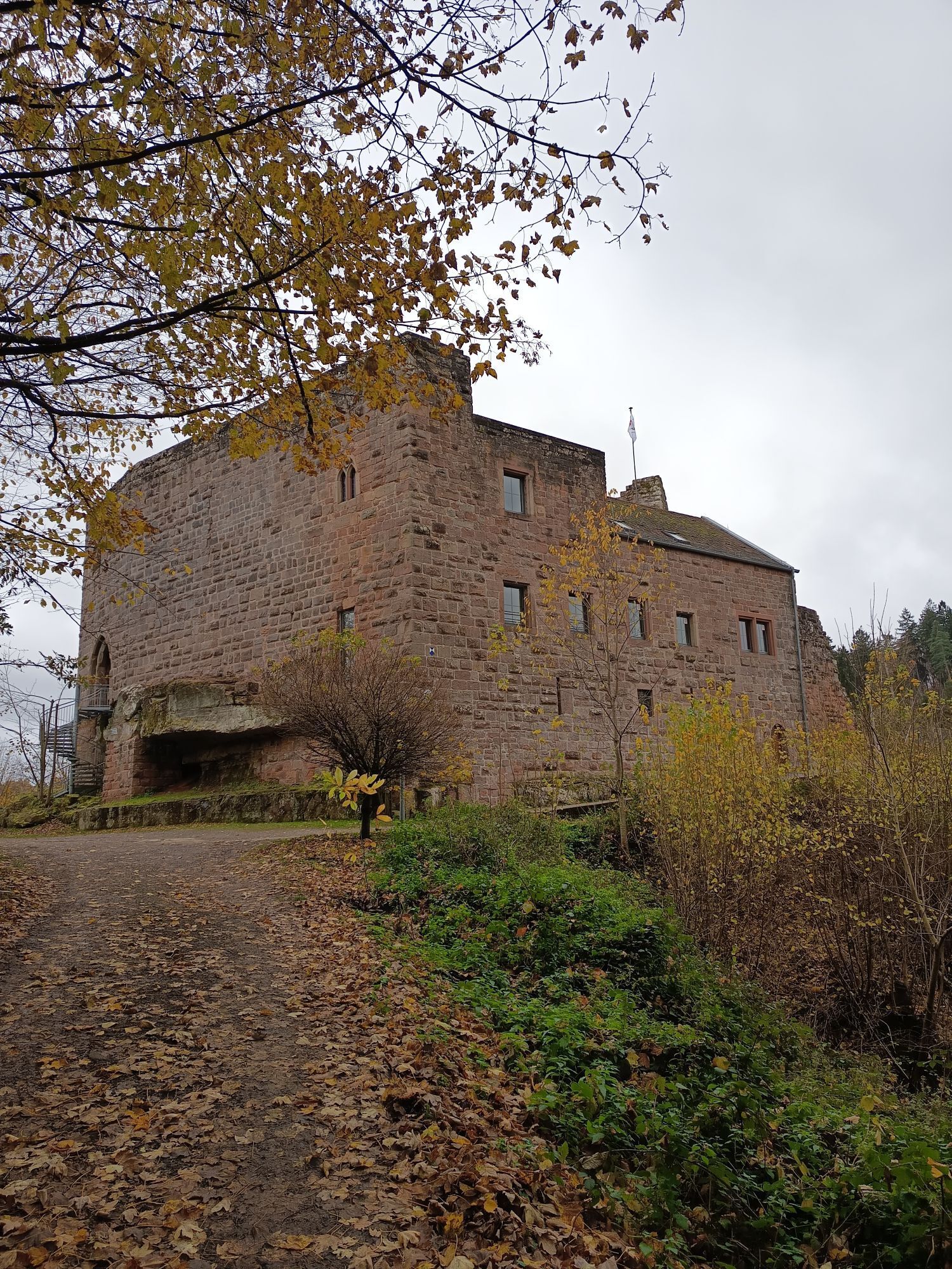
From the town center of Trippstadt, the Karlstal Gorge circular hiking route leads us westward to the Trippstadt Castle of the Freiherren von Hacke. Through a wrought iron gate, we enter the castle park with its magnificent tree stock and admire the Trippstadt Castle built in 1766 from red sandstone. In the park, we keep right and leave it through a somewhat hidden wooden gate.
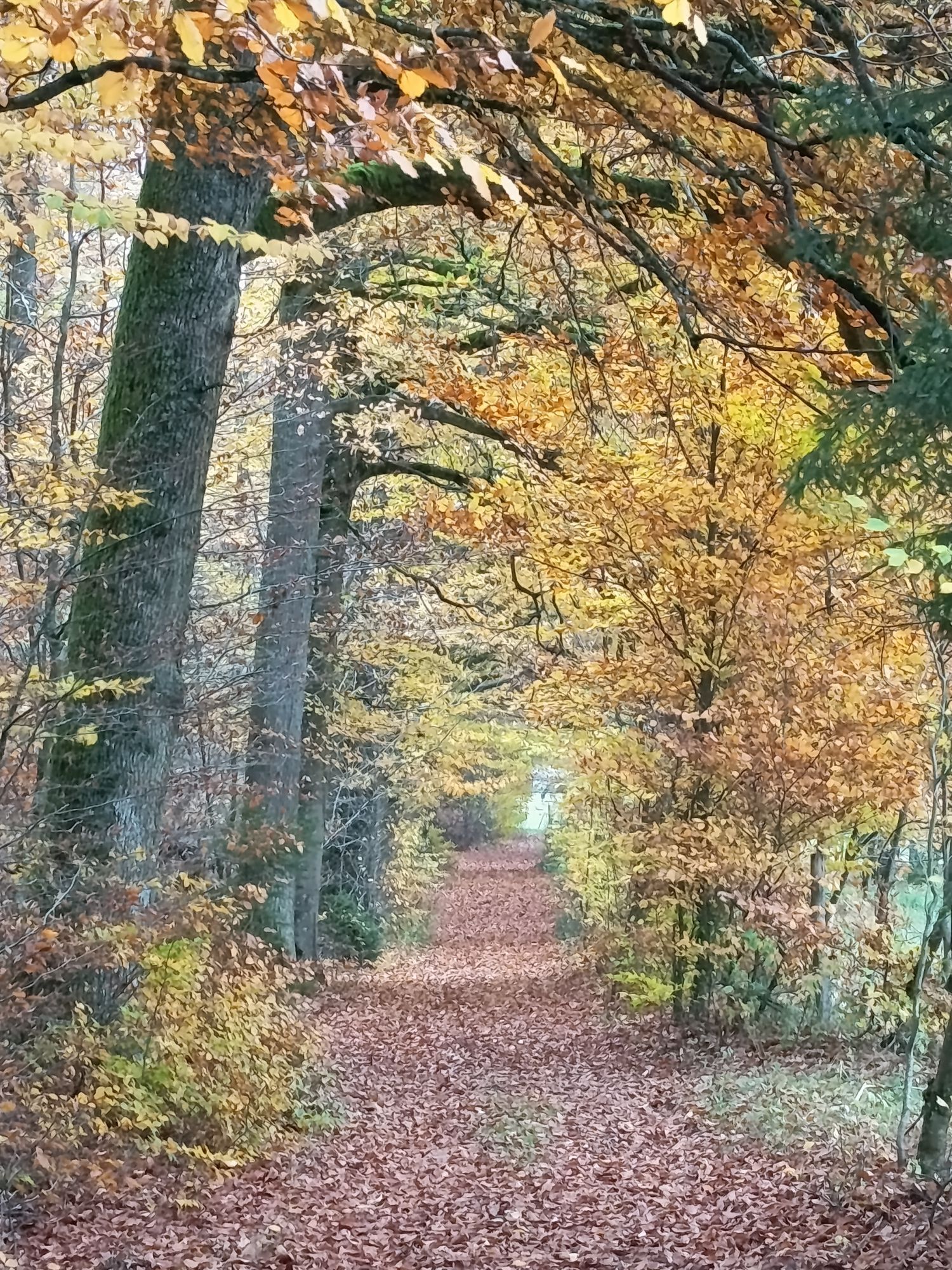
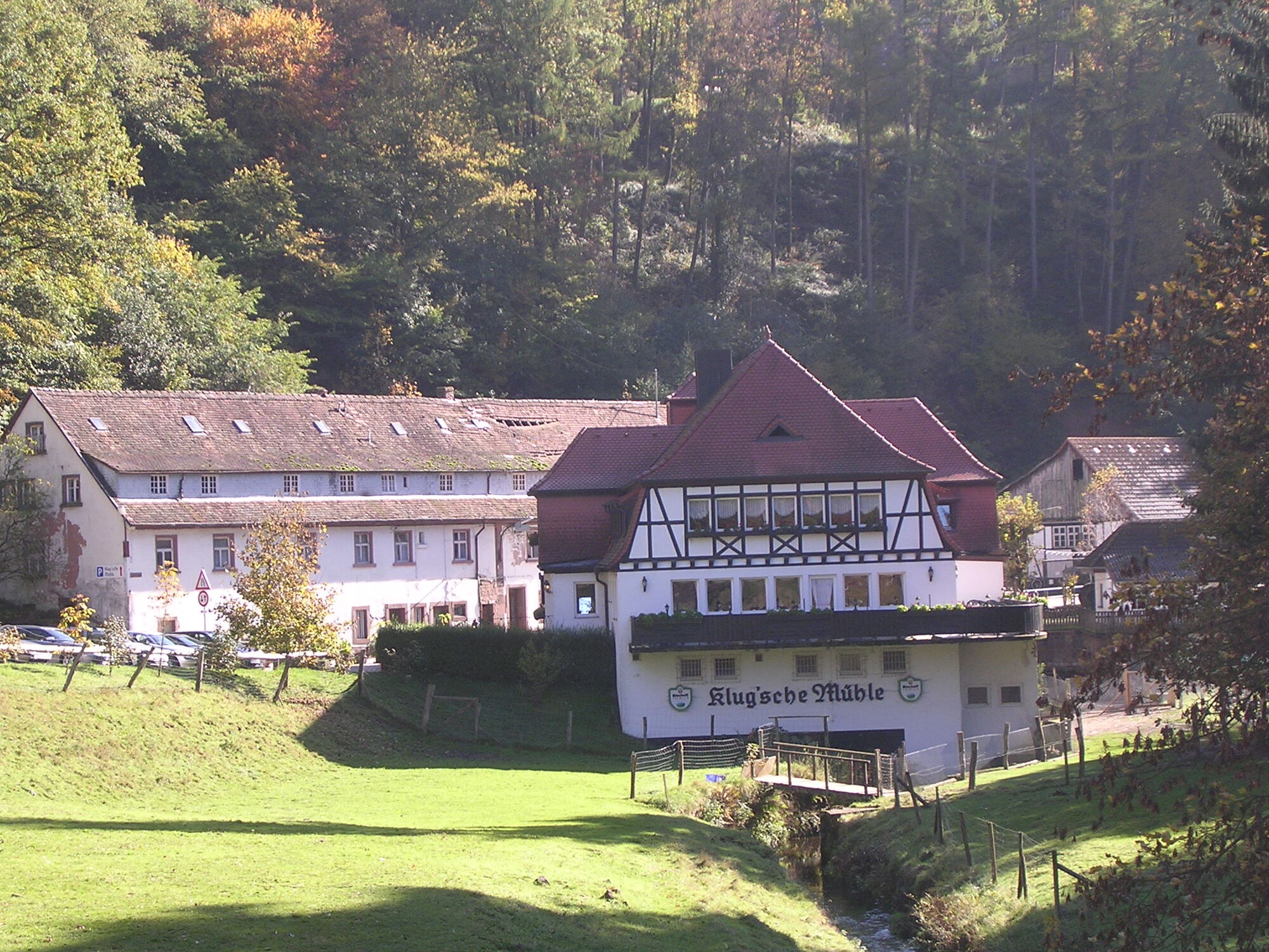
We then follow the marking steadily downhill through an elongated small valley towards the Karlstal. We pass Wilenstein Castle, and further down the valley, we can already see the Klug’s mill, a popular inn with an open terrace and garden restaurant with a small pond where two swans glide.
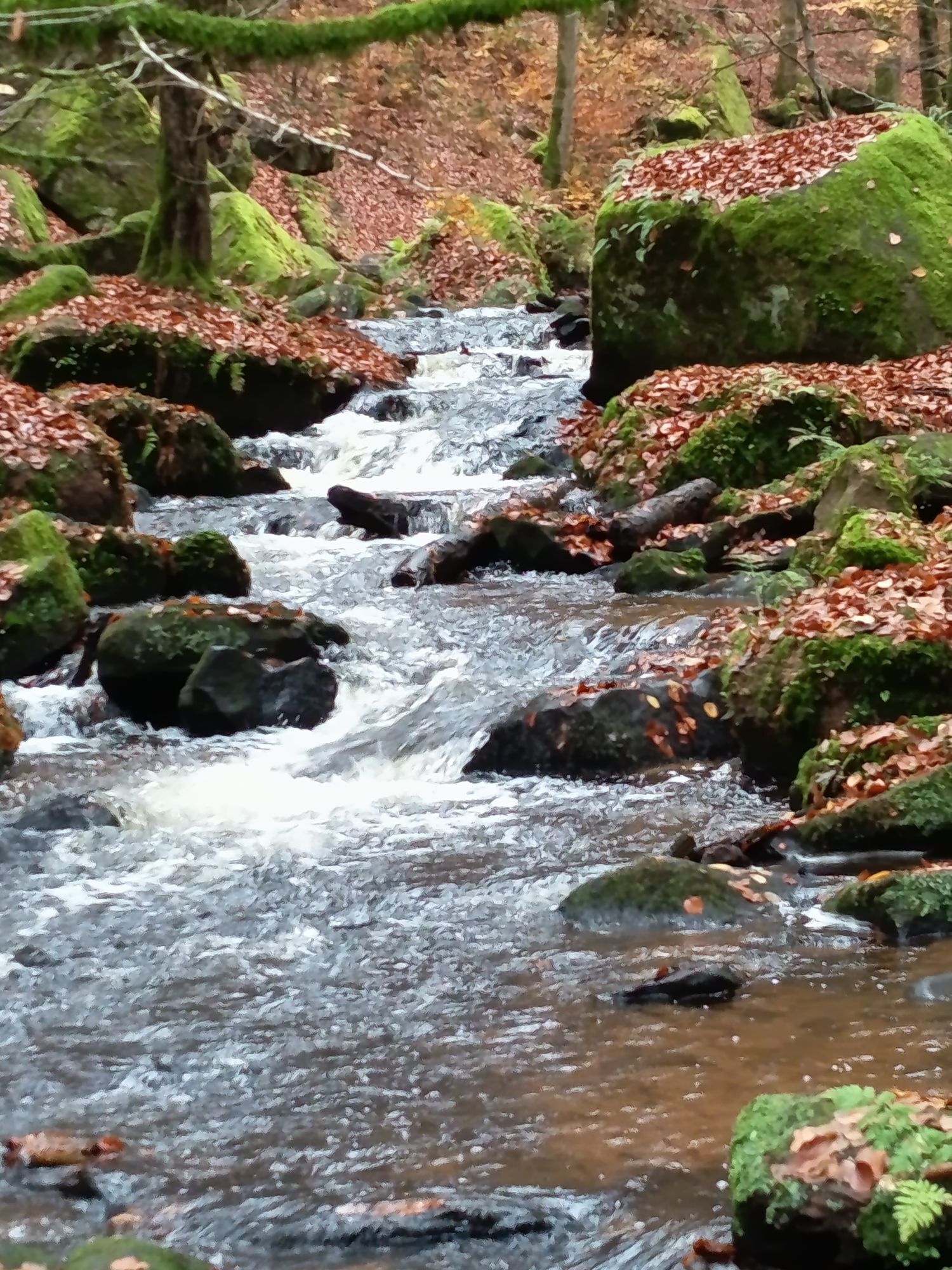
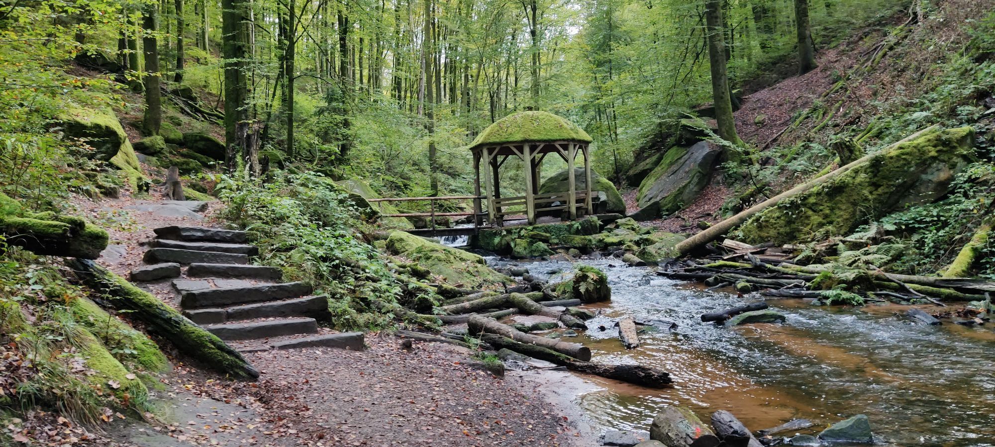
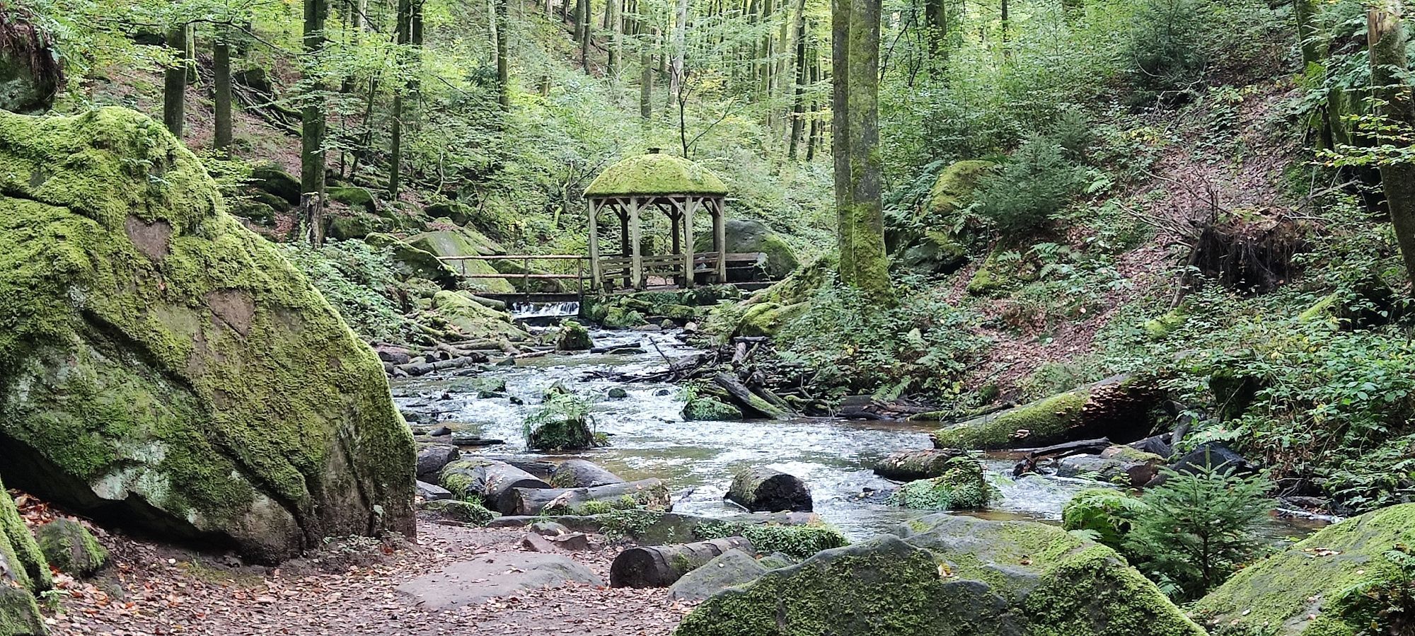
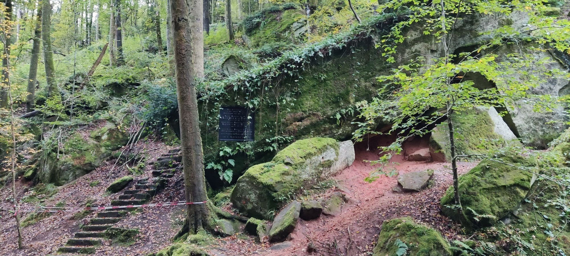
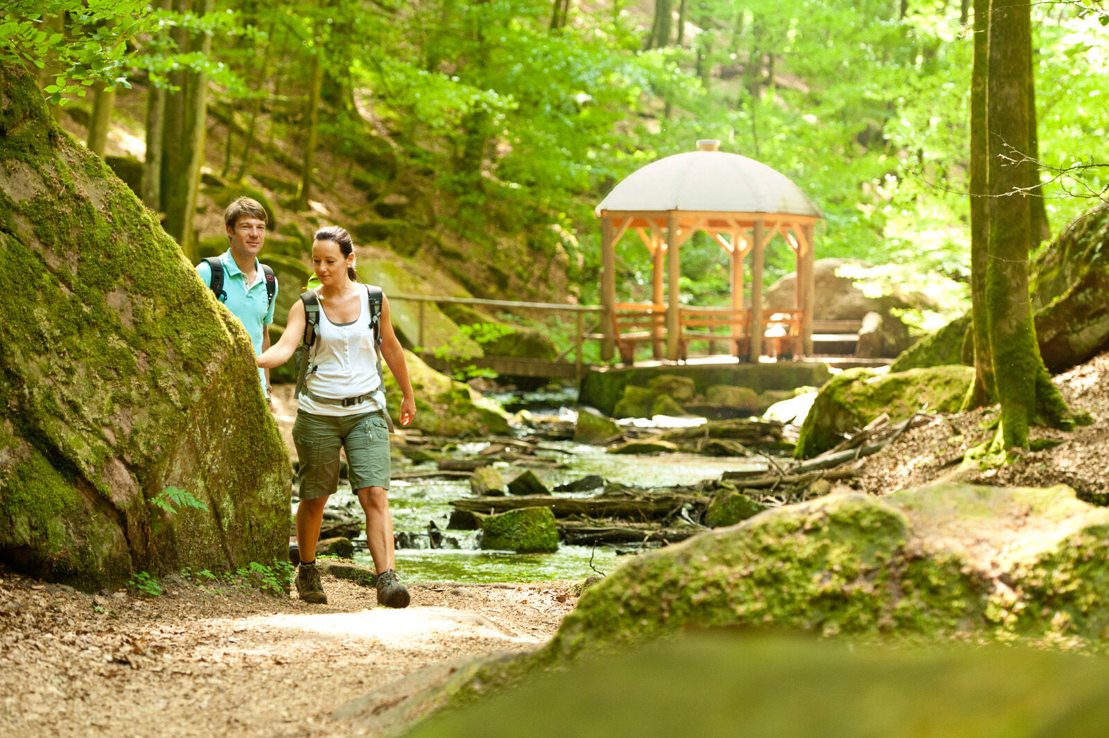
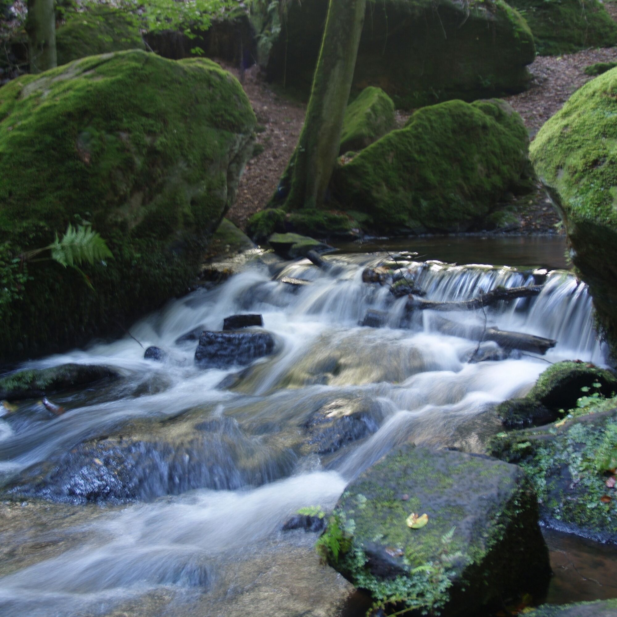
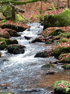
We cross the Moosalb and keep left. The sign "Karlstal Gorge" shows us the way. Now follows perhaps the most beautiful hiking kilometer in the Palatinate Forest. At the gorge entrance, a narrow path allows ascent to a cave, a former hermitage located above in a huge block sea. Through a narrow valley with massive rocks and sandstone blocks flows the Moosalb; the path leads over many small bridges sometimes on one side, sometimes on the other side of the brook. In the middle of the valley stands a small wooden pavilion above the brook, offering a dreamlike backdrop – not only for lovers.
The Karlstal ends at Oberhammer. Here we cross the street at the bus stop, pass the romantic Oberhammer pond. We now stay in the valley and hike along an endless meadow valley at the forest edge to the district "Gutenbrunnen" or Gutenbrunnerhof. Here we orient ourselves, leaving the main path sharply left, pass the game fence, walk a few steps to the right, then turn sharply left to reach the entry to a narrow path up to the Großer Rothenberg. This is probably the most strenuous part of the hike. At the top, after briefly following a main path, we first go left and then after about 200 m at a large crossroads turn right again.
We go through beautiful, lonely beech forests to the Camping Recreation Center Sägmühle, where the Sägmühl pond or the local gastronomy wants to offer us a refreshment. We cross the camping area on an official path, keep left on the road, and then immediately right again. After about 250 m, the Karlstal Gorge circular hiking route turns left, and we follow a narrow forest path uphill towards Trippstadt. A few more sunny meadow moments, and we are back at the starting point of our route.
Ano
For our hikes, we recommend the following equipment as standard:
Sturdy footwear Weather-appropriate clothing Sun and rain protection Sufficient supply of food and drinks, as there are not always places to rest or shop available or open. Even though the trails are very well marked throughout, it is advisable for safety reasons to always carry a suitable hiking map, so that you, for example, can find a safe area quickly in case of a thunderstorm or emergency.General information:
Especially in autumn, be aware that fallen leaves on the ground can hide unevenness, roots, stones, or holes in the path. After thunderstorms or heavy rains, trees may still fall or branches may drop afterward. Particularly in adverse weather conditions, natural paths can have muddy and slippery sections. Not all rocks or cliffs are secured with ropes or railings. Surefootedness is required in some places. You must expect such trail impairments when hiking. If you believe that certain sections are not passable for you, you should avoid them.
NOTE:
We strive to announce all closures caused by forestry work or hunting groups on this platform. Nevertheless, there are situations where hiking trails are closed, and we may not have been informed. If you unexpectedly encounter a trail closure or detour, please follow the instructions for your own safety.
A 6 to Enkenbach-Alsenborn, then continue on the B48 to Trippstadt.
By bus line 170 to the stop Bürgermeisteramt Trippstadt.
In the town center at the town hall.
Ano
A hike through the Karlstal offers the best impression when walking upstream towards the water (as described here). On weekends and public holidays, the Karlstal gorge is heavily frequented. In wet weather, there are wet spots in some sections, especially along the brook.

Oblíbené prohlídky v okolí
-
Pfälzer Waldpfad full route
heavydálková pěší trasa 130.6 km -
Münchweiler Höhenwanderweg
heavyTuristika 16.6 km -
5.0
Hike to the Geißenschlupf Rocks and the "Beautiful View" near Leimen/Pfalz
středníTuristika 4.33 km -
Women Go Their Way - Theme hiking trail about strong women in the Southwest Palatinate
světloTematická stezka 3.21 km -
5.0
Palatinate Forest Trail Stage 05 Rodalben - Merzalben
střednídálková pěší trasa 10.4 km -
3.7
Eiderbachtal - Hofstätten - 7 Buchen - Annweiler Forsthaus - Eiderbachtal-Parkplatz
středníTuristika 11.3 km -
5.0
Tour D of the PWV Rodalben
středníTuristika 9.79 km -
Palatinate Forest Trail Stage 06 Merzalben - Hauenstein
heavydálková pěší trasa 22.5 km -
3.0
Münchweiler Höhenwanderweg - Part 1
středníTuristika 11.3 km -
1.0
Tour C of the PWV Rodalben
středníTuristika 10.0 km
Pěší turistika a stopování


Nenechte si ujít nabídky a inspiraci pro vaši příští dovolenou
Vaše e-mailová adresa byl přidán do poštovního seznamu.