







Pälzer Keschdeweg / 1st stage Hauenstein - Annweiler
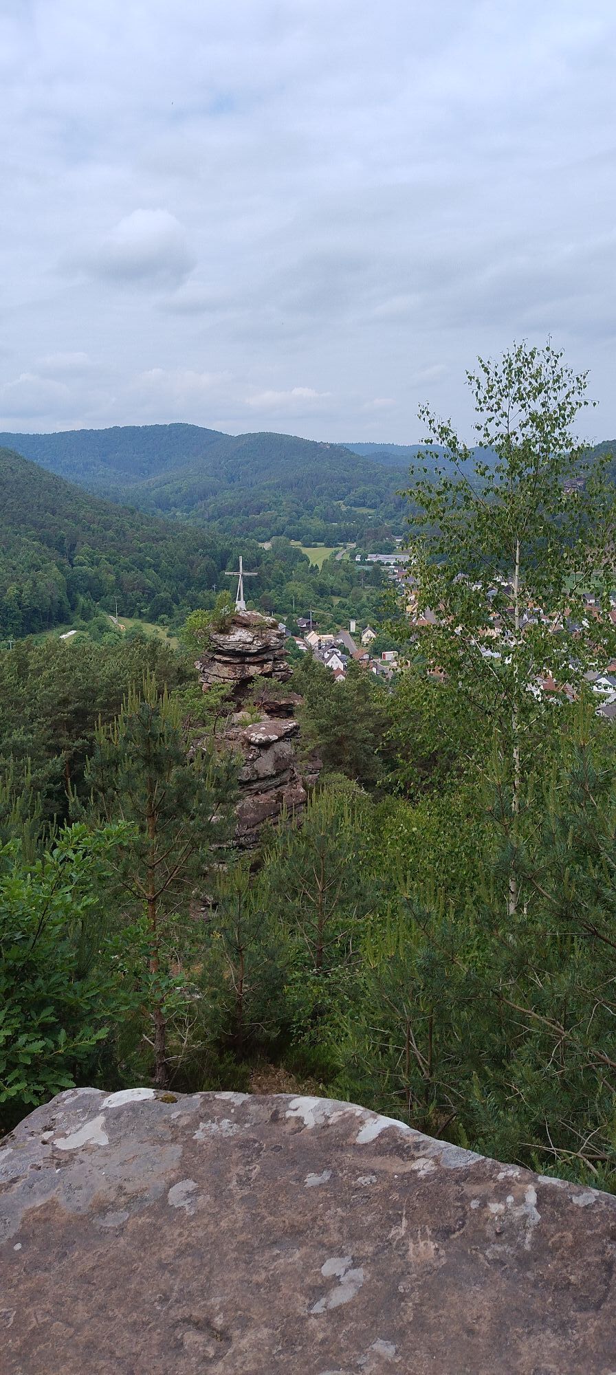
First stage arrangement "Hiking route Pälzer Keschdeweg": From Hauenstein through the Palatinate Forest, past rocks and meadows, through Lug and Wernersberg to Annweiler am Trifels.
UFFBASSE! - Campaign...
First stage arrangement "Hiking route Pälzer Keschdeweg": From Hauenstein through the Palatinate Forest, past rocks and meadows, through Lug and Wernersberg to Annweiler am Trifels.
UFFBASSE! - Campaign for considerate coexistence in nature
Travel considerately - Always behave in a foresighted, friendly, and considerate manner towards everyone you meet along the way. This applies especially on service roads where winegrowers, agricultural, and forestry workers also work on weekends.
Picnic & Waste - Remember a rubbish bag for the way and take waste back home with you. Use only the furnished rest areas for breaks & picnics.
Further information at www.pfalz.de/uffbasse


From your accommodation, walk to your starting point at the Shoe Museum in Hauenstein and hike southeast out of the village. At the end of the street "Am Weimbergsberg," turn right into the forest. Passing the Wachtfelsen, the youth campsite, and the shooting house, after about 2 km you will reach the Lourdes Grotto. Then you come to the German Shoe Road (L495), which you cross at the height of the Luger sports field and thus reach the Saarstraße via Günther-Bauer-Straße. Follow Saarstraße to the end of the street and then take a short distance on Hauensteiner Straße to reach the church in the center of Lug. From here, turn into Mühlstraße, then left into Bergstraße, and after about 500 m along the forest edge turn right into the forest.
After about 2.5 km, you have the option to take a detour to the Geiersteine (about 1 km). Back to the main path, continue following the trail marked 36. On a paved path (Kapellenstraße), past a small chapel, you reach the village of Wernersberg. In the village center, shortly before the end of Kapellenstraße, turn left into the street "Auf der Acht." At the end of the street, turn right and then immediately left again, arriving on Mühlstraße. From here, walk a short distance and then turn right again into the street with the same name, Mühlstraße. Then it goes right into the forest below Rothenberg toward Annweiler am Trifels. Hike through the forest following the "Pälzer Keschdeweg" trail marker until you arrive in Annweiler am Trifels. You can now decide whether to first return to your accommodation or first explore the historic town center of Annweiler am Trifels.
Along your way, always follow the symbol of the sweet chestnut.
Hauenstein can be reached from the direction of Pirmasens and Landau via the B 10.
The Hauenstein train stop is located on the Queichtal railway line Landau - Pirmasens (RB 55)
Oblíbené prohlídky v okolí
- 4.8
Dahner Felsenpfad
středníTuristika 13.2 km - 4.5
Annweiler Castle Trail
středníTuristika 7.72 km - 4.8
Napoleon-Steig
středníTuristika 12.3 km - 4.2
Eschbach-Trifelsblick-Madenburg-Eschbach
světloTuristika 9.37 km - 4.8
Lemberg - Salzwoog - Schwamborn-Quelle - Teufelstisch
středníTuristika 11.9 km - 3.7
Eiderbachtal - Hofstätten - 7 Buchen - Annweiler Forsthaus - Eiderbachtal-Parkplatz
středníTuristika 11.3 km - 5.0
Palatinate Weinsteig Stage 08 Dernbach - Annweiler am Trifels
heavydálková pěší trasa 14.4 km - 4.5
Schusterpfad
středníTuristika 16.4 km - 3.7
Dahn - Lachberg - Vogelsberg
středníTuristika 18.7 km - 4.5
Erfweiler - Hahnberg - Kahlenberg - Schindhard
středníTuristika 14.6 km

Pěší turistika a stopování


Nenechte si ujít nabídky a inspiraci pro vaši příští dovolenou
Vaše e-mailová adresa byl přidán do poštovního seznamu.





