


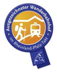
Theisbergstegen - Kusel (on the Remigius hiking trail)
The Remigius hiking trail leads through the hilly landscape of the Palatinate mountain range, lined with magnificent panoramic views of the Hunsrück and the Palatinate.
Along the way, romantically located...
The Remigius hiking trail leads through the hilly landscape of the Palatinate mountain range, lined with magnificent panoramic views of the Hunsrück and the Palatinate.
Along the way, romantically located benches invite you to linger and marvel.
There are opportunities to stop for refreshments on the way.
UFFBASSE! - Campaign for respectful coexistence in nature
- Always behave foreseeably, kindly, and considerately towards everyone you meet along the way.
- Respect nature, do not destroy plants, and always stay on the paths.
- Remember a trash bag for the way and take waste back home with you.
- Please keep your dog on a leash at all times. Other visitors and animals will thank you.
- For your own safety, observe all trail closures, even on weekends.
- Park only in designated parking spaces. Leave room for emergency routes and agricultural machinery.
- Please give priority to agricultural and forestry traffic.

The hiking trail starts at the train station in Theisbergstegen.
We follow Bahnhofstraße south and turn right into Kuseler Straße. After about 250 m, we turn right into Remigiusbergweg and follow the marking "white R on blue background" uphill to the quarry.
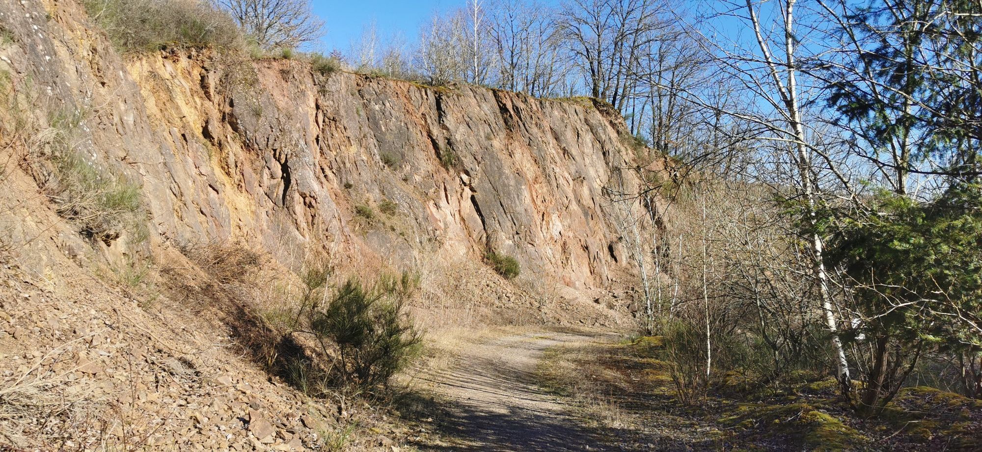
On our further route, we dive into the geological diversity of the region in the quarry between Haschbach and Theisbergstegen, with deep views into millions of years offered by the geological educational trail with its information panels. It leads through the quarry area and bridges the gap between geological past and current use.
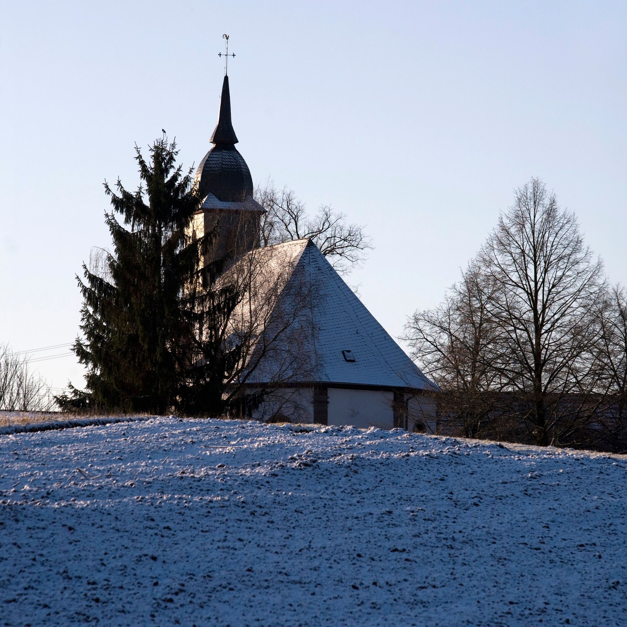
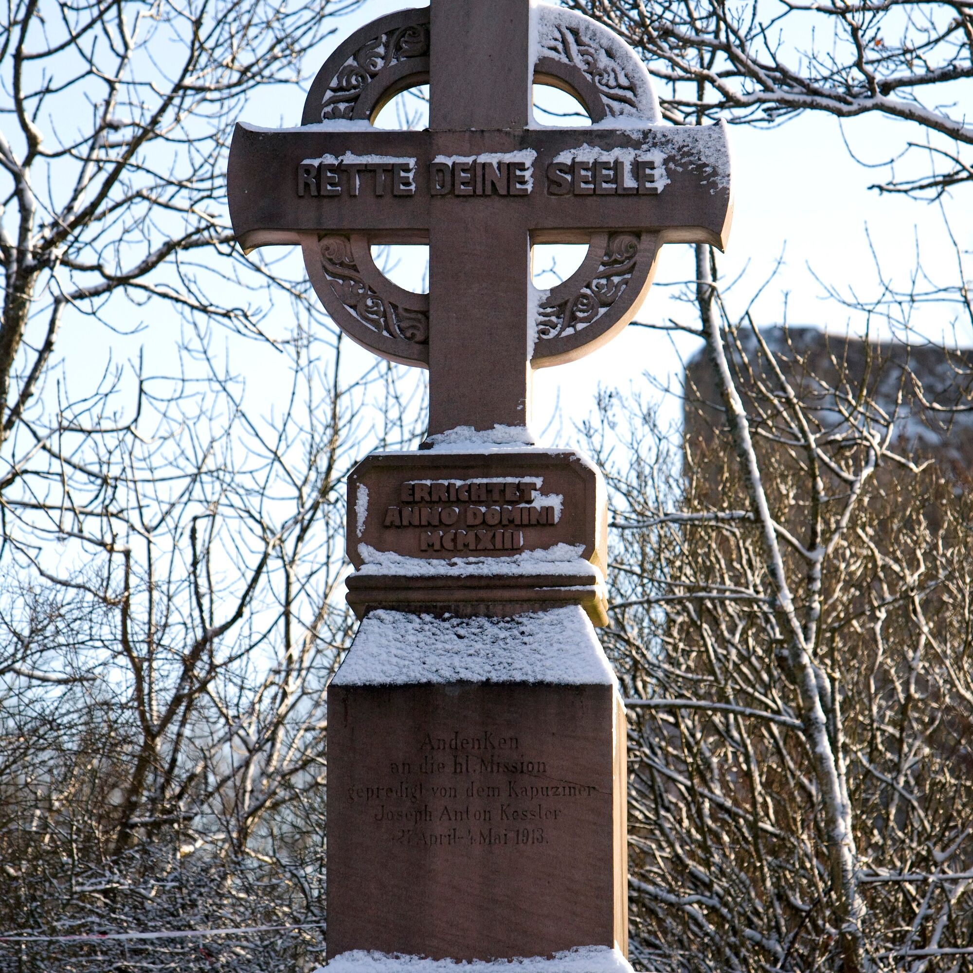
After the quarry, at a small chapel by the road, there is the possibility of a small detour up the Remigiusberg (left up - marked as "white R on yellow background").
Source: Wikipedia
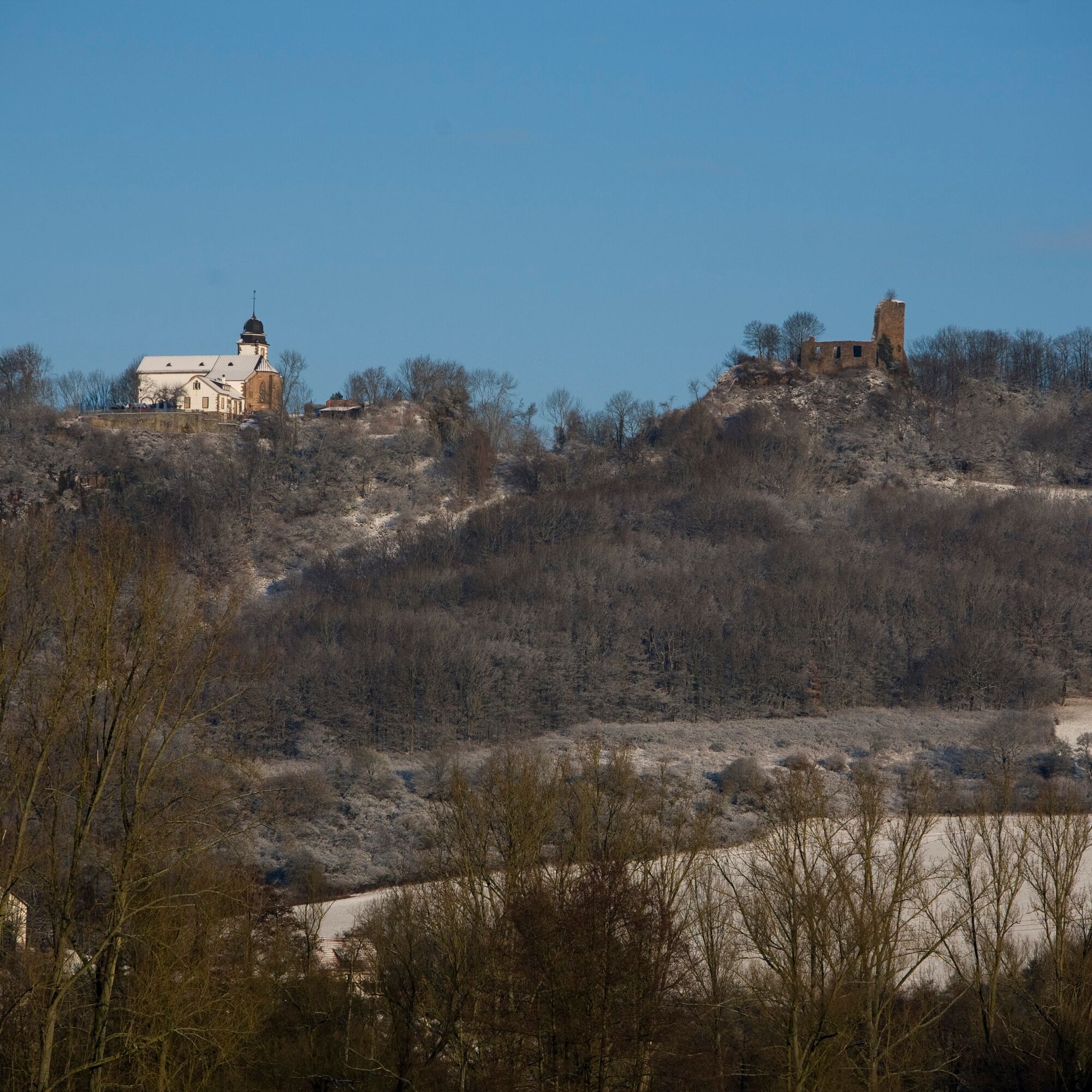
The Remigiusberg in the Rhineland-Palatinate Kusel district is a 368 meter high elevation that belongs to the western part of the Nordpfälzer Bergland and rises about 120 meters above the surrounding area.
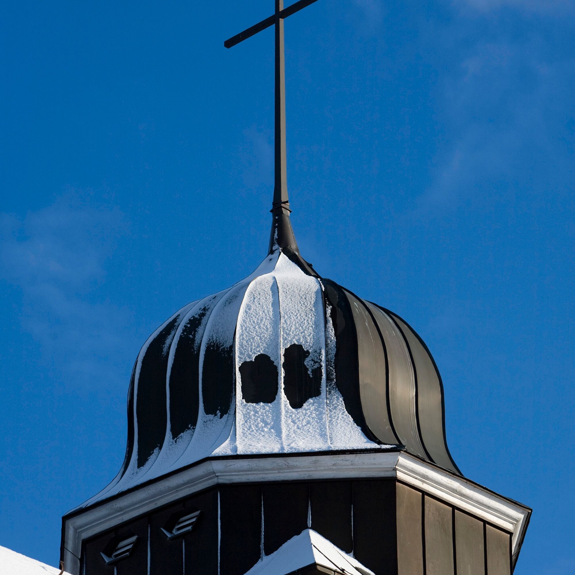
On the summit lie close together and only separated by a shallow depression the Propsteikirche St. Remigius as the only preserved building of the former provostry of the same name and the ruins of the Michelsburg.
Propsteikirche – A predecessor castle from the 11th century had to give way around 1127 for the construction of a monastery. It was a filial foundation of the Benedictine abbey Saint-Remi in Reims in honor of Saint Remigius and was named after him – as was later also the surrounding area – although the saint, who lived in the 5th/6th century, never visited the region.[1] The monastery existed until the year 1526, when it was dissolved in the wake of the Reformation.
Michelsburg – Starting in 1260, a second castle was built near the provostry which got its name from the patron of the castle chapel, St. Michael, and is today a ruin. The castle initially belonged to the County of Veldenz, later to the Wittelsbach Duchy of Pfalz-Zweibrücken. The site was heavily damaged during the Thirty Years' War and the War of the Palatine Succession. After finally being destroyed by French revolutionary troops in the early 1790s, it was officially released as a quarry in 1794. Renovation work was carried out in 1973/74.
The Rammelsbach Quarry Museum is located very nearby and can be reached quickly via the signed access path ("white R on yellow background") – visits possible by appointment at Tel: 06381 / 424270.
The main path "white R on blue background" leads us along K 21 to the Haschbach cemetery. We turn right and follow K 69 (on the bike path!) up to L 362. We follow the main marking for a short distance uphill and then turn left into the forest.
Crowned with magnificent views, we now hike on the ridge between Haschbach and Kusel. Many deciduous trees, including gnarled sequoias, shape the forest next to the path.
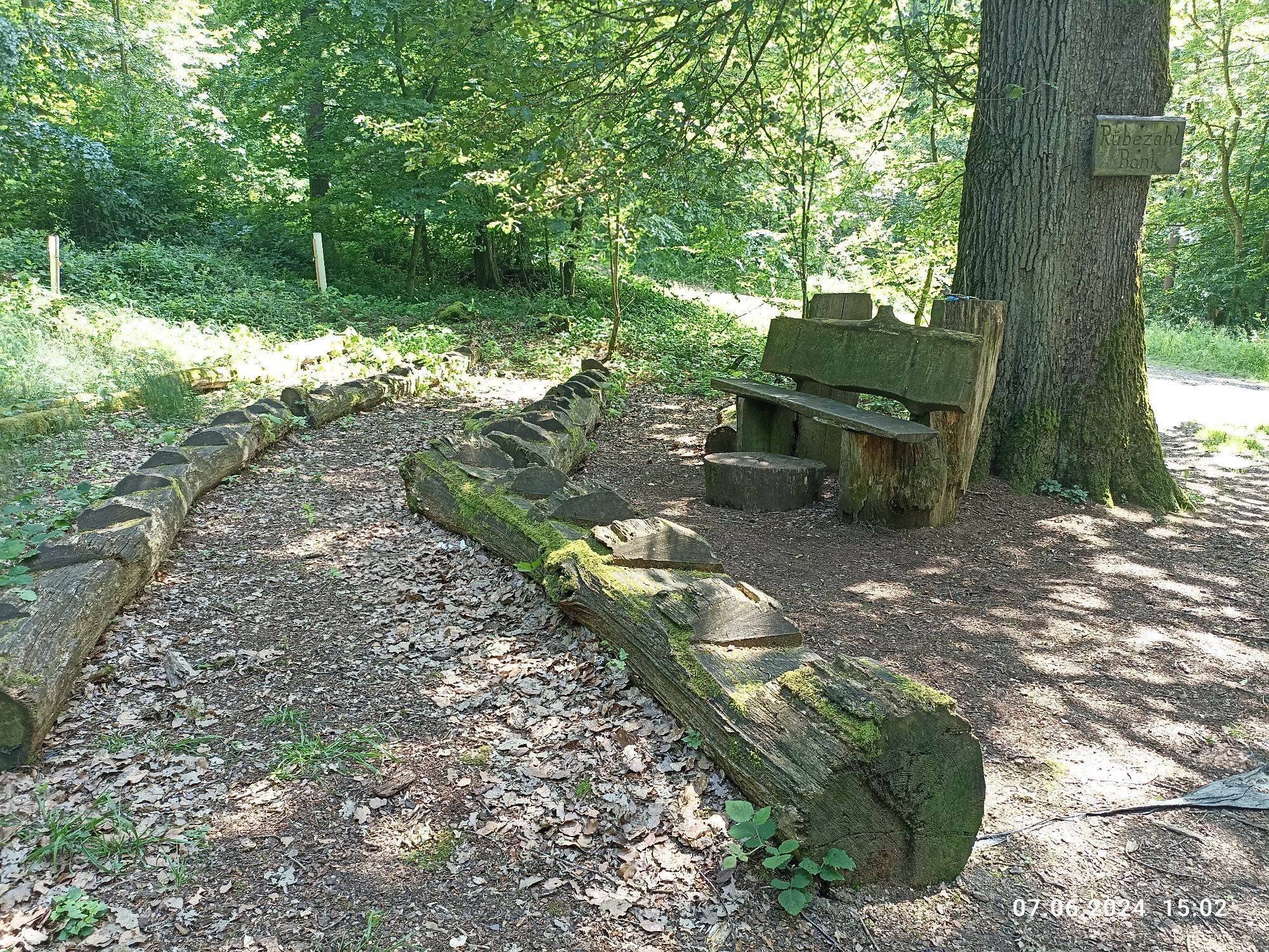
The path leads us through dense forest, past the Rübezahl bench (named due to its size, but comfortable for every hiker) and the forest classroom.
Further through the forest we reach the idyllic "Winterhelle", located by a small pond.
From here, we follow the marking "white R on yellow background" – access path
Ano
Ano
For our hiking tours, we recommend the following standard equipment:
- Sturdy footwear
- Weather-appropriate clothing
- Sun and rain protection
- Sufficient supply of food and drinks, as there are not always dining or shopping options available or open everywhere.
- Although the paths are very well marked throughout, for safety reasons it is always advisable to carry a suitable
hiking map, so that you can quickly find a safe area in case of a thunderstorm or an emergency.
- Hiking poles are recommended.
Generally applies:
Especially in autumn, you should also be aware that the leaves lying on the ground can conceal unevenness, roots, stones, or holes in the path. After thunderstorms or heavy rain, trees may still fall or branches fall down. Especially in adverse weather conditions, natural paths can have muddy and slippery sections. Not all rocks or ravines are secured with ropes or railings. Surefootedness is occasionally required. You have to expect such path impairments when undertaking a hike. If you believe certain sections of the path are impassable for you, you should bypass them.
NOTE:
We strive to announce all closures caused by forestry work or hunting societies on this platform. Nevertheless, there are situations where hiking trails are closed and we have perhaps not been informed. If you unexpectedly encounter a trail closure or detour, please observe the instructions for your own safety.
By car:
Via A 62 - exit Kusel.
B 420 to Kusel.
L 362 to Theisbergstegen.
By train:
From Kaiserslautern by regional train to Kusel.
From Kusel by regional train to Theisbergstegen.
Parking lot at the station, Bahnhofstraße 65, 66869 Kusel
Coordinates: Longitude: 7° 24′ 36″ / Latitude: 49° 32′ 19″
Parking lot Glanstraße in 66869 Kusel (at the roundabout)
Coordinates: Longitude: 7° 24′ 25″ / Latitude: 49° 32′ 19″
The Remigius Hiking Trail is named after Saint Remigius, Bishop of Reims, after whom the Remigius Church, part of a monastery complex of the former Benedictine provostry St. Remigius on the Remigiusberg, was named. The region is also known as Remigiusland, which the Frankish King Childebert II donated to the Diocese of Reims.
A visit to the family crypt of the Counts of Veldenz is possible all year round by appointment.
Internet: www.remigiusberg.de
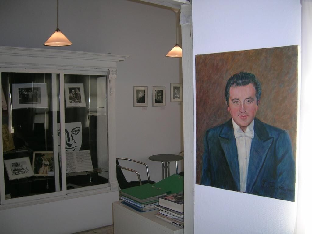
It is also recommended to allow time to visit the "Fritz-Wunderlich Museum" – the most famous son of the town of Kusel – a former star tenor.
Kusel-Altenglan Association of Municipalities (Tourism)
Marktplatz 1, 66869 Kusel
Tel.: 06381 / 6080123
Internet: https://vg-kusel-altenglan.de/vg/tourismus/
Email: Tourismus@vgka.de
Fritz-Wunderlich Association e.V., Marktstraße 27, 66869 Kusel
Opening hours: Tuesday to Sunday 2 to 5 pm
Tel/Fax: 0049 (0)6381 - 82 22
Email: info@fritz-wunderlich-ges.com
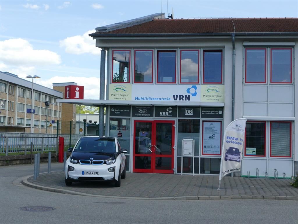
Tourist Information Palatinate Mountain Range "hin & weg"
Bahnhofstraße 67, 66869 Kusel
Tel: 06381/ 424 270, Fax: 06381/ 424 280
Email: touristinformation@kv-kus.de
Opening hours:
Mon - Fri: 7:30 am - 4 pm
Sat + Sun: 9 am - 2 pm
Family crypt of the Veldenzers: Internet: www.remigiusberg.de
Fritz-Wunderlich Museum info@fritz-wunderlich-ges.com
Oblíbené prohlídky v okolí
- 5.0
Börsborn - Muhleichenweg
středníTuristika 11.3 km - 5.0
Glan-Blies cycle path | Waldmohr - Staudernheim
středníCyklistika na velkou vzdálenost 74.9 km - 4.0
Börsborn - Von-der-Leyen-Weg
středníTematická stezka 12.2 km - 4.0
Fritz-Wunderlich Cycle Path
středníJízda na kole 26.1 km Kusel - Preußensteig
heavyTuristika 25.6 kmAltenkirchen - Cherry Land Path (circular route - 22.6 km)
heavyTematická stezka 22.5 kmWolfstein - summit trail to Königsberg
heavyTematická stezka 8.11 km- 5.0
Potzberg Hiking Trail
středníTuristika 14.7 km - 4.0
Glan-Blies Cycle Route
světloJízda na kole 127.1 km Henschtal - Eichhörnchenweg im Hodenbachtal
středníTuristika 8.18 km

Pěší turistika a stopování


Nenechte si ujít nabídky a inspiraci pro vaši příští dovolenou
Vaše e-mailová adresa byl přidán do poštovního seznamu.