


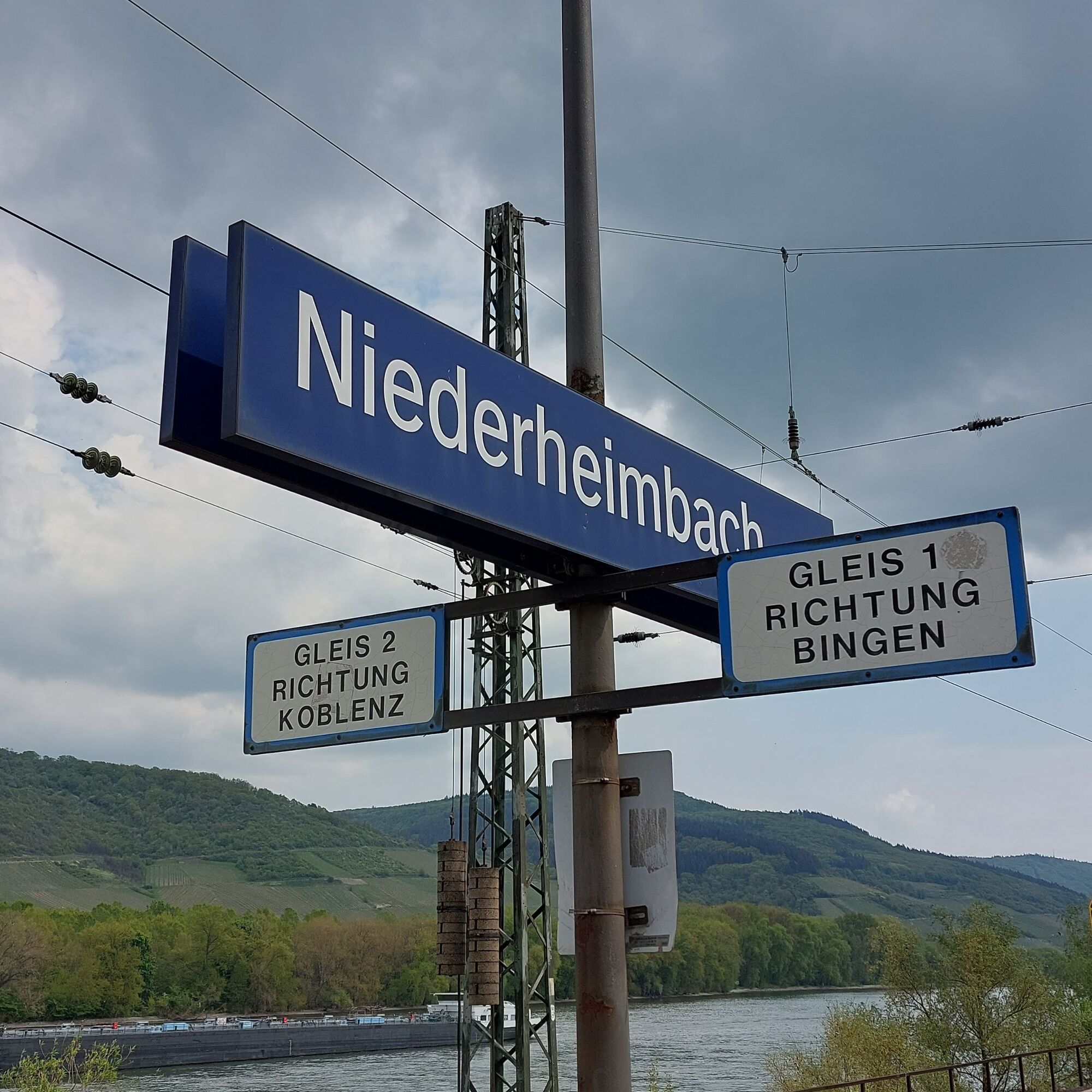
Welterbesteig Upper Middle Rhine Valley Stage 2 Trechtingshausen-Niederheimbach
With or without a detour to Reichenstein Castle: through the Morgenbach valley it goes uphill again, and this on a significantly longer section than on the Rhine Castle Trail.
Tip: at the height of the...
With or without a detour to Reichenstein Castle: through the Morgenbach valley it goes uphill again, and this on a significantly longer section than on the Rhine Castle Trail.
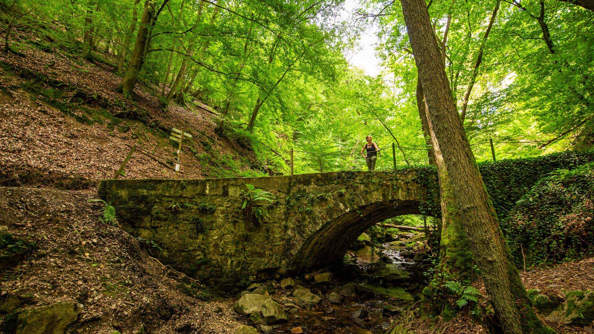
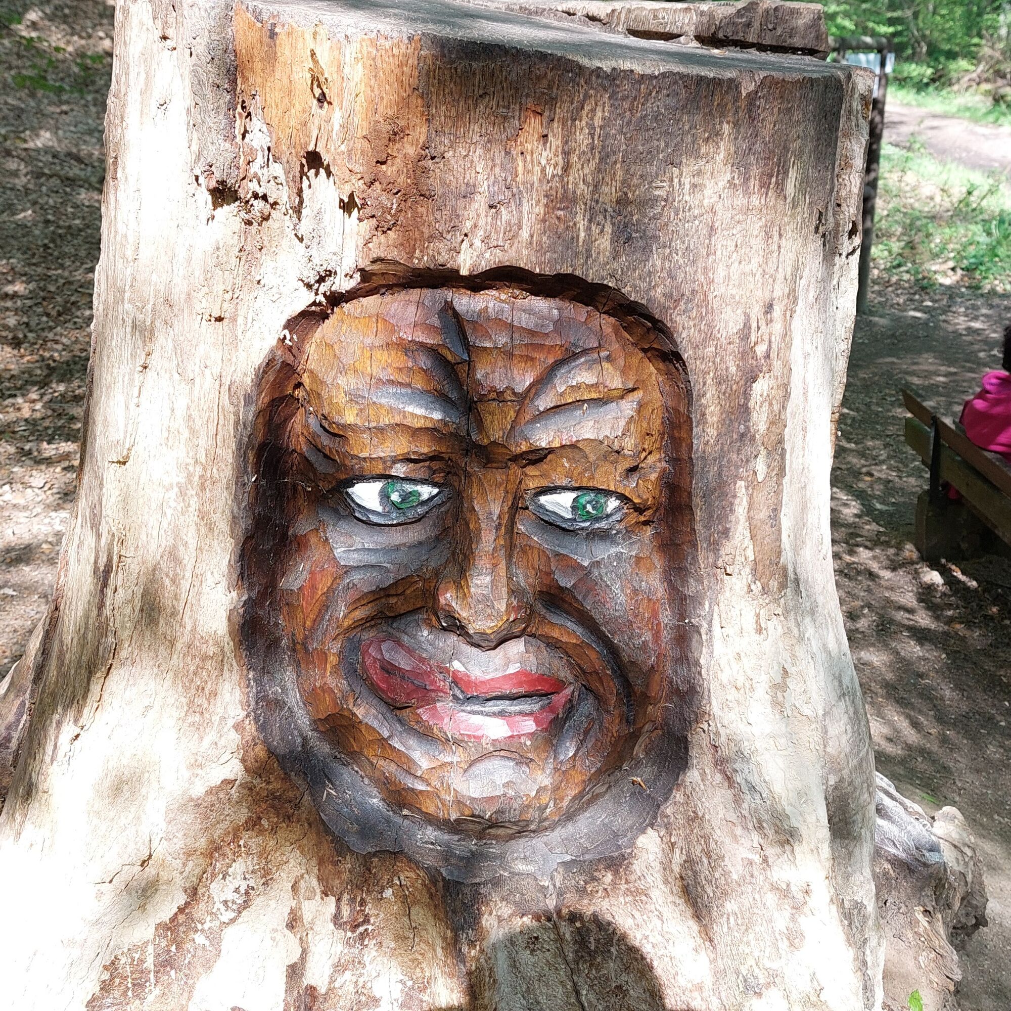
Tip: at the height of the hunter's house, the Steckeschlääferklamm, only 700 m long, meets the path with 15 small wooden bridges. More than 40 lovable tree faces have also been created here through carvings. Definitely worth seeing!
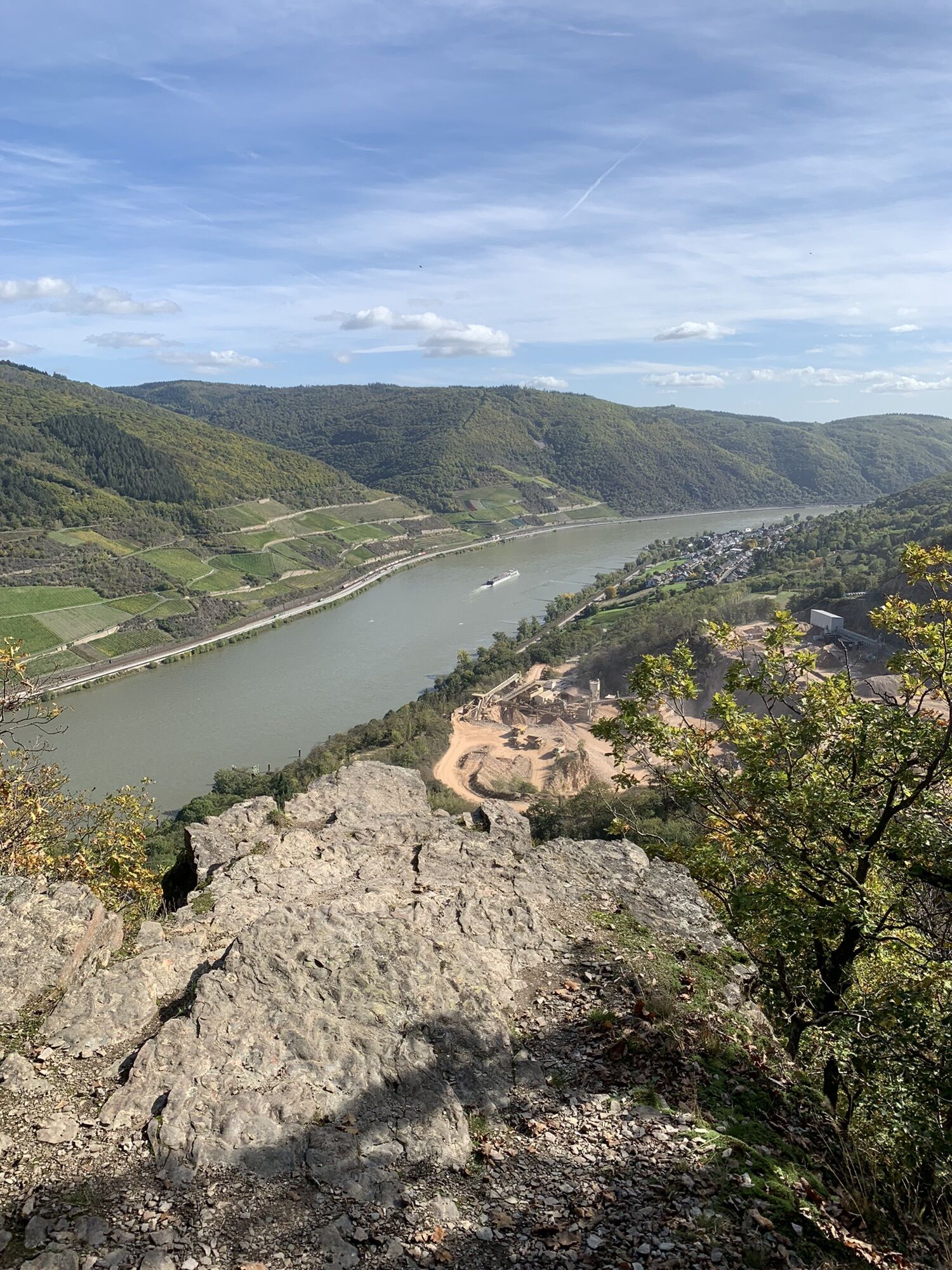
Among the natural monuments in Rhineland-Palatinate is the rock formation Schlägelskopf with the Schägle fountain at the highest point of this stage.
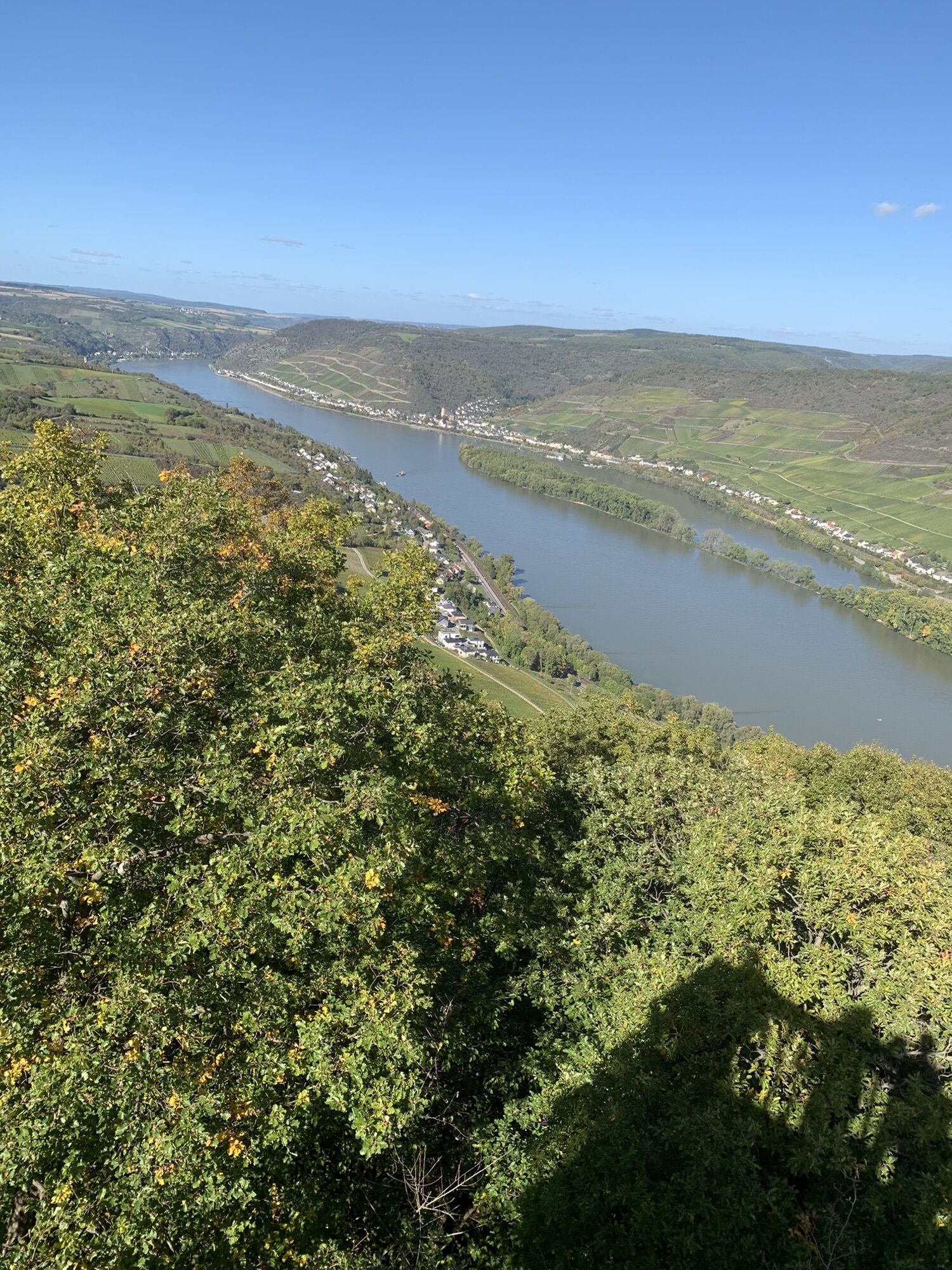
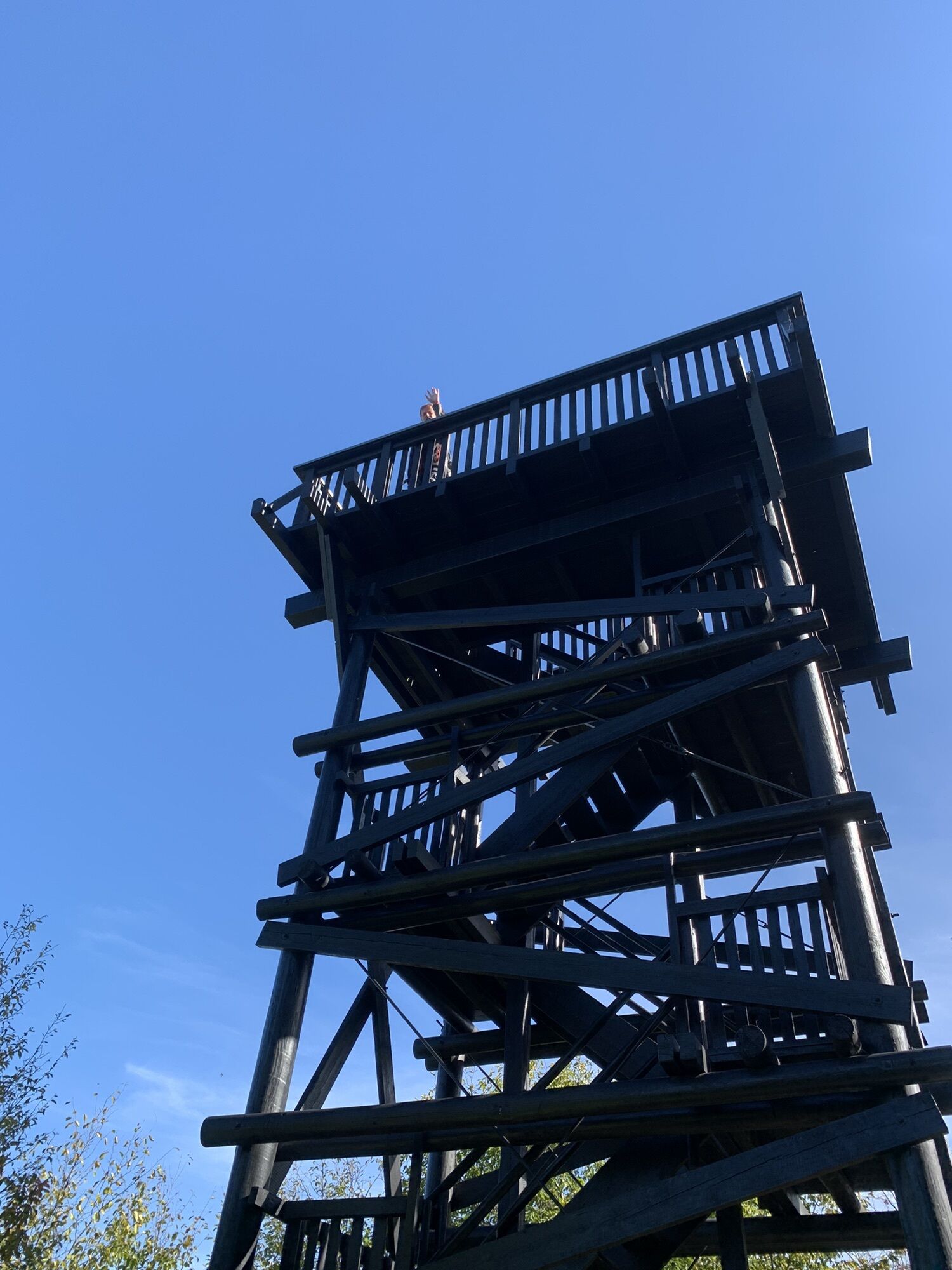
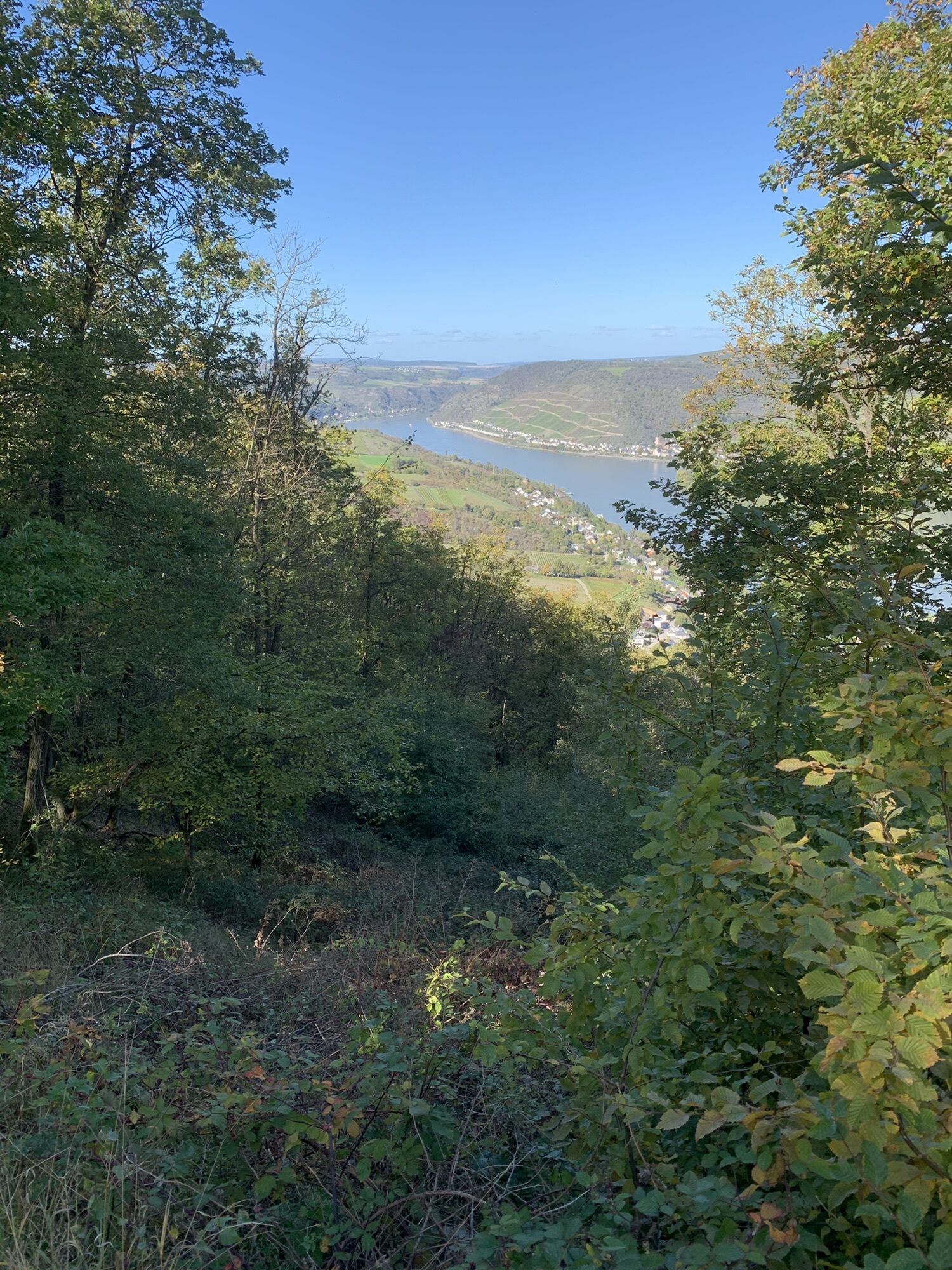
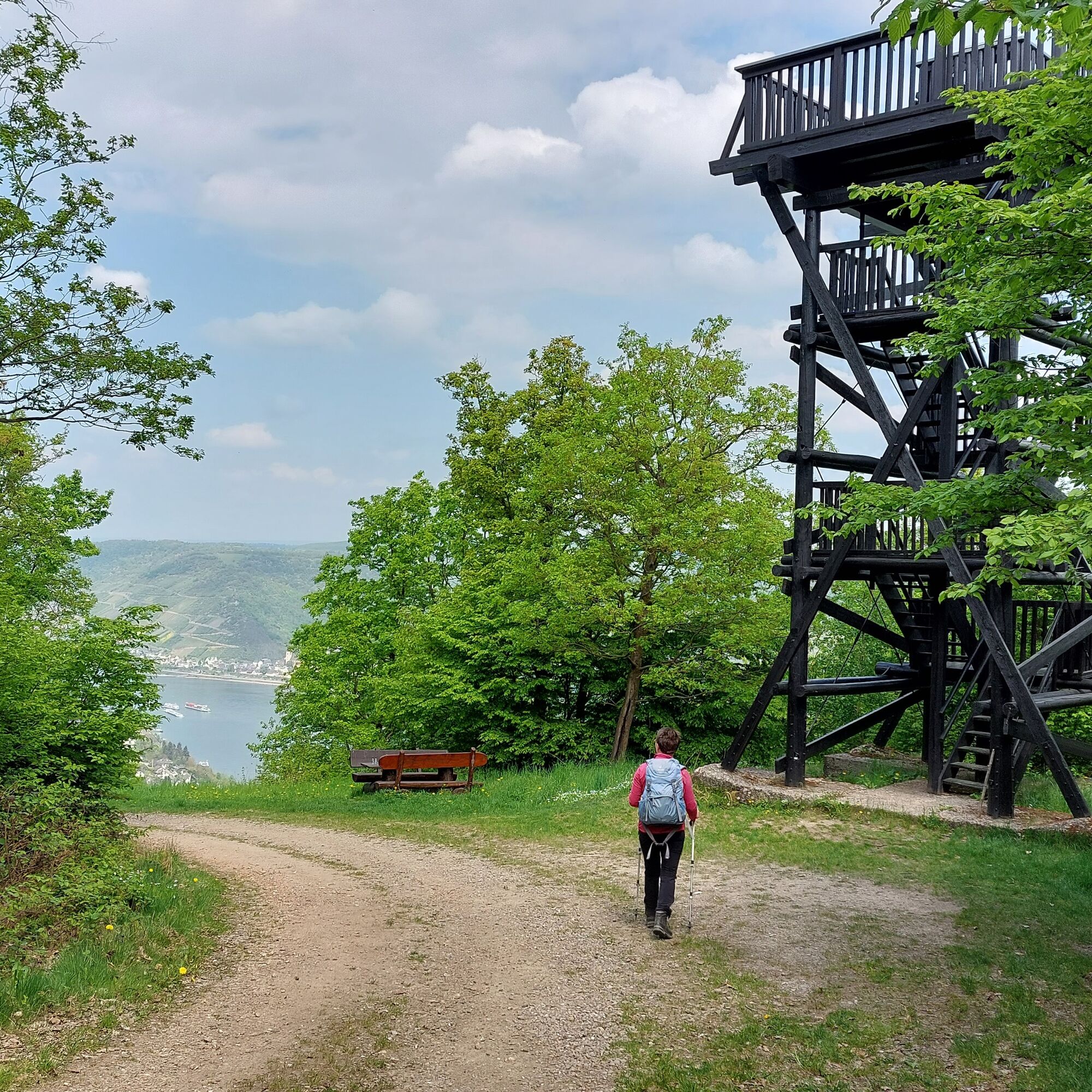
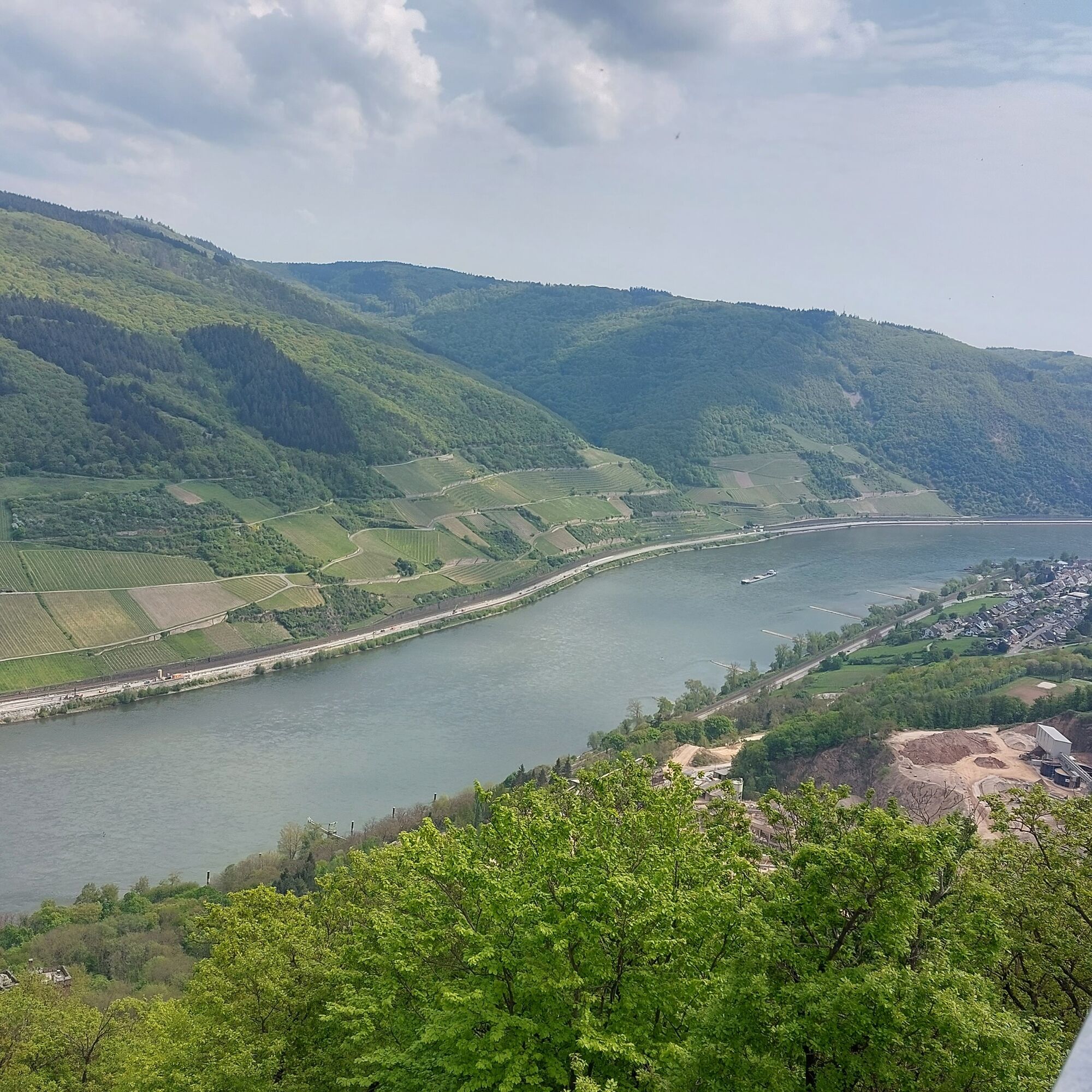
The view of Heimburg, Sooneck Castle, Stahleck Castle, Schoeneck Palace, the ruin of Kammerburg, the ruin of Fürstenberg Castle, and the Nollig ruin gives the lookout tower shortly before Niederheimbach its name: Seven-Castles-View.
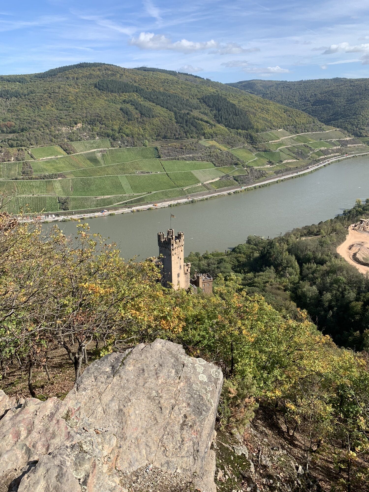
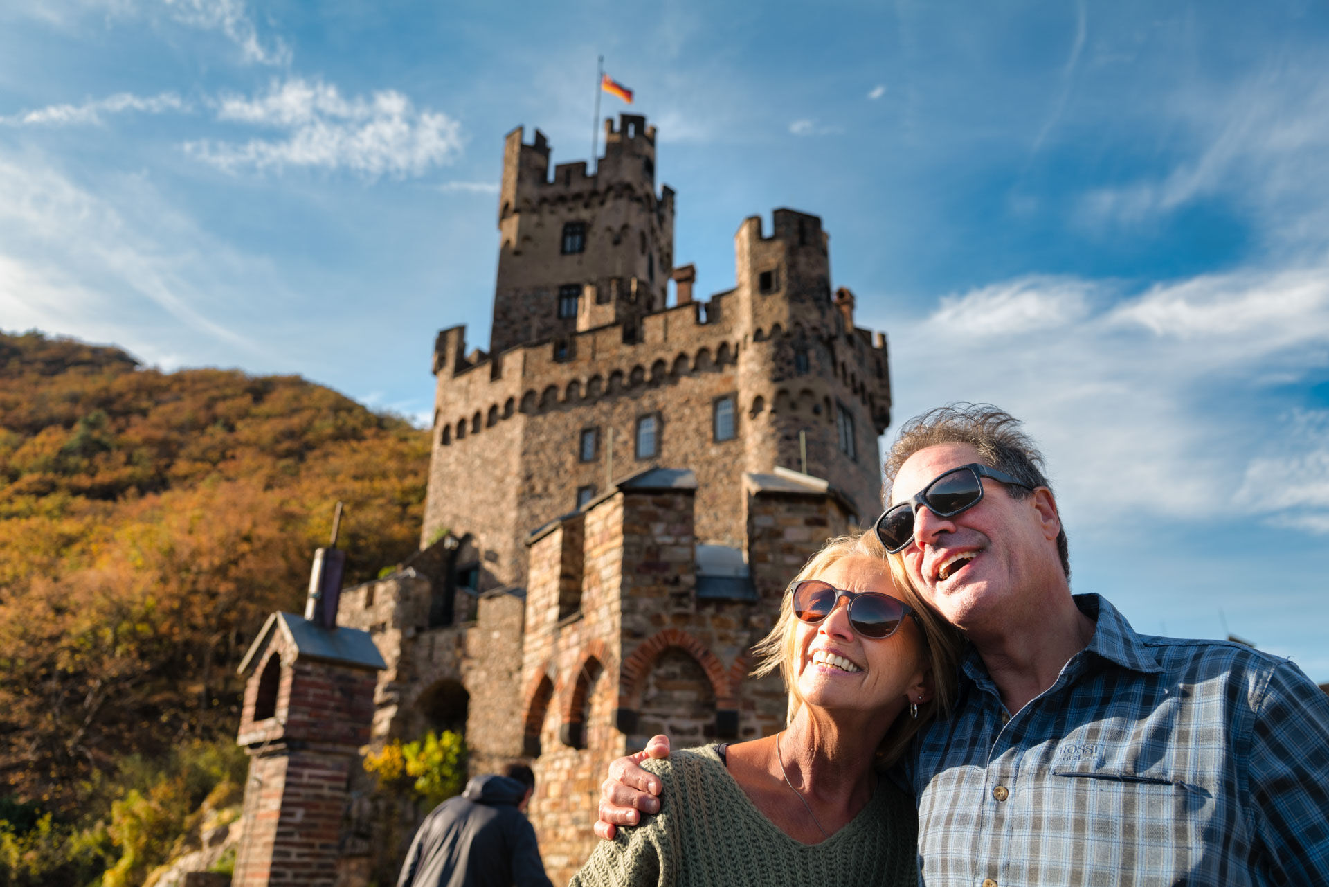
Via the Martin path it goes to the parking lot of Sooneck Castle, from here a short detour to the rose-surrounded castle is worthwhile.
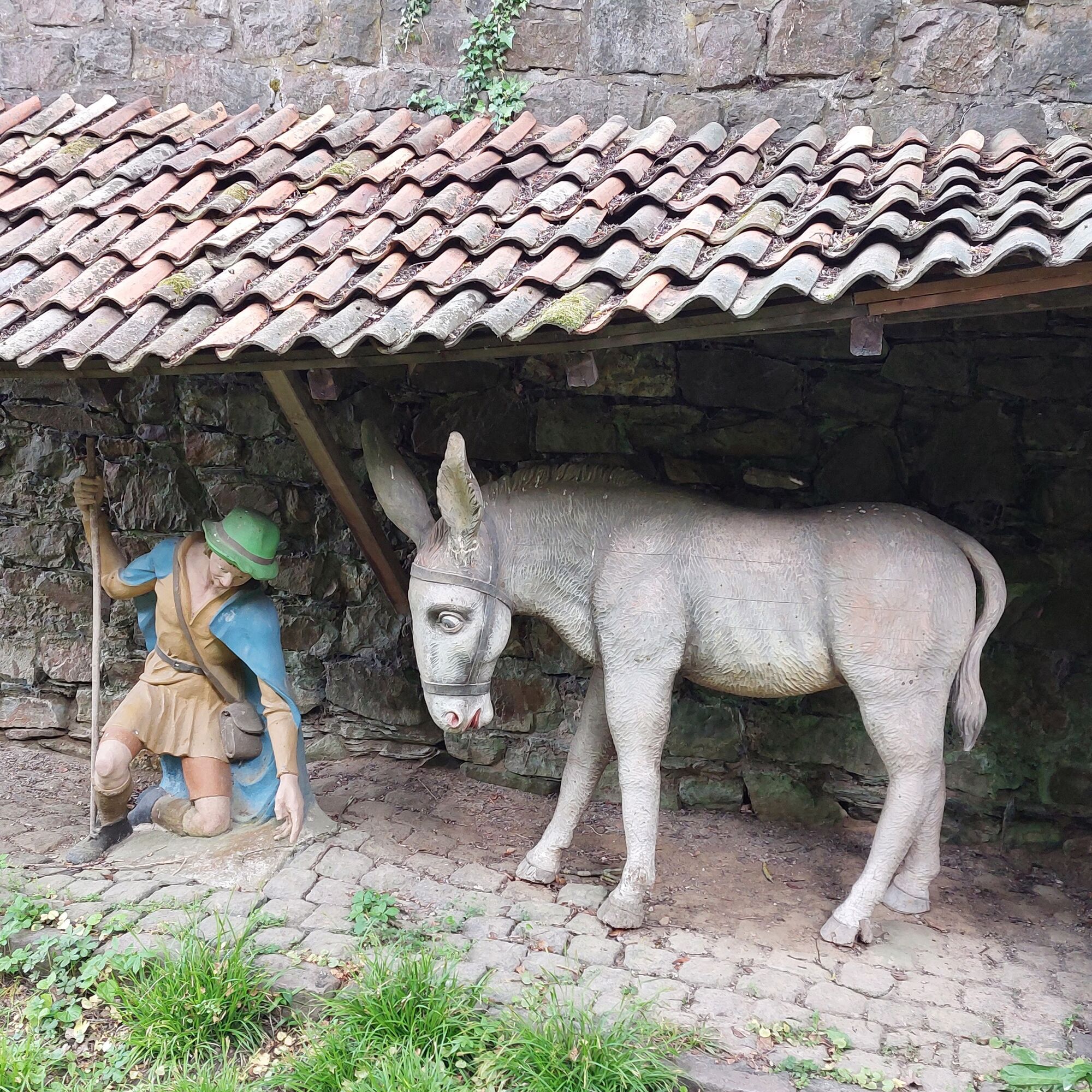
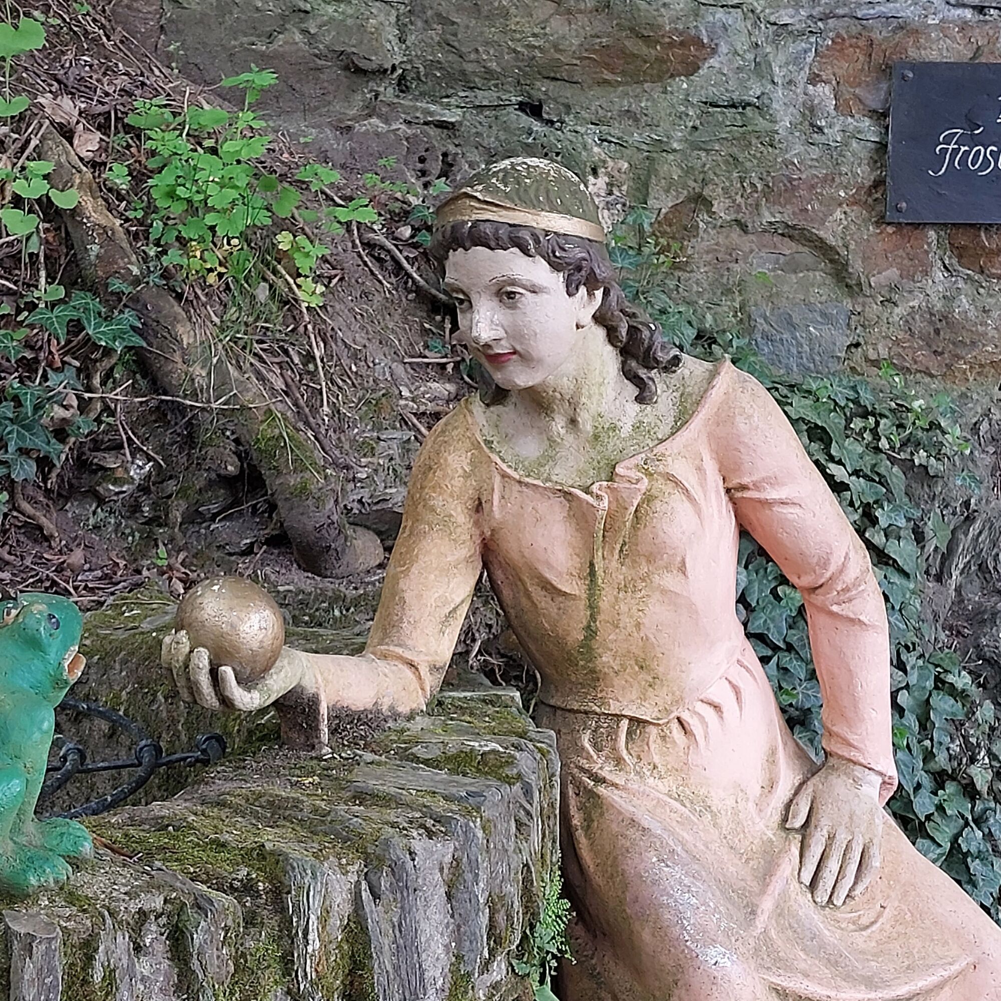
With views of Lorcher Werth, the World Heritage Trail approaches Hohneck Castle. The castle nursery is one of the World Heritage Gardens, which are part of the cultural landscape of the UNESCO World Heritage. Worth seeing – not only for children – is the fairy tale path with restored figures from a former fairy tale grove.

With or without a detour to Reichenstein Castle: through the Morgenbach valley it goes uphill again, and this on a significantly longer section than on the Rhine Castle Trail.
Tip: at the height of the hunter's house, the Steckeschlääferklamm, only 700 m long, meets the path with 15 small wooden bridges. More than 40 lovable tree faces have also been created here through carvings. Definitely worth seeing!
Among the natural monuments in Rhineland-Palatinate is the rock formation Schlägelskopf with the Schägle fountain at the highest point of this stage.
The view of Heimburg, Sooneck Castle, Stahleck Castle, Schoeneck Palace, the ruin of Kammerburg, the ruin of Fürstenberg Castle, and the Nollig ruin gives the lookout tower shortly before Niederheimbach its name: Seven-Castles-View.
Via the Martin path it goes to the parking lot of Sooneck Castle, from here a short detour to the rose-surrounded castle is worthwhile.
With views of Lorcher Werth, the World Heritage Trail approaches Hohneck Castle. The castle nursery is one of the World Heritage Gardens, which are part of the cultural landscape of the UNESCO World Heritage. Worth seeing – not only for children – is the fairy tale path with restored figures from a former fairy tale grove.
Ano
Good footwear and sufficient drinks are mandatory.
All start and destination locations are accessible via the B9 on the left bank of the Rhine:
Motorway:
Bingen: A 60 exit Bingen-East
Bacharach: A 61 exit Rheinböllen
St. Goar: A 61 exit Emmelshausen
Oberwesel: A 61 exit Laudert
Hirzenach: A 61 exit Emmelshausen
Boppard: A 61 exit Boppard-Buchholz
Rhens: A 61 exit Paffenheck
Koblenz: A 61, A 48
Since there is a train station in almost every town on the left bank of the Rhine, the routes can be planned individually. It is also possible to explore from a fixed base very well.
For orientation, below are the travel times between the individual train stations by regional train:
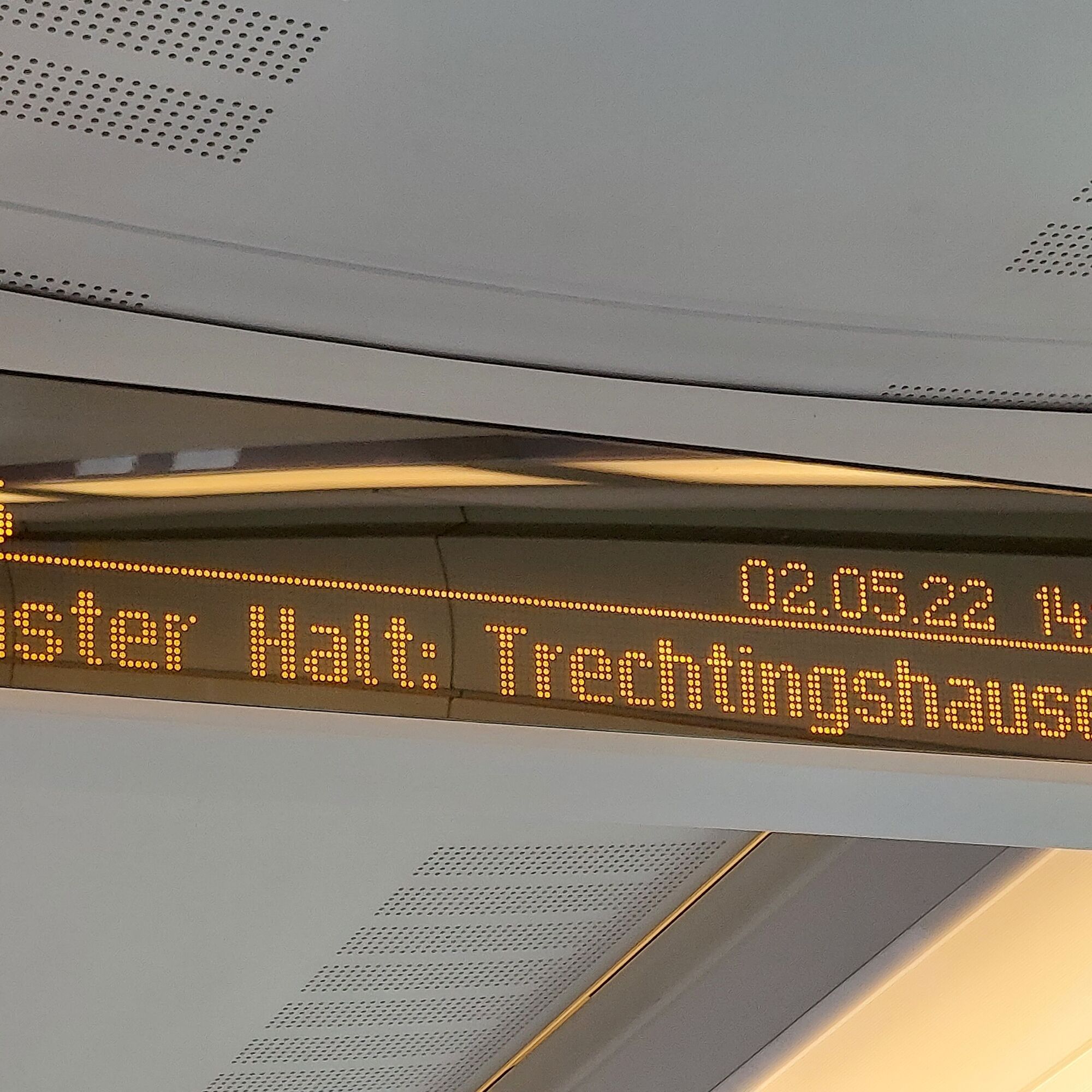
Bingen Hbf - Trechtingshausen: 4 min.
Trechtingshausen - Niederheimbach: 4 min.
Niederheimbach - Bacharach: 3 min.
Bacharach - Oberwesel: 4 min.
Oberwesel - St. Goar: 6 min.
St. Goar - Hirzenach: 4 min.
Hirzenach - Bad Salzig: 3 min.
Bad Salzig - Boppard: 4 min.
Boppard Hbf - Spay: 5 min.
Spay - Rhens: 3 min.
Rhens - Koblenz Hbf: 7 min.
Bingen Hbf - Koblenz Hbf: 48 min.
Bingen: Hindenburganlage, City-Center Bingen
Bacharach: On the B9 Rhine bank
Oberwesel: B9 town wall and Rhine bank
St. Goar: On the B9 Rhine bank
Hirzenach: Rheinstraße
Boppard: Marienberg parking deck, Remigiusplatz Mühltal
At least take a look into the 700 m long Steckeschlääferklamm.
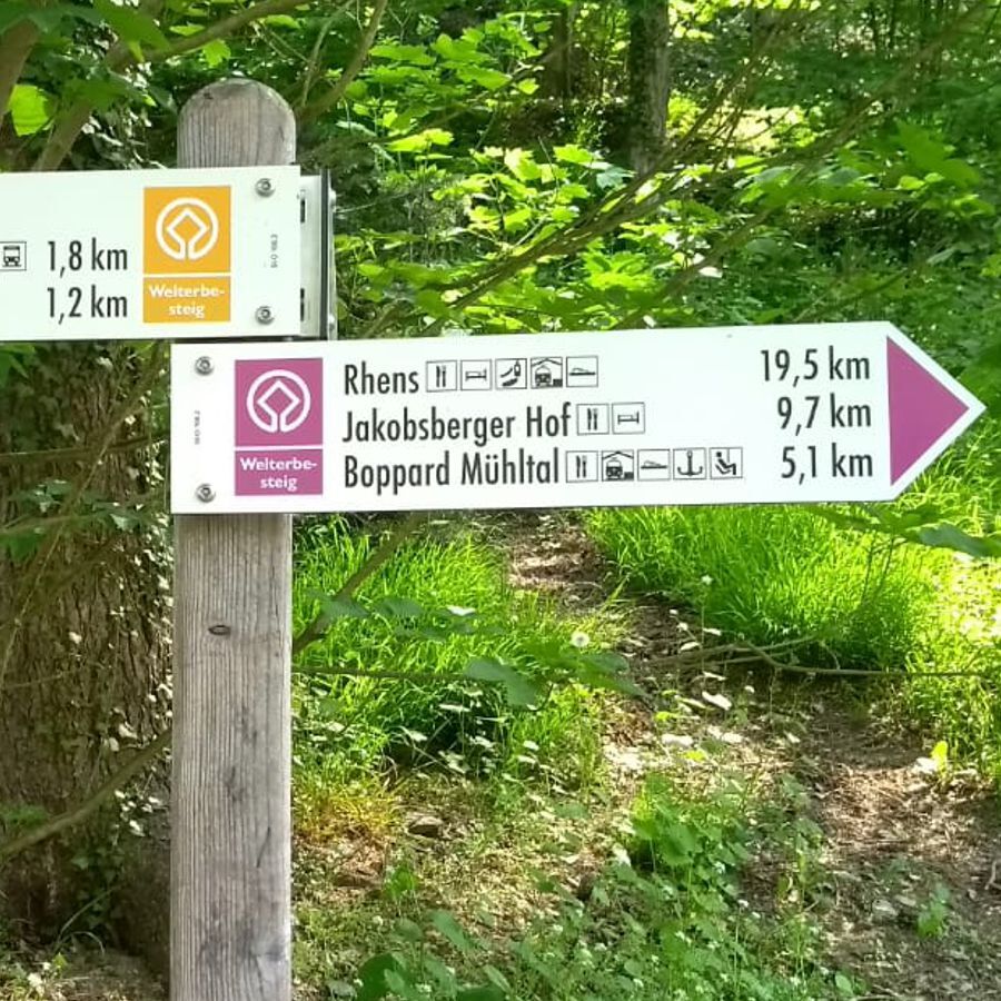
Detour to Sooneck Castle (approx. 300 meters from the path)
From Niederheimbach there is a connection by ferry to Lorch on the right bank of the Rhine.
Oblíbené prohlídky v okolí
- 4.5
Durch den Kammerforst zum Teufelskadrich
světloTuristika 12.3 km - 5.0
Kaub - Burg Herzogenstein - Spitznack - Hasenberg
heavydálková pěší trasa 22.1 km - 5.0
Traumschleifchen Pfalzblick
světloTuristika 5.68 km - 4.8
Rund ums Niederwald Denkmahl
světloTuristika 7.48 km - 5.0
Kaub - Bacharach - Clemenskapelle - Pfarrkirche St. Martin
střednídálková pěší trasa 13.8 km Traumschleife Schwede-Bure
středníTuristika 11.9 kmWisper Trail Wispertalsteig
středníTuristika 14.0 km- 5.0
Forsthaus Jägerhaus - Schlääfer Ruh - Forsthaus Heiligkreuz - Weiler bei Bingen
středníTuristika 12.9 km - 4.0
Geisenheim, Marienthal, Winkel, Johannisberg
světloTuristika 15.5 km Stadtmauerrunde BACHARACH
světloTuristika 9.20 km
Pěší turistika a stopování


Nenechte si ujít nabídky a inspiraci pro vaši příští dovolenou
Vaše e-mailová adresa byl přidán do poštovního seznamu.