Refuge Napoléon - Chapelle Sainte-Marie-Madeleine - Église Saint-Sébastien - Église Saint-Nicolas-de-Myre
heavy
Navigace na stránkách
Navigace na stránkách
Pořiďte si tuto prohlídku do mobilního telefonu
Refuge Napoléon - Chapelle Sainte-Marie-Madeleine - Église Saint-Sébastien - Église Saint-Nicolas-de-Myre
heavy
Silniční kolo
78.68
km
Naskenujte QR kód a spusťte navigaci v aplikaci bergfex.

Pěší turistika a stopování


Refuge Napoléon - Chapelle Sainte-Marie-Madeleine - Église Saint-Sébastien - Église Saint-Nicolas-de-Myre
heavy
Vzdálenost
78.68
km
Doba trvání
04:25
h
Ascent
1640
hm
Hladina moře
1122 -
2109
m
Stažení skladby
Refuge Napoléon - Chapelle Sainte-Marie-Madeleine - Église Saint-Sébastien - Église Saint-Nicolas-de-Myre
heavy
Silniční kolo
78.68
km
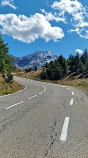
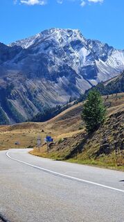
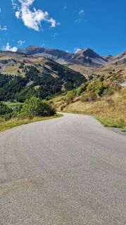
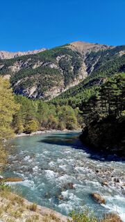
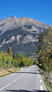
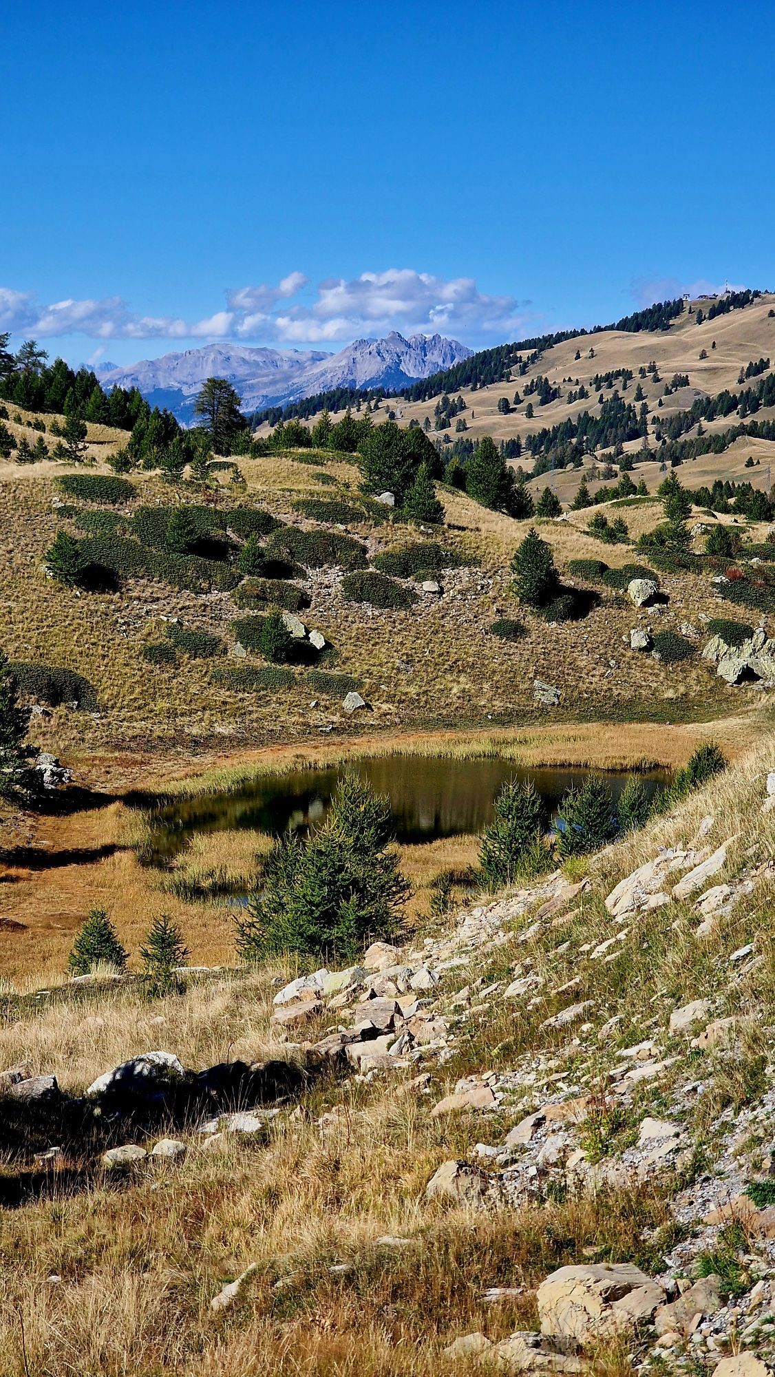
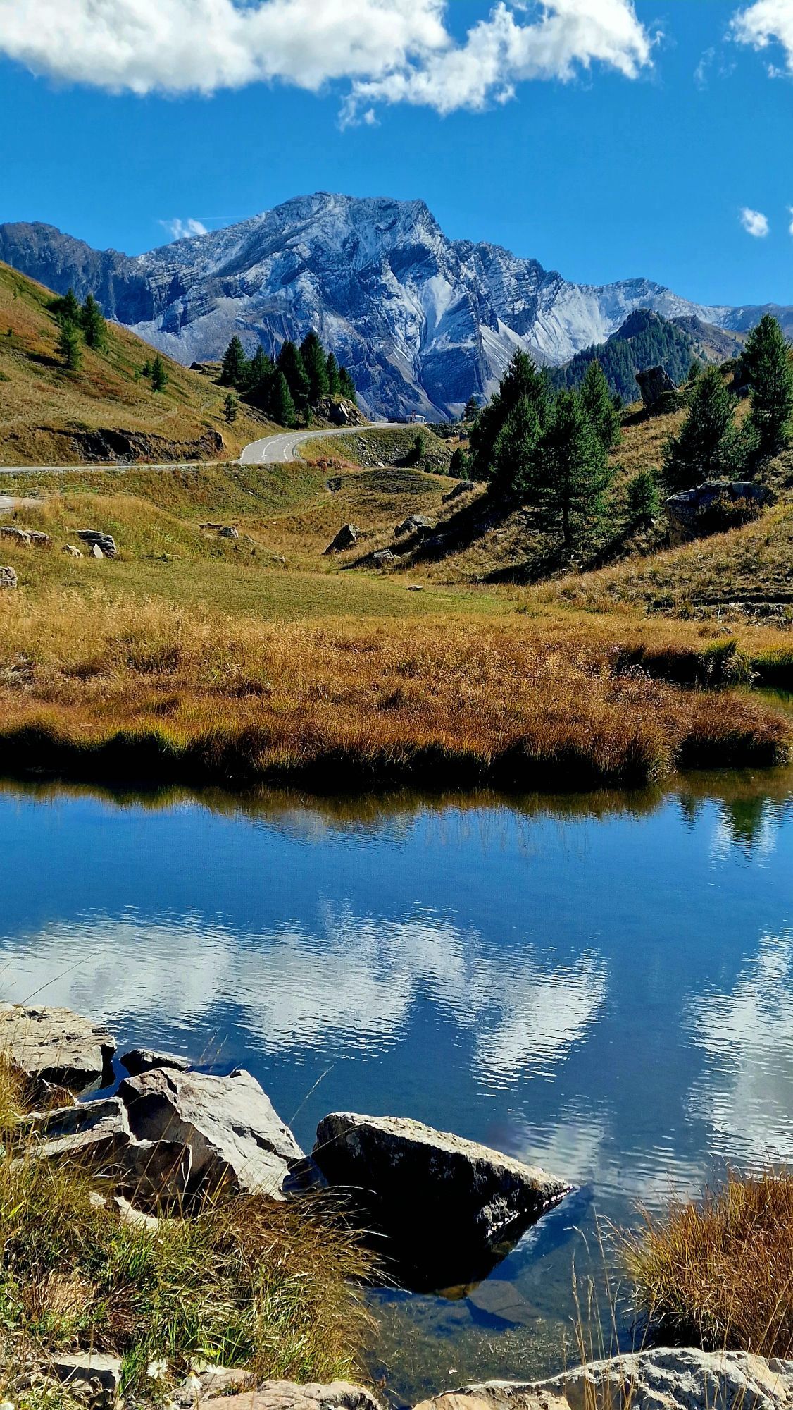
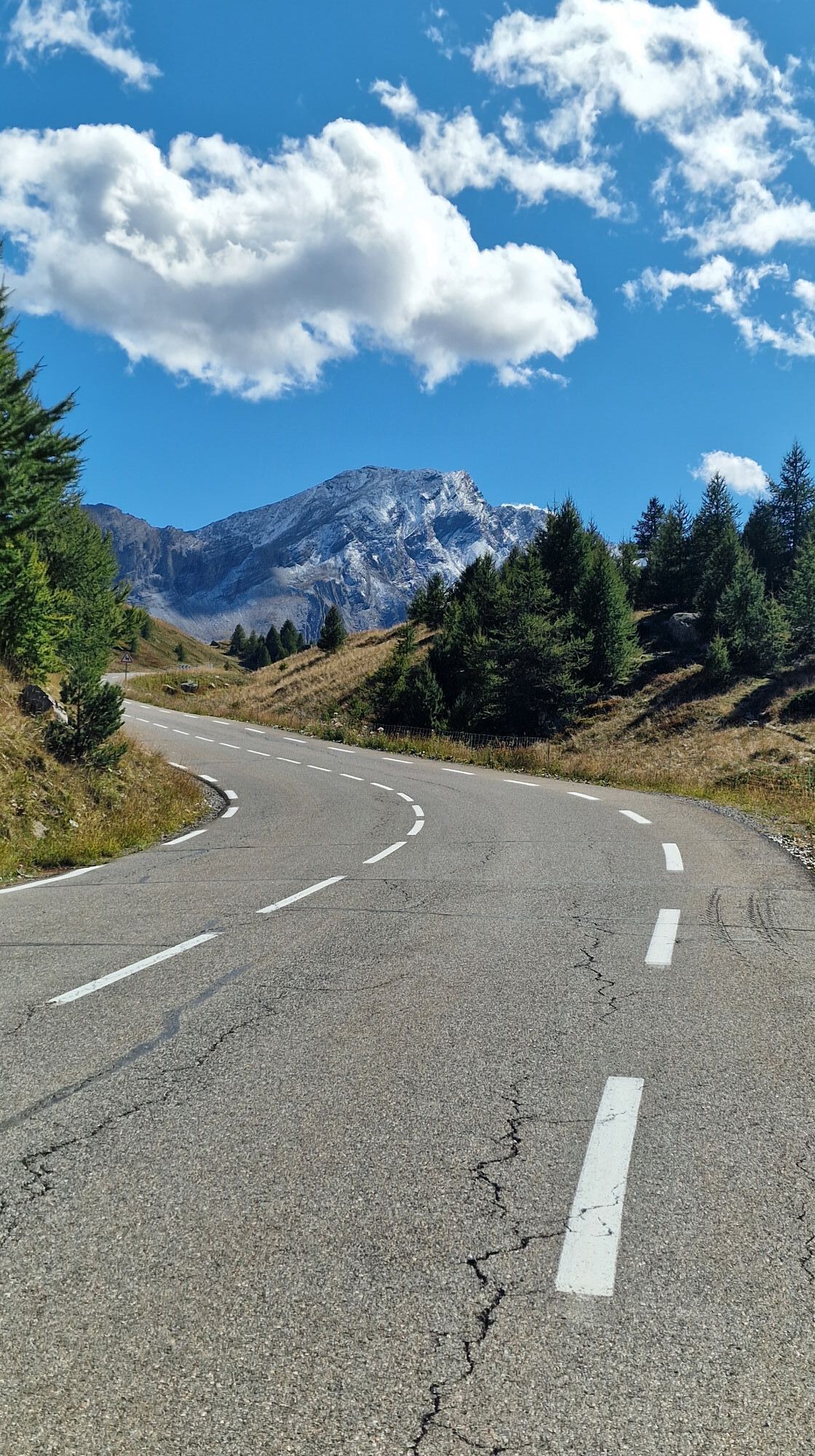
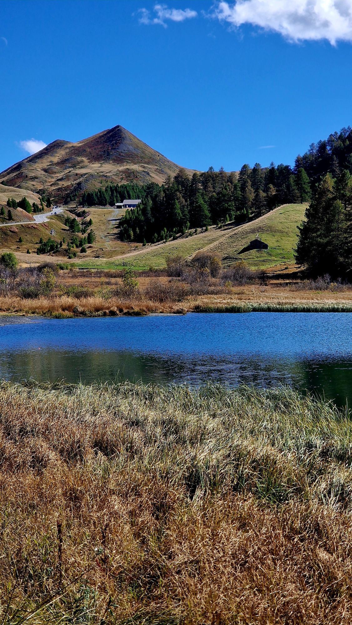
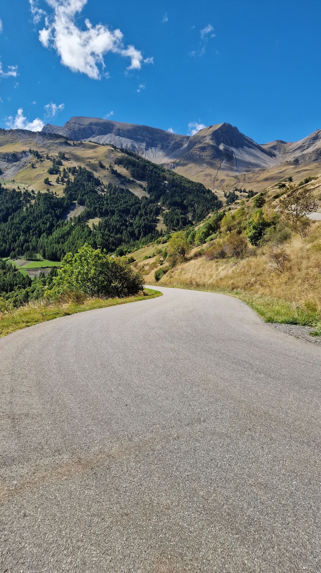
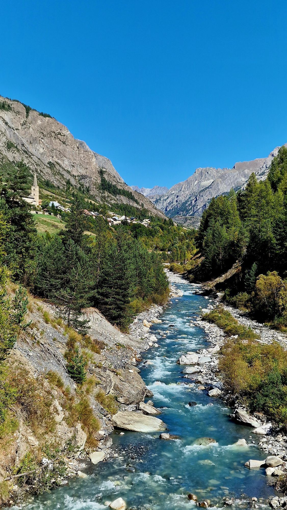
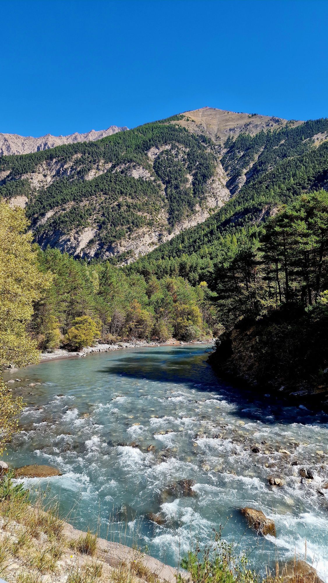
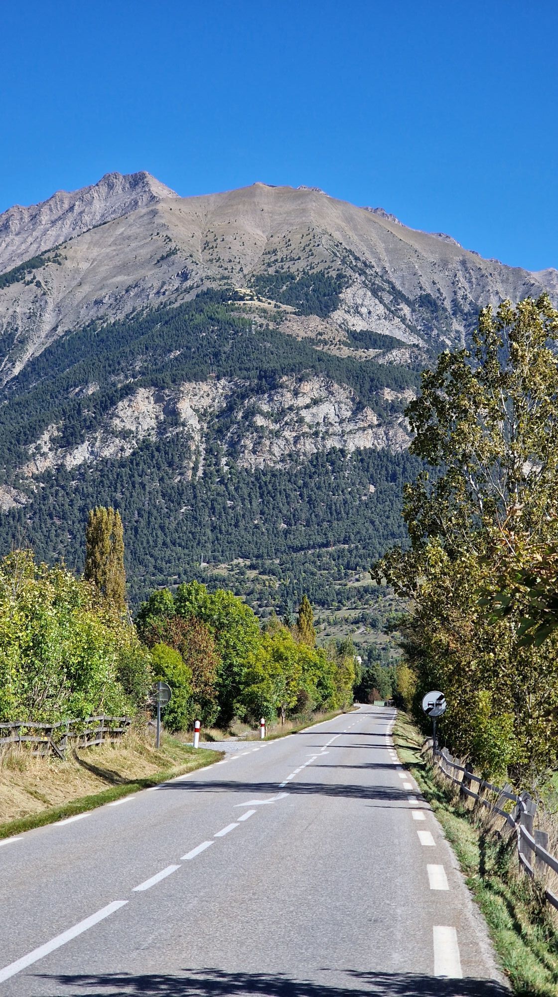
Fotografie našich uživatelů
-
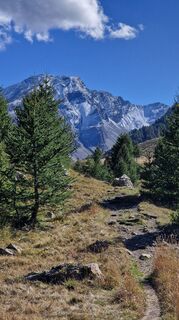
 © Fabrizi MellanoVytvořeno dne 27.09.2025
 -
 © Fabrizi MellanoVytvořeno dne 27.09.2025
 -
 © Fabrizi MellanoVytvořeno dne 27.09.2025
 -
 © Fabrizi MellanoVytvořeno dne 27.09.2025
 -
 © Fabrizi MellanoVytvořeno dne 27.09.2025
 -
 © Fabrizi MellanoVytvořeno dne 27.09.2025
 -
 © Fabrizi MellanoVytvořeno dne 27.09.2025
 -
 © Fabrizi MellanoVytvořeno dne 27.09.2025
 -
 © Fabrizi MellanoVytvořeno dne 27.09.2025
 -
 © Fabrizi MellanoVytvořeno dne 27.09.2025


Trasa
Chapelle Sainte-Marie-Madeleine
(2089 m)
Místo konání bohoslužeb
4.4 km
Église Saint-Sébastien
(1656 m)
Místo konání bohoslužeb
9.0 km
Église Saint-Nicolas-de-Myre
(1217 m)
Místo konání bohoslužeb
26.3 km
Église Saint-Pierre-ès-liens
(1134 m)
Místo konání bohoslužeb
34.7 km
Barcelonnette
(1133 m)
Město
35.1 km
Cornille
(1136 m)
Vypořádání
37.0 km
Église Saint-Nicolas-de-Myre
(1217 m)
Místo konání bohoslužeb
52.3 km
Trasa
Refuge Napoléon - Chapelle Sainte-Marie-Madeleine - Église Saint-Sébastien - Église Saint-Nicolas-de-Myre
heavy
Silniční kolo
78.68
km
Refuge Napoléon
(1988 m)
Restaurace
2.0 km
L'Igloo
(2110 m)
Restaurace
4.2 km
Chapelle Sainte-Marie-Madeleine
(2089 m)
Místo konání bohoslužeb
4.4 km
Église Saint-Sébastien
(1656 m)
Místo konání bohoslužeb
9.0 km
Les Prats
(1675 m)
Vesnice
11.2 km
Les Gîtes
(1503 m)
Sousedství
11.7 km
Saint-Paul-sur-Ubaye
(1470 m)
Vesnice
12.4 km
Les Gleizolles
(1312 m)
Vypořádání
18.4 km
La Condamine-Châtelard
(1286 m)
Vesnice
21.3 km
La Rimaye
(1286 m)
Restaurace
21.3 km
Pas de Grégoire
(1276 m)
Koridor/terén
24.7 km
Jausiers
(1214 m)
Vesnice
26.3 km
Église Saint-Nicolas-de-Myre
(1217 m)
Místo konání bohoslužeb
26.3 km
Les Davis-Haut
(1216 m)
Vypořádání
28.5 km
Domaine de Bérard
(1187 m)
Vypořádání
30.9 km
Faucon-de-Barcelonnette
(1198 m)
Vesnice
32.3 km
Église Saint-Pierre-ès-liens
(1134 m)
Místo konání bohoslužeb
34.7 km
Barcelonnette
(1133 m)
Město
35.1 km
Le Plan
(1126 m)
Vypořádání
36.0 km
Cornille
(1136 m)
Vypořádání
37.0 km
Le Pied de la Maure
(1150 m)
Vypořádání
38.0 km
Uvernet
(1177 m)
Vesnice
39.6 km
L'Auberge du Bachelard
(1175 m)
Restaurace
39.6 km
La Tour
(1171 m)
Vypořádání
40.2 km
Cornille
(1136 m)
Vypořádání
41.8 km
Le Plan
(1126 m)
Vypořádání
42.7 km
Barcelonnette
(1133 m)
Město
43.9 km
Faucon-de-Barcelonnette
(1198 m)
Vesnice
46.3 km
Domaine de Bérard
(1187 m)
Vypořádání
47.7 km
Les Davis-Haut
(1216 m)
Vypořádání
49.9 km
Jausiers
(1214 m)
Vesnice
52.3 km
Église Saint-Nicolas-de-Myre
(1217 m)
Místo konání bohoslužeb
52.3 km
Pas de Grégoire
(1276 m)
Koridor/terén
54.0 km
La Rimaye
(1286 m)
Restaurace
57.3 km
La Condamine-Châtelard
(1286 m)
Vesnice
57.3 km
Les Gleizolles
(1312 m)
Vypořádání
60.2 km
Saint-Paul-sur-Ubaye
(1470 m)
Vesnice
66.2 km
Les Gîtes
(1503 m)
Sousedství
66.8 km
Les Prats
(1675 m)
Vesnice
67.4 km
Église Saint-Sébastien
(1656 m)
Místo konání bohoslužeb
69.6 km
Chapelle Sainte-Marie-Madeleine
(2089 m)
Místo konání bohoslužeb
74.2 km
L'Igloo
(2110 m)
Restaurace
74.5 km
Refuge Napoléon
(1988 m)
Restaurace
76.7 km
Zatím žádné recenze
Oblíbené prohlídky v okolí
-
5.0
Goldtoni - Alpenbogen A077 Refugium Campo-Bousieyas
střednídálková pěší trasa 34.1 km -
Lac de Peyrol vers Vars les Claux
světloTuristika 4.60 km -
Sentier des Myrtilles-16964715
světloTuristika 5.15 km -
3.5
Le Crachet Tour
světloLyžařská trasa 8.81 km -
5.0
Vars - Chapelle Sainte-Marie-Madeleine - Église Saint-Nicolas-de-Myre - Barcelonnette
středníSilniční kolo 49.4 km -
Wandeling vanaf Halte 2000 naar meer van Terres Plaines (Jausiers, Provence-Alpes)
středníTuristika 12.1 km -
Route 'Hameau du Vivier' Provence-Alpes
středníTuristika 8.47 km -
FFC cycling circuit no. 36: La Bonette par les 2 versants et le col de Vars
heavySilniční kolo 136.8 km -
Fouillouse-refuge Chambeyron-pas de coulletta
středníTuristika 13.9 km -
super sauze - croix de l'alpe
heavyTuristika 13.0 km

Pěší turistika a stopování

Více než 550.000 návrhů výletů, podrobné mapy a intuitivní plánovač tras dělají z aplikace nezbytnou výbavu pro všechny milovníky přírody.

Nenechte si ujít nabídky a inspiraci pro vaši příští dovolenou
Přihlaste se k odběru newsletteru
Chyba
Došlo k chybě. Zkuste to prosím znovu.
Děkujeme za vaši registraci
Vaše e-mailová adresa byl přidán do poštovního seznamu.
Zájezdy po celé Evropě
Rakousko
Švýcarsko
Německo
Itálie
Slovenia
Francie
Nizozemsko
Belgie
Polsko
Lichtenštejnsko
Česko
Slovensko
Španělsko
Chorvatsko
Bosna a Hercegovina
Lucembursko
Andorra
Portugal
Iceland
United Kingdom
Ireland
Greece
Albania
North Macedonia
Malta
Norway
Montenegro
Moldova
Kosovo
Hungary
San Marino
Romania
Estonia
Latvia
Belarus
Cyprus
Lithuania
Serbia
Bulgaria
Monaco
Denmark
Sweden
Finland