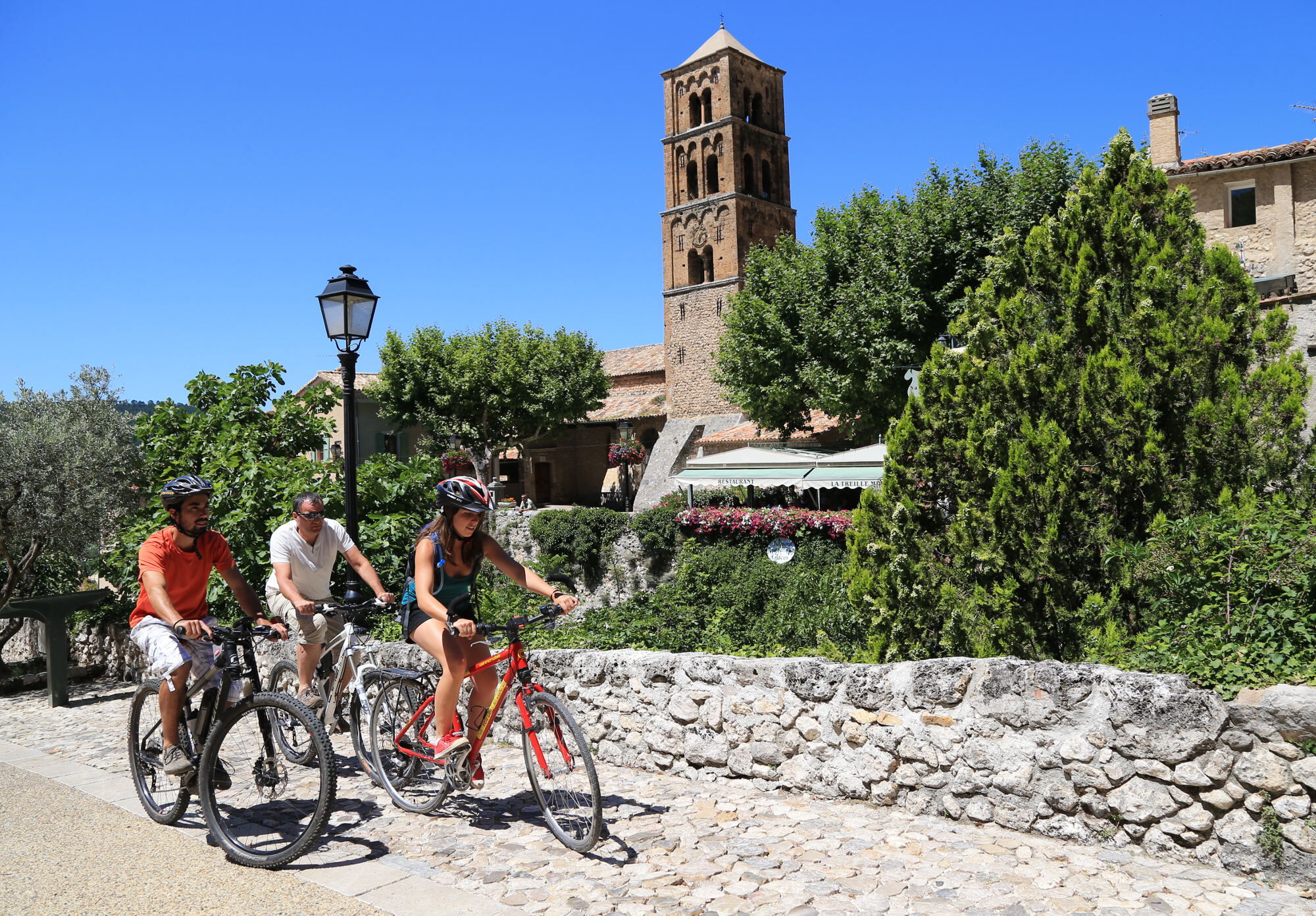
Boucle de La Romaine
střední
Navigace na stránkách
Navigace na stránkách
Pořiďte si tuto prohlídku do mobilního telefonu
Boucle de La Romaine
střední
Silniční kolo
44.40
km
Naskenujte QR kód a spusťte navigaci v aplikaci bergfex.

Pěší turistika a stopování


Boucle de La Romaine
střední
Vzdálenost
44.40
km
Doba trvání
04:20
h
Ascent
534
hm
Hladina moře
520 -
780
m
Úroveň obtížnosti: 4
Stažení skladby
Boucle de La Romaine
střední
Silniční kolo
44.40
km
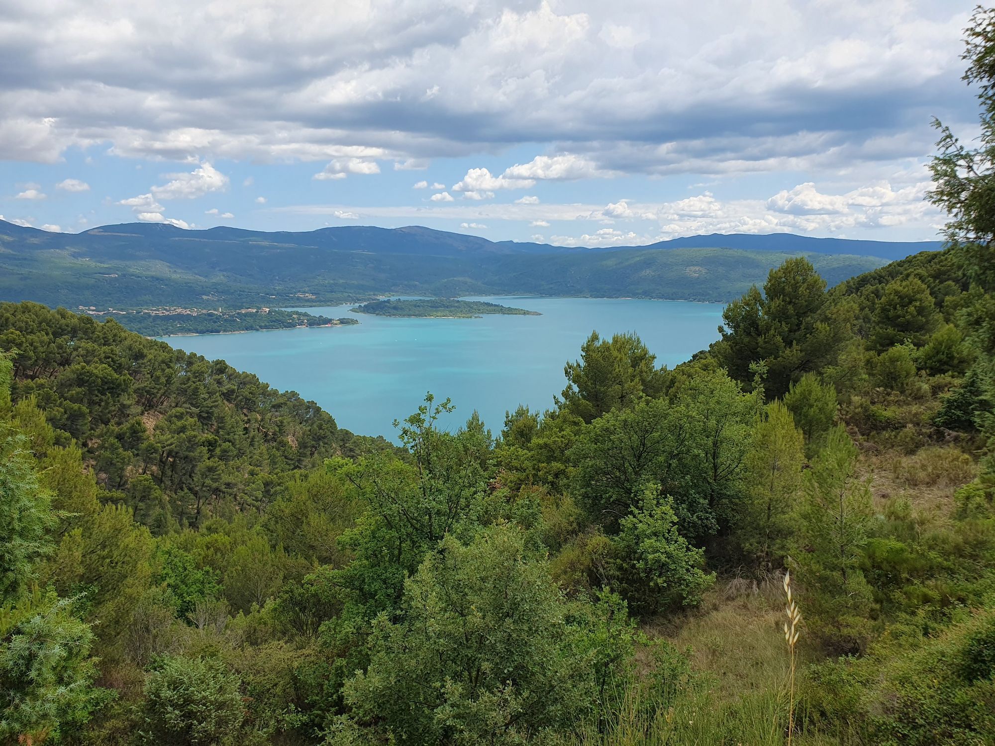
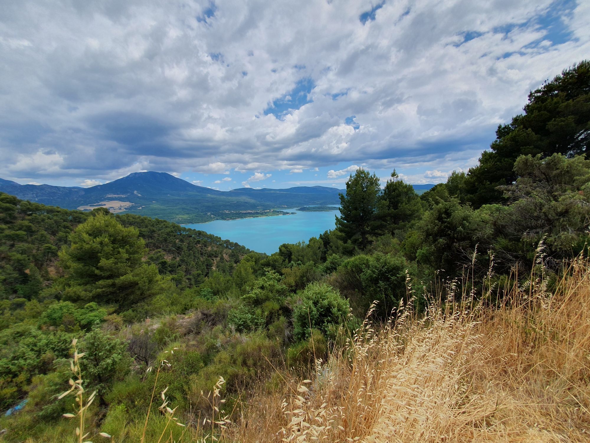
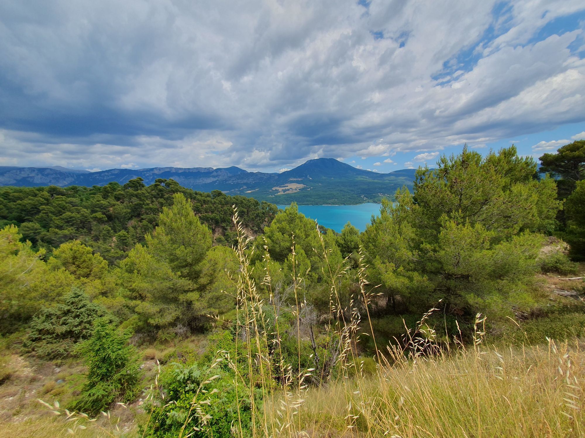
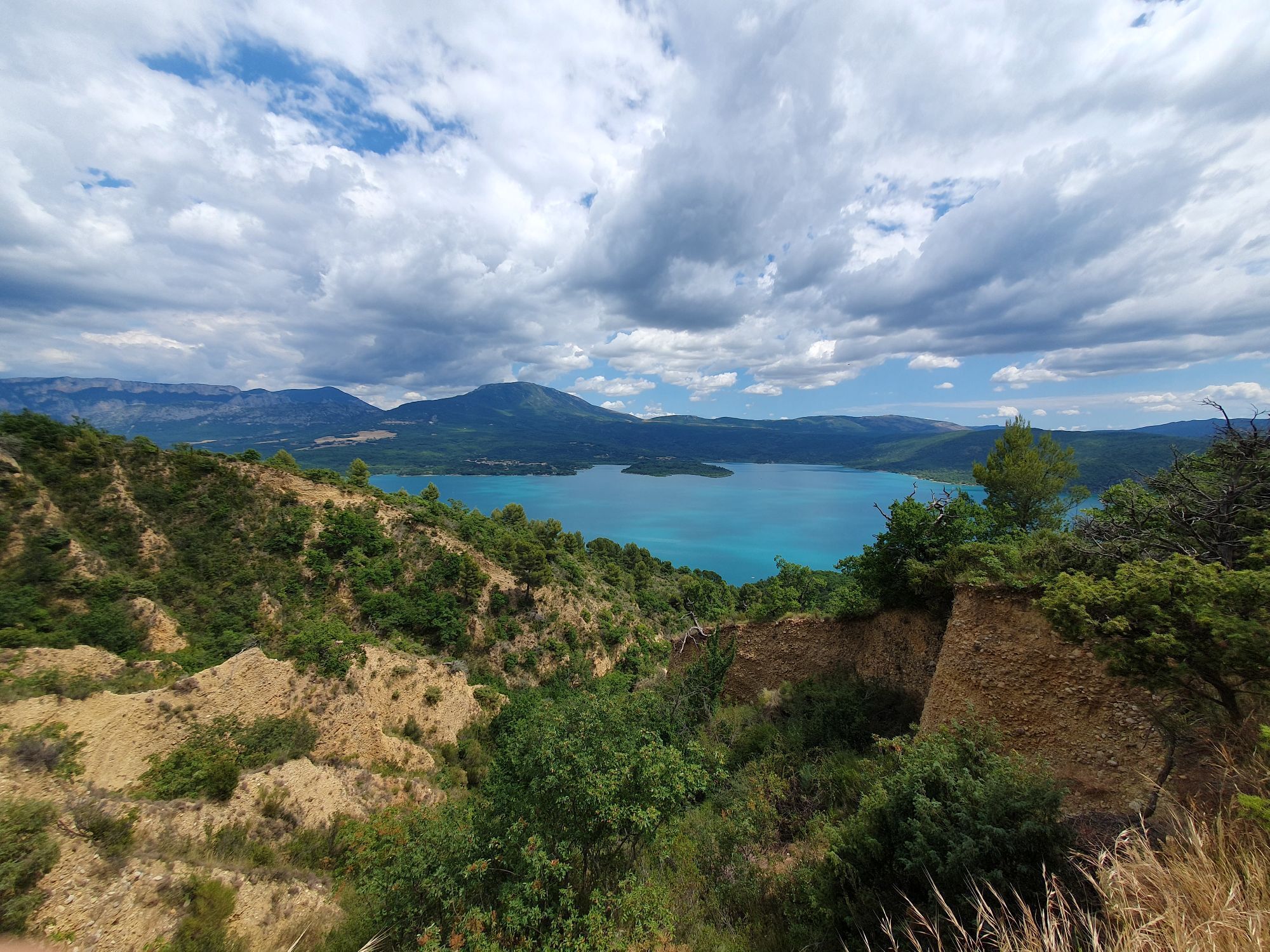
Signposted cycling route following the traces of the area's past. From Riez "the Roman", the oldest town in the Alpes de Haute-Provence, ride through lavender fields to Puimoisson then Moustiers-Sainte-Marie.
Climb...
Popis
Signposted cycling route following the traces of the area's past. From Riez "the Roman", the oldest town in the Alpes de Haute-Provence, ride through lavender fields to Puimoisson then Moustiers-Sainte-Marie.
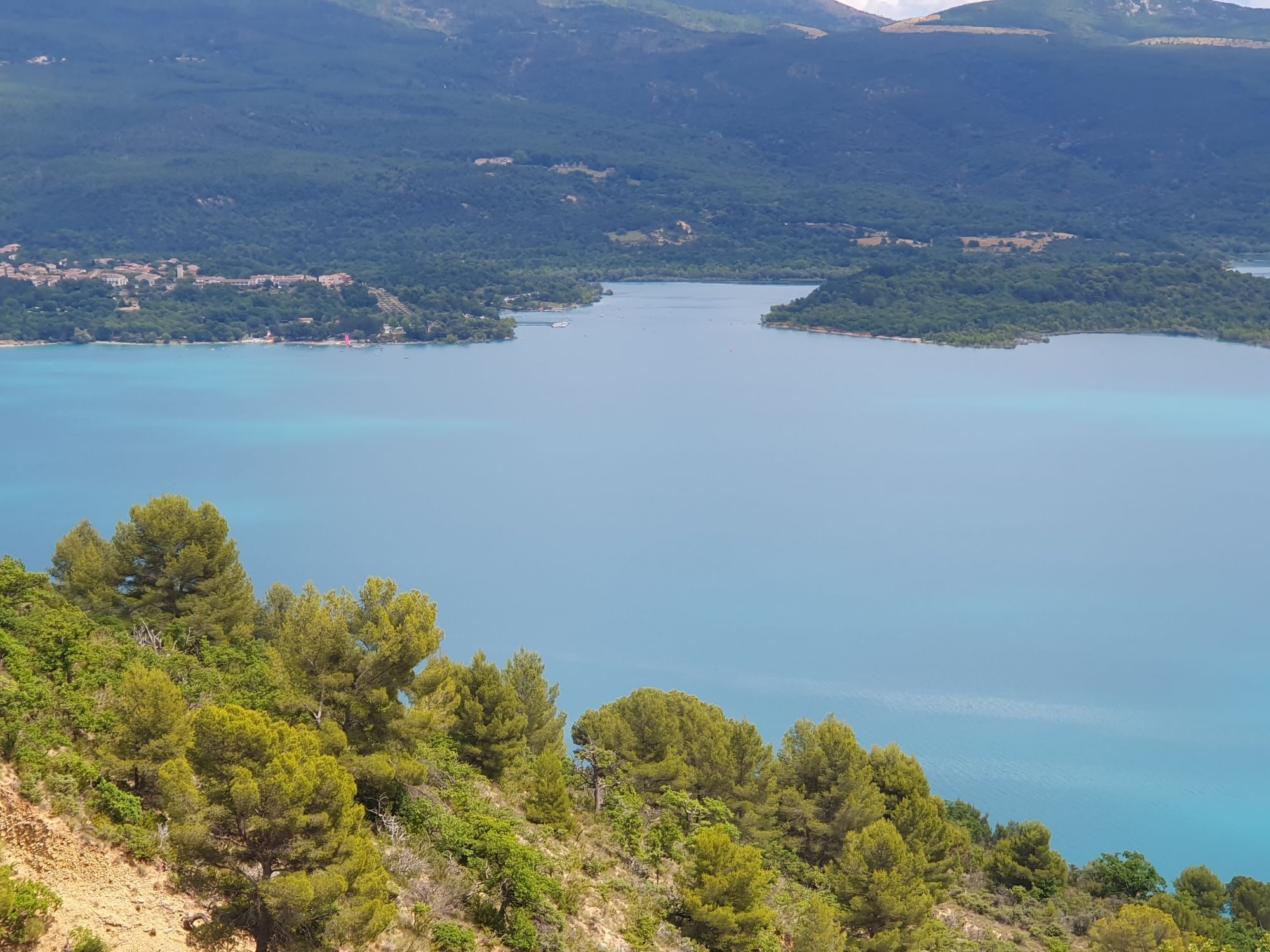
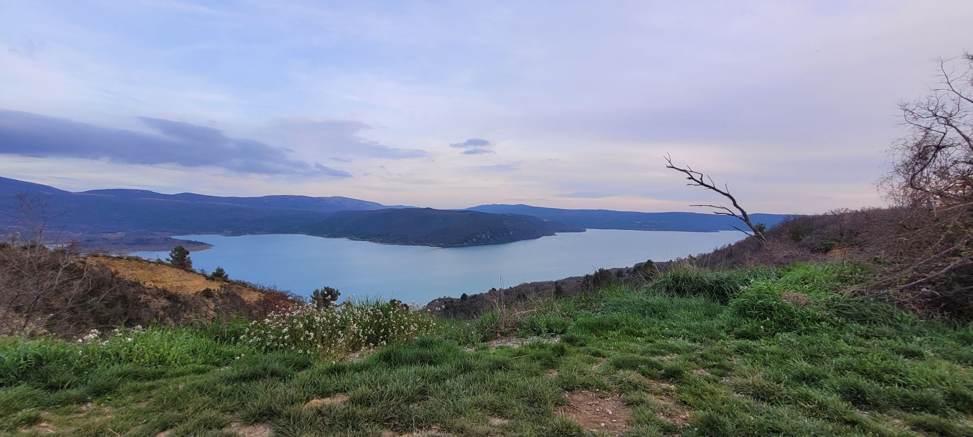
Climb onto the plateau via the famous "16%" gradient then enjoy the view over Lake Sainte-Croix during a well-deserved break. Then head to Roumoules and its castles, before descending back to Riez.
Recommended period: spring and autumn. Route strongly discouraged in summer due to road traffic and high temperatures.
Trasa
Riez
(524 m)
Vesnice
0.0 km
Coté Soleil
(698 m)
Restaurace
7.0 km
Les Roux
(654 m)
Vypořádání
29.6 km
Roumoules
(596 m)
Vesnice
40.7 km
La Table de Margaux
(590 m)
Restaurace
40.8 km
Restaurant Le Romulus
(584 m)
Restaurace
41.2 km
Riez
(524 m)
Vesnice
43.9 km
Trasa
Boucle de La Romaine
střední
Silniční kolo
44.40
km
Riez
(524 m)
Vesnice
0.0 km
Puimoisson
(693 m)
Vesnice
6.8 km
Le tracteur
(695 m)
Restaurace
6.9 km
Coté Soleil
(698 m)
Restaurace
7.0 km
Les Roux
(654 m)
Vypořádání
29.6 km
Roumoules
(596 m)
Vesnice
40.7 km
La Table de Margaux
(590 m)
Restaurace
40.8 km
Restaurant Le Romulus
(584 m)
Restaurace
41.2 km
Riez
(524 m)
Vesnice
43.9 km
Autor
Prohlídku Boucle de La Romaine zajišťuje outdooractive.com.

Bezpečnostní pokyny
In case of emergency, call 112
Informace o příjezdu
Příjezd
Consider carpooling
Parkování
Parking near the starting point
Další informace a tipy
Úroveň obtížnosti
4
Další informace
APIDAE Tourism data updated on 25/05/2020 by "Vélo Loisir Provence".
An error on this sheet? Write to the owner quoting these references:
Sheet name: Boucle de La Romaine | Sheet ID: 5271052 | URL (link) of this Outdooractive page.
An error on this sheet? Write to the owner quoting these references:
Sheet name: Boucle de La Romaine | Sheet ID: 5271052 | URL (link) of this Outdooractive page.
Zatím žádné recenze
Oblíbené prohlídky v okolí
-
4.0
Gorges de Trévans
světloTuristika 10.8 km -
5.0
Les Gorges de Baudinard
středníKajak / Kánoe 8.26 km -
5.0
Verdon - Tour in die Verdon-Schlucht
světloKajak / Kánoe 4.91 km -
The Mediterranean by bike
heavyJízda na kole 461.2 km -
Tour du Verdon by bike
heavySilniční kolo 257.5 km -
Hiking route "The Millarettes plateau"
světloTuristika 9.83 km -
1.0
Hiking route "Coteau Chiron"
středníTuristika 7.16 km -
Cycling along the water and the unique history of the Verdon
heavySilniční kolo 134.0 km -
Hiking route "Adret de Notre Dame"
světloTuristika 6.19 km -
FFC Mountain Bike Site - Provence Verdon - Circuit 43 - Blue - Montagnac-Montpezat
světloMountainbike 16.5 km
Pěší turistika a stopování

Více než 550.000 návrhů výletů, podrobné mapy a intuitivní plánovač tras dělají z aplikace nezbytnou výbavu pro všechny milovníky přírody.

Nenechte si ujít nabídky a inspiraci pro vaši příští dovolenou
Přihlaste se k odběru newsletteru
Chyba
Došlo k chybě. Zkuste to prosím znovu.
Děkujeme za vaši registraci
Vaše e-mailová adresa byl přidán do poštovního seznamu.
Zájezdy po celé Evropě
Rakousko
Švýcarsko
Německo
Itálie
Slovenia
Francie
Nizozemsko
Belgie
Polsko
Lichtenštejnsko
Česko
Slovensko
Španělsko
Chorvatsko
Bosna a Hercegovina
Lucembursko
Andorra
Portugal
Iceland
United Kingdom
Ireland
Greece
Albania
North Macedonia
Malta
Norway
Montenegro
Moldova
Kosovo
Hungary
San Marino
Romania
Estonia
Latvia
Belarus
Cyprus
Lithuania
Serbia
Bulgaria
Monaco
Denmark
Sweden
Finland