Cycling Route No. 7 - Val de Rancure and Valensole Plateau
heavy
Navigace na stránkách
Navigace na stránkách
Pořiďte si tuto prohlídku do mobilního telefonu
Cycling Route No. 7 - Val de Rancure and Valensole Plateau
heavy
Jízda na kole
75.15
km
Naskenujte QR kód a spusťte navigaci v aplikaci bergfex.

Pěší turistika a stopování


Cycling Route No. 7 - Val de Rancure and Valensole Plateau
heavy
Vzdálenost
75.15
km
Doba trvání
05:40
h
Ascent
831
hm
Hladina moře
337 -
856
m
Stažení skladby
Cycling Route No. 7 - Val de Rancure and Valensole Plateau
heavy
Jízda na kole
75.15
km
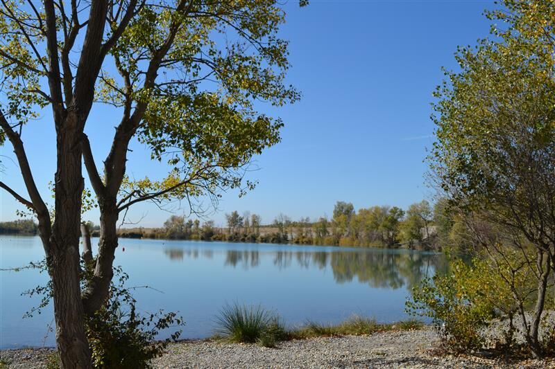
A peaceful loop linking the agricultural landscapes of the Val de Rancure to the vast openness of the Valensole plateau, ideal for discovery and serenity.
Starting from Oraison, pass through the municipalities...
Popis
A peaceful loop linking the agricultural landscapes of the Val de Rancure to the vast openness of the Valensole plateau, ideal for discovery and serenity.
Starting from Oraison, pass through the municipalities of Castellet, Entrevennes, and Brunet
Allow about 2h30 for this route.
Starting from Oraison, pass through the municipalities of Castellet, Entrevennes, and Brunet
Allow about 2h30 for this route.
Trasa
Oraison
(376 m)
Vesnice
0.6 km
Église Saint-Nicolas-de-Myre
(479 m)
Místo konání bohoslužeb
22.5 km
Église Notre-Dame
(486 m)
Místo konání bohoslužeb
23.6 km
La Bégude Blanche
(483 m)
Vypořádání
23.7 km
Chapelle Saint-Georges
(828 m)
Místo konání bohoslužeb
34.3 km
Les Condamines
(843 m)
Koridor/terén
35.6 km
Puimoisson
(693 m)
Vesnice
42.8 km
Trasa
Cycling Route No. 7 - Val de Rancure and Valensole Plateau
heavy
Jízda na kole
75.15
km
Oraison
(376 m)
Vesnice
0.6 km
Les Itardes
(452 m)
Vypořádání
5.3 km
Le Castellet
(471 m)
Vesnice
6.3 km
Entrevennes
(653 m)
Vesnice
11.6 km
Saint-Julien-d'Asse
(485 m)
Vesnice
19.6 km
Source des Saules
(470 m)
Zdroj:
22.2 km
Église Saint-Nicolas-de-Myre
(479 m)
Místo konání bohoslužeb
22.5 km
Bras-d'Asse
(482 m)
Vesnice
22.6 km
Le Clausson
(479 m)
Sousedství
23.5 km
Les Trois Chemins
(485 m)
Restaurace
23.6 km
Église Notre-Dame
(486 m)
Místo konání bohoslužeb
23.6 km
La Bégude Blanche
(483 m)
Vypořádání
23.7 km
La Planette
(484 m)
Sousedství
24.1 km
La Vache d'Or
(500 m)
Sousedství
24.2 km
Estoublon
(513 m)
Vesnice
27.4 km
Chapelle Saint-Georges
(828 m)
Místo konání bohoslužeb
34.3 km
Saint-Jurs
(887 m)
Vesnice
34.6 km
Les Condamines
(843 m)
Koridor/terén
35.6 km
Coté Soleil
(698 m)
Restaurace
42.6 km
Le tracteur
(695 m)
Restaurace
42.7 km
Puimoisson
(693 m)
Vesnice
42.8 km
Le P'tit Restaurant
(548 m)
Restaurace
57.5 km
Valensole
(567 m)
Vesnice
57.7 km
Autor
Prohlídku Cycling Route No. 7 - Val de Rancure and Valensole Plateau zajišťuje outdooractive.com.

Zatím žádné recenze
Oblíbené prohlídky v okolí
-
La Routo
heavydálková pěší trasa 509.2 km -
Hiking route "The Millarettes plateau"
světloTuristika 9.83 km -
Hiking route "La Trinité"
světloTuristika 9.35 km -
Hiking route "Adret de Notre Dame"
světloTuristika 6.19 km -
Itinéraire pédestre "Le Bois Saint-Martin"
světloTuristika 9.37 km -
Itinéraire pédestre "Paourié"
světloTuristika 6.65 km -
SAINTE-CROIX-DU-VERDON - Balade sensorielle à vélo
světloSilniční kolo 31.5 km -
VTT FFC Site - Provence Verdon - Route 38 - Blue - Valensole
světloMountainbike 18.8 km -
VTT FFC site - Provence Verdon - Route 22 - Blue
středníMountainbike 19.5 km -
Loop of the Plateau de Valensole
středníSilniční kolo 54 km

Pěší turistika a stopování

Více než 550.000 návrhů výletů, podrobné mapy a intuitivní plánovač tras dělají z aplikace nezbytnou výbavu pro všechny milovníky přírody.

Nenechte si ujít nabídky a inspiraci pro vaši příští dovolenou
Přihlaste se k odběru newsletteru
Chyba
Došlo k chybě. Zkuste to prosím znovu.
Děkujeme za vaši registraci
Vaše e-mailová adresa byl přidán do poštovního seznamu.
Zájezdy po celé Evropě
Rakousko
Švýcarsko
Německo
Itálie
Slovenia
Francie
Nizozemsko
Belgie
Polsko
Lichtenštejnsko
Česko
Slovensko
Španělsko
Chorvatsko
Bosna a Hercegovina
Lucembursko
Andorra
Portugal
Iceland
United Kingdom
Ireland
Greece
Albania
North Macedonia
Malta
Norway
Montenegro
Moldova
Kosovo
Hungary
San Marino
Romania
Estonia
Latvia
Belarus
Cyprus
Lithuania
Serbia
Bulgaria
Monaco
Denmark
Sweden
Finland