


MTB FFC circuit no. 38: Col de la Moutière / Bonette summit
Úroveň obtížnosti: S0
Starting from the village of Saint Dalmas-le-Selvage with its typical mountain architecture, you will discover the Sestrière plateau in the Mercantour Park, the millennial larches and be attentive, you...
Starting from the village of Saint Dalmas-le-Selvage with its typical mountain architecture, you will discover the Sestrière plateau in the Mercantour Park, the millennial larches and be attentive, you may have the chance to spot marmots!
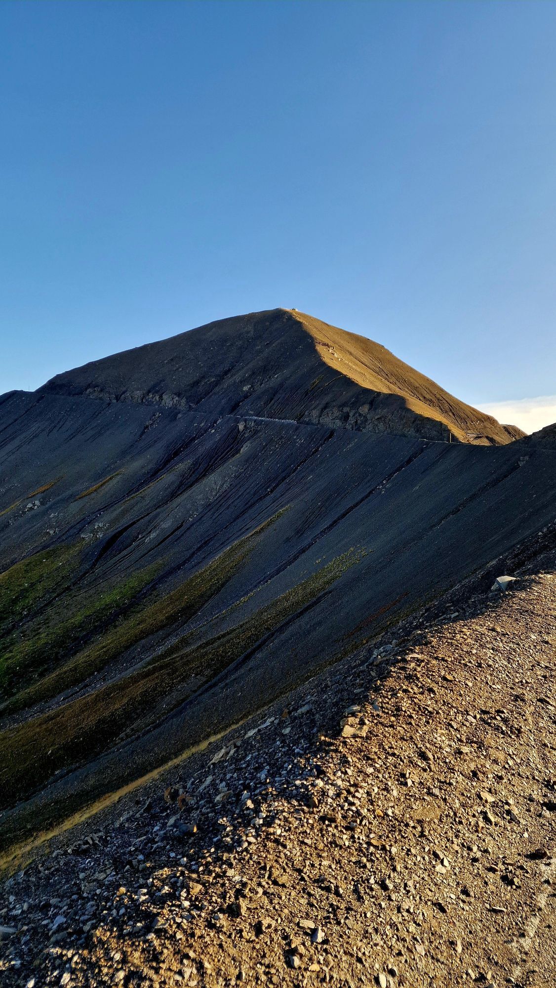
This circuit continues on the Col de la Bonette, used several times by the Tour de France and where many athletes regularly train.
This route is very difficult on a muscle-powered MTB and of medium level with an electric assisted MTB.
All outdoor activities of the Nice Côte d'Azur Metropolis are on https://outdoor.nicecotedazur.org

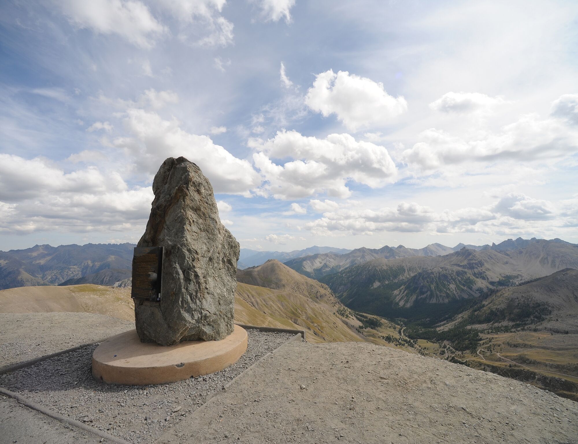
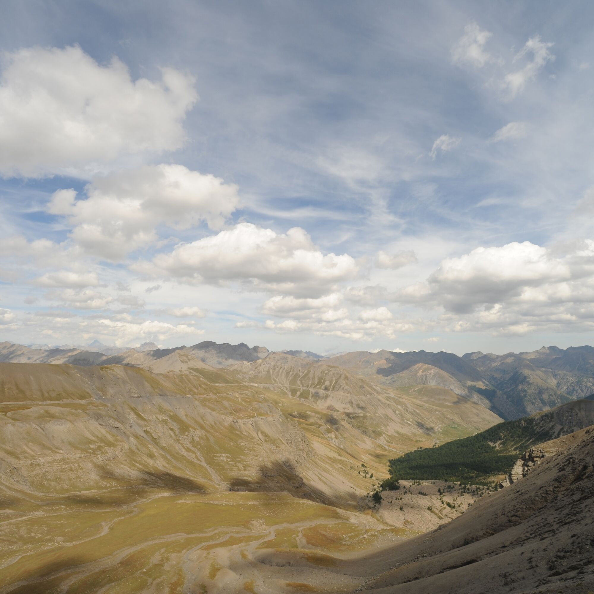
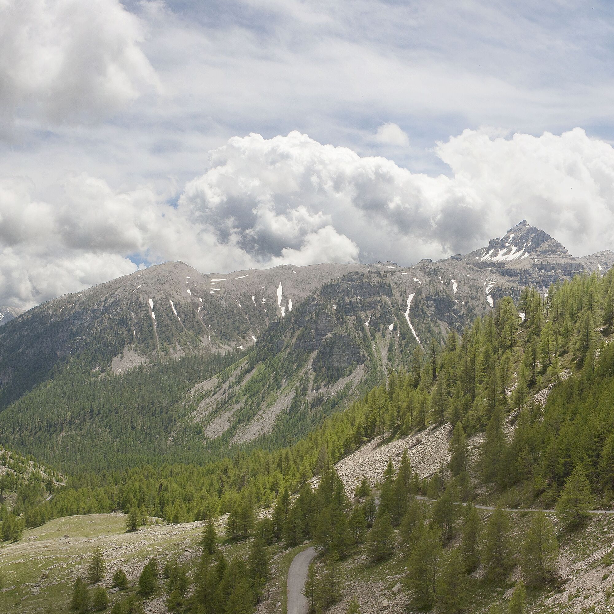
The start of the circuit is at the free camper van parking at the bottom of the village. Take the small road that climbs to the Sestrière refuge, after this refuge, it continues upward towards the Col de la Moutière in a surreal setting. After this pass, join the Bonette road via a track. Once on the road, turn right towards the Bonette menhir. It is possible to reach on foot the orientation table of the Bonette summit (alt: 2,860 m - 20 minutes) for a 360° panorama. The return is by the same route, after the Sestrière refuge, take a track to the right and cross the forest to reach the road of the village of Saint-Dalmas-le-Selvage.
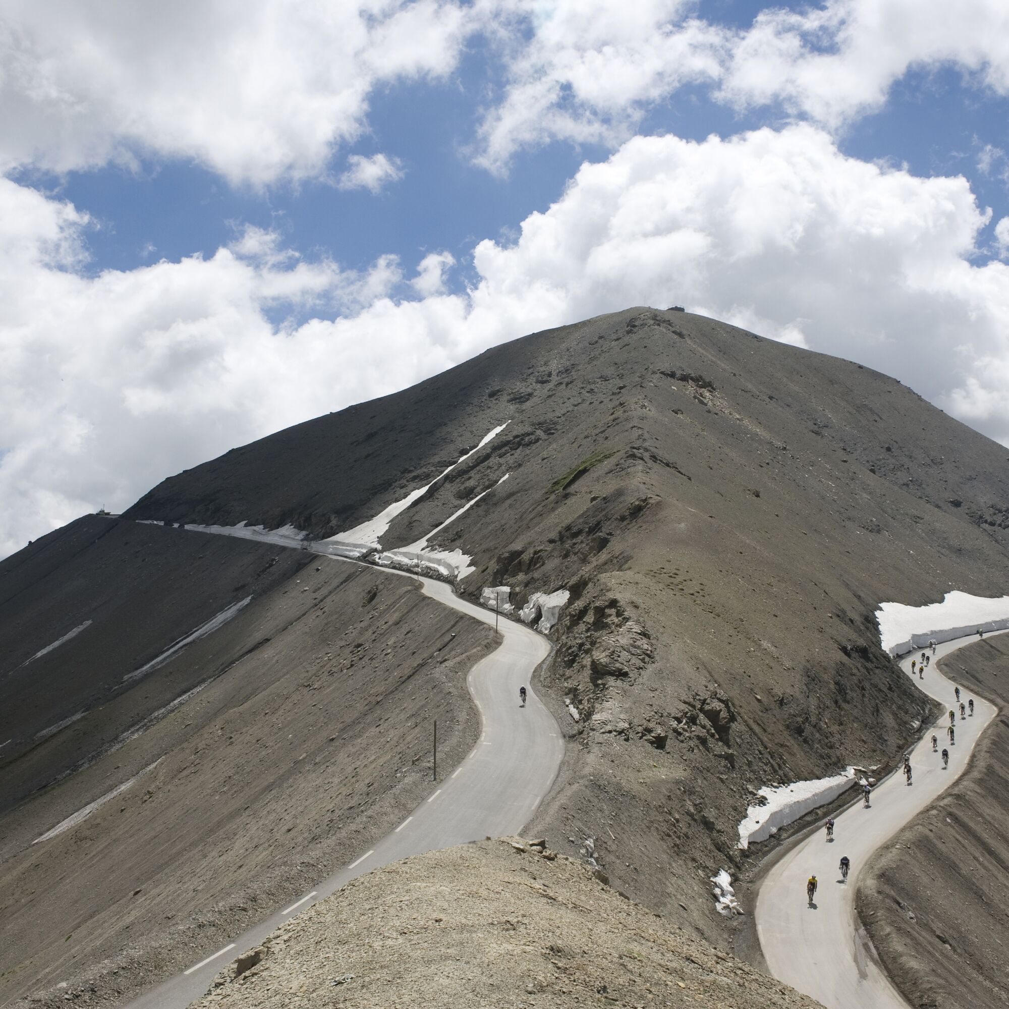
Unmarked variant: complete the circuit by returning via the famous Bonette road, passing through the hamlet of Bousieyas. This road, now essential for many cyclists and motorcyclists, offers magnificent views of the high peaks of the Mercantour massif.
Ano
Ano
Ano
Wear a helmet, bring protective gear and repair accessories.
Watch the weather: Mountain weather changes fast, bring warm clothes.
The national park is a protected and regulated area: use only the tracks authorized for mountain bikers
Follow the marked trails, do not take shortcuts and respect the direction of routes.
Before starting a route, check that it suits your level, check the condition of your MTB and leave your itinerary with someone.
Be cautious, courteous and slow down when overtaking other users.
Pay extra attention during hunting season and inquire about current drives.
If you encounter livestock guardian dogs (= patous), get off your bike, avoid sudden movements and go around the herd.
Respect private property, cultivated areas and close gates after passing.
Have an eco-citizen attitude: take your waste with you and respect wildlife and flora for a preserved nature.
Always carry the corresponding IGN map for the concerned itinerary.
The Lignes d’azur network offers a single fare throughout the Nice Côte d’Azur Metropolis. Validation is mandatory each time you board the bus regardless of the ticket used. To consult all rates, click here: www.lignesdazur.com
free camper van parking at the bottom of the village
S0
http://saintdalmasleselvage.fr/
Warning: the Bonette Menhir is located at 2,860 m, plan warm clothing, it is very cold there!
Follow the MTB markings corresponding to the circuit number: The circuit is marked with orange "VTT FFC" arrows on which the circuit numbers to follow are affixed
Oblíbené prohlídky v okolí
-
5.0
eBike MNCA stage 2: St-Dalmas-Le-Selvage - St-Etienne-de-Tinée
středníMountainbike 43.2 km -
Les lacs de vens
středníTuristika 18.9 km -
Col de la Cayolle - circuit des lacs, Frankrijk
středníTuristika 10.8 km -
Route 'Hameau du Vivier' Provence-Alpes
středníTuristika 8.47 km -
5.0
Goldtoni - Alpenbogen A077 Refugium Campo-Bousieyas
střednídálková pěší trasa 34.1 km -
4.5
Col de Larche - Lac du Lauzanier, France
světloTuristika 13.7 km -
Discovering the Natura 2000 site "Bat site of the Haute-Tinée" - starting from St Etienne de Tinée (sporting level)
středníTuristika 7.43 km -
eBike MNCA stage 1: Auron - Saint-Dalmas-le-Selvage
středníMountainbike 29.8 km -
Wandeling vanaf Halte 2000 naar meer van Terres Plaines (Jausiers, Provence-Alpes)
středníTuristika 12.1 km -
Mountain Bike FFC circuit no. 37: Col d'Anelle
heavyMountainbike 11.2 km

Pěší turistika a stopování


Nenechte si ujít nabídky a inspiraci pro vaši příští dovolenou
Vaše e-mailová adresa byl přidán do poštovního seznamu.