


Grand Villard - Enfers - RIchardette -Gran Villard
Úroveň obtížnosti: T2

The loop trail combines some of the best-known paths in Sauze d'Oulx. It takes place mainly on the borders of the Natural Park and allows you to reach hamlet Richardette. The return from the hamlet to...
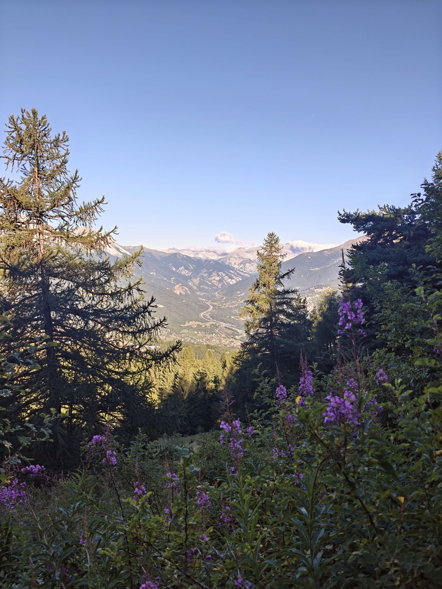
Hike immersed most of the time in dense forest except for the stretch of paved road.
Support and technical description by Barbara Demonte - Environmental hiking guide.

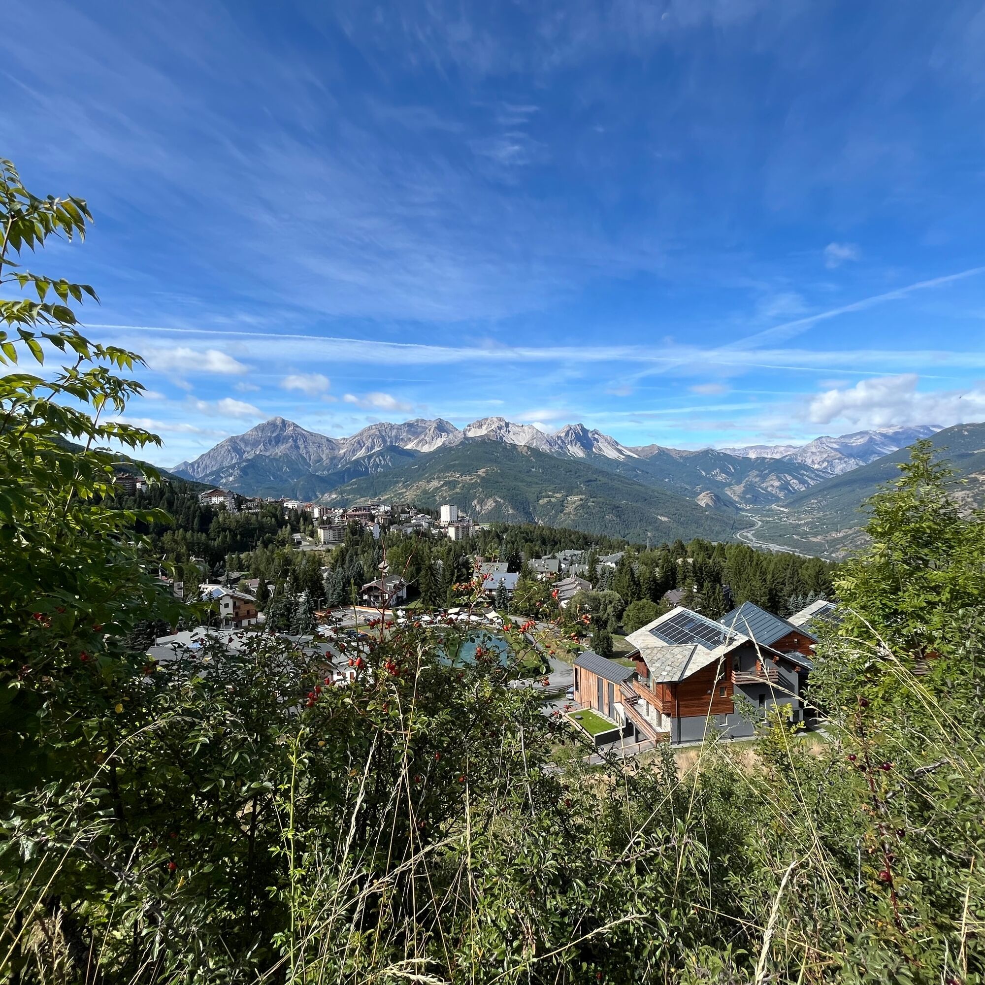
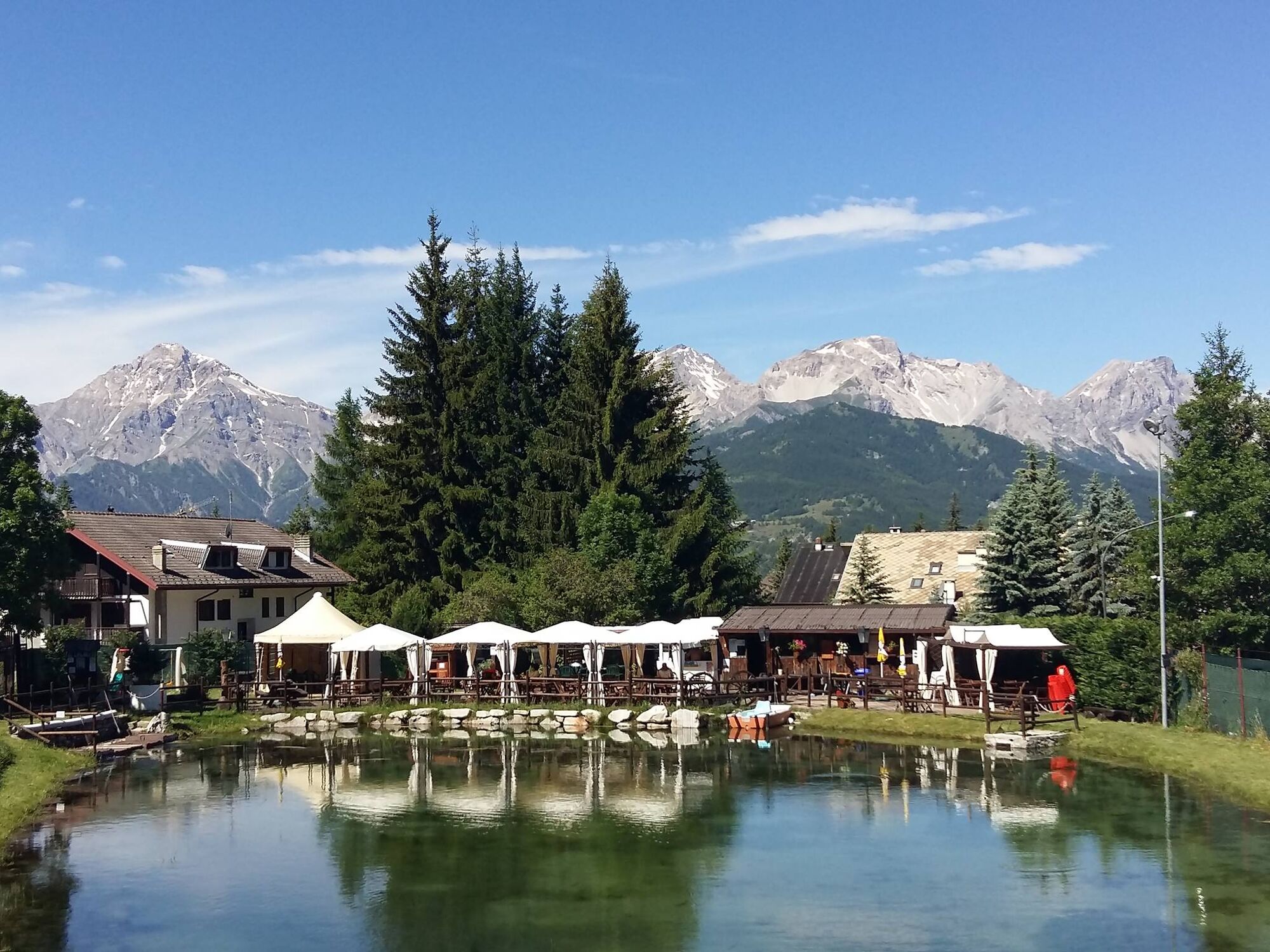
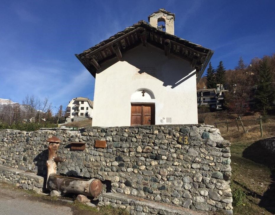
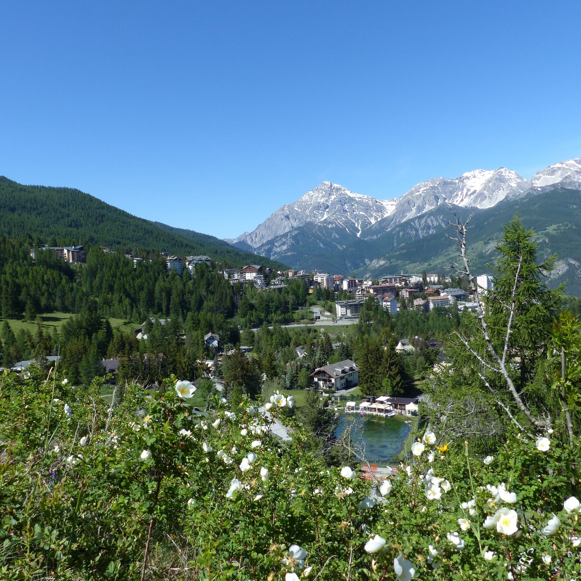
The trail starts at loc. Gran Villard mt. 1,520 near the pond (parking lot), just over 1km from the center of Sauze d'Oulx, which can also be reached by local bus (high season only). The trail is on the right of the road leading to Monfol. It climbs for a little more than 1km on a dirt road with a moderate, steady slope to the Souberaine locality at an altitude of 1,680m (renovated chalet and ruins of old houses). Here, at the crossroads with a bench, ignore trail No. 2, which heads flat to the left toward Monfol, and continue straight on No. 1, which climbs for about 20 meters, crossing again trail No. 2 coming flat from the right from the hamlet of Richardette. Continue straight on, climbing in the direction of Enfers on a decidedly steep path that, after about 800 meters, at an altitude of 1,860 meters, crosses the Gran Bosco carriage road; descend to the right in the hamlet of Enfers. At the fountain, path No. 1 bends right where it continues downhill through the woods and leads, after less than 1 km, to the hamlet of Richardette, coming out near the Don Murialdo Alpine House at an altitude of mt. 1,730. From here follow the paved road for about 350 mt. Leave the Chapel on the left and take the road (still paved) on the right. Trail No. 2 starts at the end of the road that runs through the old village core until it reaches the last apartment building. Go along the left side of the dwelling and at the back take the path that, with gentle ups and downs, leads to the junction with path No. 1 (Enfers). Here you turn left and resume the same path taken previously uphill.
Wear appropriate clothing and footwear for the environment and season.
From Turin follow the signs for Tangenziale Nord in the direction of Trafori - Frejus. Then take the A32 freeway in the direction of Bardonecchia and exit the freeway at the Oulx ring road sign, in the direction of Monginevro Sestriere. At the tunnel exit, continue on the left in the direction of Sauze d'Oulx.
Bus Arriva line 285 from Oulx to Sauze d'Oulx.
Parking at Gran Villard in the vicinity of The Pond
T2
Do not throw garbage into the environment but take it downstream, picking up any garbage left by others.
The hiking times given are approximate and may vary depending on weather conditions and one's ability.
Webové kamery z prohlídky
Oblíbené prohlídky v okolí
-
5.0
BARDONECCHIA Colle Sommeiller
středníMountainbike 25.4 km -
5.0
BARDONECCHIA Forte Jafferau Loop
heavyMountainbike 36.8 km -
5.0
BARDONECCHIA Col des Acles - Passo della Mulattiera
středníTuristika 6.23 km -
BARDONECCHIA Monte Jafferau
heavyTuristika 11.6 km -
5.0
SESTRIERE Monte Rognosa
heavyTuristika 6.42 km -
BARDONECCHIA - Loop Colle della Scala - Col de Montgenèvre - Colle del Sestriere
heavySilniční kolo 91.9 km -
5.0
CESANA T.SE Thures - Cima Bosco
heavySněžnice 3.94 km -
5.0
CESANA T.SE Cesana - Fenils
světloTuristika 4.60 km -
4.0
BARDONECCHIA Sentiero dei Cosetti by Luciano Ferraris
světloTuristika 3.24 km -
BARDONECCHIA Rochemolles Dam - Scarfiotti Refuge
středníTuristika 7.77 km

Pěší turistika a stopování


Nenechte si ujít nabídky a inspiraci pro vaši příští dovolenou
Vaše e-mailová adresa byl přidán do poštovního seznamu.