






PINEROLO towards Canada
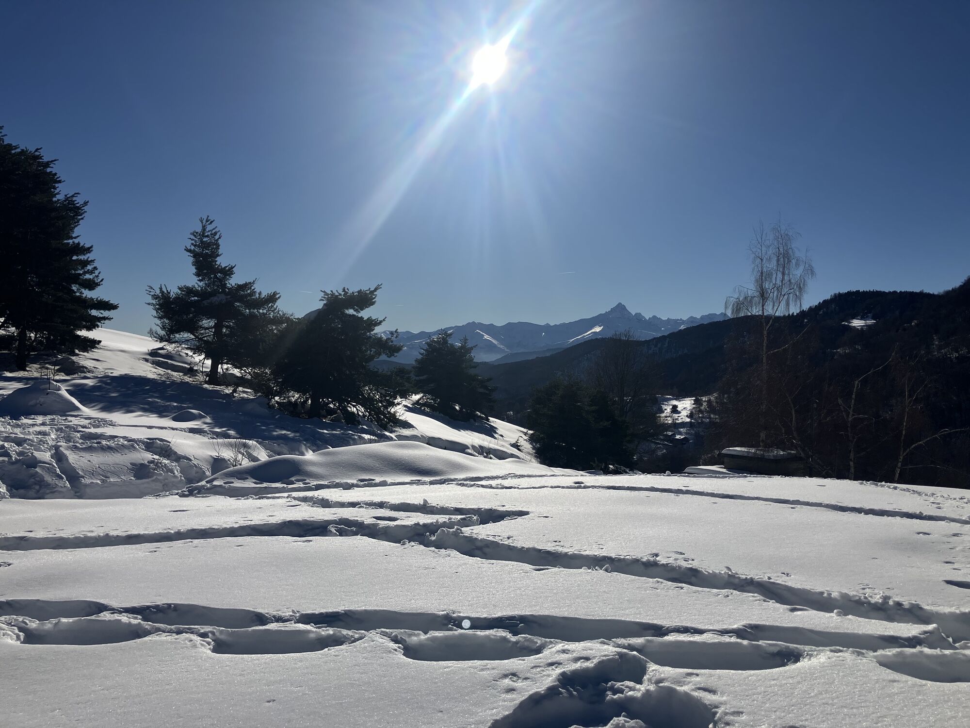
In the center of Pinerolo, not to be missed are the Saturday morning market, the Duomo in piazza San Donato, and via Principi d'Acaja. Once at the San Maurizio square, a short detour to the viewpoint of...
In the center of Pinerolo, not to be missed are the Saturday morning market, the Duomo in piazza San Donato, and via Principi d'Acaja. Once at the San Maurizio square, a short detour to the viewpoint of the Santuario della Madonna delle Grazie is worthwhile for a beautiful view over the Pinerolo plain.
Along the route lies the settlement of Talucco, known for its famous tomini cheeses, which can be tasted and purchased at the local agritourisms and refuges.
Passing through the Bosco dell’Impero, you arrive at Colle Eremita (962 m), then climb right following the signs of the Ecomuseum of the Charcoal Kilns (path 049) to Colle Ciardonet (1,081 m), about 1.20 h from Talucco. Now descend right, following the dirt road north (path 060), which leads to the “G. Melano-Casa Canada” refuge in about 25 minutes.
The route, designed by the CAI Pinerolo, is well marked by signs with the maple leaf, the symbol of Rifugio Melano.





The start is from piazza Garibaldi, in front of the Pinerolo station. Following the signs with the maple leaf, continue to piazza Vittorio Veneto (which the people of Pinerolo call piazza Fontana), where the weekly market takes place. Passing in front of the Town Hall and the Tourist Office, continue along via del Duomo. Upon reaching piazza San Donato (fountain), take via Trento and follow it to the Casa del Vicario, at the intersection with via Principi d'Acaja.
Turn right and follow via Principi d'Acaja to the San Maurizio square, 450m (fountain).
Now take Via Ciochino and, with no possibility of error by always following the maple leaf sign, reach the Church of San Defendente in Costagrande, about 570 m (fountain).
Continue now to the right of the church for about 100 m, then turn left and keep following the maple leaf. The road continues paved for about 1 km, then becomes a wide dirt track through the woods until the turnoff to Case Galletto: turn right on a steep but easy dirt track to be followed on the main route without turning left towards the houses. Continue on the main route ignoring deviations until reaching the small clearing of the Colle dell’Infernetto about 800 m.
Hikers go left: after a very short steep descent, take the right track which, after 1 km, becomes paved and leads to the settlement of Talucco. After the church (last fountain), take the first narrow paved road on the right. Here begins the Sentiero delle Carbonaie (SDB/049) and follow it passing through the village of Borgogna. Always following the White/Red signs of the Sentiero delle Carbonaie and the maple leaf, reach the Colle Eremita at about 960 m.
Continue always following the signs of the carbon works path until Colle Ciardonet at 1081 meters. Now descend and head without error to the Melano Casa Canada refuge at 1061 m, reachable on foot in 20 minutes, by cyclists in 10 minutes following the entire dirt road.
Ano
Wear clothing and footwear suitable for the environment and season
There are water points in the town, at Costragrande, near the small church of San Defendente where there is also a refreshment point, and at the arrival.
Getting to Pinerolo is easy by following the A55 if coming from Turin.
Train: the Pinerolo railway station is just a few minutes' walk from the starting point (www.trenitalia.com)
Bus: the bus terminal is just a few minutes' walk from the starting point (companies Arriva and Cavourese)
At the station and in the center of Pinerolo there are several public parking lots (some paid on weekdays)
Before undertaking any hike, it is advisable to consult weather bulletins or ask for information at local Tourist Offices.
It is good practice not to hike alone and to always inform someone about your destination.
Do not throw waste in the environment but carry it with you, also picking up any left by others.
The indicated travel times are approximate and may vary depending on weather conditions and personal abilities.
If you choose a weekday to do this route, don't miss the Pinerolo market on Wednesday (smaller) and Saturday morning.
To shorten the route, it's also possible to start directly from the village of Talucco.
The path features several small clearings with panels explaining what the charcoal kilns were and illustrating, in reality, the various stages of their preparation for charcoal production, once a precious local resource of Val Lemina.
Oblíbené prohlídky v okolí
-
Avigliana Lakes - Easy route, ideal for families with children
světloTuristika 9.25 km -
PINEROLO Route to Monte Muretto
středníTuristika 2.12 km -
TORRE PELLICE Naturalistic trail "The Jay"
světloTuristika 10.2 km -
PRAROSTINO From Piani to Sonagliette and back - SLOWLY TOGETHER
světloTuristika 6.60 km -
LUSERNA S.G. Upslowtour - Angrogna Valley Ring 11
středníJízda na kole 35.0 km -
A walk in the Megalithic - The Menhirs of Pietraborga - Direct route from the Torrioni
středníTuristika 9.30 km -
4.0
The Giro dell'Orsiera G.O. Trail Stage 1: Molè - Rifugio Balma
středníTuristika 4.52 km -
TORRE PELLICE Excursion to Colle della Sea
středníTuristika 7.83 km -
PINEROLO Trail "Ecomuseum of the Charcoal Piles"
středníTuristika 7.46 km -
Angrogna Valley Loop
Turistika 38.3 km
Pěší turistika a stopování


Nenechte si ujít nabídky a inspiraci pro vaši příští dovolenou
Vaše e-mailová adresa byl přidán do poštovního seznamu.





